Andrew Schroeder's Posts (4)

Sort by

Phantom on Field.png


On a wide, flat western Virginia field, home to the Culpeper Barnstormers radio controlled aircraft club, a bright white DJI Phantom 3 hovers in the afternoon sun like some oversized insect from the future. One of our colleagues from the NGO Action Against Hunger (ACF International), literally brand new to drone flight as of this afternoon, is at the controls. A smile spreads across his face, fingers nimbly maneuvering the joysticks. “I think I can do this no problem,” he says. “It’s much easier than I realized.” The Phantom darts up and to the left, pauses for just a moment, then dips and settles into the swooping arc of a flawless figure eight.  Chris Huston, our technical instructor from Unmanned Experts, talks him through the simple controller movements that bring the vehicle back around in a gradual descent to land at peace on the springy grass.

Maintaining Civil - Military Boundaries


Patrick front of class.jpg


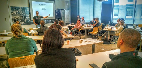
One day prior I’m in front of a roomful of colleagues from NGOs, UN and US government agencies in a narrow conference space at the Culpeper Holiday Inn Express. The UAViators Humanitarian UAV Network is helping put them through the paces of humanitarian UAV operations.  There’s a noticeable sense of unease. Our Unmanned Experts trainers have been blazing for the past couple of hours through some fairly dense material on flight mechanics, airframes and control systems. Much of that material, despite the undeniable underlying commonality of the physical processes with small civil drones, draws upon examples with overt military implications. Some folks in the group, Patrick and I foremost among them, express serious doubts over the relevance and the appropriateness of the military connections. It’s time to troubleshoot the situation.


Yet when we get up in front of the group to take their temperature, reframe the issues of technology within civil-military coordination and gauge the need for a course correction we get interestingly mixed responses. Yes, there is an unequivocal requirement to maintain clear lines between civil and military technologies and their applications. But the group turns out to be surprisingly more concerned about the level of complexity and implied cost than they are about the theoretical consistency of civil - military boundaries per se. Offering to re-route the discussion entirely towards humanitarian case studies instead of a deep dive to end the day on sensor payloads we’re told by the group that actually they’d prefer the sensor discussion at this point just to power through the technical framework to its conclusion. And so down we plunge during the day’s final two hours into the murky contours of photogrammetry, Lidar, multispectral and hyperspectral imagery.  


Safe, Ethical and Effective


Culpeper Final Presentations.jpg


With the following day’s humanitarian case studies, code of conduct discussion, practical photogrammetry walk-through and hands-on flight training concluded, the arc of the event veers towards a concluding simulation exercise on humanitarian response to the earthquake in Nepal. The students are given a challenging scenario related to mapping for assistance with damage assessment in Kathmandu along with a list of key questions and elements to consider. What types and numbers of vehicles would be required? What kinds of cost trade-offs present themselves? How can they mitigate risks before during and after the mission? What sorts of implications exist within the situation for use of the humanitarian UAV code of conduct? Can they frame the range and utility of the information products that might be produced in response to this situation?


This exact point becomes the most gratifying of the entire training for me. One of the trainees up towards the front of the room brings the scenario location into Mission Planner software and is already in the process of running the calculations on flight time.  Another group is deep in dialogue about community engagement. A third is assessing the risks involved in the cluster of nearby buildings and struggling with the issue of appropriate government permissions. Each gets up in turn to present their project proposal and each demonstrates a higher level of thoughtfulness, acuity and analytic sophistication than many of the actual UAV operators deployed to Nepal. It seems that despite the early hiccups around civil - military distinctions we’ve done our job well to orient this group towards safe, ethical and effective drone usage for future humanitarian activities.


At the Nethope Summit Humanitarian UAV Training


Prepping the Cumulus.jpg


Three days later I’m back out with the UAViators network on a windy airfield, this time on the other side of the Atlantic ocean. Jacob Peterson of Danoffice is huddled over the glow of a ruggedized tablet, prepping their fixed-wing drone, the Cumulus One, for liftoff. Although it looks like a model airplane, propeller and all, give or take the nuances of proper launching, flying the Cumulus is mostly a matter of programming within the Mission Planner software. With the vehicle comfortably aloft in the slate grey sky there’s little for the rest of us to do but wait for it to run its course and bring back its data cargo. “Bring that quadcopter back over here,” says Kevin MacRitchie of Nethope. “This is cool and everything, but it’s almost too easy. I’m actually getting a little bored.”


The UAS Test Center is located about an hour and a half outside the city of Copenhagen at the Hans Christian Andersen airport. Not too long ago the airport fell below the minimum threshold for commercial flight traffic and was at risk of being decommissioned. The government of Denmark, along with the local government in that area and the University of Southern Denmark, was able instead to repurpose the facility into a leading-edge center for research and testing of unmanned aerial systems (UAS). We’re here to team up with the university, the test center and DanOffice on a humanitarian UAV training which runs in conjunction with this years’ annual Nethope Summit.

Denmark’s UAS Test Center


Drone in class.jpg


Unlike in Culpeper,  probably because we’re at a formerly commercial airport in Europe, the aviation discussion this time centers entirely on civil applications. The lead technical trainer is a blustery old Dane who regales us with his glory days flying Cessnas beneath bridges and power lines for fun.  


The bulk of day one centers on understanding airspace regulations and flight restrictions, how to understand an airspace map, and then a deep dive into the physics of drones. Without knowing how these things really work you’re at a serious disadvantage in terms of understanding the tradeoffs required during project planning and field operations. This type of material can be a little daunting to beginners but the folks from University of Southern Denmark are masters of clear exposition.  Before long even the most novice among us is speaking the language of servos and gyros, and musing on the requisite number of satellites to acquire and maintain a secure GPS lock.  By the end of the day our colleagues from Esri and Hexagon Geospatial have pulled all of this back together into a luminous discussion of spatial data integration and image-based information products.


Following the closing simulation the group gathers up their things and heads for the train back into chilly central Copenhagen.  I’ll be leading a session in the next couple of days on interagency collaboration in humanitarian UAV operations. The Culpeper and Copenhagen trainings offer plenty of food for thought on that front. Within a week we’ve been joined on both sides of the Atlantic by universally enthusiastic colleagues from AAAS to FEMA to Last Mile Health to Greenpeace, the World Food Program and the International Organization for Migration among others. A new generation of aerial humanitarians is coming into being all around us, eager to work together, ready for liftoff. It’s a wonderful thing to behold.  


Read more…

151023060912-hurricane-patricia-friday-530-a-m-satellite-image-exlarge-169.jpg

Dear DIYDrones community, 

Please refer to the information below from the UAViators operations page for potential response to Hurricane Patricia which is scheduled to make landfall in SW Mexico this afternoon or early evening pacific time.  

http://uaviators.org/ops/mexico-hurricane-october-2015

The purpose of this Operations page is to facilitate information sharing and coordination during humanitarian UAV deployments. For immediate assistance during a disaster, please email Patrick Meier.

How to use the Ops page:

  • If you are a humanitarian professional looking for aerial imagery of a specific disaster area(s):
  • If you are a UAV operator:
  • Obtain the necessary legal permits to operate and follow the Code of Conduct.
  • Please add yourself to the Pilot Roster and add a comment below to confirm that you are available for deployment.
  • If you already have imagery that you believe would be useful to responders, please add specifics in your comment below.
  • Aerial videos and individual photographs can be added directly to Check the UAViators Crisis Map.

TO: All UAV pilots in Mexico (or headed to Mexico)
RE: Category 5 Hurricane Patricia

  • Please post a reply if you are deploying
  • Join the Humanitarian UAV Network's Pilot Roster [Link]
  • Respect Mexico's UAV Regulations and Authorities [Link]
  • Follow the Humanitarian UAV Code of Conduct & Guidelines [Link]
  • Read "Humanitarian UAV Missions: Towards Best Practices" [Link]
  • Post aerial pictures and videos to the Humanitarian UAV Crisis Map [Link]
  • Post orthorectified mosaics to Open Aerial Map (OAM) [Link]

Please contact us (patrick@UAViators.org) if you would like to share 3D models. Thank you.

Read more…

Community-Based Aerial Humanitarian Robotics

Credit: Patrick Meier / UAViators

From the World Humanitarian Summit blog.

Community-Based Aerial Humanitarian Robotics


Late September in Nepal, warm and dry after the monsoon rains subside, is an excellent time to take to the skies. My colleague Patrick Meier, founder of the UAViators Humanitarian UAV Network (UAViators.org), guides students, faculty and community members from Kathmandu University and Kathmandu Living Labsthrough a training in how and why to use small flying robots, popularly known as “unmanned aerial vehicles” (UAVs) or “drones,” to assist with critical functions for disaster preparedness and response. Patrick has been joined by a professional team from DJI, the world’s leading commercial manufacturer of small UAVs (including the ubiquitous Phantom), and Pix4D, which makes some of the best and most widely used software to process and analyze the imagery captured by these vehicles. The Nepali audience is receptive and eager to learn. They’ve just been through one of the worst disasters in the country’s history and seem well aware that effective, safe and coordinated use of UAVs, along with the high-resolution data that UAVs produce, may make an enormous difference in their abilities to assess damage, prioritize needs, find loved ones and perhaps even ferry essential relief goods and medical supplies into disaster-affected or remote areas. Over the course of a few intensive days (reported here by the Washington Post) they produce and evaluate information products ranging from mosaic images of areas like the town of Panga which is still reeling from the after-effects of the earthquake, to 3D models of hospitals which may one day guide accurate, rapid determinations of how essential infrastructure fares during disasters. With the skills they’ve acquired, networks strengthened, and the hardware and software donated to them by DJI and Pix4D, they have an impressive emerging capability to guide the application of aerial robotics for humanitarianism from the ground up for communities throughout Nepal.

Forming UAViators — the Humanitarian UAV Network

The community-based humanitarian UAV training in Nepal is only the latest in a series of events across the world over the past few years which have brought aerial robotics to the brink of mainstream acceptance as a tool for humanitarian and development assistance. During the response to Typhoon Haiyan I helped the Danish company Danoffice, which produces the Huginn X-1 quadcopter, find ways to put their tools to use for damage assessment in the cities of Tacloban, Carigara and others. I was stunned as I scanned the skies that many similar but largely unconnected and uncoordinated experiments were underway throughout the Philippines. A vibrant new community of humanitarian innovation and practice was taking flight.

It was this same type of experience that motivated Patrick in the wake of Typhoon Haiyan to form UAViators as a way to convene this distributed but like-minded community around a shared vision of the potential for UAVs to improve crisis response and community resilience. Diverse UAV deployments in Haiti, Vanuatu, Bhutan, parts of Africa, and many other places in the years since Typhoon Haiyan, have been field testing the technologies, solving the Big Data problems posed by massive new sources of high-resolution imagery, and coalescing around a set of standards and practices to ensure that these tools are used ethically, safely and effectively.

The Humanitarian UAV Code of Conduct

Perhaps the single greatest accomplishment of UAViators to date, with significant implications for discussions at the World Humanitarian Summit about humanitarian response technologies, frameworks and standards, has been the creation and refinement of the Humanitarian UAV Code of Conduct. The Code of Conduct is an openly conceived, voluntarily adopted and collaboratively written document which establishes the basis for how small aerial robotics can be integrated into humanitarian response without endangering lives, threatening privacy or causing more problems than they solve. Patrick and I strongly encourage everyone interested in this field to take the time to read and respond to the Code of Conduct, and then to join us in the UAViators network as we work to create a future where rapid advances in robotics technologies help to make communities throughout the world more capable of improving their health and well-being, reducing their vulnerabilities and strengthening their capacity to withstand the mounting crises of our fragile and turbulent planet.

Read more…

Humanitarian UAV Experts Meet at MIT

UAV Experts Meeting MIT

Early Fall mornings in Cambridge, MA have the feeling practically of American myth. The sun rises over the mist that hangs like a blanket on the Charles River, lighting the water with a pale glow that filters through multi-colored leaves and glints off the steel and glass fronts of the buildings which line the campus of the Massachusetts Institute of Technology (MIT). I’m hurrying down Massachusetts Ave towards Technology Square, wind in my face and coffee in hand, to arrive for the start of the second annual Humanitarian UAV (drone) Experts Meeting happening at MIT Lincoln Labs’ Beaver Works. The meeting is hosted byUAViators (Humanitarian UAV Network), a brainchild of my friend and colleague Patrick Meier.

What a Difference a Year Makes!

One year ago I joined a group of leading-edge thinkers from across major humanitarian organizations, government, UN agencies, funders, UAV manufacturers and academia at UN headquarters in New York City to inaugurate the field of UAVs for humanitarian assistance and development. At the time, there was palpable excitement and intense engagement but still a high degree of uncertainty about the direction all this activity would take. Would we see significant growth in the use of UAVs during disaster response? Or would a backlash against the technology materialize? What applications would add the most value to humanitarian operations? How could we best involve local communities? What kinds of regulations would be put in place? Could we create a code of conduct for humanitarian UAV operators that multiple complex organizations might actually agree to follow? What could be done about the coming deluge of high-resolution image data? Was it reasonable at all to think we might soon see drones delivering essential health and relief supplies to remote or disaster-affected areas? 

In just 12 months, the total number of use cases for humanitarian UAVs has grown wildly across the global landscape. Despite a few setbacks and missteps, there is a mounting sense of optimism among humanitarians about the implications of UAVs for key functions and situations from data collection to delivery, and from relief to conservation to development. Organizations like IOM (International Organization for Migration) are using them to map housing and displaced populations. Catholic Relief Services (CRS) is using them to track coastal rebuilding and property rights. The American Red Cross (ARC) has projects underway to use UAVs to improve post-disaster network connectivity and to map flood risks.  Groups like Medicins Sans Frontiers (MSF) and UNFPA (United Nations Population Fund) are moving forward with major new experimental applications of UAVs for global health programs. Exciting new work in computer vision and crowdsourced image analysis has emerged from QCRI in the form of the Micromappers project, which tackles the big data challenges posed by UAV imagery. 

And yes, hope is on the horizon, from Ghana to Kenya to the Philippines, that within the next year the world will have multiple viable pilot projects able to demonstrate the feasibility of drone-based delivery systems for essential health and relief commodities.

Laws, Regulations, and the Humanitarian UAV Code of Conduct


Perhaps most encouraging, the 
humanitarian UAV code of conduct, a voluntary, collaboratively written guide to standards of practice for humanitarian UAV operations, is very close to completion. The bulk of the work on that document took place online and then in person at a mid-summer Rockefeller Foundation sponsored gathering in Bellagio, Italy. The assembled delegates at the MIT experts meeting took up another round of revisions, delving carefully into the nuances of language around safety, privacy and data security, priorities for data collection and data sharing, and detailed guidelines for community engagement, compliance with government regulations and promotion of awareness among humanitarians about civil aviation standards.  

The first panel, which I moderated, saw leading figures from DJI, Pepperdine University, and MIT address the ongoing challenges of law and regulation, of which there are many.  For instance, in response to regulatory concerns about how best to secure “no fly” zones for small UAVs, manufacturers have begun to installgeofencing software in their vehicles. Geofencing uses the GPS signal to detect and then potentially to ground a vehicle that has entered a restricted area like an airport or a military base. In many ways geofencing makes good sense and helps to avoid situations like serious user error which can result in near-collisions with manned aircraft or the accidental landing of a vehicle on the White House lawn, which did actually happen not too long ago. On the other hand, geofencing can also run afoul of rights to free speech and press, or in some cases international humanitarian law. It could pose serious obstacles to the delivery of humanitarian aid if there isn’t a reliable mechanism for exemption. Despite these concerns, the fact that a multi-dimensional debate is new being joined at high levels of industry, government, humanitarianism and academia is encouraging.  Much like the Code of Conduct, which stands to be concluded and ratified by a range of parties in the upcoming year, 2016 should see major movement on issues of airspace access, geofencing exemptions and privacy rights.  

Lessons from the Nepal Earthquake

Patrick led us off with a guided tour (de force) of one of the most exciting new developments in the field to date — a collaborative deployment which concluded in late-September between DJI, UAViators, Kathmandu Living Labs and Kathmandu University. Out in the town of Panga which remains devastated by the April earthquake local Nepalis collaborated with leading figures from the UAV industry to produce high-resolution aerial maps and 3D models of structurally damaged buildings in serious need of repair. DJI left behind multiple Phantom 3 quadrotors and worked with Pix4D, the world’s leading UAV image analysis software company, to teach dozens of smart, enthusiastic young people how to use the technology themselves to guide rebuilding efforts and to catalyze sustainable businesses. This project has seeded the creation of Kathmandu Flying Labs as an adjunct to Kathmandu Living Labs, a model of community-driven technology innovation which may one day soon point the way toward a global network of local robotics and analytics hubs.  

Throughout the rest of day 1 attendees ranging from OCHA to USAID to Unmanned Experts and Halo Dropwrestled with issues which cropped up during the Nepal earthquake such as the variability of jurisdictional authority over different areas of a humanitarian operation: even where the national aviation regulators approve there may be serious disagreements with local police or other civil authorities. Often UAV operators themselves may be quite new to the field of humanitarian assistance, which can lead to misunderstandings around the types of situations they should expect on the ground. Communities affected by recent traumatic events may not understand the use of this type of technology, particularly when operators have not taken the time to sit down with them, carefully explain what they are doing, and establish a basis of trust and information sharing. All these things happened in Nepal, and the assembled delegates all struggled to come to terms with their implications for the next major humanitarian response event.

The Next Wave of Humanitarian UAV Development

We had the exceptional good fortune to hear from some of the best engineering minds at MIT and from the pioneers of leading open source projects like OpenStreetMapOpenAerialMap and OpenDroneMap about the future of the humanitarian UAV ecosystem. Sense-and-avoid technologies are emerging (but not yet ready for primetime) which allow a vehicle to detect obstacles and autonomously evade them. Integrated multi-sensor incident command structures have been designed which could coordinate multiple vehicles within a single humanitarian space. High-powered image algorithms are getting us closer to real-time processing of aerial sensors in the field. Solutions are in the works for bandwidth choke points, which slow down or disable coordination and data processing in the field. The future of autonomous, flight may not quite be here yet, but it’s in the works in the labs nestled among the Cambridge foliage.

By the end of the two-day affair, we were seeing right before us a rare convergence. Rapid technological innovation is happening in humanitarian UAVs within a structure of careful community discourse, deep ethical concern and a real sense of shared purpose. As Patrick Meier expressed so eloquently at one point on day one — nothing like this discussion happened back in the 1990s when mobile technologies were first emerging commercially;  just imagine the difference this type of rich engagement would have made to the health and well-being of communities across the world that have since benefitted enormously from advances in smartphones, social media and SMS despite huge mistakes in countless humanitarian deployments of those technologies throughout the world.

Towards a Future of Shared Innovation in Social Automation

Much clearly remains to be done to ensure that small UAVs, when they are deployed, fit usefully, safely, securely and ethically into the proverbial humanitarian toolkit. But if the two-day meeting which just concluded so thoughtfully and joyously at MIT this weekend is any indication we are on our way to a not-too-distant future in which the benefits of social automation and robotics, led by the small aerial robots we now call UAVs, will extend throughout the length and breadth of global society, to be shared by the most vulnerable among us.

Read more…