We are out for UAV field campaigns again. After one week of flying over sea ice of the Baltic sea in northern Finland we are now heading for Svalbard.
Martin Mueller's Posts (9)
Sort by
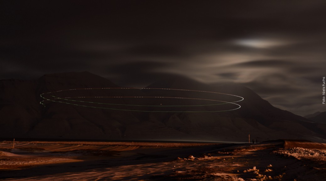 We spent a week on Svalbard and operated autonomous aircraft to collect atmospheric data. They were accompanied by a tethered weather balloon and an autonomous under water glider.
John Cassano from the University of Colorado has been flying small fixed-wing UAVs in a remote camp in Antarctica. From his blog:

Since it wouldn’t be possible for us to build a 3000 foot tall automatic weather station (AWS) on the Ross Ice Shelf we have turned to using unmanned aerial vehicles (UAVs) to study the full depth of the boundary layer. The UAV we used this year is called a SUMO – Small Unmanned Meteorological Observer. It uses the same airframe you could buy in a model airplane store but has been modified to include a small computer, autopilot, and instruments to measure air temperature, humidity, pressure, and wind.
The advantage of the SUMO UAV is that it is easy to operate, inexpensive (only a few thousand dollars), and can measure the boundary layer very accurately. It only requires two people to fly a SUMO. One person has a model airplane remote control for manual control of the plane and the other person operates the autopilot on a laptop computer that is in constant communication with the autopilot on the plane by a simple radio link.
The SUMO can do flights up to 30 minutes in duration and in this time it can spiral up to the top and back down to the bottom of the boundary layer providing two profiles of the atmosphere through the entire boundary layer. It is these profiles that are the basis for all of the research we will do.
This Antarctic summer two teams flew Paparazzi driven UAS on the southernmost continent. The University of Bergen flew at the Norwegian Troll station (video) and the University of Colorado near the US McMurdo station (blog, blog). They measured temperature, humidity, pressure, infrared radioation and wind. A descripton of the aircraft is here.
Video showing a Multiplex Twinstar II running the Paparazzi adaptive control loops. It drops 30% of the right wing with 50% of the aileron, turns off the right motor and keeps flying autonomously.
Together with the Laboratory for Energy Conversion of the ETH Zürich we have adapted their multi-hole air flow probe to Paparazzi and integrated it into our meteo Funjets. It is used to measure wind vectors/turbulences around wind turbines for a more efficient planning of wind parks. The goal is to reduce the impact that a turbine causes to the ones downstream. Swiss television has an article (in German).