Patrick Meier's Posts (59)

Sort by

TanaPic1

The Sentinel Project recently launched their Human Security UAV program in Kenya’s violence-prone Tana Delta to directly support Una Hakika ("Are You Sure"). Hakika is an information service that serves to “counteract malicious misinformation [disinformation] which has been the trigger for recent outbreaks of violence in the region.” While the Tana Delta is one of Kenya's least developed areas, both “mobile phone and internet usage is still surprisingly high.” At the same time, misinformation has “played a significant role in causing fear, distrust and hatred between communities” because the Tana Delta is perhaps parado-xically also an “information-starved environment in which most people still rely on word-of-mouth to get news about the world around them.”

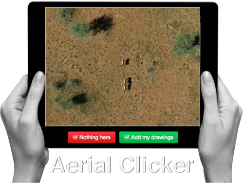
In other words, there are no objective, authoritative sources of information per se, so Una Hakika (“Are You Sure”) seeks to be the first accurate, neutral and reliable source of information. Una Hakika is powered by a dedicated toll-free SMS short code and an engaged, trusted network of volunteer ambassadors. When the team receives a rumor verification request via SMS, they proceed to verify the rumor and report the findings back (via SMS) to the community. This process involves “gathering a lot of information from various different sources and trying to make sense of it [...]. That’s where WikiRumours comes in as our purpose-built software for managing the Una Hakika workflow.”

TanaDeltaPic2

A year after implementing the project, the Sentinel team carried out a series of focus groups to assess impact The findings are particularly encouraging. In a way, the Sentinel team has formalized and stream-lined the organic verification process I describe here: How To Use Technology To Counter Rumors During Crises: Anecdotes from Kyrgyzstan. So where do UAVs come in?

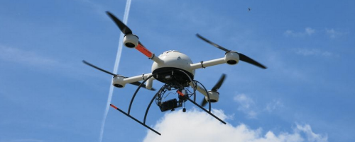
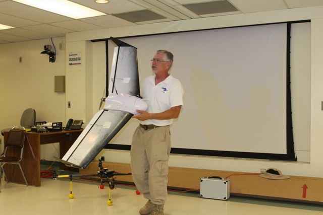
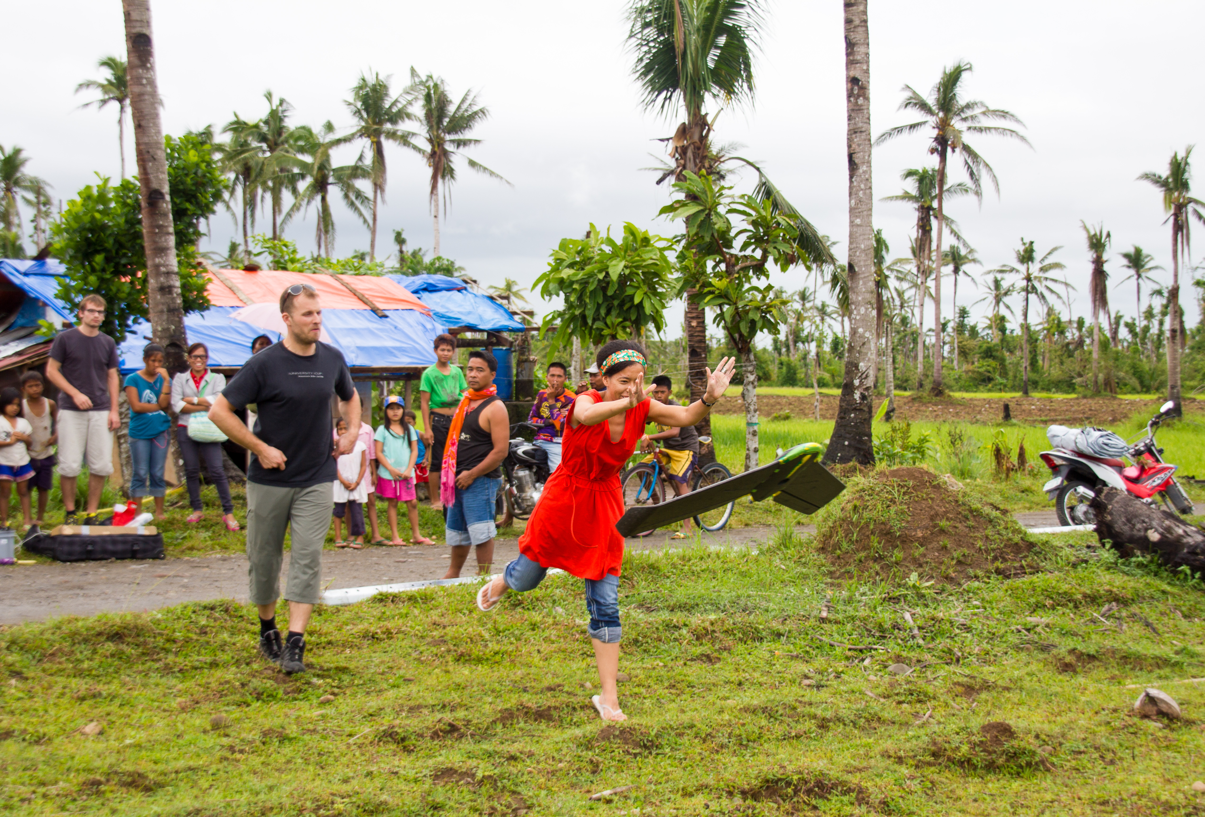
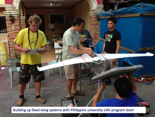
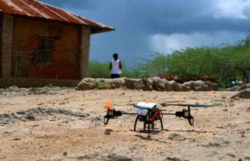
The Sentinel team recently introduced the use of UAVs to support Una Hakika’s verification efforts and will be expanding the program to include a small fleet of multi-rotor and fixed wing platforms. Before piloting this new technology, the team carried out research to better understand local perceptions around UAVs (also referred to as Unmanned Aerial Systems, UAS):

“Common public opinion concerns in places like Europe and North America relate to the invasion of privacy, misuse by government or law enforcement, a related concern about an overbearing security state, and fears of an aviation disaster. Concerns found among residents of the Tana Delta revolve around practical issues such as whether the UAS-mounted camera would be powerful enough to be useful, how far such systems can operate, whether they are hampered by weather, how quickly a drone can be deployed in an emergency, and who will be in physical possession of the system.”

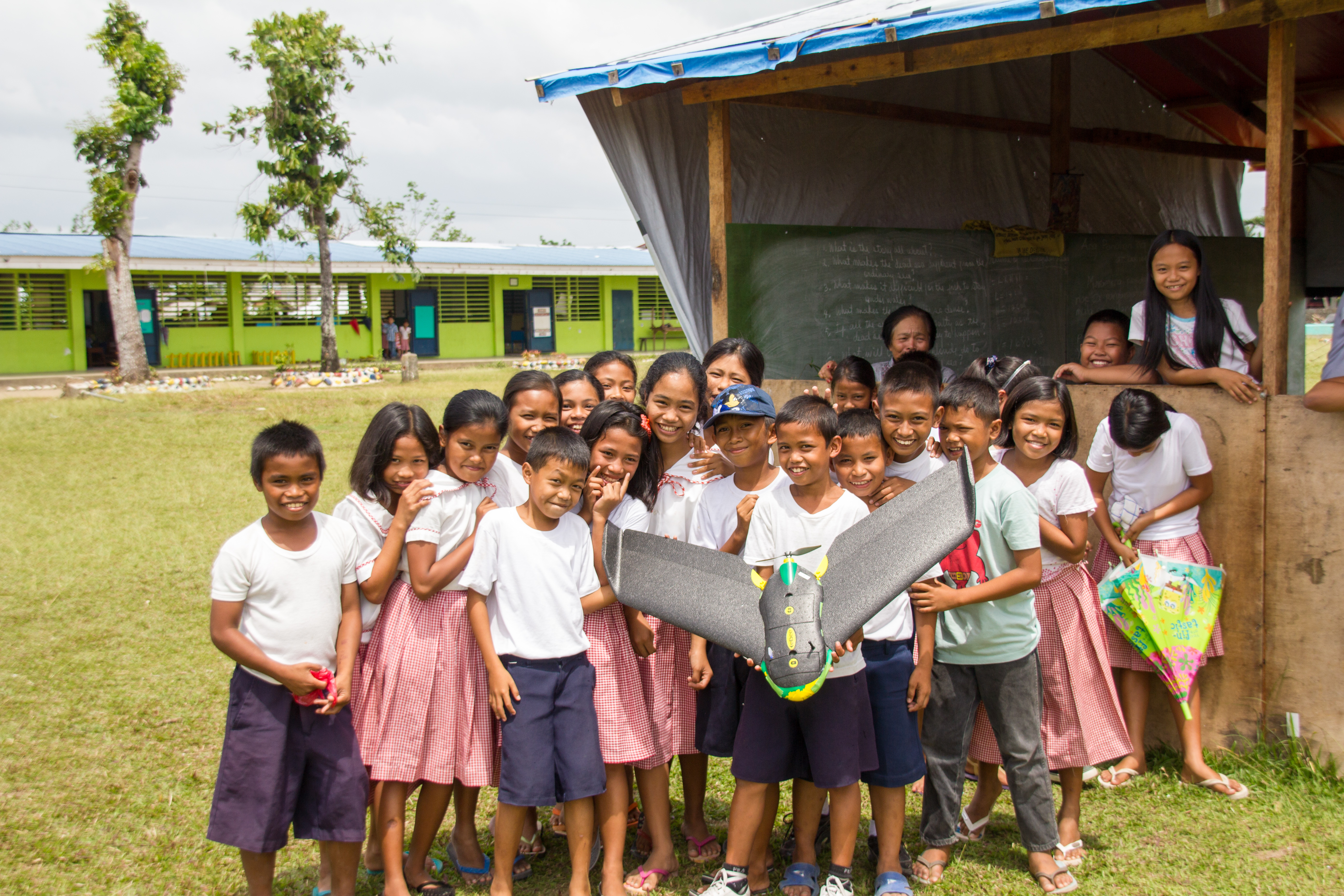
“For the most part, they [local residents] are genuinely curious, have a plethora of questions about the implementation of UAS in their communities, and are enthusiastic about the many possibilities. This genuine technological optimism makes the Tana Delta a likely site for one of the first programs of its kind. The Sentinel Project is conducting its UAS operations with the policy of ‘progress through caution,’ which seeks to engage communities within the proposed deployment while offering complete transparency and involvement but always emphasizing exposure to (and demonstration of) systems in the field with the people who have the potential to benefit from these initiatives. This approach has been extremely well received & has already resulted in improvements to implementation.”

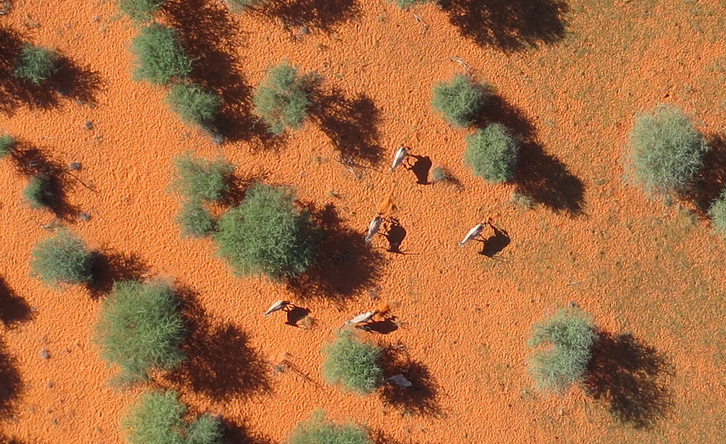
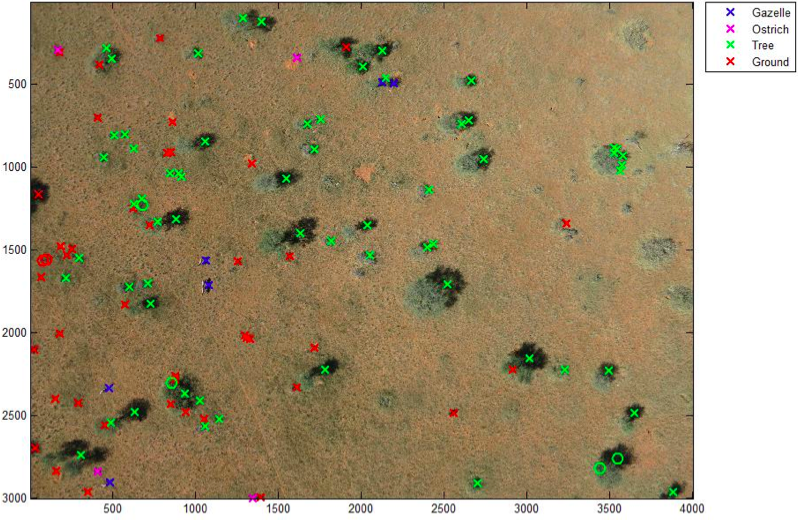
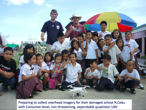
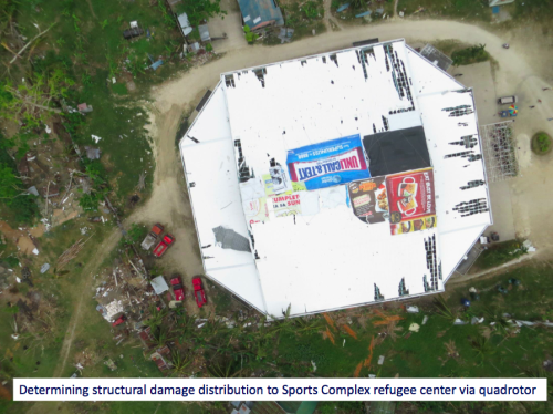
While Una Hakika’s verification network includes hundreds of volunteer ambassadors, they can’t be everywhere at the same time. As the Sentinel team mentioned during one of our recent conversations, there are some places that simply can’t be reached by foot reliably. In addition, the UAVs can operate both day and night; wandering around at night can be dangerous for Una Hakika’s verification ambassadors. The Sentinel team thus plans to add InfraRed, thermal imaging capabilities to the UAVs. The core of the program will be to use UAVs to set up perimeter security areas around threatened communities. In addition, the program can address other vectors which have led to recent violence: using the UAVs to help find lost (potentially stolen) cattle, track crop health, and monitor contested land use. The team mentioned that the UAVs could also be used to support search and rescue efforts during periods of drought and floods.

Tana3

Lastly, they’ve started discussing the use of UAVs for payload transportation. For example, UAVs could deliver medical supplies to remote villages that have been attacked. After all, the World Health Organization (WHO) is already using UAVs for this purpose. With each of these applications, the Sentinel team clearly emphasizes that the primary users and operators of the UAVs must be the local staff in the region. “We believe that successful technology driven programs must not only act as tools to serve these communities but also allow community members to have direct involvement in their use”.

As the Sentinel team rightly notes, their approach helps to “counteract the paralysis which arises from the unknowns of a new endeavour when studied in a purely academic setting. The Sentinel Project team believes that a cautious but active strategy of real-world deployments will best demonstrate the value of such programs to governments and global citizens.” This very much resonates with me, which is why I am pleased to serve on the organization’s Advisory Board.

This blog post was cross-posted from iRevolutions. More on the humanitarian uses of UAVs/drones in my new book Digital Humanitarians.

Read more…

Screen Shot 2015-02-11 at 8.38.46 AM

I had the distinct honor of both keynoting & judging the outstanding Drones for Good Challenge in Dubai last week (see my live reports). Teams from all around the world came to the UAE to compete. Some of the drones that took to the sky were truly remarkable. The winner of the National Prize, for example, was theWadi Drone built by the NYU Abu Dhabi Team who took home the one million Dirham reward ($273,000). While designed to support important conservation efforts in the region, the novel solution afforded by this innovative drone could also be used to support humanitarian relief efforts.

The ultralight Wadi Drone can fly for 1.5 hours across some 40km of the Wadi Wurayah National Park, which is the “UAE’s first mountain protected national park. The drone collects data from 120 camera traps that capture images of wild animals at the park” (1). Thanks to Wadi Drone, rangers no longer have to hike through the park (often facing temperatures upwards of 45 degrees Celsius) to manually collect the SD cards from each of the 120 cameras scattered across the area. Instead, the drone simply flies over the cameras and uploads the pictures directly to an onboard memory card (check out video here). To date, these cameras have enabled park rangers and conservationists to identify more than 800 specifies, such as foxes, wildcats and lynxes.


What if we used the Wadi Drone to collect relevant data from humanitarian base camps in the field during disasters? Connectivity and bandwidth can often be an issue in these situations. Could we use a version of the Wadi Drone to collect data on damage assessments, resulting needs, etc., along with pictures directly from the field? Laptops and/or smartphones could simply be retrofitted to push relevant data to the drone flying overhead, which would then return to HQ where (hopefully) a more solid Wifi or 3G/4G connection is available.


Am I completely off here, or is this something worth exploring? I hope my more seasoned humanitarian colleagues will chime with some of their thoughts. Is there a role for data-carrying drones in the humanitarian space? Keep in mind that drones are not immune to Moore’s Law.

Read more…

MM Oryx

3689636917?profile=original

MicroMappers combines crowdsourcing and artificial intelligence to make sense of “Big Data” for Social Good. Why artificial intelligence (AI)? Because regular crowdsourcing alone is no match for Big Data. The MicroMappers platform can already be used to crowdsource the search for relevant tweets as well as pictures, videos, text messages, aerial imagery and soon satellite imagery. The next step is therefore to add artificial intelligence to this crowdsourced filtering platform. We have already done this with tweets and SMS. So we’re now turning our attention to aerial and satellite imagery. 

Our very first deployment of MicroMappers for aerial imagery analysis was in Africa for this wildlife protection project. We crowdsourced the search for wild animals in partnership with rangers from the Kuzikus Wildlife Reserve based in Namibia. We were very pleased with the results, and so were the rangers. As one of them noted: “I am impressed with the results. There are at times when the crowd found animals that I had missed!” We were also pleased that our effortscaught the attention of CNN. As noted in that CNN report, our plan for this pilot was to use crowdsourcing to find the wildlife and to then combine the results with artificial intelligence to develop a set of algorithms that can automatically find wild animals in the future.


To do this, we partnered with a wonderful team of graduate students at EPFL, the well known polytechnique in Lausanne, Switzerland. While these students were pressed for time due to a number of deadlines, they were nevertheless able to deliver some interesting results. Their applied, computer vision research is particularly useful given our ultimate aim: to create an algorithm that can learn to detect features of interest in aerial and satellite imagery in near real-time (as we’re interested in applying this to disaster response and other time-sensitive events). For now, however, we need to walk before we can run. This means carrying out the tasks of crowdsourcing and artificial intelligence in two (not-yet-integrated) steps.


As the EPFL students rightly note in their preliminary study, the use of thermal imaging (heat detection) to automatically identify wildlife in the bush is some-what problematic since “the temperature difference between animals and ground is much lower in savannah […].” This explains why the research team used the results of our crowdsourcing efforts instead. More specifically, they focused on automatically detecting the shadows of gazelles and ostriches by using an object based support vector machine (SVM). The whole process is summarized below.

Screen Shot 2015-02-09 at 12.46.38 AM

The above method produces results like the one below (click to enlarge). The circles represents the objects used to train the machine learning classifier. The discerning reader will note that the algorithm has correctly identified all the gazelles save for one instance in which two gazelles were standing close together were identified as one gazelle. But no other objects were mislabeled as a gazelle. In other words, EPFL’s gazelle algorithm is very accurate. “Hence the classifier could be used to reduce the number of objects to assess manually and make the search for gazelles faster.” Ostriches, on the other hand, proved more difficult to automatically detect. But the students are convinced that this could be improved if they had more time.

Screen Shot 2015-02-09 at 12.56.17 AM

In conclusion, more work certainly needs to be done, but I am pleased by these preliminary and encouraging results. In addition, the students at EPFL kindly shared some concrete features that we can implement on the MicroMappers side to improve the crowdsourced results for the purposes of developing automated algorithms in the future. So a big thank you to Briant, Millet and Rey for taking the time to carry out the above research. My team and I at QCRI very much look forward to continuing our collaboration with them and colleagues at EPFL.

0c8155d.png

In the meantime, more on all this in my new bookDigital Humanitarians: How Big Data is Changing the Face of Humanitarian Response, which has alreadybeen endorsed by faculty at Harvard, MIT, Stanford, Oxford, etc; and by experts at the UN, World Bank, Red Cross, Twitter, etc.

Read more…

Drones for Good Make History in Dubai

Screen Shot 2015-02-07 at 11.00.13 AM


We've just wrapped up an incredible week at the first ever Drones for Good Challenge. Not only was this the first event of its kind in Dubai, it was the first ever such event in the world. I was thus hugely honored to both keynote this outstanding celebration of technologies for good and to also serve on the judging panel for the finalists. Some 800 teams from nearly 60 countries around the world submitted their "Drones for Good" ideas. Only 5 made it to the very final round today. I lived-tweeted the event and curated the  list of tweets below as a summary (all original tweets available here). My head is still spinning from all the possibilities, ideas and the incredible innovators that I had the good fortune to meet in person. I'll absolutely be following up with a number of them for several Humanitarian UAV projects I am working on. In the meantime, huge thanks to the organizing event team for their very kind invitation and friendship!

Screen Shot 2015-02-07 at 10.30.19 AM

Screen Shot 2015-02-07 at 10.31.10 AM

Screen Shot 2015-02-07 at 10.31.39 AM

Screen Shot 2015-02-07 at 10.31.56 AM

Screen Shot 2015-02-07 at 10.32.13 AM

Screen Shot 2015-02-07 at 10.32.34 AM

Screen Shot 2015-02-07 at 10.32.45 AM

Screen Shot 2015-02-07 at 10.33.00 AM

Screen Shot 2015-02-07 at 10.33.16 AM

Screen Shot 2015-02-07 at 10.45.12 AM

Screen Shot 2015-02-07 at 10.33.36 AM

Screen Shot 2015-02-07 at 10.33.53 AM

Screen Shot 2015-02-07 at 10.34.28 AM

Screen Shot 2015-02-07 at 10.34.43 AM

Screen Shot 2015-02-07 at 10.35.41 AM

Screen Shot 2015-02-07 at 10.35.52 AM

Screen Shot 2015-02-07 at 10.36.05 AM

Screen Shot 2015-02-07 at 10.36.18 AM

Screen Shot 2015-02-07 at 10.36.40 AM

Screen Shot 2015-02-07 at 10.49.07 AM


Screen Shot 2015-02-07 at 11.02.23 AM

I'm excited to explore the above possibility with a number of key individuals who I met and spoke with whilst in Dubai.

Read more…

3689628611?profile=original

From: The Humanitarian UAV Network (UAViators)

To: UAV/Drone pilots in the Philippines

If you capture any imagery post-Typhoon, please post it to this dedicated crisis map (recently featured in the LA Times): http://uaviators.org/map

Please be sure to observe and respect the Code of Conduct available in the same link.

See also the deployments page:

http://uaviators.org/ops/philippines-typhoon-hagupit-dec-2014

Thank you

Read more…

Screen Shot 2014-11-25 at 1.41.38 PM

More than 30 million coconut trees were destroyed by Typhoon Haiyan in the Philippines. This has had a devastating impact on local livelihoods. To make matters worse, the rotting trunks of uprooted coconut trees has let to an infestation of the Coconut Rhinoceros Beetle, which is destroying the remaining healthy trees in some areas. So the Humanitarian UAV Network (UAViators) has teamed up with the Filipino UAV company SkyEye to crowdsource the analysis of thousands of aerial photographs that were recently taken of affected areas. This week, hundreds of digital volunteers from around the world will use the MicroMappers website (screenshot above) to trace the trunks of healthy and unhealthy trees.


The results will enable our humanitarian partners to assess the current situation. We will also use the resulting data to create machine learning classifiers so that destroyed coconut trees can be automatically detected in future aerial imagery. This has applications will beyond the Philippines since many disaster prone countries in tropical areas grow and depend on coconut trees as a source of livelihood.


To take part in this crowdsourcing effort 
join the MicroMappers list-serve here simply send a blank email to MicroMappers+subscribe@googlegroups.com. The project will start on Friday, December 5th at 12pm London time (GMT) and will run until 8pm Sunday, December 7th (end time is variable). So check your emails on December 5th; we’ll send out an email at 12pm with the link you’ll need to volunteer. This link will first lead you to a tutorial which will include a short video on how to use MicroMappers to trace the trees. This is very simple to do, which means no prior experience is necessary.


Our previous deployment of MicroMappers, which also used aerial imagery, focused on wildlife protection in Namibia and was recently featured on CNN here.

3689628298?profile=original

Read more…

UN Experts Meeting on Humanitarian UAV/Drones

The Humanitarian UAV Network (UAViators) and the United Nations Office for the Coordination of Humanitarian Affairs (OCHA) are co-organizing the first ever “Experts Meeting on Humanitarian UAVs” on November 6th at UN Head-quarters in New York. This full-day strategy meeting, which is co-sponsored by the ICT for Peace Foundation (ICT4Peace) and QCRI, will bring together leading UAV experts (including several members of the UAV Network’s Advisory Board, such as DJI) with seasoned humanitarian 
professionals fro
m OCHA, WFP, UNICEF, UNHCR, UNDAC, IOM, American Red Cross, European Commission and several other groups that are also starting to use civilian UAVs or have a strong interest in leveraging this technology.

The strategy session, which I’ll be running with my colleague Dan Gilman from OCHA (who authored this Policy Brief on Humanitarian UAVs), will provide an important opportunity for information sharing between UAV experts and humanitarian professionals with the explicit goal of catalyzing direct collabo-ration on the operational use of UAVs in humanitarian settings. UAV experts seek to better understand humanitarian information needs (e.g. UNDAC needs) while humanitarians seek to better understand the challenges and opportunities regarding the rapid deployment of UAVs. In sum, this workshop will bring together 30 experts from different disciplines to pave the way forward for the safe and effective use of humanitarian UAVs.

Screen Shot 2014-06-24 at 2.22.05 PM

The Experts Meeting will include presentations from select participants such as Gene Robinson (leading expert in the use of UAVs for Search & Rescue), Kate Chapman (director of Humanitarian OpenStreetMap), Peter Spruyt (European Commission’s Joint Research Center), Jacob Petersen (Anthea Technologies), Charles Devaney (University of Hawaii), Adam Klaptocz (Drone Adventures & senseFly) and several others. Both Matternet and Google’s Project Wing have been formally invited to present on the latest in UAV payload transportation. (Representatives from the Small UAV Coalition have also been invited to attend).

In addition to the above, the strategy meeting will include dedicated sessions on Ethics, Legislation and Regulation facilitated by Brendan Schulman (leading UAV lawyer) and Kristin Sandvik (Norwegian Center for Humanitarian Studies). Other sessions are expected to focus on Community Engagement, Imagery Analysis as well as Training and Certification. The final session of the day will be dedicated to identifying potential joint pilot projects between UAV pro’s and humanitarian organizations as well as the Humanitarian UAV Network.

UAViators Logo

We will be writing up a summary of the Experts Meeting and making this report publicly available via the Humanitarian UAV Network website. In addition, we plan to post videos of select talks given during the strategy meeting along with accompanying slides. This first meeting at UN Headquarters serves as a spring board for 2 future strategy meetings scheduled for 2015. One of these will be a 3-day high-level & policy-focused international workshop on Humanitarian UAVs, which will be held at the Rockefeller Foundation’s Center in Bellagio, Italy (pictured below in an UAV/aerial image I took earlier this year). This workshop will be run by myself, Dan Gilman and Kristin Sandvik (both of whom are on the Advisory Board of the Humanitarian UAV Network).

ProPic35

Kristin and I are also looking to co-organize another workshop in 2015 to focus specifically on the use of non-lethal UAVs in conflict zones. We are currently talking to prospective donors to make this happen. So stay tuned for more information on all three Humanitarian UAV meetings as one of our key goals at the Humanitarian UAV Network is to raise awareness about humanitarian UAVs by publicly disseminating results & findings from key policy discussions and UAV missions. In the meantime, big thanks to UN/OCHA, ICT4Peace and the Rockefeller Foundation for their crucial and most timely support.

See also:

  • Humanitarians in the Sky: Using UAVs for Disaster Response [link]
  • Low-Cost UAV Applications for Post-Disaster Damage Assessments: A Streamlined Workflow [Link]
  • Humanitarian UAVs Fly in China After Earthquake [link]
  • Humanitarian UAV Missions During Balkan Floods [link]
  • Humanitarian UAVs in the Solomon Islands [link]
  • UAVs, Community Mapping & Disaster Risk Reduction in Haiti [link]

Read more…

3689615236?profile=original

UAVs are increasingly used in humanitarian response. We have thus added a new Clicker to our MicroMappers collection. The purpose of the “Aerial Clicker” is to crowdsource the tagging of aerial imagery captured by UAVs in humanitarian settings. Trying out new technologies during major disasters can pose several challenges, however. So we're teaming up with Drone Adventures, Kuzikus Wildlife Reserve, Polytechnic of Namibia, and l’École Polytechnique Fédérale de Lausanne (EPFL) to try out our new Clicker using high-resolution aerial photographs of wild animals in Namibia.

As part of their wildlife protection efforts, rangers at Kuzikus want to know how many animals (and what kinds) are roaming about their wildlife reserve. So Kuzikus partnered with Drone Adventures and EPFL’s Cooperation and Development Center (CODEV) and the Laboratory of Geographic Information Systems (LASIG) to launch the SAVMAP project, which stands for "Near real-time ultrahigh-resolution imaging from unmanned aerial vehicles for sustainable land management and biodiversity conservation in semi-arid savanna under regional and global change." SAVMAP was co-funded by CODEV through LASIG. You can learn more about their UAV flights here.

Our partners are interested in experimenting with crowdsourcing to make sense of this aerial imagery and raise awareness about wildlife in Namibia. As colleagues at Kuzikus recently told us, “Rhino poaching continues to be a growing problem that threatens to extinguish some rhino species within a decade or two. Rhino monitoring is thus important for their protection. One problematic is to detect rhinos in large areas and/or dense bush areas. Using digital maps in combination with MicroMappers to trace aerial images of rhinos could greatly improve rhino monitoring efforts.” 

So our pilot project serves two goals: 1) Trying out the new Aerial Clicker for future humanitarian deployments; 2) Assessing whether crowdsourcing can be used to correctly identify wild animals.

MM Aerial Clicker

Can you spot the zebras in the aerial imagery above? If so, you’re already a digital ranger! No worries, you won’t need to know that those are actually zebras, you’ll simply outline any animals you find (using your mouse) and click on “Add my drawings.” Yes, it’s that easy : )

We’ll be running our Wildlife Challenge from September 26th-28th. To sign up for this digital expedition to Namibia, simply join the MicroMappers list-serve here. We’ll be sure to share the results of the Challenge with all volunteers who participate and with our partners in Namibia. We’ll also be creating a wildlife map based on the results so our friends know where the animals have been spotted (by you!).

MM_Rhino

Given that rhino poaching continues to be a growing problem in Namibia (and elsewhere), we will obviously not include the location of rhinos in our wildlife map. You'll still be able to look for and trace rhinos (like those above) as well as other animals like ostriches, oryxes & giraffes, for example. Hint: shadows often reveal the presence of wild animals!

MM_Giraffe

Drone Adventures hopes to carry out a second mission in Namibia early next year. So if we’re successful in finding all the animals this time around, then we’ll have the opportunity to support the Kuzikus Reserve again in their future protection efforts. Either way, we’ll be better prepared for the next humanitarian disaster thanks to this pilot. MicroMappers is developed by QCRI and is a joint project with the United Nations Office for the Coordination of Humanitarian Affairs (OCHA).

Any questions or suggestions? Feel free to email me at patrick@iRevolution.net or add them in the comments section below. Thank you!

Read more…

IMG_0052.jpg

Setting up our Ground Control Points (GCPs) to improve the precision of the imagery. In the background, one of the Seven Wonders of the Ancient World: The Temple of Artemis in Ephesus, Turkey.

It isn’t every day that we get to fly drones over one of the Seven Wonders of the Ancient World. Thanks to our intrepid partners and hosts, the Institute of Fine Arts at New York University (NYU) and the Austrian Archaeological Institute, we’ve just returned from an amazing week in Southern Turkey where we flew over ancient theatres and temples dating as far back as the 10th Century BC. We’ll be publishing a longer, more detailed blog post once we’ve had the chance to analyze all the imagery. In the meantime, we’re excited to share a quick overview of the project.

3689614803?profile=original

Read more about our Drone Adventures Expedition here

(Includes our video interview with archaeologists) 

Read more…

Official UN Policy Brief on Humanitarian UAVs

ICARUS Quadcopter

Cross-posted from iRevolution

The United Nations Office for the Coordination of Humanitarian Affairs (OCHA) just published a pivotal policy document (PDF) on the use of civilian UAVs in humanitarian settings. Key excerpts from this 20-page & must-read publication are highlighted below.

  • UAVs are increasingly performing civilian tasks as the technology becomes more common. In fact, 57 countries and 270 companies were manufacturing UAVs in 2013.
  • Humanitarian organizations have started to use UAVs, including in Haiti and the Philippines, for data collection and information tasks that include real time information and situation monitoring, public information and advocacy, search and rescue, and mapping.
  • Use of UAVs raises serious practical & ethical issues that humanitarian organizations must address through transparency, community engagement, and guidelines for privacy & data security.
  • To tap into the growing interest in UAVs, particularly in technical communities, humanitarian organizations should engage in networks that promote good practices and guidance, and that can serve as a source of surge capacity. [Like the Humanitarian UAV Network].
  • Due to their affordability, ease of transport, and regulatory concerns UAVs used in humanitarian response are likely to be small or micro-UAVs of up to a few kilograms, while larger systems will remain the province of military and civil defense actors.
  • Interest is building in the use of UAVs to assist in search and rescue, particularly when equipped with infrared, or other specialty cameras. For example, the European Union is funding ICARUS, a research project to develop unmanned search and rescue tools to assist human teams. [Picture above is of UAV used by ICARUS].
  • The analysis of data from these devices ranges from straight-forward to quite technically complex. Analytical support from crowdsourcing platforms, such as Humanitarian Open Street Map’s Tasking Server or QCRI’s MicroMappers, can speed up analysis of technical data, including building damage or population estimates.
  • More research is needed on integrating aerial observation and data collection into needs and damage assessments, search and rescue, and other humanitarian functions.
  • The biggest challenges to expanding the use of UAVs are legal and regulatory. [...]. Most countries where humanitarians are working do not yet have legal frameworks, meaning that use of UAVs will probably need to be cleared on an ad hoc basis with local authorities. A particular issue is interference with traditional air traffic [...].
  • Any use of UAVs by humanitarian actors [...] requires clear policies on what information they will share or make public, how long they will store it and how they will secure it. [...]. For humanitarians operating UAVs, transparency and engagement will likely be critical for success. Ideally, communities or local authorities would be informed of the timing of flights, the purpose of the mission and the type of data being collected, with the aim of having some kind of informed consent, whether formal or informal.
  • Although UAVs are getting safer, due to parachutes, collision avoidance systems and fail-safe mechanisms, humanitarians must think seriously about liability insurance and its cost implications, particularly for mechanical failure. Due in part to these safety concerns, ultra-light UAVs, such as those under a kilogram, will tend to be more lightly regulated and therefore easier to import & operate.
  • More non-profit or volunteer groups are also emerging, such as the Humanitarian UAV Network, a global volunteer network of operators working for safe operations & standards for humanitarian uses of UAVs.
  • The pressure for humanitarians to adopt this technology [UAVs], or to provide principled justifications for why they do not, will only increase. [...]. Until UAVs are much more established in general civilian use, the risks of humanitarians using UAVs in conflict settings are greater than the benefits. The focus therefore should be developing best practices and guidelines for their use in natural disasters, slow-onset emergencies and early recovery.
Screen Shot 2014-06-24 at 2.22.05 PM

In conclusion, the UN brief offers several policy considerations:

  • Focus on using UAVs in natural disasters and avoid use in conflicts.
  • Develop a supportive legal and regulatory framework.
  • Prioritize transparency and community engagement.
  • Ensure principled partnerships.
  • Strengthen the evidence base.
  • Update response mechanisms [...] to incorporate potential use of UAVs and to support pilot projects.
  • Support networks and communities of practice. [...]. Humanitarian organizations should engage in initiatives like the Humanitarian UAV Network, that aim to develop and promote good practices and guidance and that can serve as advisors and provide surge capacity.

The Humanitarian UAV Network (UAViators) is actively engaged in pursuing these (and other) action items. The Network promotes the safe and responsible use of UAVs in non-conflict settings and is engaged in policy conversations vis-a-vis ethical, legal & regulatory frameworks for the use of UAVs in humanitarian settings.  The Network is also bringing UAV experts together with seasoned humanitarian professionals to explore how best to update formal response mechanisms. In addition, UAViators emphasizes the importance of community participation. Finally, the Network carries out research to build a more rigorous evidence based so as to better document the opportunities and challenges of using UAVs in humanitarian settings.


See Also:

  • Humanitarians in the Sky: Using UAVs for Disaster Response [link]
  • Live Crisis Map of UAV Videos for Disaster Response [link]
  • Humanitarian UAV Missions During Balkan Floods [link]
  • UAVs, Community Mapping & Disaster Risk Reduction in Haiti [link]
  • “TripAdvisor” for International UAV/Drone Travel [link]
  • How UAVs are Making a Difference in Disaster Response [link]
  • Humanitarians Using UAVs for Post Disaster Recovery [link]
  • Grassroots UAVs for Disaster Response [link]

Read more…

"TripAdvisor" for UAV/Drone Travel

3689610875?profile=original

The Humanitarian UAV Network (UAViators) promotes the safe and responsible use of UAVs in humanitarian settings. As noted in the network's Code of Conduct, knowing national and local UAV laws is an important aspect flying UAVs in a safe and responsible manner. To this end, we have just launched a "TripAdvisor" for UAV/drone travel in the form of this wiki.

The Wiki is a country directory for UAV pilots to share their travel and flying experiences around the world, such as going through customs and how to obtain permits for flying, for example. The Wiki also includes information on national and local laws when available. We would like this to be a community-driven effort, which is why we decided to use a Wiki. In sum, we'd like to crowdsource the content for this Wiki. Our mission is make it the most popular and useful resource on the web for UAV pilots. You can help by adding your experience and knowledge directly to the Wiki. Thank you!

See Also:

  • Crisis Map of UAV Videos for Disaster Response [link]
  • Humanitarians in the Sky: Using UAVs for Disaster Response [link]
  • Humanitarian UAV Missions During Balkan Floods [link]
  • UAVs, Community Mapping & Disaster Risk Reduction in Haiti [link]
  • Humanitarian UAV Network: Strategy for 2014-2015 [link
Read more…

SkyEyeGrassRoots

Superficial conversations on the challenges and opportunities of using UAVs in humanitarian settings reveal just how many misconceptions remain on the topic. This is admittedly due to the fact that humanitarian UAVs are a relatively recent innovation. There are of course legitimate and serious concerns around the use of UAVs in humanitarian settings. But superficial conversations tend to obfuscate intelligent discourse on what the potential solutions to these challenges might be.

I would thus like to address some of the more common misconceptions in the hopes that we can move beyond the repetitive, superficial statements that have been surfacing in recent discussions on humanitarian UAVs. This will hopefully help improve the quality of discourse on the topic and encourage more informed conversations.

  • UAVs are expensive: Yes, military drones cost millions of dollars. But small, civilian UAVs range from a few hundred dollars to the price of a small car.  The fixed-wing UAV used by the International Organization for Migration (IOM) in Haiti and by Medair in the Philippines cost $20,000. Contrast this to UN Range Rovers that cost over $50,000. The rotary-wing UAV (quadcopter) purchased by the UN Office for the Coordination of Humanitarian (OCHA) costs $1,200 (the price of a laptop). The one pictured above now costs around $500. (And balloon mapping costs even less). Like other technologies, UAVs are clearly becoming cheaper every year, which is why they're increasingly used in humanitarian settings.

  • UAVs are limited in range: So are cars. In other words, whether UAVs are "too limited" depends on what their intended use is. Smallfixed-wing UAVs have a flight time of about an hour while small rotary-wing UAVs typically remain airborne for half-an-hour (on 1 battery). Naturally, more expensive UAVs will have longer flight-times. For targeted damage assessments, current ranges are easily manageable with several batteries. With one team and a few batteries, IOM covered 45 square kilometers in 6 days of flying. As more groups use UAVs in humanitarian settings, the opportunities to collaborate on flight plans and data sharing will necessarily expand both range and coverage. Then again, if all I need is 25 minutes of flight-time to rapidly assess disaster damage in rural village, then a rotary-wing UAV is a perfect fit. And if I bring 5 batteries along, I'll have more than two hours' worth of very high-resolution imagery.

  • UAVs are dangerous: So are cars.  There are safe ways to use cars and reckless ways, regardless of whether you have a license. The same holds true for UAVs. There are safety guidelines and best practices that need to be followed. Obviously, small, very light-weight UAVs pose far less physical danger than larger UAVs. Newer UAVs also include a number of important fail-safe mechanisms and automated flight-plan options, thus drastically reducing pilot error. There is of course the very real danger of UAVs colliding with piloted-aircraft. At the same time, I for one don't see the point of flying small UAVs in urban areas with complex airspaces. I'm more interested in using UAVs in areas that have been overlooked or ignored by international relief efforts. These areas are typically rural and hard to access; they are not swarmed by search and rescue helicopters or military aircraft delivering aid. Besides as one UAV expert recently noted at a leading UAV conference, the best sense-and-avoid systems (when flying visual line-of-site) are your eyes and ears. Helicopters and military aircraft are loud and can be heard from miles away. If you or your spotter hear and/or see them, it takes you 10 seconds to drop to a safer altitude. In any event, flying UAVs near airports is pure idiocy. Risks (and idiocy) cannot be eliminated, but they can be managed. There are a number of protocols that provide guidance on the safe use of UAVs such as the Humanitarian UAV Network's Code of Conduct and Operational Check-List available here. In sum, both education and awareness-raising are absolutely key.

  • UAVs are frightening: Compare the UAV pictured above with UN military helicopters and aircraft. What looks more scary? Talk to any UAV professional who actually has experience in flying small UAVs in developing countries and virtually all will tell you that their UAVs are almost always perceived as toys by both kids and adults alike. CartONG & OSM who use UAVs for community mapping note that UAVs in Haiti bring communities together. Meanwhile, SkyEye and partners in the Philippines use the excitement that UAVs provoke in kids to teach them about science,  maths and aeronautics. Do the kids in the picture above look scared to you? This doesn't mean that process—reassurance, awareness raising & community engagement— isn't important. It simply means that critics who play on fear to dismiss the use of UAVs following natural disasters don't know what they're talking about; but they're great at "Smart Talk".

  • UAVs are not making a difference: This final misconception is simply due to ignorance. Humanitarian UAVs are already a game-changer. Anyone who follows this space will know that UAVs have already made a difference in HaitiPhilippines and in the Balkans, for example. Their use in Search and Rescue efforts have already saved lives. As such, critics who question the added value of humanitarian UAVs don't know what they're talking about. Acquiring and analyzing satellite imagery after a disaster still takes between 48-72 hours. And if clouds are lingering after a major Typhoon, for example, then humanitarians have to wait several days longer. In any event, the resulting imagery is expensive and comes with a host of data-sharing restrictions. These limitations explain why disaster responders are turning to UAVs. This doesn't mean that we don't need more evidence of impact (and failure), we certainly do since this is still a new space. But suggesting that there is no evidence to begin with is precisely the kind of ignorance that gets in the way of intelligent discourse.

I hope we can move beyond the above misconceptions and discuss topics that are grounded in reality; like issues around legislation, coordination, data privacy and informed consent, for example. We'll be focusing on these and several other critical issues at the upcoming "Experts Meeting on Humanitarian UAVs" co-organized by the UN Office for the Coordination of Humanitarian Affairs and the Humanitarian UAV Network (UAViators), which is being held in November at UN Headquarters in New York.

My advocacy around the use of humanitarian UAVs should obviously not be taken to suggest that UAVs are the answer to every and all humanitarian problems; UAVs, like other novel technologies used in humanitarian settings, obviously pose a number of risks and challenges that need to be managed. As always, the key is to accurately identify and describe the challenge first; and then to assess potential technology solutions and processes that are most appropriate—if any—while keeping in mind the corner stone principle of Do No Harm.

Cross-posted from iRevolution.net

See also:

  • Humanitarian UAV Network: Strategy for 2014-2015 [link]
  • Humanitarians in the Sky: Using UAVs for Disaster Response [link]
  • Humanitarian UAV Missions During Balkan Floods [link]
  • UAVs, Community Mapping & Disaster Risk Reduction in Haiti [link]
  • Crisis Map of UAV Videos for Disaster Response [link]
  • Using MicroMappers to Make Sense of UAV/Aerial Imagery During Disasters [link]
Read more…

Credit: CartONG/OSM.fr Video

Cross-posted from iRevolution.net.

"What if, to solve our problems, we simply need to rise above them?"

CartONG and France's OpenStreetMap (OSM) community recently teamed up to support OSM Haiti's disaster risk reduction efforts by deploying a small UAV, "which proved very useful for participatory mapping." This video documentary provides an excellent summary of this humanitarian UAV mission which took place just a few weeks ago.

As I noted in this earlier blog post on grassroots UAVs, the use of UAVs at the community level can be viewed as an extension of community and participatory mapping, which is why community engagement is pivotal for humanitarian UAV deployments. In many ways, a micro-UAV can actually bring a community together; can catalyze conversations & participation, which should be taken as more than simply a positive externality. Public Participatory GIS Projects (PPGIS) have long been used as a means to catalyze community conversations and even conflict resolution and mediation. So one should not overlook the positive uses of UAVs as a way to convene a community. Indeed, as CartONG and partners rightly note in the above video documentary, "The UAV is the uniting tool that brings the community together."

This joint UAV project in Haiti has three phases: training for data collection; analysis and use of collected data; and empowering the Haitian OSM community to lead their own projects with their own partners. The first phase, which was just completed, comprised 42 individual UAV flights (using SenseFly's eBee) in multiple locations including the Port-au-Prince area, the urbanized part of Saint-Marc, Sans-Souci Palace (Unesco World Heritage Site), Dominican Republic border areas and Bord de Mer. This enabled the Haitian OSM community to test the UAV under varying conditions and across different terrains.

Credit: CartONG & OSM.fr video

The UAV flight training included "aerial security" and an overview of the UAV's weaknesses. As CartONG rightly notes, the use of UAVs for data collection and the training that goes along with "strengthen Haitian OSM communities, so that they can fully take part in local development."

To this end, I'm hoping to see more women flying UAVs in the future rather than seeing them standing by as passive observers. Community engagement without women is not community engagement. Perhaps UAVs can play a role in uniting and enabling women to become more engaged and take on leadership roles within communities.

Credit: CartONG & OSM.fr video

As part of their initial phase, CartONG and team also set up a mini-server to facilitate the processing of UAV imagery on site. "Considering the difficulties faced regarding aerial image processing the need for such a tool has been confirmed for all situations where accessing internet & electricity is a challenge." Moreover, the Haitian OSM community expressed a direct interest in not only piloting UAVs but also in the processing and analysis of the resulting data: "communities wish to be trained to be able to fully master the process of collection and processing of aerial image, including on software such as ArcGIS and QGIS."

Credit: OSM.fr

I'm excited about these efforts and keen to follow the next phases of this UAV community mapping project. In the meantime, big thanks to CartONG's Martin Noblecourt for kindly sharing this important volunteer-driven project. If you want to learn more about this initiative, feel free to contact Martin via email at info@cartong.org.

See Also:

  • Humanitarians in the Sky: Using UAVs for Disaster Response [link]
  • Humanitarian UAV Missions in During Balkan Floods [link]
Read more…

UAViators Map

The first version of the Humanitarian UAV Network's Crisis Map of UAV/aerial videos is now live on the Network's website. The crowdsourced map features dozens of aerial videos of recent disasters. Like social media, this new medium—user-generated (aerial) content—can be used by humanitarian organizations to complement their damage assessments and thus improve situational awareness.

The purpose of this Humanitarian UAV Network (UAViators) map is not only to provide humanitarian organizations and disaster-affected communities with an online repository of aerial information on disaster damage to augment their situational awareness; this crisis map also serves to raise awareness on how to safely & responsibly use small UAVs for rapid damage assessments. This explains why users who upload new content to the map must confirm that they have read the UAViator's Code of Conduct. They also have to confirm that the videos conform to the Network's mission and that they do not violate privacy or copyrights. In sum, the map seeks to crowdsource both aerial footage and critical thinking for the responsible use of UAVs in humanitarian settings.

UAViators Map 4

As noted above, this is the first version of the map, which means several other features are currently in the works. These new features will be rolled out incrementally over the next weeks and months. In the meantime, feel free to suggest any features you'd like to see in the comments section below. Thank you.

See also:

  • Humanitarian UAV Network: Strategy for 2014-2015 [link]
  • Humanitarians in the Sky: Using UAVs for Disaster Response [link]
  • Humanitarian UAV Missions in During Balkan Floods [link]
  • Using UAVs for Disaster Risk Reduction in Haiti [link]
  • Using MicroMappers to Make Sense of UAV/Aerial Imagery During Disasters [link]
Read more…

My article on Humanitarian Drones/UAV's:

Dai partnerzone
Lawmakers need to ensure their new regulations do not run counter to the humanitarian imperative. Photograph: CorePhil/DSI

Unmanned aerial vehicles (UAVs) capture images faster, cheaper, and at a far higher resolution than satellite imagery. And as John DeRiggi speculates in "Drones for Development?" these attributes will likely lead to a host of applications in development work. In the humanitarian field that future is already upon us — so we need to take a rights-based approach to advance the discussion, improve coordination of UAV flights, and to promote regulation that will ensure safety while supporting innovation.

Read more

Read more…

FAA Grounds Missing-Persons Search Group

IMG_9909.jpeg

Source: http://online.wsj.com/news/article_email/SB10001424052702303847804579481281535674284-lMyQjAxMTA0MDAwNjEwNDYyWj

A Texas group that searches for missing people is fighting a Federal Aviation Administration order to stop using drones for its searches, adding a new challenge to the agency's authority to prohibit drones in the U.S.

The drone industry is challenging the FAA's legal authority to regulate drones. Gene Robinson, right, launches a drone as Jacob Elson handles the controls. Mr. Robinson is a volunteer drone pilot for Texas EquusSearch. RP Flight Systems

The group, Texas EquuSearch, has been using small drones, or unmanned aircraft, since 2006 to map search areas and conduct searches itself. In February, the FAA in an email ordered the group to stop immediately.

Texas EquuSearch last month responded with a letter to the FAA asserting the agency has no legal authority to prohibit drone use and threatening to take legal action if the agency didn't rescind its order in 30 days.

The spat could further emboldenentrepreneurs and companies that are growing restless with the FAA's pace in setting rules for unmanned aircraft.

The FAA effectively bans commercial use of drones in the continental U.S., and has been sending cease-and-desist letters to companies and individuals it suspects are violating that policy, including aerial photographers, journalism professors and tornado researchers, according to the letters, which were obtained by The Wall Street Journal.

The FAA says it must limit the use of drones to preserve the safety of the national airspace, at least until it finalizes rules for small drones in the U.S., which isn't expected until late 2015 at the earliest.

But the drone industry and its advocates are challenging the agency's legal authority to regulate drones at all. Last month, they won a significant victory when a federal administrative-law judge ruled that commercial drones are, in effect, already legal in the U.S.

Tim Miller, who founded Texas EquuSearch after his daughter was abducted in 2000, said drones "save a tremendous amount of time" in mapping search areas for missing-person searches, "and we know in the very beginning that time is very, very important." In about a dozen cases, drones have directly "located bodies we never would have found," he said.

In 2012, for instance, Texas EquuSearch brought in its volunteer drone pilot Gene Robinson and his 4-pound drone as authorities were wrapping up a dayslong search for a 2-year-old boy in southwest Texas. Within hours, the drone spotted a red shirt in a swampy area that led to the discovery of the boy's body.

The February email to Texas EquuSearch from Alvin Brunner, an FAA aviation safety inspector, said: "I understand the pressure to get [drones] integrated into the [national airspace] is mounting, but it must not be at the sacrifice of what is right or safe."

The group halted its use of drones in response. But it hired Brendan Schulman, a New York lawyer and drone enthusiast, to challenge the order. "There is no basis whatsoever, in law, in policy, or in common sense, to prohibit the operation of a model aircraft for volunteer search and rescue activities," Mr. Schulman wrote in his March 17 letter to the FAA.

Texas EquuSearch plans to sue the FAA in federal court if the agency doesn't rescind its order, he said in an interview.

The FAA said it must authorize anyone who wants to operate a drone in the U.S.—unless it is for recreation—and that Texas EquuSearch should obtain "emergency certificates of authorization" from the agency for its missions. The FAA grants those emergency authorizations only to police departments, public universities, or other public entities that already hold certificates for nonemergency use.

The FAA said Texas EquuSearch should try to find one of the more than 500 eligible certificate holders to sponsor its searches, such as a law-enforcement agency involved in a search that also holds an FAA authorization for drone use. It said it issued an emergency authorization within hours last year to the California National Guard to monitor the Rim Fire in the Sierra Nevada.

The agency said it planned to respond to Texas EquuSearch's letter.

Mr. Schulman also represented the man who successfully challenged the FAA's first fine for operating a drone. The Austrian videographer was hit with a $10,000 penalty for allegedly operating a drone recklessly while filming in Virginia.

Last month, administrative law judge Patrick Geraghty with the National Transportation Safety Board overturned the fine, ruling that the FAA has issued nonbinding safety guidelines and policy notices for such aircraft but "no enforceable FAA rule."

Mr. Geraghty deemed commercial drones to be the same legally as model aircraft, which he wrote aren't considered aircraft under federal law—in part because the FAA itself historically hasn't required model aircraft to comply with its rules for manned aircraft. If the FAA's argument that all types of flying devices are aircraft, the judge wrote, then the agency should also regulate "paper aircraft, or a toy balsa wood glider."

The FAA has appealed to the full boardand said the ruling by the administrative law judge is stayed until the NTSB's full board rules. The agency has said: "Anyone who wants to fly an aircraft—manned or unmanned—in U.S. airspace needs some level of authorization from the FAA."

Mr. Geraghty's ruling has helped fuel the ambitions of some drone entrepreneurs.

Steve Klindworth, chief executive of drone retailer UAV Direct, said sales have surged more than 25% to about $10,000 a day since the ruling. Dozens of people, including photographers, real-estate agents and roof inspectors, have called to inquire about drones under the perception that they are now legal for commercial use. "They're emboldened and we have to tell them to use caution," he said.

FlowerDeliveryExpress.com said the FAA told it to stop testing the delivery of flowers by drone in February. The company, based in Commerce Township, Mich., said it resumed testing after the ruling but then halted the program again after the FAA said the ruling was stayed.

"It's more than a little confusing," said CEO Wesley Berry. "Honest to God, if the FAA was around when the Wright Brothers started, there'd be no flight whatsoever."

Read more…

Welcome to the Humanitarian UAV Network

UAViators Logo

The Humanitarian UAV Network (UAViators) is now live. Click here to access and join the network. Advisors include representatives from 3D Robotics, AirDroids, senseFly & DroneAdventures, OpenRelief, ShadowView Foundation, ICT4Peace Foundation, the United Nations and more. The website provides a unique set of resources, including the most comprehensive case study of humanitarian UAV deployments, a directory of organizations engaged in the humanitarian UAV space and a detailed list of references to keep track of ongoing research in this rapidly evolving area. All of these documents along with the network's Code of Conduct—the only one of it's kind—are easily accessible here.

UAViators 4 Teams

The UAViators website also includes 8 action-oriented Teams, four of which are displayed above. The Flight Team, for example, includes both new and highly experienced UAV pilots while the Imagery Team comprises members interested in imagery analysis. Other teams include the Camera, Legal and Policy Teams. In addition to this Team page, the site also has a dedicated Operations page to facilitate & coordinate safe and responsible UAV deployments in support of humanitarian efforts. In between deployments, the website's Global Forum is a place where members share information about relevant news, events and more. One such event, for example, is the upcoming Drone/UAV Search & Rescue Challenge that UAViators is sponsoring.

When first announcing this initiative,  I duly noted that launching such a network will at first raise more questions than answers, but I welcome the challenge and believe that members of UAViators are well placed to facilitate the safe and responsible use of UAVs in a variety of humanitarian contexts.

Acknowledgements: Many thanks to colleagues and members of the Advisory Board who provided invaluable feedback and guidance in the lead-up to this launch. The Humanitarian UAV Network is result of collective vision and effort.

See also:

  • How UAVs are Making a Difference in Disaster Response [link]
  • Humanitarians Using UAVs for Post Disaster Recovery [link]
  • Grassroots UAVs for Disaster Response [link]
  • Using UAVs for Search & Rescue [link]
  • Crowdsourcing Analysis of UAV Imagery for Search and Rescue [link]
Read more…

MedAir

I recently connected with senseFly's Adam Klaptocz who founded the non-profit group DroneAdventures to promote humanitarian uses of UAVs. I first came across Adam's efforts last year when reading about his good work in Haiti, which demonstrated the unique role that UAV technology & imagery can play in post-disaster contexts. DroneAdventures has also been active in Japan and Peru. In the coming months, the team will also be working on “aerial archeology” projects in Turkey and Egypt. When Adam emailed me last week, he and his team had just returned from yet another flying mission, this time in the Philippines. I'll be meeting up with Adam in a couple weeks to learn more about their recent adventures. In the meantime, here's a quick recap of what they were up to in the Philippines this month.

Adam and team snapped hundreds of aerial images using their "eBee drones" to create a detailed set of 2D maps and 3D terrain models of the disaster-affected areas where partner Medair works. This is the first time that the Swiss humanitarian organization Medair is using UAVs to inform their recovery and rehabilitation programs. They plan to use the UAV maps & models of Tacloban and hard-hit areas in Leyte to assist in assessing "where the greatest need is" and what level of "assistance should be given to affected families as they continue to recover" (1). To this end, having accurate aerial images of these affected areas will allow the Swiss organization to "address the needs of individual households and advocate on their behalf when necessary" (2). 

ebee

An eBee Drone also flew over Dulag, north of Leyte, where more than 80% of the homes and croplands were destroyed following Typhoon Yolanda. Medair is providing both materials and expertise to build new shelters in Dulag. As one Medair representative noted during the UAV flights, "Recovery from a disaster of this magnitude can be complex. The maps produced from the images taken by the drones will give everyone, including community members themselves, an opportunity to better understand not only where the greatest needs are, but also their potential solutions” (3). The partners are also committed to Open Data: "The images will be made public for free online, enabling community leaders and humanitarian organizations to use the information to coordinate reconstruction efforts" (4). The pictures of the Philippines mission below were very kindly shared by Adam who asked that they be credited to DroneAdventures.

Credit: DroneAdventures

At the request of the local Mayor, DroneAdventures and MedAir also took aerial images of a relatively undamaged area some 15 kilometers north of Tacloban, which is where the city government is looking to relocate families displaced by Typhoon Yolanda. During the deployment, Adam noted that "Lightweight drones such as the eBee are safe and easy to operate and can provide crucial imagery at a precision and speed unattainable by satellite imagery. Their relatively low cost of deployment make the technology attainable even by small communities throughout the developing world. Not only can drones be deployed immediately following a disaster in order to assess damage and provide detailed information to first-responders like Medair, but they can also assist community leaders in planning recovery efforts” (5). As the Medair rep added, "You can just push a button or launch them by hand to see them fly, and you don't need a remote anymore—they are guided by GPS and are inherently safe" (6).

Credit: DroneAdventures

I really look forward to meeting up with Adam and the DroneAdventures team at the senseFly office in Lausanne next month to learn more about their recent work and future plans. I will also be asking the team for their feedback and guidance on the Humanitarian UAV Network (UAViators) that I am launching. So stay tuned for updates!

See also:

  • Calling All UAV Pilots: Want to Support Humanitarian Efforts? [link]
  • How UAVs are Making a Difference in Disaster Response [link]
  • Grassroots UAVs for Disaster Response (in the Philippines) [link]


Read more…

xUAV1

I was recently introduced to a new initiative that seeks to empower grassroots communities to deploy their own low-cost xUAVs. The purpose of this initiative? To support locally-led disaster response efforts and in so doing transfer math, science and engineering skills to local communities. The "x" in xUAV refers to expendable. The initiative is a partnership between California State University (Long Beach), University of Hawaii, Embry Riddle, The Philippine Council for Industry, Energy & Emerging Technology Research & Development, Skyeye, Aklan State University and Ateneo de Manila University in the Philippines. The team is heading back to the Philippines next week for their second field mission. This blog post provides a short overview of the project's approach and the results from their first mission, which took place during December 2013-February 2014.

The xUAV team is specifically interested in a new category of UAVs, those that are locally available, locally deployable, low-cost, expendable and extremely easy to use. Their first field mission to the Philippines focused on exploring the possibilities. The pictures above/below (click to enlarge) were kindly shared by the Filipinos engaged in the project—I am very grateful to them for allowing me to share these publicly. Please do not reproduce these pictures without their written permission, thank you.

xUAV2

I spoke at length with one of the xUAV team leads, Ted Ralston, who is heading back to the Philippines the second field mission. The purpose of this follow up visit is to shift the xUAV concept from experimental to deployable. One area that his students will be focusing on with the University of Manila is the development of a very user-friendly interface (using a low-cost tablet) to pilot the xUAVs so that local communities can simply tag way-points on a map that the xUAV will then automatically fly to. Indeed, this is where civilian UAVs are headed, full automation. A good example of this trend towards full automation is the new DroidPlanner 2.0 App just released by 3DRobotics. This free app provides powerful features to very easily plan autonomous flights. You can even create new flight plans on the fly and edit them onsite.

DroidPlanner.png

So the xUAV team will focus on developing software for automated take-off and landing as well as automated adjustments for wind conditions when the xUAV is airborne, etc. The software will also automatically adjust the xUAV's flight parameters for any added payloads. Any captured imagery would then be made easily viewable via touch-screen directly from the low-cost tablet.

xUAV3

One of the team's top priorities throughout this project is to transfer their skills to young Filipinos, given them hands on training in science, math and engineering. An equally important, related priority, is their focus on developing local partnerships with multiple partners. We’re familiar with ideas behind Public Participatory GIS (PPGIS) vis-a-vis the participatory use of geospatial information systems and technologies. The xUAV team seeks to extend this grassroots approach to Public Participatory UAVs.

xUAV4

I’m supporting this xUAV initiative in a number of ways and will be uploading the team’s UAV imagery (videos & still photos) from their upcoming field mission to MicroMappers for some internal testing. I’m particularly interested in user-generated (aerial) content that is raw and not pre-processed or stitched together, however. Why? Because I expect this type of imagery to grow in volume given the very rapid growth of the personal micro-UAV market. For more professionally produced and stitched-together aerial content, an ideal platform is Humanitarian OpenStreetMap’s Tasking Server, which is tried and tested for satellite imagery and which was recently used to trace processed UAV imagery of Tacloban.

Screen Shot 2014-03-12 at 1.03.20 PM

I look forward to following the xUAV team's efforts and hope to report on the outcome of their second field mission. The xUAV initiative fits very nicely with the goals of the Humanitarian UAV Network (UAViators). We’ll be learning a lot in the coming weeks and months from our colleagues in the Philippines.

Read more…