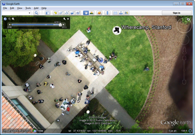
 Is your favourite flying area only covered by fuzzy satellite imagery when reviewing your flight logs? Want to do something about it? The Public Laboratory for Open Technology and Science has done the hard part to provide the tools, and the fruits of that labour are starting to pop up in Google Earth.
Take a look and see if you have imagery you might want to submit too!
Balloon and kite imagery in Google Earth at Google Lat Long Blog.
Comments
Yep they have been doing great things for ages, gosh lets hope they don't decide to enter the T3 and do a better job.......
Here is what Google is saying about adding more, DIYD layer anyone?
Hi Public Laboratory and Grassroots Mapping communities,