The UAVGuy has a terrific post on his experience with mapping vineyards with a 3DR Y6. The whole post is worth reading, including setting up cameras and gimbals for mapping, but here's an excerpt on the data analysis part:
A number of software suites exist to process images and create NDVI information, two examples are AgiSoft (http://agisoft.ru/ ) and Pix4D ( http://pix4d.com/ ). Another interesting choice is from Agribotix which is a Cloud Based NDVI service for post processing UAV images http://agribotix.com/
This survey was based on Pix4D who kindly gave us a Demo License for this investigation. The purpose of this software is numerous. Firstly it corrects for camera issues, as such the camera model used is added as input data, the separate images are uploaded and then the software joins all the separate images together in a point cloud. From this a single large image is generated and then numerous other outputs such elevation models, 3D models, plus NDVI data plots as outputs. The output formats are numerous, with Geo-Tiff been a primary output. To help the software align the images, ground control points can also be added, which gives known reference point for the software to stitch the images together.
To get a complete stitched image, all the images must overlap. The required overlap is normally 60% to 80% to allow the software to stitch properly. As such you need lots of images, and the lower you fly, the more images you need. The downside of this is that you must process more images, which takes more time. This process requires a fast computer using lots of memory, such as an Intel i7 running 32 or 64GB of memory. So two lessons fly as high as you can, but no higher than 400’, and have a very fast computer.
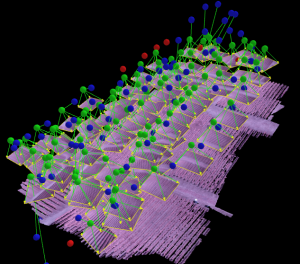
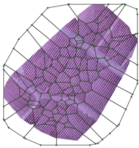
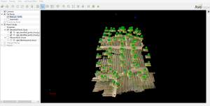
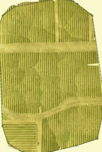
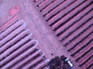
Pix4D did an excellent job of stitching the NGB NDVI images together, but issues did occur with the RGB images, although this was not a software issue. The GPS on the Canon SX260HS RGB camera had not geo-tagged the images correctly. However just using the Pix4D ground control points, the software was still able to stitch the RGB images together.
NGB Point Cloud showing the UAV position when the image was taken.NGB Mosaic Image, showing the separate images stitched together.
RGB Point Cloud, where the images were stitched using just ground control points with no GPS data.
RGB Mosaic with all the stitched images.
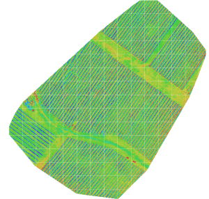
NDVI Image
The NDVI image was generated using the NGB bands processed by the Pix4D software. A quick explanation of the image brings to lights some details with NDVI imagery in vineyards. Firstly the dark blue is actually due to shadows on the ground between the vineyard rows. This was because the survey was flown in the morning around 10:30am, rather than noon with the sun directly overhead. The green indicates the ground. The red indicates the separate vines.
One of the main items to notice is where you have good vine virility and growth, you see red vines and the blue shadows. Where growth is low the vines in red are less obvious and the shadows (blue) less strong, and the ground (green) more merged together. Using this information it can be see that certain areas show lower growth and yields than other areas.
Correlating to Ground Data
After the data was processed, we went and talked with the vineyard owner, and compared ground data with our results. It was obvious from the discussions that the ground data and the UAV NDVI and RGB images both highlighted low yield areas, which were known to be lower than the rest of the vineyard due to soil type, irrigation etc. As such the UAV images with Pix4D processing were shown to have been able to correlate well to ground data.
It also became clear that the owner knew his vineyard very well, as it was approx. 17 acres, so he and his staff could walk the property and identify issues on the ground. As such UAV imagery only becomes effective as a business model when the property cannot be efficiently walked. At this point the UAV is indispensable in its ability to capture large areas and process data.
One advantage of UAV imagery that needs further investigation though, is that RGB images do not show yield issues that easily when the vines are netted, however preliminary analysis shows NDVI NGB images can show yield issues even when the vines are netted.
Lesson Learned
1. Keep it simple
2. If it can go wrong it will go wrong
3. Preplan your mission, do a site visit or use Google Earth for site info
4. The higher you fly, the less images you need which means less processing time
5. The higher you fly, the larger the area you can map
6. Always check your images when in the field
7. Fly at noon to limit shadows from the vines causing NDVI image
8. Use an observer
9. Crop analysis is 20% flying and 80% data processing
10. Image processing takes lots of computing power, get a fast processor with lots of memory
11. High quality images equates to high quality crop analysis, poor images mean poor data
12. Aerial images and analysis needs to be correlated with ground data to be effective
13. Normal photographs and video in RGB is almost as invaluable as NGB to the vineyard owner
14. Drone NDVI mapping becomes effective with vineyards greater than 50 acres
Summary
So we have shown how a UAV such as a 3D Robotics Y6, mounted with a simple Canon point and shoot camera modified with a NDVI filter, using powerful software such as Pix4D, can generate useful crop analysis for vineyards. We’ve pointed out lessons learned and are now ready to keep on helping the Santa Cruz Mountain Wineries stay the best in the World.
Comments
Hello Neolu, Good observation on the the flight path, it was flying in survey mode however, the Santa Cruz mountains have significant winds especially through the morning. That day there was extremely windy with a constant wind, but then with gusts of approx 25mph at ground level by my estimation. It was windy enough that an event at the vineyard, they were having trouble keeping the tablecloths on the tables. Not the best day to fly, but we still got the data.
"..to keep on helping the Santa Cruz Mountain Wineries stay the best in the World"
LOL :)
Otherwise, nice post!
Why the track and camera position is very messy?
The plane did not adjust well?
Not use survey flight?