I recently connected with senseFly's Adam Klaptocz who founded the non-profit group DroneAdventures to promote humanitarian uses of UAVs. I first came across Adam's efforts last year when reading about his good work in Haiti, which demonstrated the unique role that UAV technology & imagery can play in post-disaster contexts. DroneAdventures has also been active in Japan and Peru. In the coming months, the team will also be working on “aerial archeology” projects in Turkey and Egypt. When Adam emailed me last week, he and his team had just returned from yet another flying mission, this time in the Philippines. I'll be meeting up with Adam in a couple weeks to learn more about their recent adventures. In the meantime, here's a quick recap of what they were up to in the Philippines this month.
Adam and team snapped hundreds of aerial images using their "eBee drones" to create a detailed set of 2D maps and 3D terrain models of the disaster-affected areas where partner Medair works. This is the first time that the Swiss humanitarian organization Medair is using UAVs to inform their recovery and rehabilitation programs. They plan to use the UAV maps & models of Tacloban and hard-hit areas in Leyte to assist in assessing "where the greatest need is" and what level of "assistance should be given to affected families as they continue to recover" (1). To this end, having accurate aerial images of these affected areas will allow the Swiss organization to "address the needs of individual households and advocate on their behalf when necessary" (2).

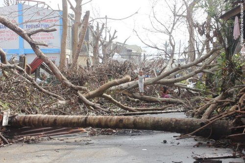
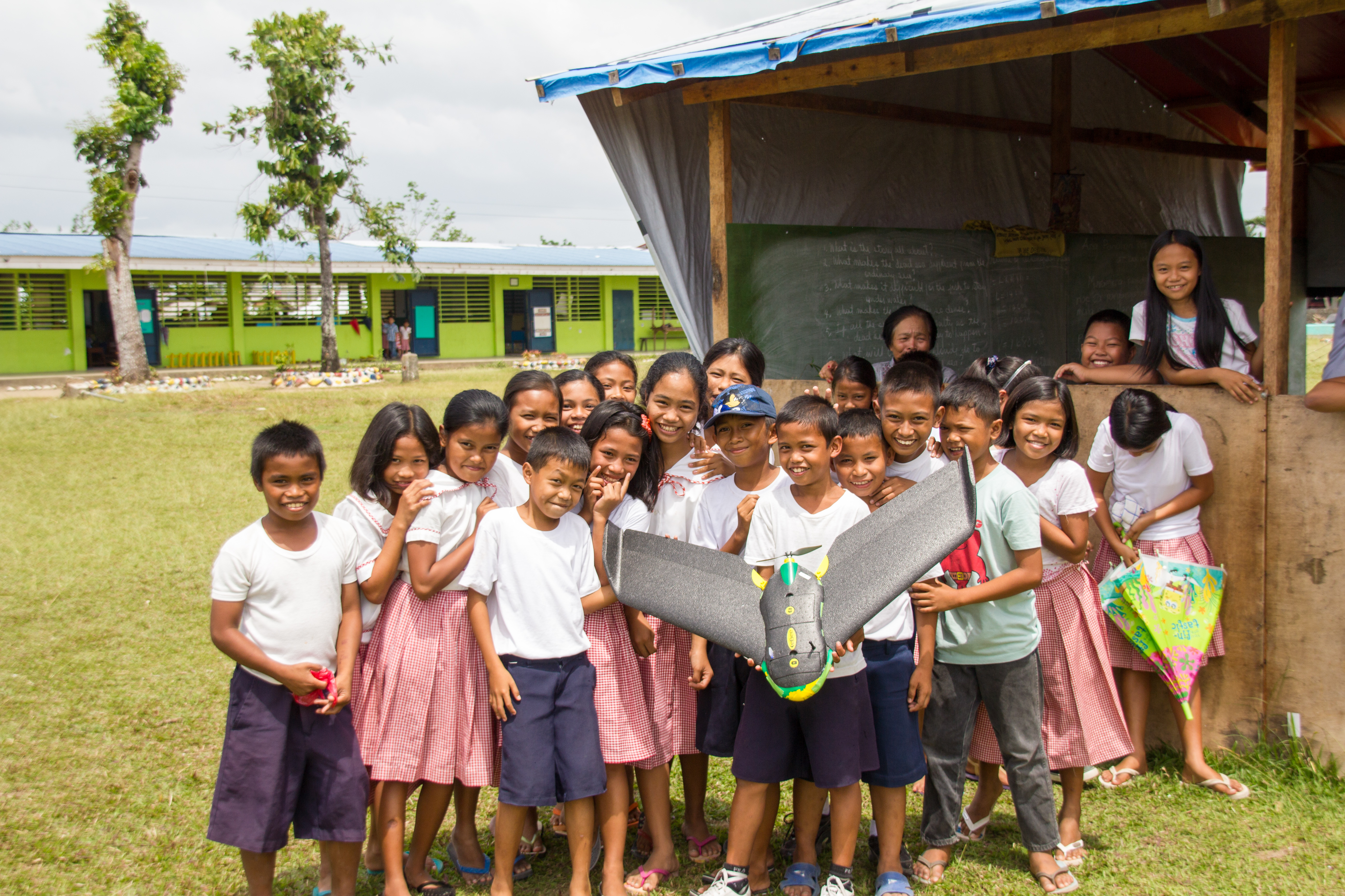
An eBee Drone also flew over Dulag, north of Leyte, where more than 80% of the homes and croplands were destroyed following Typhoon Yolanda. Medair is providing both materials and expertise to build new shelters in Dulag. As one Medair representative noted during the UAV flights, "Recovery from a disaster of this magnitude can be complex. The maps produced from the images taken by the drones will give everyone, including community members themselves, an opportunity to better understand not only where the greatest needs are, but also their potential solutions” (3). The partners are also committed to Open Data: "The images will be made public for free online, enabling community leaders and humanitarian organizations to use the information to coordinate reconstruction efforts" (4). The pictures of the Philippines mission below were very kindly shared by Adam who asked that they be credited to DroneAdventures.
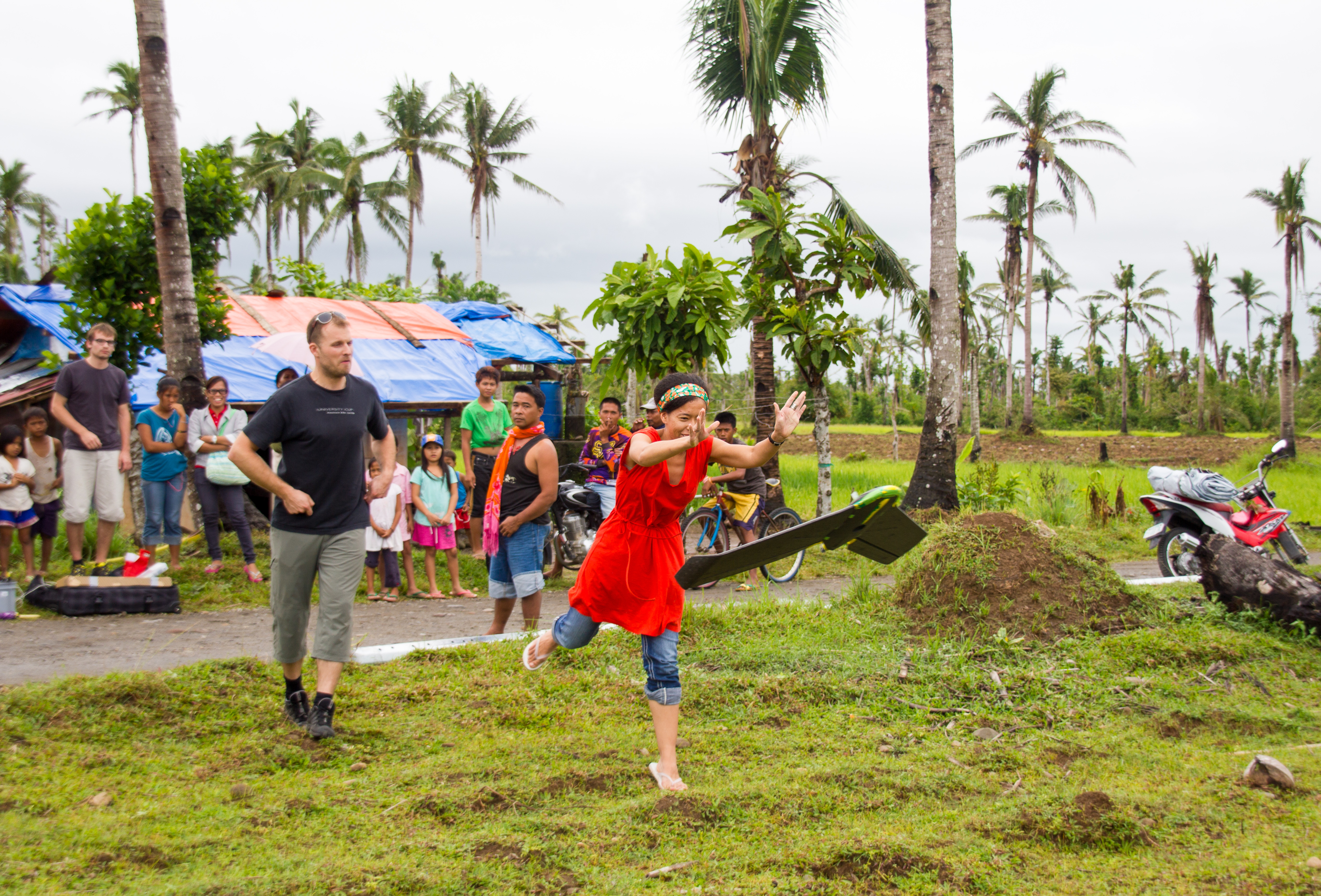
At the request of the local Mayor, DroneAdventures and MedAir also took aerial images of a relatively undamaged area some 15 kilometers north of Tacloban, which is where the city government is looking to relocate families displaced by Typhoon Yolanda. During the deployment, Adam noted that "Lightweight drones such as the eBee are safe and easy to operate and can provide crucial imagery at a precision and speed unattainable by satellite imagery. Their relatively low cost of deployment make the technology attainable even by small communities throughout the developing world. Not only can drones be deployed immediately following a disaster in order to assess damage and provide detailed information to first-responders like Medair, but they can also assist community leaders in planning recovery efforts” (5). As the Medair rep added, "You can just push a button or launch them by hand to see them fly, and you don't need a remote anymore—they are guided by GPS and are inherently safe" (6).
I really look forward to meeting up with Adam and the DroneAdventures team at the senseFly office in Lausanne next month to learn more about their recent work and future plans. I will also be asking the team for their feedback and guidance on the Humanitarian UAV Network (UAViators) that I am launching. So stay tuned for updates!
See also:
- Calling All UAV Pilots: Want to Support Humanitarian Efforts? [link]
- How UAVs are Making a Difference in Disaster Response [link]
- Grassroots UAVs for Disaster Response (in the Philippines) [link]
Comments
Thanks Euan! Glad you think that the Humanitarian UAV Network is a good idea. Yes, happy to talk further, you have my email address already and my SkypeID.
I've been looking at this specifically within the Swiss context, for it's specific problems, but already, I think the UAV network is a good idea. I think the largest problem will be the diverge number of groups that already offer their help, but rescue coordinators don't know where to go, or who to call. I have a solution to this, but we should talk more about it offline in Lausanne.
Unfortunately, my firewall blocks access to your strategy doc (until I get home), but I have some thoughts:
- Many grassroot deployments are at the "hobbyistz with a phantom with a gopro" technical level. Many volunteers offer their assistance, but many are under-equipped, have overly high expectations of what they can do and - apart from a few cases - mostly helping out of the first time. This needs to be addressed. A good example - avalanche SAR may actually involve anything from 1-5km drudge through thick snow uphill, just to get to the Ops HQ. I'm a keen cyclist (73kg, resting HR of 40bpm), and this is still damn near killed me, and I'm sure that many of the volunteers are not fit enough to complete this, never mind with 6-10kg of UAV equipment on their back. Even if it can be transported that way - its lumpy, sharp and delicate cargo. I have some thoughts about this too, which we can talk about in more detail.
- Many operators over-estimate the abilities of their craft, and their skills. This can lead to situations of lack of range, fresnel zone violations, control loss, orientation failures in unknown terrain, battery failsafes etc. If someone's life is hinging on a drone package delivery of insulin, you really don't want to have to turn round and say "errr, actually, I can't get to the target". I have some ideas on "certification", which we could discuss further.
- SAR co-ordinators are not necessarily experienced enough to make judgement calls on what "drone" technology to deploy. DroneAdventures appears to be getting the formula right, but this is only one application, and they probably had to teach medair what the technology can do. Education of the target users should be a key strategy, and some guideance on the pros and cons of each platform should be issued.
I could go on...but lets talk later!