-cross platform compatibility: built in java, program works on linux machines through a shell script, and executable on windows
-multiple map sources from NASA servers, MS servers, and others.
-immediate location maps can be cached for offline use, only limited by storage space.
-Reconfigurable GUI; drag and drop windows to suite ones needs
-expandable through the use of java modules
-customization.
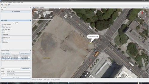
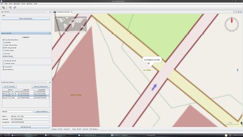
This is still a work in progress, here are some screenshots:
High res MS maps:
OpenStreetMap:

Current modules:
-Geographical view
-Map source selection
-Bookmarks
-line builder (including altitude) for path construction
-file import for the above (i.e. walk around logging a GPS course and upload)
Planned modules:
-live video feed w/OSD
-attitude indicator
-downlink data
-communication customization
And the question:
What do you want to see in a GCS?

Comments
I,m one of those "real" IFR pilots. My request is full compliment of instruments that I can fly my drone totally on instruments. These instruments must include Altimeter, Attitude Indicator, a real functioning Turn Coordinator, Verticle Speed indicator, Airspeed Indicator and Heading Indicator arranged in a true airplane configuration. Just google IFR panel configuration.
Thanks for asking. That's my wish list!!!
Regards,
Doc
Looks cool, where are you with this ?
4 Tabs for me pls.
General settings screen
IFR/VFR screen( with google earth and video screens on seperate Tabs) if on same screen that should support multipe screen spanning resolution,
Comms and tweaking /tuning with telemetry capture screen,
help/documentation/update/about Tab
-
1
-
2
of 2 Next