JP's Posts (29)

Sort by


Great video of Rano Raraku 3D via Easter Island Statue Project [eisp.org]. DEM and Orthomosaic generation by DroneMapper.com using imagery from Trimble/Gatewing UAV. 140 Images, 30cm GSD final. Cloud processing time was around 1 hour. Animation in ArcScene by Kim Anh Hoang. 

Video 3D RR Flyby

3689461275?profile=original

The above image shows the outer quarry and certain Moai statue in 3D. 

You can download the dataset from the following URL: http://dronemapper.com/gatewing1

Enjoy!

Read more…

DroneMapper Aerial Mapping Service Update

3689457353?profile=original

Hello everyone:

I don't know where to begin! This last 4 months has been amazing and very challenging. :) I couldn't have made it this far without the help the beta testers, Pteryx UAV (Krzysztof Bosak), Jeff Taylor, Irvin Stafford, Michael Oborne, Martin R and others. Thank you guys. As of now, we have a full feature set for the launch of the site around June 1st (maybe sooner). I don't have GCP support yet, but that is coming when I can get some additional time and maybe some development funds. I am pretty back logged processing flights and I am happy to report we've passed the 5000 imagery mark. Pretty cool! :D

I have been working with various companies to verify accuracy/resolution and result generation. It has been invaluable. I have to say that I am utterly amazed at the quality and consistency of the Pteryx UAV platform!

Here is an example of the worldfile results for a recently process Mikrokopter job. This job result was DEM 3cm/px with smooth/blending and Orthomosaic at 1.8cm/px.

0.0180503004230558872
0.0
0.0
-0.0180503004230558872
455529.862196518574
5569638.87532691658

3689457289?profile=original

3689457336?profile=original

3689457370?profile=original

3689457408?profile=original

(above image is SenseFly UAV Quarry Sample Imagery via DroneMapper)

Still lots of work to be done, bugs to fix and features to add. I am hoping to get some additional help with DroneMapper soon. 

Cheers and many thanks Pteryx UAV

JP Stoermer

Read more…
medium_route1map.pngHow to get good results on your mapping mission with any backend processing service!
  • Imagery should have at least 60% overlap and should have at least 20% orthogonal overlap.
  • Imagery must be shot in sequence. See examples below.
  • Images must contain required EXIF information. [more]
  • Images are shot with one camera and focal length.
  • Images should not be pre-processed. (i.e. Lightroom, Picassa, etc)
  • Images are NADIR or near vertical.
  • Flight Path should be Parallel Line (aka Lawn Mower) or other large overlapping style.
  • Flight Path should provide sufficient coverage of survey area. Meaning a large amount of overlapping images for target area.
  • Flight should be from sufficient elevation. (i.e. >80 meters)
  • Try a small subset of your imagery as a test. We process 15 images or less for free!


Flight Mode / Geolocation Guidelines:

  • Use a supported Flight Controller with supported export format. [more]
  • Sync your camera internal time with your flight controller GPS time. [more]
  • Imagery EXIF timestamps must match flight controller log timestamps to obtain rough georeference.
  • Flight Controller log exports should be in WGS84 for Latitude and Longitude. Elevation in (m) above the earths surface or actual elevation of image. Camera direction in (d).
  • Each image must have a matching GPS/IMU log entry.
Imagery Sequences with Problems:


possibleerror1.PNG?width=750
The imagery sequence above may experience problems processing due to image P1020271.JPG. This image does not have connecting
control points between P1020270.JPG and P1020272.JPG. Note: This is a small subset of over 100 images.

medium_route1map.pngFlight Path


badsequence.PNG?width=750
This sequence attempts to show aerial images with a small amount of overlap shot out of sequence. You can see the flight path does not

include a large amount of imagery overlap.

medium_route2map.pngFlight Path


Imagery Sequences with Good Results:


goodoverlap3.PNG?width=750
This sequence shows a good amount of overlap between images. A large amount of control points are detected in order to scale, rotate and mosaic. This is a small subset of over 241 images.

medium_route3map.pngFlight Path


goodoverlap2.PNG?width=750
An example of a flight from Pteryx UAV with a large amount of overlap. This is the idea situation.

medium_route5map_0.pngFlight Path


goodoverlap4.png?width=750
Another example of an imagery sequence with a large amount of overlap.

medium_route4map.pngFlight Path


Hope this information helps all you UAV mappers out there. Cheers,
JP Stoermer
Read more…

3689454408?profile=original

http://dronemapper.com

Here is an example flight from a Pteryx UAV with 181 Images at 10 Mega Pixel. The flight elevation was around 275m average. The GSD (Ground Sample Distance) is around 13cm. We don't have support for GCP (Ground Control Points) yet, but that is on the way and will make results very accurate. We are still calculating the accuracy of our flights but they depend on a number of things because GCP are not used. This method can only be as accurate as the GPS unit. We estimate a 3-8m accuracy for georeferencing without GCP.

3689454323?profile=original

The above data is viewed in QGIS using Openlayers Plugin. It will read the .tfw, you should set the projection or your overall project projection to 33N WGS84 UTM.
Low Resolution 3D Point Cloud data is viewed in MeshLab.
 

You can download the results of this flight in high resolution for evaluation here.

3689454429?profile=original

3689454387?profile=original

3689454442?profile=original

I also setup an automated model generation from meshlabserver with a webgl viewer. It allows a nice preview of the 3D data. Tons of other updates and improvements thanks to feedback and testing from the beta crew! Thanks,

JP Stoermer

Read more…

3689450314?profile=original

Hey everyone,

Quick update regarding dronemapper.com. Big thanks to all the best test users who have been helping me work out plenty of bugs and also get certain data formats more reliable. TLOG processing is working and now using the correct log fields, for the best results we have found you should have a magnetometer installed. :) There are a couple of cool new features:

  • SRTM3 DEM Data of your flight region, large and trimmed GeoTiffs are generated.
  • 3D Mosaic Blending, 3D DEM and 3D Model generation. (roughly based on Andrew Hazelden's approach)
  • Improved Ardu GPX/TLOG processing.
  • Improved "blended" 2D mosaic generation. Lots of bug fixes!
  • TLOG Processing via MAVLink Graph
Definitely a lot of work and refinement left but I am not so discouraged. :D
3689450379?profile=original
3689450392?profile=original
3689450444?profile=original
Output .PLY file downloaded and viewed in MeshLab. I hope to have an online viewer like Hypr3d shortly. 
 
3689450519?profile=original

Imagery Courtesy: Martin R.
Mikrokopter Platform: 43 Images, 25 Used in 3D Mode
 

3689450331?profile=original

Thanks to everyone involved.

Best,

JP

Read more…

3DR Quadcopter Build w/ APM2, 880kv

3689449378?profile=original

Thanks for all the hard work Diydrones team! I've finally got my quad flying and it is a lot of fun. I am on to the tuning and testing stage, burned through a bunch of batteries and props yesterday. :) oops. Being a complete newb to the RC scene, this build was pretty difficult but very rewarding. Teaching myself to fly has been great, and the last 3 months of work has paid off. Here are some details of my build, hopefully they may help someone out:
Replacement "Lowes Special Highrise" Landing Gear. Saves 40 grams. :) I suck at flying my quad, so I am always breaking stuff while learning. Yesterday I broke one of the landing gear and decided I wanted highrise but not wait for shipping. After building the new gear and comparing against the old landing gear I was surprised to see each was about 10 grams less weight. Around 40 total.

Frame: 3DR Quadcopter rev A
Telemetry: No
Controller: APM2
Motors: 880kv
Props: 10x4.5black, 10x4.5apc (worked great!), 12x4.5 (not very good for me)
ESC: Thunderbird 36
Battery: Turnigy 4000mah 3S
Sonar: XL-EZ0
Landing gear: Custom Lowes Special
Firmware: 2.5 from Mission Planner
Mode: X
PID Settings:
Defaults with RATE ROLL P = 0.105

I've had successful flights with all props with these settings, the 12" props definitely seems to introduce stab issues making the quad hard to control. The 10x4.5 and 10x4.7 from APC have been great giving me the most success. Now, a few mods that I've done to help fix bends, breaks, bruises after crashes or just make things more solid:

3689449320?profile=originalI put a couple of small washers under the motor to distribute weight and help stop the aluminum from bending. I've found it helps keep the motors straight.

3689449185?profile=originalI found small diameter aluminum tubing at Lowes, cut this into 3/4" sections and used over bolt to help keep frame from bending. Tubing

3689449407?profile=originalAdded a few extra washers here and there to help distribute weight when tightening

3689449460?profile=originalMounted the APM using faucet o-rings from Lowes. O-ring
I can't remeber the exact size. APM2 Mount

Landing gear parts:
Old gear: ~23g with hardware

New gear: 14g with foam

1) 1/2"w x 36"l aluminum strip from Lowes 3' bar
2) section of pipe insulation from Lowes
3) zipties
I hope to post some "in flight" pictures soon! Thanks, 

JP

Read more…

3689448688?profile=originalMosaic Only Mode! Unknown flight platform and controller. :) No geo reference. Thanks Hazelden.

http://dronemapper.com

Hey everyone,

It has been a crazy week! Thanks so much for all the help testing and great data. Ironed out a lot of bugs and added some new features. I can't thank the beta testers enough for the ideas, suggestions and patience! You guys rock. :)

  • The Mikrokoter workflow is solid and generates great maps. Thanks Martin R.
  • The Arudplane/Copter workflow is in progress and working good. It needs work still. Thanks Rigel, Irving Stafford and Jeff Taylor for the help.
  • The MAVinci and Pteryx workflows are solid and generating good maps. Thanks guys!
  • I am pretty sure we can accept any sort of log file with associated imagery, we are calling that "generic". 
  • Today I finished a "mosaic only" mode, which will just accept imagery. No flight data or anything. It simply builds a mosaic and downloadable geotiff. This is great for people with just aerial imagery! Thanks Hazelden for the images and idea. (still super rough, just the framework is completed)
  • We have a new feature which calculates the area of each tile and also the estimated area of the entire mosaic.
  • Almost finished a workflow which builds an SRTM3 DEM underlay with contour lines of your flight area. Your mosaic is the top layer.
  • Tons of more features and bug fixes. Memcache for the win on the UI! 
  • Many performance improvements.
  • Thanks DIYDRONES!


Re-deployed to a larger dedicated EC2 instance.

Shoot me a message with some information about your flight platform or if you just have aerial imagery you'd like to build maps from. Please let me know if you have any questions or comments! 

On a side note, I finally got my 3DR quad flying. So cool! Lost a few more props but it is very stable, my only issue at this point is wobble on descent. :D

3689448759?profile=original
3689448613?profile=originalMikrokopter Flight, Showing Area of Tile

3689448821?profile=originalArea of Imagery

3689448634?profile=originalMK Flight with SRTM3 DEM Underlay, Contour Lines Every 10m, Shaded Relief Added


3689448647?profile=originalArduPlane Flight from Irvin Stafford. Blended Mosaic

Thanks

JP

Read more…

3689447621?profile=original

Thanks for all the interest and support so far. I should have the site up and running in the next week! Still trying to figure out the most cost effective hosting solution. :) I'll definitely contact everyone who has contacted me with interest in beta testing when it is ready. I took a few days off from coding to try and get my 3DR quad flying. It was almost a success until a tethered flight in the garage went bad! Lost a motor and some props, waiting on parts now. :)


Progress on each workflow/UAV:


Pteryx UAV - 9/10 completed. (.csvp)

MAVinci UAV - 9/10 completed. (.csvm)

ArduCopter - 7/10 completed. (.log) accuracy isn't the best / (.gpx file is lacking compass/heading info)

3689447642?profile=original

(blended mosaic has trouble from forest coverage, fewer auto detected control points. it does better once resolution is turned up)


MAVinci Sample Imagery Processed! :D Very big thanks to the MAVinci team and the support they have given me! It has been very helpful in improving the MAVinci support and making some nice maps. They have a couple of really nice sample imagery sets at the following link: ftp.mavinci.de

The processing will work with GPS EXIF enabled images or not. I don't have access to non-GPS enabled images and the associated flight logs so I haven't coded this fully yet. It supports Canon and Panasonic camera's at this point, as this is all the sample imagery I could get a hold of. I can certainly add the code once I get additional camera and imagery formats. So keep an eye out for that.. 

Issues/Problems:

* blended mosaic isn't georeferenced

* control point detection isn't the best in forest, desert type areas

* ie css/browser issues

* unfinished non-gps enabled imagery workflow

* a bunch of others

I also added a interface to open source bundler, which will create 3D point clouds from the images. Once completed you can download the ply/pointcloud bundle as a zip file and do as you wish. Most of the following workflow: http://diydrones.com/forum/topics/making-digital-elevations?xg_source=activity Thanks Mark!


dronemapper.com

Read more…

3689445082?profile=original

Hello fellow UAVers,
dronemapper.com
My UAV partner (Ross) and I have been working on a project that we'd love to get some feedback and additional ideas for. Our intention is to allow free access to this web based tool and also a really cheap subscription model per month (think $4 range) to support hosting costs and the large amount of cpu processing power needed to generate maps. The free users will get all the same features but lower resolution imagery and possibly less accurate georeferenced tiles/tiffs/added watermarks to support the site. No ads.
 

Our software and backend servers use tons of different open source packages to complete the process of georeferencing and building image mosaics. We are also trying to offer an "easy to use" UI to view each flight and all the associated data. We really hope you enjoy our ideas! We are planning to open the site up to beta users by request in a month or so. Please keep an eye out for more information on that.

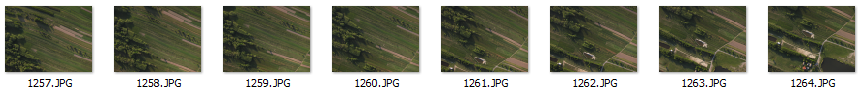
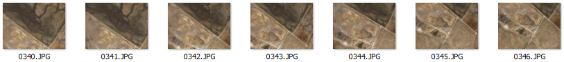
We've been having some problems getting our own flight systems up and running, ranging from a bad MUX on an APM 1 (thanks for fixing!), APM2 delays, and code issues with the Tri-Copter platform. This has prevented us from getting amazing imagery on our own at this point. :( Lucky, the awesome guys at Petryx UAV posted a ton of sample imagery which is so cool! Pteryx FTP Sample Imagery

We can't wait to open the site to beta users so you can test your own imagery and flight paths, hopefully at that point we will have our own platform up and running!

So, here we go -- some screenshots and comments:

3689445213?profile=original

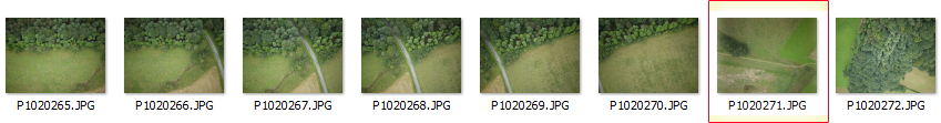
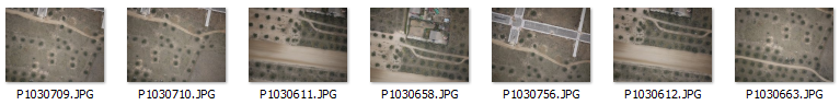
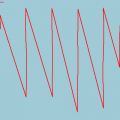
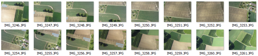
Upload your flight imagery and Ardulog/GPX/Petryx/CSV log file.
3689445156?profile=originalImagery and Flight Processing Queue
3689445177?profile=originalImagery Dashboard w/ Flight Path, GeoTIFF served via Geoserver, Blended and Georeferenced Mosaics


3689445082?profile=original

Same as above, different flight.


3689445096?profile=original

Georeferenced View w/ Google Earth API - Shows Tiles, Flight Path


3689445235?profile=original

Second Part of Georefenced View - Shows GeoTiff Mosaic Preview and Metadata


3689445308?profile=original

Third Part of Georeferenced View - Shows Additional Maps
 

3689445182?profile=originalBlended Mosaic

3689445322?profile=original

Our Tricopter platform. Quadcopter and also Skywalker platforms we've been testing!


3689445357?profile=original

Quadcopter w/ IR Powershot a490 Camera
 

We would love to hear some questions and comments!


Thanks for reading and thanks for your support,

DM Team (JP and Ross)

Read more…