The cost of assembly drones is relatively low, gradually getting popular with ordinary farmers and plant protection service teams.
However, there are some disadvantages of assembly drones, such as low intellegence, complex debugging, messy wiring etc.,which are bother most assembler dealers and service providers.
For above cases, EFT developed the Z series holistic smart drone system solution . Z series drone solution innovatived in structure,and configured with intelligent linkage system , deep integration of software and hardware, professional comprehensive inspection to ensure the quality . Realized more convenient , more intelligent and precise , more stable and durable.
If you are interested ,welcome to contact us to learn more .
𝗜𝗻𝘁𝗿𝗼𝗱𝘂𝗰𝗶𝗻𝗴 𝗭𝗜𝗢 | 𝗠𝗲𝗲𝘁 𝗧𝗵𝗲 𝗙𝗶𝗿𝘀𝘁 𝗣𝗮𝘆𝗹𝗼𝗮𝗱 𝗼𝗳 𝗚𝗿𝗲𝗺𝘀𝘆 Over a decade known as a gimbal manufacturer. Today, Gremsy introduces a new product; the initial payload is called Zio. The launch of a brand-new line of Gremsy ecosystem. Zio is a high-resolution zoom payload that combines a Sony sensor with high-stabilized three-axis gimbal technology. It enables industrial inspectors and surveyors to zoom into objects of interest and effortlessly transmit video at 4K resolution, ready to be utilized for a variety of different inspection, surveying, and public safety jobs.
The ultimate solution for remote sensing and IoT monitoring applications, this module can be easily used on unmanned systems for research, meteorological applications, wildfire monitoring systems, and security applications.
This Plug and Play module directly connects to the TELEM1/2 port of your Pixhawk system to provide satellite telemetry, easy to set up, and to use with QGC or other ground station software.
This system integrates an Iridium 9603 module to transmit telemetry information wherever on the planet.
The Grasshopper NDVI is the newest in our line of simple-to-use survey cameras. Every Grasshopper NDVI camera allows the connection to an external USB GPS receiver to automatically geo-tag each captured image. Its 8MP sensor and sharp non-fisheye lens allow you to capture aerial media easily. It captures photos on the default timer trigger or can be sent a PWM signal through the HDMI port (see below). If you supply power to the USB port it will power on the camera automatically. Sized similar to a GoPro® Hero these small survey cameras can be attached to your aerial drone platform using our various mounts.
This Red+NIR (NDVI) model sees Near Infrared 850nm and Red 660nm light. The images from this camera are commonly calibrated into an index image and then a colored lut is applied to show contrast between healthy and poor health vegetation.
Drone spraying pesticides has become more and more popular, which is cheaper and more efficient than traditional manual spraying. However, But sowing and fertilizing, most small farmers still work in the traditional way.
One is a complete drone with spraying and spreading functions, such as DJI and XAG. Another is spraying drone, which can be upgraded to an all-round agricultural drone by a detachable spreader. For example, the V2.0 granule spreader is integrated structure and tool-free,easy for pilots to modify and adapt to all open source flight controllers. For pilots or agricultural service teams, the cost of investment and replacement is lower.It can sow rice, wheat, soybean, cotton, etc. evenly and efficiently at 360°, or fertilize.
With the development of technology, drones are becoming more powerful and easier to assemble and operate. This is conducive to the majority of farmers to easily farm, reduce costs and increase income.
Pixy WE is the gimbal tailored for Workswell Wiris Enterprise, making the flawless combination ready to be used for all unmanned vehicles. The gimbal comes with all advanced built-in functions to serve mapping, security, and high-resolution imagery applications.
Posted by drone036 on November 14, 2022 at 12:39am
Autel Robotics EVO II Pro 6K Drone Advanced Rugged Bundle contains drones and accessories in a military-grade hard case for easy transport and gives your gear ultimate protection. The precision-cut foam case stores and protects the EVO II Pro aircraft, 3 spare batteries, (total 4 flight batteries), controller, charging hub, spare props and charger.
Autel EVO 2 Pro ultra-HD video camera drone featured a 1-inch sensor with 6K video and 20MP photo. Capture stunning detail not previously possible on an aerial platform of this size. An adjustable aperture from f/2.8 - f/11, HDR and intuitive camera controls make this the perfect choice for any aerial cinematographer or mapping pilot.[Autel EVO II Pro V2 drone returns to home automatically without GPS signal at high altitude.]
1″ CMOS Sensor & F/2.8-F/11 Adjustable Aperture
6K Hyper-lapse photography and More Shooting Modes
Capture the night time world
10-bit A-Log Color Recording
Connect Autel Live Deck to display live video from EVO II on any device
Adjust field-of-view to any angle from 0° to 90° while flying
Posted by Tomi Piriyev on November 12, 2022 at 11:25pm
Hello Everyone, I have been working on loko for a quite time , which is the smallest GPS tracker with LoRa peer to peer communication . And now Lora is open forpre-orders on CrowdSUpply.
Loko is a tiny, easy-to-use, open-source, battery-operated, GPS tracker that sends navigation data to its receiver via peer-to-peer LoRa radio. Loko works through radio communication and does not require a SIM card or monthly fee. It also works anywhere, even if there is no 2G, 3G, or LTE coverage.
Excellent for Drones & More
Loko is an investment that allows drone owners to protect against the common occurrence of crashes and signal loss. But Loko is useful for more than just drone tracking. You can keep track of any device or belonging, which is important in a variety of personal and professional settings where you need to know a location in realtime.
As an effective measure to reduce agricultural production costs and solve labor shortage,UAV precision spreading and fertilization technology has been promoted by various countries.
Drones improve agricultural planting efficiency
Nowadays, "drone direct planting" technology has been vigorously promoted in South Korea as an alternative measure to cope with the shortage of rural labor. The South Korean government plans to invest 15 billion won by 2025 to expand the direct seeding area to 10% of the total rice planting area (13,000 hectares). Drone spreading can precise and quantitative sowing, which can help farmers effectively save 30% of seed per hectare. Efficient and precise operation reduce labor costs by 90% and operating costs by 85%.
Drones help the development of agricultural intelligence in Southeast Asia
Southeast Asian countries are increasingly shifting from traditional to modern agriculture. Currently, 2,000-3,000 agricultural drones are flying in the fields in Thailand, only cover 20% of the farmland area, 90% of the drones are used for spraying pesticides , and the drone spreading market is growing steadily.More and more agricultural drones are flying into farmland to help farmers increase production and income.
The intelligentization and dataization of agricultural machinery is a trend, and the low-cost and high-efficiency aerial work tools of drones will be adopted by more and more farms.
Headquartered in Oostkamp, Belgium, Citymesh is a pioneer of wireless connectivity with fifteen years of experience in high-end network design, installation, and maintenance. Through the combination of various technologies including 5G, Wi-Fi, smart sensors, and data visualization, they provide B2B smart infrastructure and innovative solutions in a variety of markets that are tailored to the needs of their clients.
They specialize in private 5G services and play a key role in setting up wireless networks in (smart) cities, at events, (air)ports, industrial facilities, and warehouses.
Why Genk is Using Smart Tech to Improve Emergency Response
Rapid response in the face of crises and life-threatening situations, such as fires and incidents, is critical for city officials all over the world. Fire departments across nations are implementing new technologies to improve operations and save lives.
Drones are one such valuable tool that has assisted firefighters in improving situational awareness. The imaging technology, software and accessories on board the drone enables the emergency services to gather information more quickly and efficiently in the event of an incident. Some of the major challenges that drones are able to solve include:
Incorrect Initial Report of Incident: The emergency services often receive distress calls, either from a bystander at the scene of the incident that does not fully or sometimes even incorrectly describes the incident or from an automated fire alarm. The emergency services dispatcher allocates resources based on the report, only to discover that they are insufficient in scale and/or type for the actual incident. Response time is critical. Any delay in responding to the incident effectively could result in fatalities or additional infrastructure damage. A local drone team needs time to drive to the scene, get the drone ready and start flying.
Lack of Real-time Awareness: Determining the extent of the fire, how to tackle it and the threat it poses can frequently be challenging due to the smoke and obstacles en-route to and onsite. The capacity of fire teams to respond to the situation quickly, adequately & efficiently is limited by these difficult-to-reach locations.
However, drones piloted by humans have certain limitations especially in fast-paced, dynamic environments.
Closing the Information Gap: Only the emergency services’ own drone team at the scene and, in best case, the local fire services officer are fully aware of the situation. Streaming the drone’s camera video feed to a local emergency services command center and/or dispatch or other stakeholders is not always possible, reliable or cheap. As a result, dispatchers and fire service officers coordinating from the department’s headquarters, especially in case of large scale incidents, frequently lack complete information, making it difficult to make the right decisions.
Inefficient Operations: It is challenging to respond with the appropriate level of resources, equipment & urgency if the team lacks clear knowledge. Sending too little resources can have detrimental consequences, but sending too much resources is problematic too as it draws the limited resources away from other incidents. In addition, heavy fire trucks racing through dense city centers poses its own risks for safety.
To overcome all these obstacles, the Belgian city of Genk decided to implement a combination of autonomous drone-in-a-box technology, AI, and a private 5G network to provide unique insights to emergency services without the need for additional staff.
Mayor Wim Dries emphasizes “Because of the dynamic nature of a city like Genk, we want to keep innovating. As a smart city, we use technology to improve the help we can offer to our residents and to ensure that our police and emergency services work as efficiently as possible. In this way, we can all work together to make Genk a safer place.”
How Citymesh’s Safety Drones is Overcoming these Challenges
The City of Genk recently launched a pilot one-of-a-kind initiative with Citymesh’s Safety Drone solution to assist emergency services in collecting information more quickly and efficiently during accidents with the help of drone technology.
The Citymesh Safety Drone solution is a fully automated Drone-in-a-Box system that allows first responders to immediately deploy a drone Beyond-Visual-line-Of-Sight (BVLOS) to an incident in order to quickly and reliably get a real-time overview of the situation/incident on the ground. The Safety Drone provides first eyes on-scene, even before local response teams arrive, to all relevant stakeholders. It is a Quick Reaction Force (QRF) asset which can be deployed within 2 minutes.
Citymesh established a private 5G mobile network bubble over the city of Genk to enable both Smart City use-cases on the ground and autonomous Beyond-Visual-line-Of-Sight (BVLOS) drone operations in the air. As it is a private network, it is tailored and built-to-spec specifically for that city and its use-cases which ensures reliable, secure, low-latency, mission-critical communications across the entire 3D volume around the city. In addition, the use of a private 5G network guarantees reliable communications, even during large scale disasters when public 4G/5G networks are saturated or offline.
As Dominic Knapen, Zone Commander of the East Limburg Fire Brigade highlights,
“Using a drone in emergencies allows us to assess the situation before we arrive on the scene. This saves us crucial minutes that could potentially save lives, and gives us more insight into how best to approach the incident and conduct our intervention.”
How Safety Drone Program Works
When a distress call is placed to the emergency number 112, the Safety Drone is dispatched from the docking station located on the roof of Genk’s police station located in the center of the city. The drone flies autonomously to the incident site while being remotely monitored by an operator at the Citymesh’s Remote Operations Center (ROC) in Oostkamp, Belgium.
Remote operators from the ROC can remotely manage, monitor and control the drone and docking station using the FlytNow-powered software. The ROC systems are integrated with the emergency services dispatch systems so the remote operator instantly has all relevant information on their screen when a Safety Drone is called upon. The live HD-video feed and high-resolution images captured by the drone are transmitted in real-time to the ROC, the police forces, fire-brigade & emergency services to accurately anticipate risks and select the best equipment needed for a successful rescue mission.
The remote operators are in contact with dispatch and local first response teams so they can fulfill their requests of focusing the drone’s cameras on a specific zone or the overall incident scene. They are also in contact with air traffic services to ensure flight safety with respect to other (manned) aircraft.
Because the information is highly sensitive, it is routed through the Citymesh private 5G network and its datacenter. The data is accessible only to authorized personnel and stakeholders through a secure, internally developed, video streaming platform (DroneHub) in accordance with the GDPR (General Data Protection Regulation). The data is destroyed after a certain period of time.
How Citymesh is Ensuring Safety in Operations
Furthermore, because the drone flights will take place in urban areas, ensuring operational safety has been a critical factor in the project’s implementation. Several safety features have been included while keeping regulatory requirements in mind. Some essential features include:
Parachute Integration: In the unlikely event that the entire system fails, Citymesh’s Safety Drone incorporates integration with an autonomous parachute system so that the parachute will open automatically and the drone would land safely.
Failsafes: A number of failsafe events and associated behaviors can be configured by operators using the ROC’s software – FlytNow. For instance, a failsafe action is triggered and the drone automatically returns to the docking station if the connection is lost, the battery runs low, or it loses internet connections.
Smart Return-to-Home: Once the NFZ is set and the drone needs to return to the docking station, instead of using a straight path back home, FlytNow creates a smart path in which the drone returns while avoiding the NFZs.
Weather Station Integration: The docking station includes a weather station that records vital information such as temperature, rainfall, and humidity, among other things. If it begins to rain while the drone is in flight and the set threshold is exceeded, the drone will return to the docking station autonomously.
The Safety Drone is being used during the day in the first phase of the project, but will later be used for 24/7 operations. The drone is currently flying at a height of 90 meters and covering a radius of 3 to 4 kilometers. As progress is made and the network is expanded, the drone will be able to cover a 5-kilometer radius.
Currently, the East Limburg Fire Brigade Zone is using this autonomous technology. The local police force, CARMA, may take part in the second phase.
“We are very enthusiastic about implementing this project together with the city of Genk and the regional emergency services. This project is a unique combination of technologies that will shape the future of our society,” says Mitch De Geest, CEO of Citymesh.
Citymesh provides the full Safety Drone Solution as a service. This means emergency services, fire brigade and police do not have to invest in drones, drone and communication infrastructure nor in the education and training of licensed drone pilots.
It is important to note that the Safety Drone Solution and local drone teams are not competing with each other but are complementary to each other. Much can be learned from each other. In fact, Citymesh drone operators have been trained in first response tactics by the local first response drone teams. Emergency services sometimes already (or will soon) have their own local drone team that is equipped with small drones. These drive to the incident location and perform flight operations at the scene and swap batteries between flights. Their advantage is that it allows them to be practically continuously in the air and provide a continuous overview of the situation, especially of long duration incidents, while the Safety Drone has to return to charge/swap its batteries. Their main disadvantage is that they have a longer response time as they need to drive to the scene, get the drone ready and start flying.
The Safety Drone pilot is currently financed & supported by S-Lim, an organization which unites the Limburg municipalities to enable the region to grow into a smart region via collaboration. The experience and knowledge gained will later be shared with other cities and municipalities in the province.
Nitin Gupta, Founder & CEO of FlytBase, Inc. concludes by stating, “Citymesh’s Safety Drone project has been a revolutionary step toward using drone autonomy for saving lives and improving operational efficiency. The project will serve as a powerful guide for emergency service providers worldwide.”
Sustained high agricultural production is an important factor for social stability and development. Are drones worth investing in agricultural production? Let’s take a look at the research from india. The team found manual spraying used more insecticides and water than drone-enabled spraying. Farmers used one liter of insecticide mixed with 160 liters of water for an acre of jasmine fields. Meanwhile, drone spray reduced the consumption to 750 ml of insecticide with 40 liters of water. Roughly, Drones can reduce chemical use by 10-30%, spraying an acre field in just 15 minutes. Combining farm chemical, water and labor costs, drone spraying can save $8-10 per hectare. https://youtu.be/SmPfETe-M0s
As an important equipment for agricultural production upgrading, intelligent agricultural drones will become more and more cost-effective, flying in the fields to increase farmers' production and income, and protect global food security.
In the agricultural drone industry, plug-in model is becoming more and more popular.
Which has large capacity and heavy loads, and can quickly switch between spraying and spreading, making agricultural production more efficient.
The initial investment of purchasing a drone may be high for farmers,but with the popularization of technology, assembly and localized drones are becoming more and more cost-effective.
Farmers can collectively purchase shared use through farm cooperatives or lease spraying services. And agricultural drones also provide freelance jobs for technical young people to become pilots to provide spraying and seeding services for farms
Would you like to have this new skill in agricultural drone operation ? Take EFT's G630 as an example to show you how to assemble, debug, and fly the drone.
Posted by Saulius L. on October 7, 2022 at 12:20am
A quick demonstration of how guided zoom works (distance the the TV tower - 1.3km). Calibration is not perfect (and should be automated). The focus stays sharp during the zoom transition.
Long-range operations are becoming common these days and 4G networks are often not available in remote areas.
The Heimdall companion computer solves these issues by using low bandwidth satellite telemetry, for cheap communications without range limits.
We optimized it for the MAVLINK protocol and we are able to provide it as a plug-and-play solution for many controllers.
Heimdall uses the Iridium satellite network to send UAV telemetry and object detection data to your ground station, to do that we had to develop a custom ground software, compatible with most flight controllers.
For more information please write to heimdallai@gmail.com
Posted by Jessica Ma on September 26, 2022 at 11:36pm
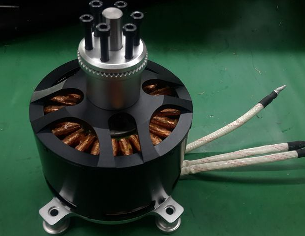
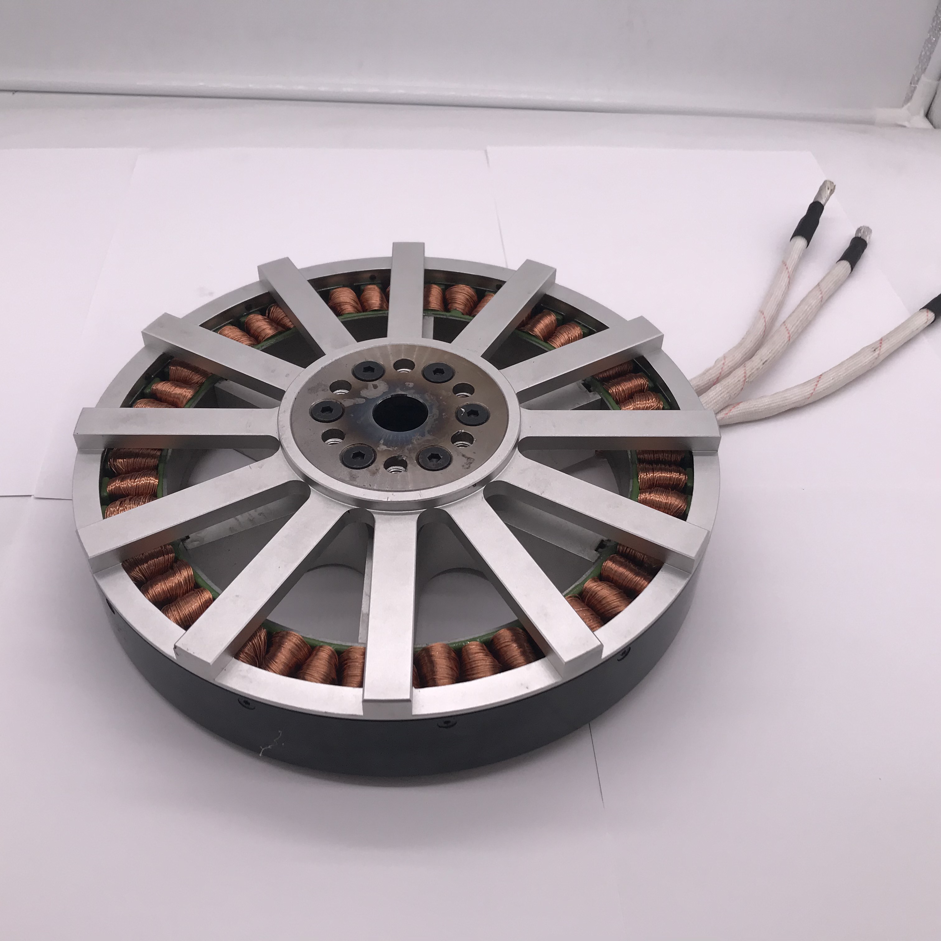
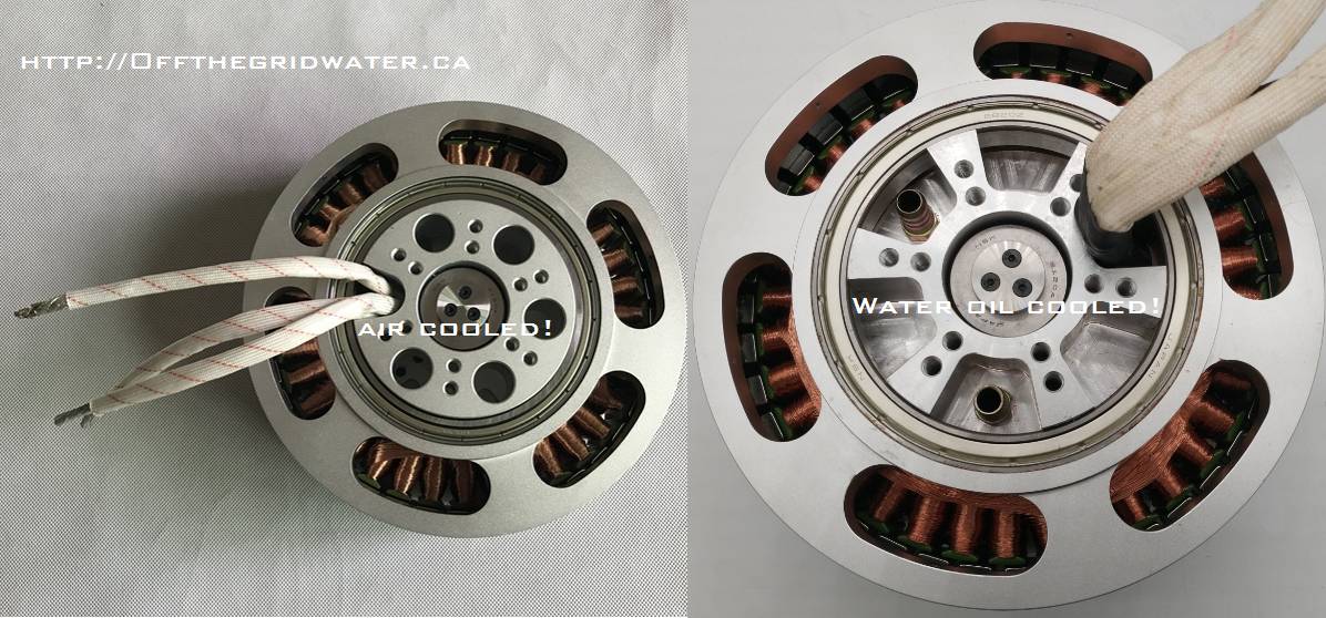
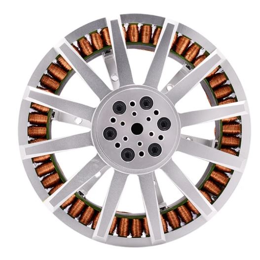
T-MOTOR is well-know as a worldwide manufacturer who provide industrial uav bldc motor, esc and carbon fiber propeller with 13+ years experiences.
And since there's a lot of choices, do you know how to choose the right T-MOTOR motors for your drones?
1-U Series, is mainly apply to aerial photography, surveying and mapping, police and security, surveillance 2-P Series, born to agricultural drone, application with powerful trust and high performance 3-Navigator Series, Tethered drone Cargo delivery, Mapping and Inspection 4-Antigravity Series, Rated thrust:3-6KG,energy efficient easy to maneuver,800h service life 5-V Series, is the motors designed forpower system (V series is a VTOL motor structure (KV is high, IP45), used on multi-rotors, if the motor model is selected incorrectly, it will cause serious heat generation,the heat dissipation cannot keep up, thus damaging the motor.Before purchasing, please show us the working condition so that we can professionally evaluate)
If anyone is interested, please contact me: Jessica@tmotor.com
Do you know you can build a drone that can carry cargo or people from redbelly available parts on the market here are some of these products designed for experimental light air craft & UAV. Motors , Props, ESC, and a lot more! If you need some help building a cargo craft or a light experimental craft, we are here to help.
TWO-AXIS T3V3 goes above and beyond enterprise expectations by advancing inspections and mappings to the next levels, thanks to its optimized flight time and unrestricted top-to-bottom visibility, and more.
🗨 "We have a lot of questions of the requests in the market that people want to inspect with a drone from under the bridges, windmills, the blades and with all these applications that people needed to be inspected from below where, of course, normally the props or the body would be in the in the picture." - 𝐉𝐨𝐫𝐫𝐢𝐭 𝐋𝐢𝐧𝐝𝐞𝐫𝐬
 Place an order: https://gremsy.com/zio-payload-store


 https://flytnow.com/wp-content/uploads/2022/10/logo-green-blue-citymesh-768x76.png 768w,
  https://flytnow.com/wp-content/uploads/2022/10/Citymesh-case-syudy-hero-300x204.png 300w,
  https://flytnow.com/wp-content/uploads/2022/10/citymesh-dock-300x169.png 300w,
  https://flytnow.com/wp-content/uploads/2022/10/city-genk-with-5g-drone-technology-300x195.jpg 300w,
  https://flytnow.com/wp-content/uploads/2022/10/drone-doc-citymesh-768x1024.jpg 768w,
  https://flytnow.com/wp-content/uploads/2022/10/dashboard-citymesh-300x149.png 300w,
  https://flytnow.com/wp-content/uploads/2022/10/No-fly-zone-dashboard-300x268.png 300w,
  https://flytnow.com/wp-content/uploads/2022/10/Citymesh-headquarters-300x168.png 300w,