JP's Posts (29)

Sort by

5334376098?profile=original

A jupyter notebook with crop analysis algorithms utilizing digital elevation models, dtm and multi-spectral imagery (R-G-B-NIR-Rededge-Thermal) from a MicaSense Altum sensor processed with DroneMapper Remote Expert.


https://github.com/dronemapper-io/CropAnalysis


Due to limitations on git file sizes, you will need to download the GeoTIFF data for this project from the following url: https://dronemapper.com/software/DroneMapper_CropAnalysis_Data.zip

These basic algorithms are intended to get you started and interested in multi-spectral processing and analysis.

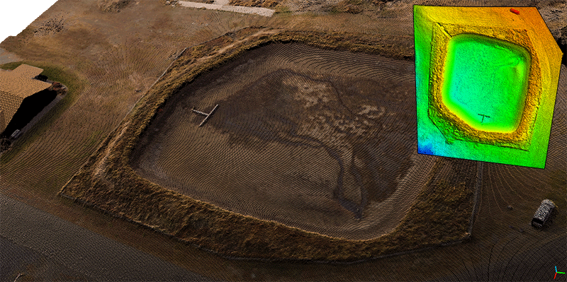
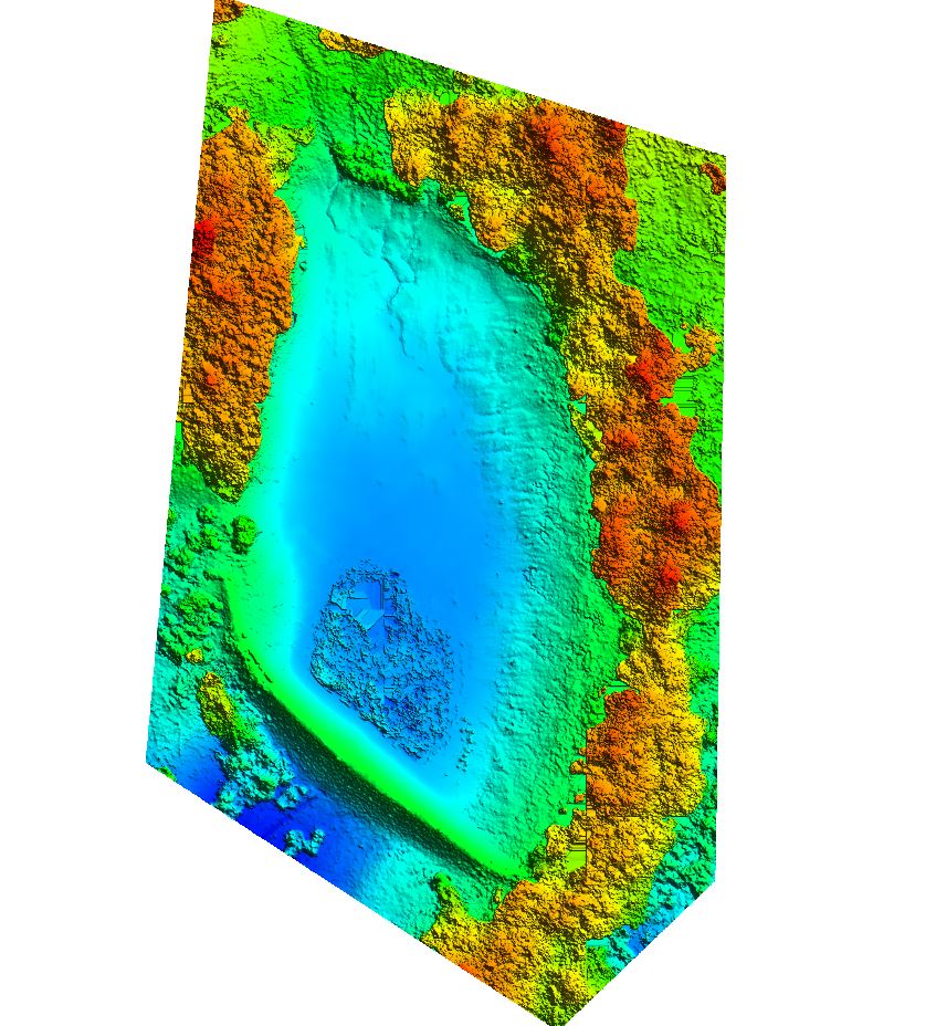
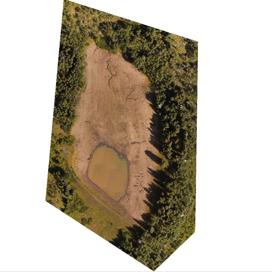
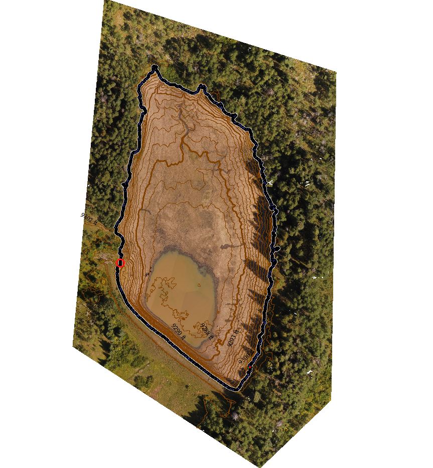
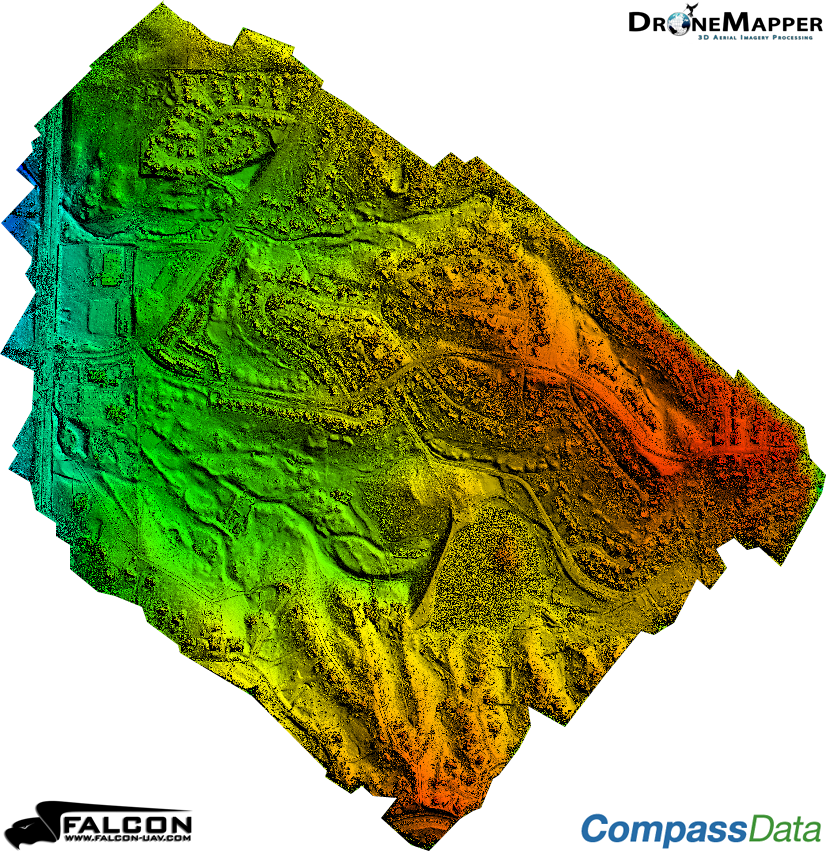
The orthomosaic, digital elevation model, and dtm were clipped to an AOI using GlobalMapper. The shapefile plots were also generated using GlobalMapper grid tool. We highly recommend GlobalMapper for GIS work!

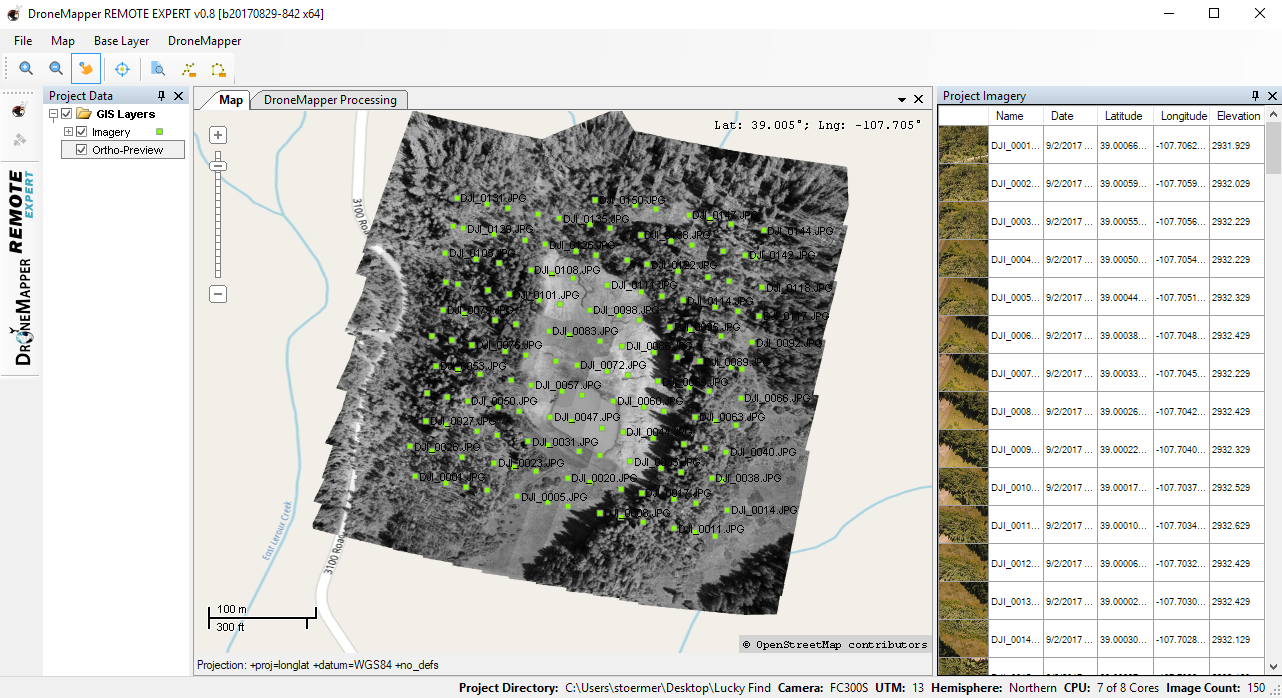
We cloned the MicaSense imageprocessing repository and created the Batch Processing DroneMapper.ipynb notebook which allows you to quickly align and stack a Altum or RedEdge dataset creating the correct TIF files with EXIF/GPS metadata preserved. These stacked TIF files are then directly loaded into DroneMapper Remote Expert for processing.

This notebook assumes the user has basic knowledge of setting up their python environment, importing libraries and working inside jupyter.

View the entire Medium article here: https://medium.com/dataseries/data-science-crop-analysis-notebook-using-6-band-micasense-altum-and-dronemapper-processed-uav-3683dbc21836

Load Digital Elevation Model and Orthomosaic

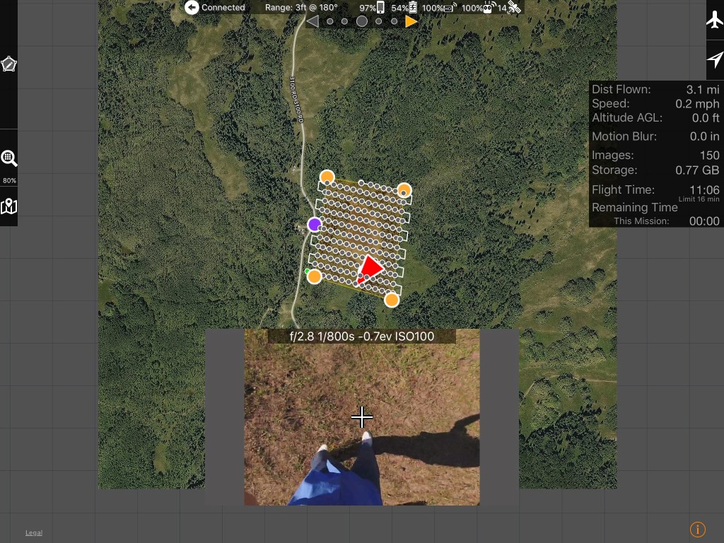
In this step, the digital elevation model and 6 band orthomosaic are loaded for processing. The data is in UTM16N WGS84 projection and has a pixel size (GSD) of 5cm for the orthomosaic and 10cm for the DEM.


5334376477?profile=original

Load Plot 1 AOI and Generate NDVI

Next, we use the NIR and RED channels from the orthomosaic to compute a standard NDVI. The plots of interested are also loaded and displayed. Utilizing Rasterio, GeoPandas and Earthpy makes easy!

5334375891?profile=original

Generate NDVI Zonal Statistics For Each Plot

Using the NDVI we generated in the previous step, we use the RasterStats library to quickly compute zonal statistics for each of the plots. That data is stored in a GeoPandas dataframe and shown below.

5334376287?profile=original

Load Plot 2 AOI & Compute DEM Canopy Mean Height For Each Plot

Here we load the plot 2 area of interest, using the DEM we can compute zonal statistics for each plot. This gives us a canopy height reading for each pixel inside a plot.

Compute Thermal Mean For Each Plot

The thermal band (6) in the processed orthomosaic shows stitching artifacts which could likely be improved using more accurate pre-processing alignment and de-distortion algorithms. You can find more information about these functions in the MicaSense imageprocessing github repository. See notes at the top of this notebook.

5334377057?profile=original

Load Plot 1 AOI & Compute Volume/Biomass For Each Plot

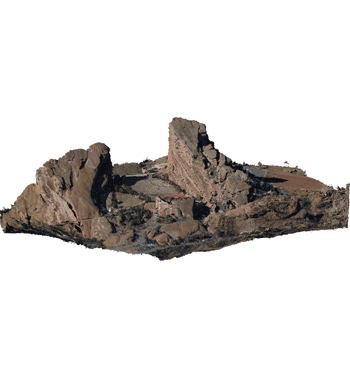
Using the DEM and DTM we can create a surface model with a ground reference of 0 meters. This allows us to calculate the volume for each plot and all pixels contained inside that plot. The volume is calculated from the ground (0m) to the top of the canopy for every pixel inside a plot.

5334376098?profile=original

Load Plant Count AOI & Count Plants

Using the surface model, we load the plant count AOI and clip our raster data to it. This process allows us to segment the plants we want to count. We then create a binary mask to allow for simple processing with OpenCV blob detector. The plant blobs are shown in white on a black background in the binary image below. The detector is run and we get our plant count, next we iterate through each of the blobs to find the center point. With the pixel center of each blob we can do a xy lookup against the original raster to determine the spatial position of each plant.

5334376674?profile=original

5334376893?profile=original

Plant Count: 310

Thanks! Keep an eye out for future notebooks and algorithms! DroneMapper.com

Read more…

DroneMapper Open Source Projects

readme_web.png?raw=true

DroneMapper.com

We are starting to release certain projects back to the open source community. You can find these new projects on our GitHub page here. We will continue to develop and contribute to these projects as time permits!

ArUco geobits: We've developed an aerial ground control point target system similar to a QR code. Our GCP targets are digitally encoded fiducial markers with computer vision software functionality to enhance workflows and provide the highest accuracy possible for photogrammetry missions.

readme_geobits_16.png?raw=true

ArUco geobits @ github

NodeMICMAC: NodeMICMAC is a Node.js App and REST API to access MicMac. It exposes an API which is used by WebODM or other projects. This project is sponsored and developed by DroneMapper. This repository was originally forked from NodeODM, which is part of the OpenDroneMap Project.


NodeMICMAC @ github

Make a pull request for small contributions. For big contributions, please open a discussion or issue first. Feel free to contact us with questions!

Thanks, DroneMapper Team

Read more…

Latest from DroneMapper Rapid / Remote Expert Release

20181120-release.png?profile=RESIZE_710xThe free version "RAPID" now allows higher resolution DEM generation and blended Orthomosaic! 

DroneMapper Rapid and Remote Expert Version 20181120 has been released. Please download the latest version here. This release has the latest UI modifications, back-end API performance enhancements and features. See the full change log below:

  • New orthomosaic functionality, multi-threading (BETA)
  • Orthomosaic seamline feathering (BETA)
  • Alternate initial tie-point computation by image center distance to neighbors
  • Added functionality to compute DEM / Ortho at native resolution
  • Various bug fixes and API updates
  • UI improvements and updates
  • New real-time API log viewer window
  • Updated/improved 3D textured mesh creation
  • Improvements/simplification of mask creation tool
  • Generate undistorted TIF images based on aerial triangulation results
  • Process stereo pairs/epipolar imagery
  • Allow RAPID users dense processing mode (4x native DEM) and 2x native ortho options
  • Allow RAPID users ability to radiometric blend ortho tiles/seamlines
  • Deprecated REMOTE version
  • Updated processing form icons
  • Fixed GSD reporting truncation issue
  • Updated UI layout
  • Updated UI components/icons

thanks and best regards, 
the DroneMapper Team

Read more…

Free Aerial Imagery Data (Personal/Commercial Use)

dm-4th-ave-res.png?width=600

Free Aerial Imagery Data Collection JPGs, GeoTIFFs and Point Clouds!

We've updated our sample data page with a number of new drone based aerial imagery collections. These are available for personal and commercial use! We would love to hear about how you make use of these photogrammetry / drone mapping examples. There is a description of each data set located on the samples page and a combination of NADIR and Oblique collections. If you need a data set with Ground Control Points, contact us. Enjoy!

Thanks,

DroneMapperdm-data-redrocks-obl.png?width=500

Read more…

xyht-dec2.PNG

DroneMapper: DroneMapper.com

xyHt Magazine: http://xyht.com

DroneMapper has been working with Arch Coal over the past 5 years in the development of an affordable work flow to accurately estimate coal stock pile volumetrics at the West Elk mine utilizing drone imagery collection, photogrammetric processing and GIS tools. The resulting work flow could lead to a significant cost saving by establishing accurate volumetrics with low latency compared with traditional manned aircraft operations. Further, more frequent drone acquired volume estimates can be used to check calibration of the real-time conveyor weight scale measurements to assure consistent calibration of mechanical systems.

Arch Coal – is the second largest domestic producer of metallurgical and thermal coal, with 96 million tons of coal sold in 2016. Arch is a well-positioned American coal company with large, modern, low-cost mining complexes and high-quality reserves in strategic U.S. coal supply basins. In total, Arch represents over 13% of America’s coal supply from their complexes in Colorado, Illinois, Kentucky, West Virginia, Wyoming and Virginia.

DroneMapper – provides photogrammetric cloud processing, desk-top software and GIS services for clients around the world. The team offers end-to-end drone operation services for imagery collections and processing as well as training. Typical products produced include high accuracy geo-referenced DEMs, DTMs, orthomosaics, point clouds, precision agricultural NDVIs, terrain contours and volumetric estimates, among others.

Arch Coal is interested in accurately quantifying their coal stockpile inventory on a regular basis. One example of this is the West Elk mine in Somerset, Colorado. The facility is a long wall mine where the mined coal is conveyed out of the mountain and deposited on the terrain surface. Figure 1 illustrates one of the stockpiles with three coal stack tubes (central left of image) with conveyor system. Ground control targets are used for every imagery collection to precisely align the imaged stockpile surface with the bare ground reference surface. Figure 2 shows the geo-referenced bare ground surface depicting zero volume or empty basin. This surface was precisely constructed using the control points that surround it. The colors represent the surface elevations with red the highest elevation and blue the lowest. Note the two ridges at the bottom of the surface illustration correspond to the ridge features seen in the stockpile image.

we-dec1.png

Figure 1: West Elk Stockpile

we-dec2.png

Figure 2: Geo-referenced Base Ground Surface

Imagery was collected by Arch Coal using a DJI Phantom 3 Advanced quad copter flying at approximately 300-400 feet above the ground/stockpile surface. At this elevation, the Phantom 3 will produce approximately a 2-inch pixel on the ground. A traditional 80% overlap (forward and side) grid was used for nadir imagery collection. The nadir imagery was augmented with an orbital oblique imagery collection to obtain stockpile surface data obscured by the conveyor system above the piles. Figure 3 illustrates the camera pose during the collection for both the nadir and oblique shots. DroneMapper has shown that the use of nadir and obliques provide for a higher quality digital elevation model (DEM) with less noise and artifacts than nadir alone. Once collection was completed the images were sent to DroneMapper for control pre-processing, full photogrammetric processing to generate the DEM and GIS manipulation for volumetric estimation.

we-dec3.png

Figure 3: Nadir and Oblique Collection Utilization

DroneMapper utilizes its Windows based REMOTE EXPERT software for 2-D control file generation and photogrammetry. The 2-D control file is generated using a tool that selects the number of images at a certain radial distance from the control by comparing the image geo-tags with the GPS coordinates of the control points. In this manner, an operator does not have to review every image for every control point in the scene, saving time. Each image identified with a control point is then zoomed in to select the pixel that the center of the control target appears. Figure 4 shows typical aerial target control points, 3-leg targets, used in image processing.

we-dec4.png

Figure 4: Mine Ground Control Points and Aerial Targets

REMOTE EXPERT uses this 2-D file and a 3-D file (defining control X,Y,Z coordinates) along with the imagery for DEM processing. Figure 5 shows the resultant DEM. Quality verification is performed by comparing the control elevations with the elevations of those points on the DEM to establish the root mean square error (RMSE) for the control. The elevation RMSE is then used to estimate the elevation accuracy which directly contributes to volumetric estimate uncertainty. Typically, we see elevation errors of less than 1 pixel or < 2 inches for this case.

we-dec5.png

Figure 5: West Elk DEM

DroneMapper employs Global Mapper, from Blue Marble Geographics, for all GIS processing. The two surfaces, DEM and bare ground are terrain combined or subtracted from each other to yield a volume model of the stockpile. The image looks identical to the DEM above, however the base of the model is at 0 meters elevation. Global Mapper then quickly computes the volume of the entire pile or sub-piles within the overall stockpile by digitizing the selected pile of interest for computation.

Data Utilization:

Arch’s West Elk facility can now quickly and affordably utilize drone and imagery processing technologies to establish a comparative volumetric estimate at the times of their choice, weather permitting. This data may be used for calibrating or augmenting other weight or volume measurement equipment being used at the facility. The data also provides visibility on ground operations within the stockpile to assess inventories of coal in various processing stages for overall accurate inventory situational awareness.

xyht-nov1.PNG

xyht-dec1.PNG

xyht-dec2.PNG

xyht-dec3.PNG

Thank you, The DroneMapper Team
 
 
Read more…

Remote Drone Mapping on Grand Mesa, Colorado

drone-mapping8_r.jpg

Delta County, Colorado agriculture has the benefit of over 300 reservoirs on the Grand Mesa, many of which supply irrigation to the variety of crops grown. This time of year, the reservoirs are being drawn down providing an excellent opportunity to map and determine reservoir capacities.

We had the opportunity to pack up our UTV with the DJI Phantom 3 advanced drone, gear, lunch and head on out to the Leroux Creek area of the Mesa. It is approximately 12 miles on Forest Service roads and 50” doubletrack to access the watershed from the Surface Creek trailhead (map shown below).

drone-mapping1.jpg

Access to some of the remote lakes between 10,000 and 11,000 feet elevation can be difficult so our Wildcat is equipped with Stihl MS200T chainsaw, Pelican dust-proof drone case, extra fuel and Warn winch.

drone-mapping2_r.jpg

The next few shots show the beautiful Mesa country on the way to Leroux. Half the fun is getting there!

drone-mapping3_r.jpg

drone-mapping4_r.jpg

drone-mapping5_r.jpg

On this trip, we pre-planned and cached the missions for 3 reservoirs including Lucky Find reservoir which was drained to the deadpool. There is no cell or internet connectivity in the Mesa backcountry so we need to have a reliable remote location programming capability. We utilized MapPilot 1.5.0 for our mission planning and execution application. The screenshot illustrates the mission plan for Lucky Find utilizing 80% image overlaps flying at an elevation of 300’ above ground. Image collection for the lake area was estimated at 150 images requiring 11 minutes of flight time.

drone-mapping6_r.jpg

The next picture is of Lucky Find drained down to the deadpool.

drone-mapping7_r.jpg

Phantom 3 has been fully programmed and ready to launch for the mapping mission.

DroneMapper’s REMOTE EXPERT Windows application was used to generate the DEM and ortho from the image collection. Screenshots of the DEM and orthomosaic follow. REMOTE EXPERT generated the data products within one hour on our laptop, allowing processing in the field and mission verification prior to pack-up.

drone-mapping12_r.jpg

drone-mapping9_r.jpg

drone-mapping10_r.jpg

Global Mapper was then used to construct 1’ interval elevation contours as shown below:

drone-mapping11_r.jpg

Each contour is selected individually and a flat elevation surface created to compute the reservoir volume and surface area associated with the selected contour. This is repeated for the elevations of interest from the deadpool up to the elevation where dam spill occurs to determine reservoir maximum capacity. The blue dotted contour shows maximum capacity prior to drainage at the spillway on the southwest side of the reservoir.

It is critical that the drone firmware and the mission application be thoroughly tested before departure to remote locations where no communications exist. If you need assistance for end-to-end mission planning and execution please do not hesitate to contact us.

Phantom 3 Advanced Firmware: 1.8.10
MapPilot Version: 1.5.0 build 031916
DJI Go App Version: 2.8.6
Ipad Mini4 iOS Version: 9.3.3
Remote Expert Version: v0.8 b20170829-842 x64
Global Mapper Version: v18

Thank you, The DroneMapper Team

Read more…

3689714837?profile=original

We appreciate all the feedback and feature requests over the last couple of months! Thank you

You can now process up to 150 images from DJI sensors for free on your Windows 10 desktop. We've also added NDVI calculations and a load of other new features to the software. Download the latest version at the following link: DroneMapper Software & Downloads | Drone Mapper Imagery Processing and visit this link for changes/updates: https://dronemapper.freshdesk.co ... onemapper-changelog

Download example data here: https://dronemapper.com/sample_data


April 13th, 2017 - v0.7 b20170413-735

  • Added functionality to export .txt file(s) containing Omega, Phi, Kappa, X, Y, Z orientation (relative and world positions)
  • Overnight mode, run all processing steps automatically
  • Various UI tweaks and bug fixes
  • Increased free DJI processing limit to a maximum of 150 images

February 12th, 2017 - v0.7 b20170212-712

  • Add NDVI generation option, creates ENDVI and NDVI from NIR orthomosaic (REMOTE, EXPERT only)
  • Add image EXIF pre-processor, metadata generator
  • Additional, improved blending for orthomosaic (REMOTE, EXPERT only)
  • Improved UI feedback from backend API, display dm3d current task count/status
  • Improved logging
  • Processing speed improvements
  • Fixed bug with DEM scaling and certain AGL EXIF tagged data collections
  • Add DSM/hillshade generation option, creates gray scale DSM render from DEM (EXPERT only)
  • Add support for FLIR Vue Pro thermal cameras (JPGs)
  • Preserve ortho preview / geo-reference results, no need to re-run once completed


DroneMapper REMOTE/REMOTE EXPERT generated NDVI:

BoetMBtb3cjiwYCpOVKUCAuGf8Gv1aEN1Q?1488817536&width=600

3689714903?profile=original

Thx @pix4d for sharing the original imagery for these two data sets on their website.

Read more…

y8dEp9lIg80aOE7BuzV5S-unyxfG8DV6FSoBx17YuD2mbOaltI2Y6NCwWVo1ZgR2d-00HaTIOwusL6kz1A6lduHUihjlqGucKea_dLcwzSX-B1a7QmUoDmjzSv0OqUuksN1BvsvQ?width=750

DroneMapper is very pleased to announce that RAPID for DJI is available for download and testing on limited imagery data sets at no cost to the user. RAPID will provide scaled DEMs and orthomosaics using up to 75 images for a scene. Results are available in near real time using modest computing hardware.

The download link can be found here: DroneMapper Software & Downloads | Drone Mapper Imagery Processing

Three WINDOWS 10 (64bit) applications with different features and functionality are offered and are summarized below:

• RAPID for DJI (Free): Allows input of up to 75 geo-tagged JPEG images of 12 Mpixel format or greater. RAPID will produce a preview orthomosaic, a DEM scaled at X8 of imagery native resolution and an orthomosaic scaled at X4 as output products in GeoTiff format. RAPID for DJI is limited to DJI platforms and sensors.

• REMOTE (Licensed): For larger mapping areas, this module allows input of up to 400 geo-tagged JPEG images of 12 Mpixel format or greater. REMOTE will produce a preview orthomosaic, a DEM scaled at X8 or X4 of imagery native resolution and an orthomosaic scaled at X4 or X2 as output products in GeoTiff format.

• REMOTE EXPERT (Licensed): This module provides full photogrammetric functionality and allows input of up to 1000 geo-tagged JPEG images of 12 Mpixel format or greater. REMOTE EXPERT produces a preview orthomosaic, a DEM scaled at X8, X4 or X2 of imagery native resolution (user selectable) and an orthomosaic scaled at X4, X2 or native resolution (user selectable) as output products in GeoTiff format. This module also will perform processing using ground control points (GCPs). This feature requires imagery pre-processing using the included GCP Tool. The module will generate a 64-bit point cloud of the results in ASCII PLY/XYZ format should the user select that feature.

Feature/Function Benefits
• Orthomosaic preview – facilitates review of acceptable imagery collection at the site, prior to equipment pack-up, by generating the preview in near real time. In many cases the preview will help identify holes in coverage, issues with image geo-tagging and poor quality imagery (blur and other imagery artifacts that hamper proper processing) before you leave the scene.
• Linear and area measurements for overlap verification and scene coverage.
• Selectable scaling of the DEM appropriate for the project requirements. If 1-2’ contours and/or volumetrics are required, then a X8 DEM may be suitable for the quickest turn around and acceptable accuracy. If finer detail is desired, then X4 and X2 DEMs are selected at the expense of processing time.
• Selectable scaling and blending of the orthomosaic for scene feature identification and production of a visually pleasing (minimal to no seamlines) scene.
• DEM and orthomosaic sub-pixel root mean square error (RMSE) of GCPs in horizontal and vertical - facilitates accurate planimetric and 3-D measurements.
• 64-bit point cloud provided for feature classification, editing and DTM generation.
• Robust processing algorithms tolerant of minimal imagery overlap. Allows user to close the loop on operations platform, camera/lens and mission planner to minimize overlaps for high efficiency collects over larger areas, quick processing turnaround times and high quality output.

Please review the operating instructions, run the application on your data sets and provide us feedback on its operation and utility. Should you need additional functionality for larger data sets please contact us for more details on REMOTE and REMOTE EXPERT.

Happy Holidays,
the DroneMapper Team

More information: https://dronemapper.com

Help and Support: https://dronemapper.freshdesk.com/support/home

Read more…

Free DroneMapper 2D Ground Control Point (GCP) Tool

GCPtoolDM.JPG?width=650We have released a test / alpha version of the 2D GCP generation tool for Windows. You may experience a bug or two but overall it should be functional. Let us know if you have problems working with the 2D GCP utility or have additional feature requests. 

Essentially, you want to create a list of images that the GCP appear in and load them into the tool. The images must be geo-tagged. Once, you've loaded all the images you can navigate between the imagery to add the 2D GCP locations. The GCPs appear in a small text box on the lower left side. When you've completed all the GCP you can save this list as the 2D GCP text file. The 2D GCP file is one half of the required GCP data needed for our processing chain.

Download Link

Let us know if you have any questions. 

Instructions for use:

ZOOM IN - Control Up Arrow or Mouse Scroll Wheel
ZOOM OUT - Control Down Arrow or Mouse Scroll Wheel
ADD GCP - Hold Shift Key and Click GCP Target
PAN - Right Click on Mouse and Drag (or use scroll bars)
NEXT IMAGE - Next Button
PREV IMAGE - Previous Button
SAVE 2D GCP - Save GCP Button or File -> Save
CLEAR 2D GCP - Clear GCP Button or File -> New

We will add additional features and fixes as needed. Best regards,
JP

Read more…

3689511163?profile=original

Subset of Tetra Cam ADC Imagery

We recently received a data collection courtesy of David Dvorak using the Tetra Cam ADC Multi-spectral image sensor. DroneMapper processed 189 geo-tagged 3.2 mega pixel images into geo-referenced Orthomosaic, DEM, DSM and Point Clouds with an area of 1.6 km sq. The AGL of the flight was 1000 ft resulting in a 15 cm GSD per pixel. Processing time was about 2 hours for this data set. 


3689511062?profile=originalGeo-referenced Orthomosaic using Tetra Cam ADC

Accurate DEM construction is still possible using 3.2 mega pixel images:

3689511140?profile=original

Read more…

3689502495?profile=original

Thanks to Pteryx for this great data set! In order to generate a geo-referenced NDVI / EVI / EVI2 Vegetation Index we need to fly the area of interest (AOI) with a visible (RGB) and full spectrum (RGB+NIR) camera. Once the RGB and RGB+NIR images are processed inside DroneMapper we have two orthomosaic results from which we can generate a pure NIR ortho. To do this, we use GDAL and the following command: 

/usr/local/bin/gdal_calc.py -A VIS.tif -B NIRVIS.tif --outfile=nir.tif --calc="(A - B)"

Now that we have created our pure NIR orthomosaic we can use this to generate NDVI or other calculations using OTB in an automated fashion.
 

/usr/local/bin/otbcli_BandMath -il NIR.tif VIS.tif  -out ndvi.tif -exp "ndvi(im2b1, im1b1)"

In order to process the orthomosaic tif files, they need to be the exact same size and pixel resolution. OTB also has many other useful commands for remote sensing work. The original flight and area of interest is 1.0 km sq @ 10 cm GSD. 

Thanks -- JP @ DroneMapper

Read more…

January 28th, 2013

We are very pleased to announce that the Utah Department of Agriculture and Food (UDAF) has contracted with DroneMapper to provide imagery processing services for the next 5 years.  UDAF collects high resolution imagery for use in conservation planning and management of natural resources. As an example, DroneMapper recently processed an imagery set as part of Utah’s effort to mitigate salinity migration into the Colorado River.

UDAF conducted an evaluation of other service providers like DroneMapper and standalone imagery processing software packages, and found that DroneMapper meets their needs in terms of quality and affordability.

We look forward to providing services to the State of Utah and its researchers to keep its lands sustainable and productive. For more information on UDAF, please visit: http://ag.utah.gov/

Read more…

January 18th, 2013


Amazing day in Colorado for a photogrammetry mission with Falcon UAV over Red Rocks Amphitheater. At 6,450 feet above sea level, Red Rocks Park is a unique transitional zone where the Great Plains meet the Rocky Mountains. Red Rocks Amphitheatre is a geological phenomenon – the only naturally-occurring, acoustically perfect amphitheatre in the world. Some of the rock formations in Red Rocks slope as much as 90 degrees, while others tilt backwards. The southern monolith, that bears resemblance to a ship, is named "Ship Rock." On the opposite side of the Amphitheatre stands "Creation Rock." Both of the monoliths are taller than Niagara Falls, and the Red Rocks Amphitheatre was once listed as among the Seven Wonders of the World.

Falcon flew late morning of January 18, 2013 and collected more than 600 photos in a little over 30 minutes. We shot a combination of nadir looking and oblique photos. One of the obliques, shown above looking to the west - southwest, gives the viewer a feel of the scale of the two monoliths that frame the amphitheatre. The nadir images were processed at a resolution of 6.6 cm and the resultant geo-referenced orthomosaic, digital elevation model and 3-D model are also shown below. If you are interested in learning more on how to precisely map difficult terrain please do not hesitate to contact either falcon-uav.com or dronemapper.com


Read more…

January 2, 2013

http://dronemapper.com

In November 2012 we described the results from an UAV survey (courtesy of Falcon-UAV) conducted over the Pinery Country Club where an area of > 1 square mile was mapped at 6.7 cm resolution. We had access to a set of precision ground control points (GCPs) (courtesy of CompassData, Inc.). The ortho below shows the Pinery area surveyed with a set of ground control used for subsequent data processing and quality control verification. The GCPs circled in red show the original 6 points used in the processing of the DEM with the other 9 used for QA verification. We had a chance to re-process this data with 9 GCPs for the DEM. The additional 3 points selected are shown circled in yellow. The table below illustrates the absolute geo-spatial accuracy improvement by the addition of GCPs.


The table compares the results of the new processing with 9 GCPs (pink or orange) against the former - 6 GCPs (light green). The evaluation conditions are 1) RMSE error in GCPs (gnd control) that were used for processing, 2) RMSE error in GCPs (QA check) that were not used for processing and 3) RMSE error for all 15 GCPs. There was a significant improvement (~ 3 X) in absolute elevation error. The easting accuracy also improved by about 50%. Have a great new year!

Read more…

Aerial Mapping Easter Island @ 15 cm GSD

December 25th, 2012

Back in May we processed an interesting data set from Easter Island, Chile at 30 cm / px GSD. Kim Anh Hoang from the Easter Island Statue Project used the 30 cm Orthomosaic and DEM to produce a 3D Flyby of Rano Raraku and an EISP excavation site. We've now re-processed the data at the highest resolution possible, 15 cm / px GSD. The original imagery was obtained using an autonomous UAV flying at an elevation (AGL) of ~330 meters with a consumer level Ricoh GR Digital III camera. The GR Digital III is not GPS enabled, so geo-tagging was accomplished locally using the UAV flight controller logs. In total, 140 NADIR images were shot at 10 mega pixel covering an area of 3.7 km^2.


"Rano Raraku is a volcanic crater formed of consolidated volcanic ash, or tuff, and located on the lower slopes of Terevaka in the Rapa Nui National Park on Easter Island. It was a quarry for about 500 years until the early eighteenth century, and supplied the stone from which about 95% of the island's known monolithic sculptures (moai) were carved. Rano Raraku is a visual record of moai design vocabulary and technological innovation, where 397 moai remain. Rano Raraku is in the World Heritage Site of Rapa Nui National Park and gives its name to one of the seven sections of the park." Rano Raraku - Wikipedia


A map of Easter Island/Rapa Nui, showing the three main volcanoes Terevaka, Poike, Rano Kau, as well as Anakena beach, the islets including Motu Nui. Modern Hanga Roa and Mataveri International Airport, the ruins at Orongo and the quarry at Rano Raraku. It marks major ahus with moai.


Above we've displayed a small subset of 8 images from the original 140. We recommend obtaining more overlap and imagery for an area of interest (AOI) this size.


Contact Us for the full geo-referenced downloadable data set.

Read more…

November 15, 2012; The Pinery Project


In a collaboration between DroneMapper, Falcon UAV, CompassData, Inc. and The Pinery Country Club we collectively demonstrated accurate geo-spatial mapping (in 3 dimensions) of a reasonably large area using affordable technology - UAV, consumer camera and ground control. First, a little bit about our partners:


  • Falcon UAV  is a small unmanned aircraft designed to provide live aerial reconnaisance and airborne sensor capabilities to those who require a military grade system at a fraction of the cost. Capable of providing over an hour of endurance, day or night, the system provides public safety communites, research organizations, academia, and industry a professional hand launched UAV solution at an affordable price. For more information please visit - http://www.falcon-uav.com/


  • CompassData, Inc. provides the world's largest commercially available ground control data set - complete global coverage with 18,000 ground control points available for download. For more information please visit - http://compassdatainc.com/


  • The Pinery Country Club offers as one of its amenities a private 27 hole golf course in Parker, Colorado. Management at the Pinery was very gracious in allowing us to collect imagery over their property. In addition, the property contained 15 precision (5 or 30 cm absolute position) ground control points that were used for data processing and accuracy quality verifications. For more information please visit - http://www.thepinerycc.com/club/scripts/home/home.asp


This ortho shows the Pinery CC area of interest and the ground control that was mapped by Falcon in a 1 hour flyover. The area covered was approximately 3.4 Km^2 @ 13 cm GSD. (6.7cm GSD available as full result)


Falcon being hand launched.


Typical ground control point being surveyed.


Pinery ortho detail.


3 digital elevation models (example shown above) were constructed using 1) only camera GPS tags, 2) only Falcon flight log GPS tags and 3) 6 ground control points. For cases 1) and 2) all 15 GCPs were used for accuracy evaluation. In case 3) 9 GCPs were used for QA evaluation. The table below shows the Root Mean Square Error in meters and the Circular Error at a probability of 90% for each of the 3 cases.


Test Case

RMSE X (m)

RMSE Y (m)

RMSE Z (m)

CE90 (m)

1 - Camera Tags

8.4

6.7

27.6

14

2 - Falcon Tags

4.5

9.2

27.7

6.4

3 - 6 GCP

0.17

0.18

1.9

0.35


The full accuracy reports from CompassData, Inc. are downloadable below:

Camera Tags - CompassDataInc_FalconUAV_DroneMapper_PineryCanonGPS13cmUTM13N.pdf
Falcon Tags - CompassDataInc_FalconUAV_DroneMapper_PineryFalconGPS13cmUTM13N.pdf
GCP - CompassDataInc_FalconUAV_DroneMapper-PineryGCP13cmUTM13N.pdf

Read more…
We made it! We are in the top ten for the Jumpstart Biz Plan Awards sponsored by the Denver Economic Development Office. Let us know if you will be in Denver for Startup Week Oct. 22nd - 27th. @dronemapper

DroneMapper has just been notified by the city of Denver, Colorado that is has been selected as a top-10 finalist in a business competition called "JumpStart, Biz 2012". The competition looks for innovative business ideas that can contribute to the growth and health of Denver, CO. 150 applicants submitted their ideas during the first phase. The second phase - more in depth evaluation of business plans occurs for the next 2-3 weeks with the finalist announced in late October. First prize is $50,000, one year of office space in Denver, CO, and business mentoring. We look forward to attending the JumpStart Biz Plan Awards events and Startup Week Denver. For more information please visit the Denver OED website at the following link: http://www.denvergov.org/oed/DenverOfficeofEconomicDevelopment/BusinessServices/JumpStartBizPlanAwards/tabid/443335/Default.aspx

Read more…

3689474898?profile=original

It has been a while since our last update! The biggest news is we now process up to 25 geo-tagged images into high resolution Orthomosaics, DEM, DSM and 3D Models for free. The site now only accepts geo-tagged images and will only process imagery with the correct EXIF metadata/geo-tags.


ConservationDrones.Org:

Lian Pin Koh and Serge Wich are doing some really interesting work with Drones. They have created a non profit organization called Conservation Drones (conservationdrones.org) with a mission to develop low-cost tools for conservation and research workers in developing countries! We mapped a large jungle canopy with an active Orangutan nest. More information on DM News and here.

3689475013?profile=original

Full orthomosaic of Orangutan Nest tract

3689474985?profile=original

3D Model of Danau Girang for ConservationDrones.org

Remote Sensing:

Using the geo-referenced orthomosaic that DroneMapper creates and opencv we can detect certain features and create shapefiles from them. Here the algorithm is looking for round objects of a certain size and attributes. If detections occur, a geo-referenced shapefile mask of the target is created! I am working to add different routines to count and classify different objects in the final orthomosaic.

3689475034?profile=originalRound object detection routine. Layers: Bing Aerial, DroneMapper Ortho, Round Objects Shapefile

3689475107?profile=originalOriginal geo-referenced orthomosaic and Bing Aerial layer

3689475069?profile=originalLine Detection Routine on Golf Course in CH.

3689475156?profile=originalShapefile results. (modifications and improvements needed in order to adapt to a road detection scheme)

Read more…