All Posts (14047)

Sort by
3D Robotics

I've just been playing with the demo version of Pulsonix, which is the best competitor to the aging Cadsoft Eagle PCB design software that is the standard in our industry. It looks fantastic, improving on Eagle in loads of ways such as easy viewing of the front or back side of the board without clicking on dozens of check boxes (a pet peeve of mine about Eagle) and built-in 3D viewing. It can also import Eagle files and part libraries with the use of a translation utility. (A full list of features is here) The only downside (and this is a big one) is that the free demo has save disabled, and the cheapest full-featured version of the software costs $475. [CORRECTION: This price actually refers to a lower-end version of the software, called Easy PC. Pulsonix is the top end of their range and sells for around $2,000. The bottom end of the range is the free, stripped-down but fully functional version of this software, which is called PCB Artist. It's very good, but doesn't support the Eagle file and library conversion utilities.] Here's the description from Pulsonix's US distributor, Advanced Circuits: …the 1st completely NEW, High Level combined Schematics Capture & PCB Layout Software announced in many years. • Pulsonix has been developed from the ground up by PCB design industry professionals using the very latest techniques in graphics and data handling. • Competitive products originate from the 80’s and 90’s and look antiquated by comparison. • Pulsonix uses Microsoft Office menu structure and is immediately familiar and attractive. • Usually does not require formal training. Designed for the casual user and the professional. • Directly imports schematics, PCB Designs, and Libraries from other PCB software products. • Built in features at no extra cost; ie, Design Variants, DRC, and Report Maker. • Can be purchased with or without an Autorouter. • Product includes all features for design, checking and manufacturing PCBs. All outputs are included (Gerber, ODB++, Excellon, etc.) • Pulsonix is delivered with an informative Users Guide and up to date, context sensitive on-line HTML help.
Read more…
3D Robotics

This week Range Video is expected to release a cool new combo: an On-Screen Display (OSD) board with a built-in return-to-launch autopilot, failsafe and and visual guides to GPS waypoints. The product page is here and a long discussion thread about it is here. It has a temperature sensor and current sensor to monitor battery and ESC status. Note: this OSD board does no stabilization (no gyros, accelerometers or thermopiles), so you either need an inherently stable aircraft like an EasyStar or to add a FMA CoPilot to handle the stabilization function. But it does have a 5hz GPS, so that should work for very docile aircraft. Also it is not an programmable autopilot. Although you can enter waypoints, it will simply give you directional indicators on the OSD, not fly the plane to those waypoints itself. The only waypoint it will fly to automatically is the launch position. Here's the promotional video:
Here's the writeup from the site: $299 purchase includes: (1) RVOSD with GPS (1) Current sensor with 150 mm wire (1) Temperature sensor (1) IR remote (controls OSD menu) (3) 150mm male to male servo wires ((to connect OSD to Rx) (3) 300mm male to male servo wires (to connect OSD to Rx) (1) KX131/KX191 camera to OSD connector (1) KX171 camera to OSD connector (1) 300mm male to bare lead servo cable (for making transmitter to OSD wiring harness) Introduction: The RangeVideo on-screen display (abbreviated OSD) is a small ( 8 x 4 x 3 cm) device which overlays GPS telemetry and and other relevant data onto a live video.This device is a must have for FPV flying! ----------------------------------------------- Features: 5Hz GPS Autopilot Failsafe Navigation and battery telemetry. Multiple screens Integrated power supply and filter New features added (update Aug 4, 2008): 1. Amateur radio call sign display. 2. Way point navigation (heading and distance to waypoint) 3. Shadows added to the display
Read more…
3D Robotics
Microsoft just announced that you can now buy the high-resolution aerial photography that it uses in Virtual Earth, without having to license the whole Virtual Earth package. I doubt our community would be in the market for this, but it does speak to the demand for such imagery, which our community could provide. The pricing was not disclosed (apparently it varies from place to place and the age and quality of the imagery). Does anyone know what the range is?
Read more…

Stanford Autonomous Helicopter Project

tempest-thumb.png
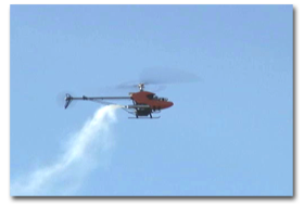
From Yann's Techno Toy Blog ...Stanford Autonomous Helicopter Project has developed new reinforcement learning techniques to stabilize and control their helicopters. The developers have been able to teach their heli to perform just about every aerobatic figure imaginable. However, the heli has no on-board intelligence. Instead, data is fed from onboard GPS and IMU with serial outputs directly into Xbee Pro modules. The signals are received by a PC on the ground, which enables operator control via the training port of a conventional R/C transmitter.
Read more…

XBee price cut

The 2.4Ghz modules may be heading up to $36, but the cost of 900Mhz access will be going down in 2009. All the way down to $39 for a 900Mhz module which is upgraded to 115200 baud but range reduced to 1.8 miles.http://www.digi.com/products/wireless/zigbee-mesh/xbee-digimesh-900.jsphttp://www.digi.com/products/wireless/point-multipoint/xbee-pro-900.jspIt will be 5V tolerant on the UART pins, but you better keep those voltage dividers around until 2009. The $32 XBees are not 5V tolerant & quickly burned out if U followed the social network hits on Google that said they were.
Read more…
3D Robotics
As we get closer to releasing products, I've set up home pages for ArduPilot, ArduPilot Pro and BlimpDuino. They're created as big posts at the moment, but they'll probably migrate to proper minisites with wikis once the products are out. They're all linked to from the front page of this site. (I've also retired GeoCrawler 4, which was based on the PicoPilot, in anticipation of leaving all the UNAV autopilots for AttoPilot as soon as it's released.)
Read more…

Paparazzi installed in airframe, nearly ready to fly.

I am happy to report that I have installed the paparazzi autopilot in one of my airframes and have done some ground testing. So far the results are positive. The telemetry works well (at short range at least), and the aircraft reports proper position and attitude. When the aircraft is held at an angle, the control surfaces move to compensate, and the behavior of the control surfaces looks correct.In the picture below, all of the autopilot system except for the radio modem can be seen.

In this view of the fuselage interior, the radio modem is visble.

This is a detail shot of the installation of the horizontal infrared sensor.

This is a detail shot of the installed vertical IR sensor.

And finally, a shot of the interior of an RC reciever that has been hacked to output the PPM signal on the channel 8 PWM pin. The cut trace to channel 8 is hidden by the capacitor.

I have a bit more ground testing and configuration to complete, and this plane will be ready to fly.
Read more…
3D Robotics

New version of the ArduPilot board

Jordi and I are preparing the final production version of the ArduPilot board, which involves the usual debugging and last-minute feature adding. The problems we've found are largely in power and noise management--we've needed to isolate the servos from the processor parts, so high current draws don't introduce voltage dips. You'll notice a couple extra diodes and capacitors on the board to handle that. As for features, here's what's new:
  • All four RC-in channels (plus the autopilot on/off channel) can now be read by the CPU. This allows the autopilot to read the initial throttle and rudder position when you switch to autonomous mode, so it can maintain speed and heading. The other two channels can be used for whatever you want, such as triggering a camera sequence or dropping an object. (Remember that the aileron and elevator channels are seperately controlled by the FMA Co-Pilot)
  • There are now status LEDs for the failsafe (on/off) and the GPS (satellite lock).
  • There is now a trim pot on the board so you can adjust the autopilot on/off position to suit your particular RC system.
Here's the schematic, in Eagle 5 format. I'm not including the PCB file yet because we're working with our commercial manufacturing/retail partner on that, and I don't want to reveal those details until we're ready to release. But rest assured that we'll make both the schematic and PCB files available here when the final product is available. For those who don't have Eagle, here are the schematics in png form (they're shown as two pages, but it's pretty easy to see which wires connect across the pages):

Read more…
3D Robotics
Jordi and I are planning to use LabView to create the open source ground station software for ArduPilot (National Instruments has kindly donated a professional edition licence to DIY Drones). We saw a lot of UAV teams, especially academic and research groups, using LabView at the AUVSI annual meeting in San Diego, and we're starting to see more interest in the open source side of it, including the OpenG community. For those in the San Diego area who are interested in learning more about LabView for UAVs, you may be interested in this upcoming AUVSI local chapter meeting: San Diego Chapter Meeting May 21, 2008 11:30 am -1:00 pm Southwestern Yacht Club, Point Loma, California Program: National Instruments software and I/O tools for autonomous platforms and payloads. Brief overview of National Instruments Case studies: Virginia Tech/TORC 2007 DARPA Urban Challenge Vehicle, Nexans Spider underwater dredging vehicle, Software and I/O tools overview, and Additional Application Examples Presented by: Charlie Knapp, US Unmanned Systems BDM, National Instruments Please visit our website for pre-registration.
Read more…
3D Robotics

ArduPilot code now in alpha

As Jordi continues testing and improving the ArduPilot boards, I've been integrating his cool binary-mode GPS parser and otherwise improving our pre-alpha code. So I think we're now a proper alpha, which is to say that although this hasn't been tested in the air yet, it does have most of the ingredients of a basic autopilot. The Arduino code is here. Improvements include: --Binary mode GPS parser with checksum error checking and high-speed (56k) throughput --Hardware-driven servo control (using the Arduino Servo Timer library), which means less processor overhead, tighter response and no jitters. --Now samples the rudder at autopilot initiation, so if the rudder is trimmed a bit one way or another that will be retained --Autopilot board LEDs now show GPS status We're going to do a few more alphas as we test the code on the latest versions of the hardware and against the simulator. Then, once we've tested it in the air, we'll move to beta. So consider this version just instructive and don't fly anything with it!
Read more…

Thermal accelerometers R back

Spring mounted mass accelerometers truly do suck. Thermal accelerometers were once the standard & they're coming back now that everyone knows what high frequency vibration does to spring mounted masses.It's China to the rescue again, as the thermal accelerometers from Memsic are being used in thousands of persistence of vision wands at the olympics. The wands can display any communist party approved message when waved by manual labor. There are no pictures of the wands except for the thousands of blue dots in stadium wide shots. It must be an election year.
Read more…

EasyStar Project

I’m not going to be able to work on this project for awhile, so I thought I would post about it, partially so that I don’t forget the details myself : )For those of you who don’t know, I’m currently working on a UAV based on a Multiplex EasyStar and an Arduino Diecimila. My main goal currently is to simply get it to fly from waypoint to waypoint, but in the distant future my goal is to extent flight time as long as possible. I’ve been working on the project for the past couple months, and it’s my first foray into both RC and serious microprocessor programming. Currently, the navigation algorithm is extremely simple, and relies entirely on GPS – if it’s too low, go up, if it’s not on the right heading turn the rudder until it is. No accelerometers, no gyros. I know I’ll eventually have to add some sort of method for the plane to know its own orientation when I start doing serious flying, but for now I’m just trying to get all of the hardware collected and the basic software written.The navigation and GPS processing algorithms I wrote from scratch, using trigonometry and such. I believe that they’ll only work in the Western hemisphere, but I’m really not sure. I find the absolute heading to one point from another by calculating latitude and longitude components of the distance (over the curve of the Earth) from the one point to the other, then treating those distances as legs of a flat 2-d triangle. I can then find the angle from absolute North to the destination point. It’s probably almost too precise, but it’s the way that makes the most sense to me, and the processor seems to be able to handle it well. I’ve pretty happy with the results of car-based tests of the autopilot…the update rate of the entire system is about 3 Hz, which I think is fine for a slow, stable glider.The aircraft has never actually flown under autopilot control, but everything has been tested on the ground and seems to work. So, when I next get a chance to work on it, my first priority will be to clean up the rat’s nest of wires on the protoshield...then install something to keep it stable in the air and start testing. It’s probably going to be on hold until December, when the semester is finished, but I think I will have enough time then to get it working in the air.Pictures and code for those who are interested follow...cheers!

Haha it looks terrible...but prototypes never look clean. You can just barely see an Arduino Protoshield underneath...NavigationMain.zip
Read more…
3D Robotics
Our alpha ArduPilot code has an okay GPS parser, but like all of them based on ASCII NMEA sentences, it's slow and doesn't handle errors (corrupted data) very well. We've now done a lot better. Here's Jordi's new Arduino GPS parser, which will be in the next version of the ArduPilot code and has the following features: --Reads the data in Sirf 3 binary mode, not ASCII NMEA sentences. --Autoconfigures your GPS module to go into binary mode. --Parses the GPS data and stores it in variables, including conversion to decimal degrees for gps data, and other stuff such as GPS status, lat, lon, MSL altitude, heading, speed over ground, and climb rate... --Super fast decoding and transmission at 57600 bps... --100% Checksum verification.. --Status LED, connected directly to the GPS fix status.. --More or less commented ;-) You can download the code and run and test it now, or integrate it into your own projects. Lots more cool improvements coming to the ArduPilot code, including better navigation routines and interrupt-driven RC channel reading. We've still got some work to do on the boards (the current one has got a problem with noise and current fluctuations when we're moving the servos, so we've got to add some diodes and capacitors), but we're getting there. Still on track for a September release, one way or another.
Read more…
3D Robotics

Review of new semi-autonomous toy heli

My other blog, GeekDad, has a review of the new WowWee BladeStar, which is like a body-less helicopter. It's got a semi-autonomous mode, using IR sensors, that lets it avoid any obstacles, from walls, ceilings and furniture or anything you wave in front of it: "If you desire, you can activate the autonomous flight function and literally navigate via waving your hands or a sheet of paper and triggering the BladeStar's IR sensors, causing it to move away. (I breathlessly referred to this phenomenon as 'gestural navigation' in my preview earlier this year.) It also packs a very impressive fly time, claimed at up to 15 minutes." More here.
Read more…
3D Robotics

UAVs over the Beijing Olympics

From our Wired Science blog: "Beginning tomorrow, a UC-San Diego professor will be sending unmanned aerial vehicles into the pollution clouds emanating from the city to measure the impacts of the government's industrial shutdowns and traffic bans on the region surrounding Beijing. "We have a huge and unprecedented opportunity to observe a large reduction in everyday emissions from a region that's very industrially active," said atmospheric scientist V. Ram Ramanathan, who also works with the Scripps Oceanographic Institution. While it does not appear that Beijing's plan has reduced particulate matter levels to World Health Organization recommended levels, the attempts still represent a large and unique science experiment. Chinese officials say they've reduced industrial activity by as much as 30 percent, although questions persist about the effectiveness of the shutdowns. Independent and government monitoring station data have been mixed since the program was instituted. But for Ramanthan, the Olympic shutdowns still provide a "once-in-a-lifetime" look at how a large atmospheric region responds to a rapid drop in particulate matter emissions. Ramanathan has been a leader in the use of UAVs and environmental sensors to measure black carbon, aka soot, levels. His previous work, presented at this year's AAAS conference, has attempted to provide evidence that black carbon is a major contributor to global warming. "By determining the effects of soot reductions during the Olympics on atmospheric heating, we can gain much needed insights into the magnitude of future global warming," Ramanathan said. His project, termed CAPMEX, is being conducted in cojunction with Seoul National University and is backed by the National Science Foundation. The UAVs will fly out of the South Korean island of Cheju. Located about 725 miles southeast of Beijing, Cheju lies in the projected path of pollution plumes called atmospheric brown clouds. The UAVs come loaded with a package of new micro- and nano-sensors that will gather important data about the interactions between various pollutants, the sun's energy, and natural meteorological conditions, said Jay Fein, the NSF program director for climate dynamics."
Read more…
3D Robotics

Interesting post from Noah Shachtman over at our Danger Room blog. Excerpt: "Flying drones from halfway-across the world used to be considered a cushy, if somewhat sterile, military job. But the wars in Iraq and Afghanistan have gone on for so long -- and become so dependent on the satellite-piloted planes -- that Air Force commanders have had to call in chaplains, psychologists, and psychiatrists "to help ease the mental strain on these remote-control warriors," the Associated Press reports. Just a few years ago, pilots of unmanned aerial vehicles (UAVs) crowed that "most of the time, I get to fight the war, and go home and see the wife and kids at night." Since then, the demands for remotely-flown spy planes have grown exponentially. Pilots' hours grew longer and longer. And they started to compare themselves to "prisoner[s] with [l]ife sentence[s]." ... In a fighter jet, "when you come in at 500-600 miles per hour, drop a 500-pound bomb and then fly away, you don't see what happens," said Colonel Albert K. Aimar, who is commander of the 163d Reconnaissance Wing here and has a bachelor's degree in psychology. But when a Predator fires a missile, "you watch it all the way to impact, and I mean it's very vivid, it's right there and personal. So it does stay in people's minds for a long time."
Read more…