A V-tail hotliner integrated with autopilot.
Endurance 30min because of small fuselage capacity,
cruise speed 50km/h. Shown loiters on small altitude since
at typical cruise altitude of 200m it is almost impossible to track a flying object on a clear sky.
Krzysztof Bosak's Posts (62)
Sort by
Rarely a semi-scale platform is chosen for hobby use as UAV since before the tuning phase is finished, the platform is usually ugly after several damages. But not this time. No flying machines were hurt during making this movie.
This is a private project, yet another integration of my autopilot with a test platform. Basically everything I ever used as RC model is now flying by itself.
The FOX is really unflyable in RC mode when the motor is below 30% throttle, autopilot handles it much better.
I believe it could be the smallest _classic_ layout winged _outdoor_ UAV in the world, the reason is that small UAVs are typically flying wings in order to have larger wing chord what plays major role at low Reynolds numbers.
It is not fun to fly in manual mode because it stalls for any reason. But it can be done and all landings are a spectacular crash when plane bounces like a ball from any obstacle it finds, spiralling around Z axis.
It has surprisingly good 31min endurance and 50km/h cruise speed, what because of its size feels like it would be flying at 100km/h. It is so small you lose it from view if you turn in the wrong direction, I cannot tell its orientation from more than 250m away. From 400m it is a tiny dot that you lose forever if you blink. It is also inaudible from more than 150m away so flying it is a real thrill: 'is it still up there?'.
Yet another UAV on rudder only I have made, but there are others with full house mechanics. No, airspeed sensor is not necessary for this airframe but would make tuning so much easier. It would be also the first thing to break all the time, so I am using Pitot tube only on a few specific birds.
This plane is fully autonomous and can navigate waypoints even 20-25km away as endurance permits, RC controller is used for trimming, testing and backup control.
It is driven by FLEXIPILOT, developed by me in ancient times.
Not for sale, not a gift. But it works and scares the neighbours, 'because it can be done'.
Hi all pls find the actual version of the recommended configurations from here
http://code.google.com/p/ardupilot-mega/downloads/list
What is intriguing is that
XTRK_GAIN_SC is varying widely, very high PTCH2SRV_P for skywalker,
and unexpected differences in rudd tuning for bixler and easystar.
What is your favorite 'best setup'? Please share.
Hi all,
we have shuffled together a few IR photos, extracted 3D model with PhotoSynth, meshed, textured, projected and other stupid things.
Now could somebody tell me if it serves any purpose because I got creativity crisis.
Hi all,
in the subject of mapping from the air, it is important to know how many pixels fall per cm on the ground.
Following
http://en.wikipedia.org/wiki/Angle_of_view

we got the following angles of view from equivalent focal length and we can compute aspect ratio from them:
| Focal Length (mm) | 24 | 28 | 35 | 43.3 | 50 |
| Vertical (°) | 53.1 | 46.4 | 37.8 | 31 | 27 |
| Horizontal (°) | 73.7 | 65.5 | 54.4 | 45.1 | 39.6 |
| 1.38794727 | 1.41163793 | 1.43915344 | 1.45483871 | 1.46666667 |
On the other hand you have sensor resolution:
Canon S90 is 3648 x 2736 = 9980928 roughly 10MPIX
this is aspect ratio 3648/2736=1.333...
It is said to be equivalent to focal length 28...105mm.
On the other hand all aspect ratios calculated above are well above 1.33.
Conclusion: even standard lens are generating wider view than the sensor is,
resulting in less horisontal than vertical resolution.
True or false?
Hi all,
looks that with the spread of processing methods and technology,
we can make things that were available only to national security agencies, once upon a time.
Take a look at the maps of the flight made May 18th:
one day to fly, one day to upload, one day for processing, (one day for grill party), one day to download.
Few of you might remember the 3km long flight with EasyStar (a single line), stitched with Microsoft ICE.
The map above is 2.2x2.2km. It took 746 photos to make this map.
Funny fact: if the aircraft would fly straight, the surface covered would be >16km2 instead of just 4.5km2 (null side overlap).
The overlap used was 70% side, 80% along.
Hi,
I couldn't resist to share the close-ups of our custom delivery of Pteryx PRO for AGROCOM Polska (precision agriculture consulting services).
This is most probably the only operational setup in the world that can do simultaneous mapping of both visible and full spectrum (including near IR) photos.
We have used mechanical triggering (scheduled automatically by the autopilot) that allows using different cameras with the same metal mount. The head is a part of Pteryx UAV and is made of kevlar+carbon fiber, it is also roll stabilised for guaranteed ground photo overlap.
How about reviving T3 contest?
Must use only free processing tools.
Minimal distance to takeoff 1km or a mile. Must follow the plane and maintain visual contact as per actual laws. Electric winged machines only. Extra points for motor-off gliding over target.


http://www.aerialrobotics.eu/pub/bezmiechowa-2010-05-29/
Those below can be downloaded using MeshLab:Filter/Create New Mesh Layer/Import Photosynth data
http://photosynth.net/userprofilepage.aspx?user=kbosak&content=Synths
Dear all, during routine test flying of Pteryx UAV, we had an opportunity to capture maps of various sizes.
The following example is made near our factory in Opaleniska village, South-East Poland.
One thing is clear: Google Earth is lying! The earth from above never looks as it shows.

The original is here:
http://www.aerialrobotics.eu/examples/GD800MapCollage.jpg
We have made this map collage out of 5 cases:
BLUE SNOW, RED SNOW, BROWN, BEIGE, GREEN. The samples were not the wisest, sharpest, largest nor the most glorious ones.
The stitching was made using fully automatic method (minus manual entering of time offset for camera) being developed for Pteryx UAV. However you could get plausible result with Microsoft ICE if your aim is surface documentation and when you can give up some accuracy.
Observe as in some cases you have highly varying cloud cover (lower-left corner). The two largest maps are around 2km^2 here and are not the biggest we have produced, as surface coverage varies between 3km^2 per 2h of flight (square map made of 75% overlap photos +reserve) to 24km^2 (80% overlap 80km straight line +reserve).
I think this post illustrates the key selling point of UAVs: it really does matter WHEN you make aerial photos and better do it below cloud level.
since I am doing photomapping of terrain,
I have experienced, that the light tends to change progressively as I shot photos.
The problem is, the flight is following zig-zag or spiral shape and as a result I have gradual variation
of brightness and contrast across ortophotomap.
In my case I am striving for fast response, not for HDR quality, and it might be difficult to repeat a mission
that takes up to 2h of UAV flight.
The question is, are there any tools that can linearly/gradually or maybe automatically apply some correction to a list of images?
We are talking abotu 300-3000 photos per flight, up to a few times per day. A real mill.
I am aware of ImageMagick toolset, but it is not a solution:
The problem is that any automatic method I know gathers statistics over a single image, then applies the correction to one or many.
Also ImageMagick scripts I tried to apply by merging photos etc show insufficient processing speed of Image Magick (it is general tool, with dozens of intermediary memory copies/logic layers during processing a script).
What is needed is a tool that analyses 3..tens..all neighboring images (consecutive in the list) and applies slowly changing correction.
I know that somebody will advise fixing exposition in the camera but thsi is NOT the way to go in 50% cloud cover changing the lighting 8 times during the flight.
What is needed is something like Deflicker algorithm used in movies, but this would be ideal but I doubt it exist for photos.
At the moment I am looking for anything that works.
I know the issue could be known to ppl doing Timelapses but I have no idea what are the solutions (I guess they usually merge the results into a movie, then apply Deflicker filter in movie processing soft, but the resolution, compression and quality is lost).
At the moment typical application of autobalance or histogram equalize/anything leads to photos where 1 out of 20 pops up with very off colors or other parameters.
5 months before Chris Anderson's LEGO autopilot, Attopilot and Flexipilot prototypes.
Not to mention about Picopilot and RCAP which are much older. Amateur autopilots are old stuff.
Hi all and Merry Christmas,
On the video you can see some issues you would encounter during wintertime.
Motorway aerial mapping Pteryx UAV long range from Krzysztof Bosak on Vimeo.
Aerial mapping with Pteryx UAV
motorway construction site length 20km
(40km round trip)
A short report of a custom mission flown by Pteryx UAV.
Normally you are expected to use pre-programmed missions flying over a square area using rotary mission selector mounted on the fuselage.
This time we demonstrate a case when the client has supplied a list of 200 fixed coordinates. Around 30 of them were used for defining round-trip route hoping to map the motorway construction site in Poland.
We have used a light compact camera and unusual payload of batteries that allowed more than 1.5h of autonomy (it could have been more but was estimated to be already an overkill). We have used only 50minutes of endurance in presence of 20km/h head-wind which is close to practical limit for photomappping.
This was 'flying for business' and everything was set-up in such a way we can repeat such kind of mission many times.
The takeoff and landing was in manual RC mode because we wanted to have a nice landing video, there was 2min of manual control during the whole flight.
As a recovery a parachute landing is possible, plus the system is designed as having multiple failsafe conditions.
We were lucky to find a parallel road so we were able to maintain visual contact during the flight, which otherwise was 40% over forests, 50% over fields mixed with trees and 10% over public roads.
Flight altitude 200m above (varying) terrain level.
Air traffic control was aware of our activity.
pteryx.eu
Pteryx UAV photo mapping from Krzysztof Bosak on Vimeo.
After completing testign campaign and delivering the first examples we haverushed to publish a short documentary.
Pteryx is an UAV designed for civilianuse, together with its mission-oriented autopilot.
Our focus is in reliableoperation and single button interface. basically you have to put UAV on the
rails, select missions with rotary knobs, hold takeoff button until the
autopilot completes propulsion test, pull the bungee lock.
Pteryx can lift800g compact digital SLR in roll-stabilised head, providing superior quality
photography unachievable by other means: Better flying precision than manned
crafts, inaudible electric propulsion, very few parts to break (only 2 control
surfaces, folding propeller).
Endurance up to 120min, parachute landing,protected propeller.
Possible takeoff from hand and manual piloting.
By law,limited to visual range (some 500m) what yields 1km x 1km map.
Observe custom groundstation and catapult...
There are 4 participants with quite interesting UAVs.
AFAIK they were stabilized FPV planes in 2009 with onboard autopilot prototypes made by the students.
Current constructions are:
-----------------------------------------------------------------------------------------------------------------------------------------
Rzeszów University of Technology
PR-5+ Wiewiór
http://kni.prz.edu.pl/bsi/?module=pr5plus&action=opis
(Wiewiór=male squirrel, probably the one from Ice Age Cartoon, watch the nose...)
(see picture above)
Wiewiór, following my imagination:
Maiden:
https://www.youtube.com/watch?v=y5JaiPQnqss
Catapult testing:
https://www.youtube.com/watch?v=zGtdsM8GUFk
-----------------------------------------------------------------------------------------------------------------------------------------
Warsaw University of Technology
Adeli 2 http://aerodesign.meil.pw.edu.pl/uav/
https://www.youtube.com/watch?v=aL1dEbgLxpc
-----------------------------------------------------------------------------------------------------------------------------------------
Bialystok University of Technology
PB-BSL-2
http://www.bslbialystok.yoyo.pl/
Maiden flights (sort of Delivery 1 from Outback challenge)
https://www.youtube.com/watch?v=t-vR4BNGtYk&NR=1
https://www.youtube.com/watch?v=L0HCqMdQx84
https://www.youtube.com/watch?v=A_qsmVzjjqQ
-----------------------------------------------------------------------------------------------------------------------------------------
Wrocław University of Technology
UAV BALSA (in fact made of fiberglass)
http://pwrbalsa.blogspot.com
Maiden:
https://www.youtube.com/watch?v=xVON2oHNhr4
-----------------------------------------------------------------------------------------------------------------------------------------
Rules (of course in Polish - yes, is profitable to learn Polish in order to follow the most recent developments in avaition technology)
http://miwl.smil.org.pl/download/Regulamin_BSP-2010.pdf
Note: BSL means UAV in Polish.
Almost all entrants have very well engineered platforms made of kevlar, carbon fibrglass, CNC machined metal wing joints, pan-tilt turrets.
Somehow Poles got crasy about bimotor with less or more inverted Vtail plus ailerons.
No landing gears, apaprently no flaps, at elast 2 got parachute since 2 years.
Adeli and Wiewior had their SAE heavy lifter versions.
The mission is similar to Outback challenge in that the main problem is identifying a target position (square cloth). Nothing has to be dropped, the search area is closer, but the landing area is very difficult (must land uphill or between the trees, this is a glider airstrip on mountain slope. Pteryx was there, see the photomap:
http://www.aerialrobotics.eu/pteryx//bezmiechowa-stitch-2010-05-29.jpg).
Roll and pitch estimation corrected for coriolis forces
(10% to 25% improved roll and pitch estimates)
"
According to
http://en.wikipedia.org/wiki/Coriolis_effect
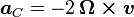
|omega_earth|=2*PI/day=2*3.14/(24*60*60)=7.27e-5[rad/s]
assume aircraft diving at 20m/s in earth reference frame
|ac|=2*7.27e-5*20=0.003[m/s^2]=3e-4[G]
assume we have 16bit ADC which covers 100% range of the useful voltage (overly optimistic),
and the accelerometer is quite sensitive with 6G full span (+/-3G) (overly optimistic, procerus claims +/-10G).
Therefore 6G is divided into 65536 counts.
3e-4G equals then to around 3 ADC counts which is below noise level of most
accelerometers which would be around 2^4, by eye.
Therefore coriolis acceleration is barely detectable (you can attach a plane to the rails, push it down, and the only deviating force will be at most those poor 2-4 counts on extremely sensitive ADC, overswamped by natural sensor noise).
How did they come to 10%/25%?
Where is an arorr in my calculation?
Unmanned Aerial Vehicle EasyUAV fully automatic takeoffs and landings from Krzysztof Bosak on Vimeo.
This is an entry for T3-7 contest.
The best distances landing to takeoff are 35 and 37m.
Only the last 6 of 8 flights are recorded in this video.
Compressed Google Earth logs:
8 automatic takeoff&landings.zip