All Posts (14049)
Sort by
Weighing in at only 30 grams each, these legs will help lessen the impact of most hard landings and generally decrease vibration damage to instruments on the vehicle. This also increases ground clearance by 2 1/2 inches. Spring-loaded toilet paper holders are fairly ubiquitous in America, so Brits and most Europeans are SOL, as their TP dispensers are only metal poles with a tiny balls at the end. Asia might be the same. I'm not sure how common Wiffle balls are overseas, let alone golf ball-sized ones. But as necessity is the mother of invention, I'm sure they will prevail. Also, ping pong balls are the right size, but shatter easily.
The fat end of the roller is right up against the arm, so I put two layers of shock absorbing foam in between. There's a small protrusion at either end of the roller (to keep it in the holder), so slathered it and one of the holes in the Wiffle with rubber cement and merged them. It's best to use a flexible adhesive as crazy glue or any cyanoacrylate will snap the moment angular pressure (i.e. landing) is applied. A binary adhesive will surely bond them, but may turn the Wiffle ball into a Wiffle puddle.
From Ars Technica:
[On the Antarctic ice], an ever-present danger is posed by crevasses: rents in the ice sheet up to 60 meters deep and 9 meters across—big enough, at their widest, to swallow a supply-towing tractor whole. New crevasses are formed by movements in the ice sheet, but they can be hidden from view by fresh snowfall. That snow can bridge the gap, but it's incapable of supporting a supply vehicle's weight.
For about 20 years, the solution to this problem has been to manually survey for crevasses with ground-penetrating radar (GPR). A radar antenna, often housed in an inner tube, is pushed along on a 6-meter boom by a PistenBully or some such vehicular beast of burden at the head of the traverse. Alongside the driver rides a GPR operator who monitors real-time scrolling radar images, looking for the tell-tale signature of a crevasse. "If a crevasse is detected, the operator has about two seconds to stop the tractor before it crosses," Laura Ray, Professor of Engineering at Dartmouth, explained to Ars. If a crevasse is found, it is probed to see if it is passable. If it is not, the crevasse can be blasted and filled, or an alternative route can be found.
But approached at a shallow angle, crevasses can go undetected, and unusual GPR signatures can make crevasses difficult to identify. Unseen, a crevasse is as dangerous to a GPR survey vehicle as it is to a supply tractor. James H. Lever, a mechanical engineer at the US Army's Cold Regions Research and Engineering Laboratory, has conducted manual GPR surveys and photographed the dangers: collapsed snow bridges and (thankfully) minor incidents of vehicles partly caught in crevasses. "These incidents caused no damage and only minor delays, but they left a lasting impression," reads the accompanying caption in a new research paper published in the Journal of Field Robotics. Interpreting these accounts, one is left with the impression that the process of manual surveying would be extremely tedious were it not for the occasional moments of considerable risk. The process is repetitive and stressful, or, in other words, ripe for automation.
A robot to the rescue

Enlarge / A GrIT towing tractor ensnared by a crevasse.
The paper in question is titled "Autonomous GPR Surveys using the Polar Rover Yeti," which neatly summarizes a solution to the problem. A robot with a GPR antenna in tow (which at about 80kg is light enough to cross snow bridges) is a tremendous ally when it comes to traversing ice sheets. Following jaunts along the Greenland Inland Traverse to the NSF's Summit Station and from the McMurdo Station to the South Pole, Yeti is claimed to be the first robot proven in the field to be capable of identifying crevasses hidden under the snow.
Roughly a meter wide, the GPS-equipped, four-wheel drive robot follows preprogrammed routes to survey areas for hidden fissures. For lightweight vehicles, wheels with low-pressure tires are thought to offer decreased turning resistance compared to caterpillar tracks. Perhaps surprising for a vehicle that operates at temperatures as low as -30°C, Yeti is powered by six lithium-ion batteries capable of powering the in-wheel motors. Yeti trundles over snow at a speed of 2.2m/s for between 2.2 and 9.3 hours. Pleasingly, researchers resorted to chemical hand-warmers to keep the batteries and GPR controller warm, the latter being even more sensitive to cold temperatures.
Though Yeti can be driven manually, automation is necessary for accurate surveying. To master the tricky problem of approach angles, Yeti follows looping paths, outward and back to a central point, as if describing the outlines of flower petals. "A grid pattern may be used to do a broad survey to locate possible crevasses. A rosette survey helps determine the direction of the crevasse and provides us with data from multiple approach angles," explains Ray, who co-authored the paper. "When a crevasse is crossed perpendicular to its length, it is most easy to see on a radar image. However, when it is approached at a shallow angle—which happens routinely because crevasse directions are not known in advance—its signature lacks characteristics (parabolic reflections) that make it easy to detect by human eye. The rosette pattern provides us with multiple crossing angles so that we have data from many characteristic crossing angles to develop our classification algorithms."
Because identified crevasses are positioned relative to Yeti, it's imperative that Yeti's GPS positioning is accurate. In the field, Yeti typically acquires 10 to 12 satellites for a position accurate within ±3 meters, which the authors describe as "acceptable" for locating crevasses.
Though unrelenting in its search for hazards below ground, Yeti is completely blind to those above. The relative lack of surface obstructions on the ice sheets makes the cost of obstacle-recognition systems hard to justify. In the rare event that Yeti's path is blocked (unusually soft snow is a problem), the team takes manual control.
Though Yeti relies on a human operator to identify possible crevasses in the data, it is hoped that the database of signatures gathered from encounters with hundreds of crevasses will help to develop algorithms for autonomous crevasse detection in the future. There's hope, too, that future robots will be able to detect and avoid obstacles in their path.
Yeti is a multitasker
It turns out that Yeti is good for more than mapping crevasses. In recent months, Yeti mapped the ice caves on the approaches of Antarctic volcano Mount Erebus. It's thought that, thanks to volcanic outgassing and the warmer conditions inside the caves, they may play host to undiscovered microbial life. Yeti has also mapped the abandoned 1950s Old Pole research facility, now buried under 3-10 meters of snow. An accident in 2010 had seen a tractor "accidentally discover" a top hat, a false attic built to reduce the weight of snow while the facility was in use. The remaining top hats were blasted and naturally in-filled with snow. A subsequent Yeti survey assessed the success of the operation to determine if the Old Pole site was safe to reuse. In part a learning exercise, Yeti managed to detect a separate unknown outbuilding that prior surveys failed to pick up.
Asking Ray what would make the shopping list for Yeti II, new wheels are top of the list. "Oddly enough, we probably would not consider more sophisticated sensing systems, at least not in the environments in which we operate Yeti," she tells Ars. "The most significant change might be in the wheels. We used off-the-shelf aluminum hubs with rubber ATV tires. Custom wheels could reduce mass significantly, and increasing their width would reduce ground pressure. Reduced ground pressure means the robot will sink less, and thus resistance is reduced."
Yeti will return to the field this year to check the Old Pole site one more time, as will its predecessor, the atmosphere-sampling Cool Robot. Polar science looks set to follow space science in putting robots on the front line of research in the field.
Journal of Field Robotics, 2013. DOI: 10.1002/rob.21445 (About DOIs).
This project will debut this weekend at the Engadget Expand show in San Francisco, which I'll be speaking at. From The Verge:
As the world of remote control devices inexorably turns into a world of drones, the distinction between the two might be a little fuzzy to most people. So you might be forgiven if you take the Ziphius as little more than a cute, remotely-controlled boat. That's not the case at all, though, as this little device has a Raspberry Pi computer inside and an adjustable video-camera up front. In normal use, you control it from an iOS or Android device, directing the motors with your left thumb and adjusting the camera above and below the waterline with your right. However, they guys behind the project say that they're creating apps and planning on releasing a developer SDK that will allow the Ziphius to act autonomously. The simplest example might be following a red ball in a robotic Marco Polo game, but they could see other users as well — their apps are built on the Unity engine, so augmented reality is a real possibility.
We played around with an early prototype in a kiddy-pool and it does exactly what you'd expect, cutely tootling around at a slow pace (they rightly didn't trust us with the full-speed version in such a tiny space). The Wi-Fi range will vary, of course, and the company expects that your average battery life should be about an hour — depending on just how hard you push the motors. Luckily, the Ziphius has a very low center-of-gravity, so it should be able to handle wake and waves and recover gracefully when flipped. Ziphius is an entrant in the "Insert Coin" competition at the Engadget Expand conferenceand hopes to launch on Kickstarter in a month or so, for "around $200."
 There are a lot of people talking about banning drones. They claimed that drones would fly over their backyards and capture their privacy. Does it really the reason people want to ban drones?
First, the problem is how to define a drone? You may think a drone is unmanned aerial vehicle. But how about an model plane with a camera on it? I have seem such model plane with autocontrol device can fly 1000feet high, it can definitely watch your backyard Should we ban these model planes? If yes, then how about the RC toy with camera which I bought from walmart? Maybe people may say drone is something with automatic control.
Then, think about the smart phones we are using. A lot of apps can activate the cameras and microphones on you phone automatically and secretly, your location, your conversation, your image could be captured and uploaded to somewhere. I would say your smart phone is more a spy than an UAV just fly by. Should we ban our smart phone? I guess it is impossible. Why? because everyone gets benefit from using smart phones, they are helpful.
So why people want to ban drones? Because the drones have not been widely applied in our daily life, people haven't get benefit from them. Maybe in next 15 years, when automatic machines are everywhere, people will get used to them.
Privacy? I think it is just an excuse.
March 15, 2013
Do you want to keep drones out of your backyard?
An Oregon company says that it has developed and will soon start selling technology that disables unmanned aircraft.
The company, called Domestic Drone Countermeasures, was founded in late February because some of its engineers see unmanned aerial vehicles—which are already being flown by law enforcement in some areas and could see wider commercial integration into American airspace by 2015—as unwanted eyes in the sky.
"I was personally concerned and I think there's a lot of other people worried about this," says Timothy Faucett, a lead engineer on the project. "We've already had many inquiries, a lot of people saying 'Hey, I don't want these drones looking at me.'"
Domestic Drones Countermeasures was formed as a spin-off company from Aplus Mobile, which sells rugged computer processors to defense contractors—though the company won't discuss its specific technology because it is still applying for several patents. Faucett says that work has helped inform its anti-drone technology.
The company will sell land-based boxes that are "non-offensive, non-combative and not destructive." According to the company, "drones will not fall from the sky, but they will be unable to complete their missions."
Though Faucett wouldn't discuss specifics, he says the boxes do not interfere with a drone's navigation system and that it doesn't involve "jamming of any kind." He says their technology is "an adaptation of something that could be used for military application" with the "combat element replaced with a nondestructive element."
"We understand the nature of the equipment drone manufacturers are using and understand how to counter their sensors," Faucett says. "We're not going to be countering Predator drones that are shooting cruise missiles, but we're talking about local law enforcement drones and commercial ones that people might be using for spying."
For now, Faucett admits the technology is "expensive," but the company is already ready to design custom anti-drone boxes for customers.
"We envision it could be cheap enough for residential use very soon," he says. "It's quite possible to deploy it if you were shooting a movie and wanted to protect your set, or if you had a house in Malibu and wanted to protect that, we could deploy it there. If a huge company like Google wanted to protect its server farms, it can be scaled up for a larger, fixed installation."
As drones become more commonplace, Faucett says more people will begin searching for a way to protect their privacy.
"The thing that brought it home for me was Senator [Rand] Paul doing the filibuster, there's a lot of unanswered questions," he says. "We think there might be as much business for this counter drone stuff as there is for the drones themselves."
This week I was busy making a propeller hub for the Radian pro propeller blades and welded the motor mount to the aluminum spine that is going to run down the center of the Multiplex easy Star . The Radian pro motor is a tractor motor. So rather than turn it around and mount it on the Easy Star and run it backwards causing the motor to pull against the mounting bolts and possible issues pulling a internal thrust bearing the wrong way I cut the motor shaft off mounted it the right way around and made a propeller hub for the folding blades that mounts on and pushes against the back of the motor (I was thinking of taking it over to the tire place and see if they could balance it? he he) if it doesn't work I will go out and buy a proper motor and prop. I also cut out the Flaperons for the wings I am going to look into wing stiffening and since I fly out my back door I can make the wing attached to the plane one piece You Guys Have a Great Day!
Here they all are, i'll be building the pan/tilt pretty soon here once i get some servos.
From The Verge:
Researchers from the University of Pennsylvania have created a bird-like claw that can be attached to an unmanned aerial vehicle (UAV) to enable it to pick up objects at high speed. Inspired by how an eagle uses its talons to grab prey, the team crafted a three-fingered claw using 3D printing and attached it to a 4-inch long motorized arm. The drone is able to use the system to pick up stationary objects flying at three meters (almost ten feet) per second.
In the future, the team wants its machine to be able to react automatically to environmental changes using an on-board camera. It hopes the camera will allow the drone to make in-flight adjustments when attempting a pickup. The researchers are also considering programming it to detect places where it can make a controlled landing and "perch" to cut down on noise and save energy.
(hat tip to Sonal for the link)
Week end. Friday.
Primus fuse remove from building slip.
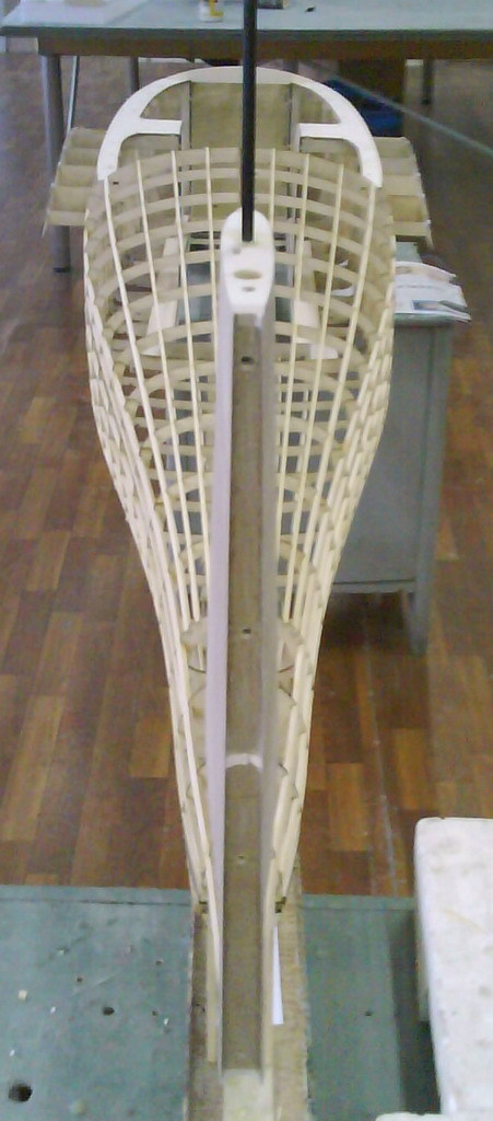
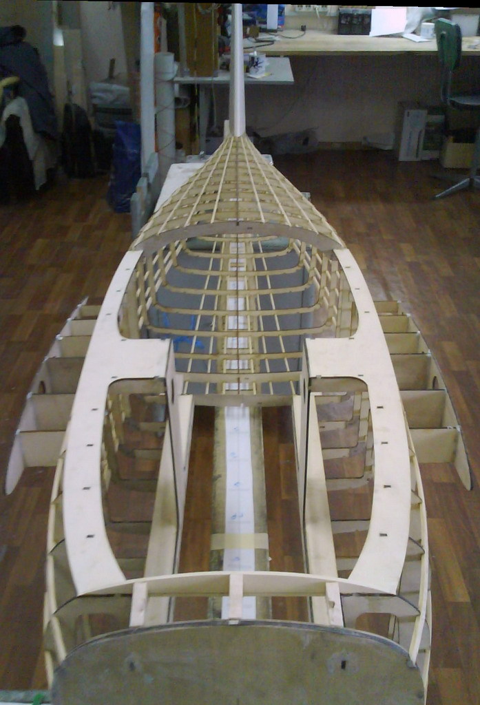
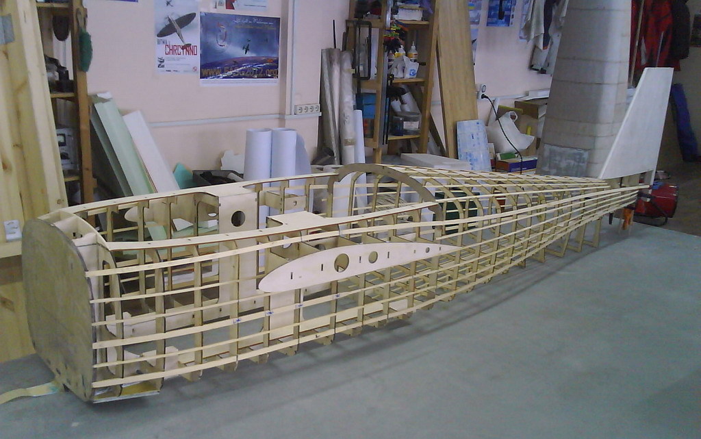
Looking small, but still have over 2 meters. :)
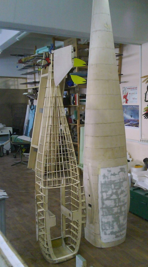
Photo: (c) European Space Agency, Anneke Le Floc'h.
At the Advanced Concepts Team of the European Space Agency, we have just released an iPhone game called "Astro Drone". People who possess a Parrot AR drone can play the game, in which they are challenged to perform different space missions in an augmented reality. The first release contains a training level, in which players will learn to dock as well as possible to the International Space Station.
However, the iPhone app is more than a game. Players can choose to participate in a scientific crowd-sourcing experiment that aims to improve autonomous capabilities of space probes, such as landing, obstacle avoidance, and docking. If participating, the app extracts visually salient features from the images made by the drone's camera. The features are then combined with the estimates of the drone's state (speed, height) and uploaded. The data is used in a research aiming to improve robot navigation.
The Astro Drone app can be downloaded for free at the Apple store. If you want to contribute to the research, please visit the high score table.
For more info: http://www.esa.int/
Download at the Apple store.
Support site: http://www.astrodrone.org/
Have fun!
Guido.
BROOKLYN PARK, Minn. (WCCO) – Charles Eide and Mike Danielson have been flying radio controlled aircraft since they little kids growing up in the same neighborhood.
As adults they formed a business, sharing a love of video production and photography.
Soon, they discovered their hobby could merge with their business, which took a huge leap when they began taking on aerial photographic work.
By mounting stabilized cameras onto the bellies of the drone aircraft, Eide and Danielson can offer customers a bird’s-eye view of anything from construction sites, to city attractions, to real estate listings.
“It helps sell houses, which is really in my opinion a huge economic impact in the Twin Cities — helps houses move faster,” Eide said.
Business was booming, until a call came from the Minneapolis office of the Federal Aviation Administration. They were simply told to ground their commercial use of the aircraft. Turns out, current regulations don’t allow unmanned aircraft for commercial purposes.
In fact, their use is strictly prohibited from operating in what the FAA defines as “Class B” airspace. That’s found in densely populated areas around key airport traffic routes, most often the airspace surrounding the busiest airports with a high volume of commercial air traffic.
Eide says he understands the need for safety regulations, but argues that his company has its own flight safety protocols. They rarely fly more than 200 feet above the ground and will never operate near airports.
“What we’re doing is low-range stuff to show off the real estate market and features in a house or property,” Danielson said.
The FAA says the urban airspace demands strict safety restrictions. Eide understands, but argues with tens of thousands of dollars invested in radio controlled aircraft, flying safely is job No. 1.
“I agree that there should be regulation on this stuff because there are more and more hands touching this stuff,” Eide said. “However, we need to work together here.”
The duo wants to work with the FAA over this. The current rules are clear, but the FAA is going to look at these rules on Friday.

Image: wikimedia.org - CC-BY-SA
Being slightly annoyed by recent posts that just show off but don't share information and trying to find an optimal long-endurance setup myself at the moment, I decided to create a multicopter setup list in my blog. Some of you might know my X8 setup list where I started to collect efficient X8 setups. This multicopter setup list is basically the same idea. Everybody who likes to share can email me his setup which I will then put to the list. The list will be sorted by endurance, long endurance first, and grouped by the type, e.g. tri, quad, hex, etc.
I hope, after a short while, we will have a comprehensive list which should be a help for newbies as well as for experienced hobbyists to determine an efficient setup.
The list is up at http://stefan.gofferje.net/projects/uav-projects/multicopter-setup-list (nothing in it yet, though).
If you'd like to share and your copter can go >20 minutes in flight or >30 minutes in hover, please email your setup to multicopter-setup@gofferje.net. In this email, please provide all data which is shown in the list. If possible, please provide links to the components used. Please also tell, what you use the multicopter for (hobby, professional, SAR, etc.). You can also provide additional information, like a link to your DIY-Drones profile. Please also tell, if and what contact information you would like to see published with your setup.
Of course, I'm also open to suggestions regarding the structure of the list.
As a follow up to an indoor test we did a about a month ago (blog post here), Assistant Professor Nagatani-san of Tohoku University, Izu-san of EnRoute (a primarily Japan based RC company) and I tested dropping a 2.5kg rover from a 4kg Hexacopter outfitted with an APM2.5 running ArduCopter 2.9.1. The test was done on the side of a semi-active volcano, Shinmoe which is in Kyushu, Japan.
The flight was all in Loiter mode with the release of the Rover via a servo controlled by the Camera Shutter function attached to channel 7 on the transmitter. The pilot (me) was positioned right near where the video was shot from.
Basically it worked but there we hit a number of issues:
- AC 2.9.1's Loiter has a 5m radius deadband meaning it moves back to it's original target unless you move more than 5m away (from the target). This meant that repositioning the copter precisely was quite difficult.
- As it was shot on the side of a Volcano at >1100m elevation, the wind was relatively strong and pushed the copter around at times.
- the release mechanism for the rover was slightly damaged in transport meaning it took multiple attempts to get it to release.
Next time we will try to do it fully autonomously.
We also took the opportunity to fly a separate large Quad outfitted with a 10000mAh battery up for a view of the crater. The flight took about 12min but it could have flown at least another 5min. Problems we hit included:
- Like the large rover-carrying-hexa this quad had very large propellers which could be caught by the wind at times meaning the controller had a lot of work to do to keep it upright at times.
- Arducopter 2.9.1 has a bug in that it proceeds to the next waypoint once it's reached the target lat/lon. This is fine for mostly horizontal flights but it's serious trouble for a flight like this in which the vertical component takes longer than the horizontal. The solution was to set the target take-off altitude to 150m and reduce the WP_SPEED to 2m. We ended up overdoing it so we flew the mission higher and more slowly than necessary.
Still, it did the mission as planned.
All feedback welcome!
As is customary and traditional, we celebrate every new 1,000 members here and share the traffic stats. This time it's 36,000!
There were 2 million page views this month (we get over 70,000 page views a day). It took us just 21 days to get this latest 1,000 members--we're averaging about one new member every 30 minutes.
Thanks as always to all the community members who make this growth possible, and especially the moderators who approve membership applications and blog posts and otherwise answer questions and keep things ticking here. We've got about 70 moderators now, but if anyone would like to join this group, please PM me. If you've been here for a while and have been participating, you'll fit in great.
This Is what happens when my little brother forgets the #1 rule: Stay Behind Me! So, to avoid hitting him I had to crash off to the side. At least I got a cool Video =)
125 min (02:05:07) ultra-long flight (#2)
now on one battery pack :)
sorry, closed hardware setup
A great initiative for kids...Sci-Tech Discovery Center has announced it will hold a Quadrotor Build and Fly Camp (presented by OnPoynt Flight School) in Frisco, Texas April 13 -14.
Full details here: Sci-Tech Discovery Center Announces Quadrotor Build and Fly Camp
Sparkfun has posted rules, walkthrough video, registration for the 2013 AVC.
Both air and ground competitions should be really interesting. The ground course is slightly shorter than previous years, and features fixed, known locations for barrels, the bonus hoop, and the ramp (my robot Data Bus is going to to *love* that feature)
Air competition is primarily over water! And features a wicket hoop thingy to fly under for a bonus, required autonomous takeoff, and a bonus autonomous tennis ball drop.
Scoring is points based with a starting pool of points to which bonus points are added, and time (seconds) is subtracted.
This application is being developed to provide another avenue for the control of micro-uav systems. The application incorporates a LRS radio and the ability to read MAVLINK generated feeds. A host of other features are being incorporated and more details/videos will be provided.