All Posts (11086)

Sort by
3D Robotics

3689720675?profile=originalAt this weels Interdrone conference Yuneec and Dronecode announced the new DroneCore SDK, which is now shipping on the new Dronecode-based Yuneec H520 commercial hexacopter. The above slide shows how the architecture works, but basically Dronecore replaces the old DroneKit SDK, and provides an easy-to use mobile (Android and iOS) and onboard (C++ and Python) interface to Dronecode/PX4-based vehicles. Of which there are many!

3689720756?profile=original

The library provides a simple core API for managing one or more vehicles, providing programmatic access to vehicle information and telemetry, and control over missions, movement and other operations.

Developers can extend the library using plugins in order to add any other required MAVLink API (for example, to integrate PX4 with custom cameras, gimbals, or other hardware over MAVLink).

DroneCore can run on a vehicle-based companion computer or on a ground-based GCS or mobile device. These devices have significantly more processing power that an ordinary flight controller, enabling tasks like computer vision, obstacle avoidance, and route planning.

The full reference is here.

Read more…

Remote Drone Mapping on Grand Mesa, Colorado

drone-mapping8_r.jpg

Delta County, Colorado agriculture has the benefit of over 300 reservoirs on the Grand Mesa, many of which supply irrigation to the variety of crops grown. This time of year, the reservoirs are being drawn down providing an excellent opportunity to map and determine reservoir capacities.

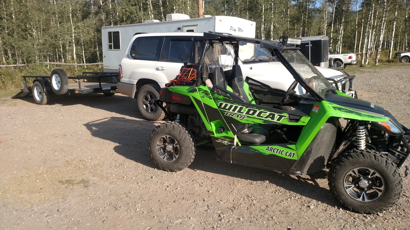
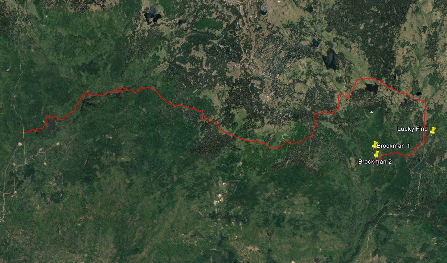
We had the opportunity to pack up our UTV with the DJI Phantom 3 advanced drone, gear, lunch and head on out to the Leroux Creek area of the Mesa. It is approximately 12 miles on Forest Service roads and 50” doubletrack to access the watershed from the Surface Creek trailhead (map shown below).

drone-mapping1.jpg

Access to some of the remote lakes between 10,000 and 11,000 feet elevation can be difficult so our Wildcat is equipped with Stihl MS200T chainsaw, Pelican dust-proof drone case, extra fuel and Warn winch.

drone-mapping2_r.jpg

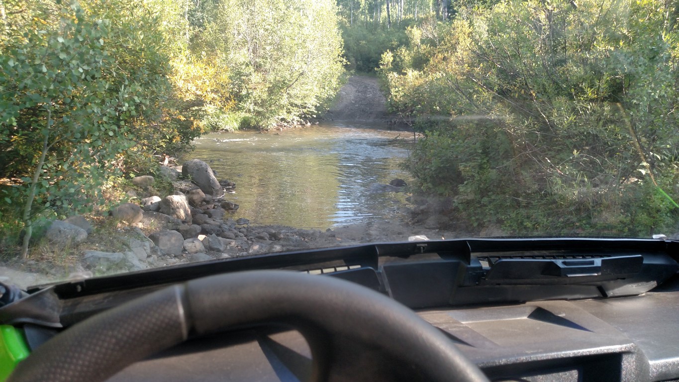
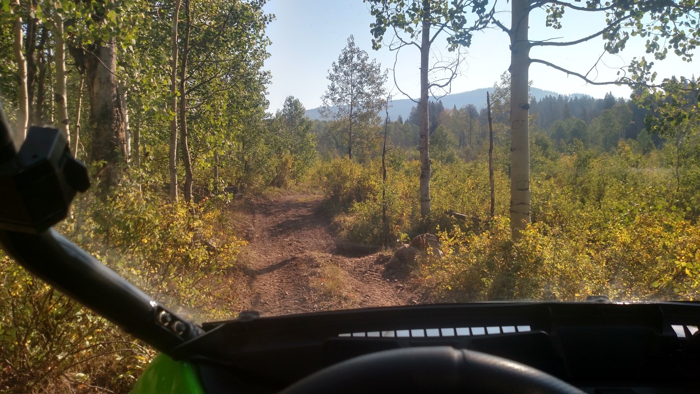
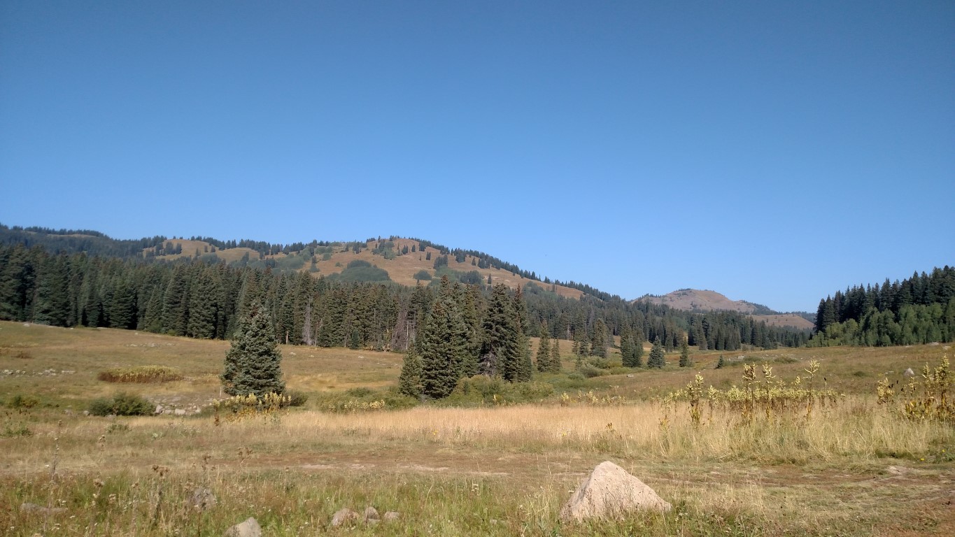
The next few shots show the beautiful Mesa country on the way to Leroux. Half the fun is getting there!

drone-mapping3_r.jpg

drone-mapping4_r.jpg

drone-mapping5_r.jpg

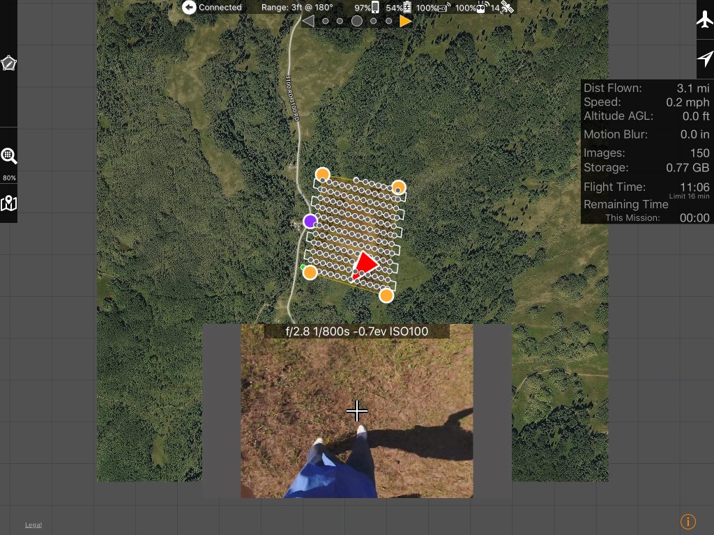
On this trip, we pre-planned and cached the missions for 3 reservoirs including Lucky Find reservoir which was drained to the deadpool. There is no cell or internet connectivity in the Mesa backcountry so we need to have a reliable remote location programming capability. We utilized MapPilot 1.5.0 for our mission planning and execution application. The screenshot illustrates the mission plan for Lucky Find utilizing 80% image overlaps flying at an elevation of 300’ above ground. Image collection for the lake area was estimated at 150 images requiring 11 minutes of flight time.

drone-mapping6_r.jpg

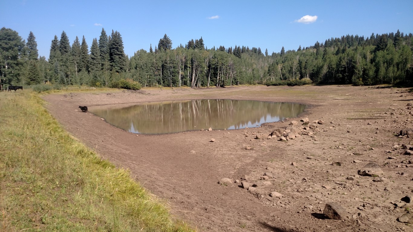
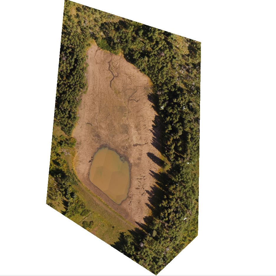
The next picture is of Lucky Find drained down to the deadpool.

drone-mapping7_r.jpg

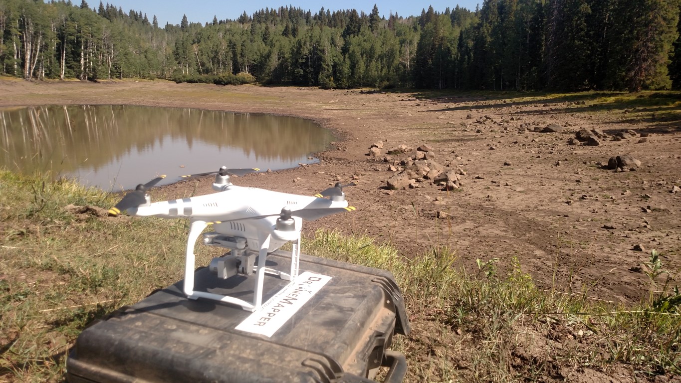
Phantom 3 has been fully programmed and ready to launch for the mapping mission.

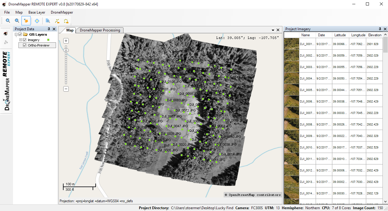
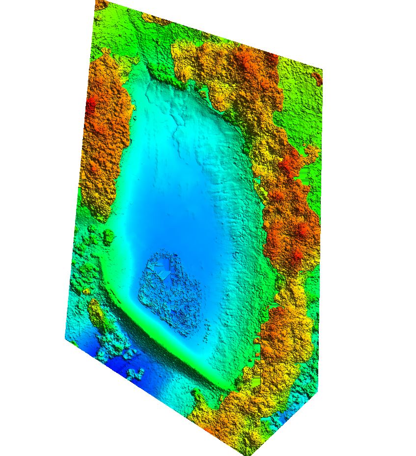
DroneMapper’s REMOTE EXPERT Windows application was used to generate the DEM and ortho from the image collection. Screenshots of the DEM and orthomosaic follow. REMOTE EXPERT generated the data products within one hour on our laptop, allowing processing in the field and mission verification prior to pack-up.

drone-mapping12_r.jpg

drone-mapping9_r.jpg

drone-mapping10_r.jpg

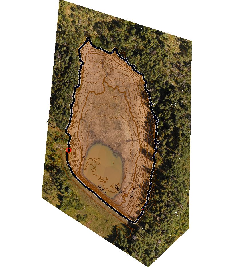
Global Mapper was then used to construct 1’ interval elevation contours as shown below:

drone-mapping11_r.jpg

Each contour is selected individually and a flat elevation surface created to compute the reservoir volume and surface area associated with the selected contour. This is repeated for the elevations of interest from the deadpool up to the elevation where dam spill occurs to determine reservoir maximum capacity. The blue dotted contour shows maximum capacity prior to drainage at the spillway on the southwest side of the reservoir.

It is critical that the drone firmware and the mission application be thoroughly tested before departure to remote locations where no communications exist. If you need assistance for end-to-end mission planning and execution please do not hesitate to contact us.

Phantom 3 Advanced Firmware: 1.8.10
MapPilot Version: 1.5.0 build 031916
DJI Go App Version: 2.8.6
Ipad Mini4 iOS Version: 9.3.3
Remote Expert Version: v0.8 b20170829-842 x64
Global Mapper Version: v18

Thank you, The DroneMapper Team

Read more…

New Event 38 Mission Planner Features

The latest version of Mission Planner for Event 38 has just been released and we have some exciting new features to share. We often develop these items specifically for our aircraft but I like to hear back from the DIY Drones community what features, if any, you think would be useful to have. If anything looks interesting, let me know and we'll work to get it into the main Mission Planner development branch. As always, you can download our version as-is on our Downloads Page.


Preflight Checklist

The Preflight Checklist has been updated to help ensure that the proper mission and camera are selected prior to takeoff. After checking the box next to Valid Waypoints, Mission Planner will download the waypoints off the drone and display them on the Flight Data screen's map for inspection.

If your drone uses multiple different cameras, you can select the camera used for each flight and check the checkbox to upload the correct parameters to trigger the camera.

Inflight Monitoring

The new inflight monitoring section is an easy way to tell at a glance if there is anything that needs the operator's attention. By default, it checks for low altitude, excessive groundspeed, orientation, GPS satellites, excessive current draw, and servo voltage. You can access and adjust the parameters or add a new custom monitor by pressing ctrl+p. 

Perimeter Run

The edges of a mission tend to have the least overlap. In cases where it's difficult to overfly neighboring areas or where it's critical that the full mission area have maximum overlap, it can make sense to run a lap around the edges of the mission area taking pictures. We've programmed this route to be added automatically when you select the Perimeter Run checkbox in the Survey/Grid screen.

Tuning Averages

This one is mostly for internal and testing use, but if you want to keep a particularly close eye on certain parameters in flight, we've added a min, max and average readout to the tuning graph and added the ability to set the time scale. We use this for trend monitoring on production aircraft.

Read more…

3689719893?profile=original

3689719801?profile=original

3689719596?profile=original

Brilliant team of engineers, modern equipment, cutting edge components, and business driven innovation = recipe of wireless power breakthrough by GET to shape out future of drone delivery industry

p.s. We have raised money to disrupt drone delivery industry (press release)! Here are some pictures from our newely opened engineering center in Moscow

3689720002?profile=original

3689719926?profile=original

3689720052?profile=original

3689719974?profile=original

3689720012?profile=original

3689720030?profile=original

3689720000?profile=original

3689720176?profile=original

3689720192?profile=original

3689720217?profile=original

3689720251?profile=original

3689720068?profile=original

3689720115?profile=original

3689720288?profile=original

3689720135?profile=original

3689720364?profile=original

3689720095?profile=original

3689720314?profile=original

3689720420?profile=original

3689720341?profile=original

3689720456?profile=original

3689720445?profile=original

Read more…

3689719854?profile=original

All-in-one Autopilot with RaspberryPi Compute Module 3.

We want to bring Pixhawk and Raspberry Pi developer community together to move drone technology to next level.

Droneepilot comes with built in all the necessary sensors/modules to build a drone .

GPS, Next Gen Airspeed sensor, Microhard Telemetry module, RaspberryPi Compute Module 3 and many many pheriperials for developers.

We developed Droneepilot to remove hardware hassle, people can easly build drone and connect to on-board RaspberryPi to start to write code directly on ready-to-use system.

For more information visit our webpage : DRONEEPILOT

Read more…

6 Best Apps for Drone Photography

6 Best Apps for Drone Photography


3689720570?profile=original

Source


Drones have really taken off lately as both objects for hobbyists and as serious tools for work ranging from construction to farming to hydrology. Equipped with a camera, a drone provides a way to gain a whole new perspective on things. They’re typically ready to run straight out of the box and can do a lot. The addition of apps, though, provides a means of making these valuable machines even more powerful in their capabilities. There are plenty of apps around but only a few stand out for the enhancements they provide. With the ability to run on both Android and iOS platforms while handling virtually all makes and models of drones being a must, here are six apps that should prove to be indispensable.


*Sun Surveyor

*Pix4D

*Hover

*AirMap

*Flightradar24

*SKRWT


Sun Surveyor

Outdoor lighting strongly depends on the location of the sun and most professional drone photographers can’t escape this fact. The Sun Surveyor app supplies information about where the sun will be at any given time in any given spot. This is obviously important for artistic purposes, but there’s no shortage of practical uses for such knowledge as well. The Sun Surveyor app handles this work by showing the sun’s path within existing images along with other valuable information like the moon’s path and phases superimposed within an image. It also reveals information about the golden hour, the period around sunrise and sunset when golden tones are most prevalent in exterior ambient lighting, and the blue hour before sunrise and after sunset when the sky radiates its purest blue hues.


Pix4D

In many professions, like architecture or landscaping, having a three-dimensional mock-up of buildings and terrain are invaluable. Available as an annual subscription, the Pix4D app makes this possible by collecting overlapping images and constructing 3D models. The software provides the options of either downloading the raw data into the user’s desktop computer for processing or simply letting the company’s own servers to do the heavy lifting. Work begins with the app determining the best flight path for the drone to gather images from. The final product includes the elevation of each data point in the model for exact analysis. With this level of precision, a high resolution camera can come in handy.


Hover

Drones don’t handle rough weather particularly well but the Hover app provides the solution. This app is simple to use and supplies data on current weather conditions and projected weather events several hours into the future to avoid surprises. It also supplies an easy to understand list of no-fly zone to keep the drone and its operator from heading into other types of surprises.


AirMap

Even more important than the sun’s location is the location of aircraft in the area. The AirMap app provides information about current flight paths and potential interference from commercial craft along with warnings about private airports and buildings equipped with helipads. The best feature of this app is its ability to link the drone operator with nearby airports so they can inform them of their intentions to fly the drone within five miles of the facility and keep things legal. To date, 125 airports are registered with AirMap’s digital notice and awareness system or D-NAS and more are being added regularly.


Flightradar24

While the AirMap app lets the drone operator know where existing flight paths are along with letting the airports know where the drone operator is, Flightradar24 lets the drone operator know where the actual aircraft are in real time. It works by collecting data from radar tracking and sends it to the mobile app to give the pilot a better sense of what’s really going on. This is especially valuable if an aircraft veers off its planned course.


SKRWT

After the photos and video have been shot, the operator will usually find a certain number of distortions in the final images. The SKRWT app is ready to take care of these problems by correcting for both horizontal and vertical biasing. The app handles these generic errors by allowing the user to tilt the images along their horizontal and vertical axes. There are also precision controls for moving the image center in or out. In addition, the SKRWT app supplies a menu of the more common platforms including iPhones, wide-angle scenes, fisheye lenses, and GoPro cameras so that the distortions typically found in each can be automatically ameliorated.


Don’t Fly Without Them

From knowing when it’s safe for takeoff to enhancing the final images, these apps cover the essential features that an amateur or professional drone photographer needs. For the hobbyist just wanting a little fun, they can make things more enjoyable. When work is involved, these apps can make a crucial difference. You should choose the best drone for you. If you’re on a budget and want to use the drone solely for flying it around the house while your dog is chasing it, then it’s no use to go for a difficult-to-maneuver and costly drone. Of course, if you are willing to dedicate a bit of time in learning how to fly and your budget allows it, a high-end drone is the best choice if you want a true drone pilot experience. Either way, these apps are technological marvels and definitely worth looking into.
Read more…

Which flight controller will you choose?

3689719748?profile=original

As we know, there are so many flight controller brands on the market like RJXHOBBY, Crazepony, DYS, Betaflight, Openpilot, Hobbypower, Kiss etc. But which is the proper one for your FPV?

Listed the popular FC as below, after reading them, which one will you choose? I need your suggestions. Thank you.

RMRC-Seriously-flight-controller-250-fpv-racing.png

RMRC Seriously Dodo Flight Controller Rev 3b

  • 8 input channels, 8 output channels
  • 2-6s input voltage, 5v output
  • 3 UARTS
  • STM32 256k processor
  • 5.4g

The RMRC Seriously Dodo flight controller has an excellent reputation of being one of the very best flight controllers on the market for drones and drone racing. Dont worry about an external BEC like you do with other flight controllers, because the Dodo can take the power right from your flight battery! Easily configure and set up your dodo with Cleanflight. Compatible with PPM, SBUS, and Spektrum receivers.

3689719820?profile=original

RJX Raceflight Betaflight REVO F4 STM32 F405 Flight Controller

  • STM32 F405 MCU, Betaflight -REVO firmware.
  • Betaflight easily delivers 125us (or faster) loop times on the F4 flight controller.
  • SBUS/PPM input (Pinheaders)
  • DSM/DSM2/DSM X input(Plug),6PWM output (Pinheaders).
  • New generation F4 hardware flight controller for FPV race, STM32 F405 MCU.

Frequency up to 168Mhz ,Flight controller firmware is pushing flight controllers to the limit. Fast loop times enable sophisticated filtering to deliver the locked in, flying on rails feeling. Betaflight easily delivers 125us (or faster) loop times on the F4 flight controller.


Crazepony-F3-Flight-Controller-Acro-Cleanflight-6DOF.png?width=500

Crazepony F3 Flight Controller

  • Acro Cleanflight 6DOF Cleanflight
  • Supported Oneshot ESC
  • The F3 has a standard 35x35mm form-factor with 30mm mounting holes and weighs just 6 grams.
  • I2C port always powered, perfect for external sensors or always-on OLED Screen.

Specifically designed for racing, it gives pilots all the features, connectivity and expansion capabilities they need. Supports a variety of aircraft, tricopters, quadcopters, hexacopters, octocopters, planes and more.Supports OneShot ESC and more than 8 RC channels. Gives you all the features you need for the heart of your aircraft, whether you're into FPV racing, acrobatic flying or aerial photography it's perfect.

Read more…

Dealing with jamming/hacking?

3689720614?profile=originalI recently picked up a used Promark P70-VR (it may not be the best thing around, but it's better than nothing - and I don't have the money for the latest and greatest). I got a registration number for it and am practicing in my back yard (staying well within the property lines and not over 100 feet). Problem is, it appears that there is someone hacking into the drone and trying to take control of it.

It started about a week ago, after I'd had it for a couple of weeks. I had flown up above my tower (60 feet) to record (video) a connection in an antenna, and suddenly the thing started climbing above the trees (to maybe 150 feet) - and then spun around a couple of times and then took off south towards the main road. I finally was able to command it to go down, but it was bobbing up and down as it descended and and spun around a couple of times around before went below the tree line (took me an hour to find it). I checked the batteries in the control - they were good.

Today I was practicing, flying no more than thirty feet up (most of the time only about 5 feet up) - learning to control it smoothly and evenly and doing things like figure 8s and circling my tower at an even distance. Suddenly the drone started climbing and heading south. I ran towards it with my control held high and finally the control (fresh batteries) seemed to regain control - minor crash #1. I tried flying it again... and after a minute it suddenly started straight up again. I ran up near the drone with full down, and finally it came down. I commanded it to land... and it did and the motors spun down... then suddenly the motors spun back up, and it took off straight up into the limbs of a tree - climbing, turned south, and started heading that direction when it hit the limbs. Now I have a busted prop and one of the motors is squealing a bit every now and then.

We have someone in the neighborhood who is quite technically capable and who hacked into our cable internet modem THROUGH THE CABLE (turned on the wireless and basically took over our internet - the cable company ended up getting us a special high security modem/router). I wouldn't put it past them to be hacking something like a drone.

Has anyone else had this problem? Is there a solution? Any suggestions (remember - VERY limited budget here!!!)???

Read more…

The new Sony looks way more Pro than GoPro

3689719783?profile=original

The New Sony RX0 looks like a really Superior camera for our use.

Probably too much to ask to make it work in our old Solos, but maybe with a Cube - who knows.

1" image sensor and high speed HD and shutter and zero to infinity focus and  pretty much distortionless.

Also has uncompressed 4K output.

My guess is this will totally take over from the GoPro in the Pro and Semi Pro applications.

https://www.sony.com/electronics/RX0-series

Read more…
100KM

3689715147?profile=original

This Saturday at DronesLab we achieved an important milestone in the final steps towards the public release of the DeltaQuad: A 100KM autonomous mission carrying a 1KG payload. This marks the achievement of the most important goal we have set when we started the development of this vehicle over a year ago.

The DeltaQuad is an electric VTOL flying wing capable of fully autonomous operation. It is driven by either the PX4 or AirRails flightstack in combination with proprietary safety and performance software. It is controlled through a tablet and streams telemetry (and optionally video) over an encrypted VPN using the cellular network. Most notably it flies without the need for an airspeed sensor. This improves reliability, usability and performance.

After extensive testing and hundreds of flight hours we knew it could achieve this goal in theory. But as with any theory it needed to withstand the test of reality. So we we started preparing for a mission that would do just that.

The mission

3689715165?profile=originalThe mission was flown in a square pattern. It was setup to autonomously take off vertically to an altitude of 22m, complete 20 laps on a 5km circuit at an altitude of 30m, and land vertically near it's takeoff point. It cruised at approximately 15m/s. The mission took 1 hour and 50 minutes to complete. It was outfitted with a 23Ah 4s lipo and consumed 20.7A of which 19.3 was used for fixed wing flight and 1.4 for vertical takeoff and land.

The payload consisted of a 1KG box filled with dummy weight. The total distance was confirmed through a KML export of the mission loaded in google earth as you can see in the image above. 

The full log of the mission can be found here: http://logs.uaventure.com/view/QEofXUiC5dwm9zh7B3vXgk

Whats next

The DeltaQuad will be publicly available this summer under a new label that we will soon announce together with the full specs and pricing. Additional options and modules will be released shortly after that. Although we can not yet release any more details we are confident that it will be one of the most reliable, scalable and affordable VTOL UAV's that is suitable for commercial applications.

** Update **

The DeltaQuad has been publicly released. Visit https://www.verticaltechnologies.com to find out all the details.

Read more…
100KM

3689719760?profile=original

Vertical Technologies has released their DeltaQuad series of autonomous VTOL UAVs. This hybrid vertical takeoff fixed wing vehicle can stream telemetry and video over the cellular network using VPN, and boasts an impressive 1 Kg payload capacity, 2 hour 45 minute flight time and 150 Km range.

The DeltaQuad is developed by members of the PX4 Pro autopilot development team and uses several impressive features that make this UAV as easy to control as setting up a navigation system. It requires no pre-flight calibrations and the Pro model comes equipped with an onboard computer that almost completely replaces the operator. This makes the vehicle suitable for BVLOS missions. The included DeltaQuad simulator makes it easy to get familiar with the controls and allows test flying missions before they are executed.

The DeltaQuad is aimed at the professional market and has been priced very competitively. It is built with industrial quality hardware and many electrical components are specifically designed for the DeltaQuad.


It comes in 3 different varieties: the DeltaQuad Base, One and Pro. The DeltaQuad Base is a kit version intended to be outfitted with aftermarket avionics. The DeltaQuad One is the RTF version. The DeltaQuad Pro comes with 4G VPN secured telemetry and video, and is equipped with an additional board computer running the DeltaQuad Safety and Performance System for advanced autonomous capabilities. These advanced features include weather condition checking, mission and terrain validation and air traffic awareness using ADS-B.


Vertical Technologies, a company started by the people from DronesLab, has been working on the DeltaQuad in relative secrecy for more than 14 months. Today they open their doors on https://www.verticaltechnologies.com and are ready to ship DeltaQuads world-wide.


Read more…

How it Works!

AWuAV 3015E the Revolutionary Open Source drone

AWuAV

"Annular Wing Unmanned Air Vehicle"

The vehicle has only 2 parts the ring wing and the motor-propeller no other moving parts for a gain in weight. AWuAV is controlled only by a Thrust Vectoring Flight Control (TVFC)

WHY A ANNULAR WING

A shrouded ducted annular wing can be smaller and carry more payload than a bi or quadcopter.

WHY A VECTORING FLIGTH CONTROL SINGLE MOTOR

To reduces the weight and power consumption of the unit. The electric motor-propeller is fixed on a ring gimbal mechanism with 2 servos at 90 degrees. (no control surface). This technological leap makes it possible to manufacture drones of 0.30 meters to 1.5 meters of diameter which can carry 2 times their weight from 2 kg to 150 kg of payload and about 40 minutes to 10 hours in air. Up to 0.60 meters in diameter, the electric motor with or not a hybrid fuel range extender is essential, above we use a twin gaz engine from 7 hp to 160 hp multi-fuel. The idea of ​​making a drone vtol of 25/40cm with a single motor + propeller to start 2 years ago there were 2 possibilities

SingleCopter Has a single motor and 4 independent flaps. The vehicle's yaw is controlled by adjusting all four fine to point slightly clockwise or counter-clockwise.

CoaxCopter Has two counter-rotating motors and at least two independent flaps (4 individual servos / flaps can be used. The vehicle's yaw is controlled by adjusting the speeds of the two motors. I.e. speeding up the clockwise motor while slowing down the counter-clockwise We tested the singlecopter solution but having the load above the drone did not please us. The project leader had the idea to use a mobile motor + helice assembly to direct the drone.

4 mechanisms have been tested for gimbal motor

- axe + ball and 2 servos at 90 ° (takes too much place in height)

- 2 square chassis and 2 servos at 90 ° (not solid enough, takes too much place)

- 2 pieces with hinge and pivot at 90 ° (takes too much place in height)

Your choice

MORE on http://awuav.world/how-it-work/

Read more…

Tricopter update

3689719702?profile=originalThought it about time I posted an update.

Attached are a couple of CAD sketches for the current Tricopter, the last one almost flew but was too fragile.

Changes are :-

  • Folding front booms.
  • Enclosed fuselage.
  • Foam plug anti-vibration mount for PixFalcon.
  • 2-axis gimbal (maybe)
  • M2M is 400mm
  • 3G, Wifi & Bluetooth, all at the same time

The prototype will have a 3D printed fuselage shell but I'm hoping to mould a polycarbonate sheet. Perhaps a coke bottle, a heat gun and a vacuum pump will do the trick. If it works out it'll be super light.

3689719688?profile=original

Here's a rear view showing the tail servo mechanism.

The servo is a GS-8901MG & the gearing ratio is 7:12 so there's plenty of torque.

One thing I'm not sure on - initially I put the GPS/compass module at the very front however I was going to try having it stuck to the top of the PixFalcon, for no other reason than it seems to fit and leaves useful free space at the pointy end.

Is it better to have maximum separation between the two compass modules or is that not really an issue ? I was also thinking the extra weight on the PixFalcon may help with vibration damping.

Thats all for now, I'll post an update when the first set of parts are ready for assembly.

Read more…

UgCS DDC Drone Swarm with Smoke

3689719674?profile=original
Recently we participated in an air show near our headquarters with 7 drones running ArduCopter. We thought you guys might be interested in seeing the footage.

UgCS DDC gives the power to create beautiful drone shows without the need to have sophisticated hardware. All of the drones we used were assembled from widely available off-the-shelf components and were using open source ArduCopter firmware (version 3.5 in this case).

The flights were planned using UgCS and the drones were controlled using UgCS DDC (Drone Dance Controller). Each drone was equipped with four smoke grenades which were triggered remotely.


Here is the video from the show:


You can find more information about UgCS DDC here: http://www.ugcs.com/ddc

If you have any questions feel free to leave them in the comments or drop us an e-mail: ugcs@ugcs.com

Safe flights, 

UgCS Team

Read more…
3D Robotics

In this episode, the Roswell Flight Test Crew speaks with John Leipper, the Solutions Architecture Manager for drone manufacturer Insitu. At the Future Farm Drone Rodeo in Pendleton, Oregon, Insitu conducted a drone swarm demonstration using three 3DR Solos – all controlled by a single pilot using a computer. Of course, to stay in compliance with FAA regulations, an individual pilot for each aircraft was on standby should immediate human intervention be required. The long-term goal is to make drones more efficient through automation, requiring less direct human input to gather data more quickly than would be possible with a single drone. Such a control system would also allow the drones to be operated remotely via the Internet or other networks.

Read more…
3D Robotics

In this episode, the Roswell Flight Test Crew speaks with John Leipper, the Solutions Architecture Manager for drone manufacturer Insitu. At the Future Farm Drone Rodeo in Pendleton, Oregon, Insitu conducted a drone swarm demonstration using three 3DR Solos – all controlled by a single pilot using a computer. Of course, to stay in compliance with FAA regulations, an individual pilot for each aircraft was on standby should immediate human intervention be required. The long-term goal is to make drones more efficient through automation, requiring less direct human input to gather data more quickly than would be possible with a single drone. Such a control system would also allow the drones to be operated remotely via the Internet or other networks.

Read more…

Nvidia TX1 SE kit a steal at $200.00

Hi all, long time no post, but this is too good.
3689719623?profile=originalThose of you doing development want this.
At $200.00 it is 3 times cheaper than the TX1 normal development kit/board and the only difference is no camera module, but any USB camera can be used.

Not quite the poop of the TX2, but for object avoidance or even navigation, by far the best / cheapest deal anywhere.

You will need to sign up as a Nvidia developer, but easy peasy.

http://www.nvidia.com/object/JetsonTX1DeveloperKitSE.html?nvid=nv-int-jnt1drktsntndkfm-20075

If you really want to do neat stuff, this is what you need.

Best regards,

Gary

Read more…

3689719653?profile=original

Introduction

The true success of any commercial product is defined by its customers. Customers who believe in the product and use it to solve real world problems. At FlytBase, we celebrate our customers who leverage our platform to build innovative commercial drone applications for their industry verticals.

One such customer is Shingo Matsuura. Shingo runs a research lab, Systems Nakashima Co. Ltd in Japan. Shingo’s most recent customer was a construction company, looking to integrate drones into their regular workflow, for improved efficiencies. They approached Shingo with a requirement to develop a deep learning solution deployed on a drone, that could detect and recognize construction equipment on site.

After evaluating various available options, Shingo decided to use the FlytBase platform to implement his solution.


How did FlytBase help?

“FlytBase platform is compatible with different autopilots and allows you to work on companion computer of your choice. This independent nature of the FlytBase platform made it an obvious choice.” said Shingo, when asked about why he chose FlytBase.

Shingo made use of FlytBase’s deep learning and object recognition capabilities to automatically recognize various equipment and to track their movement. He took inspiration from the Deep Learning Demo available with FlytOS on the Nvidia TX1 platform. FlytBase offers ready APIs and SDKs for quickly integrating complex drone applications, including, deep learning capabilities.

Visualizing the data on the user-interface, over a remote connection, is critical to the success of any drone application. Shingo used the FlytConsole, a web-based mission control software, bundled with FlytOS, to build his custom user-interface. This greatly simplified the visualization of detected objects, live video feed and exposing other controls on the UI.

FlytBase platform provided Shingo with all the tools, that he needed to assemble his drone application in under 10 days.

Results

Shingo showcased his solution at the Artificial Intelligence (AI) Expo held in Japan, which demonstrated the power of FlytBase platform. His work garnered a lot of attention and was very well received by the audience.

FlytBase congratulates Shingo Matsuura and everyone at Systems Nakashima for their success, and wish them the best for their future work.

————

Building a commercial drone application? Let FlytBase experts help you accelerate your development!

Visit flytbase.com/applications

Source

Read more…