All Posts (11086)

Sort by
Developer

UAVs for measuring radiation levels in Japan

3689515274?profile=originalTwo years after the March 11th tsunami in Japan that triggered the Nuclear disaster at the Fukushima power plant, there are still just over 300 thousand people who have not been able to return to their homes due to high radiation levels.  The government has decided that radiation levels must be below 1 micro sieverts/hour (=5mSv/year, see here for what this means) before children can return to school in the area (adults may return to their home at 1.9micro-sieverts/hour, 10mSv/year) and there is a building-by-building clean-up effort that is going on to try and get the radiation levels down to the required levels.

The radiation levels are being measured from manned helicopters flying at approximately 300m but the issue is that the ground level where people actually live can only be estimated roughly from the air.  To get the more accurate "human level" readings the government is relying on mobile surveying trucks or individuals wearing protective clothing but there has also been some limited use of UAVs.

3689515310?profile=originalIn particular the very top image was taken at the Yamakiya elementary school (40km from the plant) using the Chiba University's MiniSurveyor hexacopter outfitted with a geiger counter.  The readings were performed twice, once back in August 2012 and then again in December.

What you can see is that over the 4 months that significant portions of the school ground has returned to near natural levels and the part of the ground that was high radiation (2 ~ 3 micro-sieverts/hour) has mostly fallen to 1~2 micro-sieverts/hour.  This area, by the way, is where the top few cm of earth from the school playground was removed and placed in the middle of the ground and covered by a plastic sheet.

During this test an EBA Japan Hyper-spectral camera was also used (although, in fact it was mounted on a manned helicopter mostly because it weighs 2kg and the mini-surveyor was perhaps unable to lift that weight for an extended period).  These sorts of cameras can produce an image broken down into hundreds of bands of bands of light which can be used to determine what surface the radiation has fallen on.  This is important because the level of radiation remaining at a site is greatly determined by the surface.  For example it has been found that different types of trees retain radiation differently.  A cedar will retain 50% of the radiation within it's leaves while an oak will only retain 20% (the rest falls to the ground).

3689515100?profile=originalAfter the clean-up is done, having a UAV capable of travelling over all the various different surfaces and verifying the success of the effort is another good use that's been put forward.

The Mini-surveyor was developed under the guidance of Professor Nonami (who wrote this book).  It costs about about $15k each including a fancy simulator for learning how to use it.  It apparently uses a "physical model" instead of PID controllers for attitude control.  You can see a video of it flying here.

Read more…

APM 2.5 for photogrammetry

Today I share with you my experience after four years of trial and error with APM, and managed to optimize my skywalker as UAV for photogrammetry, is a team of professional results for less than 4k USD, APM is a great platform for autopilot dornes developed for different applications at the beginning is a bit confusing and frustrating but then you start to see the benefits of this open source autopilot. georeferencing tools like pictures (control + F) is very useful for a good result.

my drone is equipped with:

skywalker 1900

motor : scorpion 1100

camera: samsumg nx200 lens 20mm

LRS : dragon link

radio : futaba 12fg

camera video : gopro3

modem: maxstream xt9

APM 2.5 


3689515327?profile=original


Here are other examples

3689515342?profile=original

3689515416?profile=original

Read more…

Is the camera on?

images?q=tbn:ANd9GcRQcpdMf52A8Uf93WGpxyv2EpB-eVN0Y4iFaVUg3s2kfSAMG5xaMy inexpensive starter quad (click here for my post about it) comes with a built in standard definition 60fps camera. The whole package, being less than $70, is a great buy, but the lack of high definition is slightly disappointing. I have been looking for a lightweight high definition camera to mount instead. I considered a key chain camera, but while at a discount store the other day, I found the Emerson HD Action Camera. 

It is a high definition GoPro-esque camera which records 720p high definition, at 30fps. It was about $35, so not much more expensive than the better high definition key chain cameras, and I wouldn't have to wait for shipping. Knowing the store I was buying from has a good return policy (even on damaged items) I decided to give it a try. I stopped by to pick one up on my way home from work yesterday. I will review the camera at a later time, but for now, back to my story.


I stripped it down to its circuit board, which I put into a padded anti-static package, cut a hole in it for the lens, and rubber band mounted the whole thing to my quad. It worked! It was lightweight enough to fly, and actually gave a little more stability to the quad by hanging a little extra weight below the center of gravity. I flew it around the house last night, and have some wonderful video of my walls, but didn't have a chance to get it outside before the sun went down. Today, by the time I made it home from work, we had a storm moving in, and there was a literal calm before said storm. Winds were only between about 3 and 5mph, so I decided to drag my new high def setup quad out, and take some aerial shots of the storm front. I am an amateur meteorologist, so this type of shot is something I have actually been interested in with aerial photography.


I got the quad up about 65 feet, started doing some pans of the horizon, fought some wind gusts, decided I had at least a few good shots, and brought it down just as the wind gusted up to about 25mph. Excited, I go into the house, pull the SD card, put it into my computer, pull up the video, and...I have a wonderful shot of me looking at the camera, adjusting it a little, and then...nothing. I somehow bumped the record button on the camera while making sure it was secure, and turned the darn thing off! ARGH! Even in my makeshift packaging, I can see the LED blinking when it records, and could have easily checked to make sure it was recording before sending my quad up on its dangerous mission. BUT, in my haste, I did not do the final check, and lost out on what I am sure would have been award winning aerial video footage of a storm front. OK, that may be going a little far, but still, it could have been cool. Maybe next time.


Read more…
100KM

Chasing own drone with fpv mini quad

It's simple, put an apm2.5 on a mscomposite swift-II flying wing, launch it on a mission, put video goggles on, launch miniquad and start chasing :-)
Actually it wasn't so easy to find the drone in the sky, looking through the videogoggles. I needed some help from a spotter to get the done in my sights. Once locked in I could follow it fairly well though.

Only 1 person in my club attempted to fly 2 planes at once before me.  He had each one put on 1 stick of his transmitter.  That went ok for a very short while,...

Read more…
3D Robotics

3689515060?profile=original

From sUASNews:

French manufacturers of the worlds most popular UA have plainly run into problems.

They issued a statement yesterday:-

AR.Freeflight 2.2 was removed from iTunes last month due to the need for patents’ clarification on accelerometer and absolute control.In the meantime, we have enriched AR.Race2  App (version 2.2) with a free piloting mode in order for our customers using iOS devices to continue enjoying flying the AR.Drone.We’ll keep you updated.Sincerely,Parrot Team

Its not noted if the patent issue affects the Android version of its software which was behind its iOS version anyway. Back in 2010 I thought that Apples TOS 4.2  changes might push the platform towards Android.

Andropilot

Tablet control and flight following for several Open Source autopilots is now a reality. Openpilot, Tau Labs  andArdupilot all have working examples. Last week I started flying with free app, Andropilot created by Kevin Hester of Geeksville Industries.

The simplicity of set up was quite amazing. The app saw my3DR radios immediately, never has getting telemetry to work been so straightforward. Increased situational awareness always welcome. A voice tells me what mode I have selected on my standard RC controller and a HUD and moving map let me see what’s happening.

My sons fly our AR.Drone very well tilting the tablet, but my head is firmly stuck in the dark ages and prefers the position feedback that sticks bring to thumbs. But that’s just me, if you have known no other way then it will not be an issue.  In a couple of years time I don’t believe anyone will be left flying UAS with conventional RC gear when the smartphone in their pocket will be able to cope.

Read more…
Moderator

modelaircraft.jpg

By Ben Wolfgang -The Washington Times

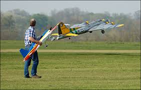
CROWNSVILLE, Md. - Steve Barnett has been flying unmanned aerial systems for more than 30 years — long before the word “drone” started making global headlines.

But now, the 65-year-old Army veteran and model-airplane enthusiast finds himself answering new questions as his hobby gets dragged into a white-hot national debate.

“At no time has the word ‘surveillance’ ever been used. That’s not the reason for us to be out here,” said Mr. Barnett, an instructor with the 80-member Chesapeake Bay Radio Control Club, as he took a break from flying his craft over the group’s sprawling field near Annapolis.

Even just a few years ago, model pilots such as Mr. Barnett wouldn’t have had to address the issue of drones or the Fourth Amendment. That’s quickly changing because of public distress about anything that flies overhead without a human pilot on board.

Mr. Barnett has kept an eye on the rise of the domestic drone industry; more importantly, he is keenly aware of how the cutting-edge crafts are inspiring new federal legislation, state privacy protection laws and other regulations.

“It’ll eventually impact us,” he said, as one of his students worked on a model plane nearby.

A thin, blurry line

Read more: http://p.washingtontimes.com/news/2013/apr/9/model-aircraft-owners-drawn-privacy-debate-drones/?page=1#ixzz2Q2ZhuwtO

Read more…

2HP Quadcopter

Hi,

These videos are a bit old, but I wanted to post them anyway. This is my first quadcopter. I had no experience at all in that. I'm more into airplanes than copter things.

Anyway, here's a short description. I'm using 4 380W (1100kV) motors and 6600mAh of energy spread in two 18.5V lipo packs. On the videos I'm flying with 12 inches props (the ones found on diydrones store). Total weight : 4.8 pounds. Bad idea... if you make the calculation and compare to the speed of sound, you'll understand.


Here's the part two of the flight. You can see the quad a bit closer and landing.


The quad you see in the video crashed. I so regret not having it on video... It basically exploded in flight when one prop broke, breaking an arm, and all that before touching the ground on a windy day.

Today, I've upgraded. I now have an aluminium/acrylic frame (this one was a cheap wooden frame from Hobbyking...). And I now use 9 inches tri blades props. Video when temperature gets better in Québec!


Read more…

My first DIY Quadrocopter

3689514884?profile=originalHey All!

This is my first blog here and hopefully not my last. The picture is obviously the frame of my DIY Quadrocopter. I'm waiting on a delivery of the electronics to complete it. I got anxious and couldn't wait to share my project with you all so this will be part one of more to come, so long as the final assembly, tuning and maiden voyage are all successful. I've been reading a lot and learning a lot from all of you here. So I wanted to share my project and get your input.


The frame is 3/4" Oak. Each boom measures about 12" from the center. It will be powered by NTM Prop Drive Series 35-30 1100kV (380W) motors, 30 Amp Turnigy Plush ESCs, 11.1v Lipo (of various assorted mAH), KK2 Control Board, I've ordered an assortment of propellers from 8X4.5 to 10X4.7. I think the 10X4.7 will work best given the results from http://www.ecalc.ch/. I could probably push it up to a 14.8v, but I wanted my first quad to be manageable horsepower (Watts). So far I'm really enjoying my new therapy - I mean hobby. I'll have more to share as I progress.


Joe

Read more…

My Brookstone 2.0 Rover Overview

Link to the Brookstone Rover

I hope you folks enjoyed my overview of the Brookstone 2.0 Rover.  In my next blog (Part 1) I'm going to include tons of video footage from the rover's Camera and Night Vision Camera (Going to use it when it gets dark tonight).  If you have any experience with intercepting commands from the Device/Controller to the Rover so I can use the codes/commands to reverse engineer the rover.  I'm going to need all the help that I can get!

To Do List:

1.  Purchase an Android Tablet

2.  Upgrade Telemetry Kit

3.  Switch out current power source (6 AA Batteries) to a LiPo Battery System

4.  Get Mission Planner Working/Running

5.  Integrate an APM 2.5

6.  Get it to work with ArduRover

7.  Get it to work with AndroRover (Once step 1-6 are complete)

3689514965?profile=original

Brookstone Rover 2.0 Specs:

Video Stream Format.mp4
Video FPS25 fps
Snapshot FormatJPEG
CMOS300,000 pixels
Wi­Fi Antenna802.11 b/g
MicrophoneYes
Movement Motor6500 revolutions per second, DC 9.0V
Age Grade14 and up
CompatitbilityiPod touch® (3rd & 4th generation), iPhone® 4S, iPhone® 4, iPhone® 3GS, iPad®, iPad® 2 and iPad® (3rd generation), Android™ 2.2 and later, Apple iOS: 5.1 and later
Batteries6 AA (included)
Running TimeApproximately 2.5 hours
Maximum RangeUp to 200 ft.
Weight2.3 lbs
Dimensions with Antenna10.25"w x 7.75"l x 7.75"h
DistanceApproximately 200 ft. (unobstructed), 100 ft. (obstructed)
Camera320x240px at 25 frames per second
Stealth Night Vision Lens850nm
Social Media Compatibility

Email, Facebook, YouTube, Tumblr

Read more…

3689514846?profile=original by Daniel Terdiman April 8, 2013 3:30 AM PDT Link to the Article on CNet

After setting a world record for the longest distance traveled on Earth's surface by a robot, Liquid Robotics today unveiled the latest version of its Wave Glider technology.

The updated platform is capable of autonomously prowling the world's seas while analyzing, processing, and transmitting data gathered from a wide variety of on-board sensors.

The new Wave Glider SV3 is essentially a self-powered sea-faring data center, a system that gives users the ability to investigate the world's water ways for months on end. The SV3 features a hybrid propulsion system, Silicon Valley's Liquid Robotics said, that can drive the Wave Glider on either wave or solar power. It also comes with a vectored thruster that lets the robot continue its missions in high seas and dead calms alike.

At its heart, the SV3 is meant to carry a heavy duty load of sensors designed to serve everything from the oil and gas industry to fisheries to coast guards and the military. Its power management systems were designed, the company said, so that its on-board servers can continuously bring in data, and simultaneously analyze the information before transmitting conclusions via satellite communications.

The SV3 was also designed with a data center-like architecture allowing multiple users to each have their own data gathering and crunching take place at the same time, all totally independent of the other. And because the computers are meant to be strong enough to do most of the processing locally, the new Wave Glider can send back conclusions via high-bandwidth, low-power connectivity rather than large amounts of raw data that must then be analyzed once they arrive.

In a sense, Liquid Robotics is hoping that the Wave Glider SV3 can be the Amazon Web Services -- a floating server rack -- of the open oceans, said the company CEO Bill Vass. The system can be dynamically configurable, with multiple ARM-based processors, and can use either solid-sate or spinning disk storage. Customers can choose whatever combination works best for them.

The SV3 is also fully backward compatible with Liquid Robotics' previous generation Wave Glider SV2.

Read more…
Moderator

The Mainstreaming continues...


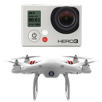
920447.jpgFrom another group (populated mainly by photographers interested in aerial photography), here's a link to B & H Photo, selling a GoPro and Phantom in one package.

B & H is one of the largest resellers of photo and video equipment in the US, so it's quite a milestone to see them list a quadcopter there.  And encouraging that they identify it as a quadcopter and not a drone?

Read more…
3D Robotics

PETA getting their own drones

3689514930?profile=original

I'm sure this will end well...

From PETA:

PETA has decided to use a remote-controlled aircraft to collect and publicize footage of hunters shooting animals and allowing them to escape, only to die slowly and in agony, among other common violations. PETA has contacted Australia-based drone manufacturer Aerobot, maker of the state-of-the-art, remote-controlled helicopters that can be outfitted with a video camera, to discuss which of its products would best fit the purpose. The drones can also be used to fly over factory farms and other areas that are hotbeds of abuse.

Read more…

DJI Phantom Set-Up Demo

There's been a lot of random discussion about the Phantom and whether or not it's worth the money, does it fly well, etc. I say yes to all.  Here a quick video of my set-up.

I also fly an Arducopter and XAircraft X-650-V8 but for quick and easy set-up and great flying the Phantom is a blast.  Won't lift the heavy cameras or fly waypoints but for GoPro shots or just to practice flying you can't beat it.

Read more…
Moderator

Some MAVLink Protocol Notes

3689514863?profile=original

Here's some notes on fiddling with MAVLink.  Andreas and I started at the bottom of the stack (the byte stream) and are working our way up.  Along the way I filled in a few possible holes in the documentation.

http://eastbay-rc.blogspot.com/2013/04/mavlink-protocol-notes-packet-decoding.html

There's a demo of one process receiving an APM MAVLink stream, decoding packets, and multicasting the packets to other processes, sort of an on-the-cheap message bus.  There's a link to the sample code.

Read more…
Moderator

DJI Phantom Vision

Phantom_Vision.jpg

They are certainly trying.

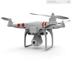
The PHANTOM Vision is the only quadcopter on the market to offer professional-level multi-rotor flight control technology, an intelligent GPS-based autopilot system, an integrated HD camera and an iOS app for full camera control. The PHANTOM Vision also comes with a remote control unit containing pre-programmed autopilot parameters allowing pilots to switch between different flight modes to achieve particular flight experiences. Also incorporated are safety parameters, such as a failsafe feature that will bring the PHANTOM Vision back to its take-off point and land itself if it loses signal from the remote control unit for any reason.

http://www.suasnews.com/2013/04/22136/dji-introduces-first-consumer-uav-with-integrated-14-megapixel-and-full-hd-camera/

Read more…
Moderator

indianrhinos.jpg

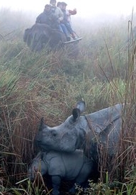
Something close to my heart, I am currently ramping up for a radio collar trial in South Africa with some new technology. Rhinos are just one animal in great danger. Time to redress the balance. GM

by Abdul Gani

Kaziranga National Park, for the first time is to witness a test flight of the much anticipated unmanned aircraft on Monday in presence of Wildlife Institute of India (WII) Scientist, Dr. K. Ramesh who leads the monitoring programme, said Rakibul Hussain, Minister for Environment and Forests at press conference today. This test is to begin tomorrow and extend till April 11 so as to understand all measures that will be required for implementation of the unmanned aircraft for better surveillance at the national park.

It is to be mentioned that Assam Chief Minister Tarun Gogoi has been pressurising the Central Ministry for a CBI enquiry in to the unabated poaching of endangered one horn rhinoceros. The CBI has now accepted the State Government’s request to probe into this matter. Hussain also said that the Chief Minister has welcomed CBI’s gesture and has promised to extend full support to control the illegal activities at this national park. The unmanned aircraft is one of the measures undertaken by the State Forest Department and National Tiger Conservation Authority (NTCA) which could be one effective measure to keep a track of events at the national park. Minister also emphasised that use of this advance technology will help to monitor unwanted movements of the poachers and thus keep a track. Though a clearance is yet to be acquired from the Defence Authority but once the test is cleared the Minister is hopeful for its implementation at the earliest.

The minister ascertained that an unmanned aerial vehicle would also soon be inducted for better surveillance of the park to prevent poaching of rhinos and other wildlife. He also informed about a workshop to be held on April 20 at Kaziranga wherein Keshav Kumar, Joint Director, CBI from Mumbai will train the Field Directors of North East and Central India to combat and sharpen their investigative directives against such poaching.

http://www.assamtimes.org/node/8150

Read more…
3D Robotics

3689514657?profile=originalI'm a loyal AUVSI (Association of Unmanned Vehicle Systems International) member, but this is just sad. In an effort to distance the industry from public perceptions around the word "drone" at a congressional hearing last week, they said this:

“This is more than a pilotless vehicle,” Michael Toscano, president of the Association for Unmanned Vehicle Systems International, said at Leahy’s Senate Judiciary Committee hearing, convened to consider privacy risks. “There’s nothing unmanned about unmanned systems.’’

First of all, what?? Second, it may be that there are 60+ people in ground support for each Global Hawk in the air, but that's sure not the case for the smaller drones, including the ones we fly. At the moment we still usually keep one "pilot" on the ground (guy just watching and able to take over manual control if needed) for each drone in the air, but that's just a safety measure. These things take off, run their mission and land autonomously. When all goes well, there's no human in the loop at all. 


Either the AUVSI is out of touch with what's really going on with drones, or they're backing themselves into a rhetorical corner that they won't be able to get out of. 

(Photo of CyFly tethered drone from Boston Globe article linked above)

Read more…

ArduPlane flies at 4500m altitude


3689514622?profile=originalDuring a 4 weeks mission to Peru we have done several UAV flights for mapping purposes. These included flights at high altitude over the Andes. The highest one was over the scenic “Bosque de Piedras”, at 4500m altitude, where we have mapped a 1km2 area in a matrix flight pattern.


3689514721?profile=original

 - Images processed with PIX4D - 


These flights fit within a Belgian - Peruvian cooperation (KU Leuven – UNALM) to study and improve agricultural production in coastal, Andes and Amazon areas of the country. Special thanks to all the developers here at diydrones, dedicated to make Arduplane rock-solid and performing well under difficult conditions. During the 30+ autopilot missions, Arduplane never failed  and we managed to finish the project with one X8 frame, despite the harsh conditions (rainy season, high altitude, challenging landing spots..). Below a road-movie from the Andes part of the trip:

Read more…