All Posts (11069)

Sort by
XAG-Adopts-AI-in-Fruit-Tree-Spraying

XAG has confirmed that its UAS crop protection services have covered an accumulated farmland of 20 million hectares, amid a large-scale cotton defoliation operation in Xinjiang, China.

Among the first to introduce fully autonomous drones to transform the way crops are grown, XAG has become one of the world’s largest agriculture drone manufacturers and service providers.

Its crop spraying drones have operated in 38 countries including South Korea, Japan, Australia, Vietnam, Brazil, Mexico, Zambia, etc.

According to XAG Flight Information System (XFIS), up to September 11, the company’s total drone service record has exceeded 20 million hectares, which is 400% higher than that of a year ago.
Particularly, this August, XAG conducted a record-breaking, single-day operation on as many as 140,000 hectares of farmlands, marking a milestone in the global UAS crop protection industry.

XAG says its 20-million-hectare service record indicates farmers’ strengthened trust on the new technology.

The precision spraying solutions have been applied to sustainably safeguard a wide range of crops, including maize, cotton, rice, wheat and fruit trees, from harmful weeds and pest diseases.

Original address:

XAG deploys crop-spraying drones to successfully protect 20m hectares
https://www.commercialdroneprofessional.com/xag-deploys-crop-spraying-drones-to-successfully-protect-20m-hectares/

Read more…

Heliguy to launch in the United States

USA-Large-700x429.jpg?profile=RESIZE_710x

Heliguy have spent 15 years becoming one of the leading drone supply and support companies in the world.

They have now announced that they are launching in the USA.

A new hub, in Dallas TX, will serve as Heliguy's home in the USA.

Heliguy bring with them a worldwide network of drone expertise, including being a Gold partner with DJI - for both consumer and enterprise-level products.

In addition, you'll be able to source brands like 3DR, Micasense, Slantrange, PGYTech, PolarPro and more with Heliguy.

For more infromation please read the full release here: https://www.heliguy.com/blog/2019/09/26/dji-airworks-2019-heliguy-to-open-in-the-usa/

Or contact Heliguy directly:

3200 Commander Dr. #100,
Carrollton,
Texas,
75006,
United States

T: 862 298 5964
E: info@heliguy.com

Read more…

The Dumb-Battery Era is Over

68747470733a2f2f6c68362e676f6f676c6575736572636f6e74656e742e636f6d2f4f5f4b6633347a626549394f75695f714872597137626b3177576b4f4e456c3962616836654950774c664c5968646866677149466279384c685650556b48516d4b637554624275624f746674626439326472647a4445474a386578416778374d496746635741397a34537530376958716a4e75577a6b446d624d3677374b7561385356774d49696c?profile=RESIZE_710xOver the past couple of months, we have been working on a "smartification kit" to obtain accurate state of charge for Lithium batteries. Currently most systems use voltage based capacity estimation which is inaccurate and make it hard for flyers to

  • maximize their flight time
  • understand changes to battery capacity over time
  • choose from the best pack among the many-in-hand to race with

Batmon helps solve all of the above issues and also automatically discharges the battery to storage voltage after set-time to enhance the life of the pack. 

The board currently works with modified pixhawk, ardupilot and arduino firmware. More details about the kit is available here: https://github.com/rotoye/batmon_reader

We also help assemble custom lithium ion and polymer packs with Batmon integrated for your specialized use case. 

Please PM me if you'd like to know more details. 


3689742084?profile=original

Read more…

Pixhawk FC university alumni discount available conditions apply!!!

M8%20-new.png?profile=RESIZE_710x 

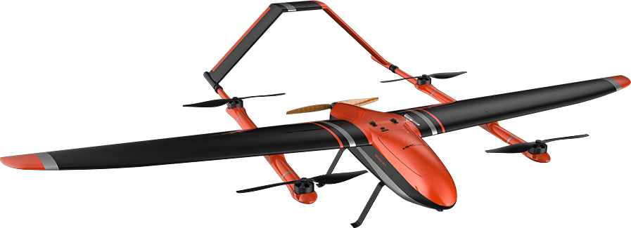
A drone with a wingspan of 2.5 meters using PIX Hawk FC for aerial surveying - MMC‘s’GRIFLION M8. This drone combines the advantages of multiple rotors and fixed wings: flexible take-off and landing, limited by the environment; fast flight speed, long battery life, can be equipped with high-definition cameras; with RTK+PPK system, one button At the same time of accurate take-off and landing, it meets the requirements of high-precision drawing. Hydrogen Fuel cell version also available with 800w-1800w hydrogen fuel sell & HP  2L- 20L tank! cumming soon gas electric hybrid version please enquirer about fuel cell kits available for most multi copter applications as well .

http://brushlessgimbal.ca/Aerial-Photography-CUSTOM-UAV-AR/GRIFLION-M8-VOLT-RTK-PPK-Servay-DRONE  

Hydrogen power delivery kits available with tank , valve and fuel cell as well as hydrogen production station and compressor to fill the tanks.

VERSION 1 # BASIC default: NO GIMBAL Packing: 1 unit*drone, 1 unit*Futaba handset, 2 pcs*portable backpacks
VERSION 2 # Griflion M8 RTK : Survey Mapping, RTK+PPK+MMC Station Software, not compatible with gimbal) Packing: 1 unit*drone, 1 unit*Futaba handset, 2 pcs*portable backpacks, 1 set*RTK ground unit
VERSON 3 # Griflion M8 Inspection: compatible with BGC gimbal Packing: 1 unit*drone, 1 unit*Futaba handset, 2 pcs*portable backpacks, 1 unit*Etlas Neo Ground Station

Hybrid Gas Electric VOLT Griflion M8 8hr flight time coming soon contact us for details !

Read more…
1*bivBanrz_87b17uVJYAsRw.png?profile=RESIZE_710x

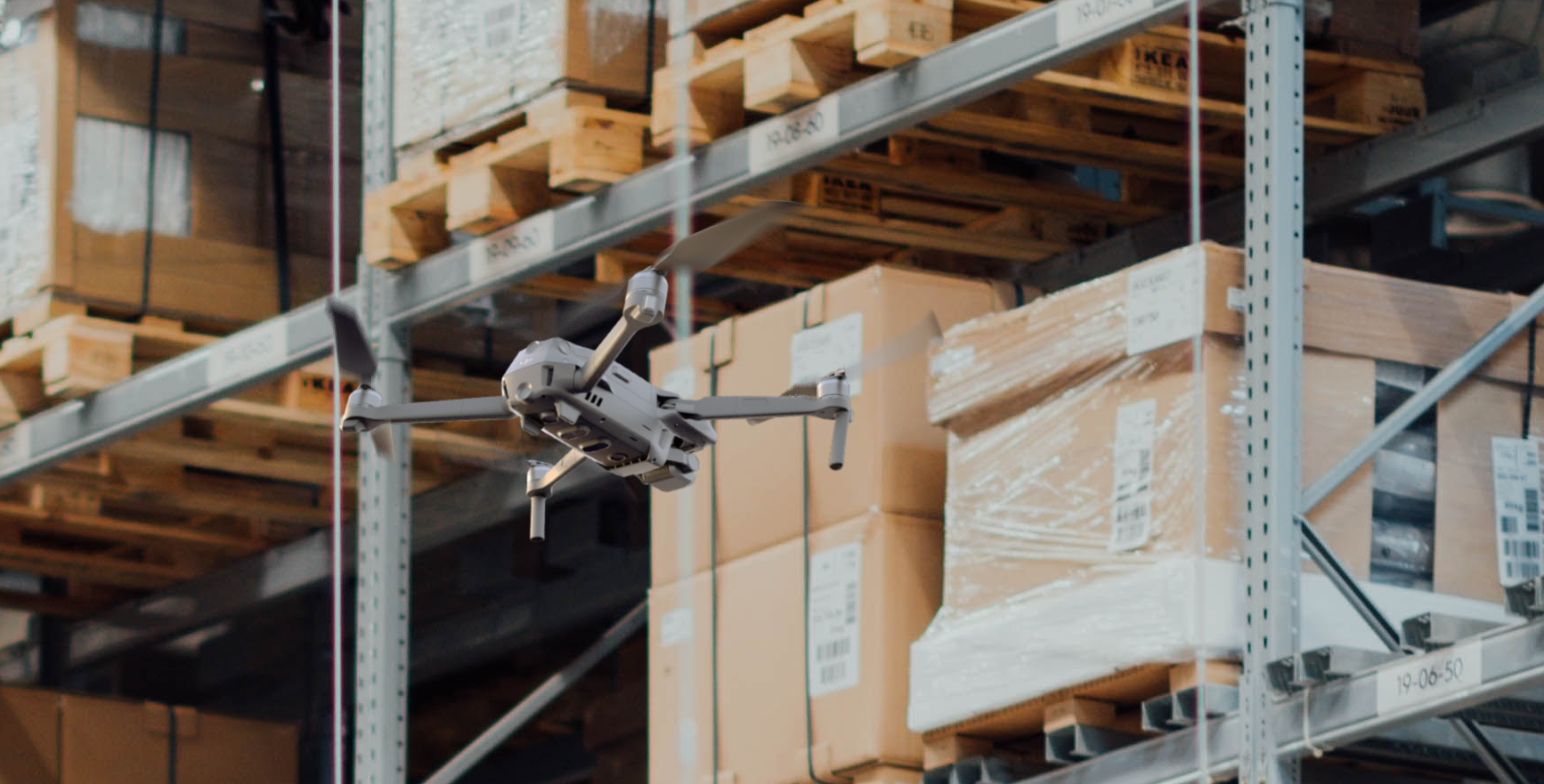
Cycle counting of warehouse inventory, a labor intensive but high-value business activity, can now be done aerially, automatically and intelligently. FlytWare, an autonomous drone solution for indoor operations, is designed to be deployed for pallet and case reserve counts; be it freight forwarding sites, cargo storage facilities, and warehouses — or — DCs, fulfillment centers and retail stores.

Traditional warehouses are being disrupted by global e-commerce, high velocity supply chains, same-day delivery commitments, and intense cost pressures. Supply chain executives are keenly aware that digital transformation is not just a buzz word — without rapid technology adoption, their inventory operations will soon be obsolete. Expensive real estate is pushing warehouse managers to accept very narrow aisles and very tall racks, labor shortages are leading CXOs to embrace automation and customer SLAs are forcing 3PLs to higher frequency cycle counts. Shutting down picking/storage areas during working hours or doing incomplete cycle counts is simply not an option — neither is location inaccuracy or the lack of auditable data.

This is exactly the pain point that drones, for the past several years, have sought to address. However, custom, expensive drones that lacked stability and reliability turned out to be unsuitable for aerial inventory counts — as did manually flown, off-the-shelf drones retrofit with scanners and sensors. Far from offering a fair return on investment, these solutions failed to dive deeper into the ground realities of warehouse inventory operations — such as full vs. broken pallets, one-deep vs. multi-deep storage, case reserves kept in VNAs, enormous variations in the quality of barcode labels, limited hours available for drone flights, etc.

Kaushik Gala, Chief Business Officer, FlytBase, who recently spoke about this challenge — as well as opportunity — at the  noted “Since last year, we have been in deep conversations about aerial inventory counts with warehouse general managers, inventory stakeholders, VPs of digital transformation & operations, IT systems managers, finance controllers, and supply chain innovation teams. Despite past setbacks, they continue to believe that autonomous drones are one of the most promising warehouse automation solutions — not only because of their cost-effectiveness and rapid scalability, but also because of the opportunity to easily adopt them as part of continuous operational improvement initiatives”.

With FlytWare, inventory stakeholders can now adopt technology that has matured beyond R&D to PoC and pilot deployments, and is ready for production rollouts across dozens of sites and hundreds of drones. Having overcome the key challenges of indoor autonomous navigation, automatic barcode scanning and reliable, affordable hardware, FlytWare has advanced to a commercial solution that can be a) configured for various storage layouts, b) operated through an operator-friendly dashboard, and c) integrated with API-enabled WMS. The operational success of FlytWare is driven by continuously refining the solution in close partnership with warehouse inventory and IT teams.

FlytWare builds upon the robust FlytBase technology platform, which combines flight autonomy, edge intelligence and cloud connectivity with the ability to remotely manage drone fleets and support for all major drone hardware.

Nitin Gupta, Director, FlytBase, highlighted this: “Our close engagement with a large European air cargo company has resulted not only in the successful pilot deployment of FlytWare at their freight forwarding warehouse but also in an acceleration towards a production rollout of autonomous drone fleets across their sites. The power of intelligent automation software, that leverages commoditized drone hardware, is reflected in the business value for customers — payback period could be as short as 1 year, IRR could potentially cross 30% in 3 years, and recurring expenses may drop to a fraction of what they would be for manually counts — at the desired frequency, auditability, and accuracy.”

The journey to adopting drones at warehouses can be started in a matter of days with a quick PoC deployment, followed by seamless integration of FlytWare into existing warehouse operations, and on-site training & certification.

To learn more about FlytWare for autonomous aerial inventory counts, visit https://www.flytware.com or write to flytware@flytbase.com.

Read more…

Pi-Connect on Indiegogo

3689741924?profile=originalAfter 6 months of research, development and testing, I've launched the Pi-Connect on Indiegogo. The Pi-Connect is an addon board (HAT) for the Raspberry Pi that provides easy and reliable integration with autonomous vehicles.

It provides:

  • 5.1V / 3.5A power supply
  • JSH-GH telemetry port for connection to a flight controller
  • 2x powered UART ports in "FTDI" 0.1" headers for connection to on-board serial devices
  • ADC (MCP3008) for monitoring of voltage rails or other sensors
  • Power button that safely shuts down the Raspberry Pi

I'm using Indigogo to fund a small production run, so if you want a board go to https://igg.me/at/piMdxRo2YBg/x/2660470#/

Read more…

An easy way to use ArcticDEM data in UgCS

3689741840?profile=original

(image taken from https://www.pgc.umn.edu/data/arcticdem/)

I would like to say a big thanks again to ArcticDEM project (https://www.pgc.umn.edu/data/arcticdem/). Using their elevation data it is possible to fly drones safely in parts of the globe not covered by "standard" sources of maps and elevation data. ArcticDEM covers a huge area north of 60°.

Look at this Google Earth view - a random point somewhere in Norway, with coordinates  69°45'31.73"N  19°52'0.85"E. According to Google data, the elevation here is ~335m.

3689741796?profile=original

Here is the same point in UgCS (without ArcticDEM)

3689742002?profile=original

Lets do 5 seconds of magic in UgCS:

  • Click on the Map options icon and select Map layers

3689741973?profile=original

  • Click on the Elevation tab, and then click Add

3689742031?profile=original

3689741911?profile=original

  • Make the new elevation data layer active, then close Map Layers window

3689741986?profile=original

That's all. Now in the same point we have an elevation of 352m.

3689742102?profile=original

It may not seem like a big difference (~17 meters), but even such a small error can be disastrous if you fly a route like that with a magnetometer attached to a rope.

3689742055?profile=original

It is totally worth spending those 5 extra seconds and have a bit more confidence...

In some areas I have observed a difference of up to tens meters (Greenland, Svabald, etc).

Very important: this online source of ArcticDEM data for UgCS was build using a 32m grid. It is enough for most missions and is much better compared with SRTM, but you should be careful in case of very low altitude flights.

Another important note: in same places ArcticDEM can have voids and processing artifacts, especially over water near the shore lines. So please check your routes carefully...

Safe flights,

UgCS team

Read more…

3689741771?profile=original

Want this affordable, locally operable and repairable cargo drone? Flyings Labs are using this drone in Nepal, Fiji and the Dominican Republic to deliver medicines, patient samples and more. Like any drone, there are trade-offs, of course. It's a simple solution, nothing fancy, no hype, just does what it needs to do. To learn more and get in touch, please follow this link.

Please note that we are a not-for-profit organization (WeRobotics). Our focus is on knowledge transfer, technology transfer, and opportunity transfer to local experts in Africa, Asia and Latin America. As such, we are technology agnostic and obviously do not develop cargo drone solutions to make a profit. In fact, the only reason we started re-purposing the M600 into a cargo drone in 2017 was because there were no affordable alternatives that were as mature, widely used and reliable as the M600. This still seems to be the case today.

Read more…

3689741869?profile=original

We’re super excited to announce a few amazing improvements to our ever popular Dronee Plane wing mapping drone. Our second generation Dronee CORNETTE comes with two new versions ( RTK/PPK and ACCURATE) now offer the very best accuracy.

To ensure that our RTK/PPK version provides the best possible GPS accuracy, we’ve utilized a double frequency (L1/L2; E1/E5; B1/B5) multi-GNSS system. This means the Dronee CORNETTE receives GNSS data from 5 satellite systems concurrently, with less than 20 sec convergence time. Whilst maintaining constant communication by receiving both frequencies transmitted for each satellite. The RTK technology ensures this data is corrected to within 1cm (0.4") + 1ppm. By applying the PPK process, your data is accurate to within 0.8cm (0.3").
Our RTK Drone system is compatible with Rinex v3.

Low Latency RTK is another great innovation that greatly improves accuracy. Most telemetry systems experience delays resulting from buffering, usually around 50ms. So, not all RTCM (RTK) systems transmit data within the required latency. Dronee has developed ZOON technology which synchronizes RTCM (RTK) data between the drone and base station with less than 1ms latency.

Dronee CORNETTE Accurate is an intermediate version, somewhere between the Regular and the advanced RTK version. The Dronee Accurate system provides orthomosaic position accuracy down to 50cm (19.6").

Improved Battery technology provides up to 55-minutes flying time for incredible coverage – 540ha (15cm/px) with a 70% side overlap.


SINGLE FLIGHT COVERAGE

3689741824?profile=original

ZOON NeverLOST technology offers a telemetry radius of 11km (6.84mi).

You can pre-order with a 37% DISCOUNT for shipping October 20, 2019.
Find out more at dronee.aero/RTK

Read more…

DIY Portable IOS/QGC ground station

3689741803?profile=original

This document describes the design, construction and operation of a portable ground station that
can be used to implement QGroundControl (QGC) on an IOS device. The cost of this ground
station, excluding the IOS device, is reasonable and construction is straight-forward.
This portable ground station consists of the following components
(1) 915 mHz SiK telemetry radio
(2) MAVBridge
(3) 3S LiPo battery
(4) 5 volt DC USB power module
(5) Power distribution board (PDB) with 5 volt DC output
(6) Digital voltage monitor
(7) IOS device (iPhone or iPad)
(8) 10 inch square wooden plaque
The telemetry radio provides communication with a Unmanned Aerial Vehicle (UAV) carrying a
second telemetry radio. The MAVBridge provides communication between the ground station
telemetry radio and the QGroundStation software installed on the IOS device. The LiPo battery
provides five volt power by way of the PDB to the telemetry radio and MAVBridge. The USB
module can be used to recharge the IOS device. The LiPo voltage can be monitored using the
digital display.

More in the following PDF

IOS_QGC.pdf

Read more…
By Bloomberg

By Bloomberg

An army of drones deployed to fight a crop-devouring pest in a southern area of China has recorded a mortality rate of as high as 98%, according to the manufacturer.

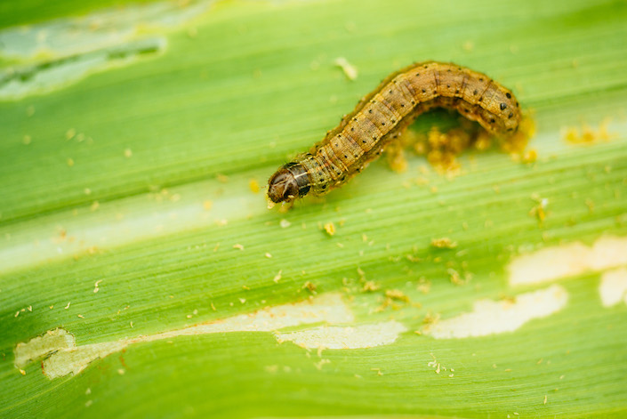
XAG, a Guangzhou-based drone maker, teamed up with Germany’s Bayer Crop Science in a drone swarm operation to kill the fall armyworm in China’s Guangxi region. The autonomous devices, loaded with low-toxicity insecticide, have also successfully managed the pests in a government-led operation in the southwest province of Yunnan, XAG said.

“It is the ‘crop-devouring monster’ that attacks over 80 crop varieties,” XAG said in a statement Monday. Most farmers resort to traditional insecticide sprayers, which not only fail to move fast enough against the “ravenous, fast-moving fall armyworm” that can fly up to 100 kilometers in one night, but also expose them to dangerous chemicals, it said.

The fall army worm, a crop-devouring pest, has spread from the Americas to Africa and Asia, gorging on rice, corn, vegetables, cotton and more. Since arriving in China, it has advanced north, affecting 950,000 hectares of crops in 24 provinces as of mid-August, including parts of Hebei, Shaanxi and Shandong, according to an official report published late last month. Outbreaks at 90% of the affected areas are now under control, the report said.

Drones can safely operate after sunset to kill the pests, which feed most actively at night, XAG said. According to a local media report, drones have also effectively helped to control the spread of the pests found in some cornfields in the northern province of Henan.

Read more…

Sputnik GIS free by Geoscan

3689741686?profile=original

We are pleased to announce a free version of Sputnik GIS software. Sputnik GIS is a professional drone surveying software for engineers, surveyors and urban planners: https://www.geoscan.aero/en/software/sputnik/


In free version users can view and perform 3D analysis of point clouds, orthomosaics, DEMs, 3D models, raster and vector maps.  In case of need for advanced analysis tools, users can easily upgrade to the paid version. 

In case you use drones and Agisoft Metashape for precision agriculture purposes, take a look at Sputnik Agro:https://www.geoscan.aero/en/software/sputnik/agro

Do not hesitate to send any feedback via sputnik@geoscan.aero or support@geoscan.aero or using Geoscan forum.

P.S. Now we are working on some improvements of our products and looking for feedback from UAV mapping community. It would be great if you could complete a quick survey — it will take you 15 minutes. We will use your feedback to improve our products and make them more useful for you. Survey is available via: https://docs.google.com/forms/...

P.P.S. We also released open source QGIS plugin - Geoscan forestPlugin allows to search for tree tops and perform tree crowns segmentation on orthomosaic. 

Read more…

Landmark set to take off with drones

3689741631?profile=original

Jonathon Smith (left), Stratus Imaging, chats with Farmanco consultant Andrew Smith at last week's TECHSPO about the AeroShield drone spraying service using the XAG P30 drones

THE next step in drone technology was unveiled at last week's TECHSPO with aerial spray application showcased to the crowd.

Come next year, Landmark believes it will be in a position to launch a full service package that will involve contract spraying with the use of five large drones.

It has entered into a partnership with Chinese company, XAG, which already has 15,000 drones operating in China spraying crops.

Precision imaging company, Stratus Imaging, will operate the XAG P30 drones on behalf of Landmark.

Landmark business development manager Glenn McTaggart said the contracting service would be called AeroShield and involve the drones operating in a swarm formation.

"Initially we will be focusing on smaller, intensive crops and we are doing trial work with growers as we speak," Mr McTaggart said.

"Later on we will do some trials of spot spraying of late radish in cereal crops to see how it goes in a broadacre environment."

Mr McTaggart said they would establish hubs in the South West first to service the horticulture, viticulture and forestry sectors and then establish hubs in the Wheatbelt over time.

"We held some field demonstrations in October last year and there was a good response to those with about 150-200 people attending," he said.

"We are finalising the service package and hope to launch it in March 2020 and clients will be able to book the service through Landmark branches and outlets."

Stratus Imaging's Jonathon Smith said aerial application had been worked on for quite a while but the viability of using a drone had not been proven until now.

"We just recently became certified to be able to have five drones in the air with the one pilot and so we can run our drones in a swarm formation," Mr Smith said.

"What that means is we can carry 75 litres of liquid in total, with redundancy, and so it gives us the ability to cover areas in a timely manner.

"We have carried out quite a bit of testing of the process and we will continue to do that.

"The horticulture, viticulture and forestry sectors are being targeted first and we are also speaking to government departments and councils about the services we can offer to them."

Mr Smith said the drones could be used for a variety of uses such as mosquito control and pesticide and herbicide application.

"The drones will give you the ability to spray crops where you want to avoid compaction or over waterlogged areas where you can't get machinery onto," he said.

"They can be set up to do spot spraying and blanket spraying and if you are blanket spraying we can program them to miss certain areas such as dams and so on so you are not wasting spray and you can also change the rate of application mid-flight as well."

To maximise efficiency, Mr Smith said the drones would fly until the liquid runs out and then when they land the batteries will be replaced at the same time.

"In terms of how long they can run, it really depends on the rate of application," he said.

"With five in the air carrying 15 litres per drone, then they could probably fly anywhere from 10 to 20 minutes."

Mr Smith said at this stage the range was about one kilometre, but again that depended on what the drones were being used for.

"In a broadacre environment we are not going to replace boomsprays because you will need them to cover large areas but this could definitely be a viable alternative to offer a more targeted solution," he said.

Read more…

Crowfunding Update, Four Years Later

Four years ago, Chris Anderson posted a list of delayed Kickstarter campaigns. I was intrigued by this list and came back to it a few times over the years. 2014 and 2015 was the peak of the drone hype.

3689671914?profile=original

Unsurprisingly, most crowdfunding campaigns were late. Surprisingly, however, most (10 out of 17) crowdfunding matured in companies that are still around almost 5 years later. Crowdfunding is not the only way to start a business, but it looks like it was quite beneficial for those companies at that time. Alternatively, we could say that Chris Anderson is quite good at selecting crowdfunding campaigns!

Here is the updated spreadsheet. Let me know in the comments if I made a mistake.

Read more…

Drones to one day swarm WA crops: innovator

3689741551?profile=original

Stratus Imaging operations manager and chief pilot Andrew Dedman with a Xaircraft drone at TECHSPO

Flying up to five drones at once above broadacre farms could be an eye in the sky for the State’s grain growers to manage crops, according to Stratus Imaging chief pilot Andrew Dedman.

Speaking from the sidelines at TECHSPO in Katanning last Thursday, Mr Dedman championed the Perth-based company’s ability to provide farmers with aerial imaging and mapping.

Stratus uses normalised difference vegetation index technology, or NDVI, across crops to help producers make “quantifiable management decisions throughout the growing season”.

Flying an unmanned aerial vehicle equipped with a multispectral camera, NDVI imaging gives Stratus a birds-eye view of an entire crop to asses its health.

Earlier this month, Stratus became the State’s only company with Civil Aviation Safety Authority certification to fly five drones with one pilot and one controller at once for aerial application.

Mr Dedman, who is also the company’s operations manager, said gaining the CASA certification would prove beneficial in Stratus efficiently mapping farmers’ crops.

3689741605?profile=original

One of the drones in flight

“With one drone, you can only do limited areas, but when you get five you can do about 20ha per hour,” he said.

“To get a swarm certification from CASA, the manufacturer (XAG) had to demonstrate that this system could be safely operated with one pilot and five drones.”

Stratus uses 38.5kg plant protection drones designed by XAG, formerly known as XAIRCRAFT.

XAG, a Chinese-founded drone manufacturer, is working to fit the unit with weed detection technology.

Mr Dedman said aerial weed detection would be an efficient management tool for farmers.

“It will allow the drones to fly out in a swarm to find weeds and spray them,” he said.

“It’s great technology and we are pretty excited by what it has to offer.”

Mr Dedman also has an aerial application licence, through Aerial Application Association of Australia, to spray approved chemicals from the aircraft.

Read more…

3689741486?profile=original

Sky-Drones has launched a new product. It's called SMARTLINK, this is broadband digital datalink with integrated onboard computer. Two HD video channels, telemetry and control with ultra low latency and range up to 20 km. Fully supported by SmartAP GCS app on all platforms and compatible with PX4, Ardupilot, QGroundControl and Mission Planner. More information here.

smartlink-dmhx-use-case.jpg?profile=RESIZE_710x

AIR Module

SmartLink Air is based on powerful quad-core ARM Cortex A53 SoC (system-on-chip) computer running Linux. 

The system is capable of handling two real time HD video streams from cameras, autopilot telemetry and control. 

It also has plenty of resources for user applications. Various interfaces e.g. USB, UART, I2C, SPI allow to connect payload and tightly integrate it with flight controller and / or ground control station

GROUND Module

Ground module is very compact and lightweight, it has micro USB connector to interact with any kind of device - laptops, smartphones, tablets, desktop computers supported. All you need to do is connect it and open SmartAP GCS App.

Ground module features active cooling system which allows the module to withstand high ambient temperatures making it reliable even in harsh environments.

2x2 MIMO technology provides higher bandwidth, lower latency and longer range.

SOFTWARE

SmartLink was specifically designed to be used with SmartAP GCS - powerful cross-platform ground control station. SmartAP GCS supports:

  • 2x HD video streams display
  • Full camera controls
  • Video recording on microSD card
  • Image capture on microSD card
  • Radio settings configuration
  • Drone control joystick
  • Payload control joystick

SmartAP GCS can be used on any platform and operating system including MacOS, Windows, iOS, Android and Linux.

3689741659?profile=original

smartlink-air-interfaces.jpg?profile=RESIZE_710x

Read more…

We recently completed a first successful flight test of the JetQuad: Quad Jet-Engine VTOL Drone. The JetQuad combines the best from the world of VTOL drones and jet-aircraft. The drone utilizes four microturbines and thrust vectoring systems to achieve vertical take-off and landing as well as stable hover. Packs a combined 200hp from all four turbines and carries a 5-gallon diesel tank. This is the only drone of its kind where the turbines are used both for attitude control, vertical flight, and horizontal flight.

For more information about the drone itself please visit http://fusionflight.com/jetquad

3689742164?profile=original3689742203?profile=original3689742268?profile=original3689742230?profile=original

Read more…

x3QP5vV.jpg?profile=RESIZE_710x

This morning, I saw a news report. In a reservoir in a city in China, law enforcement officers used drones equipped with thermal infrared cameras to detect nighttime illegal acts and take photos for evidence.

A water reservoir is undoubtedly a key place for a city and an important source of water for urban drinking. Therefore, how to effectively protect the water source, for law enforcement agencies, often need to face the challenges of various illegal activities.

How to protect water sources, traditional methods generally rely on manual inspections, can only be opened along the shore, with the naked eye. However, with the development of drone technology, the application of thermal infrared equipment in the inspection of drones has improved the efficiency of inspection and expanded inspection scope.

Not only that, but the drone thermal imaging equipment can also judge whether there is sewage discharge according to the difference in sleep temperature, and combat the illegal discharge of sewage.

For the application of drones, not only in the field of inspection, but also in the field of drones, the drones have been developed in many fields such as surveying and mapping, precision agriculture, urban management, and sport management.

In the various application fields of the drone, the drone is used as a working platform to carry out different tasks by carrying different tasks, so a good task load night vision is very important.

As a leading manufacturer of industrial drones, MMCUAV has released mission loads for a variety of scenarios since last year. The Thyea T2 is a thermal infrared pan-tilt camera for fire rescue, inspection, and other fields.

The characteristics of Thyea T2 are: with 50Hz refresh rate, resolution up to 640*512, reaching the advanced level in the industry, and also supporting 4x digital zoom, which not only meets the requirements of fine analysis but also has a long imaging distance and can maintain large security. Distance, increase; temperature measurement accuracy up to 0.06 ° C, temperature range -20 ° C -150 ° C, for most of the inspection, detection, search tasks can be satisfied; at the same time can also carry out regional temperature measurement, pointing temperature measurement, Pointing movement, high temperature alarm, automatic inspection and many other functions.

x3QP5vV.jpg?profile=RESIZE_710x


Read more…

3689741579?profile=original

Two units of amphibian Aeromapper Talons were utilized successfully during a set of trials during an expedition to beautiful Turneffe Atoll in Belize, in a work lead by the Zoological Society of London and the Turneffe Atoll Sustainability Association. The drones, built by Canadian company Aeromao, were used to detect and document illegal fishing activities and ecology research toward conservation efforts. The Turneffe marine protected area (MPA) in Belize, was delineated in 2012, but is difficult to manage, in part due to illegal fishing, its remoteness, and high running costs.

 The water-landing and waterproof fixed-wing, long range, multi camera drones were trialled to monitor and survey marine megafauna (such as turtles, dolphins and sharks) but also as an exercise to gather evidence of illegal, unreported and unregulated fishing (IUU).

  The amphibious drone was able to fly to the site of interest at 110m altitude, gather intelligence and fly back very quickly. The images highlighted that indeed illegal building work had been occurring. Without the UAV the conservation officers would have no way of knowing this and they were very excited at this revelation”, states one of the conservation officers.


The current enforcement strategy on the Turneffe atoll involves patrols in small boats, around the atoll, to find illegal fishers. Systematic surveys for megafauna aren’t regularly carried out, so the conservation officers tend to document animals they happen across on their patrol. However, boat fuel is very costly, and this limits the amount of area the conservation officers can patrol. The drones proved to a be an exceptional low-cost solution to these challenges.  


The conservation team found the front live-link HD camera an exceptional revelation, especially since they were immediately able to spot a diving boat on the LCD screen, that they could barely see from land. The UAV can fly for up to one and half hours, which, flying at 62kph, is a considerable distance and area potentially covered for surveillance.

The pair of drones were also repeatedly operated in BVLOS scenarios. In fact, 24 BVLOS flights were successfully flown during the trials, average length of 10.9km and with total transect lengths of 263km.  The UAV reached a furthest point Beyond Visual Line of Sight (BVLOS) of 11.3km. BVLOS was tested in a scenario where the conservation officers particularly wanted to scope out a development site several kilometres away across a large bay in order to detect any infringement of their building contract. The amphibious drone was able to fly to the site of interest at 110m altitude, gather intelligence and fly back very quickly. The images & video recorded highlighted that indeed illegal building work had been occurring. Without the UAV the conservation officers would have no way of knowing this and they were very excited at this revelation “We now have the tool we need to see further and faster than before. No one will see us coming!”, Maurice, a conservation officer reported.


“The pair of drones were also repeatedly operated in BVLOS scenarios. In fact, 24 BVLOS flights were successfully flown during the trials, average length of 10.9km and with total transect lengths of 263km.  The UAV reached a furthest point Beyond Visual Line of Sight (BVLOS) of 11.3km.”


 Whilst the UAV flies, the 20mp nadir camera takes 5 images per second, or stunning HD film and the front camera, which can be panned left to right, films and records a live stream, allowing the conservation officers and us, to see what’s out there, in real time, on an LCD screen back at the ground station. Although the drones normally fly on pre-designed routes in auto mode, switching to “assisted mode” to investigate something of interest, is no problem. This kind of flexibility means that if fishers are found in the wrong place, the drones can be steered quickly to get closer pictures of them or loiter around the point of interest at the desired altitude to keep a constant eye in the sky, or if dolphins are spotted for example, the drones can be redirected to take a closer look and use the images to estimate the numbers of the population in the area. Mapping of habitats, using the nadir camera was also possible. Some areas of coral reef and seagrass beds were mapped using Agisoft Metashape.  


Several static launches of the UAV from a small, moving skiff were successfully performed, which is something that is unheard of for a fixed wing – long range amphibious unmanned aircraft. This is a tremendously important, and previously unknown ability of the UAV, as it now means that the conservation officers can steam to an area where a beach for launching may not exist (very common in mangrove forests), and simply launch from the boat, then land on the water besides the skiff once the mission is completed. This way, no-where the atoll is out of reach for the conservation team.


Impressive geo-referenced images of turtles, sharks, eagle rays, manatees and birds were gathered during the surveys. A variety of habitats were captured, and to identify environmental issues, such as accumulation of plastic debris, and of sargassum seaweed which can cause deoxygenation of the water and block out sunlight.


Data was used to build a spatial picture of how the atoll is used, be it by fishers or fauna, i.e. how the animals use different habitats and when, and when and where fishers are acting with impunity. The results and conclusions can feed directly into planning where marine protected zones are placed. Previously, information on fish abundances would be collected from by-catch on fishing vessels. Since the Turneffe Atoll is a protected area, you can’t rely on catch data anymore- this is where the drones really come into their own as a non-invasive and efficient tool for surveying.

The scientists leading the expedition stated that having a UAV which can easily land on the ocean, safely, and be flown again in moments, is an exceptionally valuable tool. Likewise, the conservation officers in the Turneffe Atoll are adamant that a UAV like the ones trialled, will become an essential part of their patrolling and enforcement strategy, which will ultimately lead to increased biodiversity in the area.


Read full report Case Study and Technical Report here.

About the Aeromapper Talon Amphibious


The Amphibious version of the Aeromapper Talon allows maritime operations by autonomously belly landing on water. It’s the perfect solution for scouting, data collection and mapping thanks to its dual camera set up and long-range video link, up to 2hr endurance and demonstrated BVLOS capabilities up to 30kms from the operators.

The only truly amphibious multipurpose fixed wing drone in the market today, it can sustain repeated operations in salt or fresh water. Perfect for:

  • Fisheries
  • Marshlands
  • Marine research and conservation
  • Search and rescue
  • Water quality monitoring
  • Off-shore infrastructure inspection
  • Coastal surveying
  • Hydrography
  • Marine management

More information:  https://www.aeromao.com/products/aeromapper-talon-amphibious/

Read more…
3D Robotics

From Hackaday:

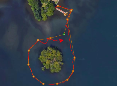
There’s nothing quite like the sight of a plastic box merrily sailing its way around a lake to symbolise how easy it is to get started in autonomous robotics. This isn’t a project we’re writing about because of technical excellence, but purely because watching an autonomous tupperware box navigate a lake by itself is surprisingly compelling viewing. The reason that [rctestflight] built the vessel was to test out the capabilities of ArduRover. ArduRover is, of course, a flavour of the extremely popular open source ArduPilot, and in this case is running on a Pixhawk.

The hardware itself is deliberately as simple as possible: two small motors with RC car ESCs, a GPS, some power management and a telemetry module are all it takes. The telemetry module allows the course/mission to be updated on the fly, as well as sending diagnostic data back home. Initially, this setup performed poorly; low GPS accuracy combined with a high frequency control loop piloting a device with little inertia lead to a very erratic path. But after applying some filtering to the GPS this improved significantly.

Despite the simplicity of the setup, it wasn’t immune to flaws. Seaweed in the prop was a cause of some stressful viewing, not to mention the lack of power required to sail against the wind. After these problems caused the boat to drift off course past a nearby pontoon, public sightings ranged from an illegal police drone to a dog with lights on its head.

If you want to use your autonomous boat for other purposes than scaring the public, we’ve written about vessels that have been used to map the depth of the sea bedtrack aircraft, and even cross the Atlantic.

Read more…