All Posts (11069)

Sort by

5334376098?profile=original

A jupyter notebook with crop analysis algorithms utilizing digital elevation models, dtm and multi-spectral imagery (R-G-B-NIR-Rededge-Thermal) from a MicaSense Altum sensor processed with DroneMapper Remote Expert.


https://github.com/dronemapper-io/CropAnalysis


Due to limitations on git file sizes, you will need to download the GeoTIFF data for this project from the following url: https://dronemapper.com/software/DroneMapper_CropAnalysis_Data.zip

These basic algorithms are intended to get you started and interested in multi-spectral processing and analysis.

The orthomosaic, digital elevation model, and dtm were clipped to an AOI using GlobalMapper. The shapefile plots were also generated using GlobalMapper grid tool. We highly recommend GlobalMapper for GIS work!

We cloned the MicaSense imageprocessing repository and created the Batch Processing DroneMapper.ipynb notebook which allows you to quickly align and stack a Altum or RedEdge dataset creating the correct TIF files with EXIF/GPS metadata preserved. These stacked TIF files are then directly loaded into DroneMapper Remote Expert for processing.

This notebook assumes the user has basic knowledge of setting up their python environment, importing libraries and working inside jupyter.

View the entire Medium article here: https://medium.com/dataseries/data-science-crop-analysis-notebook-using-6-band-micasense-altum-and-dronemapper-processed-uav-3683dbc21836

Load Digital Elevation Model and Orthomosaic

In this step, the digital elevation model and 6 band orthomosaic are loaded for processing. The data is in UTM16N WGS84 projection and has a pixel size (GSD) of 5cm for the orthomosaic and 10cm for the DEM.


5334376477?profile=original

Load Plot 1 AOI and Generate NDVI

Next, we use the NIR and RED channels from the orthomosaic to compute a standard NDVI. The plots of interested are also loaded and displayed. Utilizing Rasterio, GeoPandas and Earthpy makes easy!

5334375891?profile=original

Generate NDVI Zonal Statistics For Each Plot

Using the NDVI we generated in the previous step, we use the RasterStats library to quickly compute zonal statistics for each of the plots. That data is stored in a GeoPandas dataframe and shown below.

5334376287?profile=original

Load Plot 2 AOI & Compute DEM Canopy Mean Height For Each Plot

Here we load the plot 2 area of interest, using the DEM we can compute zonal statistics for each plot. This gives us a canopy height reading for each pixel inside a plot.

Compute Thermal Mean For Each Plot

The thermal band (6) in the processed orthomosaic shows stitching artifacts which could likely be improved using more accurate pre-processing alignment and de-distortion algorithms. You can find more information about these functions in the MicaSense imageprocessing github repository. See notes at the top of this notebook.

5334377057?profile=original

Load Plot 1 AOI & Compute Volume/Biomass For Each Plot

Using the DEM and DTM we can create a surface model with a ground reference of 0 meters. This allows us to calculate the volume for each plot and all pixels contained inside that plot. The volume is calculated from the ground (0m) to the top of the canopy for every pixel inside a plot.

5334376098?profile=original

Load Plant Count AOI & Count Plants

Using the surface model, we load the plant count AOI and clip our raster data to it. This process allows us to segment the plants we want to count. We then create a binary mask to allow for simple processing with OpenCV blob detector. The plant blobs are shown in white on a black background in the binary image below. The detector is run and we get our plant count, next we iterate through each of the blobs to find the center point. With the pixel center of each blob we can do a xy lookup against the original raster to determine the spatial position of each plant.

5334376674?profile=original

5334376893?profile=original

Plant Count: 310

Thanks! Keep an eye out for future notebooks and algorithms! DroneMapper.com

Read more…

We are a group of software engineering researchers at Carnegie Mellon University trying to better understand why and how robotics developers use simulation when developing and testing their systems. If you have ever used these tools, we would like to hear from you.

Simulation holds the potential to provide an automated, cost-effective, and scalable alternative to the manual and expensive process of field testing. Numerous companies in the autonomy sector, such as Uber, NVIDIA, and Waymo, have begun to use simulation on a large scale to aid the testing and development of their products.

Motivated by this potential, we want to learn why, when, and how developers use to develop and test their robotics software, and the reasons that developers opt not to use simulation. We hope that the results of our study can be used to provide guidance to developers and researchers on building the next generation of simulation platforms that better serve the needs of developers.

We are asking people who have worked with robotics software or code to participate in a survey, conducted via an online questionnaire. We estimate that this survey will take less than 20 minutes. Participation in this study is limited to individuals age 18 and older. There will be no cost to you if you participate in this study. If you have any questions about this study, you should feel free to ask them by contacting us at ctimperley@cmu.edu .

If you are interested in participating in our study, please follow this link: https://www.surveymonkey.com/r/X6H2786

If you have questions pertaining to your rights as a research participant; or to report concerns to this study, you should contact the Office of Research integrity and Compliance at Carnegie Mellon University. Email: irb-review@andrew.cmu.edu . Phone: 412-268-1901 or 412-268-5460. Your participation in this research is voluntary. You may discontinue participation at any time during the research activity.

Thanks,

Chris Timperley, Deby Katz, and Afsoon Afzal
Institute for Software Research
School of Computer Science
Carnegie Mellon University

Read more…

3689742816?profile=original

Hi Guys,

Recently we built one 2.5 hours long-endurance VTOL fixed-wing plane using the Pixhawk Cube flight controller. Auto flight demo: https://youtu.be/H-M0Mm12N7Y

Specification of the VTOL

MTOW20.3kg
Weight w/o battery and payload9.69kg
Wingspan3200 mm
Length1,200 mm
Height500 mm
Frame weight3.2kg
Max payload(battery included)10.61kg
Battery weight7.53kg
Endurance(20.3kg take-off weight)2.5 hours
Cruise speed78-90km/h
Max speed100km/h
Stall speed57.6km/h

Read more…

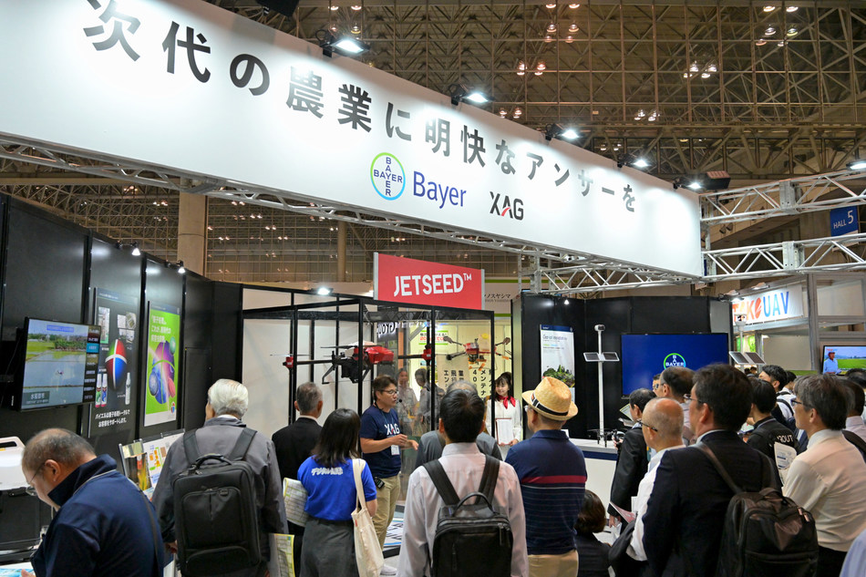
XAG and Bayer jointly participated in Agri-Week Tokyo 2019

XAG and Bayer has recently held a joint news conference in Tokyo, 4 Oct, to announce the latest progress of their strategic partnership in Japan. This cross-industry alliance has been unfolded on three main projects involving drone sales, technological research and digital farming. Justin Gong, Co-founder and Vice President of XAG, together with Masahito Niki, Head of Customer Marketing, Bayer Crop Science, attended the conference to elaborate how the two companies would develop precision spraying technology to support Japan's smart agricultural movement.

XAG and Bayer have also hosted their first-ever international co-branding exhibition from 9th-11th October at Agri-Week Tokyo, Japan's largest agriculture technology show where XAG's new products – P30 centimetre-level autonomous drone and JetSeed™ Granule Spreading System made their debut to the Japanese market.

P30 is the latest enhanced model of XAG P Series Plant Protection UAS equipped with a 16L liquid tank and IP67 water-proof feature. It assembles all the intelligent functions ranging from RTK positioning, obstacle avoidance, night operation, swarm operation and terrain tracing. Compatible with the P30 drone, JetSeed™ is designed to dispense granules such as seeds, fertilisers and pesticides precisely and effectively to the targeted environment through high-speed airflows.

At the expo, Justin Gong was invited to share the growth story of how XAG expands from a small drone maker to the world's leading agriculture technology company with 20-million-hectare crop protection service record. XAG has aligned with Bayer to develop integrated tailored solutions that leverage drones, artificial intelligence and internet-of-things to tackle Japan's pressing agricultural challenges.

The Three Pillars of XAG-Bayer Alliance

Japan has been experiencing the food self-sufficiency crisis, which might have the potential to undermine the nation's future food security. According to the Ministry of Agriculture, Forestry and Fisheries, Japan has witnessed a record-low 37 percent of food self-sufficiency rate in 2018, while 83 thousand workers retreated from the farming sector every year with the average age of farmers reaching as high as 66 years old.

To cope with the ageing farming population and shrinking agriculture labour, XAG and Bayer Crop Science signed an exclusive business agreement on joint promotion of drone application technology in Japan, November 2018. During the latest joint press conference held this October, the two companies reiterated that the partnership is primarily based on three pillars, including business sales cooperation, drone spraying technology development as well as digital farming and digital solutions project utilising IoT technology.

In addition to harnessing Bayer's consolidated sales network for distribution of XAG drones in Japan, the two companies are working on optimum spraying solutions that combines unmanned aerial system (UAS) with innovative formulation technology. Building on Bayer's world leading expertise in seeds and crop protection, XAG can adapt its drone technology to different varieties of crops and further enhance the spraying accuracy with UAS-specialised products for control of weeds, disease and insects, and fertilisers.

Drone Application to Accelerate Japan's Digital Farming Process

According to a report from Japan Agricultural News, 27,346 hectares of farmlands in Japan was served by multirotor crop spraying drones in 2018, a 280% increase compared with 2017. Rice, wheat and soybean account for 99% of this operation area. However, due to complex terrains and lack of registered pesticides, automated spraying for vegetable and fruit trees on hilly and mountainous areas remains a key challenge for local farmers.

Since establishing its subsidiary XAIRCRAFT Japan K.K. in 2016, XAG has closely collaborated with local authorities and business partners to speed up the adoption of drones for diverse agricultural applications, such as field mapping, aerial spraying and rice direct seeding. As one of the few fully autonomous UAS approved by Japan Agriculture Aviation Associate (JAAA), XAG's spraying drones have been applied on rice, vegetable and fruit trees to fight against pest diseases and grow high-quality produce with less water and pesticides.

This September, XAG collaborated with local agriculture department and fruit tree research centre to conduct drone spraying demonstration on citrus trees in Japan's Ehime-ken. By accurately controlling the discharge rate, droplet size and spraying width, the atomisation spraying technology could ensure that the pesticide was uniformly deposited onto each side of the leaves without overdose or misses.

In accordance with Japan's strict regulations on crop spraying, XAG's drone has proved to be both legitimate and sustainable.

The Agriculture Ministry of Japan has published a drone promotion plan on March 18, which includes introducing agriculture drones for one million hectares of farmland by 2022 and increasing the number of registered pesticides for vegetable and fruit trees. With strong support from Japanese government, XAG would play a key role in scaling up agri-tech to rejuvenate the country's ageing agriculture.

Read more…

rctimer.com is gone

Hi,

A week ago I placed an order of over $300 on rctimer.com site, PayPal account was charged but I never got order confirmation from rctimer.

Two days later, the site disappeared and emails are bouncing back.

I know they sell on AliExpress as well, be very careful.

Gal

Read more…

MMC UAV is to exhibit in Shenzhen CPSE 2019

3689742843?profile=original

The 17th China International Social Public Safety Expo (CPSE)will be held from October 28th-31 th,2019 in Shenzhen Convention & Exhibition Center, Shenzhen,  China. At that time, it will present the most advanced artificial intelligence, big data, and intelligent security products to the world.

The largest scale in the exhibition

This CPSE will be held at all exhibition halls of the Shenzhen Convention and Exhibition Center, The scale of this exhibition is the largest in history, with an exhibition covers an area of 30,000㎡, and hundreds of industry brand companies and more than 2,000 exhibitors participated in the exhibition. As a high-end brand event in China's security industry and one of the important international security expo with global influence, the Shenzhen security expo will focus on showing smart city solutions, security prevention solutions, police equipment, emergency rescue, Bio-recognition, artificial intelligence machines, and other industries. This exhibition has attracted great attention among manufacturers, engineers, and distributors in many industries across the country.

UAVs play an important role in security

In the construction of smart security, UAVs play an important role. In the security scenes of military reconnaissance, emergency flood control, drought prevention, border surveillance, police monitoring, forest fire monitoring, and environmental monitoring, the drone acts as a "security weapon" for the reconnaissance unit. It can perform various tasks such as air surveillance, daily patrol, and rapid air attack. It can cooperate with the background command and control system, with the ability of situation sharing integration, collaborative planning and scheduling, remote command, and diversified intelligence processing.

As one of the exhibitors of this Shenzhen security expo, MMC has established a ground-to-air integrated security system with its intelligent and advanced complete set of UAV products and big data dispatching backstage, which has played a huge advantage in the security field. MMC will exhibit the latest automatic drone inspection system security solution at this expo, including the full range of core intelligent application products such as “Sky eye” dispatching platform, high-performance drones, high-definition zoom tracking gimbal, and automatic police equipment. Today, MMC drones have evolved from a single “moving eye” to a versatile “smart cloud brain”.

The world's first industrial UAV industry chain

As the leading industrial UAS manufacturer, MMC is the first UAV company in the world to get through the whole industrial UAV industry chain and achieves win-win cooperation with upstream and downstream industries with a positive and open mind. MMC has achieved independent research and development, design and production of core components including full carbon fiber integrated molding case, power system, flight control, image transmission, ground station, etc. All of the gimbal adopt standardized fast-release interface, which has strong compatibility.

In addition to opening up the industrial drone industrial chain, MMC has strong product customization capabilities in the UAV industry's application solutions. It not only mastering the systematic management of cost and quality, but also continuously develops towards the direction of intelligent solutions. In the global drone industry chain, MMC has been at the forefront.

"Technology security in the Sky". At this security expo, MMC will build a technology security and smart city through the big data integrated management platform based on the automated inspection system and diverse equipment.

Shenzhen CPSE 2019 is about to begin, MMC sincerely invites you to visit. We are here waiting for you.

Address: Shenzhen Convention and Exhibition Center, China

Booth number: Hall 8-845.


Read more…

Cars vs robots

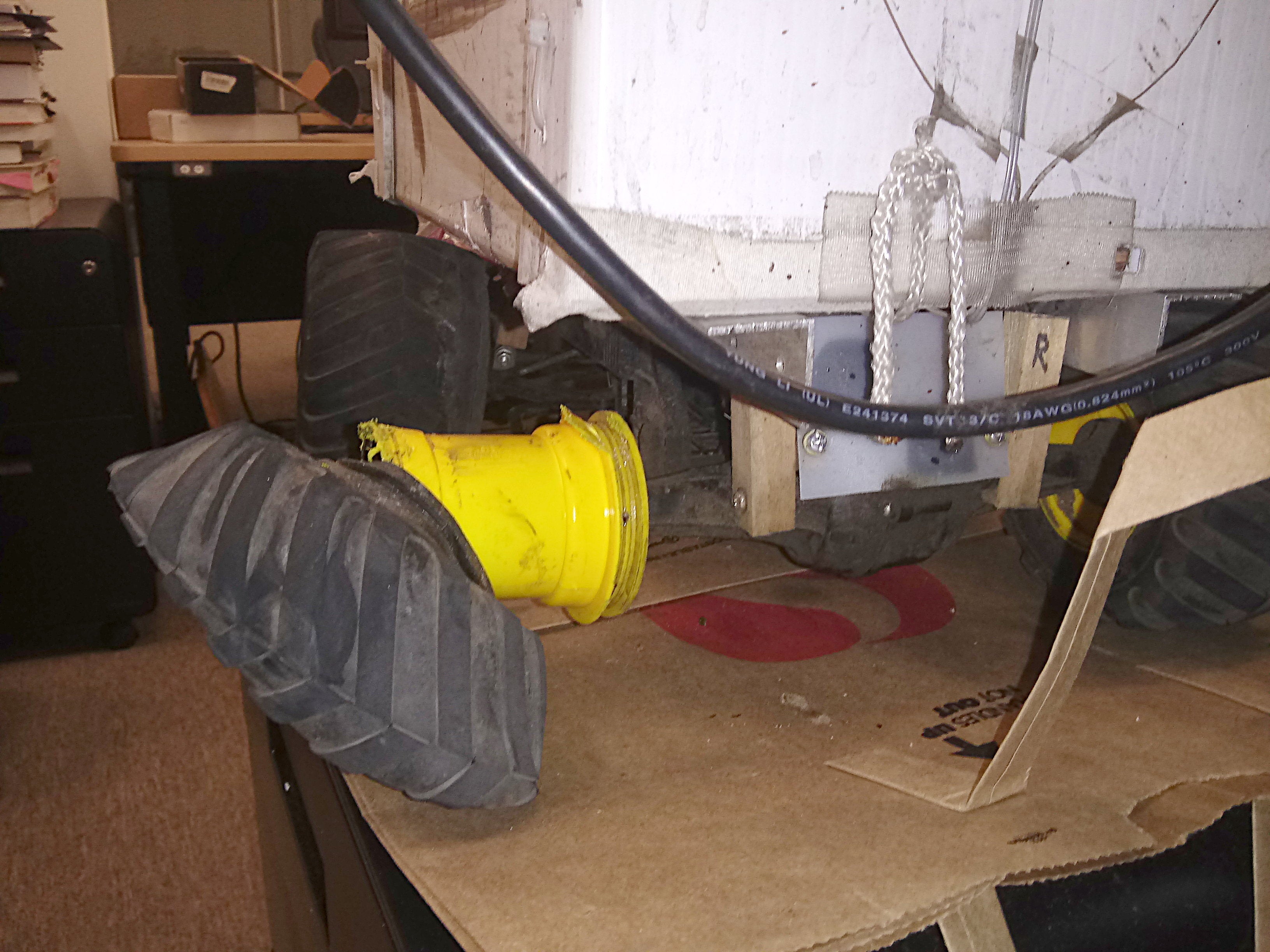
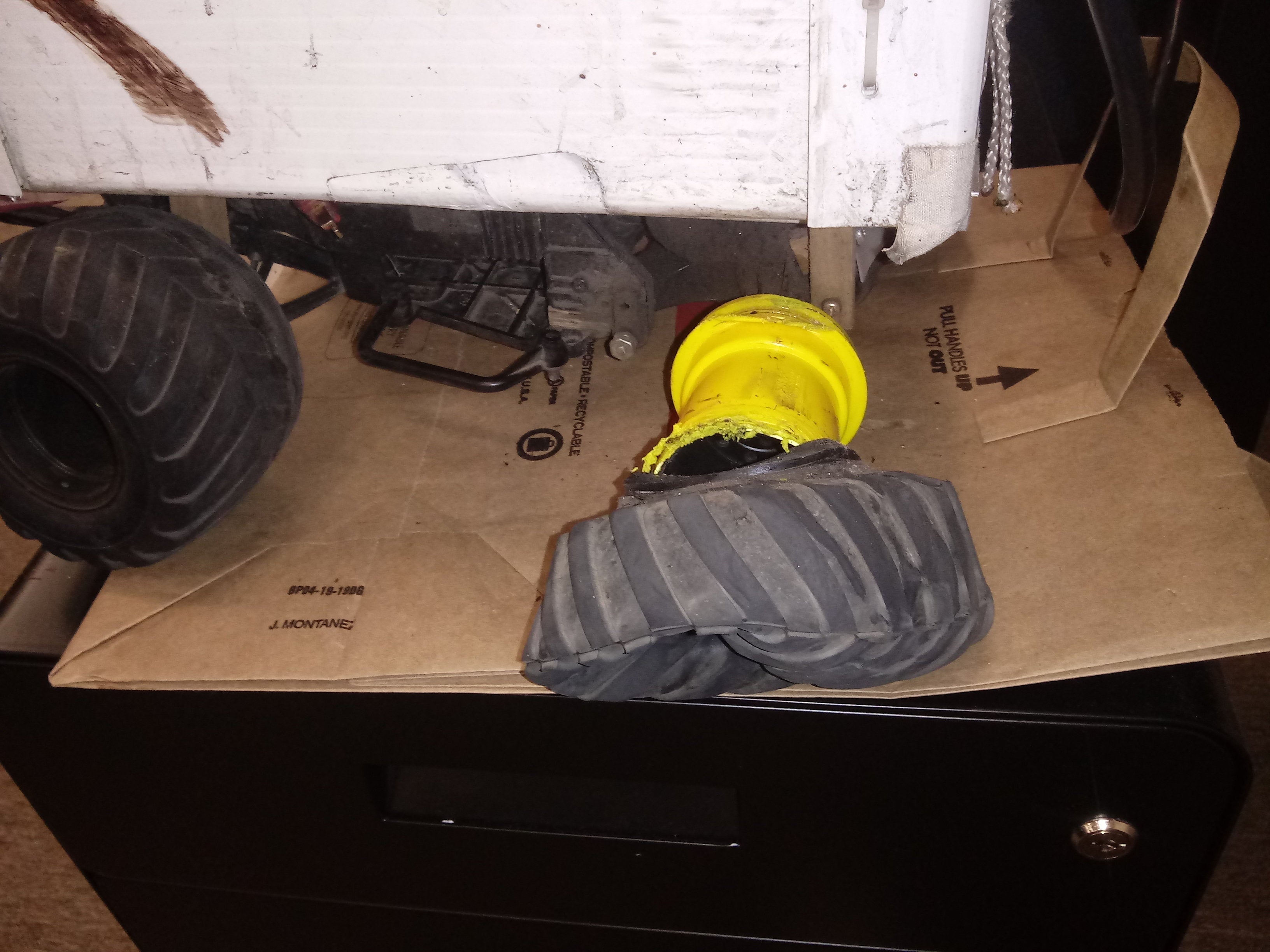
a12700341-88-truck27.jpg?profile=RESIZE_710x
a12700339-79-truck28.jpg?profile=RESIZE_710x
A scooter ran a red light at 25mph & smashed straight into it. Miraculously, only the wheel was smashed. He broadsided it & dragged it a few feet, but manely took out the food it was carrying. Scooters & bikes are in the grey area of not having red light rules enforced & not having speed limits.

In regular use, the lion kingdom has had 1 wreck every 2 years & all in crosswalks or sidewalks. The 1st wreck was an SUV turning right, destroying the cargo area, damaging the chassis & 1 wheel.  Enough was left to keep it going for under $50, but a more permanent repair will eventually be $150.

Ground vehicles which use the road network have similar expenses as flying, but instead of impacts with the ground, it's impacts with full sized vehicles. Fortunately, they don't damage the other vehicles or cause injuries, but when cars impact robots, car insurance doesn't cover it & it's pretty much the robot owner's expense.

They're quick with the sorry's & the excuses but no driver is willing to pay for it. Lions don't pressure anyone for money because of what happened to quad copters. If there's any hint of liability, they'll regulate the ground robots into the stone ages. They're already banned in almost as many areas as quad copters.

The mane problem is they're harder to see than humans. Near misses with cars happen every month, usually when cars make right turns. High acceleration & planning for it is key. The lion kingdom usually has the robot drive ahead, in order to bait cars. If the car keeps going, there's a good chance they don't see the lion.

There were a few right turns that would have impacted lion instead of robot. The robots are all intended to be expendable, but there's still a desire to prevent one from becoming a total $500 loss, in today's money.


Read more…

3689742686?profile=originalMy hacked Altair Aerial Blackhawk continues to serve as a great test platform for experiments in DIY flight controllers. So, when I heard the buzz surrounding the ESP32 line of Arduino-compatible microcontrollers (Dual 240 MHz cores, WiFi/Bluetooth on-chip), I knew I had to try one of these boards on the "Hackhawk".  

If you've been following the developments in the ESP32 community, you know that the smallest ESP32 board is the recently-released TinyPICO.  With its petite form factor, this board seemed to me like an obvious choice for indoor MAVs, and I wasn't disappointed.  This wiki shows how I got the Hackhawk flying with the TinyPICO, using my favorite IMU solution and some small additions to my platform-independent C++ flight-control firmware toolkit. 

Future plans for this project include:

  1. Finding (or designing) an IMU that will mount on the TinyPICO without sacrificing two of the GPIO pins to serve as power and ground.
  2. Switching from standard / old-school ESCs to DSHOT600, using C++ code I've already tested on ESP32 boards. (The ESP32's RMT signal module and FreeRTOS kernel make this especially easy.)
  3. Using the TinyPICO's on-board Bluetooth (or wifi) for real-time sensor telemetry, and possibly even control from a mobile device.
Read more…

View image on Twitter

BioCarbon Engineering technician prepares the UAV for the seeding demonstration at Ellerslie site in Edmonton.

Drones might be seen as pests by Gatwick Airport traffic control, but increasingly farmers are beginning to see them as pest-killers.

This is one of many uses drones have in agriculture. One obvious use is for aerial images, which has led to its take-off in the consumer market. But this same use is making it popular in the agriculture sector.

Drones take the hard work out of planting

European start ups such as HummingBird Technologies and Delair offer aerial imaging for precision agriculture.

One of the most radical ones is British start up BioCarbon Engineering which stated its goal is to plant 500 billion trees by 2060. Its drones fly 3m above the ground and drop two seeds per second.

It is targeting areas affected by logging and natural disasters such as bushfires. Beyond this it can also monitor the growth of seeds. Greening Australia is one of the organisations in partnership with BioCarbon.

Drones can also seek out weeds that humans either cannot or take lengthy periods of time to discover.

Beyond just being reactive, drones can also monitor crop conditions on an ongoing basis. In July, Iowa-based Rantizo won the right to conduct drone-based agricultural spraying and provides solutions to the entire Midwest.

Founder Michael Ott said this could also solve labour shortages that come at the same time food needs are booming.

“Soon there will be 9 billion people in the world but fewer and fewer are working in agriculture,” he said. “We need ways to create more food with fewer workers, so we have to automate and use new technologies like drones.”

He noted his company was popular among a wide variety of agriculture players. “We’ve had interest from wildflower seed producers, hemp growers, commodity growers, berry farmers, vineyards and others,” he told Commercial UAV News last month.

Bug-fighting

Another thing drones can do is fight pests and one pest in particular is causing big problems right now.

The fall army worm has invaded more than 80 crop varieties in over 100 countries since 2016. In 2018 alone it caused $US4.6 billion in losses. Developing countries, including Zambia and Vietnam, have been terribly hit with farmers lacking expertise to deal with sudden infestation.

These creatures can destroy a crop field in hours, fly 1,000km in one night and lay 1,000 eggs in its life. Chemical spraying has been the traditional way to resolve this but it is time consuming and exposes farmers to the chemicals themselves.

One Chinese company, XAG, has developed a drone that does the job en-masse. It does so using 30 per cent less peptides and 90 per cent less agricultural water. It has been tested in the Guangzi province and this growing season killed up to 98 per cent of larvae.

Read more…

Sensors for Attitude Estimation

3689740489?profile=original

Hello UAV enthusiasts,

I recently created a slide deck on the topic of sensors for attitude estimation (i.e. gyroscopes, accelerometers and magnetometers). In these slides, I review

  1. Installation considerations,
  2. Stochastic models,
  3. Bias characterization,
  4. Sensor calibration, and
  5. Conceptual models.

The methods and concepts contained in these slides have been "battle tested''. That is, these are the methods and concepts I used while developing a lightweight autopilot system for UAVs. I hope you find some of this material useful. These slides were part of a graduate course titled "Control of Marine and Aerial Vehicles".

All the best,

Matthew

silic_uav_sensors_v2.pdf

silic_uav_sensors_v3.pdf

Read more…

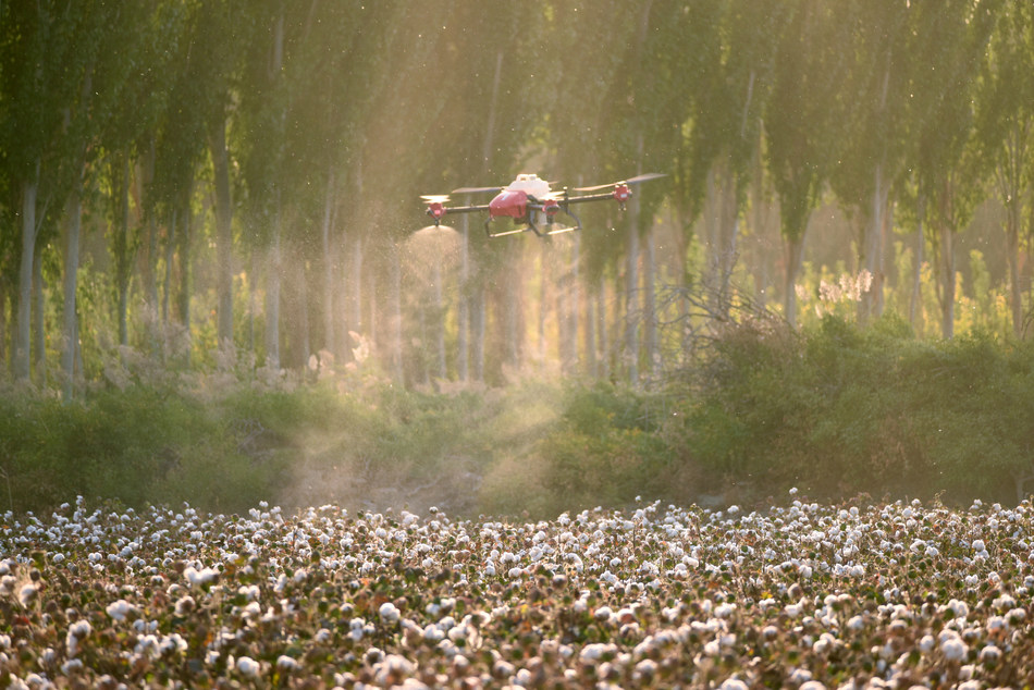
XAG Drone Spraying Cotton Defoliate in Xinjiang

XAG Drone Spraying Cotton Defoliate in Xinjiang

As a global leading agriculture technology company, XAG has initiated its Unmanned Aerial System (UAS) spraying operation  “Take Off for Harvest Time” for the third consecutive year in China’s Xinjiang Uygur Autonomous Region. Since late August, over 1500 drone pilots and 1000 crop protection teams with approximately 3000 sets of XAG P Series Plant Protection UAS have convened in Xinjiang to help local cotton growers spray defoliant and boost crop yields.

This is the world’s largest cotton defoliation operation that involves the use of fully autonomous drones to ensure a cost-effective, eco-friendly machine harvest. Up to mid-September, one million hectares of cotton fields have been defoliated with XAG’s crop spraying drones. It is estimated that the accumulated service record of this year’s operation will exceed 1.3 million hectares, a 200% increase compared to 2018 when XAG served approximately 0.45 million hectares.

Defoliation is the harvest-aid operation which applies chemical to accelerate cotton boll opening and encourage cotton leaves to drop from plants within a specific short period time. It is a necessary process to ensure timely, intensive mechanical harvesting and reduce impurities in cotton fibre.

Traditionally, cotton was mostly handpicked, but this has no longer been a viable solution due to the rising labour cost and the shortage of agricultural labour. Cotton harvesting machines have been widely adopted to improve cost-efficiency while eliminating a great deal of tedious physical labour. In China, for example, Xinjiang constitutes 85% of the nation’s total cotton production forecast at 6.16 million metrics tons this year. According to Xinjiang Agricultural Machinery Bureau, the mechanisation of cotton harvesting has steadily risen from 21% in 2016 to 30% in 2018.

However, cotton defoliation prior to the machine harvest used to heavily rely on manual or tractor spraying, both of which have deficiency that either increases the costs of production or results in certain level of yield loss. When people walk into the densely planted cotton fields for spraying, they might accidentally knock the cotton bolls onto the ground, easily get skin injury by thorns or expose themselves to chemical substances. People are reluctant to undertake such overwhelmingly labour-intensive work.

Spraying defoliant through large ground-based machinery is highly efficient especially when it comes to scale farming. Yet, it would cause crop damage and soil compaction when the tractor crosses over the cotton fields. For instance, in China’s Xinjiang, the economic loss resulted from tractor spraying could range from 16,000 to 19,200 RMB on a 65-hectare cotton field. In addition, the failure to achieve precision spraying on the appropriate timing might further enlarge the yield gap.

XAG had identified such problem back in 2013 and self-developed a fully autonomous agriculture drone specifically designed for efficient, precise crop spraying operation. One XAG P Series Plant Protection UAS can reach the spraying efficiency of 10 hectares per hour, which usually takes 60 workers to complete.

Real-time Kinematic (RTK) navigation and Intelligent Rotary Atomisation Spraying system are two core technologies that enable XAG’s drone to precisely deliver pesticides and fertilisers. As a centimetre-level positioning technique, RTK is used to correct meter-level errors and enhance the accuracy of position data in the Global Positioning System (GPS). Equipped with RTK, drones can conduct operation on the pre-set flight paths to prevent overlaps or misses while automatically avoid any surrounding obstacles within the croplands to ensure flight safety.

The atomisation spraying system is engineered to atomise liquids into micro-level droplets. The drone propellers can generate powerful downdraft to reduce drifting and ensure that the atomised defoliant evenly adhere to the plant surface. This has proved to conserve 90% agricultural water and save 30% defoliant, compared to the traditional approaches.

XAG is the first drone maker to introduce UAS precision spraying technology into the rural area of Xinjiang. To cope with local farmers’ increasing demands for UAS cotton defoliation, XAG deployed over 1000 plant protection drones from all across China and initiated the operation ‘Take Off for Harvest Time’ for the first time in 2017. With the widespread adoption of agriculture drones, the cotton industry has been taking a giant leap forward in sustainability and intelligence.

Since tapping into the smart agriculture sector in 2013, XAG has transformed crop protection approach on a wide variety of crops, ranging from cotton, rice, wheat, corn to fruit trees, with its precision agriculture devices operated under high-accuracy navigation network. Artificial intelligence and Internet-of-Things are also developed to help farmers manage their fields more scientifically as well as creating a transparent, traceable food value chain. Up to mid-September, XAG has offered UAS crop spraying services on 20 million hectares of farmlands, which helped conserve 4.29 million tons of agricultural water while reducing 18600 tons of pesticides and fertilisers.

original address: XAG Drone Fleets Take Off for Large-scale Cotton Defoliation Operation in Xinjiang

Read more…

YANGDA Mapird is a professional VTOL(vertical take-off and landing) fixed-wing drone for mapping, aerial survey, and inspection mission. It comes with two tilting motors and two lift motors, which will allow the mapping drone to ascend like a helicopter. For the airplane survey mission, the front two tilting rotors will transition to forward mode and make the drone fly like a fixed-wing plane.

Rugged airframe
We reinforce the two wings of Mapird VTOL drone using 3K carbon fiber. Therefore, the frame structure is greatly strengthened.

Fast deploy
Due to its modular airframe design, Mapird mapping VTOL can be set up in less than 5 minutes by a single man.

Long endurance
Equipped with one 200 grams mapping camera, one unit 6S 22000mAh battery, the Mapird survey drone can fly up to 1.5 hours and complete an 8 square kilometer area mapping job in a single flight.

Big inner space for payload
Mapird mapping drone comes with a big internal space to accommodate various mapping cameras and payload, like SONY A7R/A6000/A5100 camera and oblique camera.

No piloting skills needed
Mapird can conduct fully autonomous mapping and survey missions without human interaction.

Read more…
3D Robotics

Evolution of solar-powered drones

From Hackaday:

Many of us have projects that end up spanning multiple years and multiple iterations, and gets revisited every time inspiration strikes and you’ve forgotten just how much work and frustration the previous round was. For [Daniel Riley] AKA [rctestflight] that project is a solar powered RC plane which to date spans 4 years, 4 versions and 13 videos. It is a treasure trove of information collected through hard experience, covering carbon fibre construction techniques, solar power management and the challenges of testing in the real world, among others.

Solar Plane V1 had a 9.5 ft / 2.9 m carbon fibre skeleton wing, covered with transparent film, with the fragile monocrystaline solar cells mounted inside the wing. V1 experienced multiple crashes which shattered all the solar cells, until [Daniel] discovered that the wing flexed under aileron input. It also did not have any form of solar charge control. V2 added a second wing spar to a slightly longer 9.83 ft / 3 m wing, which allowed for more solar cells.

Solar Plane V3 was upgraded to use a single hexagonal spar to save weight while still keeping stiff, and the solar cells were more durable and efficient. [Daniel] did a lot of testing to find an optimal solar charging set-up and found that using the solar array to charge the batteries directly in a well-balanced system actually works equally well or better than an MPPT charge controller.

V4 is a departure from the complicated carbon fibre design, and uses a simple foam board flying wing with a stepped KF airfoil instead. The craft is much smaller with only a 6 ft / 1.83 m wingspan. It performed exceptionally well, keeping the battery fully charged during the entire flight, which unfortunately ended in a crash after adjusting the autopilot. [Daniel] suspects the main reasons for the improved performance are higher quality solar panels and the fact that there is no longer film covering the cells.

Read more…
D5C00403F68EEFCD0452011F4676626A

Bayer and XAG has recently collaborated in Hangzhou, China to host a crop dusting drone demonstration on citrus trees.

Justin Gong, Co-founder and Vice President of XAG, together with Bayer’s crop scientists and agricultural experts from China, Germany, India, and U.S., attended the joint convention.

It showcased its UAS fruit tree solution based on Artificial Intelligence (AI) and 3D flight mode.

XAG’s claims its fruit tree solution is the world’s first all-terrain autonomous drone spraying technology that resolves the challenge of applying pesticides and fertilisers on complex terrains, such as mountains, hills and terraces.

The partnership between XAG and Bayer, combining pioneer crop science research with advanced agriculture technology, aims to develop an innovative horticulture crop solution that would improve food safety and encourage healthy diet with high-quality fruits and vegetables.

To examine the efficacy of UAS fruit tree solution, XAG and Bayer selected a typical citrus orchard in Hangzhou’s Jiande Town to conduct spraying on mandarin trees.

The orchard covers a small area of 1.5 hectares but is located in rugged hills, where the mandarin trees are planted in uneven density and have grown to different heights. It used to take three days for three workers aged over 60s to manually spray the entire orchard for one time.

original adress: 

XAG joins Bayer on drone-based horticultural crop solution demo

Read more…

3689742329?profile=original

Designing electric multicopters for a specific flight time is a complex multidisciplinary optimization problem. This short blog post is some of my thoughts on how to think about this problem. Obviously, there so many different ways of doing this and welcome suggestions and other constructive discussions.

From an energy conversion standpoint, multirotors is a pretty simple systems. Energy is available from the batteries which is routed via ESCs to the motor and the propeller. 

The challenging part is that batteries do not always provide the same efficiency(energy). They are dependent on the power draw (watts,current). For most batteries, the higher the current you draw from the battery, the lower the total-energy available from them. This is mainly due to the internal resistance of the batteries which is pretty low (milliohms or less), but not zero. A typical characteristics of few of the different battery cells are given below. The y-axis shows the energy density (Wh/Kg) of the battery and x-axis shows the power that was drawn from one Kg of battery.


3689742473?profile=original

Notice how the increased drain causes the energy capacity to drop sharply for all the cells. 


If we ignore the ESCs power loss characteristics, the other significant power conversion is from the electrical energy received to the motor and the thrust provided by the propeller. One intuitive way to think about this conversion is W/Kg. This is the watts input to the system for every Kg of thrust generated by the propeller. 

If we ignore the motor and consider just the propeller, we can define this as

“Mechanical power (watts) supplied to rotate the propeller / Kg of thrust”.

If we consider the motor, this unit becomes “Electrical power input to the motor (watts) / Kg of thrust”.

Shown below is an “electrical watts/Kg of thrust” of various sizes of propellers tested with different motors. The x-axis shows the “electrical watts/Kg of thrust” and y-axis is the total thrust generated by the propeller. Each color shows a propeller of a particular size.

3689742497?profile=original

The three things to note are 

  • How the same propeller can have widely varying efficiency with different motors. 
  • How a given propeller drops its efficiency for higher thrust
  • The higher efficiency of a larger propeller 

Designing an optimal multirotor requires matching the characteristics of the battery to those of the motor and the propeller. Would love to discuss more about this is in a later blog

Read more…