All Posts (11086)

Sort by
3D Robotics

I recently wrote a little post designed to help those coming from a drone background pass the Fundamentals of Surveying exam, which I believe is an essential step to actually getting value out of drone data. Let me know what you think. Agree?

http://www.ddmckinnon.com/2017/06/20/becoming-land-surveyor-trainin...

When I joined 3DR two and a half years ago, I had a very broad mandate: define the product that will shepherd us from selling low-margin consumer electronics to high-margin enterprise tools. The figure Chris Anderson, my boss, published in Harvard Business Review several weeks ago, was nearly identical to the one I saw on my first day on the job. The mission was clear–go forth and get us to the green line.

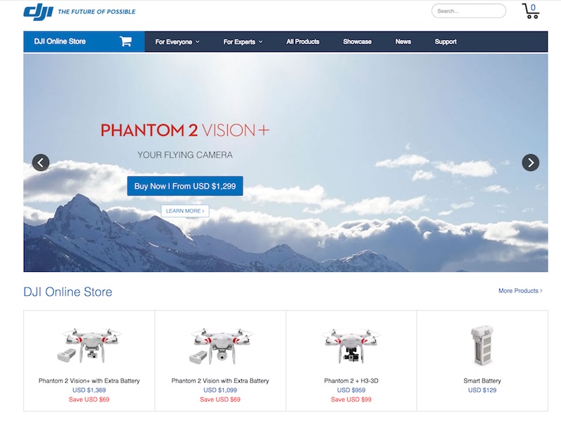
At that point, it was not clear if the green line would be attained by hardware, software, services, or some innovative combination of all three. This uncertainty seems hard to believe in the summer of 2017, but it’s important to remember that the drone world has moved faster than any other in tech history. In January 2015, when I started at 3DR, DJI Phantom 2 Vision was struggling against the GoPro-carrying equivalent, Iris+ was a bleeding-edge RTF platform, and Parrot Bebop wowed the world with its solid-state stabilization. Drones were weird tech curiosities purchased over the internet, not consumer-grade toys that occupied entire aisles at Best Buy. To put this in perspective, iPhone 6 was released in September of 2014. If I handed a Mavic Pro user an Iris+, she would hardly recognize it as a drone. If I handed an iPhone 7 user and iPhone 6, she would feel right at home.
Digression aside, there were very few constraints applied to building 3DR’s first commercial product. Back then, a services team existed to build custom hardware for several enterprise clients, a handful of large companies were buying components for their own custom airframes, interest was swirling around selling a supported version of Arducopter, a handful of serious firms were using off-the-shelf Iris+s for mapping and inspection work, and we offered a joint mapping SKU with Pix4D. Through a rigorous customer development journey that was inspired by Four Steps to the Epiphany (.pdf link from Steve Blank’s course), I investigated nearly every vertical that could benefit from drone hardware, software, or services. I climbed cell towers, inspected hail-damaged roofs, descended into quarries, visited construction sites, and rode along with police. Much of this activity is covered in a podcast interview that I did with Ian Smith of Commercial Dron..., but the key takeaways were that 3DR could compete best in software, that software would eat most of the value in commercial drones, and that AEC (architecture, engineering, and construction) stood to gain the most from drone technology. After narrowing our focus, we set to work building Site Scan, a broadly focused product for mapping and monitoring construction sites.

The learning did not stop there. After shipping Site Scan, we continued to learn and iterate. While many personas across AEC benefit from drone data (an owner may want a progress update, a superintendent may want to understand how work was performed, a PM may want to know if adequate materials have arrived, and so on), introducing new data into an old industry is always problematic. For example, while a PE may love to use drone data to walk back through time to understand where the post-tension cables lie underneath a concrete slab, collecting and interpreting a new data stream represents a significant burden on his day-to-day activities. Through our continued rigorous customer development, we learned that civil engineers, earthworks, and design firms spend a significant amount of money commissioning terrestrial topographic surveys accurate to one-tenth of a foot. To generate this type of survey, a firm will send out a crew with a robotic total station or GPS rover and shoot a point at some specified grid interval (25 feet or 50 feet are typical). From the grid elevations, contours, cut/fill diagrams, earthworks designs, and earthworks bills are generated. A nice example shamefully stolen from some corner of the internet is shown below.
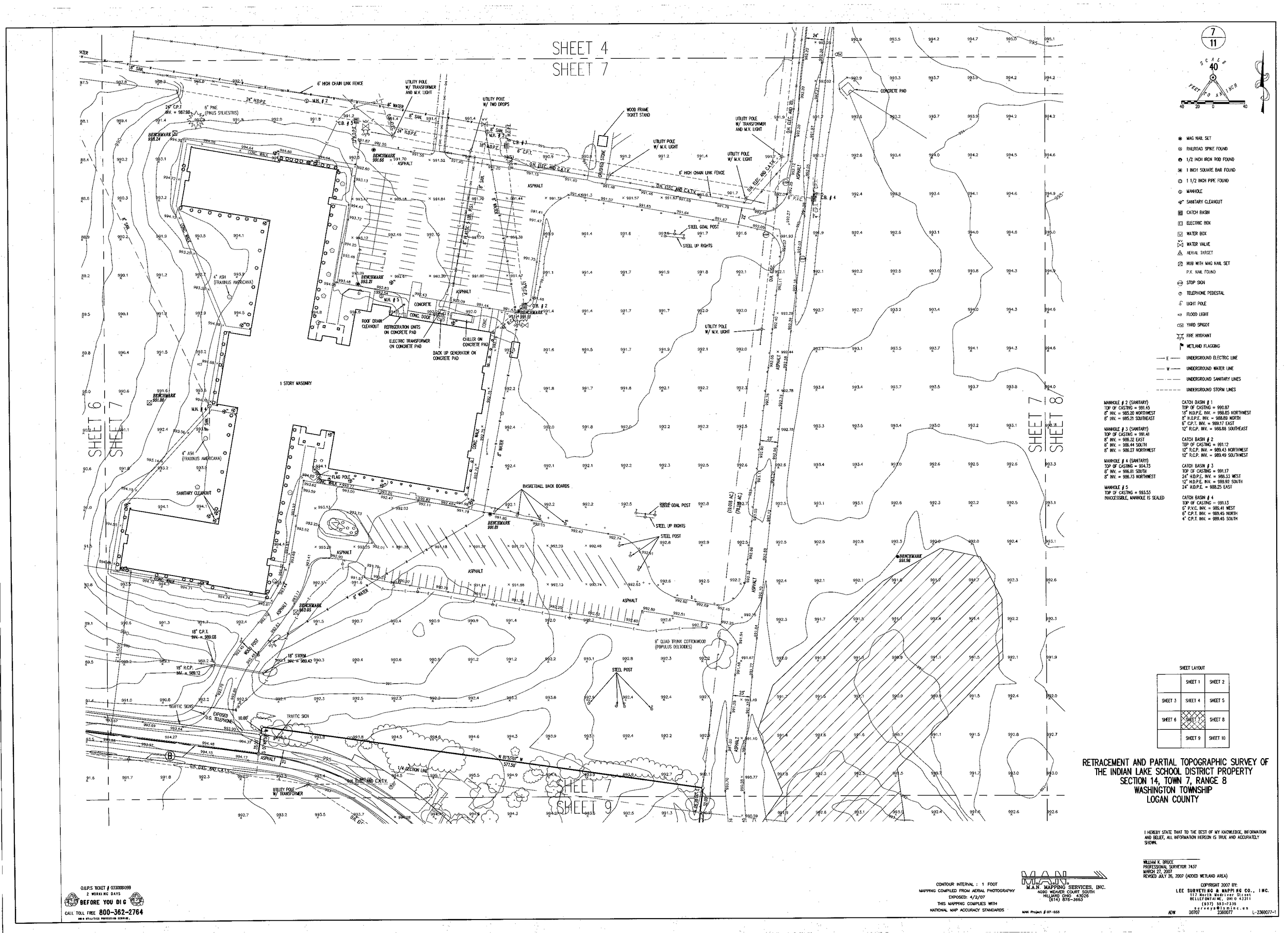
When analyzing these topographic surveys, we learned that the exact same data product could be generated 4-10x faster and cheaper with a drone. Unlike many of the other strong use-cases in AEC like progress monitoring, pre-bid site capture, stakeholder communication, and QA/QC, the drone data served as a direct replacement for something that our users were already doing. Instead of forcing two new behaviors (new way to capture and new data to interpret), users performing topographic surveys with drones only had to learn one (new way to capture). This led me to the conclusion that, while drones can do many, many things, autonomous drones are primarily a tool to decrease the cost and collection time of topographic surveys. For specifics, check out our case studies with Bogh Engineering and All-American Surveying.

As I begin to chew on this concept, I started bouncing ideas around with Christian Stallings, the UAS lead at McKim & Creed, a large engineering and geomatics firm. At McKim & Creed, they have used drones for everything from monitoring erosion on a sensitive beachto surveying an active landfill, but each use-case is fundamentally hinged upon topographic survey. Toward the end of our conversation, Christian said, “Dan, since you’re so interested in survey now, you should become a surveyor. If you know a little math it should be easy to pass the test.” As in engineering, surveying is governed by NCEES, the National Council of Examiners for Surveying and Engineering, and one must pass the Fundamentals of Surveying exam to become a Land Surveyor-in-Training. I had previously passed the Fundamentals of Engineering exam for my role at Exponent, so I had some familiarity with the NCEES and decided to take Christian’s off-hand comment as a challenge. Besides, as a huge disciple of the method acting school of product management, I knew that building for surveyors meant becoming a surveyor. The next day I registered for the FS exam.

And then I waited. And waited. I scheduled the exam for a month out, so I had plenty of time to study. Right? I bought George Cole’s Surveyor Reference Manual, Jan Van Sickle’s Surveying Solved Problems, and the official FS practice exam and printed out the reference manual provided during the exam. The weekend before I was scheduled to sit for the exam, I cracked Surveyor Reference Manual and began studying.

First off, I would strongly recommend against this approach. The FS exam is fairly challenging. It covers obscure geometry and trigonometry problems that you haven’t seen since high school, mainstream three-dimensional calculus that you haven’t seen since college, and esoteric property law that you likely have never seen if your background is not in survey. Fortunately, the Surveyor Reference Manual does a tremendous job covering each of the topics. Those coming from a survey or civil engineering background will likely have a totally different approach to studying, but those coming from technology who want to learn more about the industry could probably benefit from following my approach below.

To begin, I would recommend flipping through every section of the Surveyor Reference Manual to attain some rapid-fire familiarity with all of the topics.

Math

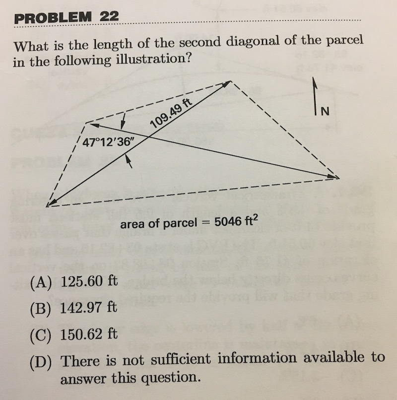
This guide is written for someone with a good math background, but minimal recent experience with geometry. It is critical to refamiliarize yourself with trigonometric and geometric identities for oblique triangles. A strong plurality of questions on the exam involve some kind of oblique triangle calculation and I am guessing you haven’t thought about the law of cosines for a decade. You must understand how to solve a triangle from an area and three angles, two angles and a side, and so on. Likewise, be comfortable solving a circle given a radius and a chord or two other pieces of information that entirely define the shape. The problems below show examples of both of these.
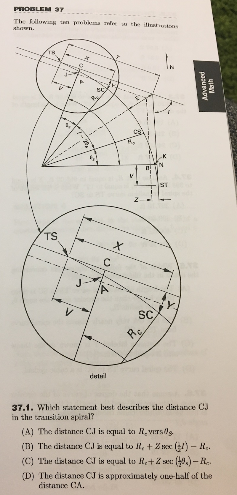
If you can nail these two concepts and briefly remind yourself how to calculate volumes of solid rotations, you will crush the math section. It is important to remember that many relevant formulas will be given in the reference manual. Keep the reference manual close when studying so you know what you do and don’t need to commit to memory.

Field Data Aquisition

This part will be super unfamiliar but is critical for understanding how surveyors work today because so much of their behavior is rooted in history. Briefly, 66-foot Gunter’s chains and 100-foot tapes are still used as units of distance measurement (always remember that one acre is equal to ten square chains) and a dozen or so questions on pin counting, back-sighting, leveling, and compass survey will appear on the exam. Because these questions cover several centuries of technical survey history, my best recommendation is to pretend you are surveying with these archaic tools and try to understand the process rather than commit individual steps to memory. For example, when a question on marking pins arises, think about how you would use the pins rather than memorize how many pins will be left in each of the chainsman’s hands. Using this technique, I scored well on this section of the exam, despite spending minimal time studying.
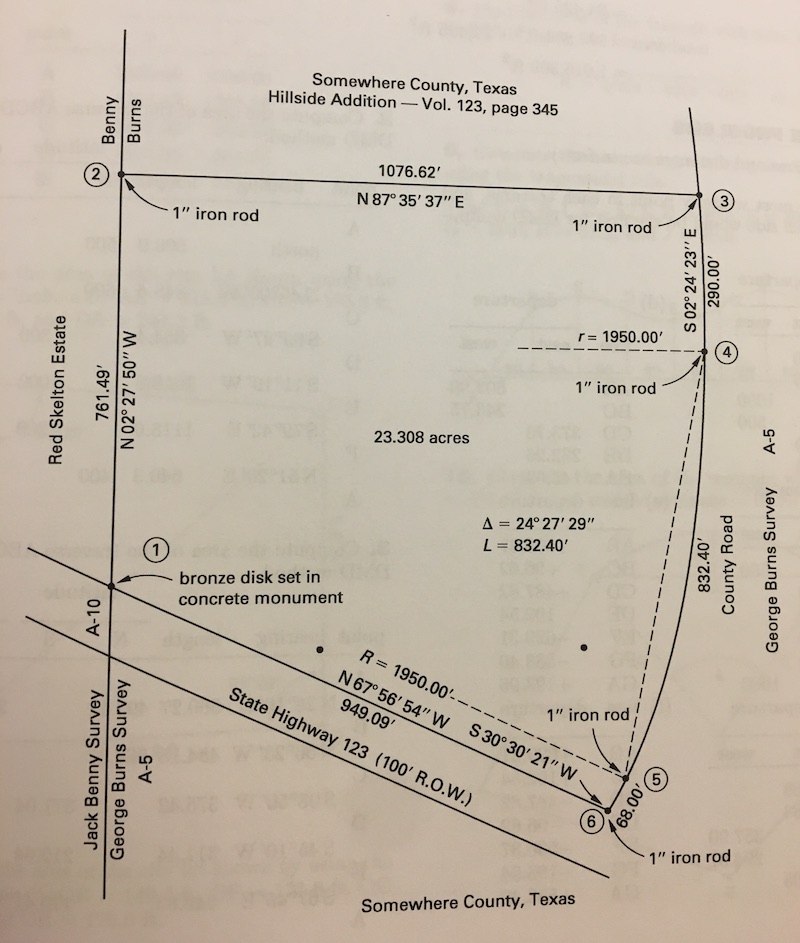
In addition, it is critical to remember that many of the concepts introduced in the section will apply to every section. The math problems are generally not straightforward math problems, but rather word problems that one must use survey understanding to translate descriptions into numbers. An infinite number of problems could be derived from the diagram above, but if you are not familiar with field data acquisition basics, it would be very difficult to solve any of them.

Plane Survey Calculations

This section simply combines the previous two. After a few hours of studying, you will likely be totally comfortable with the math, so try to spend time solving problems from this section that require you to set up the math problems using your knowledge of field data acquisition. When you get stuck (grrrrr… How do I calculate the central angle of an arc from a chord and two stations?), return to the previous section for help. A solid 40% of the exam could be traced back to this section, so you must get pretty comfortable with solving these–and fast. You have an average of 3 minutes to answer each question, so there is no time to derive relationships that are sometimes necessary to solve systems of oblique triangles. Try to commit the basic frameworks to memory.

Geodesy/Survey Astronomy

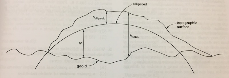
Finally an easy section! If you have been involved in drones or GIS to any extent, this section should come naturally. I would breeze through this section to make sure you understand the basics of GPS, datums, projected coordinate systems, and other GIS fundamentals, but your study time will likely be better spent elsewhere.
Cadastral and Boundary Law

This section is nasty. There is no way around it. Around 30% of the exam is composed of you-know-it-or-you-don’t questions regarding survey law. Unlike the previous sections, it is very difficult to divine or derive from first principles the answer to these type of questions. I am strongly unmotivated to commit trivia to memory, but that is exactly what is required here. I enjoyed giving this section a quick read to understand the origins of property law, but I did not spend adequate time memorizing the various terms, rules, and exceptions to those rules. If you are like me and have no inclination for flashcards, I would recommend quickly scanning the section and identifying common themes that can be used to answer more specific questions and back out the number of themes you need to commit to memory.
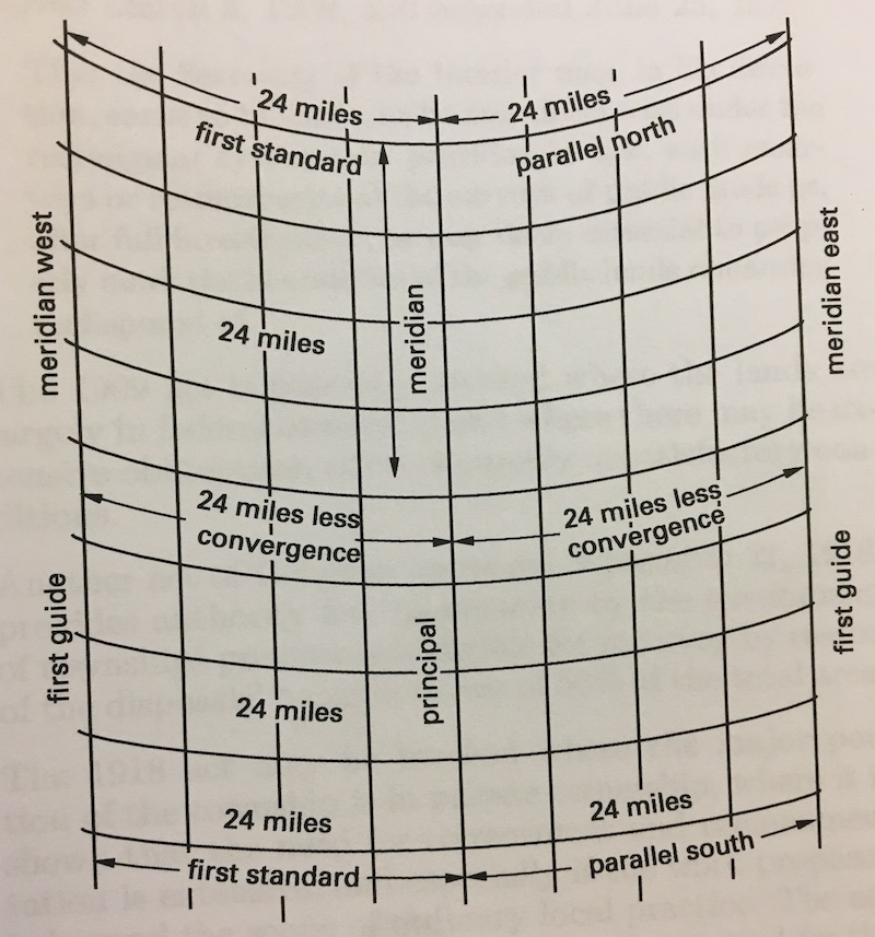
If you are a strong memorizer, you can guarantee yourself a pretty good start on a passing score by simply memorizing most of the concepts in this section.

Mapping

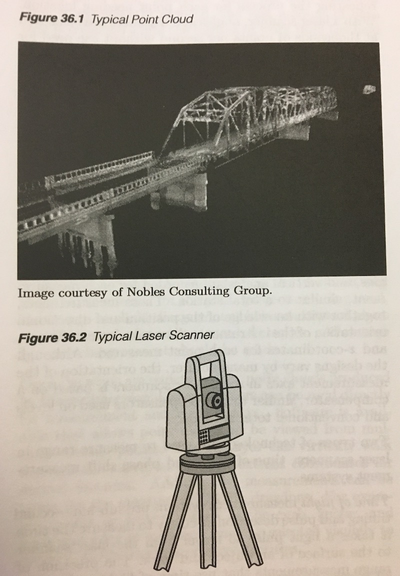
After the experiencing the heartless gauntlet of cadastral and boundary law, you earn a rest in the world of mapping. Coming from the drone world, the mapping section should be very straightforward. You must understand the principles of photogrammetry, contours, control, GIS, and LiDAR. I read this section mostly out of interest and curiosity and didn’t return to it until the exam.
Specialty Surveying Areas

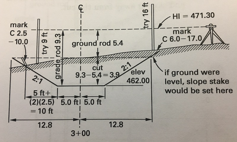
This is where you should spend the majority of your study time for two reasons. First, every problem in this section requires knowledge of each of the previous. You are not going to calculate the staking pattern of a curve in a highway without geometry, survey fundamentals, plane survey calculations, and possible boundary law. Second, and most important, your customers/competitors are doing this type of work right now. As I mentioned earlier, drones are fundamentally a topographic survey tool. This section covers topographic surveys in depth. Perhaps your tool involves construction staking. Drones and other tech tools can help with that as well. I would encourage you to solve a handful of problems from start to finish and really think about how your tool could either increase speed, accuracy, or safety. Put yourself inside the head of the survey tech taking measurements for a cut/fill estimation and visualize the labor required versus your solution. Visualize the final deliverable and understand how the data are manipulated into a final product. Even better, if you have time, connect with a survey crew and try your newfound knowledge in the field. This section only represents 10% or so of the exam, but these tend to be the most time-consuming questions. Give yourself plenty of time to savor them by saving them until last.
Computer Programming/Business Management

This final section deserves a quick review, but should not present any kind of challenge. Understand how to select projects by NPV, how to make ethical decisions, and the basics of logic and you will ace this part of the exam. Consider this a 10-question gift from NCEES.

My results

In the end, I probably studied a solid 20 hours for this exam but would have been more comfortable with more time (I suppose this is a truism). I calculated that I knew the answer to 75% of the questions with good-to-excellent certainty and guessed on the rest. Assuming that I nailed 90% of that 75% block and 33% of the rest, I likely nailed about 75% of the questions, which turned out to be a passing score. NCEES doesn’t appear to publish any guidelines on the raw scores needed, so this may be the only quantitative estimate on the internet.

I have not yet filled out the reams of paperwork needed to become a California-licensed Land Surveyor-in-Training, but I am excited to join their ranks and that I have taken the time to learn the fundamentals of the profession. The professional empathy I have gained by going through this somewhat painful process has already paid dividends in my role at 3DR and I would highly recommend that anyone in the space follow my lead. Product management by method acting is pretty darn powerful. After all, the best way to know the customer is to become the customer.

Read more…
3D Robotics

3689717640?profile=original

I noticed that Digikey is now selling Honeywell's newest aerospace-grade IMUs, which cost $1,328 each (note that's just for the IMU; it's not a full autopilot). How do the specs of these aerospace IMUs compare to those we use here? Are they worth the extra money? 

In terms of overall approach, the Honeywell IMU seem very similar to modern autopilots such as Pixhawk 2.x and 3.3: they both have MEMS sensors with internal environmental isolation and temperature compensation.

As for the sensors themselves, I'm no expert on specs, so I'll just post the basics here, comparing the Honeywell sensor to the Pixhawk 3. 

3689717770?profile=original

On the face of it, the Invensense and ST sensors in the Pixhawk 3 appear at least as good, if not better. But I imagine that there are some other factors that may be more important, such as gyro drift and vibration filtering. The Honeywell specs in drift are shown here: 

3689717807?profile=original

Meanwhile the Invensense ICM-20602 sensor in the Pixhawk 3 gives its drift in different units: ±4mdps/√Hz. I really don't know how to compare those.

Finally, I'm sure that a lot of the performance depends on the software running on the Pixhawk boards, be it PX4 or APM, both of which use GPS to augment the raw IMU data to compensate for drift, along with a lot of other smart filtering. 

So for those IMU experts out there: how do you think these two approaches compare? Are aerospace-grade IMUs worth the extra money?

Read more…

3689717597?profile=original

This time an Aeromapper Talon flew a mission autonomously to a target located 30km away from the operators, while maintaining at all times a strong communications and control link. This demonstrates the great potential for Beyond Visual Line of Sight operations for applications such as power line and pipeline monitoring, roadways survey, surveillance and wildlife control, and long linear missions in general. Best of all, the Aeromapper Talon costs only a fraction compared to systems with similar capabilities, traditionally 2x or 3x more expensive.


The mission was carried out in the Andes Mountains of South America. The location of the flight is situated at 2,800m above sea level and the flight was performed at a cruise altitude of 250m agl. The UAV travelled over a body of water during 50% of the flight. The drone travelled a total distance of 60km in one hour of flight, still having plenty of flight time left, thanks to its 2 hour flight endurance.

The UAV could have gone further than 30km but the operators decided to bring it back since the area in the path of the UAV was full of high peaks in excess of 3,500 m above sea level. Further missions are being planned to demonstrate the capabilities to reach 50km. 

The Aeromapper 300 also uses the same long range communication system.


Watch full video here

(link:  https://www.youtube.com/watch?v=09EHfr1Ed7s)


Powerful solution for linear mission challenges


At Aeromao Inc, we constantly receive many requests from clients wanting to fly linear missions sometimes to survey thousands of kilometers of pipelines, power lines or roadways. Having done ourselves hundreds of kilometers of linear projects in the past we know very well the challenges faced during this type of operations.


The Aeromapper Talon proves to be the key solution because of its capabilities and affordability. Linear missions usually demand the following set of characteristics from a UAV, in which the Aeromapper Talon excels in all:

  • Able to operate in difficult terrain and with a mobile GCS with a reliable strong communications.
  • Quick deployment and easy operation: the Aeromapper Talon can be flight ready in 15 minutes and is one of the easiest UAVs to operate.
  • Several cycles of takeoff and landings per day from different locations: here the handlaunch and parachute landing are pretty much a MUST have. A large area survey needs the flexibility of operating from virtually anywhere.
  • Reliable and easy to repair in the field, as well as affordable and interchangeable spare parts.


Complete UAV solution, multiple fronts


The Aeromapper Talon is also a multi-mission payload complete solution for all your fronts such as agriculture, centimeter accurate surveys, surveillance and monitoring thanks to its full range of payloads


3689717720?profile=original


- 24 Mp RGB + with Parrot Sequoia simultaneously: complete your full survey at high resolution and get vegetation data in a single flight.

- 24 Mp RG + Thermal Infrared: How about a high resolution mission where Thermal information is required? Ideal for pipeline or wildlife monitoring.

- Forward looking day / night payload: need an affordable surveillance and observation platform with long range video streaming? All systems are swappable easily in case you need to do mapping missions as well.

- Micasense RedEdge: serious agriculture power with this swappable payload option.

- GNSS PPK: eliminate GCPs and achieve up to 3 cm of accuracy for those engineering projects. Also available as a swappable payload that can be easily removed if required.

- Pix4DMapper Aeromao Edition: serious post processing power for the most exhaustive power, available in an affordable bundle package with the complete UAV system.

- Agisfot Photoscan Pro: affordable and flexible post processing software to become a post-processing Ninja.


More information can be found at www.aeromao.com


Read more…

Phantom 4 vs dji Spark

Just a comparison video for the benefit of anyone curious.

on a side note, it is strange that DJI has decided to make you connect to the controller via wifi (and has decided to use a stunted mavic controller), i found that you could connect via cable to the dji application via USB because my wifi connection was horrendous and i had no internet when connected to the wifi. Just thought i would share this anywhere i can so anyone who decided to buy the spark can see this feature, this should also in theory improve the range of the drone because there is less interference.

Link to the phantom pilots thread: http://www.phantompilots.com/threads/dji-spark-unboxing-hidden-feature-found.117312/

Read more…

quadcopter Flight controllerFlight controllers tend to be aimed at different types of flying style: Cinema Flying, Sport Flying and Autonomous Flying. At the same time, there is a massive number of flight controller brands in the market, so it's hard to know which is best. Today I will give some perspective on that.


Flight controller For Cinema Flying

Pixhawk PX4 :Integrating with ARM 32bit chip and PX4FMU+PX4IO, this is yet another incredible option for any aerial photographer. Boasting UART, CAN, SPI and 12C bus interfaces; you will love its performance.

Features

  • Advanced 32 bit ARM Cortex® M4 Processor running NuttX RTOS
  • 8 PWM/servo outputs
  • Abundant connectivity options for additional peripherals (UART, I2C, CAN)
  • Redundant power supply inputs and automatic failover
  • Integrated safety switch and optional external safety button for easy motor activation
  • Multicolor LED indicator
  • Integrated multi-tone piezo audio indicator
  • microSD card for long-time high-rate logging

The DJI NAZA-M V2: It is best to use if you want to do an aerial photography.  Its lightweight makes it quite convenient for your drone while the well designed control platform places the entire control process at your fingertips. In fact, it gives you total control of your drone as you capture those incredible aerial images.

Vector Flight Controller: If you are bold enough, you can also try Vector on your drone. Integrating an Eagle Tree system, you will definitely love its excellent performance. Ideal for professional and beginners alike, it also boasts an ETR00150 which gives it that unique performance and reliability. Its weight and size make it really convenient for aerial photography while the easy-to-use design adds to its awesome features.


Flight controller For Sport Flying

The KISS flight controller: It is mostly used in small sized drones. It does not have many features but you can be able to navigate through the user interface without causing a lot of confusion. Kiss is an acestar flight controller for fpv racing such as 250 quad. If you are looking for unrivalled performance, then you have to give it a shot.

RJX SP flight controllerr: lets you record flight data comfortably and conveniently. It integrates the latest Compass, accelerometer, baro and altitude sensor technology which makes its performance even better. Its 2 through holes are quite compatible and can mount onto PDBs as well as OSDs.

The Naze32: It gives you an opportunity to solder on both sides which makes it quite convenient. It comes with an input voltage of 2-6s which is similar to the other flight controllers for 250 quad fpv racing. 


Flight controller For Autonomous flying

QWinOut APM : This is an opensource flight controller which comes with a protective case for ultimate durability. Its advanced construction requires you to have basic understanding of c-programming language which is one of the earliest programming languages, monolithic integrated circuits as well as electrical and mechanical knowledge. 

The 3DR Pixhawk: It is one of the best flight controllers in the market. It is best to use in autonomous flights. It has backup system supports all kinds of sensors and other different flight considerations.

The MultiWii Pro: It is cheap and is readily available worldwide. It is capable of stabilizing remote control style plane, helicopter or a multicopter. It has a barometer, magnetometer, and GPS.

Drone Flight controller


On the basis of contrast of flying style as above, price and specs from the popular quadcopter flight controllers, you will have discovered some important differences that help you to choose items not only today but into the future as well.

If you have any question of any thing about flight controllers and have more experiences, please leave your message on here, Thank you.

 Reference source: http://www.rcdronegood.com/flight-controller-board-comparison/

Read more…
3D Robotics

Intel cancels Edison, Joule boards

3689717677?profile=original

It was well known that Edison was going to be discontinued this year, but Joule, which was just released, is a surprise. This is bad news for any autopilot board that uses Edison, such as Pixhawk 2.1, which will now have to move to another companion computer. (I'd suggest Raspberry Pi). From Hackaday:

Sometimes the end of a product’s production run is surrounded by publicity, a mix of a party atmosphere celebrating its impact either good or bad, and perhaps a tinge of regret at its passing. Think of the last rear-engined Volkswagens rolling off their South American production lines for an example.

Then again, there are the products that die with a whimper, their passing marked only by a barely visible press release in an obscure corner of the Internet. Such as this week’s discontinuances from Intel, in a series of PDFs lodged on a document management server announcing the end of their Galileo (PDF), Joule (PDF), and Edison(PDF) lines. The documents in turn set out a timetable for each of the boards, for now they are still available but the last will have shipped by the end of 2017.

It’s important to remember that this does not mark the end of the semiconductor giant’s forray into the world of IoT development boards, there is no announcement of the demise of their Curie chip, as found in the Arduino 101. But it does mark an ignominious end to their efforts over the past few years in bringing the full power of their x86 platforms to this particular market, the Curie is an extremely limited device in comparison to those being discontinued.

Will the departure of these products affect our community, other than those who have already invested in them? It’s true to say that they haven’t made the impression Intel might have hoped, over the years only a sprinkling of projects featuring them have come our way compared to the flood featuring an Arduino or a Raspberry Pi. They do seem to have found a niche though where there is a necessity for raw computing power rather than a simple microcontroller, so perhaps some of the legion of similarly powerful ARM boards will plug that gap.

So where did Intel get it wrong, how did what were on the face of it such promising products fizzle out in such a disappointing manner? Was the software support not up to scratch, were they too difficult to code for, or were they simply not competitively priced in a world of dirt-cheap boards from China? 

Read more…

3689717617?profile=original

Here's an antenna with high quality but low price ($5/piece), universal usage for all FPV equipment, like fpv googles, fpv transmitters and receivers, fpv monitors, quadcopters, multicopters, drones, etc

Features:

Small size: 4mm x 1mm x 88mm (Max diameter x Min diameter x Height)

Connector: 1 x SMA Male, 1 x RP-SMA Male

Genuine 5DBi enable better transmission

5.8 GHz suit for transmitter and receiver

Specifications: 

Frequency Range:5.8GHz
Connector:SMA/RP-SMA
Gain:5dBi
VSWR:<1.5:1
Max Power:50W
Impedance:50Ω
Height:88mm
Max diameter:4mm 
Min diameter:1mm 
Lighting Protection:DC Grounded
Polarization:Circular polarization (RHCP)
Model Type:4-leaf Antenna 
Package Included: 
1 x 5.8G Four Leaf SMA Male Antenna
1 x 5.8G 4-Leaf RP-SMA Male Antenna

Read more…
3D Robotics

Is it flattering that NASA uses a 3DR Y6 to teach "crash management" techniques? I'm going with yes! Register here. 

ASA’s Langley Research Center is offering a free informational webinar on its  autonomous crash management system for small UAVs that enables landing a malfunctioning unit to a safe and clear ditch site. The webinar will take place on July 25th @ 2PM (EDT).

The mission of the system, called Safe2Ditch, is emergency management to get the vehicle safely to the ground in the event of an unexpected critical flight issue. For example, a drone delivery flight that loses battery power before reaching desitnation.

Safe2Ditch uses intelligent algorithms, knowledge of the local area, the remaining control authority and battery life to select the safest landing location for a crippled UAV and steer it to the ground. The system helps minimize the risk of UAVs to people and property. This mission is performed autonomously, without any assistance from a safety pilot or ground station and all while residing on a small processor onboard.

During this free webinar, lead inventors Patricia Glaab and Louis Glaab will discuss this technology and its potential uses, followed by an open Q&A session.

Read more…

SmartAP 3.2 Pro Available

3689717518?profile=originalSky-Drones announces release of the next generation flight controller - SmartAP 3.2 Pro, the system became even more integrated, powerful and provides extensive set of features. It has 3x-redundant temperature-stabilized IMU, integrated OSD telemetry with power supply for camera / video TX, integrated long-range 500 mW telemetry module, FrSky S.Port telemetry support, RTK GNSS support (with additional SmartAP RTK extension), 10-60V (3-14S) power input and much more. SmartAP supports any type of multirotor UAV and provides the highest navigation and control precision. The main capabilities of the flight controller are: 

  • Outstanding flight stability in all modes - manual (user control), position hold (semi-autonomous control) and auto (fully autonomous navigation and control)
  • 3x-redundant temperature-stabilized IMU
  • Fully compatible with SmartAP GCS Ground Control Station for Configuration and Mission Planning
  • Integrated OSD (On-Screen Display for FPV) with camera / video TX power supply
  • Accurate GPS Position hold (up to 40cm with good GNSS reception quality)
  • Accurate Altitude hold (up to 10 cm)
  • Return to Home flight mode
  • Fully autonomous waypoints flight mode
  • Guided flight mode
  • Various failsafe events configuration and triggering

3689717339?profile=original

Temperature-stabilized IMU allows using the system in the wide range of temperatures (-40...+60) with no need of recalibrating.


General Hardware Specifications

  • Powerful microcontroller 32 bit 168 MHz STM32
  • Compact board size of 8x8 cm (3.15"x3.15"), weight 60g, 6 layers PCB design
  • Power supply from the main LiPO battery (3S - 14S) support, up to 60 Volts
  • Power supply from BEC 5V support
  • 12V, 5V, 3.3V generated onboard, dedicated voltage regulators for MCU, sensors, peripherals
  • Integrated GNSS receiver UBlox NEO M8N, GPS/GLONASS, up to 24 sats, 10 Hz), active antenna
  • Exnternal GNSS module support (primary configuration)
  • Integrated 500 mW telemetry module (primary configuration)
  • External telemetry module support
  • Integrated OSD module with power supply for video TX and camera 
  • Up to 24 PWM I/O support (5V out, high-power)
  • SBUS input support
  • FrSky S.Port output support
  • USB interface for configuration / firmware update
  • Various communication lines (UART/USART, RS232, I2C, SPI)
  • 6-pin JTAG port for programming / debugging
  • MicroSD card driven by 4-bit SDIO interface for data-logging / parameters
  • Backup battery for real-time clock and GNSS receiver
  • Integrated main LiPo battery voltage monitoring
  • 4 ADC inputs, battery voltage / current monitoring
  • Electromagnetic sounder
  • 3-channels bright LED support (up to 300mA/ch)
  • RGB LED support
  • 2-channel solid state relay

The system is also available as a kit which includes:

3689717449?profile=original

  1. SmartAP 3.2 Pro Flight Controller Main board
  2. External GNSS / Magnetometer module
  3. Ground telemetry module
  4. Onboard telemetry antenna
  5. High-gain ground telemetry antenna
  6. Power input cable
  7. MicroSD card with SD card adapter

SmartAP has its custom Configuration and Mission Planning software called SmartAP GCS, which supports Windows, Mac OS X and Linux. 

3689717560?profile=original

SmartAP GCS supports complex flight planning (including waypoints, survey grid generation, payload control, etc), real-time monitoring of flight parameters, video streaming and high-level commands control.

3689717543?profile=original

Sky-Drones also creates accessories such as SmartAP RTK for precise positioning and SmartAP PDB for power distribution and voltage / current measurements. 

3689717581?profile=original

More information about SmartAP Autopilot and other Sky-Drones products can be found on the website: http://sky-drones.com/

Read more…

Testing rig

I built a custom testing rig out of some plywood sticks and these kind of elastic cords:

3689717316?profile=original

There is just enough clearance for 7 inch props and the quad is free to rotate around one axis (Y or roll in the video). I can easily change the free axis as the cords connect to the arms with metal hooks.

The issue I’m debugging now is related to a tendency of the motors to generate different thrust for the same throttle input. I think it’s because the ESCs have different settings on them as I couldn’t find any issue with my code so far. If I send 50% throttle to all motors the quad spins a lot.

Read more…

Sign Up for the WeRobotics Roster!

3689717472?profile=original

WeRobotics is an international NGO dedicated to scaling the positive impact of social good projects through the localization and responsible use of appropriate robotics solutions such as UAVs/drones. We work in multiple sectors including humanitarian aid, global development, public health, nature conservation and agriculture. Over the past year, we have carried out numerous projects and trainings in Nepal, Tanzania, Peru, Maldives, Haiti, Senegal, Fiji, Vanuatu, Cook Islands, Dominican Republic and Liberia, for example. Future projects will take us back to many of these countries in addition to new ones like Indonesia, Myanmar and Panama. WeRobotics supported by the Rockefeller Foundation, World Bank USAID and has received funding from World Food Program (WFP), UN Development Program (UNDP) and others. We have formal partnerships with ESRI, DJI, Parrot, senseFly, Pix4D and other industry leaders.

3689717427?profile=original

Given the increasing demand for our expertise and services, we are building a roster of top notch experts with proven expertise in range of fields such as operating aerial and marine robots, geographic information systems, imagery analysis, artificial intelligence and machine learning, cargo logistics, web development, communications and storytelling. If selected, you will be invited to join short term projects (typically ranging from 1 to 7 days) in various countries around the world. Only applicants who make it to the final selection round will be contacted for interviews. All information provided below will be kept strictly confidential.

http://werobotics.org/roster

Read more…

basic parameters of drone battery

Here are some tips to help you consider the main parameters for choosing a lipo battery for your drone. 

Main parameters

Capacity

Normally, more capacity is mean more power and more energy. In fact As the battery gets larger, the increase in flight time becomes ineffective, because of the weight of battery. You should have to think about the weight when consider the capcity, Should not be absorbed in choosing bigger capacity battery simply.

 Discharge Rate

Discharge Rate is yet another crucial aspect that need to be checked before you decide to settle for any battery for your drone.You need to get a battery whose C rating is convenient for your drone. you have to compare target c-rating and battery c-racing. In short, my principle is that battery c-racing  is greater than  target c-rating but not too higher.

Voltage

With a higher cell count, performance is maintained above par. However, higher cell counts translate to an increase in weight which, in some cases, affects performance. Choosing the right voltage of battery, you should reference in the datasheet of motor and esc.

Connectors

There are many common connectors include Deans, XT60, EC3 and JST etc. What is the performance impact of these connectors?

Drone battery connectors

  • JST connector – up to 5A
  • XT60 connectors- up to 60 Amps
  • Deans – up to 60 Amps
  • EC3 connector – up to 60 Amps
  • EC5 connector- up to 120 Amps

Brand 

Tattu , Bonka, Multistar, Turnigy , Zippy , Graphene , SMC, Dronelabs, Ready MadeRC, ThunderPower, Floureon, Venom, Pulse , E-flite etc. Which one is the best one? All of them are good enough, I highly recommend Tattu battery.

Conclusion

Choosing the right drone battery is no doubt important, and looking after your lipo battery is also important.

If you have any question of any thing about the main parameters for choosing your drone battery and have more experiences, please leave your message on here, Thank you.

Read more…
3D Robotics

From Nvidia: Here's the full paper.

Most drones would be lost without GPS. Not this one.

A drone developed by NVIDIA researchers navigates even the most far-flung, unmapped places using only deep learning and computer vision powered by NVIDIA Jetson TX1 embedded AI supercomputers.

Although initially designed to follow forest trails to rescue lost hikers or spot fallen trees, the low-flying autonomous drone could work far beyond the forest — in canyons between skyscrapers or inside buildings, for example — where GPS is inaccurate or unavailable.

“This works when GPS doesn’t,” said Nikolai Smolyanskiy, the NVIDIA team’s technical lead. “All you need is a path the drone can recognize visually.”

To keep costs low, researchers built their drone with off-the-shelf components. The drone navigates without GPS and relies instead on deep learningResearchers built their drone with off-the-shelf components to reduce costs.

No GPS? No Problem

Although the technology is still experimental, it could eventually search for survivors in damaged buildings, inspect railroad tracks in tunnels, check stock on store shelves, or adapted to examine communications cables underwater, Smolyanskiy said.

The team’s already trained it to follow train tracks and ported the system to a robot-on-wheels to traverse hallways. The drone also avoids obstacles like people, pets or poles.

“We chose forests as a proving ground because they’re possibly the most difficult places to navigate,” he said. “We figured if we could use deep learning to navigate in that environment, we could navigate anywhere.”

Unlike a more urban environment, where there’s generally uniformity to, for example, the height of curbs, shape of mailboxes and width of sidewalks, the forest is relatively chaotic. Trails in the woods often contain no markings. Light can be filtered through leaves; it also varies from bright sunlight to dark shadows. And trees vary in height, width, angle and branches.

Flight Record

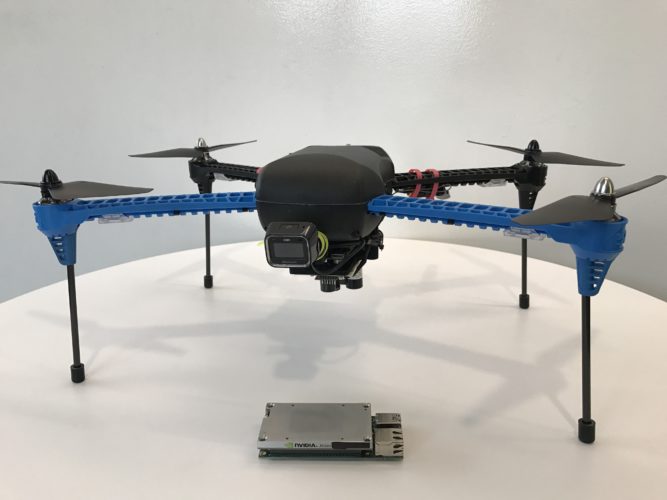
To keep costs low, the researchers built their device using an off-the-shelf drone equipped with the NVIDIA Jetson TX1 and two cameras.

“Our whole idea is to use cameras to understand and navigate the environment,” Smolyanskiy said. “Jetson gives us the computing power to do advanced AI onboard the drone, which is a requirement for operating in remote environments.”

The NVIDIA team isn’t the first to pursue a drone that navigates without GPS, but the researchers achieved what they believe is the longest and most stable flight of its kind. Their fully autonomous drone flies along the trail for a kilometer (about six-tenths of a mile), avoiding obstacles and maintaining a steady position in the center of the trail.

Team member Alexey Kamenev played a big role in making this happen. He developed deep learning techniques that allowed the drone to smoothly fly along trails without sudden movements that would make it wobble. He also reduced the need for massive amounts of data typically needed to train a deep learning system.

In the video above, the drone follows a trail in the forest near the researchers’ Redmond, Wash., office. The areas in green are where the robot decided to fly and the red areas are those it rejected.

No Breadcrumbs Needed

The drone learned to find its way by watching video that Smolyanskiy shot along eight miles of trails in the Pacific Northwest. He took the video in different lighting conditions with three wide-angle GoPro cameras mounted on the left, center and right of a metal bar on a mini Segway.

In addition to their own footage, researchers trained their neural network — called TrailNet — on video recorded on trails in the Swiss Alps by AI researchers at Istituto Dalle Molle di Studi sull’Intelligenza Artificiale (IDSIA) in Zurich.

In fact, IDSIA’s work on drone forest navigation was one inspiration for NVIDIA’s autonomous drone team. The other inspiration was NVIDIA’s self-driving car, BB8.

Next Steps

The team now plans to create downloadable software for Jetson TX1 and Jetson TX2 so others can build robots that navigate based on visual information alone.

Long term, the idea is to tell the robot to travel between two points on any map — whether it’s a Google map or a building plan — and have it successfully make the trip, avoiding obstacles along the way.

For more information about the team’s work, see “Toward Low-Flying Autonomous MAV Trail Navigation using Deep Neural Networks for Environmental Awareness” or watch their talk at the GPU Technology conference.


Read more…
3D Robotics

New two-motor VTOL from Horizon

This kind of 2-motor vertical take-off plane was a PhD thesis 2 years ago, a TED talk 1 year ago & now it's a $150 toy. From Horizon Hobby:

Key Features

  • Multirotor versatility and sport plane agility
  • Takes off and lands vertically in small areas
  • Fly slow or fast and perform aerobatics in airplane mode
  • Can be hand launched and belly-landed like a conventional wing
  • Simple tail-sitter design and SAFE technology makes VTOL flying easy
  • Stability and Acro modes that provide a wide range of flight performance
  • Optional and patent-pending FPV camera and servo-driven mechanism (sold separately)
  • 280-size brushless motors compatible with 2S 450-800mAh LiPo batteries
  • Outstanding speed and climb performance
  • Lightweight and extremely durable EPO airframe
  • Colorful decal sheet with multiple trim scheme options
  • Ready to fly within minutes of opening the box
  • Propeller guards and vertical fins that are easy to install or remove
Needed to Complete
  • Full-range, 6+ Channel DSMX®/DSM2® transmitter
  • 450-800mAh 2S LiPo flight battery
  • 2S compatible LiPo charger
What's in the box?
  • (1) X-VERT VTOL Airplane
  • (1) 3-in-1 Receiver/ESC/Flight Controller Unit
  • (2) BL280 2600Kv Brushless Outrunner Motor
  • (4) Decal Sheets
  • (1) User Manual

Overview

The X-VERT™ VTOL gives you all the fun and versatility of a Vertical Take Off and Landing aircraft without the need for complex mechanics or fancy programming. It also makes the transition between multirotor and airplane flight as easy as flipping a switch. You can also take your flight experience to a whole different level using the optional and patent-pending FPV camera and servo-driven mechanism that transition automatically when the X-VERT does (FPV gear sold separately).

Sleek and Simple Design

A lot of VTOL aircraft require complex mechanisms like tilting wings and motors to achieve vertical and forward flight. The X-VERT park flyer's simple, tail-sitter design and SAFE® stabilization technology allow it to fly like an airplane or a multirotor using nothing more than differential thrust and its elevons. The simplicity of this design also makes the lightweight, EPO airframe remarkably durable.

Wide, Pilot-Friendly Flight Envelope

The light wing loading and efficient aerodynamics inherent in the aircraft's design play a big role in making it easy to fly, especially in airplane mode. Fast or slow, pilots will enjoy smooth, predictable response at any speed.

SAFE® Flight Control Software Makes it Easy

At the heart of it all is exclusive SAFE (Sensor Assisted Flight Envelope) flight control software that has been expertly tuned so almost any RC pilot can experience the fun of VTOL flight.

Automated Transition

Making the transition between multirotor and airplane flight is as simple as flipping a switch. The flight controller will automatically transition the aircraft from one to the other using SAFE technology to stabilize everything so you can relax and have fun.

3 Flight Modes

The advanced flight control software features three flight modes that, along with the model's light wing loading and efficient aerodynamics, give you a wide range of performance.

-   Multirotor Stability Mode

This mode allows you to take off and land vertically like a multirotor aircraft. It's also great for indoor flight. In this mode the aircraft's tail remains pointed at the ground while the flight controller uses a combination of differential thrust and elevons to control pitch, bank and rotation. Pitch and bank angles are limited, and SAFE technology will work to keep the model in a stable hover whenever you release the sticks.

-   Airplane Stability Mode

In this mode the aircraft responds to pitch, roll and yaw commands like a typical airplane. SAFE technology limits pitch and bank angles so new pilots can experience airplane flight without accidentally rolling upside down or losing control. It will also return the wings to level whenever the sticks are released.

-   Airplane Acro Mode with AS3X® Technology

In Airplane Acro Mode the model becomes an agile, fully aerobatic flying wing. There are no angle limits or self-leveling. The large, long-throw elevons will allow you to perform incredibly tight turns as well as a wide range of aggressive aerobatic maneuvers. And because you have the forward thrust of two brushless motors working for you, there is plenty of speed and power to spare. You can even use the differential thrust of the motors for yaw control to perform wild spinning and tumbling maneuvers.

As you fly, AS3X technology works behind the scenes to smooth out the effects of wind and turbulence. It feels completely natural, too. It won't interfere with or limit your control in any way. You simply enjoy a sense of stability and precision that makes you feel like you're flying a much bigger aircraft.

Customize Your Trim Scheme

The included decal sheet gives you multiple trim scheme themes to choose from - a military theme with bomb and rocket decals, and different sport themes with vibrant colors. You can even personalize your trim scheme by mixing and matching decals from different themes.

FPV Ready

You can also take your flight experience to a whole different level using the optional and patent-pending FPV camera and servo-driven mechanism that transition automatically when the X-VERT does (FPV gear sold separately).

Super-Simple Transmitter Setup

The model comes equipped with a Spektrum receiver that is built into the flight controller. It can be flown with any full-range, 6+ channel DSMX/DSM2 aircraft transmitter. No complex programming or setup is required. All you have to do is assign switches for the flight mode/transition changes and throttle arming.

Read more…
3D Robotics

Dronecode/PX4 1.6 code released!

3689717365?profile=original

From the Dronecode release post:

We’re very excited to announce the release of PX4 v1.6, the latest version of the Dronecode Flight Stack (PX4 Pro). This firmware represents a huge increase in both usability, functionality, and stability/robustness since our last significant delivery back in August 2016 (PX4 v1.5.0).

Just a few of the new features and enhancements in this release are:

  • New flight modes for Fixed Wing – Acro and Rattitude
  • New uLog logging format that directly logs uORB topics for more accurate time stamping. This is already supported for review and analysis here: http://review.px4.io
  • Improvements to camera triggering to make it easier to use and and provide better real-time feedback
  • Support for survey flights in multicopter and fixed wing with an intuitive UI
  • Temperature calibration and compensation
  • Support for MAVLink and PWM controlled gimbals
  • Support for generic helicopters and Blade 130 mixer
  • Improved robustness in EKA2 and hardening against marginal GPS reception.
  • Significant improvements to user experience for both the Qualcomm Snapdragon Flight and the Intel® Aero Ready to Fly Drone
  • Support for STM32F7 and NuttX Update to a recent release
  • New hardware support including the Crazyflie v2, FMUv4 PRO and FMUv5 (Special thanks to Drotek and Team Blacksheep for donating the FMUv4 and FMUv5 hardware!)

This is also the most tested and hardened PX4 release to date. The dedicated test team that have done hundreds of hours of testing, on all the major vehicle platforms and using all the main reference flight controller hardware.

A breakdown of the testing since the last stable release (1.5.5) is listed below:

  • 2257 commits tested.
  • 847 total flights on 12 different vehicles and 6 different flight controllers:
    • Pixhawk mini (DJI F450): 554
    • Pixhawk mini (Generic Quad): 11
    • Pixhawk 1 (DJI F450): 15
    • Pixhawk mini (Hexa): 11
    • Pixhawk mini (Phantom FW): 17
    • Pixhawk mini (QAV 250): 28
    • Pixracer (DJI F450): 34
    • Pixracer (Flipsport): 140
    • Pixhawk 3 Pro (DJI F450): 27
    • Dropix (VTOL): 1
    • Intel® Aero Ready to Fly Drone: 6
    • Snapdragon (200qx): 3
  • 6 releases tested: 1.6.0-rc1, 1.6.0-rc2, 1.6.0-rc3, 1.6.0-rc4, 1.6.0, 1.6.1
  • 22 PR’s tested: 6362, 6438, 6440, 6505, 6633, 6756, 6777, 6862, 6863, 6920, 7003, 7009, 7017, 7036, 7095, 7260, 7265, 7268, 7274, 7281, 7287, 7346

The firmware is already available in QGroundControl (for access to the best UI you may choose to use the “daily build” here). We owe a huge debt of gratitude to the whole PX4 Development Team for this outstanding work.

Check out the release notes for more information

Read more…

Andruav - Same Device with Mission Planner

Andruav system is mainly an Android based system, recently it has supported Web using Andruav WebClient.  In this article the video shows a new integration tool. Andruav Web Plugin it is a simple application enables you to connect Mission Planner Directly to your Drone(s) anywhere in the world via Andruav Web, you dont need Andruav GCS mobile to connect your Mission Planner anymore.

Technically, Andruav Web Plugin is a nodejs app that you can easily install on your Windows, Mac or Ubuntu using a single command line. That means using any laptop you can open AndruavWeb on Chrome or FireFox, and connect to all your drones allover the world. Not only that, you can get low level control using Mission Planner or similar Apps that you run on your laptop using Andruav Web Plugin. 

Using Andruav Web, you can select different levels of speeds based on your connection bandwidth, and your needs. The default is level 2 which is the best optimization of mavlink messages that balance between speed and response. You can choose other levels based on your needs.

Have A Safe Flight

Read more…

3689717084?profile=original

The latest version of the Event 38 geotagging utility is now available for download and as always, it is available to the wider DIY Drones community. It’s compatible with standard MAVLink telemetry logs. If you’re using telemetry logs to geotag your images and find that the number of CAM messages doesn’t always match the number of images taken by your camera, this utility will help by automatically sorting out which cam messages were missed. The utility will skip tagging images for which there are no CAM messages available. We’ve found that missing a few tags here and there is no problem for most missions. Even missing a relatively large number does not necessarily ruin a mission as long as the geotags available are spread evenly throughout the mission area.


In the example image above, we missed a lot of geotags in the corner of the mission while the plane was very far from the ground station. Tagging these images 1:1 with the camera messages resulted in a large error as each misaligned tag built on the last. The new utility took care of it and the overall geotag error was just 4.2m. Grab the latest utility on our downloads page, and let us know what you think.


event38.com/downloads/

Read more…

Announcing release of UgCS 2.11

3689717237?profile=originalHi, guys,
We are very excited to announce the release of UgCS 2.11. It's been long in the making, but is finally here and we think you'll enjoy it. We have added countless new features and improvements to the new version, some of them are mentioned here.First off, we have added support for many new drones to expand upon the wide base of drones supported in UgCS:

  • DJI Inspire 2
  • DJI Mavic Pro
  • DJI N3
  • DJI Phantom 4 Pro

New important features include route import from .KML and .CSV files, allowing to easily import a set of coordinates into UgCS as waypoints.

KML_data_import_UgCS_2.11.png

We've improved the telemetry player, allowing you to see the whole flight path of the drone when replaying your flights.


For UgCS PRO and UgCS ENTERPRISE versions we have added functionality to show image centre locations from EXIF data on the map, enabling drone operators, when out in the field, to easily see if any image gaps exist.

Camera_position_from_EXIF_UgCS_2.11.png

Changes have been made to the Click&Go mode as well, allowing you to change the heading of the drone when setting the point.

Click_n_Go_heading_UgCS_2.11.png
See the video below to get a glimpse of what's new:


Get UgCS 2.11 here: https://www.ugcs.com/en/page/download

Safe flights,
UgCS Team

Read more…

Dear Dronists, For the fourth year in a row, we are very pleased to announce the opening of the 2017 International Drone Photography Contest supported by National Geographic.

Previous editions shown to the whole world how the drones could capture beautiful images and provide a very unique perspective.
We all look forward to see how drone photography has evolved.

It's time to prove that we are in the beginning of a revolution!
Together, let's celebrate the beauty of drone photography!

FROM MAY 30 to JUNE 30 - 2017


3 CATEGORIES
To enter the contest, you need to publish your best shots at www.dronestagr.am under the following three categories:

JURY
The panel of judges will include Patrick Witty, Deputy Director of Photography at National Geographic, Jean-Pierre Vrignaud, Chief Editor of National Geographic France, Emanuela Ascoli, Photo Editor of National Geographic France and Dronestagram's co-founders Eric Dupin & Guillaume Jarret. The competition will be judged on creativity, photographic quality and respect of each category.

SPONSORS & PRIZES
Europ Assistance, Kodak Pixpro, Studiosport, Lowepro, Zeinberg &Homido are sponsors of the event and will reward the winners offering cameras, drones, virtual reality headset, printing of photos, etc.

Take a look at the amazing rewards waiting for you!

3 drones DJI Spark offered by Studiosport
3 cameras SP360-4K offered by Kodak Pixpro
3 Virtual reality Headset V2 offered by Homido

9 Prints offered by Zeinberg
3 Droneguard BP 450 AW offered by Lowepro

The sky is your playground? Prove it!

WE WISH YOU ALL GOOD LUCK!
Read more…