All Posts (11086)

Sort by
Moderator


3689582111?profile=original


Today i create a Google Community Group for manage the beta testing of VR Pad Station this is the link : 

http://plus.google.com/communities/102697330643558260161

This is the official Virtual Robotix Discussion group about VR PAD Station 2.0 :

http://www.virtualrobotix.com/group/vr-pad-station-2-0


We upload the last revision of VR radio RC . The new name is VR PAD Station 2.0 . We integrated the mavlink 1.0 telemetry function with original Virtual RC project so now is possible to use VR PAD Station as tools for :

  • Receive telemetry from drone.
  • Setting Parameter .
  • Change Flight Mode.
  • Set waypoint.
  • Send direct command as Return to Landing point , Land or Guided mode.
  • Virtual Remote control with a lot of advanced feature for setup the radio stick

We are work in progress with some advanced feature as Special Follow me mode , Fligh log book and VR Gimbal integration.

The App is compatible with APM Copter , Plane and Rover.

Inside the community could be possible discuss directly with developer about the new request feature .

After join the community could be possible download the APK in a special section of  google play


This is the direct link to google play store beta registration: 

https://play.google.com/apps/testing/com.laser.VrPadStation


If you yet register in the community appear this message .... 


3689582050?profile=original

If your registration accepted you can download the beta testing of our application :)

.

3689582124?profile=original


Feedback about our application are welcome ... :) In the next week we intend improve a lot the application with new feature under development.

Credits about Opensource component : 

The VR Pad Station it's a framework of advanced opensource tools and library from different source : 

the mavlink comunication library and it's original user interface is a fork of great work doing by  Arthur Benemann and his team in rev 1.0 of droidplanner .

The library used from video decoding is a wrapping library from : opensource VLC project.

The GPL code modify and improve by our Team will be release in the next days at this address :

https://code.google.com/p/vr-pad-station/ 

Best

Roberto


Read more…

Arducopter: Motor Response Compensation

3689582032?profile=original

I see a lot of work being done to increase the update rate getting to the motors of a quad for stability. The APM only updates the PWM value at 100hz (not ideal), so I got to thinking about how one could improve the performance without too much headache... (TODO: see if the 100hz loop could be increased to 200 or more...)

In this graph I modeled a couple of step responses being imposed on the motor - blue line is requested throttle, purple line is an idealized response from the motor ignoring load conditions. Basically, the motor responds to the step input with a certain time constant. 

The red and the green lines represent a calculated output pwm based on the requested "throttle in" and the modeled motor response. The goal being to shorten the step response time constant by boosting the pwm output during the initial rise. 

KA = constant for motor response estimate. 0.1 = slooooow response, 1.0 = instant. 

KB = Boost factor. Multiplied by the difference between the request and the response and added to the request. 

LIM = caps the amount added or subtracted from the request.

I coded this idea up, and have to say I'm please with the results. On a new quad I was playing with, I noticed that if I let it freefall for a while and then punched the throttle to hover, I'd get some wobbles. With this in place, you can hear the motors responding much quicker and get much more stability. Unfortunately, the SimonK firmware I have in the HK30A escs doesn't actively slow the props down. If it did, I think this mod would be even more effective. The next steps are to play with the Stability / Rate gains to see if there are improvements to be made there. 

Patch against 2.9.1b (I'm sure it looks like hell just pasted in, sorry)

diff --git a/ArduCopter/ArduCopter.pde b/ArduCopter/ArduCopter.pde
index 945b187..26009bf 100644
--- a/ArduCopter/ArduCopter.pde
+++ b/ArduCopter/ArduCopter.pde
@@ -1,6 +1,6 @@
/// -*- tab-width: 4; Mode: C++; c-basic-offset: 4; indent-tabs-mode: nil -*-

-#define THISFIRMWARE "ArduCopter V2.9.1b-Bob 2014-Mar-12"
+#define THISFIRMWARE "ArduCopter V2.9.1b-Bob 2014-Mar-14"
/*
* ArduCopter Version 2.9
* Lead author: Jason Short
diff --git a/libraries/AP_Motors/AP_Motors.cpp b/libraries/AP_Motors/AP_Motors.cpp
index 5a435ac..3c4876a 100644
--- a/libraries/AP_Motors/AP_Motors.cpp
+++ b/libraries/AP_Motors/AP_Motors.cpp
@@ -35,6 +35,24 @@ const AP_Param::GroupInfo AP_Motors::var_info[] PROGMEM = {
// @Range: 20 80
AP_GROUPINFO("TCRV_MAXPCT", 3, AP_Motors, _throttle_curve_max, THROTTLE_CURVE_MAX_THRUST),

+ // @Param: TBST_KA
+ // @DisplayName:
+ // @Description:
+ // @Range: 0 - 1.0
+ AP_GROUPINFO("TBST_KA", 4, AP_Motors, _throttle_boost_ka, THROTTLE_BOOST_KA),
+
+ // @Param: TBST_KB
+ // @DisplayName:
+ // @Description:
+ // @Range: 0 - 1.0
+ AP_GROUPINFO("TBST_KB", 5, AP_Motors, _throttle_boost_kb, THROTTLE_BOOST_KB),
+
+ // @Param: TBST_KB
+ // @DisplayName:
+ // @Description:
+ // @Range: 0 - 1000
+ AP_GROUPINFO("TBST_LIM", 6, AP_Motors, _throttle_boost_limit, THROTTLE_BOOST_LIM),
+
AP_GROUPEND
};

diff --git a/libraries/AP_Motors/AP_Motors.h b/libraries/AP_Motors/AP_Motors.h
index 18e7754..671f80f 100644
--- a/libraries/AP_Motors/AP_Motors.h
+++ b/libraries/AP_Motors/AP_Motors.h
@@ -50,6 +50,11 @@
#define THROTTLE_CURVE_MID_THRUST 52 // throttle which produces 1/2 the maximum thrust. expressed as a percentage of the full throttle range (i.e 0 ~ 100)
#define THROTTLE_CURVE_MAX_THRUST 93 // throttle which produces the maximum thrust. expressed as a percentage of the full throttle range (i.e 0 ~ 100)

+#define THROTTLE_BOOST_KA 1.0
+#define THROTTLE_BOOST_KB 0.0
+#define THROTTLE_BOOST_LIM 0
+
+
// bit mask for recording which limits we have reached when outputting to motors
#define AP_MOTOR_NO_LIMITS_REACHED 0x00
#define AP_MOTOR_ROLLPITCH_LIMIT 0x01
@@ -182,6 +187,10 @@ protected:
AP_Int8 _throttle_curve_mid; // throttle which produces 1/2 the maximum thrust. expressed as a percentage (i.e. 0 ~ 100 ) of the full throttle range
AP_Int8 _throttle_curve_max; // throttle which produces the maximum thrust. expressed as a percentage (i.e. 0 ~ 100 ) of the full throttle range
uint8_t _reached_limit; // bit mask to record which motor limits we hit (if any) during most recent output. Used to provide feedback to attitude controllers
+ AP_Float _throttle_boost_ka; // motor time constant (0.01 = very slow, 1 = instant response)
+ AP_Float _throttle_boost_kb; // boost factor, multiplied by the difference between the normalized motor speed estimate (based on ka) and the requested throttle
+ AP_Int16 _throttle_boost_limit; // max boost/cut to apply to the commanded throttle
+ int16_t _motor_v_estimate[AP_MOTORS_MAX_NUM_MOTORS];
};

#endif // AP_MOTORS
\ No newline at end of file
diff --git a/libraries/AP_Motors/AP_MotorsMatrix.cpp b/libraries/AP_Motors/AP_MotorsMatrix.cpp
index fff0a74..e6149f7 100644
--- a/libraries/AP_Motors/AP_MotorsMatrix.cpp
+++ b/libraries/AP_Motors/AP_MotorsMatrix.cpp
@@ -85,6 +85,8 @@ void AP_MotorsMatrix::output_min()
if( motor_enabled[i] ) {
motor_out[i] = _rc_throttle->radio_min;
_rc->OutputCh(_motor_to_channel_map[i], motor_out[i]);
+
+ _motor_v_estimate[i] = _rc_throttle->radio_min;
}
}
}
@@ -253,6 +255,17 @@ void AP_MotorsMatrix::output_armed()
}
}

+ // throttle booster, experimental. Try to get motors to the desired rpm faster
+ if(_throttle_boost_kb != 0)
+ {
+ for( i=0; i<AP_MOTORS_MAX_NUM_MOTORS; i++ ) {
+ if( motor_enabled[i] ) {
+ motor_out[i] = motor_out[i] + constrain( ((motor_out[i] - _motor_v_estimate[i])*_throttle_boost_kb), -_throttle_boost_limit, _throttle_boost_limit);
+ _motor_v_estimate[i] = (_motor_v_estimate[i]*(1.0-_throttle_boost_ka)) + (motor_out[i] * _throttle_boost_ka);
+ }
+ }
+ }
+
// adjust for throttle curve
if( _throttle_curve_enabled ) {
for( i=0; i<AP_MOTORS_MAX_NUM_MOTORS; i++ ) {

Read more…
3D Robotics

3689582065?profile=originalCongrats to AirDroids, who's PocketDrone Kickstarter campaign raised nearly $1 million. Delighted to see another APM platform company hit it big! From TechCrunch:

The AirDroids Pocket Drone is a soaring success. Keep reading for more bad puns.

The Hardware Battlefield contestant’s Kickstarter campaign just ended with the company raking in over 2,000 preorders for the Pocket Drone. The campaign ended with $929,212 in pledges, becoming the most popular drone project on Kickstarter.

Timothy Reuter, president and co-founder of AirDroids, tells me the company is thrilled by the results.

“Hitting close to a million dollars and becoming the most popular drone project in the history of Kickstarter validates our idea that there is huge demand for convenient and accessible consumer drone products,” Reuter said. “In the same way that point of view videography, with tools like a GoPro, has transformed the way we tell stories, we think the widespread ability to capture aerial imagery will empower people to understand their world in new ways. We are looking forward to a future where everyone will be able to have their own personal flying robot.”

The Pocket Drone will ship to Kickstarter backers this summer. Starting in April the drone and accessories will also be available for pre-ordering on AirDroids.com. The company is also in talks with well-known retailers, and Reuter tells me the company plans on having the Pocket Drone on shelves this fall.

The company is seeking venture capital to grow out its team, develop a line of Pocket Drone accessories, and continue to innovate.

The guys behind the pocket drone impressed the judges at TechCrunch’s inaugural Hardware Battlefield held at CES 2014 where they demonstrated the device for the first time. As the name suggests, the Pocket Drone is a pocketable drone that folds up for easy storage and transportation. While it won’t fit in the pocket of your jeans, it’s certainly compact enough to easily stuff in a small bag.

Expect big things from AirDroids. As the success of its first product shows, this is a company that knows it’s high-flying market.

Read more…
3D Robotics

3689582025?profile=original

Congrats to Conservation Drones and Falcon UAV for the great coverage in Smithsonian Mag!

The forest rangers of Nepal’s Chitwan National Park are charged with protecting some of the world’s last remaining one-horned rhinoceroses and Bengal tigers. But they have a problem: Patrolling the 360-square-mile swath of wetlands and forests in the Himalayan foothills is costly, time-consuming and dangerous to do on foot.

So on a warm, clear day in Nepal, a group of camo-clad, combat-booted rangers gather around a professor from the University of Adelaide who has a possible solution. The professor is holding what appears to be a model airplane—only this is not a toy. This is a drone designed specifically for conservation purposes. Lian Pin Koh, a cofounder of the non-profit Conservation Drones, shows off the 33-inch wingspan, the autopilot system and the GoPro video camera. Then, in one swoop of his arms, he flings the plane over his head. It wavers for a moment and rises away, collecting video footage that will show the rangers what it’s like to have eyes in the sky.

Often referred to as unmanned aerial vehicles, or UAVs, drones are most commonly associated with military operations, and their civilian use has, until recently, been limited almost entirely to collecting scientific data, monitoring crops, tracking down criminals and observing forest fires and disaster areas. In the last few years, however, conservationists have begun to develop UAVs to survey wildlife, monitor deforestation and help park rangers locate poachers before apprehending them on foot. Scientists believe the tool could revolutionize the way conservation is done in many countries, slashing the costs of monitoring large, rugged areas and, ultimately, better protecting wildlife from threats.

“The pressure on natural resources in almost all conservation spaces on the planet is increasing,” says David Wilkie, director of conservation support for the Wildlife Conservation Society, which is testing drones in Madagascar, Cambodia and Palau, among other places. “How do you move beyond enforcing the law and catching guys with ivory to preventing them from shooting the elephants in the first place? Can we use drones to do that? That gets people’s ears pricked up and they begin to think, oh my gosh, this could really be a game changer.”


Drone test flights at the Chitwan Elephant Breeding Center. ( ConservationDrones.org)
The Falcon UAV unpiloted aircraft's rugged design includes a parachute landing for landscapes dominated by thorny acacia and mopane woodland. (© Rachel Kramer/WWF-US)
(© Helge Denker/WWF-Namibia)
Lian Pin Koh explains the use of UAVs for conservation to senior government officials in Nepal. (ConservationDrones.org)
A launch practice training of the Vanguard drone on the Chitwan Elephant Breeding Center. (ConservationDrones.org)

Just over two years ago, Lian Pin Koh and ecologist Serge Wich, a professor at Liverpool John Moores University in England, first hatched the idea to use a UAV for conservation work when they identified a problem in their own research on primates: Surveying forested areas can be expensive and arduous. A drone, they reasoned, could help them survey orangutan nests without trips into the bush.

At the time, however, the pair couldn’t find a model that was commercially available for less than $5,000, so they built their own low-cost version using instructions and parts ordered off the Internet. After tweaking several models, in late 2012, they flung their drone into the sky in North Sumatra and, about 20 minutes later, it returned with some of the first aerial footage of treetop orangutan nests.

Since then, dozens of scientists have caught wind of the gadget and asked for drones of their own. Eventually, to keep up with demand, Koh and Wich founded Conservation Drones, which continues to develop drone designs but has transferred production to manufacturers in New York, Switzerland and Borneo. Pilot flights have gone off in more than a dozen countries, including Scotland, Belize and Greenland, where they’re used for purposes as diverse as monitoring ice and surveying protected waters for illegal fishing.

After the testing of two different drone models in Nepal, officials with Chitwan National Park ordered five drones. They recently arrived and will soon begin skimming the park’s lush forest canopy and grasslands in search of poaching activity.

Meanwhile, commercial UAV manufacturers have started developing drones specifically for conservation. In 2012, Denel Dynamics, a South Africa-based defense manufacturer, provided a high-tech drone that has since helped rangers locate poachers in Kruger National Park, a last refuge in a country where more than a thousand rhinos died at the hands of poachers last year. In December, San Francisco-based Airware tested a UAV designed to detect poachers with night-vision cameras in Kenya’s Ol Pejeta Conservancy. And, in Namibia, the World Wildlife Fund recently tested drone systems designed by Falcon UAV in the savannas of Etosha National Park.

“You put this web of communication and data feeds across the park, and it all comes together in one command center so you can have an instant response to poachers,” says Crawford Allan, who heads up the Wildlife Crime Technology Project at WWF. “It’s never going to be a replacement for rangers, but it really ranks up their game.”

Even as Nepal’s forest rangers adopt the technology, though, there are new problems to be solved, such as short flight times because of limited battery life and the heft and high cost of surveying technology such as thermal imaging. In October, the Al-Kareem Foundation announced a contest, the Wildlife Conservation UAV Challenge, to encourage researchers and hobbyists to develop even smaller, more affordable, easier-to-use drones with capabilities like image stabilization. About 130 teams from 28 countries are currently competing for cash prizes, and the winners will be announced this fall.

While many conservationists believe UAVs could be a powerful tool for good, drones aren’t without controversy. Critics say that UAVs could also create noise pollution, erode the quality of public space and compromise civil liberties, especially privacy. “There are some really important uses of drones, but we need to be concerned about what kind of data they’re gathering,” says Jennifer Lynch, senior staff attorney for the Electronic Frontier Foundation, which is devoted to protecting civil rights in the digital world.

Despite the concerns, in the United States, some government agencies and universities have nevertheless started using UAVs for science and conservation, with special permits from the Federal Aviation Administration. The U.S. Geological Survey, for example, has tracked wildlife like sandhill cranes and bighorn sheep, and NASA has measured greenhouse gas levels with the help of drones.

The use of conservation drones in fledgling democracies and authoritarian states is an equally touchy issue. Critics fear the technology could be diverted for military purposes, and even distract from ongoing conservation efforts.

“Using militarized means to lock down the perimeters of parks and escalate firefights with poachers will do little good by itself,” says Ken Conca, director of the global environmental politics program at American University. “It may also divert emphasis and funding from the most important tasks, and deepen tensions with local communities that are already skeptical about the benefits of conservation.”

No one can predict exactly how U.S. and international airspace will change as drones multiply, but one thing is certain: Conservationists are clamoring for them. “Demand is very high,” says Koh. “By 2015, I think it’ll be a common thing for biologists to have a UAV in the field. It’ll be just as essential as a pair of binoculars.”  

Read more…
3D Robotics

Update on drone insurance

3689582083?profile=originalGood piece on the beginnings of a market to ensure drone operators, from DroneReport. Excerpts:

There is no federal requirement for aviation insurance, Miller explained, but people manage their personal risks by avoiding uninsured operations, and that includes those flying overhead. Aviation insurance policies, on the other hand, require compliance with itemized federal regulations that deal with airworthiness and pilot training. Because these requirements do not yet exist for drones, Miller had to establish his own when he wrote the first of several hundred drone policies two years ago.

...

On average, Transport Risk insures one in 30 drone applicants. The company is not making money on any of them. But, he said, “It’s our money, and if we want to roll the dice on it, we will. There’s just so much being put into this, bringing capacity to the market developing claims adjusters, educating underwriters.”

His stringent selectivity also protects the seven insurance syndicates that back the policies. Most of them are in Europe, where thousands of drones are already flying. “We all want a safe, responsible industry,” he said, and bringing down an airliner, an EMS helicopter, or an ag spray plane “will not do good things for the future of UAVs…the American public will not put up with people being killed by machines. If it happens, we’re out of business.”

Read more…
Distributor

3689581943?profile=original

Various UAVs were on display at the 2014 Security & Policing Event, 11 - 13 March in Farnborough, UK.

The exhibition featured a Live Demonstration Zone, allowing exhibitors to present their equipment to the audience.

Below a few UAVs showcased at the event:


COBHAM Surveillance UAV

3689581878?profile=original


aerovironment Qube

3689581814?profile=original


aerovironment Puma AE, Raven and Wasp AE

3689581967?profile=original


Altura Zenith ATX8

3689581900?profile=original


3689581981?profile=original


www.diesunddas.co.uk
Read more…

3689581796?profile=original

I am pleased to announce the first multirotor frame X-UAV has launched. It is all made of foam so the weight is kept to a minimum and  at a Price of $32 for the kit one can afford to crash it every now and gen.

Once my shipment has arrived I will build one of these oaks and do a review on it.

3689581738?profile=original

3689581633?profile=original

3689581750?profile=original

3689581912?profile=original

3689581855?profile=original

Quadcopter 450 PC&FOAM Version
Flying Weight: 1500g
RECOMMEND DRIVE SYSTEM
Drive System: 4*4225 KV680
Propeller: 9045
ESC: 4*20A
Battery: 14.8V, 4S Li-polymer

Read more…

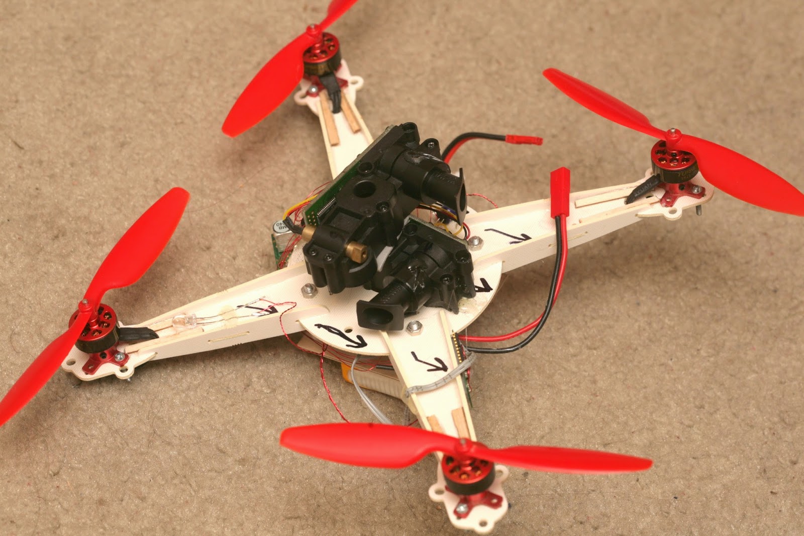
XV-11 lidar copter

lidar33.jpg?width=320


lidar01.jpg?width=320


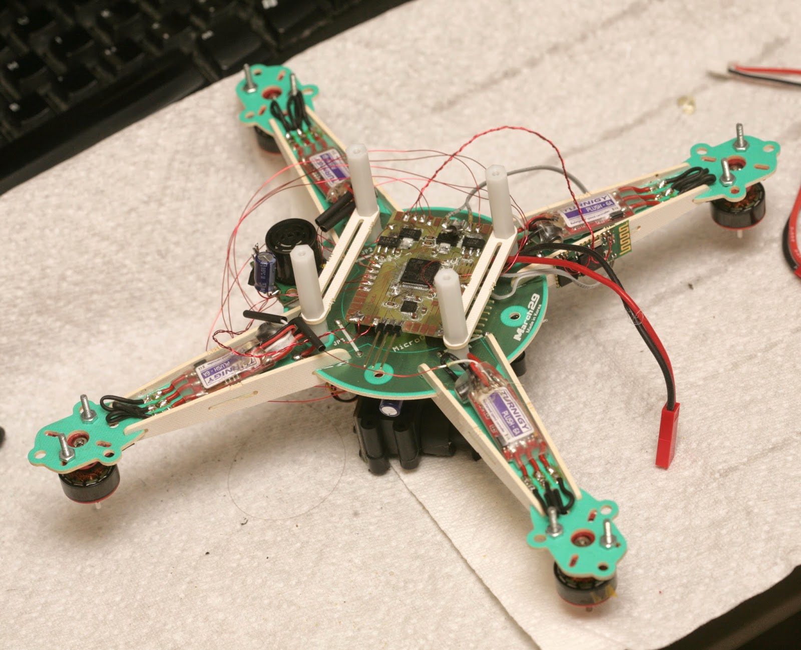
The journey begins with 3 XV-11 lidar modules.


lidar02.jpg

lidar04.jpg

lidar05.jpg

lidar07.jpg


lidar11.jpg


Random bits of information about the XV-11 lidar:

http://xv11hacking.wikispaces.com/


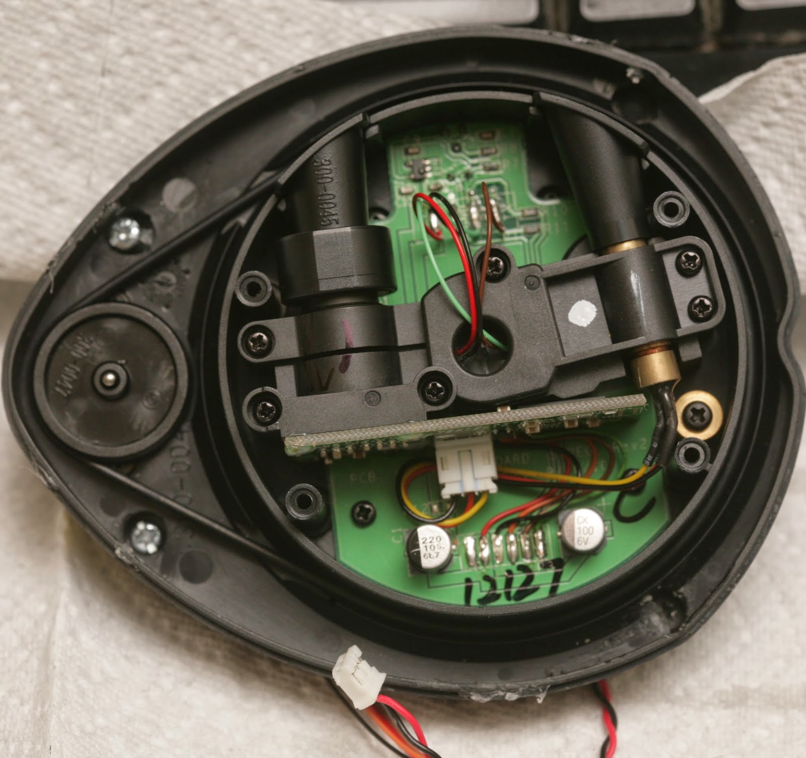
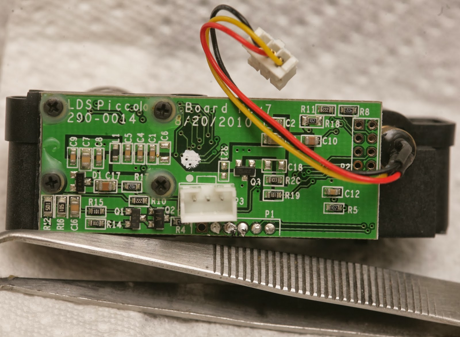
It's definitely a Silicon Valley startup product. There's no emphasis on miniaturization. It's loaded with unnecessary, cosmetic plastic. The PC board is 1/16" thick. It uses 1990's era 0603, 0805 components, full size JST connectors. The laser & camera are giant. It's bare minimum set top box parts repurposed for lidar.

The sensors came from fully assembled vacuum cleaners, since they still had the screws with threadlock.

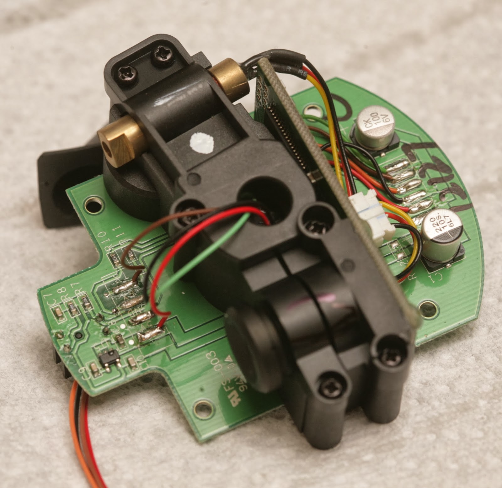
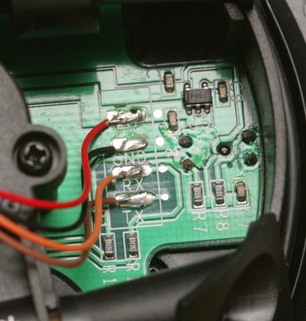
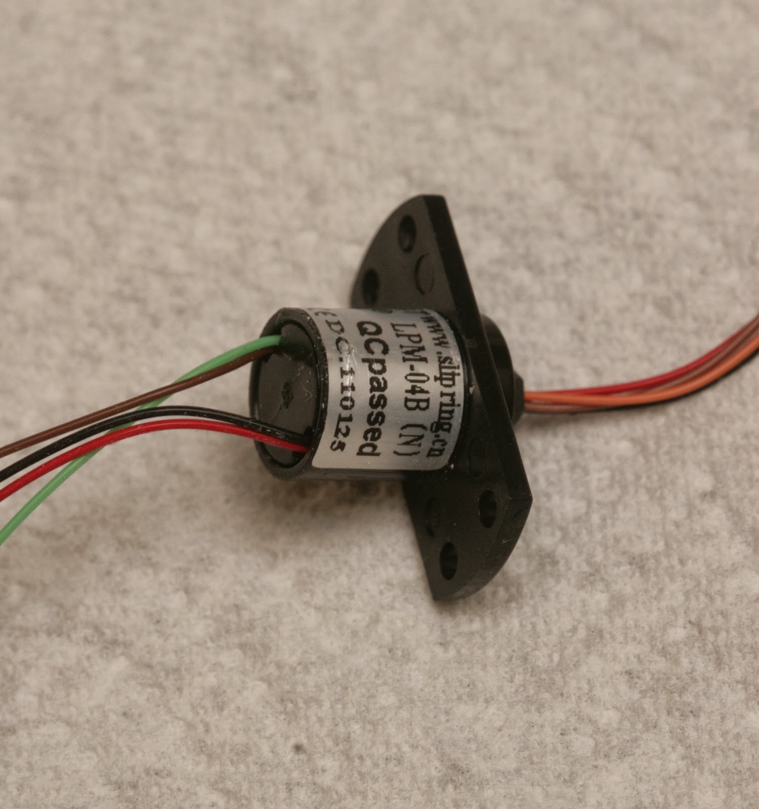
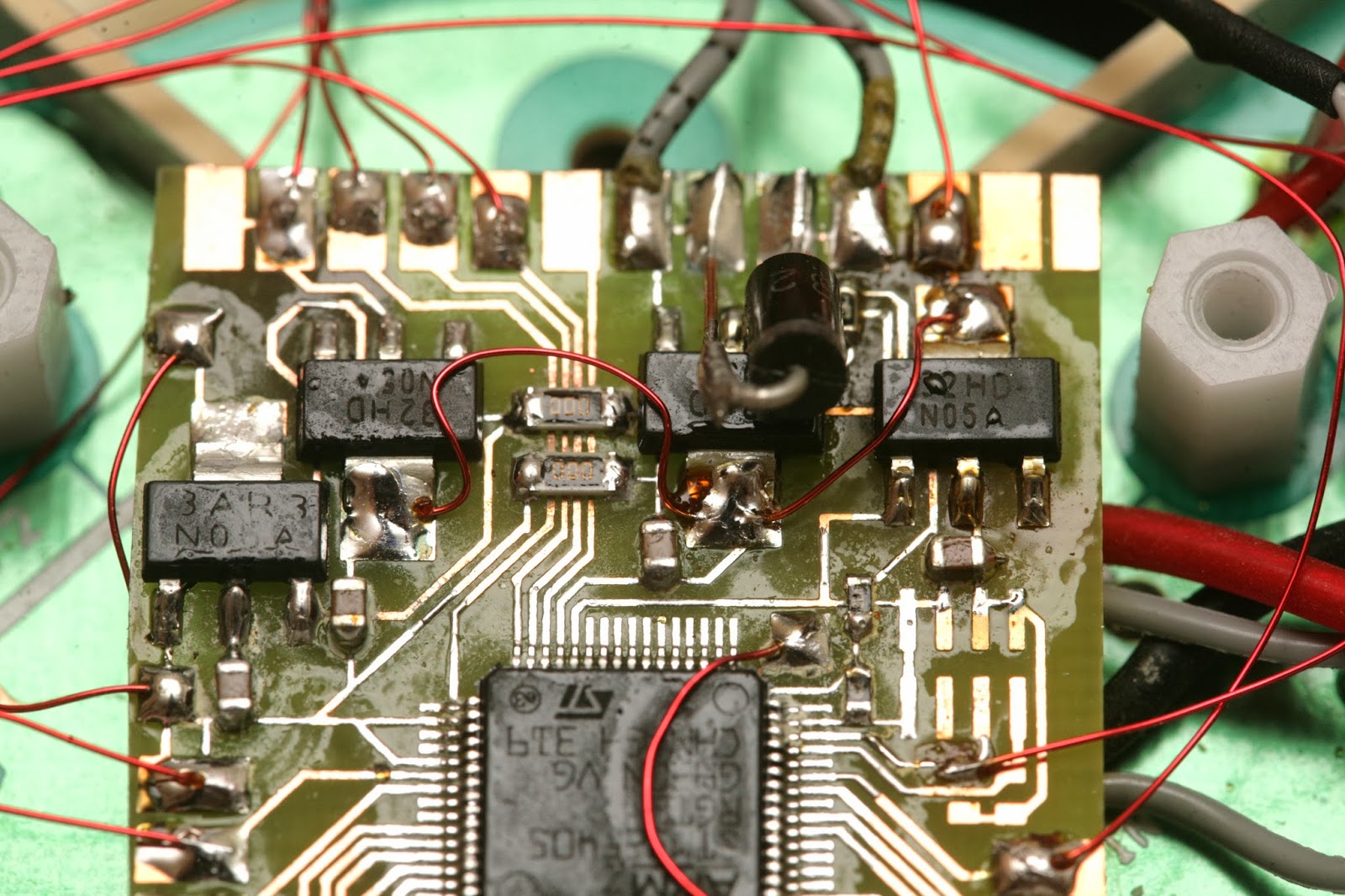
Since it clearly was too heavy to fly in its spinning form, it was time to extract the bare ranging element. The ranging element weighs 30g. The PX4flow weighed 17.5g. The board has 5V labeled, but it's converted to 3.3V by an LDO.

red: 3.3V
black: GND
orange: photodiode output
3.3V when interrupted 0V when clear

brown: TX data going into device
green: RX data going out of device


In true silicon valley H1B worker fashion, the TX & RX labels were reversed.  TX on a device normally means signal going out of the device, but the sensor has it meaning signal going into the device.


lidar17.jpg


A 220uF cap filters the 5V power. A 100uF cap filters the 3.3V power. The UART signals have 4.7k resistors.

lidar10.jpg

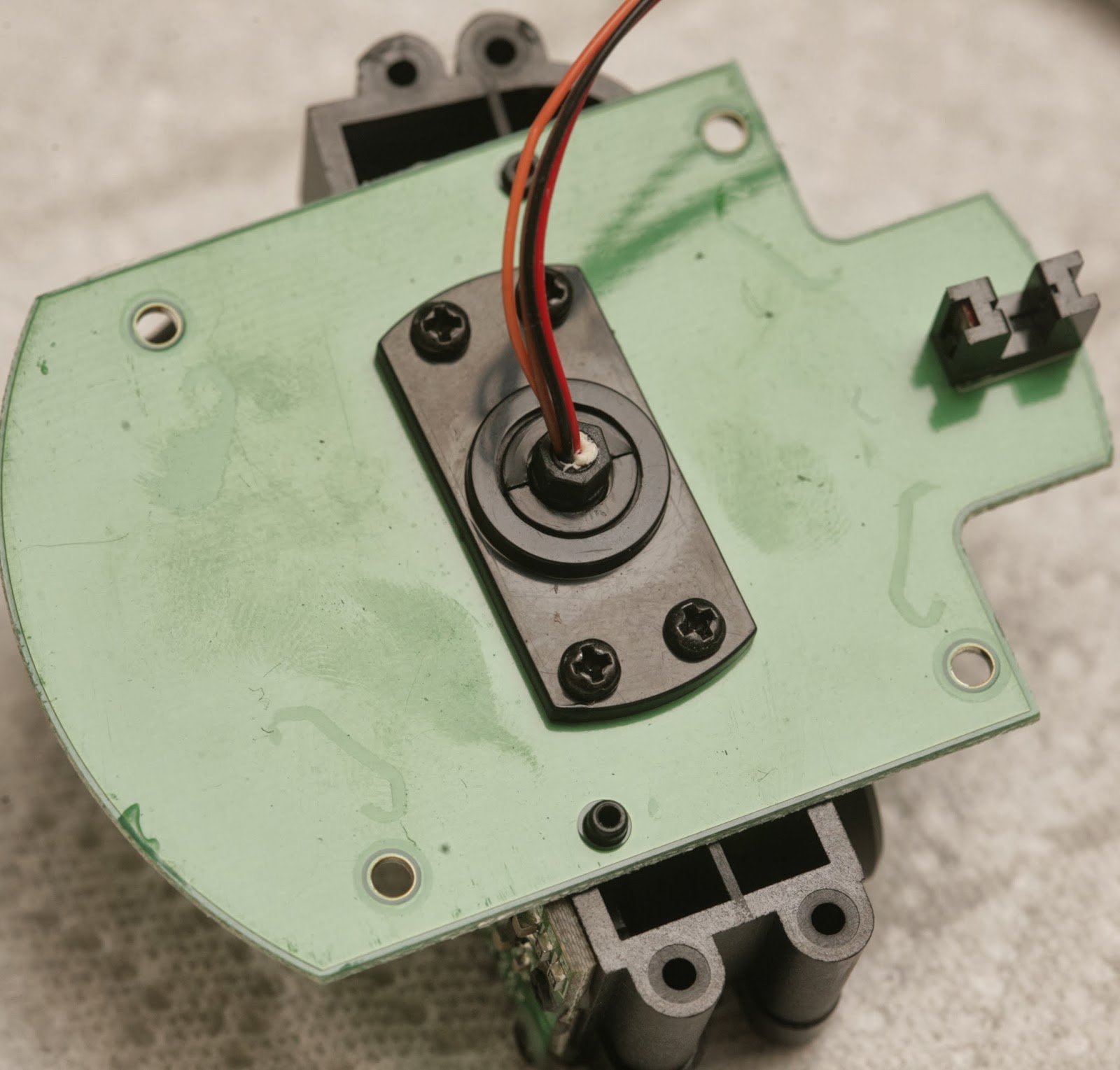
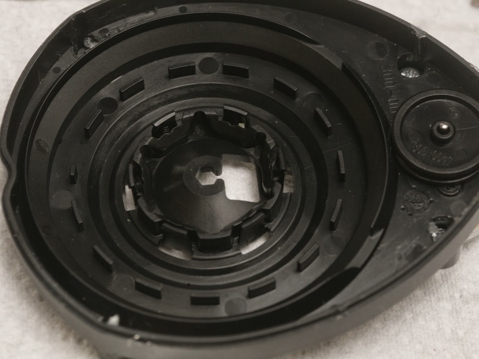
The photo interrupter pattern has 15 interruptions per revolution with a shorter one to tell it where the azimuth is.


lidar12.jpg

lidar13.jpg


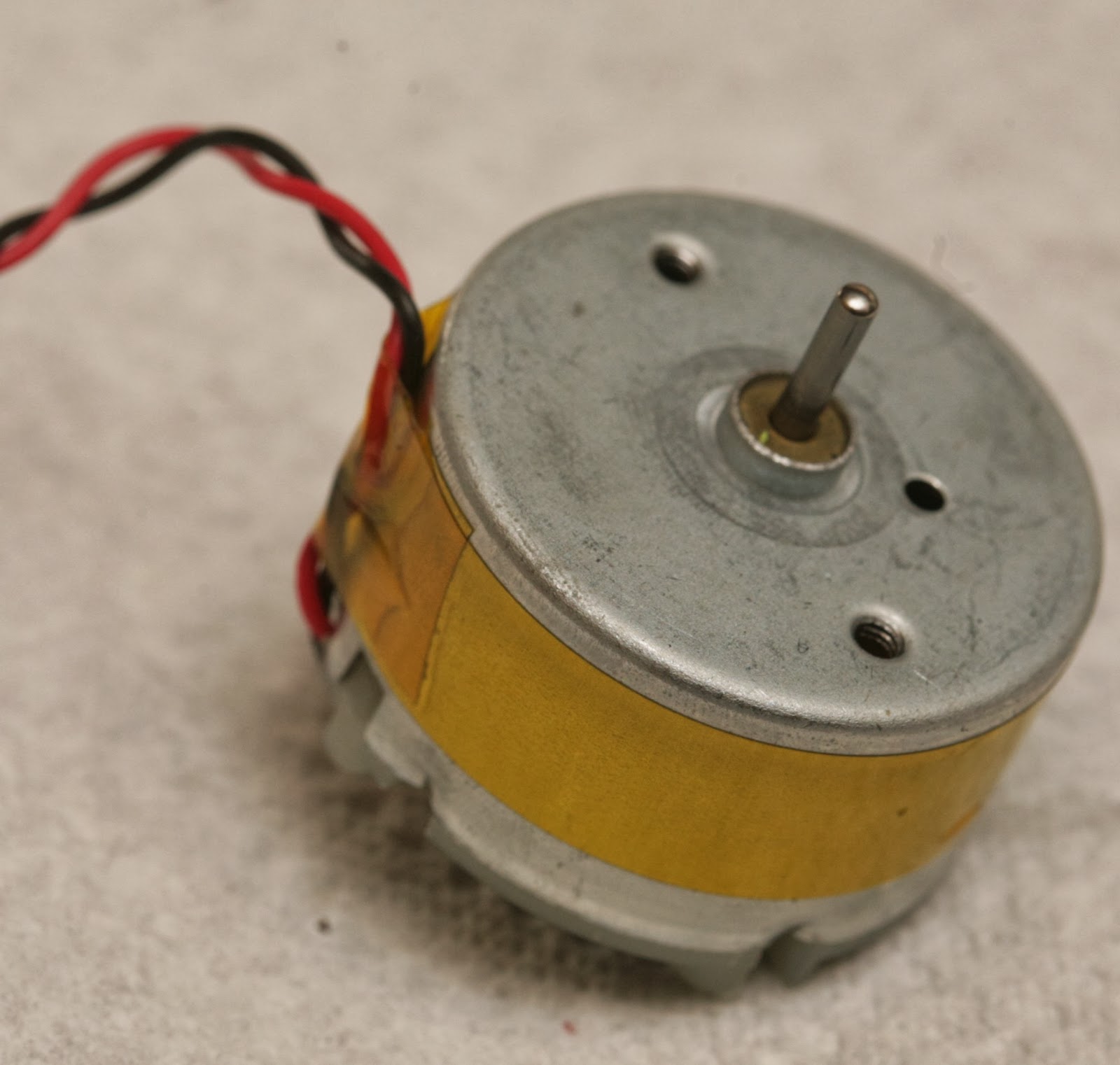
There's a decent quality bearing & brushed motor.

lidar06.jpg

The slip ring would be very useful if you're into synthetic aperture radar & have a way to drill perfectly aligned holes.

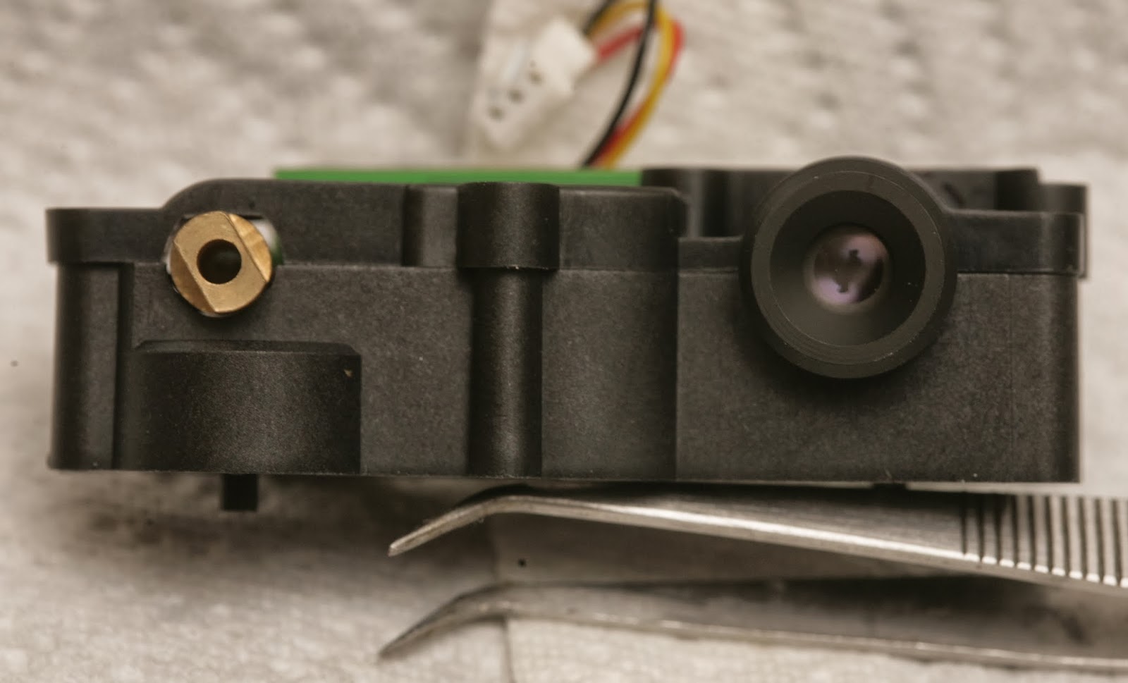
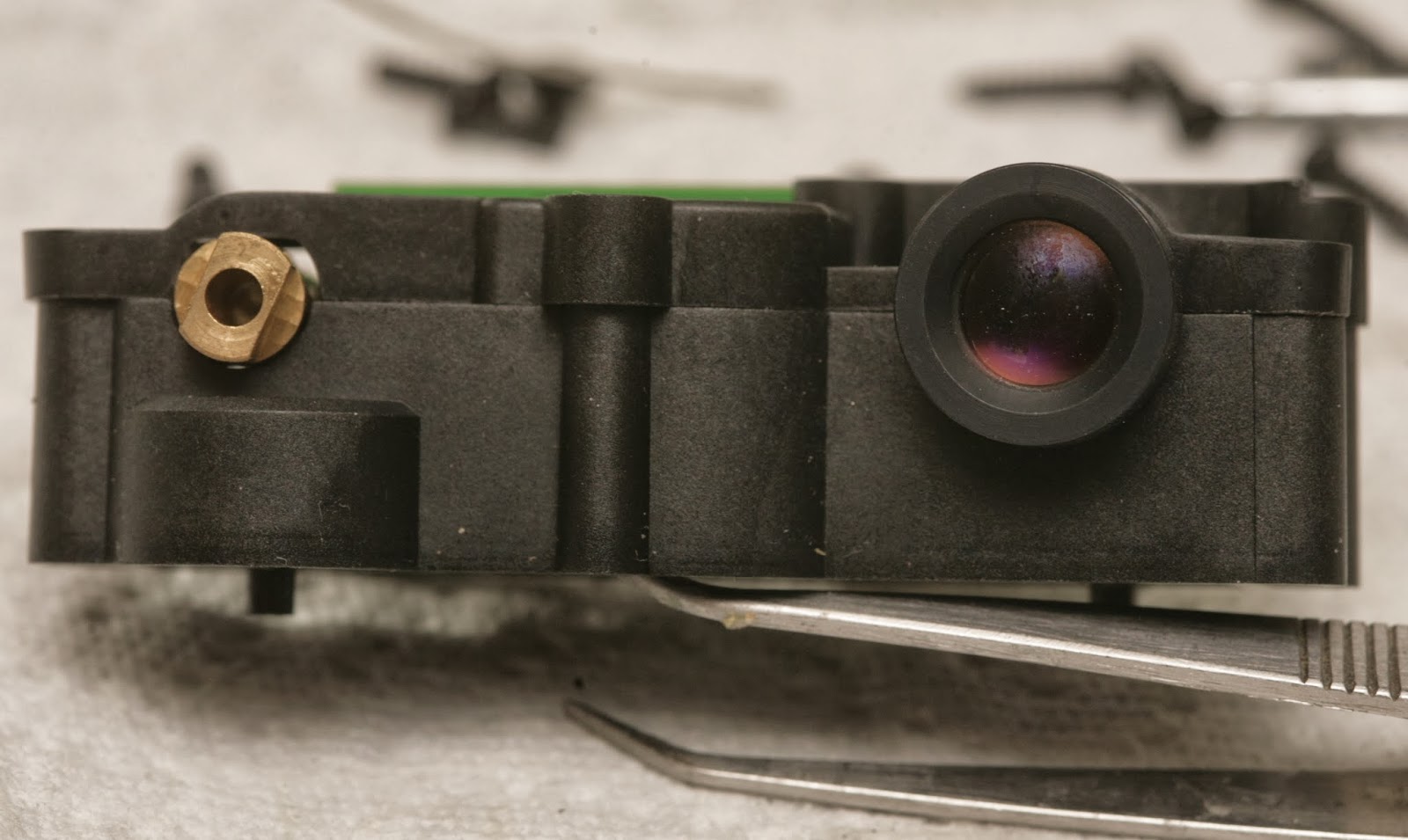
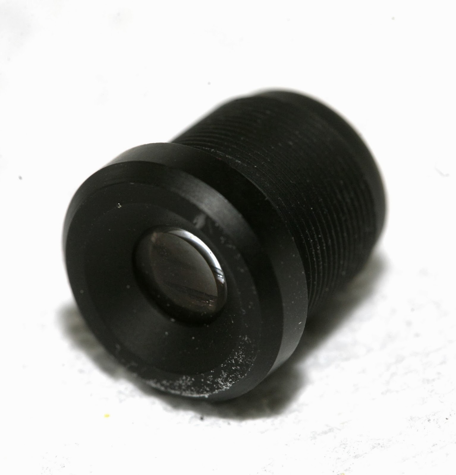
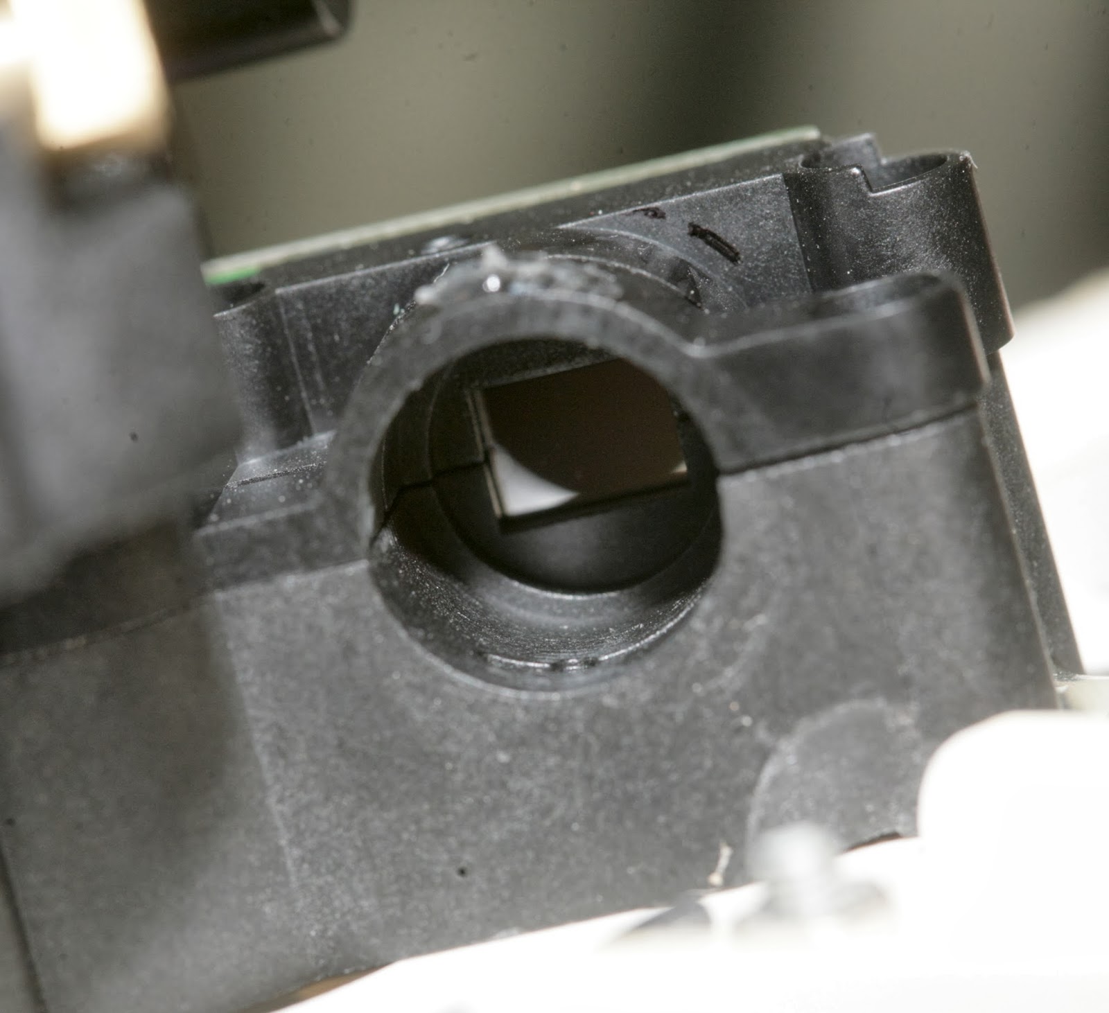
The lens is variable focus with 1 screw clamping it down.  Once unscrewed, it becomes lose.  There's no way to focus it without an unknown debugging mode.

lidar08.jpg

lidar09.jpg


2 of the modules had smaller lenses.  1 had a larger lens.

lidar14.jpg

lidar15.jpg


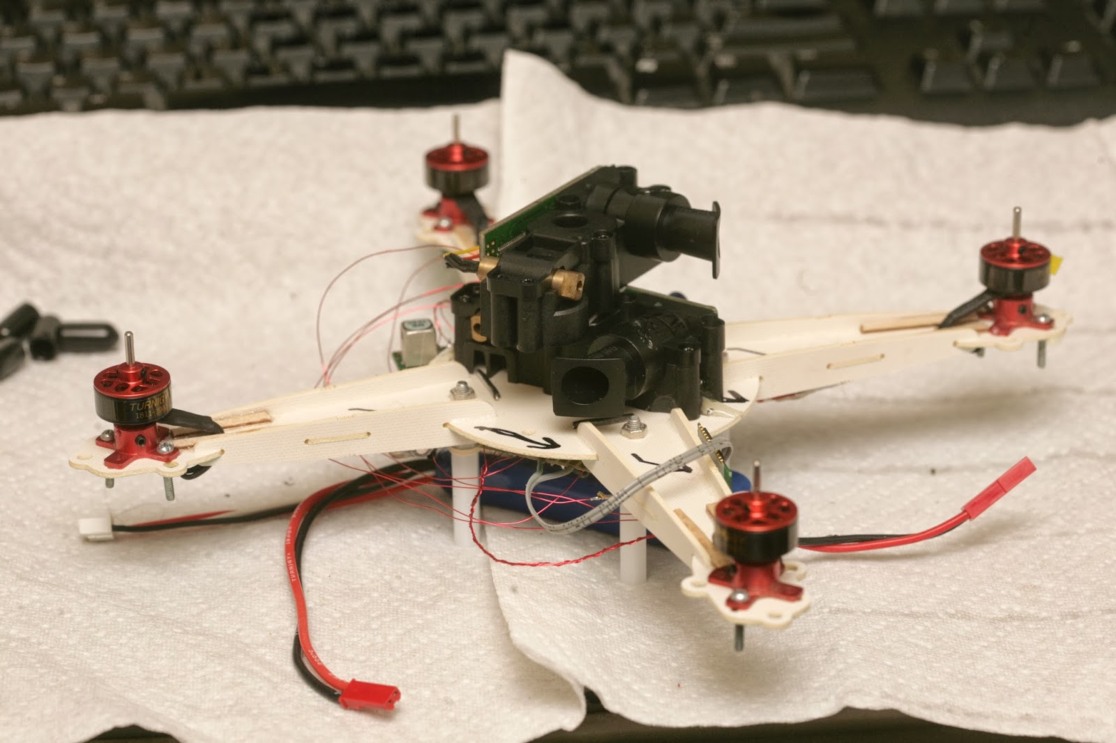
A 1st attempt at attaching everything led to a huge brick.  It's going to be really slow.  There's no durable way to attach the 2 LIDAR modules.

After a day of getting only error codes from the XV-11, the problem narrowed down to the rotation sensor.  Then it became clear that it needed a very very specific signal from its rotation sensor.

Lacking any meanings for the error codes, the key was reading the rotation rate encoded in the packets.  The internet claimed a very narrow range of 180-360 rpm being required.  There was no way it could do more than 6 scans per second.

lidar18.jpg


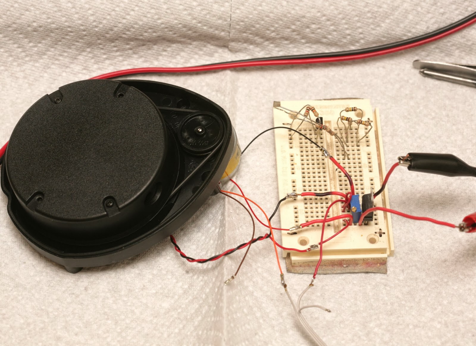
Even with a stock sensor that still spins, with the RPM perfectly dialed in, most of the readings were error codes.  The stock motor needed to be down to 2.8V before it was slow enough.  Then, there was routing the stock rotation sensor through the TX pin to capture it.


lidar16.png


That revealed the exact direction of rotation & azimuth code, 14 pulses of 50% duty cycle & 1 pulse of 25% duty cycle.  The 25% pulse needs to come after a 75% delay.  It doesn't work if the pulse comes before the 75% delay.  There definitely wasn't any margin in the software for any anomalies.


lidar19.jpg

lidar20.jpg

lidar21.jpg

lidar22.jpg


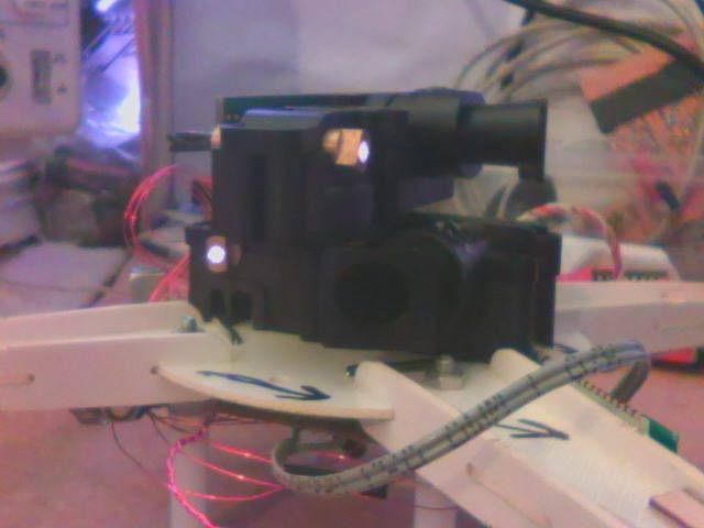
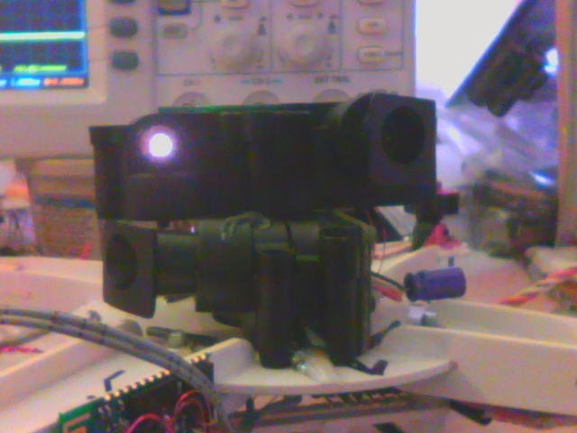
A crusty webcam reveals the IR laser.  It would be bad to look at it.  It's actually correlated to the rotation speed.  It doesn't turn on if there's no rotation.  It's very faint if the RPM is too high or too low.  It's only fully on inside the narrow RPM range.


So hacking it to stay on with no rotation & using it as a horizontal range finder is a dangerous application of something that's safe in its normal application.  You definitely need laser goggles.


lidar23.jpg


 RPM out of range

lidar24.jpg


RPM in range

lidar28.jpg


 1 of the sensors failed.  Tried focusing it, but it wouldn't detect farther than 1m.

lidar29.jpg


 It doesn't have any focusing threads.  It just slides in & out.

lidar30.jpg


 Tried bridging all the 3.3V regulators to cool off the board.  It was melting off the standoffs from only 0.2A.

lidar31.jpg

lidar32.jpg

lidar33.jpg


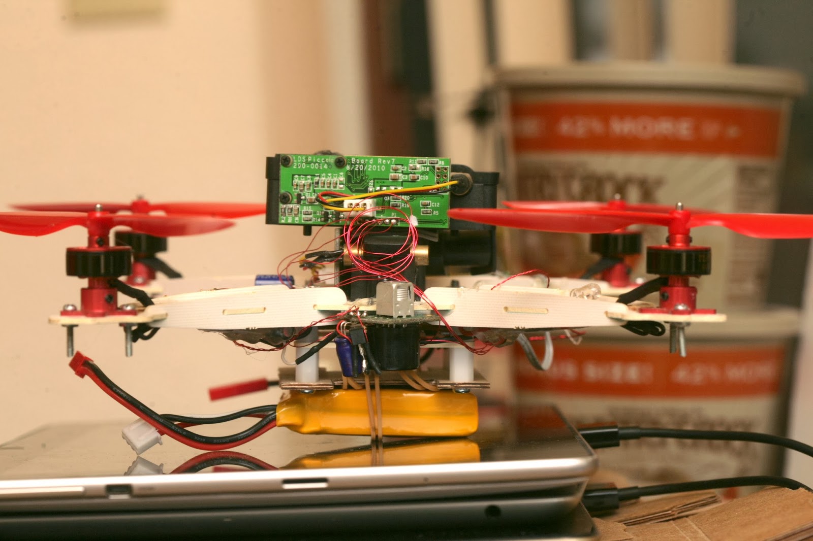
After a full day of replacing the sensor, the complete stack briefly flew manually.  It took nearly full power.  IMU drift was too high to fly more than a minute.  2 PWM pins were swapped.

The only way for the coordinates to work was to assume it was always pointing north.  The calibration has to face the direction it's going to point when flying.  Rotating the lidar output to point in any arbitrary direction caused massive glitches, every time it slightly rotated.


The video has several attempts to hover, several attempts at a waypoint mission. The waypoints failed because of an unknown software bug. The final flight was an attempt to hover, with the PID gains converging in on decent values. The testing ended when an arm broke, despite all the double layer wood.

Altimeter was all over the place. Seemed to be power distribution interfering with the cable routing or having the mane board under the frame.

Flight time was 2 minutes & maneuvering was real lousy. It definitely moved like a single female, very overweight & unwieldy.

It had to stay far from the walls to prevent crosstalk, yet be close enough to prevent detecting the floor. Didn't have any obvious floor detection at 1.5m from the walls & 0.3m altitude.

Velocity needed to be updated at 10Hz to have any success.

Absolute position was excellent. There was no more drifting.

Would recommend wearing laser goggles.

IMU drift made it drift. Would need to start over on the vibration problem, with the new board arrangement.


Read more…
Moderator

This is last Update on VRGimbal project , in first video you can see a big Handy Gimbal configuration from our customer 
- In the video you can see the Pitch , Roll and yaw smooth compensation .
- Control by Joystick.
- Follow frame on YAW.
In second video there is an another great example of test doing by Robert on his Hely class 600 controlled by VR Gimbal:
comment by Robert : 
Here's a quite test video from last weekend.  The results are not perfect, but there was a fair breeze blowing (about 20-30 km/h) and it was in Loiter which we all know can be quite busy. You can actually see the landing gear in the frame towards the end of the video which gives you some indication of just what the gimbal had to deal with.  Overall, I think this is pretty decent so far.  Main goal now is to work on better stability of the helicopter and reducing Loiter "busy-ness".
Now start to work on Mavlink integration , the board work fine on small gopro 2 axis configuration but also on big Gimbal configuration as in the video.
Before to end of this month will be also available the control gui on Android Pad.
here are available more techincal detail : http://vrgimbal.wordpress.com/
With last gui and firmware update.
The VR Gimbal is compatible with
best
Roberto
Read more…

3689581445?profile=original


Check out this link for the official wiki

http://planner.ardupilot.com/wiki/common-how-to-get-apmpixhawk-telemetry-on-your-taranis/

So just as with all my tutorials, This is simplifying the process of doing whatever it is aimed at.

Very often you will find tutorials on how to do things but they are poorly explained or make assumptions on what you know already,
I try to make the tutorial "for Dummies" put everything in to answer every question.
So here we go!

IF you would like one pre made and programmed

Search the following in ebay:

Telemetry adapter for APM to smartport

and simply plug and play or you can build one yourself in which case you will need a few things, Most importantly a Teensy 3.1, A servo lead and a Telemetry Plug.

http://cgi.ebay.co.uk/ws/eBayISAPI.dll?ViewItem&item=131139237471 In the listing is the link for a telemetry plug

And this is the link for the teensy.

https://www.sparkfun.com/products/12646 

you will need the above and a Soldering Iron and shrink wrap if you want to make things tidy.

Get your teensy and solder on the plugs

3689581293?profile=original

The servo plug is soldered on the same side as the Micro USB,

Red wire to the hole rite of the Micro USB.
Black to the hole left of the USB (GND)
white to the hole two down from the black (1)

On the telemetry side you solder the Yellow wire ( Number 2 on the plug to hole 9)

The green or blue wire depending on your cable (no 3 on the plug, goes to 10)

The black wire (5 on the plug, goes to the center hole on the back of the teensy.

the end result is this:

3689581503?profile=original

3689581557?profile=original

Now you need to program it:

To do this you need arduino, i will let you download that just google arduino installer.

Once downloaded you will need to download the teensy installer

http://www.pjrc.com/teensy/td_download.html

pick the one appropriate for your operating system.

once downloaded just run the installer.

You now have the teensy software for your computer, now you will need to copy the library folder contents into the Arduino library folder which is in

C:\Program Files (x86)\Arduino\libraries or where ever you told arduino to install.          

The library folder is in this zip MavLink_FrSkySPort_1.2%20%281%29.zip  

Now that all this is done you will want to copy the other folder in the zip file and extract it to your desktop, then open MavLink_FrSkySPort in arduino, it should just open not ask to be put in a folder, if it does, you did something wrong

3689581530?profile=original

Now that it is ready in arduino, go to tools and them select board and choose the teensy 3.1.

Then click upload3689581468?profile=original

This window will appear when you do , press the reset button on your teensy and it will start uploading.

It takes only seconds and that is it!

Now you plug it into the apm and SBUS.

And power it up using a UBEC , Do not use USB as it will not work.

The teensy will blink red while the APM initializes which can be up to 10s.

IT should then start blinking very fast, this indicates it is communicating.

If it continues to blink it means your APM is operating above 5v or it is not connected correctly,

IF it still blinks then your APM regulator might be blown. get a multimeter and check it out.

Now to get this telemetry on the taranis is simple, power on the taranis and when at the home screen press menu.

Then long press page twice to get to telemetry, scroll down to page two and change the - - - to each telemetry choice.

and the original creators post is here http://diydrones.ning.com/forum/topics/amp-to-frsky-x8r-sport-conve...

do thank him, his contribution made this possible

Read more…

3689581408?profile=originalHere I would like to share my impressions after UAV UNVEX 2014 exhibit in Madrid, Spain. It took place from 4th till 7th of March.

About third of people who attended expo were in uniform. MOD of Spain was personally here for about a half a day. Indra, MBDA, Thales and Airbus have created killer UAV system and that is the center of attention in expo.

It is definitely Spanish expo not European.  Today got just four visitors not from Spain. Two of them other exhibitors.

Nevertheless, got interest even from them and their English-speaking colleagues have arranged meetings to look at UGCS later.

Overall was busy enough not to get asleep or bored at booth and did not had time to go around other booths. Neighbors are building copters. For fixed wing, they will write their own autopilot, they found our software interesting and will pass info to developer of autopilot.

Two Microdrones resellers/users come by.  One have MD4-3000 mockup at their booth, I would like to see one in operation.

Couple of universities are present and one person have even already downloaded our software but have not yet installed.

Others are trying to write the software themselves. I told to look at ours and stop wasting their time. Initially did not got the message, but then I explained how much effort has gone into UGCS got thoughtful and told that will have serious thinking on their estimates.

Couple of potential resellers and more or less serious drone builders came along. Couple could be perspective, as they clearly understood that it is waste of resources to work on all fronts by themselves.

I have several meetings scheduled with other participants with whom had just chance to say Hi at the opening day.

It is central UAV event in Spain and is really UAV only. Even people from other industries have come to look at the expo.

Next day was less intense but overall better quality. People like how our product looks, especially after they have tried or seen how easy it is to use. Especially building tool is eye-catching piece.

Met couple of drone builders who were looking for mission planning software for their drones. Both are writing own autopilots. They will download UGCS and take a more detailed look at it later.

There where system integrators who liked option of custom maps, re-branding and our ability to add new autopilot in ~3 months.

Met several end-users. They like UGCS, but experienced ones are not that impressed. They have their specific usage, which we by being "universal" have not addressed properly at the moment. OEM and integration companies catch on idea of saving time and effort by adapting UGCS.  End-users, at least individuals or very small companies, on the other hand rather would like to have fully functional all-inclusive UAV package for particular task without need to go around shopping on different components and learning about all “Lego bricks” in UAVS.

Met three universities, they were interested in using free U|g|CS Open version and SDK for their projects.

Today military noticed our booth. Got little bit intimidating moment with whole delegation of military attaché getting around our booth, not used to ~10 uniforms peering at you with stone faces while you present your product.

Representatives from big companies came by. One where Thales subcontractors. They thoroughly watched every aspect of UGCS and told that will consider UGCS as simulation/training platform. Cloud Cap came by. They liked functionality and looks of UGCS.

One of integrators/service providers who works with Microdrones came for second time with his tech person. Tech person was not so impressed said that mdCockpit is good enough for him as he is used to that software, but U|g|CS map is definitely better and for first timers learning curve would be shorter with U|g|CS.

We have to work more on information about us and U|g|CS. To let world know we have platform that can be customized quickly and easy for particular task or individual needs of customer.

Last day of expo. Today mainly students, universities and institutes. They like our concept of free U|g|CS Open version for research and prototyping.

Came by two clusters. Madrid aerospace and tech hub of engineering companies creating parts for UAVs. I gave bunch of our flyers to pass around their members. They were caught on idea that with our help their members can deliver products faster to the market and save costs on mission planning software development.

In total 1200 visitors were here.

Today demo day. UAVs up to 50kg were flown. Most from http://www.usol.es

In Spain, autopilots from local airelectronics.es and Embention are popular.

Most interesting thing, Go Pro showed to be great camera. Some hi-tech gimbals gave worse picture.

Interesting product was small fixed wing. Made by USOL with Airelectronics autopilot on it. It had DGPS and therefore geo-referenced online video. Transmission and picture where very good even up to 2-3km. Frame, provided acceptably priced, could be good for our test purposes.

USOL K50 is nice craft. Acceptable noise, stable flight, auto landing with ease.

Fixed wing UAV in shape of foam brick with yellow tail from Aero-Tools. Despite the looks, it flies surprisingly well and lands on tarmac without any damage. Have agreed to catch up later to discuss using U|g|CS for the UAV.

Had a chat with Indian and South Korean defense attaches. Nice guys and surprisingly well versed on topic. Listened with interest on our OEM advantages and promised to pass our message to manufacturers they know at home.

In the end I would like to thank whole team of U|g|CS. hank you guys for creating great product which leaves impressed both students and big players in UAV industry alike.

Thanks,

Janis

Read more…

3689581382?profile=original

Since about 2010 3d printers have been becoming more and more popular, thousands of news reports on the good and bad of 3d printers for the public, politicians looking to ban 3d printers for the public, others looking to put them in all schools, as with any new technology there was outcry and applause.

From the beginning people have wanted to make there own frames as let me be honest, the ones available to buy are well...not great, at least they do not do exactly what you want, so making your own frame is a serious step.

In this case we have the T4, it is great, it looks amazing, it is very clean and most importantly it is a very efficient design

it has plently of space for 3S 6000mah or 4S 4200mah Lipo. and a variety of electronics.

This design is all available on CAD drones

go check it out!

http://caddrones.com/blogs/3D+Printed+Parts

There is designs for all sorts of devices including laser cutters.

3689581271?profile=original

As always good luck from me Jared Reabow

Read more…
3D Robotics

3689581339?profile=original

Worth watching the video of the ABC Denver news report of a drone flyaway (it was a Storm Drone 6 with a DJI Naza controller).  A screenshot of DIY Drones makes an appearance ;-) I can't embed the video, but you can watch it here. 

DENVER - We've seen flyers for lost dogs, lost cats, even lost birds, but never a lost drone -- until now.

Loyal Merrick says his $2,000 Storm Drone 6 with a $400 GoPro camera attached just floated off like a balloon.

He has posted flyers around the Denver metro area.

7NEWS has discovered that drones floating away from their operators are becoming more common with this new technology.

"This one makes it bank, this one makes it turn," said Merrick as he showed how the controls work on the transmitter.

He still has the transmitter, but as for the aircraft itself, it's gone.

"I tried to run in the direction to get closer to it, and I don't know," said Merrick. "I just lost track of it. It's that simple."

Merrick was flying the drone on Friday over the now closed Rosedale Elementary School.

"And then it got a little bit too high," he said.

So, he hit the fail-safe button on the transmitter.

"It's supposed to return to its exact take-off spot," said Merrick. "Just like a boomerang. It didn't do that. It just kept flying off in the same direction."

7NEWS discovered several drone blogs indicate this is a common problem.

Merrick invested in his drone for a possible future aerial photography business.

"If you can get a GoPro up in the air at the right place, it just can capture the beauty of Colorado," said Merrick. "I could use it to photograph real estate, especially high-end real estate, weddings, bike races, events. Right now it's just a hobby, but it could be a career."

Even though the FAA has declared you can't fly drones for commercial gain, Congress has mandated the FAA integrate drones into commercial airspace next year.

"I took a big risk, but that's what entrepreneurs do."

As for the liability of the drone flying off, Merrick says even if it crashed it wouldn't do much damage because the carbon fiber is so lightweight, and the drone itself is noisy.

"So it's not going to sneak up on people. It's not going to be hitting people. People are going to see it and get the heck out of the way," Merrick said. "For me, this was just a very expensive first mistake."

Read more…
100KM

A new tools for forest restoration monitoring

3689580935?profile=original( Our new Iris with video team from Al Jazeera Earthrise series )

Recently we try the Iris equip with Gopro Hero 3 in front to monitor the progress of forest restoration in North Sumatra National Park.

The beauty of this system is its full automatic capability. Pilot or the forest restoration manager just need to program a series of waypoints and the desire altitude according to the resolution require. Then the Iris will take off by itself once it was commanded, slowly accents to altitude and fly in a constant forward speed. It also navigate the grid line well.

This system also provide a very important and essential properties because of it's capability of vertical takeoff and landing. In tropical rain forest, one almost impossible to find a good landing spot for plane base UAV. Parachute recovery may end up hanging the drone on top of tree canopy because of changing winds direction.

The only drawback of this system currently is the flight duration. With a Gopro on board, we can only program for a 7 to 8 minutes flight which travel a distance of about 2 KM. It will be great if 3D robotic will upgrade it to fly for at least 20 minutes. With a longer arm, low kv dish type motor and a big propeller and battery, I think it is not too difficult to get there.

But even with the current set up, one can easily monitor 20 to 30 hectares of forest in less than 10 minutes. 5 fully charge battery will enable the forest manager to cover more than 100 hectare in less than 2 hours. Compare to ground survey, a few forest ranger may take weeks to complete the same task.

As the Iris is relatively new to me and the fact that I am also new to arducopter firmware, I will need to accumulate more flying hours with it and explore different functions the powerful Mission Planner can offer. I already had a very good start thanks to the Ready to Fly Iris. I do hope to discover more ways to use the system for various conservation, research and agriculture work.

https://www.youtube.com/watch?v=0LtpnuP3shI


Read more…
Developer

3689579503?profile=original

[UPDATED to 2.0.7: we had a serious issue with serial connectivity and APM2.x and FTDI, it now fixed. All users that download 2.06 will be notified automatically of the new release]

APM Planner 2.0.7 has been released. This is the first official stable release of AP2, which is the cross-platform (Mac/Windows/Linux) ground station/setup utility for APM/Pixhawk-based UAVs.  Here's a list of features

APM Planner 2.0.7 Release Notes

Here’ the first official release of APM Planner 2.0.
Features
 
General
  • Auto Update. new stable versions will be notified automatically.
    • will add a feature to also add daily builds to this.

Flight Data View
  • Real time monitoring of telemetry information (Quick View & more detailed Status View)
  • Real-time control of UAV
  • Message view tat shows PreArm warning messages
  • Primary Flight Display (HUD)

Flight Plan View
  • Waypoint editing
  • Saving and Loading waypoint files
  • Map Vendor selection

Initial/Config & Tuning Views
  • Full Configuration of APM:Plane and APM:Copter (APM:Rover is a work in progress)
  • Reworked Battery Monitor setup where you can select known presets
  • Parameter Download for known frame types
 
Graph View
  • Real-time plotting of MAV link telemetry values
  • Dataflash Log analysis
  • Value are plotted on a range that is scaled automatically
  • Values can be group on in same range (up to 4 groups)
  • Ranges can be set manually
 
Terminal View
  • Allows access to the APM CLI Interface
  • Used to download Dataflash logs (MAVLink downloading of logs coming soon)
  • Option to convert logs to KML format for Goole Earth view.

Known Issues:
  • Google Maps shows only outlines at some zoom factors
  • When switching between APM:Plane/APM:Copter/APM:Rover restart is required
  • Multiple MAV support is not fully tested and is a work in progress

more detailed issues can be found here http://github.com/diydrones/apm_planner/issues
For support please post here first APM Planner Support Forum
Going forward
  • Improve support for Google Maps
  • Improvement of Waypoint editing to support specific APM waypoint types
  • Automatic grid pattern generation
  • Incorrect warning on windows install about installing Win C++ 2008 redistributables (just ignore, click OK)

Enjoy: and please report any issue you have, the next stable update is scheduled in about 2 weeks. We want this to be continuous improvement on that schedule.

Thanks AP2 Team.

3689579400?profile=original

Read more…
3D Robotics

With ten days to go, the LIDAR-Lite laser rangefinder project is just $5,000 from its crowdfunding goal (it's 91% funded). Now's the time to back it and put them over the top!

I love this project (I've backed it) and we're integrating it into the APM code. Along with using it for terrain following with copters (it's less noisy than sonar), we're optimistic that it will help with precision autolanding with planes, by providing precise altitude date under 10m so the aircraft can flare at exactly the right moment. We're going to fly an early prototype with APM:Plane and datalog the results; if that's successful, we'll put it into production and give it full support.

Read more…