All Posts (11086)

Sort by
3D Robotics

The cool LIDAR-Lite rangefinder project hit their base goal and are now just $1,000 away from their stretch goal of $75,000. If they hit that they'll switch the LEDs in the current design for real lasers, for even longer range and accuracy. If you haven't backed the project, now is the time. Let's push them over the top! (I've now ordered a second set)

[UPDATE: They did it! Lasers are go]

Read more…

NAVIO: Raspberry Pi autopilot

Navio.jpg

Hi guys!

Want to share what we have been working on lately, it is an autopilot shield for Raspberry PI. It is called Navio and has everything what you will usually find on an autopilot platform. A powerful platform like Raspberry gives many opportunities like streaming video, 3g,wi-fi, ethernet connectivity and possibility to run computation intensive algorithms like Kalman filtering or RTK GPS. RTK or real time kinematics is one of the main features of the board, it is equipped with a GPS capable of providing raw data output: carrier phase, pseudo-ranges and ephemeris. Processing this data against a stationary receiver increases GPS positioning accuracy to centimeters. A radio link between the two is required, but you anyway have it to GCS. If network RTK is available in your area, you can use corrections from the internet over 3G thus eliminating the need in second receiver.

Our plans include porting APM to Raspberry Pi + Navio.

Features:
MS5611 barometric pressure sensor
MPU9150 (MPU9250 on future models) 3-axis gyro, accelerometer and magnetometer.
ADS1115 16-bit ADC
PCA9685 PWM extender to control servos
u-blox NEO6T GPS module with raw data on SPI, we saved the only UART on raspberry for Xbee or different telemetry.
13 servo connectors
Pixhawk compatible UART, I2C and SPI connectors
RGB LED – just because we love them

Truck.jpg

What we wanted to know if there is any interest in platform like this, because we have everything ready for manufacturing and to keep the cost down we need to manufacture as many as possible. We have written tutorials how to use the board and are now preparing them for publishing, all code for the board will be released under open source license. Some more pictures and details are available on our website.

Read more…

3689583437?profile=originalContinuing on from the last post on this subject, here's a complete sparse point cloud generated from some 40 images. In the twoview case it became apparent that you can triangulate points from 2 images. In a two-view match you sometimes get inaccurate or incorrect matches, which lead to outliers. If the feature is consistent and static, you can triangulate points from a 3-view instead. Such 3+ matches quite perfectly eliminate outliers, which leaves you with a sparse point cloud that then mostly contains inaccuracies due to (relatively rough) pixel measurements, incorrect distortion parameters, slight drifts in feature recognition, pose fitting errors, etc.

In this stage of processing, the sparse point cloud generation, the objective is to discover camera poses at the same time as adding new points to the cloud so that future matches can take place and the cloud can grow. In this case, I use the point cloud itself to estimate future poses. For each 3D point, I maintain a list which images contributed to that point. Then a new image which has matches with already registered images can figure out which feature match in its own image corresponds to an existing 3D point in the cloud. Then I simply build a list of 3D points and 2D points that should correspond together. When I have that information, I can figure out, based on how the 3D points should appear in the image, where the camera ought to be located. So it's basically "triangulating backwards" from the points to the camera knowing where they are projected on the sensor in 2D and then figuring out where the sensor was located.

When I have the pose, I triangulate matches that I do not yet have in the cloud as new 3D points and grow the cloud a little.

The order in which you attempt to add cameras (images) to the cloud is important because the current state of the 3D point cloud determines how many points you have available for pose estimation. If that number is low, you may have very little or inaccurate information (outliers!) to do the pose estimation. If the pose is bad, the point cloud deteriorates and future poses cannot be determined.

So, how does it work in more detail in a way that makes the solution stable?

  1. "Boot" the point cloud using two images only as in the previous article.
  2. Grab a new image and find all matches with other images that we already have camera poses for.
  3. Create a vector of 3D (point cloud) positions and 2D (image) points which should correspond.
  4. Estimate the pose in combination with an algorithm called Ransac to remove outliers (grab some points, try a fit, see if it can improve, exchange some points for others, iterate towards a best fit).
  5. Refine the pose estimation further.
  6. Triangulate new 3D points that we don't have yet by looking at matches from this image with other images (cameras) we already have in the point cloud.
  7. Refine the new 3D points.
  8. back to 2 if there are more images.
  9. Print out a point cloud for all 3D points that have more than 2 "views" (points which originated from more than 2 images).

This sparse point cloud, although crude, can already serve certain purposes. It still needs to be subjected to a process called "Bundle adjustment", where poses and 3D points are refined further on a global scale. The outcome of that improves the appearance of planar surfaces and further refines the camera poses.

So what does this teach us about collecting uav data?

  1. Always make sure that each feature appears in 3 or more images to ensure it's stable. Too little overlap can still produce point cloud data, but at the cost of having many outliers and low numerical stability of the solution in the processing pipeline. Some processing tools will simply discard the feature, others keep them and attempt to  "smooth" them out into the rest of the cloud, usually creating humps or valleys in objects. Make sure the survey area is large enough for all objects you want to have with accuracy. Better data is much better than relying on algorithms to interpolate/extrapolate and in other ways fantasize data together.
  2. In processing this set I recognized that I had a very large number of stray points right above an area where a tree was expected. Turns out that features of that tree were not stable and not recognized in 3+ images, so triangulation produced a very noisy subcloud in that location. Eventually all those points disappeared in the final cloud, leaving a hole in the point cloud at that location, because the ground under the tree was never triangulated. Again: vegetation needs very high overlap.
  3. Adding (correct) GPS to images reduces processing time if the pipeline knows how to use location data. In this set I used the telemetry log (over data), which contained errors, sometimes 60 degrees out. Not all tools (not even commercial ones!) deal with such GPS errors or missing information correctly. Worse even, the images were eliminated from the set, reducing local overlap and thus the number of views per feature, which could lead to bad pose estimations and local inaccuracies.
  4. It even further explains why surfaces like water cannot be mapped. Everything that's moving around while pictures are taken result in features that match in 2 images, but not the third. Even if it matched consistently, it will eventually be filtered out as noise.

Interesting ideas:

- use two cameras instead of one, horizontally apart even by just a little bit. This will double the number of images and increase the chances to reproduce vegetation correctly (stereo imagery without the "snapped at the same time" constraint).

- variable speeds and CAM_TRIGG_DIST for a mission? When over simple geometry speed up, when over complex geometry slow down to improve the match quality.

Read more…

Philippine Disaster Relief Mapping

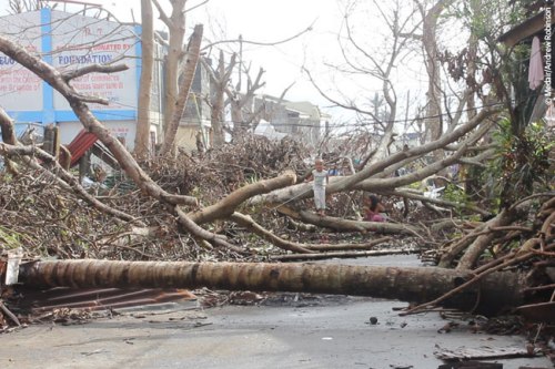
3689583699?profile=originalIn the wake of the strongest typhoon in recorded history, Swift Radioplanes LLC of Prescott, AZ recently returned from the Philippines, where they created aerial maps of the extensive damage as part of an open-source project. Shortly before Christmas, the team packed two of their Lynx Unmanned Aerial Systems (UAS) and deployed to the central Philippine island of Cebu, where Super Typhoon Haiyan left behind a magnitude of destruction that is still not yet completely known.

The team spent seven days collecting thousands of high-resolution photos that will be composited into 3-dimensional maps to be given to the Philippine government and the worldwide academic community. “Our main objective was to document the destruction in the remote areas that the government hasn’t gone into,” said Stephen Rayleigh, co-founder.3689583753?profile=original

In the Philippines, the Department of Social Welfare and Development (DSWD) is venturing out into the remote villages, where assessors must physically see a destroyed home before they can give governmental aid. They are reportedly understaffed, and the task ahead of them is far from over. Meanwhile, storms like Haiyan have become more frequent and increasingly severe, a pattern that some researchers say is due to climate change.

The company, which makes the small, hand-launched UAS, donated over 20 square kilometers of imagery, ranging from 2 to 7 centimeters per pixel in resolution, to the DSWD and universities in the Philippines and the United States. Soon, that imagery will be hosted on the Internet under a Creative Commons open-source license, allowing researchers to use the imagery for post-disaster UAS studies.3689583725?profile=original

Embry-Riddle Aeronautical University, where Rayleigh also works as a part-time professor, assisted in the post-disaster effort. The UAS program at the Prescott, AZ campus provided travel funding, spare airframes, and sent one of its students enrolled in the UAS minor.

Rayleigh says the Lynx UAS was built for deployment into harsh environments like the ones they encountered in the Philippines, and the design was inspired by his company’s prior experience as UAS operators in the U.S. Army. “The technology we’ve developed- we want to see it used to help people around the world, and I think we’ve shown that it can.”

Haiyan left as many as 7,986 people dead or missing across the Philippines, according to a recent government tally. Much of the country is still recovering from the massive disaster, and bodies are still reportedly lying under the rubble. “It was a demanding environment, and it certainly pulled at the heartstrings,” remarked Rayleigh, “but it has to be done.”3689583751?profile=original

Read more…

multi-spectral

The EigenCAM app is an imaging and analysis software specifically designed for multi-spectral imaging applications to extract as much information as possible from the images. Promising applications include near infrared photography, vegetation analysis, assisted night vision, authentication, biological detection, urban growth analysis, defeating camouflage, disaster assessment, etc.

http://www.eigenimaging.com/eigenCAM-App

How about this app and camera?

Could be a cheap and great way to have more options.


Read more…

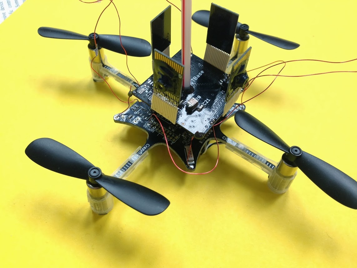
eoU6wviPzAMERIWnGof_7BPpNcgrMBYhWWnEz7I-7Ig=w1143-h857-noI've been working on adding visual stabilization to a Crazyflie nano quadrotor. I had two goals- First is to achieve the same type of hover that we demonstrated several years ago on an eFlite 'mCX. Second is to do so in extremely low light levels including in the dark, borrowing inspiration from biology. We are finally getting some decent flights.

Above is a picture of our sensor module on a Crazyflie. The Crazyflie is really quite small- the four motors form a square about 6cm on a side. The folks at Bitcraze did a fantastic job assembling a virtual machine environment that makes it easy to modify and update the Crazyflie's firmware. Our sensor module comprises four camera boards (using an experimental low-light chip) connected to a main board with an STM32F4 ARM running. These cameras basically grab optical flow type information from the horizontal plane and then estimate motion based on global optical flow patterns. These global optical flow patterns are actually inspired from similar ones identified in fly visual systems.The result is a system that allows a pilot to maneuver the Crazyflie using control sticks, and then will hover in one location when the control sticks are released.

Below is a video showing three flights. The first flight is indoors, with lights on. The second is indoors, with lights off but with some leaking light. The third is in the dark, but with IR LEDs mounted on the Crazyflie to work in the dark.

There is still some drift, especially in the darker environments. I've identified a noise issue on the sensor module PCB, and already have a new PCB in fab that should clean things up.

Read more…
3D Robotics

Facebook buying solar drone maker

3689583629?profile=originalA few weeks ago it was rumored that Facebook would buy Titan Aerospace for long-duration solar-powered drones to provide Internet access in the developing world. Today, however, the company announced that it was actually buying Ascenta, a small British firm that does the same thing (or perhaps it will buy both of them and has only announced one). From the New York Times:

Watch out, Google. Facebook is gunning for the title of World’s Coolest Place to Work. And its arsenal includes unmanned drones, lasers, satellites and virtual reality headsets.

Mark Zuckerberg, co-founder and chief executive of Facebook, announced on Thursday that the company was creating a new lab of up to 50 aeronautics experts and space scientists to figure out how to beam Internet access down from solar-powered drones and other “connectivity aircraft.”

To start the effort, Facebook is buying Ascenta, a small British company whose founders helped to create early versions of an unmanned solar-powered drone, the Zephyr, which flew for two weeks in July 2010 and broke a world record for time aloft.

“We want to think about new ways of connectivity that dramatically reduce the cost,” said Yael Maguire, engineering director for the new Facebook Connectivity Lab. “We want to explore whether there are ways from the sky to deliver the Internet access.

...

The lab is part of Mr. Zuckerberg’s ambitious Internet.org project to bring the Internet to the two-thirds of the world’s population without Internet access. With partners like Qualcomm and Nokia, Facebook is working on technology to compress Internet data, cut the cost of mobile phones and extend connections to people who can’t afford them or live in places that are too difficult to reach.

That last part of the problem — reaching the 10 percent of the world’s population that are in areas difficult to reach via traditional Internet solutions — is the initial focus of the connectivity lab, said Mr. Maguire.

Currently, satellites can deliver Internet to sparsely populated areas with spotty Internet connections, but the cost is very high, said Mr. Maguire.

Facebook wants to explore whether access could be delivered more cheaply through both new types of satellites and unmanned aircraft.

The company envisions drones that could stay aloft for months, even years, at a time at an altitude of more than 12 miles from the surface of the earth — far above other planes and the ever-changing weather.

Read more…

Get a College Degree in "Drone"

3689583658?profile=original

LAS VEGAS (FOX5) -

The FAA has picked Nevada as one of six unmanned aerial systems (UAS) testing sites.

UNLV College of Engineering's Dean Dr. Rama Venkat said the university's professors and students will help lead the way in research, testing and development.

"We first of all need to integrate them into the air space. We need policies, procedures, regulations. We need to figure out who can do it, is it safe, will people's privacy be violated," Venkat said.

The curriculum for the minor will include a law class on privacy issues, and the educationicon1.png will evolve as they explore and learn more.

In spring of 2015 a continuing education certificate will be available for those seeking a career change.

UNLV rolling out drone minor in fall

Read more…

DIY in AUVSI (Get out your vote!!!)

3689583423?profile=original

I know there are many in the DIY community who also do UAV/UAS work as their profession and are members of AUVSI.  I cast my ballot this morning and the leadership is still very top heavy in Defense Corporations and Mega Corps.  This year we do have a chance to have our DIY and small business voice represented with two people who are up for election.

Ben Miller (http://benforauvsi.com/), of the Mesa County Sheriff's Office, is running for the Public Safety Board position.  Ben currently operates my companies aircraft, Falcon UAV.  We used to run Procerus/Lockheeds Procerus autopilot but have now converted all of our aircraft to APM and Ben is fully on board with that.  In fact this week Ben and I executed some Falcon/APM mapping missions over in Mesa County.  He is a firm believer in the power of open source, member of DIY Drones, and supports two COAs for Falcon and Falcon Hover running the APM autopilot.

Mark Blanks, Kansas State University, is running for the Academia Board position.  Mark is a very common sense down to earth guy.  Their university team is  very much a DIY team putting together platforms for Agriculture and Public Safety uses.  Mark is currently running a program dealing with airworthiness certification and will be an advocate for small businesses who don't have the money and funds to put their aircraft through an expensive airworthiness certifications and will apply common sense to how small businesses would operate.

If you are a member of AUVSI and want the voice of the little guy heard I highly recommend you put your vote in for these two candidates.

Thank You,

Chris Miser

Lead Falconer

Falcon UAV

Read more…
Developer

DSC_7054.jpg

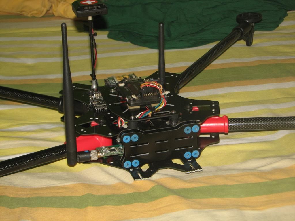
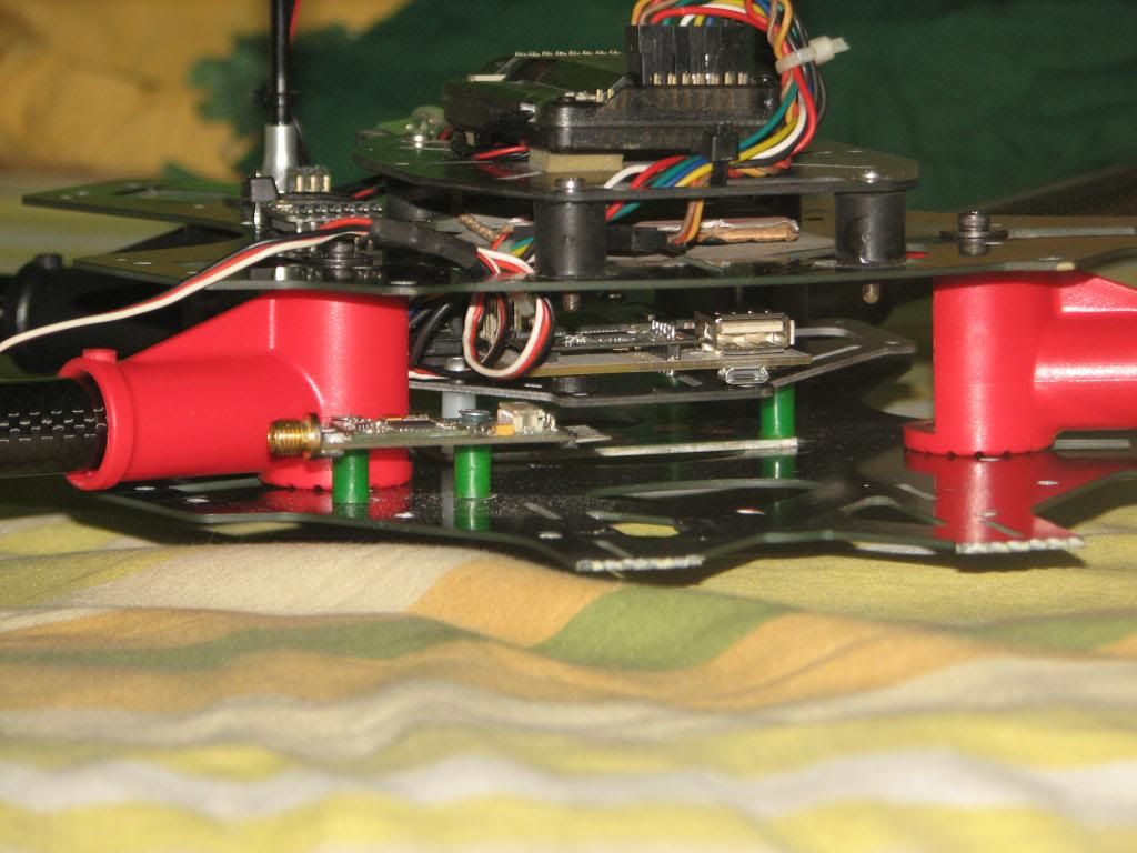
Been some time since I've posted anything, since I've been working on this really big dream project of mine, a quadcopter which can fly for around 60 mins , provide a HD video downlink and have a really powerful flight controller.

I had to consider many things to acheive my goal, especially :

The Copter :

Long flight times meant I needed to have a lightweight copter with large props and low kV motors. EndOfDay's thread (http://www.rcgroups.com/forums/showthread.php?t=1880665) was a wealth of information and I took the time to go through each and every page to gather knowledge.

I decided on this setup :

  • MultiStar 4108 - 380kV motors 
  • 16x5.5 props
  • AfroESC 12A
  • 17000mAh 4S5P NCR18650B battery pack
  • ~1900g AUW

IMG_6124.jpg

IMG_6122.jpg

The Lynxpilot Hybrid FC :

Next came the flight controller. I had been experimenting for many days with a pcDuino , a 1GHz board with an ARM SoC which fitted great with my purposes. But with it came the problems of running timing-intensive operations on Linux. Due to the non-realtime nature of Linux this was especially problematic. To work around this I patched the 'linux-sunxi' kernel sources with a RT-PREEMPT patch and got the realtime kernel running on my board. This took a long time since the kernel sources were hardly documented and also obsolete to some extent.
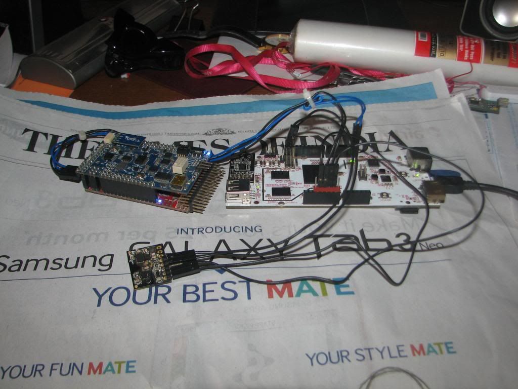
IMG_6111.jpg

Testing some code with an old APM

The software running on the board was my next consideration , since I couldn't decide whether to port AP_HAL over to it or write my very own. In the end I decided to write my own. Now, I already had a spare APM 2.5 and i thought, why not use it as a slave for a robust autopilot system. I went ahead on this angle and ended up with running the computationally intensive algorithms (EKF , etc.) on the pcDuino while using the APM to get raw sensor data and R/C inputs and shoot it over a UART to the pcDuino. I was inspired by El Gallinazo's work (http://gallinazo.flightgear.org/) to do this.
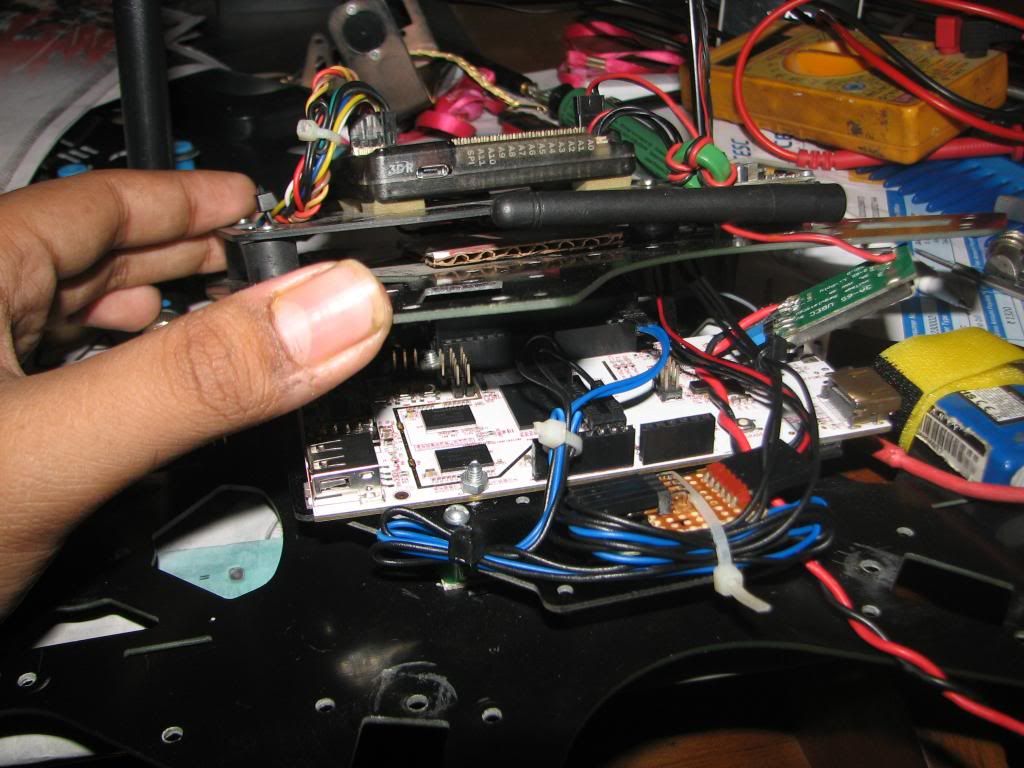
IMG_6129.jpg

Onboard integration

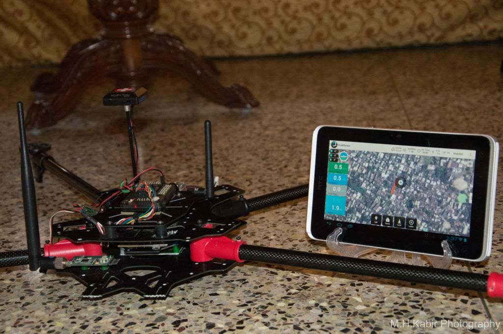
I had decided to use the APM for controlling the ESCs too, but I got some AfroESCs which are awesome and allow me to use i2c to control the motors. I ported a firmware patch (https://github.com/balrog-kun/tgy) to the latest version of SimonK which allows me to use the ESCs to get motor RPM feedback back to the flight controller allowing for major improvements in stability. My code is yet to implement this as of now as I still haven't tested the firmware on the Afros (ordered some from HK). I presently use a very limited set of Mavlink parameters for telemetry, but will expand this in the future. Telemetry will be run via the same radio as below - the Rocket M5

High-Definition FPV :

My third and last wish for my project was to have a high definition digital video downlink as I was really frustrated with the low-quality analog we use presently.

I've been successful in streaming low-latency video over my wifi network using a crappy webcam using the pcDuino, so I decided to expand the same system for the downlink as it had worked well for me. I have decided to go with the following equipment for the downlink as seen in this post : http://diydrones.com/profiles/blog/show?id=705844%3ABlogPost%3A1433488

3689583561?profile=original

  • 2 x Ubiquiti Rocket M5's - Air side one will be decased and carrying 2x cloverleaf antennas [lighter that a Bullet with a heavy N-Type connector at 85 grams]
  • 1 x Logitech C920 webcam - has hardware H.264 encoding which means the pcDuino can just route packets without any computation required for encoding the video stream 

Present Status:

Presently I have finished my custom frame which allows for large props and mostly unobstructed camera views. The motors and ESCs are on their way from HobbyKing. I am yet to buy the 20 NCR18650B cells required for making the battery pack.

Flight control software is very very beta, more work needs to be done. It can stabilize a quad , altitude hold and position hold (with inertial data !! ) presently. I had a simple hover test with my SFC quad , and basics seem to be OK. I learnt a lot from the ArduCopter code and am slowly implementing features into my own. PIDs will need to be tuned to suit my large quad , but that comes later. A simple command-line interface allows me to change params. I had started off with Python , but switched to C++ as I could reuse lots of code and use the Eigen library. The EKF should give exceptionally good performance.

The HD FPV part has been on pause due to lack of funds , since I'm a 16 year old student doing this with saved up pocket money, and really don't have the funds for buying the Rockets + Webcam. The software setup required to stream HD-quality video over UDP is ready, but I cannot proceed without hardware.

How YOU can help :

I've been saving up for this for a long time and most of my funds have gone on the copter itself. I would really be grateful if people would support my project with some small contribution as that could mean I can go ahead with the whole system. If you have any parts or stuff which you can spare, it would be a great help. I cannot go ahead at this stage without some sponsors / contributors. I am willing to work in exchange for help.

I still need to get the Rocket M5s , the Logitech c920 and the 20x NCR18650b cells . It would be great if anyone could help out on these angles. This is going to be my last project before college (university for those of you in other parts of the world) so I'd really like it to be successful.

The work done till now wouldn't have been possible without :

Wayne - Long time supporter and friend.

Chris - Gave me my first APM which I'm using here.

Jani - Helped me with the GPS , MinimOSD , etc. 

Mr. Mohtashim (www.tutorialspoint.com) - Huge supporter, has helped with a lot of hardware

Mr. Steve Taylor - Donated frame arms and some electronics.

RCBazaar.com - Helped me with some hardware like radios , etc.

Faheem Adam (www.adamengineering.co.za) - Helped with a nice donation

You can PM me or write to me at mhkabir98@gmail.com for information or if you'd like to help out. ;)

In the future if I'm successful with this, I may sell complete HD FPV kits which would be just plug and play so that anyone could take advantage of present-day systems and taking the 'guess' out of it at the same time. The LynxPilot flight controller though a baby presently, could grow up and become a contender in the world of high-performance autopilots.

Please follow my blog : cpvrc.wordpress.com for updates or keep checking back here at DIYD :)

Thanks for reading!!!

Kabir

Read more…

MedAir

I recently connected with senseFly's Adam Klaptocz who founded the non-profit group DroneAdventures to promote humanitarian uses of UAVs. I first came across Adam's efforts last year when reading about his good work in Haiti, which demonstrated the unique role that UAV technology & imagery can play in post-disaster contexts. DroneAdventures has also been active in Japan and Peru. In the coming months, the team will also be working on “aerial archeology” projects in Turkey and Egypt. When Adam emailed me last week, he and his team had just returned from yet another flying mission, this time in the Philippines. I'll be meeting up with Adam in a couple weeks to learn more about their recent adventures. In the meantime, here's a quick recap of what they were up to in the Philippines this month.

Adam and team snapped hundreds of aerial images using their "eBee drones" to create a detailed set of 2D maps and 3D terrain models of the disaster-affected areas where partner Medair works. This is the first time that the Swiss humanitarian organization Medair is using UAVs to inform their recovery and rehabilitation programs. They plan to use the UAV maps & models of Tacloban and hard-hit areas in Leyte to assist in assessing "where the greatest need is" and what level of "assistance should be given to affected families as they continue to recover" (1). To this end, having accurate aerial images of these affected areas will allow the Swiss organization to "address the needs of individual households and advocate on their behalf when necessary" (2). 

ebee

An eBee Drone also flew over Dulag, north of Leyte, where more than 80% of the homes and croplands were destroyed following Typhoon Yolanda. Medair is providing both materials and expertise to build new shelters in Dulag. As one Medair representative noted during the UAV flights, "Recovery from a disaster of this magnitude can be complex. The maps produced from the images taken by the drones will give everyone, including community members themselves, an opportunity to better understand not only where the greatest needs are, but also their potential solutions” (3). The partners are also committed to Open Data: "The images will be made public for free online, enabling community leaders and humanitarian organizations to use the information to coordinate reconstruction efforts" (4). The pictures of the Philippines mission below were very kindly shared by Adam who asked that they be credited to DroneAdventures.

Credit: DroneAdventures

At the request of the local Mayor, DroneAdventures and MedAir also took aerial images of a relatively undamaged area some 15 kilometers north of Tacloban, which is where the city government is looking to relocate families displaced by Typhoon Yolanda. During the deployment, Adam noted that "Lightweight drones such as the eBee are safe and easy to operate and can provide crucial imagery at a precision and speed unattainable by satellite imagery. Their relatively low cost of deployment make the technology attainable even by small communities throughout the developing world. Not only can drones be deployed immediately following a disaster in order to assess damage and provide detailed information to first-responders like Medair, but they can also assist community leaders in planning recovery efforts” (5). As the Medair rep added, "You can just push a button or launch them by hand to see them fly, and you don't need a remote anymore—they are guided by GPS and are inherently safe" (6).

Credit: DroneAdventures

I really look forward to meeting up with Adam and the DroneAdventures team at the senseFly office in Lausanne next month to learn more about their recent work and future plans. I will also be asking the team for their feedback and guidance on the Humanitarian UAV Network (UAViators) that I am launching. So stay tuned for updates!

See also:

  • Calling All UAV Pilots: Want to Support Humanitarian Efforts? [link]
  • How UAVs are Making a Difference in Disaster Response [link]
  • Grassroots UAVs for Disaster Response (in the Philippines) [link]


Read more…
Moderator

chrisandiris.jpg

(I don't you think you launch them like an Easystar Chris)

Marco Della Cava USA Today

BERKELEY, Calif. — The flight plan of Chris Anderson's life is filled with funky layovers. Punk rocker. Physicist. Magazine editor. Book author. Geek dad.

But all those stops were just formative detours on the journey to his current role as CEO and co-founder of drone-maker 3D Robotics.

"I could argue that every step of my career makes sense, although from 50,000 feet it looks utterly random and insane," says Anderson, 52. "Even the punk rock phase makes perfect sense. Well, no, it doesn't make any sense at all."

Anderson laughs easily and readily, often at himself. Make no mistake, he's a voluble Renaissance man who's fully aware of his accomplishments as a particle physicist (at Los Alamos National Lab) turned magazine chief (with The Economist and thenWired, which he edited for the past 12 years).

But he'd rather talk about how he's the dumbest guy in the room at 3D Robotics, a mushrooming year-old garage-based operation that — thanks to some $37 million in venture capital infusions — is poised to be a leader in the coming drone economy.

"Being a journalist and being a CEO are similar, because as a journalist you're writing about the do-ers, and as a CEO you're empowering them and taking delight in their success," says Anderson. "I'm the worst programmer and electrical engineer here. And I should be."

http://www.usatoday.com/story/tech/2014/03/25/change-agents-3drobotics-drones/6345823/

Read more…

Facebook buys Occulus VR for $2 billion

occulusbook.jpg


Not quite the $15 billion they spent on Whatsapp last month, but still more than the $1.1 billion they spent on Instagram.  The speculation is for grand universes of virtual reality news feeds, virtual reality sharing of private UAV flights, but the reality is probably more down to Earth.  It's a play on injecting advertizing into the video feeds that go into the Occulus Rift, with some algorithm that tries to make it relevant to the content of the video feeds.  The history of Facebook acquisitions has been pretty disastrous.  Instragram went absolutely nowhere.

Occulus VR, like most multi billion dollar startup acquisitions, has never shipped a product.  The closest they ever got was a development kit.  Now development kit 1 is discontinued & they're still planning a version 2, someday.


The big question when reading about these escalating buyout prices is how much Google is going to pay for 3D Robotics.  It'll undoubtedly be the largest robotics buyout ever.  Someone actually sat down & made a list of Google's acquisitions.

http://en.wikipedia.org/wiki/List_of_mergers_and_acquisitions_by_Google

It's interesting to note that the entire Android universe started out as a $50 million acquisition while the $12 billion Motorola acquisition went down like a lead weight. 

To save themselves from looking like the complete idiots they are, Google doesn't normally disclose their buyout prices, but 3D Robotics will probably be sold for $30 billion.  Before that can happen, 3D Robotics needs to stop shipping products, of course.


What will Google change about 3D Robotics?  Arducopter will be rewritten in Java, require 8 gigs of RAM, 64 gig of flash, & a quad core 2Ghz ARM.  There will be mandatory upgrades every 3 days to cripple the offline map functionality & create more annoying, bloated user interfaces that fill 1/2 the screen with search dialogs & frames.

Flights will require loading 1 gigabyte of javascript to your remote control & watching a 5 minute commercial about adsense, which you may click through after 5 seconds, sometimes.  FPV video will have banner ads covering 1/2 the screen which may be closed, only to reappear when the wind changes direction.  Flights over copyrighted property will result in immediate motor cutoff & incineration of your arducopter.


Read more…

Mini octo V1 and V2

3689583303?profile=original

Hey guys, throughout my time working with multirotors i have never seen a mini Octocopter, i have teen tonnes of min quads and a few Hex but no octos??? So I decided to build my own, this tiny beasty has 8 1534KV 53gram motors.
I could have gone smaller and gone for micro octo, but i wanted to be able to use 4s and 3s and these were the smallest motors that offered 4s capability.

http://hobbyking.com/hobbyking/store/__5423__FC_28_12_Brushless_Outrunner_1534kv.html

So i chose them, now i wanted this to be a fully fledged "drone" so i gave it enough internal space for the Taranis RX, the APM 2.6 and space for lighting controller.

The fact is all this micro quads etc do not offer the functionality of the APM, so i was determined to use it.

(on that note, please push hobbyking to relese the design files for the APM mini)

So anyways, the first frame i built was made from PVC, i made it in a vacuum former, I wanted it to be similar to the wardrones frame however as i had said to them , i had suspicions that the huge surface area under the prop blades would drastically affect performance and it did!

3689583278?profile=original3689583321?profile=original


3689583366?profile=original

The copter was weak, lifitng itself was difficult, let alone a camera gimble!
And the worst part was it took me about 5 days to manufacture this thing eek.

I will also point out my arms are thinner than the wardrones frame was and so i can only imagine how much power they are loosing in flight.


Anyways, after all that effort and a dissapointing result, i went back to designing and made this:


3689583293?profile=original


The mini octocopter V2 laser file, this is one of two files for this simple but effective frame, it took me about 20 minutes to make the design and about 2 hours to cut and build the copter.

It can be made from MDF, plywood, acrylic etc, all are very strong, i chose MDF

It can withstand some hard impacts without taking much damage and is easy to fix.

I made large mounting areas for the key electronics so that you can use all sorts of setups, you can also remove 4 arms to use it as a Quadcopter or 5 to use as a tri copter.


This one looked far better and flew excellently!

3689583336?profile=original

3689583382?profile=original


 I hope you guys like the design, maybe this will inspire a generation on mini and micro ocotcopters hehe,

Just to sum it up, it can lift about 2KG using 8 1500kv with 7"props on 3s, i have 4s ESC's on order which should make it a rocket!

Tip to tip it is approx 55CM


So i hoped you liked it, i would like you to maybe answer a few yes or no questions please, not madatory hehe.


Yes or no to all please

1 Do you like the Idea of Mini Quads?  

2 Do you think the bright lighting will help with orientation?

3 Do you like the intergrated mini gimbal (go pro / mobious compatible)?

4 Do you think it is a robust (strong) design that can withstand a few dings?

5 Would you buy the Frame if it were to be sold, Costing about $10?

6 Do you find orientation to be an issue when distance flying multirotors?

7 Do you like the option of 4s and 3s for flight power?

8 Do you think this frame would work well with a variety of setups?

9 Do you use lighting on your copter to help with orientation?

10 do you prefer octos to Quadcopters?


Read more…

MAVBoard Indiegogo Ending Soon

3689583183?profile=original

Hey all, I just wanted to remind everyone the MAVBoard Indiegogo Campaign is ending in less than 5 days. It is just shy of half way meeting its goal, but its a flex funding campaign, so everyone will get their boards regardless. But if you would like one in the initial batch, now is the time to get one!

I recently decided I was going to do all my own SMD assembly for the boards. I bought an arduino based reflow oven, and did a trial run batch of boards the other day. 

Here is a peek at my assembly station:

3689583242?profile=original

The resulting boards look fantastic (see picture at top)

Full details have been posted to the Indiegogo updates page.

I have also started to port the Teensy code to the MAVBoard pro to support native telemetry display on the Taranis RC transmitter. I have a few MAVLink variables showing up, so its just a matter of cleaning up the code, and getting the remaining pieces of data into the serial stream. My OpenLRSng just showed up as well, so that will be next after the Taranis.

Thanks to everyone who has already backed the project! 

Read more…

From 2D to 3D

3689582931?profile=original


Hi i´ve been working for a while doing photogrammetry test, and basiclly building the learning curve of me and my workmates.

What i want to share with diydrones community is a very cool process that we completed last week, and is the following:


1)photograph acquisition

2)photograph selecting

3)3D model reconstruction

4)3D model printing


Obviously there is a background process a bit larger, like the planning of the mission and the set up of all the equipment associated to the photogrammetric flight.

After we processed the model in 3D, it was sent to the makerbot 3D printer, and finally we got a physicall model of the terrain. Pretty cool stuff for us.


Greetings from venezuela guys!


PD: The process is on the attatched pics.

3689582997?profile=original


3689582948?profile=original

3689583092?profile=original

Read more…

xUAV1

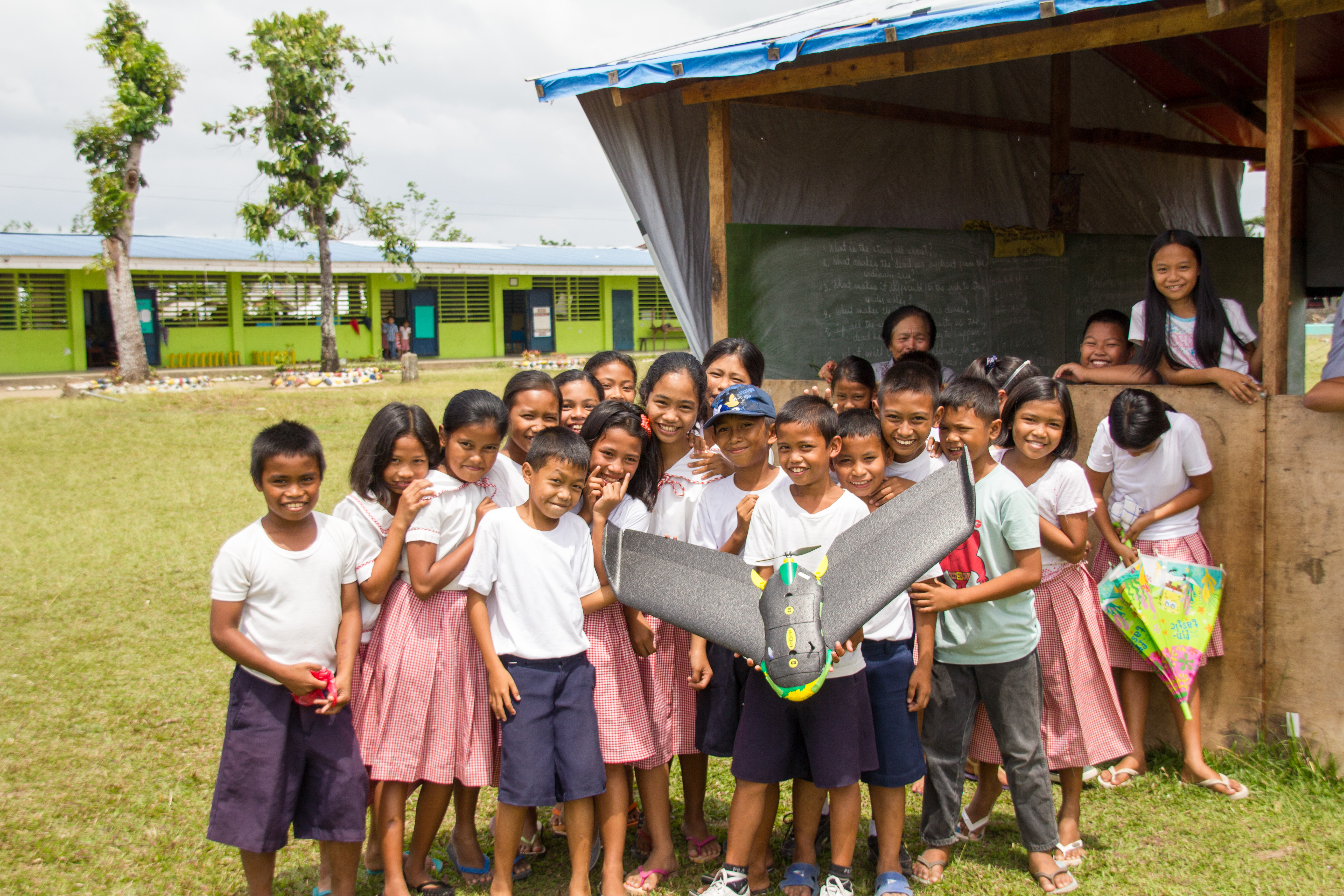
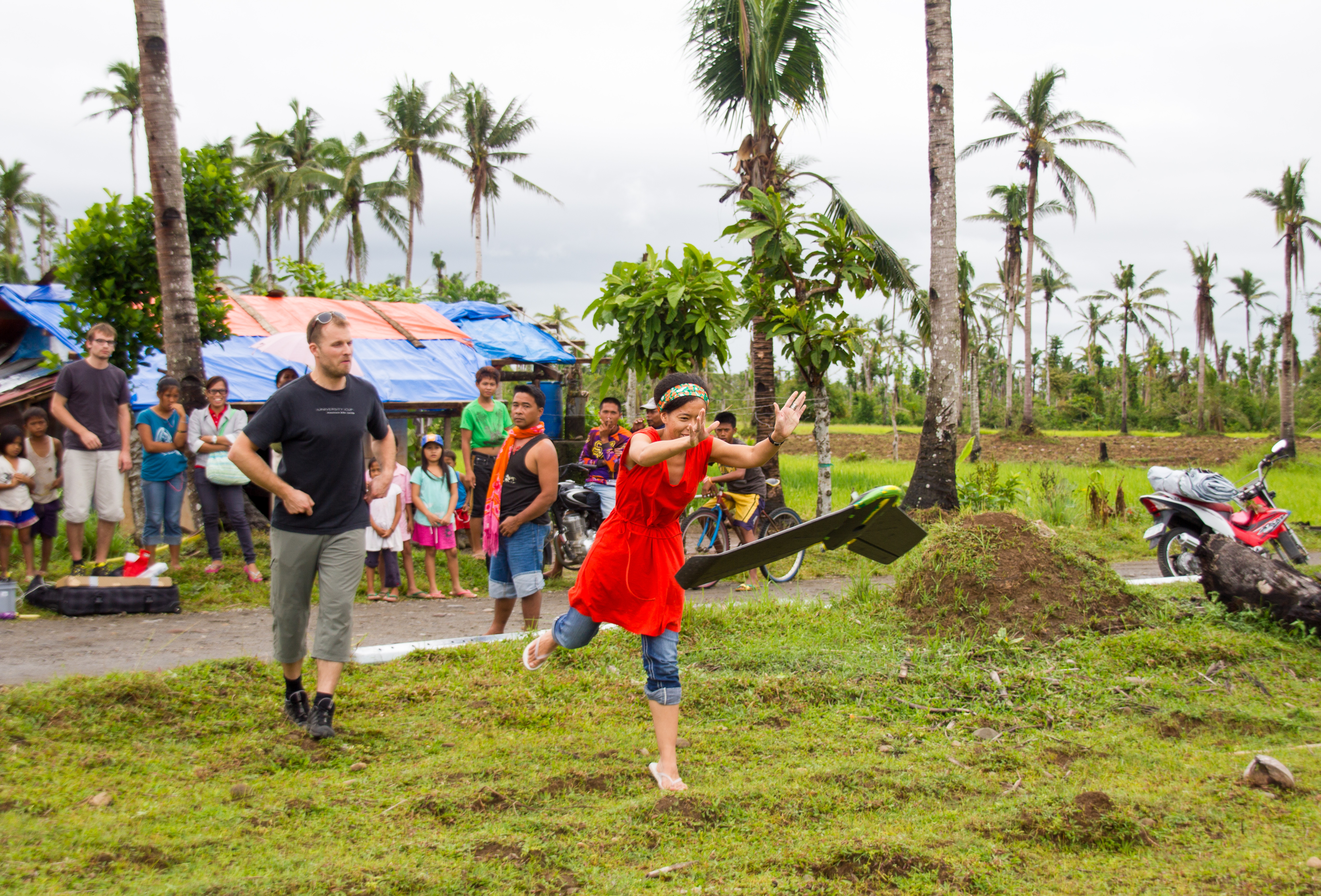
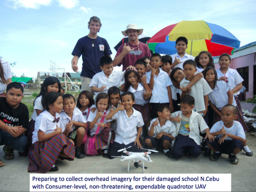
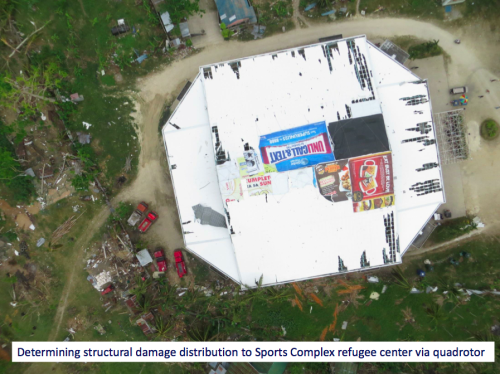
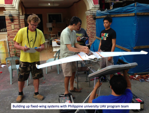
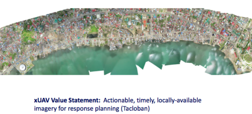
I was recently introduced to a new initiative that seeks to empower grassroots communities to deploy their own low-cost xUAVs. The purpose of this initiative? To support locally-led disaster response efforts and in so doing transfer math, science and engineering skills to local communities. The "x" in xUAV refers to expendable. The initiative is a partnership between California State University (Long Beach), University of Hawaii, Embry Riddle, The Philippine Council for Industry, Energy & Emerging Technology Research & Development, Skyeye, Aklan State University and Ateneo de Manila University in the Philippines. The team is heading back to the Philippines next week for their second field mission. This blog post provides a short overview of the project's approach and the results from their first mission, which took place during December 2013-February 2014.

The xUAV team is specifically interested in a new category of UAVs, those that are locally available, locally deployable, low-cost, expendable and extremely easy to use. Their first field mission to the Philippines focused on exploring the possibilities. The pictures above/below (click to enlarge) were kindly shared by the Filipinos engaged in the project—I am very grateful to them for allowing me to share these publicly. Please do not reproduce these pictures without their written permission, thank you.

xUAV2

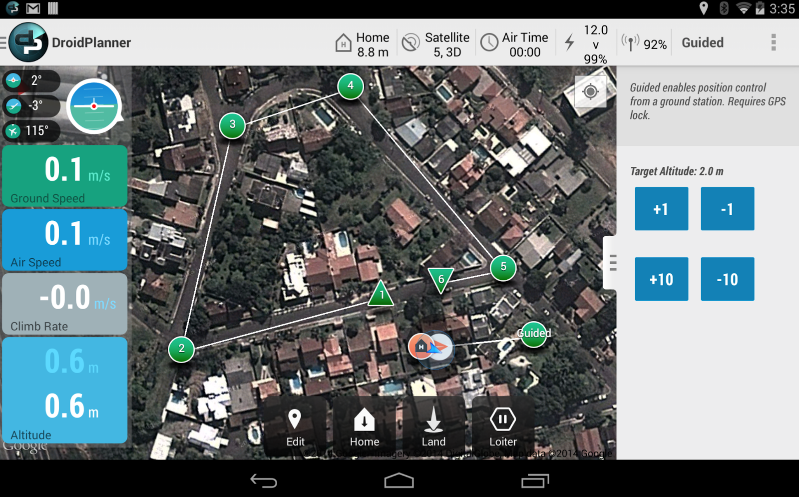
I spoke at length with one of the xUAV team leads, Ted Ralston, who is heading back to the Philippines the second field mission. The purpose of this follow up visit is to shift the xUAV concept from experimental to deployable. One area that his students will be focusing on with the University of Manila is the development of a very user-friendly interface (using a low-cost tablet) to pilot the xUAVs so that local communities can simply tag way-points on a map that the xUAV will then automatically fly to. Indeed, this is where civilian UAVs are headed, full automation. A good example of this trend towards full automation is the new DroidPlanner 2.0 App just released by 3DRobotics. This free app provides powerful features to very easily plan autonomous flights. You can even create new flight plans on the fly and edit them onsite.

DroidPlanner.png

So the xUAV team will focus on developing software for automated take-off and landing as well as automated adjustments for wind conditions when the xUAV is airborne, etc. The software will also automatically adjust the xUAV's flight parameters for any added payloads. Any captured imagery would then be made easily viewable via touch-screen directly from the low-cost tablet.

xUAV3

One of the team's top priorities throughout this project is to transfer their skills to young Filipinos, given them hands on training in science, math and engineering. An equally important, related priority, is their focus on developing local partnerships with multiple partners. We’re familiar with ideas behind Public Participatory GIS (PPGIS) vis-a-vis the participatory use of geospatial information systems and technologies. The xUAV team seeks to extend this grassroots approach to Public Participatory UAVs.

xUAV4

I’m supporting this xUAV initiative in a number of ways and will be uploading the team’s UAV imagery (videos & still photos) from their upcoming field mission to MicroMappers for some internal testing. I’m particularly interested in user-generated (aerial) content that is raw and not pre-processed or stitched together, however. Why? Because I expect this type of imagery to grow in volume given the very rapid growth of the personal micro-UAV market. For more professionally produced and stitched-together aerial content, an ideal platform is Humanitarian OpenStreetMap’s Tasking Server, which is tried and tested for satellite imagery and which was recently used to trace processed UAV imagery of Tacloban.

Screen Shot 2014-03-12 at 1.03.20 PM

I look forward to following the xUAV team's efforts and hope to report on the outcome of their second field mission. The xUAV initiative fits very nicely with the goals of the Humanitarian UAV Network (UAViators). We’ll be learning a lot in the coming weeks and months from our colleagues in the Philippines.

Read more…

3689582969?profile=original

In the framework of the VlIR-UOS-North-South-South initiative aimed at capacity building for developing countries, Latin-American and African Universities participate in a 7 day workshop on UAV-technology, currently being held in Lima, Peru. In this workshop organized by University Nacional la Molina, researchers from Peru, Ecuador, Colombia, Cuba and Ethiopia receive training on UAV mapping, making use of low-cost and open-source technologies. Beside the theoretical training and hands-on with simulators and training planes, also a 3-day demonstration is organized in the Andes region. With the UAV imagery, the researchers hope to study and improve productivity of small scale agro-ecosystems. In the next month’s 4 other demonstrations will be organized at the participating countries, ranging from sugar cane monitoring in Cuba to fighting malaria spread in Ethiopia.

The training is given by my company, Usense, which is using the APM 2.5 as autopilot for mapping purposes. I am happy to say that the researchers were very enthusiastic to work with this open-source technology and found it very user-friendly. You'll probably see some of them around here in at Diydrones in the coming months. Currently I am giving them a demonstration with the USENSE-X8 UAV on high altitude. Yesterday we flew at 4000m, with some stunning views from the Andes! 

Prof. Eddie Schrevens (KULeuven), who is leads the project: “We have been investing quite some money on satellite imagery to evaluate the productivity of agro-ecosystems in many parts of Peru, without success due to high cloud coverage in these regions. Since one year we are doing tests with imagery taken from a UAV resulting in high-quality orthomosaics and digital surface models. These UAVs fly, and fly well, but now we need to investigate in smart algorithms to derive the right information from the imagery.

Some more pictures from the workshop

3689582906?profile=original

3689582980?profile=original

Read more…