My god they reproduce
Is it bad doctor ?
My god they reproduce
Is it bad doctor ?
Hey everyone, so I don't have the APM tuned very well but at least its hitting waypoints and holding altitude and airspeed. I decided to get it flying and see just how long it would go. Here it the result:

this is the equipment list:
APC 12*8 prop
2x Zippycompact 6s 5000 mah lipo
APM 2.5 + telemetry + airspeed sensor
So whats next for the techpod? well, I will refining the gains. After I have it flying smoothly, I have a setup in the works that will be pushing flight times over 5 hours. Stay updated on the lated techpod news @ hobbyuav.com
Andra Keay has a terrific report on RoboHub on last week's SUSBX conference in SF, which was really excellent (sold out, great speakers, fantastic venue). She highlights some themes, including the paradox of ITAR (intended to control arms, it actually often forces companies to become "arms dealers" because military sales are the only ones allowed), and public controversy over drones, which parallels the controversy over the introduction of automobiles in the early 20th Century.
Here's her section on drones and agriculture, which is the subject I spoke on:
As the AUVSI report from March 12 2013 explains, agriculture is the optimal vertical for unmanned systems at the moment, and can deliver billions of dollars of economic value alongside thousands of jobs and the social good of reduced pesticide/fertilizer use. The barriers to entry are lowest and the potential returns are the highest in this market. There were several speakers focussing on aspects of this area including Chris Anderson of 3D Robotics, one of the fastest growing venture backed robotics startups in the Valley. 3D Robotics has iterated from a DIY community supplier to a consumer robot company, and now to a data and payload service provider.
As Chris Anderson asked, what is drone data good for? Vineyards currently use an analog sensor technology that has been unchanged for thousands of years. There is a rose at the end of each row of grapes and the rose is an early warning for fungal infections. Drones can expedite our emerging ‘Big Data’ capabilities in agriculture, which is the largest industry in the world.
Half of our agricultural inputs (e.g. water, fertilizer) are being wasted because the cost of not treating is greater than the waste cost. Knowledge of where there were leaks in the system would allow for adjustment and an opportunity for closed-loop farming. Farmers want this but they don’t necessarily care about the technology that delivers the data. Drone developers need to talk to farmers in order to create custom trusted solutions.
The folks at 3D Robotics have been talking to a lot of farmers in the last year and have found that each farm is different, not just each crop. Anderson says that companies need to build a community interface and offer a multi-solution package. For example, a farmer should be able to deploy a rover or a copter or a fixed wing system with equal ease, depending on requirements. It should be as simple as picking up a tablet, drawing your boundary, pushing a button to go.
The industry is still at a very early stage, with most customers in it ‘for bragging rights’ rather than economic benefit, however in a short time there should be a bank of success stories to draw on that will support future growth. The market opportunity is in delivering insight, not just drones. It’s about image acquisition, processing and locating. Georeferencing is a significant field opportunity. Data may be freely available but it’s the processing and the insight that offers huge commercial opportunities.
Anderson said, “Stewart Brand is often misquoted. Yes, he said “information wants to be free” but he also said that “information wants to be expensive, because it’s so valuable.”
On the one hand information wants to be expensive, because it’s so valuable. The right information in the right place just changes your life. On the other hand, information wants to be free, because the cost of getting it out is getting lower and lower all the time. So you have these two fighting against each other. [Whole Earth Review, May 1985, p. 49.]
Read the whole thing here.
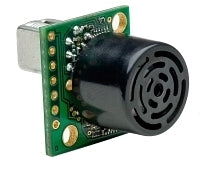 This is a post about how to receive data from a I2CXL-MaxSonar ultrasonic sensor with RPi's GPIO. Maybe this information can be useful to you or it can save you some time. I am happy for some feedback or optimization proposals etc.
The I2CXL-MaxSonar sensor should be connected to the following RPi GPIO Pins (*):
Before you are able to receive data from the the ultrasonic sensor you have to make sure that I2C-support is enabled within the RPi Linux system settings. You can check one of my previous posts for instructions how to enable it.
You can use the shell commands i2cset and i2cget to test the functionality of your sensor. The default I2C-Address of the sensor is 0x70. To perform a range measurement you must send the "Take Range Reading” command byte 0x51.
# i2cset -y 1 0x70 0x51
# i2cget -y 1 0x70 0xE1 w
0xfd02
A python script can easily be implemented by using the smbus module functions write_byte() and read_word_data(). Finally the two bytes of the returned value need to be swapped because they are received in the wrong byte order.
from smbus import SMBus
from time import sleep
try:
i2cbus = SMBus(1)
i2cbus.write_byte(0x70, 0x51)
sleep(0.12)
val = i2cbus.read_word_data(0x70, 0xe1)
print (val >> 8) & 0xff | (val & 0xff), 'cm'
except IOError, err:
print err
The default I2C-Address of the sensor 0x70 can be changed by overwriting the sensors EEPROM. The sensor requires two separate values 0xAA and 0xA5 to be sent in sequence before the final byte sent is used for changing the stored 8-bit I2C-Address. The I2C-Address should not be modified to often because a EEPROM can only be reprogrammed a limited number of times. Changing the I2C-Address may be required if the default address is already in use or if you plan to use multiple I2CXL-MaxSonar sensors connected to one I2C-Bus. Use the shell command i2cdetect -y 1 to display and verify the current (or changed) I2C-Address of the sensor.
from smbus import SMBus
try:
i2cbus = SMBus(1)
i2cbus.write_block_data(0x70, 0xe0, [0xAA, 0xA5, 0x71 \<\< 1])
except IOError, err:
print err
Have fun and stay tuned.
References:
Notes:
The I2CXL-MaxSonar-EZ series (only) supports I2C clock frequencies up to 100kHz
(* of course you can use any other 3.3V or GROUND Pin)
3D Robotics gave a sneak preview of a comparatively cheap consumer drone at an unmanned aircraft convention in San Francisco this week.
The company's new quadcopter, or four-rotor helicopter, can be controlled from a tablet running an Android flight system or other similar app. The as-yet-unnamed drone will cost about US$700 and is aimed at an audience of hobbyists, even wedding photographers, who could attach a camera to the front and get sweeping shots from the sky.
You can see an IDG News Service video of 3D Robotics engineers flying two drones here.
"I think the bigger market is people who just want to do stuff, regular people like you or I," said Brandon Basso, a research and development engineer at 3D Robotics.
Some people attending the conference were there to learn how to implement drones for search and rescue.
"I'm not saying that a person can be replaced in the cockpit yet, but you can fly some of these (drone) missions at about a tenth of the cost, and you can fly them in weather where a human pilot wouldn't be out," said Colin Loring, a volunteer search and rescue pilot from Greenville, S.C. He intends to buy a drone for his group within a few months.
Larger commercial-sized drones were displayed but not flown at the convention. Drone maker MLB brought its V-Bat UAV vertical take-off and landing drone, as well as the Super Bat, which is made of Kevlar and has cameras with target tracking and 20X zoom lenses. Prices for those drones start around $120,000.
A national drone convention is slated for Aug. 12-15 in Washington, D.C. The California event's organizers say it's possible that the D.C. meeting will have protestors demonstrating outside against military applications of drones
From http://www.pcworld.com/article/2045360/drone-show-attendees-flock-to-new-700-model.html
This video is doing by our VRGimbal user VR Gimbal with Sony 3D HXRNX3D1U ( 720 gr) in handeld mode
This is a video using complete VRGimbal with Panasonic GH2
Dear Friends,
after first batch of board available only for developer and hard work on firmware , hardware and software we are ready for end user :)
more detail here :
These are specification of our : VR Gimbal :
Micro Controller is STM32F1 at 72 mhz.
3 Axis Brushless Direct Drive gimbal :
For each channel we have 3 high power pwm 5 Amp output .
I2C IMU that support 3 axis . It is on camera module , so we can know exactly the position of camera and control in realtime the 3 Brushless motors. MPU6050 (6 DOF) + HMC5883 (3 DOF)
1 USB port.
1 Serial port that support mavlink protocol.
1 Power module that support until 3S battery.
4 Radio RC Input for :
4 Analog Input 0-3.3v
1 IR Out , so is pssible to control a remote camera by its ir receiver.
On new revision 2.0 we add :
In this video is possible see the utility available for measure the current used by different kind of motors. This feature is very usefull for evaluate the specification of motors.
Is available a new tools for firmware update you can found more detail here :
https://vrgimbal.wordpress.com/quick-start-guide/firmware-upgrade/
Last revision of code is 1.0.5 this is good for end user all function of standard brushless gimbal is available and is possible also to manage the 3th axe using rc radio. This firmware is a porting and BruGi_049B_r161
more info is available here :
https://vrgimbal.wordpress.com/download/vrgimbal-1-05/
The firmware is opensource the repo is available here :
http://code.google.com/p/vrgimbal/
So if you want to join in development you are welcome .
This is a screenshot of VR Gimbal Gui developed using .net technology, so could be work also using mono on mac and linux , test on that platform is welcome ,you can connect directly by usb to VR Gimbal or by radio link as 3dr module , blueetooth or other ttl wireles adapter :

With VRGimbal is possible to control this kind of gimbal ;
Handheld and Air Drone Gimbal 2-3axis Entry level gopro gimbal.
Handheld and Air Drone Gimbal 2-3axis Heavy dslr gimbal.
This is an example of video doing by our user of VRGimbal on heavy dslr gimbal :
This is official thread in virtualrobotix community is here join us for have more info and support :
http://www.virtualrobotix.com/group/vr-gimbal-user-group?xg_source=activity
For reserve and pre order your VR Gimbal 2.0 board send a mail here :
The first board will be available in the end of August and begin of September we have only 100 boards available for our user.
We can also support our user in custom development on oem - odm gimbal hardware or firmware contact us for more detail.
For more info original blog post is here :
Best
Roberto Navoni

What's LinkedIn you may be asking yourself?!
LinkedIn is a social networking website for students, and people in every occupation. You can connect and social network with all sorts of people that are professionals in your industry or field of study.
What kind of members on DiyDrones.com could benefit from connecting with fellow Diy Drones Members?!
Everyone!
Connect with me on LinkedIn and I will go through your Diy Drones Profile and view the content you have submitted (Discussions, Blogs, responses) and endorse all the skills that I think you possess. I'm very passionate about how much LinkedIn can help all my fellow Diy Drones members. So I'm willing to volunteer a lot of my free time to help Diy Drones members set up professional looking LinkedIn profiles and help you connect with the type of people that you need to become successful in whatever industry that you're in. You can connect with me on LinkedIn by Clicking on the www.LinkedIn.com/in/diydrones link at the top of the blog or the LinkedIn Button at the top.
From the Washington Post:
WASHINGTON — Federal regulators say they have certified two types of unmanned aircraft for civilian use, a milestone expected to lead to the first approved commercial drone operations later this summer.
The Federal Aviation Administration said Friday the drones are Insitu’s Scan Eagle X200 and AeroVironment’s PUMA [shown above]. Both weigh less than 55 pounds, are about 4.5 feet long and have wingspans of 9 to 10 feet.
A major energy company plans to fly the Scan Eagle off the Alaska coast starting in August to survey ice floes and migrating whales. The PUMA is expected to support emergency response crews for oil spill monitoring and wildlife surveillance over the Beaufort Sea.
Most nonmilitary use of drones in the U.S. has been limited to police and other government agencies.
As some of you know, I've been having some issues with altitude drift:
Various alt loss scenarios on alt hold, auto and loiter
Well, tonight I have a video showing it, and I think I've got a repeatable working solution to this. I run the test 3x for 2 hours (over 3 nights basically), and the last hour the baro is rock solid (+/- 0.05m).
It's not ideal - you need to get the APM booted up *one hour* before flight - but it does at least work. It should mean more accurate flight and less severe auto landings for those of us suffering from this. Power source is irrelevant, so I recommend power up from USB to save flight pack volts, then swapping to the pack when ready to fly.
As well as using this method, I highly recommend using black tape over the baro. It fluctuates by up to 10m if you flash a light over it! (I did have it on video, but managed to delete it!) It does re-settle, but why expose yourself to this problem. It will mostly affect you if you flying on on/off cloudy days.
To see this for yourself, dim the lights in your room, then flash a 60W bulb over the baro from about 10cm, which you have telemetry running. You see an immediate change in altitude and around a 15 second correction. Take the light away, and it will do the same.
Hope this helps someone.
We are trying a new design of gimbal for heavy cameras (assembled from parts of cinestar :) ) ...
Gimbal design can be found at the end of the video:
I set up a 5k circuit of waypoints, with a max distance from the ground station of 1.6k, and set the Raptor to fly it, and continue to fly it, even if it lost radio signal on the Tx or the Telemetry connection.
The 9x started losing signal about 1.6k or 1mi away, while the 100mA 900mhz telemetry held strong at about 60% during the longest range points.
I'll have to try it a little further on the telemetry to see what it's maximum range is.
Thank you to all the support on getting the Failsafe to work correctly: http://diydrones.com/group/apmusergroup/forum/topics/continue-mission-on-signal-loss
-Trent
Learn More:
Raptor Details: http://www.mygeekshow.com/theairplanes/Raptor.html
USA Trip Details: http://www.mygeekshow.com/usatrip/
Equipment Used:
Autopilot: APM2 (no longer sold, visit http://store.3drobotics.com/products/apm-2-5-kit)
FPV/Onboard Camera: http://www.foxtechfpv.com/horyzonhd-full-hd-1080p-fpv-camera-v3-p-877.html
Radio Tx: ParkeFlyer Turnigy 9x Tx: http://parkeflyer.com/
Reciever: 6ch FlySky http://www.hobbypartz.com/79p-r6b-receiver.html
Telemetry: 915mhz 3DR http://store.3drobotics.com/products/3dr-radio-telemetry-kit-915-mhz
Battery: 2.2Ah 30C Sky Lipo: http://www.hobbypartz.com/77p-2200mah-3s1p-111-30c.html
ESC: 30A Brushless http://www.hobbypartz.com/07e04-proton-30a.html
Motor: 2220 1800kv brushless http://www.hobbypartz.com/75m55-optima450-2220-1800kv-2.html
Prop: 8x4 APC Style http://hobbyking.com/hobbyking/store/__23610__APC_style_propeller_8x4_E_USA_Warehouse_.html
Servos: 9g http://www.hobbypartz.com/topromisesg9.html
UBEC (for FPV camera): 3A http://hobbyking.com/hobbyking/store/uh_viewItem.asp?idProduct=4319
Follow the Show:
Website: http://www.mygeekshow.com
Facebook: http://www.facebook.com/MyGeekShow
Twitter: http://twitter.com/mygeekshow
Google+:http://plus.google.com/116950154481685699344
Skype: MyGeekShow
UStream: http://www.ustream.tv/channel/mygeekshow
Filmed, Edited, Produced and Published by Trent in Arkansas, USA
At the office, when we see experiments in hybrid design like this we always title the email thread "Unicorn or Spork?" (brilliant innovation or the worst-of-both-worlds). Not sure which of those this walking flying wing from EPFL falls into, but you have to admire the mechanicals, at least.
From Robohub:
The Deployable Air Land Exploration Robot (DALER) uses its own wings to crawl and roll over a variety of terrains. Using a self-adjusting structure to transform its wings into rotating arms, the robot is able to flip, rotate and navigate its way around and over obstacles on the ground. Sharing the wings across different modes of locomotion reduces the amount of infrastructure and weight the robot must carry, thus improving flight performance. The ability to adapt to a variety of environments is important in search and rescue operations, where both air and ground searching may be required.
...
The DALER is currently optimized for ground speed. The prototype shown in the video above can move forward at 0.2 m/s (0.7 BL/s), can rotate on spot at 25°/s, and is capable of walking with different gaits. Future iterations of the robot will focus on increasing the adaptability of the wings to improve forward flight, hover flight and displacement on the ground. For example, wings could be fully deployed for flying outdoors and reduced for hover flight and ground modes.
The DALER was developed at the Laboratory of Intelligent Systems at EPFL in Lausanne, Switzerland, where researchers investigate bio-inspired artificial intelligence, develop autonomous robotic systems, and address biological questions using computational and robotic models.
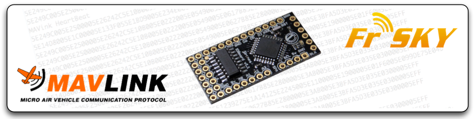
IOBoard Let's make it better... We need testers...
Awhile ago we made first translating program for IOBoard and since that people have been using it as it was and/or modifying its open software. Now that we have more and more devices supporting FrSky telemetry, converting becomes more fun.
So let's make it. Current roadmap for IOBoard is:
- Have full support for MAVLink/FrSky conversion
- LED driver with configurable patterns
- OpenTX, er9X support
- TLD-02 display support
- Updated Configurator
Currently tested features on Taranis radio:
Heading, Temperature 1, Temperature 2 (shows satellites/fix type), Armed/Disarmed and Throttle values,
Lat/Lon, Altitude, Voltage, Cell volt (avg), Speed
jD-IOBoard can be found from jDrones store
Latest MAVLink/FrSky software is IOBoard_FrSkyMAVLink.v03a
software can also be found from arducodes repository at google code
Let us know how it works and if you have ideas, post it on..
(image taken from the aeroSee website)
The aeroSee project had its inaugural trial mission on the 25th July 2013. I signed up and spent an hour reviewing pictures as they came in.
I had read the BBC article posted on the 16th of July, about the project and thought it would be a good activity to get involved in - especially as I had time off from work on the day of the first mission.
The involvement of 'the crowd' is very interesting as the UAS can generally be activated and enroute to the search area in a faster time than a mountain rescue team, so the UAS can start the search and provide coverage of large areas quickly. Any agents logged on to the search system can be provided with a brief (eg. we are looking for two men and two women, 2 in red, 1 in blue and 1 in black, all with black rucksacks.) and can then start reviewing still images sent from the UAS to the ground station, and then on to the search servers.
The search agents can add tags on the pictures in areas with something that the searcher thinks is of interest. A brief note to say what/why they've tagged something of interest to them (location of the tags needs some refinement but that shouldn't really be a problem). The responses are then analysed and down-selected to be sent to the Mountain Rescue HQ for them to decide on a response plan. I don't know what the analysis is, but I should think that it is possible to analyse images and the locations of tags on images to show frequency and concentration of tags and decide which images have raised the most interest in the searcher group. Hopefully those down selected images will show the target of interest!
I did this on my home desktop / adsl / wifi link and the service was very quick - I could page through images as fast as I needed. Quality of the images was variable, and there were IR shots thrown in to the mix too, however, you could make out people, and spotting humans wasn't that hard on the day the images are taken - nice and sunny so there were good long shadows and good shape and feature definition. Also, quite surprisingly you could recognise the shape of a face from relatively few pixels. Unfortunately I didn't save any example pictures this time around - if there's another trial I'll try and remember.
If there is another trial flight I think I'll use my mobile phone and it's 3G link to see if there's a noticeable difference in performance. I'm pretty sure that the site isn't optimised for it, but it could mean that you could help out in your lunch break sat at your desk or in your car, or as a passenger on a long journey with nothing better to do, this kind of activity would be available to you.
I think that getting a good level of searcher service for a crowd sourced initiative all the time could be an issue considering there could be 10000 images to search through without too much effort on the part of the recording device - 1 image every 0.5 seconds is 7800 images an hour. It seems that this could be key to realising the savings and efficiencies possible with such a system.
To sum up - this is really interesting and I'm looking forward to seeing where this goes. I'm already wondering at how it could help local lowlands rescue teams when called upon by the police to look for missing persons late at night.
Hello everybody,
Yesterday I successfully supported my diploma thesis on the development of a UAS. It was an all-around research, from navigation algorithms to hardware development. In all, the nature of the thesis was an experimental one.
The .pdf can be found on this Dropbox link, as I had problems with uploading the .pdf on the diydrones servers. If a mod could help me on this I would be grateful.
EDIT: Here is the permanent link for my thesis, in the library server.
If you care to open it, make sure you read the Acknowledgment. The body of the text is in English, don't be put off by the Greek first few pages.
The level of the thesis was quite basic, but the adventure continues onto my PhD.
I present the Alabama Hills in Lone Pine CA.
I've been flying for about 7 years now and I think this has got to be my favorite place yet.
There are all kinds of cool rock formations to zoom around most of which can easily be climbed in case you need to retrieve a downed copter.
The color of the sand and rocks are more or less a middle grey which the gopro's auto exposure handles really well.
The color also makes finding a downed copter very easy.
There are no hard to see branches or power lines.
There's lots of detailed terrain to make fpv navigation easier.
Most mornings are a dead calm until about 8 or 9 am from what I hear.
It's so quiet there that even if you get lost fpv flying you can echo-locate your way back home. (I had to do that more than once)
Most of the time there is not another soul for miles.
And the park ranger I met was actually stoked that I was flying there!

Interesting read on the limits and human factors complicating flight automation. I contend that all issues are solved with better sensors & processing ability/reliability.
From Things With Wings:
"As far back as 1980, renowned aviation human factors guru Earl Wiener (pictured sitting in the captain’s seat of the a Northwest Airlines Boeing 757 circa 1992) was asking the question on everyone’s mind after the tragic crash of Asiana Flight 214 in San Francisco earlier this month – Has automation gone too far?
Had he been around and of sound mind, Wiener would surely have weighed in.
However he passed away June 14 at the age of 80, the victim of a long bout with Parkinson’s disease.
Along with his family, books and scholarly papers and a new generation of human factors professionals, Wiener left us with Wiener's Laws, 15 jewels of wisdom that will keep giving for decades to come because human nature, hence human error, is not changing all that rapidly.
The laws were sent to me by former Wiener student and co-worker Asaf Degani, Ph.D., now a technical fellow at General Motors. “Some are funny and some are dead serious,” says Degani.
I have no explanation of why Laws 1-16 are "intentionally left blank"...
Which one is your favorite?
WIENER’S LAWS
(Note: Nos. 1-16 intentionally left blank)
17. Every device creates its own opportunity for human error.
18. Exotic devices create exotic problems.
19. Digital devices tune out small errors while creating opportunities for large errors.
20. Complacency? Don’t worry about it.
21. In aviation, there is no problem so great or so complex that it cannot be blamed on the pilot.
22. There is no simple solution out there waiting to be discovered, so don’t waste your time searching for it.
23. Invention is the mother of necessity.
24. If at first you don’t succeed… try a new system or a different approach.
25. Some problems have no solution. If you encounter one of these, you can always convene a committee to revise some checklist.
26. In God we trust. Everything else must be brought into your scan.
27. It takes an airplane to bring out the worst in a pilot.
28. Any pilot who can be replaced by a computer should be.
29. Whenever you solve a problem you usually create one. You can only hope that the one you created is less critical than the one you eliminated.
30. You can never be too rich or too thin (Duchess of Windsor) or too careful what you put into a digital flight guidance system (Wiener).
31. Today’s nifty, voluntary system is tomorrow’s F.A.R.
...
Wiener in the early 1980s began researching what happens when humans and computers attempt to coexist on a flight deck. Though his “day job” was professor of management science at the University of Miami, Wiener is widely known for embedding in jump seats of his airline pilot subjects as part of research projects funded by the NASA Ames Research Center. Wiener would continue performing NASA human factors works for more than two decades. “Earl was an ongoing grantee,” says a NASA co-worker from that time. “He would publish a paper and 25 people would write their masters’ theses or doctoral dissertations on the topic.
In a 1980 paper he co-wrote with NASA’s Renwick Curry, “Flight-deck automation: promises and problems”, Wiener wrote, “It is highly questionable whether total system safety is always enhanced by allocating functions to automatic devices rather than human operators, and there is some reason to believe that flight-deck automation may have already passed its optimum point.” Compilations of scholarly papers by Wiener and his colleagues resulted in two key human factors books, one of which – Human Factors in Aviation – is still in publication today, albeit as a new edition with new editors.""
So after having made multiple autonomous flights, from my home to my parents (10km) and from my home to the rc-club (5km), Some clubmembers got my head crazy and kinda challenged me to cross the English Channel autonomously. But heck, I want my plane back, so I'll be crossing the Channel AND going BACK.
The idea seemed crazy enough at first, but I couldn't get it out of my head and started doing the math (and the $$$ math).
I read about some long distance fpv flights, so there should be airframes capable of such distances. After quite some thought, reading and consulting, the choise fell on the skywalker X8. Total grounddistance to cover is about 70km, but to account for some crosswind and other unforseen circumstances, I wanted a range of 100km.
To make a long story short, my X8 covered a total distance of 102km in 1 flight a few weekends back, complete with onboard video, video transmitter for fpv, minimOSD and telemetry. I still had a little juice left in the batteries when I landed. This flight was for the most part flown with my rc transmitter off (simulated out of rc range). Telemetry was always on (in range) but I have successfully flown with telemetry disconnected and groundmodule ID changed (simulated out of range telemetry)
Now the only thing keeping me from realising my challenge is legislation. I'm a technical guy, so this is not my strongpoint. Has anyone got some info how to tackle this? Should I contact French and English air traffic authorities ? Would I be likely to get permission ?
I plan to fly 97% over sea at an altitude of 100m. At that height I don't think I pose a threat to any ships nor any airplanes. Anything else I should consider regarding safety ? I think the biggest risk I take is losing my plane, which is ofcourse a risk I'm willing to take, but any comments are welcome!
I've uploaded a Tlog file of my 102km flight to droneshare : droneshare 102km flight
Please disregard the total flighttime on droneshare. Flighttime was 90 minutes, not 229 minutes as is mentioned on droneshare.
I have found an online weather report for a calais buoy so I can check for a day where wind conditions are favorable (not to much wind and not too cross)
Ofcourse if anyone from England is reading this and is willing to lend a hand by standing watch and giving me a call when he sees the plane, or maybe even have a pc with telemetry to follow the plane if it gets out of my range, I'll be happy to keep him(her) in the loop. Maybe Martin from http://www.buildyourowndrone.co.uk/ would be interested in giving me a hand ?
Any further advice to help me complete the challenge sucessfully is welcome !
Regards,
U4eake
Hi everyone,
just wanted to share our latest UAV: The Aeromapper X5, already available in our website at www.aeromao.com
Yes, it uses the Skywalker X5 fpv wing as airframe, but here at Aeromao it suffers an interesting transformation.
It is equipped with APM 2.x (of course) and 3DR radios, but we'll start testing soon with RDF900 to extend the telemetry range and we'll try to adjust it so we don't sacrifice much endurance.
As it's big brother (The Aeromapper) it also uses the Spektrum DX8 with 5 flight modes and Dragon Link long range system.
Probably one of the most interesting features is its parachute landing. We have seen many small UAVs (some of them really expensive) of similar size landing autonomously, but in reality is a controlled crash. You are lucky if the camera survives 5 landings....
The Aeromapper X5 is excellent to cover small to medium areas. For larger areas simply land and change batteries! the parachute landing really facilitates the overall mapping process in the field.
We aimed to keep things easy, simple and safe, as well as giving the user an affordable quality platform to create maps at very high resolution. It carries the Sony NEX 7 camera (24 megapixels). More cameras can be also adapted. And we'll probably be offering a variant with the Tetracam ADC multiespectral camera.
The video shows its basic features, but you can find more info at our website, and we'll be posting more videos and info soon.

(Chris Anderson is the third speaker in this clip)
Kicking off at 0900 Pacific the sUSB Expo in San Francisco all things being equal live streaming should pop up on the sUAS News YouTube Channel and our G+ Group. Should the tech fail we will be recording all the speakers and putting their presentations and slides up after the show. Chris and members of the 3DR team will be among the guests.
Here’s the speaker times if you want to tune in for somebody in particular, all subject to change and slide of course. Look out on twitter @sUASNews for timetable changes.
Thursday 25th July
9:00 – 9:10 Welcome and Opening Statements – Bruce Parks, AgriFlight
9:10 – 9:30 Open for Business – Patrick Egan, sUAS News
9:30 -9:45 From the Dark Continent – Gary Mortimer, sUAS News (Skype)
9:45 – 10:15 Chris Norris, Alta Devices
10:15 -10:30 The Benefits of AUVSI Membership – Gretchen West, AUVSI
10:30 -11:00 BREAK
11:00 – 11:30 Eileen Shibley, California UAS Portal
11:30 – 12:00 Jonathan Downey, Airware
12:00 – 1:30 LUNCH
1:30 – 2:00 Tad McGeer, Aerovel
2:00 – 2:30 Seeking Fair Solutions to Public Concern over Commercial Unmanned System Use – Chad Partridge, 2D3
2:30 – 3:00 Film Production UAS Gus Calderon, IsisCopter
3:00 – 3:30 BREAK
3:30 – 4:00 ASTM F-38 Update -Ted Wierzbanowski
4:00 – 4:30 Karl Hedrick, U.C. Berkeley
4:30 – 4:45 Sean Varah, Motion DSP inc
Closing Statements
Reception sponsored by Motion DSP inc
Friday 26th July
9:00 – 9:15 Joerg Lamprecht, AIRBOTIX
9:15 to 9:45 Legal Considerations – Douglas McQueen, LeClair Ryan Law
9:45 to 10:15 Ken Giles, UC Davis
10:15 – 10:45 Lidar Demo – Wolfgang Juchmann, Velodyne Lidar
10:45 to 11:00 BREAK
11:00 – 11:30 Dr. Jerry LeMieux, Unmanned Vehicle University
11:30 – 1:00 LUNCH
1:00 – 1:30 Chris Anderson, 3D Robotics
1:30 – 2:00 sUAS for SAR – Gene Robinson, RP FLightsystems
2:00 – 2:30 Robotic Aircraft For Public Safety – Dr. John Appleby, DHS
2:30 – 3:00 BREAK
3:00 – 3:30 Douglas Hunsaker, Scaled Composites
3:30 – 3:45 Mathew Schroyer, DronesforGood.com, Drone Journalism
3:45 – 4:00 Drone Gaming – Eli D’Elia, Game Theory Robotics
Tickets at http://www.susbexpo.com