All Posts (11086)

Sort by

We have recently developed and tested a formation control algorithm for fixed-wings in Paparazzi. The position of an arbitrary number of vehicles can be controlled in a circular path. In fact, we are not restricting ourselves to circles but to any closed orbit, such as ellipses, thanks to the guidance vector field that guides the planes.

The algorithm is under more tests, but it should be soon available for the general public. It is quite easy to employ, the user has to declare only the IDs of the planes, the communication topology (neighbors' relationships) and the desired inter-angles.

In the following video the planes exchange positions every second. Delays, out-of-date positions (GPS delays), packet losses, etc are expected to be (and actually they are) present. It is quite interesting to remark how robust the algorithm is. According to our calculations the impact of such nasty things are not very important (ofc up to a certain point) for the convergence of the algorithm.

The work will be submitted to the next IROS conference. Once the paper is ready, I will also post it here just in case somebody is curious about the details.

Read more…

Search and Rescue Smart Drone Project

3689712453?profile=original

I am currently working on a search and rescue drone for National Parks that uses machine learning to detect missing people from a 3DR Solo.  If you are interested, please check out our website, I would love to hear feedback from fellow drone enthusiasts!  ARI is an unmanned aerial system capable of detecting people from aerial video data during the initial search for a missing person.OUR MISSIONARI is designed to increase the chances of finding a missing person using the newest drone and machine learning technology. The system is modified to fit the methods of search and rescue teams of the National Parks so that it can be easily integrated without disrupting the current search processes.HOW IT WORKSAt the start of a search for a missing person, a drone is deployed and autonomously scans the area. RGB and thermal video from the flight is quickly processed through a trained neural network from Amazon Machine Learning to determine the exact video frame and GPS location at which a person was found. All data collected can be viewed on a GIS map, allowing members of the Search and Rescue team access to the locations of the found person.OUR PLATFORMOur platform is the 3DR Solo, which is already being used for search and rescue throughout the National Park System. ARI uses and RGB camera as well as FLIR thermal sensors for more accurate data and the ability to perform searches during the night.OUR COMPANYARI began as an undergraduate research project at the University of California, Merced, and is now competing in the Berkeley Big Ideas Competition for Spring 2017 in the Hardware for Good category.WHAT WE'VE ACHIEVEDInitial stages of training the neural networkArcGIS online capabilitiesSystem integration into existing SAR methodsOUR FUTURE GOALSGet full system working for Yosemite National Park to useSuccessfully help find missing personsUse for other applications such as wildlife research

https://www.projectari.com/

Read more…

3689710899?profile=originalI promised a while ago that we're going to show you some simpler gear than our high-end client builds or series production stations. Well, this is one of them.
3689710842?profile=originalA smartphone and a self-powered snap-on telemetry modem. You may ask what the point is in combining these two things together, especially when the Bluetooth telemetry bridge solution has already been out there for quite a while. Mainly because it's handy, extremely compact and, of course, there are always some reliability issues with other applications, when the BT connection breaks down, as you may as well just walk out of its range.
3689710976?profile=originalSince the BT link only has to bridge about an inch of fixed distance here, there's no way any external RFI can break it down, but it still helps maintaining the secure IP67 level waterproof state of both the Sony phone and the modem box. There's nothing to plug in during operation, just snap on the phone, switch on the unit and go.
3689711005?profile=originalIt is mainly intended for highly autonomous sUAS systems capable of automatic take-off, landing and waypoint based flights, but since the manual controls are already implemented in a couple of Android based GCS sw, there's no reason to limit its usefulness for other applications. It's also a good companion telemetry station for dual operator scenarios, where the manual functions are controlled through FPV by the other crew. While the RFD900 is certainly an overkill for most short range platforms, there's is still the possibility of using it with a digital video downlink, too.
3689710997?profile=originalThe bridge box is based on a modified RFD900/868 modem with a serial BT module attached to it. We've replaced the heat sink of the modem with a ceramic type, mainly because it was way easier to seal it than the jagged edge of the original one, but it's also more protected like this in a recess. The miniature toggle switch and the charger connector are also waterproof, and they go well together with these stock industrial enclosures.

3689710904?profile=originalAn intelligent PCM protects the lipos that power the box for a good few hours of battery endurance, depending mainly on the output setting of the RFD modem. However, even running at a full 1W I couldn't deplete them in over six hours. There are two versions presented here in two variants of the same enclosure line. The thicker type makes use of the diversity capabilities of the modem  and it also has a bit more Whs of batteries in there, 15Wh instead of the thinner's 12Wh.
3689710925?profile=originalBecause I personally hate large smartphones with 5"-5.5" screens, this one is a relatively small 4.6" beauty, making the whole assembly even more compact. If I need a larger display for any application, I'd rather use an 8" tablet instead of a cumbersome phone. BTW, we have also made such snap-in carrier boxes for various 8" Android and Windows tablets for similar applications. I can also create a blog entry about those the next time, if you are interested...

Read more…

Press on the proposed Montana drone ban

J.D. "Pepper" Petersen

Destroying Montana’s drone industry will cost jobs

http://helenair.com/news/opinion/guest/destroying-montana-s-drone-industry-will-cost-jobs/article_fd09d8dd-e4dd-5bb7-9cbe-979121e6d51c.htmlHelena IR

Drones in agriculture will prove to be the greatest advancement in ag in decades, and the type of high tech drone work I have seen at Montana’s Universities will help to revolutionize farming. Drones are already increasing Montana’s farm profits, and are poised to dramatically decrease water usage and herbicide input saving billions of dollars a year while keeping our environment cleaner. And that’s just the beginning!

Montana’s high tech drone industry brings millions of dollars into the economy across Montana. In small towns and big cities, from Alzada to the Yaak, drone manufacturers, operators, and associated industries employ dozens of people in Montana today. As a drone entrepreneur, I’m concerned about recently introduced legislation to severely limit drone usage in Montana.

State Senator Hinebauch’s bill is essentially a drone ban. As written, SB 170 makes it impossible to meaningfully operate a drone in Montana. Banning or severely limiting unmanned aircraft usage in Montana will hurt our economy and cost jobs. SB 170 was reportedly written to curtail rogue drone operators. As written, it isn’t legal (as it steps on federal authority over airspace) and it won’t likely stop any criminals either.

Don’t get me wrong, I wholeheartedly dislike rogue drone operators, probably more than most. Anyone serious about unmanned flight tech looks at rogue drone operators with some level of disdain. Stopping these problem children has proved difficult, even with existing laws. These rogue drone pilots willfully flaunt their lawbreaking then post their antics on social media. Adding an ill-conceived and unenforceable Montana statute won’t stop these lawbreakers, just the law-abiding operators and hobbyists.

Per recent political ads, Montana politicians seem likely to seek a lead based solution in the form of a 12 gauge or similar remedy in response to drone problems. We are all rightly anxious about how drone technology could affect our lives, our privacy and our safety. No American wants to be harassed or surveilled by the government or anyone else. However, severely limiting drones is a knee-jerk reaction.

I’m certain that drone anxiety played into the development of SB 170, which points to good intentions with bad implementation. The proposed rule would apply heavy fines to our brightest young people who dared fly a drone in Montana airspace. Drones provide so much opportunity for STEM education our kids need in our increasingly high tech world. While drone operators unquestionably require defined boundaries, banning drone flights isn’t the answer or a good idea.

Our neighboring states of North Dakota and Idaho, whose combined airspace is second only to Montana’s, have become tech hubs for drones. The states’ University systems and private industry are seeing great benefit from drone development in the form of cash and economic diversification and growth. That means high tech jobs for local kids when they graduate college and more money into the local economy through cutting edge industry. Laws like SB 170 can kill these opportunities.

Rather than banning or severely limiting drone flights for Realtors, hobbyists, and school kids working on science projects; our Legislature can find more reasonable and enforceable privacy rules that would protect our citizens while still welcoming millions and billions of dollars in investment to our state.North Dakota and Idaho, who are both traditionally more politically conservative than Montana, have already blazed a trail for drones legislatively that protects privacy while promoting a growing industry. Last I checked Idaho had not become a drone surveillance state. Let’s use laws like Idaho’s 21-213 governing UAV’s as a starting point. It protects privacy and ensures a healthy drone industry.

Instead of bowing to drone hysteria born of ignorance, let’s work towards realistic enforceable solutions that will keep Montana on the cutting edge of a high-flying, high-tech industry. If other states have addressed drone related privacy issues without banning drones, surely Montana can too.

Pepper Petersen is CEO of Big Sky UAV in Helena. He frequently speaks on drone technology and was named among the Top 20 under 40 entrepreneurs in Helena in 2016 for his work with drones.

Read more…
3D Robotics

3689710793?profile=originalThis seems very doable -- indeed, I think an off-the-shelf product from PrecisionHawk or Agribotix can already do all of this. Am I missing something?

Challenge Overview

Land O’Lakes, Inc. is seeking proposed solutions that enable scalable, autonomous drone usage in precision agriculture (the “Solution(s)”). While drone technology is one of the hottest topics in the agriculture industry today, current solutions have not yet evolved to make drones a valuable or cost effective tool for farmers.

Land O’Lakes, Inc., a farmer-owned cooperative, is investing in the Land O’Lakes Prize (a total potential prize purse of $150,000), to be awarded to an individual or team that evolves drone technology into a valuable, user-friendly tool for farmers.

The new drone hardware and software Solutions we seek will solve critical issues for farmers. They will limit the need for human involvement in the collection of high resolution field data, decrease the time needed to access crop imagery, and improve the ability for a farmer to make decisions based on field health data. The decision-making this technology will enable has the potential to help farmers better tailor care to the specific needs of crops and that leads to potential gains in water efficiency and crop yield while reducing fertilizer waste. 


Plans for the winning Solution

Land O’Lakes is seeking scalable Solutions that they can offer to their members and is using a crowdsourcing challenge to find and evaluate new technologies (the “Challenge”). The competitors will retain ownership of any intellectual property contained in the proposed Solutions.

Solutions that are developed to compete for the Land O’Lakes Prize will also have the potential to be independently repurposed for use in security, inspection, livestock surveillance and other applications which require regular, repeated flights and data collection with high autonomy.   


Finalists and Prizes

Competitors must submit written proposals along with videos, log files and other supporting information by August 1, 2017.  Judging will determine up to three finalists (the “Finalists”) which will be invited to attend a live demonstration event at an FAA approved test location. Performance at this live demonstration event will support the determination of the Grand Prize winner, if any. If it is determined, in the judges’ sole discretion, through this demonstration that none of the Finalists have met the Criteria listed herein, no Grand Prize will be awarded..

The Challenge offers the Grand Prize winner a cash prize of $140,000 USD. For each of the Finalists not selected as the Grand Prize winner, the Challenge offers a cash prize of $5,000 USD.


How do I particiapte?

To be eligible to be selected as a Finalist, the Solution must, at minimum:

  • Be able to record orthorectified crop images with Red (600-720 nm) and IR (760-900 nm) spectral bands in a minimum of georeferenced .geotiff format.
  • Be capable of autonomously determining an appropriate flight path to image a field after receiving a file containing the bounds of the area to be imaged
  • Be capable of autonomously operating (take off, collect data, land, transmitting data etc.) unattended for multiple days, with multiple flights per day.
  • Utilize wireless connectivity (suitable for use in rural areas) to transmit and receive data.
  • Be able to operate in winds of up to 20mph, and use data connection to determine if weather conditions are safe for flight.

The Solution may include a variety of approaches, including, but not limited to:

  • Drone and UAV hardware (multi-copter, fixed wing, fixed wing/vertical take off hybrid, inflatable, etc.)
  • Base stations, ports, or hanger hardware to enable longer term autonomy


The judging panel will rank the eligible Solutions submitted against the following criteria:

Criteria

Description

Percent Importance

Imaging Capabilities

  • Record orthorectified crop images
  • Red (600-720 nm) and IR (760-900 nm) spectral bands in minimum of .geotiff format
  • Automatic image stitching with sun/brightness correction
  • Ability to store unique identifier to associate imagery with a grower/farmer

15


Autonomous Operation

  • Receive a file defining the bounds of the area/fields to be imaged
  • Autonomously determine a flight path to image a given area
  • Identify and avoid obstacles during flight
  • Ability to operate (take off, collect data, land, recharge, transmit data output etc.) unattended for multiple days, with multiple flights per day
  • Ability to receive/alter instructions mid flight
  • A human operator must be able to override with manual inputs at any time

35

Communications and Data Handling

  • Utilize Verizon LTE network, or other wireless connectivity (suitable for use in rural areas) to transmit and receive large amounts of data
  • Solution must be able to collect and store large amounts of collected data

15

Scalability

  • A single flying vehicle should be able to image multiple different fields (at least 3 - 70 acre fields) in a 1.5 mile radius in a 4 hour window
  • Preference will be given to Solutions able to collect data unattended from the greatest number of fields in the largest total area 

25

Safety

  • Operation in winds of up to 20mph
  • Utilize data connection and/or locally collected data to determine if weather conditions are safe for flight
  • Long intervals between needed service/failure
  • Drone must be able to receive a signal mid-flight to return to a safe location

10

Additional information may be requested before making a final selection of Finalists.


Additional Rules

 Participation Eligibility:

The Prize is open to individuals, age 18 or older, private teams, public teams, and collegiate teams. Individual competitors and teams may originate from any country.  Employees of Land O’Lakes, Inc., HeroX, and the Dean’s Office and Computer Science and Engineering Department at the College of Science and Engineering of the University of Minnesota, and their respective immediate family members or persons living in their households (whether or not related), and advertising agencies, affiliates and/or subsidiaries of any of the above, are not eligible to enter or win.

Submissions must be made in English. All Challenge-related communication will be in English.

To be eligible to compete, you must comply with all the terms of the Challenge as defined in the Challenge-Specific Agreement – Competitor Retains IP, which will be made available and must be signed by the individual or an authorized representative of the team upon registration.


Intellectual Property Rights:

As detailed in the Challenge-Specific Agreement – Competitor Retains IP, each competitor will retain all intellectual property rights in its proposed Solution. Each competitor represents that its proposed Solution is of original development by such competitor, is specifically developed for purposes of the Challenge, and shall not infringe or violate any patent, copyright, trade secret, or other proprietary right of any third party.


Right of First Negotiation:

In exchange for the cash prize, each Finalist acknowledges and agrees that for a period of twelve (12) calendar months after the date on which the Grand Prize winner is announced (the “Period”), Land O’Lakes, Inc. shall have a right of first negotiation to become the exclusive licensee of the Solution for purposes of the agricultural industry worldwide. As soon as practicable, and in any event within five days after a Finalists’ receipt of any oral or written offer from a third party during the Period with respect to an exclusive license to the Solution for purposes of the agricultural industry, such Finalist shall notify Land O’Lakes, Inc. in writing of such offer, and if the offer is in writing, provide a copy thereof. Land O’Lakes, Inc. and such Finalist shall have ninety (90) days from the date of such notice to negotiate in good faith, an exclusive license at terms no less favorable than those contained in the offer.  If an exclusive license is agreed upon during such ninety (90) day period, the Finalist and Land O’Lakes, Inc. shall than execute a substantive agreement with respect to such exclusive license.  If Land O’Lakes, Inc. elects, in its sole discretion, not to pursue the exclusive license, the applicable Finalist shall be free to agree to the offer from such third party so long as such agreement does not affect any otherwise existing obligations between such Finalist and Land O’Lakes, Inc.


Registration and Submissions:

Submissions must be made online (only), via upload to the HeroX.com website, on or before 4:59pm EST on August 1, 2017. All uploads must be in PDF format. No late submissions will be accepted.


Selection of Winners:

Based on the winning criteria, prizes will be awarded per the weighted Judging Criteria section above.

Should multiple submissions equally meet the requirements as stated in the judging criteria, preference will be given to submissions that can overperform (i.e. higher image resolution, ability to image a larger area, etc.)


Judging Panel:

The determination of the winners will be made by the sole discretion of Land O’Lakes based on evaluation by a panel of judges selected by Land O'Lakes.


Additional Information

  • Any indication of "copying" amongst competitors is grounds for disqualification.
  • All proposed Solutions will go through a process of due diligence; any proposed Solution found to be misrepresentative, plagiarized, or sharing an idea that is not their own will be automatically disqualified.
  • All ineligible applicants will be automatically removed from the Challenge with no recourse or reimbursement.
  • No purchase or payment of any kind is necessary to enter or win the Challenge.
  • Void wherever restricted or prohibited by law.


Read more…

Zero-baseline test of GNSS receivers

3689710872?profile=original

A zero-baseline test of 4 GNSS receivers (Precis-BX305 incl.) was conducted by Daniel Tampubolon from Institute Teknologi Bandung in Indonesia. He used zero-baseline test in order to obtain noise of receiver by single-differencing the raw. Then he found out the characteristic of noise for each receiver by analyzing its spectrum.

Test/Experiment Setup: He connected 4 GNSS receivers, including two Precis-BX305 boards (indicating as TerA & TerB in all charts) to one antenna with a one-to-four RF splitter. Then he formed four double different zero baselines between every two receivers and analyzed the quality of the double different observations. Part of the results shown in following figure and details could be found in PDF file, click here.

Read more…

montana_senate__william_marcus_.jpg?width=750

The Montana Senate Judiciary Committee took testimony on a bill that would apply a civil fine against anyone flying a drone less than 500 ft over private property.
It's a dangerous step towards outlawing drones altogether, and could hobble our growing UAS industry in Montana.
It's really a horrible piece of legislation attempting to solve a problem better dealt with in other ways.
The original text called for a $500 fine for flying less than 500ft over private property.
Here's the story about the proposed rule in the Helena IR.
Below I've pasted a link to the contact info for members of the Montana Senate Judiciary committee.
Please call or email everyone of them and tell them that Montana has been on the cutting edge of drone technology and irrational fears and misguided legislation can stifle a budding Montana UAS industry.
Thanks,
Pepper
Read more…
3D Robotics

Very cool! From the project repo:

AirSim is a simulator for drones (and soon other vehicles) built on Unreal Engine. It is open-source, cross platform and supports hardware-in-loop with popular flight controllers such as Pixhawk for physically and visually realistic simulations. It is developed as an Unreal plugin that can simply be dropped in to any Unreal environment you want.

Our goal is to develop AirSim as a platform for AI research to experiment with deep learning, computer vision and reinforcement learning algorithms for autonomous vehicles. For this purpose, AirSim also exposes APIs to retrieve data and control vehicles in a platform independent way.

3689710744?profile=original

Development Status

This project is under heavy development. While we are working through our backlog of new features and known issues, we welcome contributions! Our current release is in beta and our APIs are subject to change.

How to Get It

Prerequisites

To get the best experience you will need Pixhawk or compatible device and a RC controller. This enables the "hardware-in-loop simulation" for more realistic experience. Follow these instructions on how to get it, set it up and other alternatives.

Windows

There are two ways to get AirSim working on your machine. Click on below links and follow the instructions.

  1. Build it and use it with Unreal
  2. Use the precompiled binaries

Linux

The official Linux build is expected to arrive in about a couple of weeks. All our current code is cross-platform and CMake enabled so please feel free to play around on other operating systems and report any issues. We would love to make AirSim available on other platforms as well.

How to Use It

Manual flights

Follow the steps above to build and set up the Unreal environment. Plugin your Pixhawk (or compatible device) in your USB port, turn on the RC and press the Play button in Unreal. You should be able to control the drones in the simulator with the RC and fly around. Press F1 key to view several available keyboard shortcuts.

More details

Gathering training data

There are two ways you can generate training data from AirSim for deep learning. The easiest way is to simply press the record button on the lower right corner. This will start writing pose and images for each frame.

record screenshot

If you would like more data logging capabilities and other features, file a feature request or contribute changes. The data logging code is pretty simple and you can modify it to your heart's desire.

A more complex way to generate training data is by writing client code that uses our APIs. This allows you to be in full control of how, what, where and when you want to log data. See the next section for more details.

Programmatic control

The AirSim exposes easy to use APIs in order to retrive data from the drones that includes ground truth, sensor data as well as various images. It also exposes APIs to control the drones in a platform independent way. This allows you to use your code to control different drones platforms, for example, Pixhawk or DJI Matrice, without making changes as well as without having to learn internal protocols details.

These APIs are also available as a part of a separate independent cross-platform library so you can deploy them on an offboard computer on your vehicle. This way you can write and test your code in simulator and later execute it on the real drones. Transfer learning and related research is one of our focus areas.

More details

Paper

You can get additional technical details in our paper (work in progress). Please cite this as:

@techreport{MSR-TR-2017-9,      title =  } 

Contribute

We welcome contributions to help advance research frontiers.

License

This project is released under MIT License. Please review License file for more details.

Read more…

Full PX4 Support for E-flite Convergence

3689710813?profile=originalAfter our Christmas experiment of getting the E-flite Convergence flying autonomous missions with PX4 we’ve now gone one step further and implemented a rate controlled acrobatics mode in fixed-wing. This allows you to fly the Convergence in the same 2 modes which the original flight controller provides (Stabilized and Acro). In Acro mode (rate control, also known as gyro stabilization in classic RC) you benefit from unconstrained control over the aircraft but at the same time it will compensate external influences such as wind which gives you a truly flying on rails feeling!

Support will be available in PX4 soon (pending pull-request). For a short glimpse of what's possible check out the video on our news page: http://uaventure.com/2017/02/12/airrails-enables-fixed-wing-acrobatics/

Read more…

3689710765?profile=original

The Amazon is home to thousands of local indigenous communities spread across very remote areas. As a result, these sparsely populated communities rarely have reliable access to essential medicines and public health services. Local doctors in the region of Contamana report an average of 45 snakebites per month and no rapid access to antivenom, for example. WeRobotics recently traveled to the rainforest to learn more about these challenges, and to explore whether cargo drones (UAVs) could realistically be used to overcome some of these problems in a sustainable manner. We are excited to share the results of our latest field tests in this new report (PDF); Spanish version here. We were able to deliver anti-venom and blood samples to a remote village about 40km away from the nearest town. A regular boat (canoe) takes up to 6 hours to complete the journey. For the video documentaries and high-resolution photos, please follow this link. We're back in Contamana this week carrying out additional field-tests. 

Read more…

3D Precision Plane Acrobatics with Ardupilot

3689710691?profile=original

The AddictionX is a popular model plane allowing for spectacular high precision acrobatics. In addition to more common barrel rolls and vertical loops, its extremely light  wing loading and high motor thrust to weight ratio provides expert flyers with  capabililies such as precise vertical hover and  knife edge maneuvers.

What if this kind of flying could be performed by an autopilot? Lead Arduplane developer Andrew Tridgell and the Ardupilot development team got started towards doing just that. Building up on previous  VTOL work such as  Ardupilot support for quadplane, tail sitter, tilt rotor and tilt wing VTOLs along with  fully autonomous inverted flights, Tridge  interfaced Ardupilot to the popular RealFlight flight simulator, and successfully flew the simulated AddictionX model, including vertical hovers, with Ardupilot.

Coming up in the near future: Tridge actually owns an AddictionX, and expects to fly one with Ardupilot. Also coming up with Ardupilot:  ArduSoar, a  soaring "extension" of ArduPlane for gliders. Stay tuned!

Read more here including video  here  including video.

Read more…
MR60

XUAV Clouds build part 2 :

Clouds is a twin motor UAV. Total weight with full payload could get as high as 4Kg.
For an easy hand or catapult launch, a 1:1 weight/power ratio would be more than enough.
This means using two motors producing each a maximum thrust in the 1.8-2Kg range.

So what motor, propellers, battery voltage then to use ?

Check the previous build video,
XUAV Clouds Build - Part1: Wings : https://youtu.be/3CkiUq-qIeU

Read more…
3D Robotics

DIY Drones at 83,000 members

3689710649?profile=original

It's customary and traditional that we celebrate the addition of every 1,000 new members here and share the traffic stats. We've now passed 83,000 members!

Thanks as always to all the community members who make this growth possible, and especially to the administrators and moderators who approve new members, blog posts and otherwise respond to questions and keep the website running smoothly.

Read more…

Maiden Flight of Ranger EX 757-3

3689710664?profile=original

I completed the maiden flight of my Ranger EX 757-3 today, with mixed results.  The flying weight today was 6lbs, using a standard rule of thumb, the power requirements would be 450 - 600W.  The supplied 3715/1000KV outrunner brushless motor only provides 300W.

The GOOD:

  • Initial parameter selection flew the aircraft safely and successfully in Manual and FBWA! 
  • The build was good (no bits flew off)!
  • All the systems checked out
    • Pixhawk
    • GPS/Compass
    • Power monitor
    • LIDARlite V3
    • Airspeed sensor
  • Modes checked
    • FBWA
    • Manual - now have a good trim

The Mediocre:

  • Under powered, with the current motor and 6lbs flying weight takeoff and climb out were sluggish
    • Batteries 2 x 5100mah 3S 8C batteries in parallel - which should deliver 40A each 
    • 40A ESC
    • 25A motor (~300W)
    • Looking to upgraded the motor to 450W plus and may need 60A ESC for 600W motor
Read more…

A MICRO RC PLANE BUILDER SHARES HIS TRICKS

There are individuals who push tools, materials, and craftsmanship to the limit in the world of micro RC aircraft, and [Martin Newell] gives some insight into the kind of work that goes into making something like a 1:96 scale P-51 Mustang from scratch. The tiny plane is 100% flyable. It even includes working navigation lights and flashing cannons (both done with 0402 LEDs) and functional, retractable landing gear. It weighs an incredible 2.9 grams. Apart from the battery, everything in the plane was built or assembled from scratch. A video is embedded below.

[Martin] shares some of the techniques that went into the many specialized parts of the plane. Two documents (Part 1 about techniques used for small aircraft and Part 2 about the P-51 Mustang pictured) are worth a read. In true craftsman fashion, he’s aware that while he rolled his own solutions and wasn’t aware of any similar prior work, he would be surprised if none of his innovations had ever been done by someone else before.

At such small scales many problems need re-solving, like electrical connectors. All the usual off-the-shelf connectors are far too big or heavy to go on such a small device where every fraction of a gram counts. Whenever possible, connectors are avoided entirely but sometimes — like to connect the custom-wound motor — it needs to be done. In these cases [Martin] made his own.

ultra-micro-connectors
Micro plug and socket [Source: Warbirds at 1:100 Scale by Martin Newell]
The pin on the left of the photo above is made from a 0.1″ length of 0.010″ diameter brass rod soldered to a wire lead, supported with 0.020″ ID heat shrink tubing. The socket on the right is a 0.1″ length of plastic insulation from 32 AWG wire, with the strands from the other wire drawn through and around, and covered with 0.020″ shrink tubing. Contact is made by the brass pin (left) being squeezed against the multiple strands inside the plastic insulation tube (right).

Another innovation was hinges for the control surfaces like the rudder, ailerons, and flaps. Unsatisfied with plastic hinges, [Martin] made his own nearly-frictionless and nearly-weightless ones complete with re-centering springs. Each weighs 1.6 milligrams.

hingesControl surface hinge design [Source: Warbirds at 1:100 Scale by Martin Newell]
The hinges on the left are made from 0.008″ nickel wire and a 1 mm length of 0.4 mm plastic tube. The centering spring is a nylon bristle from a paintbrush, which [Martin] observed was pointed on one end and seemed quite springy. The tip of a single bristle is inserted into the model and by adjusting how far it is inserted, the amount of maximum deflection the control surface is allowed can be controlled. Once satisfactory, it is secured with a tiny bead of glue.

[Source: microflierradio.com]
A sample micro actuator. They get even smaller. [Source: microflierradio.com]
Servos are the usual means of actuating control surfaces like rudders and ailerons on model aircraft, but a plane like this one is far too small and lightweight to carry even the smallest servo. Instead of servos, these micro aircraft use tiny coils and magnets as actuators. They exert no force unless active, which means that whatever control surfaces they connect to need to provide their own means of re-centering and holding stable when idle. This type of actuator is common in micro aircraft, but understanding the design gives insight into why [Martin] designed the hinges and centering springs the way he did. Similar actuators are visible on the bottom of the wings in the video embedded below. They are responsible for moving the two ailerons, and the two flaps. More are present on the rudder and elevator at the rear of the plane.

[Martin] says that by far the most difficult part was the retractable landing gear. The solution uses 0.001” diameter Nitinol muscle wire. Muscle wire can be stretched about 5%, then when it is heated above a critical temperature by passing a current through it, it exerts a considerable force in attempting to contract back to its original length. By using two lengths of muscle wire, a pull-pull mechanism can be built in which the contraction of one wire has the effect of stretching the other while either raising or lowering the landing gear at the same time.

optimized-landing-gearA push-pull system using nitinol “muscle” wire provides the raw power behind actuating the landing gear, but required a significant custom assembly to work.
However, that was much easier said than done. [Martin] explains:

“Unfortunately this appealingly simple mechanism is fraught with implementation issues when trying to meet the design requirements. One of them is that after stretching one wire by contracting the other, when the current is stopped the contraction recoils about 30%. Therefore a lock is needed to keep the wire fully stretched. Then a second lock is needed to secure the landing gear up or down, so that sharp sideways forces do not result in any forces back on the muscle wire, which could collapse the landing gear. These requirements were met with a unit that weighs about 400 milligrams. The muscle wires rotate a 0.030” diameter capstan 90 degrees. The muscle wire recoil is countered by an over-center spring acting on an idler at the end of an arm attached to the capstan.”

[Martin] goes into detail about the whole retract assembly for the landing gear in Part 2 of his documentation.

A familiar question has been whether these planes are available for sale. The answer is probably also familiar to people who make such labor-intensive things: [Martin] says they are not for sale, at least not from him. If he did offer them for sale, nobody would pay the price he would ask because of the amount of work involved.

It took [Martin] about a year to develop and build the 1:96 P-51D Mustang, and he just recently shared a video of the tiny plane flying on his YouTube channel. It is embedded below.

[Martin] demonstrates all 8 channels of control in the video below:

Speaking of scratch-built RC aircraft, we previously covered a project dedicated to 3D printing parts for a flying RC plane, complete with in-depth testing and analysis. RC hobby aircraft is an example of a field that, while filled to the brim with off-the-shelf systems, is nevertheless home to individual innovation and DIY spirit.

taken from here

Read more…

FlytOS now supports Intel Edison!

3689710371?profile=original


While there has been a lot of interest in use of Intel Edison on drones, it has been quite challenging to get this tiny board configured for any practical use. FlytOS now brings the power of advanced drone applications to the Intel Edison platform. With FlytOS, you can make use of your Edison to implement all these (and more) capabilities on your DIY drones:

  • get video streaming (over wifi or 3G/4G) up and running on Intel Edison in minutes!
  • get your drone to autonomously detect and follow objects (vision based), with object selection/lock, etc. on your GCS. Ready code to do this is available on github.
  • recognise machine-tags (April Tags) for landing sites, etc. Sample application is available on github.
  • implement visual servoing to lock on to objects and track them using a gimbal. Complete code is available to get this up and running in minutes (video on youtube)
  • your drone can be controlled/monitored via web-based (RESTful and websocket) APIs. This can be done over local networks, or over 3G/4G links. Web-based GCS - FlytConsole - is integrated with FlytOS to provide an over-the-air, installation-free GCS.
  • build/configure swarms (multiple drones) to coordinate and talk to single/multiple GCS/apps.
  • quickly build your custom mobile apps (using APIs/SDKs) to command/monitor your drones. Several sample apps are available on github.
  • quickly implement variety of custom algorithms in Python/C++/ROS using the APIs.

Download FlytOS here (free): https://goo.gl/txlxOk
Installation Guide / Documentation: https://goo.gl/H1vRTi
Youtube channel: https://goo.gl/yLkuT3
Sample Applications on Github: https://goo.gl/nGZj1d
FlytOS Support: https://goo.gl/zxKPAo

FlytOS, of course, supports various other more-powerful companion computers, like: Odroid, Nvidia TX1, Raspberry Pi 3.

Read more…

3689710633?profile=original

The Civil Aviation Safety Authority (CASA) has teamed up with specialist company, Drone Complier, to develop a smartphone, tablet and web-based app to help drone flyers fly safely and responsibly.

The app, called ‘Can I fly there?’ is due to be launched in May this year.

The app will allow those flying drones for fun, or under the new sub-2kg commercial category to enter a location where they are proposing to fly. It will then flag nearby ‘no-drone zones’ such as airports, helicopter landing areas and other restricted areas.

It will also flag ‘no-drone zones’ areas where emergency services such as firefighters are operating.

CASA’s Group Manager, Aviation, Graeme Crawford, said that the app would also educate Australia’s drone community on what rules to follow.

‘The app will encourage these drone flyers to operate responsibly and to follow our standard operating conditions each and every time they fly,’ Mr Crawford said.

‘We know people want to have fun with their drones. We want to help them do this safely by reducing the potential for them to fly their drone inadvertently in a way that might cause a threat to aircraft or other people.

‘This app will provide them with the relevant content and services they expect to have at their fingertips when out flying.’

Drone Complier’s Chief Executive Officer, Wayne Rochat, said that they were excited to have been selected by CASA to support the Australian sub 2kg drone category. 

‘Our software is focused on ensuring simple drone compliance, delivering safety and simplicity for both hobbyist and enterprise customers,’ Mr Rochat said.

‘Drone Complier’s new app will provide CASA with a capability to execute on their vision to create safe skies for all.’ 
Drone Complier was selected by the Civil Aviation Safety Authority following a competitive tender process that opened in September 2016.


Read more…

A real flying submarine drone

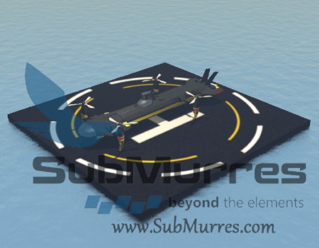
Innocorp has a new drone that is a flying submarine. It is an unmanned underwater vehicle (UUV), unmanned aerial vehicle (UAV) drone and iot can transitio from water to air to land without any individual or multiple deployments, fission of elements, (as in rockets), or complicated maneuvering. 


Like the Murres, a unique seabird which can circumnavigate in the air and in water, SubMurres does both in unprecedented fashion. SubMurres has all the key features of a submarine, including complete marine functionality, communication tower with periscope for panoramic viewing of above-water landscape, dual propulsion blades, fully-articulated rotors that emerge as needed, sensors, and more. But it doesn’t end there.

The dual submarine aircraft moves ubiquitously from water to air. As a submarine, Submurres glide silently underwater performing its mission as it surfaces. Once on the water surface its flight system is engaged and its four rotors emerge from their compartments as vertical take-off and landing (VTOL) is initiated. Once airborne, there is no expulsion of parts. SubMurres simply flies unfettered, with all components intact. Its landing apparatus allow it to settle on terrain, and its second camera system allows it to fully capture surroundings. From land, it can be directly re-dispatched to water. No need to redeploy or to be picked up by another carrier aircraft, unlike any of the chief aeronautic industry or Navy-funded university’s latest submersive drone models.


submurres2.png

submurres.png 


SubMurres, can return to the water without redeployment from another submarine or any other transport vehicle. Unlike other drones in use today, the device is controlled by command rather than by a thin tethered wire or other medium.

SubMurres is a diesel/battery powered vehicle. It has a main diesel engine, a generator, and a battery bank. The diesels engine can either power the vehicle or run the generator that recharges the battery bank. 

As a diesel/battery powered UUV/UAV, SubMurres surfaces to run its diesel engine to charge the batteries. Once fully charged, SubMurres can head underwater using the battery-powered electric motors to drive its thrusters, sensors, cameras, and related equipment. While diesel/battery powered submarines are nothing new, InnoCorp is the first to implement this technology in a UUV/UAV drone, thereby significantly extending its operational capacity.

Even better than fictional Thunderbird 4 and UFO Skydiver

Thunderbird 4 was a fictional vehicle that was a submarine and a fast surface ship which could be carried in the air by Thunderbird 2.

TB41.jpg


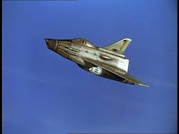
Skydiver in the TV show UFO was a submarine that could launch a fighter plane

skydiver1.jpg

skydiver12.jpg
Read more…

Slung load controller

This post is to share a bit of the final experimental work of my PhD, since my doctoral defense is next week... 

Multirotor Unmanned Aerial Vehicles (MRUAV) have become an increasingly interesting area of study in the past decade, becoming tools that allow for positive changes in today’s world. Not having an on-board pilot means that the MRUAV must contain advanced on- board autonomous capabilities and operate with varying degrees of autonomy. One of the most common applications for this type of aircraft is the transport of goods. Such applications require low-altitude flights with hovering and vertical take-off and landing (VTOL) capabilities.

Similar as before in this project we use the AltaX Flight Stack which is compromised by a Raspberry Pi 3 as companion computer and a naze32 as flight controller.

mruav-sl.jpg?resize=601%2C1024&width=400

The slung load controller and the machine learning estimator is running on the RPI3, although of course the training of the recurrent neural network was done offline in a big desktop computer. The RPI calculates the next vehicle position based on the estimation of the position of the slung load, everything is running using our framework DronePilot and guess what? its open source ;). Keep reading for more details.

If the transported load is outside the MRUAV fuselage, it is usually carried beneath the vehicle attached with cables or ropes, this is commonly referred to as an under-slung load. Flying with a suspended load can be a very challenging and sometimes hazardous task because the suspended load significantly alters the flight characteristics of the MRUAV. This prominent pendulous oscillatory movement affects the response in the frequency range of the attitude control of the vehicle. Therefore, a fundamental understanding of the dynamics of slung loads as they relate to the vehicle handling is essential to develop safer automatic pilots to ensure the use of MRUAV in transporting load is feasible. The dynamics of the slung load coupled to a MRUAV are investigated applying Machine Learning techniques.

The learning algorithm selected in this work is the Artificial Neural Network (ANN), a ML algorithm that is inspired by the structure and functional aspects of biological neural networks. Recurrent Neural Network (RNN) is a class of ANN that represents a very powerful system identification generic tool, integrating both large dynamic memory and highly adaptable computational capabilities.

In this post the problem of a MRUAV flying with a slung load (SL) is addressed. Real flight data from the MRUAV/SL system is used as the experience that will allow a computer software to understand the dynamics of the slung in order to propose a swing-free controller that will dampen the oscillations of the slung load when the MRUAV is following a desired flight trajectory.

This is achieved through a two-step approach: First a slung load estimator capable of estimating the relative position of the suspension system. This system was designed using a machine learning recurrent neural network approach. The final step is the development of a feedback cascade control system that can be put on an existing unmanned autonomous multirotor and makes it capable of performing manoeuvres with a slung load without inducing residual oscillations.

The machine learning estimator was designed using a recurrent neural network structure which was then trained in a supervised learning approach using real flight data of the MRUAV/SL system. This data was gathered using a motion capture facility and a software framework (DronePilot) which was created during the development of this work.

rnn.png?resize=768%2C434&width=600

After the slung load estimator was trained, it was verified in subsequent flights to ensure its adequate performance. The machine learning slung load position estimator shows good performance and robustness when non-linearity is significant and varying tasks are given in the flight regime.

control-strategy.png?resize=768%2C406&width=600

machine-learning-estimator.png?resize=768%2C246&width=600

Consequently, a control system was created and tested with the objective to remove the oscillations (swing-free) generated by the slung load during or at the end of transport. The control technique was verified and tested experimentally.

estimator-performance.png?resize=768%2C519&width=600

The overall control concept is a classical tri-cascaded scheme where the slung load controller generates a position reference based on the current vehicle position and the estimated slung load position. The outer loop controller generates references (attitude pseudo- commands) to the inner loop controller (the flight controller).

control-scheme.png?resize=768%2C234&width=600

The performance of the control scheme was evaluated through flight testing and it was found that the control scheme is capable of yielding a significant reduction in slung load swing over the equivalent flight without the controller scheme.

The next figures show the performance when the vehicle is tracking a figure-of-eight trajectory without control and with control.

no-control.png?fit=1470%2C733&width=600

with-control.png?fit=1470%2C733&width=600

The control scheme is able to reduce the control effort of the position control due to efficient damping of the slung load. Hence, less energy is consumed and the available flight time increases.

Regarding power management, flying a MRUAV with a load will reduce the flight times because of two main factors. The first one relates to adding extra weight to the vehicle, consequently the rotors must generate more thrust to keep the desired height of the trajectory controller, hence reducing the flight time. The second factor relates to aggressive oscillations of the load for this reason. The position controller demands faster adjustment to the attitude controller which increases accordingly the trust generated by the rotors. The proposed swing-free controller increases the time of flight of the MRUAV when carrying a load by 38% in comparison with the same flight without swing-free control. This is done by reducing the aggressive oscillations created by the load.

sl-support.gif?resize=640%2C567&width=600

Check the nice quality gif here.

The proposed approach is an important step towards developing the next generation of unmanned autonomous multirotor vehicles. The methods presented in this post enables a quadrotor to perform flight manoeuvres while performing swing-free trajectory tracking.

Look at this beautiful light painting photo comparison:

3689710459?profile=original

Don’t forget to watch the video, it is super fun. Original post in here.

Read more…