All Posts (11086)

Sort by

Missoulian article

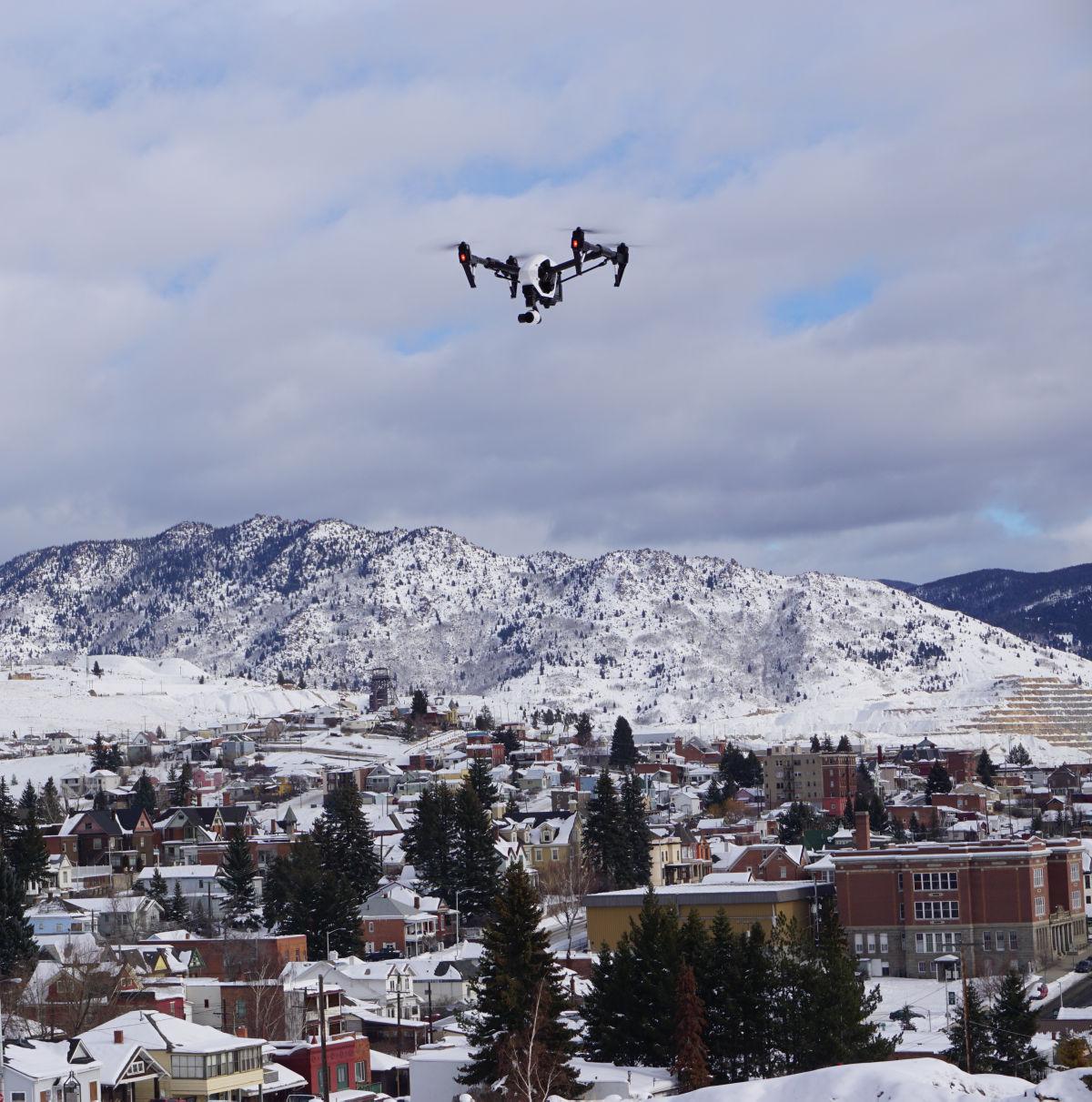
Drone Over Butte

Montanans anticipating the day when their medicine, packages or even a pizza will be delivered via drone are in for a rude awakening if a new law that passed the Montana Senate severely restricting drone flights in Montana airspace is adopted.

State Sen. Steve Hinebauch, R-Wibaux, has introduced legislation that would make drone delivery services like Amazon’s illegal in Montana. The Montana Senate voted 30-19 in favor of the drone ban, ignoring the millions of dollars and dozens of jobs drone businesses are already bringing to Montana.

Under Hinebauch’s Senate Bill 170, most drones would be banned in all airspace under 500 feet without explicit permission from the landowners below, including delivery drones. When asked how this might affect drone delivery services for goods like medicine or packages, Hinebauch said that drones should follow the existing roads on the ground rather than fly in straight lines, and if they dare fly over anyone’s property without permission, they should be fined.

This statement is likely the most ridiculous response to a realistic question one could have expected on the floor of the Montana Senate. In fact, flying in straight lines and avoiding the extra time of road travel is the entire point of using drones in delivery in the first place. Imagine if Delta Airlines or medical helicopters were asked to follow roads and never cross private property lines? Where are the property lines in the sky, anyway? Really?

This issue may be all fun and jokes for Hinebauch, but for many people in Montana like myself who work in this emerging industry, this drone ban means less money to put food on the table, pay the mortgage or pay for a business lease on an office, automobile or other needs.

Then of course there’s the fact that the Federal Aviation Administration governs aircraft and airspace, not state legislatures, for obvious reasons. If every state and city could write different rules for airspace, pilots and passengers lives would be at risk and no one would be able to fly anywhere.

SB 170 is a radical departure from all case law governing airspace ownership and use, and directly conflicts with federal law, which says that the sky is public domain and regulated solely by the FAA.

Montana legislators haven’t always been so hostile to the drone industry. In 2011, then-state Sen. Ryan Zinke, Montana’s two-term congressman and now secretary of the Interior, was among the first Montana state legislators to push for increased drone technology development for firefighters, surveyors and ag producers through partnerships with Montana’s universities.

Sadly, Heinbauch and other Montana state legislators seem intent on destroying Zinke’s and Montana’s progress towards building a drone industry in Montana. Our state legislature should be helping create jobs not working to destroy them. If this drone ban passes, Montana will lose out on billions of dollars and hundreds of high tech jobs tailor made for rural Montana entrepreneurs.

Realtors, farmers, news outlets, first responders and small-business people like myself all over Montana hope our legislators will rethink the proposed rule and join Zinke and others promoting an industry forecast to grow rapidly.

It’s time for Montana’s government to get serious about drones and put together a group of professionals, private property owners, law enforcement, drone industry representatives and airspace experts to help the state responsibly govern the drone industry without conflicting with federal law or hurting Montana businesses and working families.

Pepper Petersen is CEO of Big Sky UAV in Helena.

Read more…

3689711559?profile=original

In this short blog series I’m outlining the hardware and software of The Groundhog, my entry into the recent MAAXX-Europe autonomous drone competition held at the University of the West of England, Bristol.

In this post I shall overview the approach taken to the image recognition system used to track the line being followed around the track.  Remember the line is red, about 50mm across and forms an oval track 20m by 6m.  We are attempting to race around as fast as we can, avoiding other UAVs if necessary.

Please note this blog is not a line by line treatment of the code, indeed the code provided is neither tidied or prepared as if for ‘instruction’.  In fact it is the product of much trial and change over the competition weekend!  Nevertheless, I hope it provides some useful pointers for the key ideas developed.

Approach

Image recognition is undertaken by the Raspberry Pi 3 companion computer using Python 2.7 and OpenCV 3.0.   I am indebted to Adrian Rosebrock of pyimagesearch for his many excellent blog posts on setting up and using OpenCV.

So we are trying to follow a red line which forms an oval track about 20m x 6m.  The line is about 50mm across.  However, we have limited processing power with the on-board Raspberry Pi, so we need to minimise the load.  Here’s the approach:

When following the line:

  1. Present a steady and level image by use of a roll/pitch servo gimbal.  This is driven directly by the Pixhawk.
  2. Reduce the image resolution to 320 x 240 pixels to reduce computational load.
  3. Convert the image to a top-down view using inverse perspective mapping.  This will help us accurately measure the angle of the line ahead.
  4. Blur the image and filter for the desired colour (red) using a mask.  This leaves us with the line in white against a black background.
  5. Apply a ‘band’ region of interest across the top of the image.  Use contours to identify where the line being followed intersects this band, giving us one coordinate.
  6. Do the same along the bottom of the image, giving us another coordinate.
  7. Use the coordinates to calculate and return the bearing of the line and intercept on the x-axis.
  8. The bearing is the signal for yaw, the intercept is the signal for roll.

If the line is lost:

  1. Return the bearing of any part of the line that can be located.

Additional features:

  1. Maintain a 5 frame moving average for the bearing and offset to reduce noise.
  2. Maintain a ‘confidence’ level to assess the quality of the lock and this a means to establish if it has been lost.
  3. Rather than be fixed, the two region of interest bands range from the bottom and top of the image until they find the line.  This gives the best chance of locating the line in sub-optimum conditions, whilst still a valid giving bearing and offset.
  4. The image capture and processing code is implemented as a class running in a separate thread on the RPi.  This permits much more efficient use of the RPi and again credit is given directly to Adrian Rosebrock at pyimagesearch.
  5. When following, the width of the image is variable, widening as the bearing increases to try to keep the line in view.

Competition Evaluation

The approach worked well during the competition.  In fact, it was clear that the ability of the Groundhog to detect and measure the line exceeded most other competitors.  Other notable points were:

  • The returned bearing and offsets seemed sensible;
  • The lock was maintained reliably whenever the line was in view, even if only partially.
  • Performance ranged continuously from around 13fps (widest image) to 19fps (narrowest view).

However:

  • The 5 point moving average for the bearing and offset seemed to produce noticeable lag.  As the lock seemed very reliable without it, the moving average was removed later in the competition, which seemed to improve the response times.
  • The optimum camera angle was difficult to achieve.  Furthermore, moving the camera angle changes it’s perspective and hence the homography used for the inverse perspective mapping exercise.  Calculation of the homography is fixed in the code and so does not take account of this change, thus creating error in calculated angles.  Ideally the homography would be calculated from the camera angle dynamically.
  • Repeated application of the homography to warp the image caused frequent segmentation faults.  This remained a problem throughout the competition and I suspect was due to an imperfect compilation of OpenCV.

Image Sequence

3689712491?profile=original

The unedited image of a test line on my desk. Obviously the parallel lines run towards a vanishing point.

3689712641?profile=originalThis view is after the image has been warped to get the ‘top-down’ view.  It also shows the upper and lower regions of interest, with a successful lock of the line in each.

Image Processing Code

Please see my website post here.

The code is also to be placed shortly on GitHub and I'll edit this post as soon as that happens.

Read more…
3D Robotics

From The Verge:

Of all of the weird and wonderful ways nature creates resilient bodies, perhaps the most underappreciated is simply being so squidgy your problems just bounce off you. Well, a group of biomimicry researchers from Swiss university EPFL are taking note, and have created a soft, crash-proof drone modeled after the flexible bodies of insects.

According to IEEE Spectrum, the scientists were inspired by a unique joint found in wasp wings. These joints allow the creatures’ wings to stay stiff during flight, but “reversibly crumple” in the case of a crash — saving the thin membranes from tearing. The EPFL researchers didn’t copy this system exactly for their quadcopters, but paired a flexible external frame with a magnetic coupling system that joins the frame to the central body. In the event of a crash the body pops out of the frame before clicking back into place.

The foam arms of the drone are attached via a magnetic joint to the central body. Image: EPFL

“The uniqueness of the proposed design lies in the fact that the frame is rigid during flight, but softens during collisions,” wrote the researchers in a paper published in the journal IEEE Robotics and Automation Letters. “This allows combination of the advantages of both rigid and soft systems: stability and rapid response to user commands during flight [and] crash resilience like a soft system.”

The test drone withstood 50 crashes with no permanent damage. The researchers say one main benefit of their system (apart from durability) is keeping humans safe from drone crashes. 

Read more…

The Cyfoam is a hybrid vehicle developed at ENAC Drone Lab. The aircraft is a foamy, with a 3D printed fuselage, version of the composite-made Cyclone, i.e., before risking the expensive one, we committed the first flights with this foamy version. 

The vehicle is powered by the new Paparazzi autopilot board Chimera! which executes the control algorithm for transition flight developed at Delft MAV Lab. 

Still figuring out what is the most convenient way for taking off and landing in a total autonomous way this kind of hybrid vehicle. Stay tuned :P.

Read more…

Delivery Drones Take DC via Irish news

Robots are now delivering takeaways in Washington DC

Robots are now delivering takeaways in Washington DC Robots are now delivering takeaways in Washington DC

10 March, 2017 10:04

Having to awkwardly greet the person delivering your takeaway food when you’re hungover and still in your pyjamas at 5pm could soon be a thing of the past.

US company Postmates have launched their first fully robotic food delivery service based in Washington DC – and there are plans to launch it across Europe.

robot(Postmates)

Built by Estonian based Starship Technologies, the robots transport food from the restaurant to your home.

You order a meal using the company’s app, and then the robot goes on a little trip to pick up your food using their nifty sensors. But, we know, we know – you have some burning questions.

How does it cope with traffic lights? How does it not get lost? How does it not crash? Well, the robot can read electronic signs, plus it has cameras which help it find its way to your home successfully. Nifty, hey?

The service is currently only a thing in Washington DC, but keep your eyes out for these on a street near you soon.

Read more…

We have been lobbying hard against the proposed MT drone ban. Here's the latest story on the ban and our efforts to stop it.MT Drone Ban GF Tribune

Heidi pic

HELENA – The state Senate on Wednesday tentatively approved a bill regarding unmanned aerial vehicles, putting forth a proposal that opponents say fly in the face of federal regulations and will outlaw drones in Montana.

Senate Bill 170 allows for fines for unauthorized operation of an unmanned aerial vehicle over property without permission. The word “drones” is not mentioned in the bill, but its sponsor, Sen. Steve Hinebauch, R-Wibaux, and other lawmakers used the word during their discussion on the Senate floor.

“The bill deals with a change in technology,” Hinebauch said, adding that drones and other unmanned aerial vehicles will be a great asset to business and personal enjoyment.

“Now I think it is time for us, states, to have regulations for property rights,” he said.

Hinebauch said it should not hamper access, adding “if you can drive it, you can fly it.”

However, the owners of Helena-based Big Sky UAV, which uses drones in its business, said they have talked with the Federal Aviation Administration and the bill will not stand up to federal government standards.

J.D. “Pepper” Petersen and Greg Heide after the vote said in their aerial photography business they use drones for “1,000” different tasks.

The say the proposed state rule does not allow drones to go under 500 feet and the FAA dictates drones cannot fly under 400 feet. They said most drones cannot fly above 400 feet, adding SB 170 contradicts federal law and effectively outlaws drones as most cannot fly higher than 400 feet.

However, they plan to oppose it in the House and should it become law, they will challenge it.

“We’re going to fight it and we’ll bring the FAA with us,” Petersen said.

The FAA declined to speak specifically on Montana’s proposed law, but forwarded this comment: “Federal law gives the FAA sole jurisdiction over the nation’s civilian airspace. Local governments looking to adopt drone ordinances should make sure their proposed laws don’t conflict with the FAA’s jurisdiction.”

Drone technology has grown by leaps and bounds in the past 20 years. Today, drones are used for aerial photography, surveying, security and warfare. There have also been claims of voyeurism and trespassing. Drones are also being used in some places for deliveries.

MAINBuy Photo

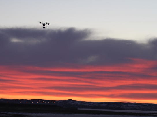
A drone flies toward sunrise at Fort Peck Dam. Senate Bill 170 allows for fines for unauthorized operation of an unmanned aerial vehicle over property without permission. (Photo: Tribune photo/Kristen Inbody)

Sen. Margie MacDonald, D-Billings, said about 35 states have passed laws regarding unmanned aerial vehicles.

She said SB 170 would make it hard for businesses that use drones as it conflicts with FAA rules. She said the bill needed more work.

Sen. David Howard, R-Park City, said companies such as Amazon are considering delivering packages with drones. He asked if Amazon would have to get permission from every property owner to fly over their home.

He said the bill was about a problem that doesn’t exist.

However, Sen. Keith Regier, R-Kalispell, said the bill was a good balance of personal property rights in Montana plus promoted drone technology.

The bill, which passed its second reading 30-19 and will undergo a third reading before moving on to the House, states the property owner is entitled to not less than $500 if the violation was above private property and not less than $2,500 if above a “critical” infrastructure facility.

Hinebauch said critical infrastructure facilities could be power plants, feed lot or transit centers.

Sen. JP Pomnichowski, D-Bozeman, asked if that would include reservoirs as well and prevent people from flying drones over such facilities.

She said the fact there was not clearer definitions gave her “pause.”

Hinebauch said the news media uses drones and flies over private properties.

“The news media does not strike me as being the people I want taking pictures of what I have,” he said.

Read more…
MR60

This is the maiden flight of the latest X-UAV model : "Clouds". It is a V-Tail fixed wing platform, similar to their previous model "Talon".
It runs Arduplane 3.7 on a Pixhawk1 (I try to get a Pixhawk2 for months without any success...Frustrating).
I was supposed to have a flight buddy who would throw the plane while I would hold the Taranis, in order to first maiden it in FBWA. As he cancelled on the last minute and I really wanted to fly the thing, I decided to burn a few steps and try directly this fixed wing alone by programming an auto take-off (hand launched : that means that the following parameters have been set:
•TKOFF_THR_MINACC was set pretty low to 5
•TKOFF_THR_DELAY was set to zero because it is a front propelled fixed wing. Don't do this with a pusher airplane or you might shred your hands !
•TKOFF_THR_MINSPD was set to zero

I have a digital airspeed sensor installed but it was obviously not yet calibrated since this was the first flight. However the EKF managed to fly it through its auto mission correctly on the first try.

I still find amazing how Ardupilot works great, even after dozens of builds I've done with it. Tridge and Randy are just two geniuses (and all other dev I don't know).

Read more…
3D Robotics

3689712285?profile=originalFrom GPS World:

3DroneMapping completed a project under tight time and space constraints — surveying a tiny tropical island without disturbing guests.

The 15-hectare island nine kilometers from the Zanzibar coast is isolated from the rest of the world. Surrounded by coral reefs and sandbars, the island is home to an exclusive resort, but its limited space is threatened by erosion from changing currents.

Developers are concerned that proposed structures will be washed out to sea in a few years. Because no plans or maps of the island have ever been drawn or surveyed, they felt it was important to provide scale and dimension to architects for a master plan.

surveying-with-pole-W

The survey needed to include existing structures, pathways, major trees, visible services, high-tide marks, levels and contours. It needed to be done in a tight timespan, before the island closed for renovations in three months. Also, the survey could not disturb any guests.

Using a custom-built multi-rotor drone with a high-resolution camera allowed 3DroneMapping to obtain images with good detail but taken far enough from guests to not bother them. Control points were located strategically, in places not visible to the public.

surveying-with-drone-O

Luke Wijnberg, CEO of 3DroneMapping, conducted the survey with the L1 Reach by Emlid. “Such a survey could not have been possible without drones and Reach kit,” Wijnberg wrote in a blog. “Using this technology kept the pricing low for the customer, kept time on the ground and disturbance to guests to a minimum and provided a very quick turnabout time.”

Reach-Base-W

After fieldwork was completed, the photogrammetric process was a fairly simple affair with 600 images collected and control added to the model. A high over and sidelap was required to obtain ground strikes between the vegetation.

The ground strikes were then extracted from the dense point cloud using specialized 3D point cloud editing and classification software. Other features were exported to a CAD program.

All files were handed to the client via an online GIS platform with AutoCAD files for the master planners.

Learn more about the project on the 3DroneMapping website.

Read more…
MR60

X-UAV Clouds build part 3

This is part3 and the final assembly stage of the X-UAV Clouds build

It is equipped with  a barebone Pixhawk autopilot (from Jordi Munoz co founder 3DR, Mrobotics.io) running the latest Arduplane code,

and no need to say this is the best of all ! (thx Tridge and Randy and all others I miss). I will publish the maiden flight which is an auto take-off, fully automated : just put the radio Tx aside, throw your plane. It flies by itself. I still find this amazing even after a few years in this hobby. We now just need drones that assemble themselves, it would be less work.


Check the previous build videos,
X-UAV Clouds Build - Part1: Wings : https://youtu.be/3CkiUq-qIeU

X-UAV Clouds Build - Part2 : Motor-prop-battery combo choice : https://youtu.be/YAFJJnHktCo

Read more…

3689712360?profile=original

https://devblogs.nvidia.com/parallelforall/jetson-tx2-delivers-twice-intelligence-edge/

NVIDIA is pleased to announce Jetson TX2, the world's preeminent embedded computing platform for deploying deep learning, computer vision, and advanced artificial intelligence solutions to edge devices in the field. Jetson TX2 delivers server-grade performance that fits in the palm of your hand and runs on less than 7.5W of power.

Driven by integrated NVIDIA Pascal GPU with more than a TFLOP/s performance and hex-core CPU complex with dual-core NVIDIA Denver2, quad-core ARM Cortex-A57 and 8GB 128-bit LPDDR4, Jetson TX2 includes user-tunable energy profiles (Max-Q and Max-P) and is built from the ground-up for ultimate compute efficiency. Jetson TX2 is packed with hardware multimedia engines for streaming high-bandwidth data and 4K inputs/outputs, including up to six simultaneous MIPI CSI cameras, Image Service Processors (ISPs), video encoders and decoders supporting H.245/H.245/VP8/VP9, and additional high-speed I/O like PCIe and USB 3.0.

NVIDIA JetPack 3.0 AI SDK provides comprehensive software support out of the box, including CUDA Toolkit 8.0, cuDNN 5.1, TensorRT, Linux kernel 4.4, and Ubuntu 16.04 LTS. Jetson TX2 is the ideal platform for deploying deep learning frameworks like Caffe, Torch, TensorFlow, and others into an embedded environment.

Developers can get started deploying AI with NVIDIA Two Days to a Demo, a tutorial on GitHub which provides neural network models and deep learning vision primitives like image recognition, object detection, and segmentation, and teaches the workflow for re-training the models using NVIDIA DIGITS interactive training system. New to Two Days to a Demo for TX2 are segmentation models geared for drones and an aerial training dataset to encourage development of autonomous flight control systems. To learn more, see my in-depth technical Parallel Forall blog on the NVIDIA site.

3689712321?profile=original

Jetson TX2 is available as a developer kit and module. The module is $399 in 1K quantities, and the Jetson TX2 Developer Kit is $599, with the $299 Jetson Educational Discount for those belonging to academic institutions. In addition the price of the Jetson TX1 Developer Kit has been reduced to $499. Preorders are available with shipments in North America and Europe beginning March 14.

Key to the recent resurgence in artificial intelligence, it's been exciting times at NVIDIA experiencing the vast increases in compute horsepower put at the fingertips of developers everywhere. With Jetson comes the ability to deploy advanced deep learning capabilities into embedded environments, onboard remote edge nodes. We hope you'll join us to begin developing your own AI-powered smart devices and computer vision solutions. See our full blog post with the details to learn more.­­

Read more…

We would like to share two of our recent and ongoing results related to autonomous exploration and mapping in darkness. As opposed to approaches that rely on localization based on LiDAR systems, the videos below rely on visual-inertial localization with LEDs illuminating the scene appropriately. For the first case, visible-spectrum cameras are used, while for the second near-infrared cameras are employed. We believe that operation in darkness is an important feature for aerial robotics and we would like to see more in that direction. 

For more please visit: http://www.autonomousrobotslab.com/ 

Read more…

3689712260?profile=original

There are many videos of Skywalker series in Youtube, including Skywalker 1680, Skywalker 1720, Skywalker 1800, Skywalker 1880, Skywalker 1900. There are still some customer misunderstood the model of Skywalker, therefore I think this is good platform to figure out and understand these aircrafts clearly.

   With reference to aerodynamics and flight mechanics, it is a best rudimentary model for FPV because its fuselage has smooth appearance, reasonable structure and convenient operation.

   Overlooking the blue planet from FPV, Skywalker will take you through the vast sea of clouds and inspire infinite imagination.

    Next, I will talk about these aircrafts to you under below. I hope this will give great assistance to understand Skywalker series FPV aircrafts.(You could see details in our company's website)

    Skywalker 1680:It is adopted new improvement that has strong and durable EPO material with high density, module installation. The wing connection is made by plastic module and rubber band makes flying easier, faster, safer.

3689712260?profile=originalSpecification

Brand :Skywalker               Wing area:  36.16㎡          

Model :1680                       Flying weight:   2200-2500g

Material: Imported EPO      Take off:  Hand cast, Catapult

Wingspan:1680mm             Landing:Glide down

Fuselage:1180mm             CG:From Wingsleading edge to backward 75-76mm


Recommended Configuration

Motor  2814KV900-980           Propeller    9-10inch

ESC   45-60A                        Battery   4S 5500mah

Servo 12g*4pcs                     Radio    4CH

Skywalker 1720: Skywalker, the global classic and special-purpose FPV aerial vehicle, has been new upgrading. It has high efficiency with T-tail fin, strong aerodynamic performance.

     The horizontal stab is on the top of airflow to keep away from fuselage’s interference and increase its stability. It has big wingspan, heavy load, stable flying, large interior space to provide special position to Yuntai and image transmission.

3689712174?profile=original

Specification

Brand :Skywalker               Wing area:  36.18㎡          

Model :1720                       Flying weight:   2200-2500g

Material: Imported EPO      Take off:  Hand cast

Wingspan:1720mm             Landing:Glide down or parachute landing

Fuselage:1300mm             CG:From Wingsleading edge to backward 75-76mm


Recommended Configuration

Motor  2820KV780-850           Propeller    11*6-12*6

ESC   45-60A                        Battery   4S 5500mah

Servo 12g*4pcs                     Radio    4CH

Skywalker 1800: Skywalker, the global classic and special-purpose FPV aerial vehicle, has been new upgrading. It has high efficiency with T-tail fin, strong aerodynamic performance.

     The horizontal stab is on the top of airflow to keep away from fuselage’s interference and increase its stability. It has big wingspan, heavy load, stable flying, large interior space to provide special position to Yuntai and image transmission.

Read more here: http://skywalkermodel.com/en/

Read more…
Developer

Generic Flight controller mixing

Once upon a time RC control of an aircraft consisted of a Transmitter with a single button. Your aircraft had a rudder only. Hit the button once to go left, twice to go right.

Increasingly RC transmitters offered more functionality with different mixing facilities and modern transmitter software such as open TX offer very flexible facilities.

But, if your aircraft is being controlled by a flight controller, have mixing on the RC Transmitter is no good, you need the mixing to be on the flight controller.

The mixing for different model types so far has usually been hard coded into the flight controller so you get what you are given. PX4 improves matters with its mixing scheme but it is quite cryptic so I decided to try to offer an alternative.

The result is mixer_lang, a flexible mixer for Flight controllers

some features

  • High level Specification.

    The specification is based on a context free grammar and well documented semantics. The goal is consistent semantics, so that you arent reliant on the vagaries of a particular implementation.

  • Strongly typed, type deduction.

    Expressive economical language with type deduction, but strongly typed to give well defined and predictable qualities

  • Access to system values.

    The language enables defining system values either constant or variable and of real, integer or bool type as inputs to the mixer.

  • Inputs and Outputs as Integers, floats or booleans.

    Inputs and Outputs can be comprised of combinations of integer real and boolean. You can select the underlying integer and floating point types to the best combination for space and performance on your system.

  • Tunable at runtime.

    The language specifies how selected values in the mixer can be remotely modified in flight to tune best performance in real time.

  • Multipoint mixers specified in the language

For more info visit the project on github mixer_lang, a flexible mixer for Flight controllers

Read more…

UAV Challenge - Medical Express 2018

Sponsors and Organisers

Here we go again!

Same place, same time in 2018, and mostly the same rules!

The main differences to last years event are:

  • 3 separate prizes depending on level of achievement
    • $25,000 for completing the mission with the highest points 
    • $25,000 for using type 2 autonomy (now being redefined as "no controller/user interference, but with constant comms link to controller)
    •  $25,000 to avoid Dynamic No Fly Zones (details yet to be disclosed)
  • Manual hand launches are no longer considered autonomous (excluding them from getting type 2 prize)
  • Layout of course is different, with only the first two waypoints needing to be completed in order and the inclusion of no fly zones

3689712133?profile=original

Still the same:

  • Range and VTOL required to pickup the blood sample from the remote landing site
  • Aircraft size allowances, propulsion etc
  • Geofence requirements (addition of no fly zones)
  • Comms required when retrieval aircraft is on the ground at remote landing site (ADS-B transponders might be introduced) 

Overall it seems like the biggest change in comparison to the last one in 2016 is the emphasis on, and the extra prizes for automation. The aircraft platforms are the same, so our last one should work fine.

Time to start building...or should I say coding? :-) 

Link to OBC site: https://uavchallenge.org/medical-express/

Link to rules: https://drive.google.com/file/d/0B5JgqjkRDqw8SHkyUUU1NDZTaDQ/view

Read more…

Universal Adapter for DJI Gimbals

3689711950?profile=original

We would like to share with you a project we've been working on at SPH Engineering. We have developed an adapter that makes it possible to connect and use DJI gimbals / camera systems with virtually any other drone or autopilot.

It was designed as a part of our tethered drone system AirMast (airmast.com), however, it will be available separately as well. Here's a video of the adapter:

The device features an Ethernet interface and can be operated through a web browser. Video stream can be played with media players such as VLC and others as ffmpeg. Furthermore, REST API is also available for controlling the camera.

The adapter is sold separately. For orders or more information please contact us at ugcs@ugcs.com
Get the latest version of UgCS here: www.ugcs.com

Safe flights,
UgCS Team

Read more…

Gopro controlled over RC link

3689712354?profile=originalGoPro_RC_Remote_v01_02_20170301.zipHi everyone!

I'd like to share a little project I have been working on, perhaps it may be of use to some. Let me know what you think!
It's not totally finished, but for now it seems to be working.

I made a little device in order to control my GoPro 4, which is mounted on a brushless gimbal under my Pixhawk controlled Tarot 680 hexacopter.

Two switches on my Taranis are used for starting/stopping the recording, switching between video and stills and to control zoom level.

It is based on ESP 8266, which functions as a tiny Arduino with WiFi functions.

The ESP is connected to one channel of my RC reciever. It reads this signal and then decides what control commands to send to the GoPro over wifi.

3689712411?profile=original

3689712342?profile=originalThe hardware needed for this is:
- ESP-03 module
- 3.3 V power regulator ( The ESP doesn't like 5V on Vcc! The GPIO's are OK with it though)
- resistor of 200 Ohm or so (not critical)
- small switch
- pcb
- wire
- shrinksleeve


3689712436?profile=original
For flashing the firmware, a USB-UART converter is needed.
Programming is done in Arduino, make sure to add the ESP arduino library.

On the Taranis, I programmed these mixes:

3689712514?profile=original

It all seems to work quite well.

I must admit that I am not a programmer, so things may be inefficient or even weird. One of the thing I don't like is using the pulse-in function for reading the RC input. I wanted to use an interrupt, but somehow this causes the ESP to crash and reset every few seconds.

Also i want to make some more improvements; right now it only supports GoPro 4, but it is not difficult to add Gopro3 commands. Also the SSID and password are hard-coded; it works, but it's not very user friendly.

So any tips and advice is welcome, or if someone wants to improve it themselves: pease do :-)

Any questions? Please ask.

Some final notes:
-If you want to try it,  don't forget to modify the SSID and password of your GoPro in the code.
- Currently the code only works for GoPro Hero4. The commands for other types are sometimes slightly different; you can find them on https://github.com/KonradIT/goprowifihack
It would be cool to let the code detect the type of camera itself!

- Both ESP and my Taranis work on 2.4 GHz. So far I have not noticed any problems with the RC link, but make sure to do a rangetest before first use!

- it turns out the Hero 4 doesnt seem to have a "narrow" zoom setting  for all resolutions. So maybe I'll find another use for this switch position.

Ps I also made a post on RCgroups, but so far no reactions:

https://www.rcgroups.com/forums/showthread.php?2836301-GoPro-control-over-RC#post36910884

Read more…

3689712114?profile=original

Airspace integration and management solutions for drones continue to garner new investment, but most options are based on fairytale scenarios and raise more questions than answers.

I’ve been doing research on the commercial drone industry since early 2012, and it never ceases to amaze me how much hype there is.  A week doesn’t go by where I find a new fantasy forecast or see an announcement on how this or that drone networking solution is “game changing.”

How real are those claims that drones will one day be filling our skies and delivering packages? Where and when will we see massive industry growth and is that growth dependent on the existence of a drone network?  In this post, I’ll go over a few misconceptions, discuss the harsh reality, and offer two lessons learned that I hope will help make the conversation a bit more rational.

The hype

Question: How much spin is out there on drone networks?  Answer: A lot.

Take this piece, for example: In The Drone Network of Tomorrow (It’s Closer Than You Think). The author wants you to believe that the drone network of tomorrow is a few hurdles away.  In this futuristic world, users will remotely dispatch multiple drones right from their offices. They’ll specify the flight path, and the drones will fly there autonomously and collect data. In this world, there will be drones-for-hire stationed at key locations and you will just click on button to summon them at your command. It will be “the Internet of drones” and it will be accomplished via the LTE network, the same network to which every smartphone is connected today.

Investors buy it.

Read The Big Money Continues to Bet on Drones, which discusses Verizon’s recent acquisition of Skyward. Read Airmap’s own take on their announcement of $26 million in Series B funding from Microsoft, Airbus, Qualcomm, Yuneec, and Sony, with Microsoft leading the round.

The press buys it.

Read this recent article in Recode. It says:

Drones are, after all, flying computers that connect to the internet—connectivity on a drone is often used to share flight information with other drones, report to air traffic control or send aerial imaging back in real time to the operator.

I bought it, too.

In December 2014, I wrote Why Drones Are the Future of the Internet of Things.

But since that time I’ve done a lot a research to find evidence supporting industry claims, and the truth is, at every turn I’ve come up empty handed and found many misconceptions.

Continue reading here:http://droneanalyst.com/2017/03/02/why-the-drone-network-of-tomorrow-is-farther-away-than-you-think/

Read more…
3D Robotics

3689712097?profile=originalParrot is the only publicly-listed consumer/commercial drone company, so their quarterly and annual financial reports are one of the few places to get accurate and up-to-date numbers on how the drone industry is really doing. They published their Q4 2016 and full-year 2016 financials earlier this week and as always it makes for interesting reading.

Some observations:

  • Consumer drones continue to be tough for everyone (aside from DJI) due to rapid price declines and commodification: Parrot's consumer drone sales fell by 46% in 2016.
  • Gross margins fell even faster, from 50% in Q4 2015 to 20% in Q4 2016
  • As a result, Parrot lost a lot of money in 2016: losses were $138m for the year and $45m in Q4 alone.
  • Sales are slowing at their commercial drone subsidiary, Sensefly, too, down 32% to $15m for the year.
  • But their partially-owned software subsidiary, Pix4D, had another great year, up 160% to $16m for the year.  

Parrot says that it expects 2017 to be better, in part because it will cut costs by eliminating 250 jobs and introduce new products. It will also spin off its older automotive and consumer electronic sides and become a pure-play drone company. 

Bottom line: drone hardware is a tough market, consumer drone hardware is even tougher, but the market for commercial drone software, while still young, is looking good. 

Read more…
3689712072?profile=original
Most power supplies these days have overcurrent protection, but for those of us too poor for anything besides a Mastech & who were left with an ancient, unused 3DR BEC after the world migrated to DJI, there is hope.  Instead of hacking the Mastech to detect its current limiting LED, it was decided to make a standalone fuse which was fully programmable from a serial terminal. Merely plug the fuse into a USB port & it provides its own console interface. It requires 5V from the serial dongle. The load & power for the load are on a separate circuit from the fuse.

It was the 1st programming of an 8 bit PIC in C, with the official MPLAB. It was also the 1st use of a C program on a point to point soldered, through hole chip. All those years of assembly language with the free gputils & nedit weren't worth it. MPLAB on even a Mac is lightyears faster. It has all the navigation & autocompletion functions of other IDE's. It has handy displays of memory usage. The compilation & flashing is automatic. The crippled features of the commercial compiler don't matter. Many commercial products are made with unpaid versions of the compiler.

The fuse program used 80% of the PIC's 4k of ROM & 20% of its 256 bytes of RAM, but probably a lot more of its stack. It needed a few 32 bit operations to handle current & time conversions. It needed routines for persistent settings & a menu interface. It wasn't a huge amount bigger than an assembly language program.


The original idea was to have just a bag of analog comparators & RC timers. After LTSpice proved that to be very complex, it moved to a microcontroller with LEDs & a pot to set the fuse limit. There would be a table of pot voltages corresponding to current limits. When the parameters grew to a variable time delay & 2 limits, the design changed to a pure serial terminal interface implemented entirely on the microcontroller. Despite the need to be near a computer & to open a 2nd serial terminal, it's the most flexible interface.


The trick with the fuse was allowing a programmable delay. Current exceeding the limit can run long enough to power a motor movement before it blows the fuse, a very useful feature when developing motor controller firmware.  A 2nd limit is a hard limit that instantly blows the fuse. All the commercial power supplies have only a hard limit which instantly blows the fuse. Although the software has a limit to the limit of 15A, the Mastech only goes to 10.7A, so there was no way to test it. The fuse was only tested up to a 10A limit.


The maximum current detectable by the fuse is limited by the LM324's saturation voltage. The 3DR current sensor has a very low output voltage for current below 15A, so the fuse needs an LM324 to boost the 3DR's output. It was predicted to saturate at 15.4A. If the fuse is set to 15A, the LM324 may saturate below that & never blow. The fuse MOSFET may also overheat over 10A & fail closed. It gets smoking hot at 10A.


Another problem is the 3DR current sensor uses the load power to power its own op-amp. If the load voltage drops below 2V, the 3DR current sensor reports nonsense current values. Fortunately, the nonsense current values escape towards 8A as the load voltage drops, so the fuse blows for any load below 2V, as long as the limit current is below 8A.
a9828587-211-fuse03.png
a9828588-233-fuse02.jpg
a9828589-212-fuse01.jpg
a9833828-65-fuse04.png
The source code:

Read more…