All Posts (11086)

Sort by

Greetings everyone,3689713718?profile=original

The first release of Libcanard v0.1 was published yesterday. Grab your copy on Github.

Libcanard is a dependency free, very compact implementation of the UAVCAN stack in C99. It is designed for low cost, deeply embedded applications with limited computing resources and small amounts of available ROM and RAM. It supports NuttX, STM32 (any RTOS and baremetal), Linux SocketCAN, and AVR microcontrollers so far, with more platforms to come.

Special thanks goes to Antoine Albertelli, Michael Sierra, Paul Patience, Matthias Renner, and others - without their help the project would not have been possible.

If anyone is willing to lend a hand to further advance the project, let's coordinate on Github.

Also consider subscribing to the mailing list and join the public chat room to stay up to date.

Read more…

3689713641?profile=original
Some of you might remember our previous post about the universal adapter for DJI gimbals we have developed: http://diydrones.com/profiles/blogs/universal-adapter-for-dji-gimbals?xg_source=activity

We are excited to share with you that recently we have managed to add support for DJI Zenmuse XT infrared camera. This means that using the adapter this infrared camera from DJI can be mounted on almost any drone / autopilot system.


Here is a video of it being controlled from the web interface:


For more information please contact us: ugcs@ugcs.com

Get the latest version of UgCS here: https://www.ugcs.com/en/page/download


Safe flights,
UgCS Team

Read more…

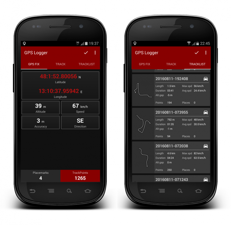
Updated GPS Logger and field test

android-gps-logger_FIGURE_1-768x747.png

Some time ago we presented a free software mini-suite that can be useful to support UAV based survey tasks/general purpose operations.

The new Basic Air Data GSP Logger App release was tested at Centre for Geoinformatics, IIFM, Bhopal, India; the results were as expected.

They produced a pdf report and 15 minutes quick start up video-tutorial for GPSLogger. The pdf report contains the details about GPS Logger altitude correction.

You find everything in this link.

Read more…

3689713604?profile=original

The World Food Program (WFP) is officially partnering with WeRobotics to develop coordination mechanisms to guide the safe and effective use of aerial robotics (UAVs) in response to humanitarian disasters. With 80 country offices around the world, WFP provides food assistance to some 80 million people in nearly 80 countries each year. WFP was also one of the very first humanitarian organizations to explore the use of UAVs back in 2007. So we’re deeply honored that WFP selected WeRobotics as the implementing partner for this important project. The need for coordination mechanisms is absolutely imperative given the increasing use of UAVs following major disasters. To be sure, the lack of formal coordination mechanisms is already presenting serious problems during relief efforts.

Learn more about the WFP-WeRobotics approach here.

Read more…

3689713515?profile=original

As many of you know I’ve been researching and writing about agriculture drone solutions since early 2012. I recently came across this OpEd in PrecisionAg titled “Opinion: The Agricultural Drone War Is Over, And They Lost” and read it with great interest. Two and half years ago, our research indicated the same thing—that small drones might not be able to deliver more usable data to a farmer or provide a cost benefit over the existing image solutions available to them.

Even last year I had my doubts. In our June 2016 report, The Truth about Drones in Precision Agriculture, we looked at how drones have been used as remote sensing devices in agriculture thus far, reviewed competitive and traditional approaches using incumbent technology (like satellites and manned aircraft), and discussed the opportunities and challenges posed by the technology itself.

But a lot has changed since then.  Agriculture drones have matured, and so have the sensors and analytical solutions that support them.  A rising number of software vendors are targeting the agriculture space with increasingly useful solutions. And a new generation of drones is delivering much-needed functionality.

Not all agriculture drone solutions are created equal, so it pays to do a bit of research before committing. There are many factors to consider, from software compatibility to price to technical capabilities such as:

  • Can you get all the components—drone, sensor, software, and analytics—from one company?
  • Is an internet connection required in order to process data?
  • Will it integrate well with your existing tools?

The research process to find the best solution can be overwhelming and time-consuming, but there is some good news. We’ve done a fair amount of this work already which you can access in our latest report, Using Drones to Ensure ROI in Precision Agriculture.  You’ll also find a checklist there to help you determine which solution is the best fit.  Here is an excerpt:

Nearly all agriculture drone solutions process RGB color, near infrared (NIR), and normalized difference vegetation index (NDVI) data.  But not all solutions provide additional analytics and tools better matched to the needs of growers and agronomists. For example, only one solution we know of in the market allows users to view live NDVI data via streaming video while the drone is flying without an internet connection. This means you can more easily fly missions and see critical information at the field’s edge without requiring a trip back to the office. This eliminates a huge bottleneck. Most solutions require that you upload images from the UAV to a mobile device, a laptop or cloud service where they are stitched together to create a base map and the underlying spectrum data is processed into a usable NDVI layer.  In most solutions, you have to wait for that information—sometimes for hours. But with this solution, you don’t have to do that, and the added benefit is you can use the time savings to gather additional inputs from the areas the real-time map shows as suspect.

The report goes on to detail the following:

  • The importance of timely inputs
  • New analytics and tools
  • The importance of an integrated solution—sensor, drone, and analytic data platform
  • The challenges of understanding ROI
  • The benefits of end-to-end solutions

You can get the report, plus an End-to-End UAV Solution Checklist for Precision Agriculture, here. 

Look for another report from us on this topic soon. If you have questions about the information in the report or would like to comment on it after reading, write me at colin@droneanalyst.com.

Image credit: Sentera

Read more…

3rd Flight of Ranger EX 757-3

Finally had the time for the next flight.  I increased the Roll and Pitch gain settings as the first two flights were quite sluggish to control inputs.  I was hoping to complete the "Manual" mode trim setup this flight but I continue to have too much starboard roll for the trim setting on the controller.  

  • The gain setting increases helped (some) with the sluggish control responses.
    • In addition, I found the control surface hinge lines to be far too stiff. (I cut relief sections to reduce stiffness) 
    • During the build, I laminated the wing, tail, and control surfaces to stiffen the airframe
  • Manual mode trim was also affected by the laminating material, which caused a slight twist in the starboard alerion.
    • Reheated starboard control surface to improve the shape, next flight will tell

Read more…
100KM

VTOL by Arkbird

3689713495?profile=original

Banggood is now taking pre-orders for a VTOL wing. It seems to be the holy grail of VTOL to me - no redundant motors, no extra servos, so it's a simple, reliable, and above all, efficient.

http://www.banggood.com/Arkbird-VTOL-Vertical-Takeoff-And-Landing-Electric-FPV-RC-Aircraft-Airplane-KIT-p-1138877.html?rmmds=search

Note that the link above excludes electronics, the Arkbird Lite 2.0 FC is required, along with the usual electrics.

Tridge..? :)

https://www.youtube.com/watch?v=uQibL09skJ8

Read more…

3689713468?profile=original

In this short blog series I'm outlining the hardware and software of The Groundhog, my entry into the recent MAAXX-Europe autonomous drone competition held at the University of the West of England, Bristol.

Connecting the Raspberry Pi 3 to the Pixhawk took quite some working out, so I am hoping that by publishing my own step by step checklist, it may help others save a little time.

Code


All code is posted to my GitHub repository.

Connecting the Pi to the Pixhawk


I have previously blogged on how to connect a Pixhawk (running arducopter) to a Raspberry Pi 2 using the UART interface.  The hardware connection is identical for the Raspberry Pi 3.  However, there are some critical differences in setting up the Pi and in the code required to make the connection.

Configuring the Pi


Here is my installation checklist for installing Dronekit on the Pi and making the connection between the Pi and Pixhawk.

Start with Pixel installed on the Pi3 and do basic Pi configuration and updates:

Install Jessie Pixel
sudo raspi-config
Expand filesystem
Disable serial for OS
Reboot
sudo apt-get update


Now start to set up the development environment:

sudo easy_install pip
sudo apt-get install python-dev
sudo apt-get install screen python-wxgtk2.8 python-matplotlib python-opencv python-numpy libxml2-dev libxslt-dev


Install pymavlink and mavproxy to provide comms protocols between the Pi and Pixhawk.

sudo pip install pymavlink 
sudo pip install mavproxy


Install Dronekit and libraries to simplify control of the Pixhawk.

sudo pip install dronekit
git clone http://github.com/dronekit/dronekit-python.git


Now sort out the clash on RPi3 between our need to use the UART and it's use by the Bluetooth interface.  There are several versions of this config change about but this was the one that worked for me.

In RPI, add 2 lines at the end of /boot/config.txt (it will disable bluetooth and you can use /dev/ttyAMA0 to make the connection):

enable_uart=1
dtoverlay=pi3-disable-bt


So now we switch to the Pixhawk, connected to a PC using Mission Planner.  The version needs to be at least 3.4.0 which allows for GUIDED_NOGPS mode.  We also need to make sure Telem2 is properly configured, which we do from the Full Parameters list.

Check pixhawk firmware is 3.4.0
Check Serial 2 parameters:
SERIAL2_PROTOCOL '1'
SERIAL2_BAUD '57'
BRD_SER2_RTSCTS '0'


Now we can make the physical connection between the Pi and Pixhawk and test it out.

Note on power:  At this point, I had the RPi and Pixhawk independently powered, so the 5V connection between the two units was disconnected.  As long as they have a common ground, all is good.

Make physical connection

Test connection.  On the Pi:
sudo -s
mavproxy.py --master=/dev/ttyAMA0 --baudrate 57600 --aircraft MyCopter
param show ARMING_CHECK
watch HEARTBEAT (You should see mavlink heartbeat messages going both ways, every second)
Cntl - c
Reboot RPi


If you can see heartbeat messages during the test, like those below, all is good!

> HEARTBEAT {type : 6, autopilot : 8, base_mode : 0, custom_mode : 0, system_status : 0, mavlink_version : 3}
< HEARTBEAT {type : 6, autopilot : 8, base_mode : 0, custom_mode : 0, system_status : 0, mavlink_version : 3}
< HEARTBEAT {type : 13, autopilot : 3, base_mode : 81, custom_mode : 0, system_status : 3, mavlink_version : 3}

Setting up the Software in the Loop Simulator (SITL)


Beyond making the basic connection work, I found the SITL crucial to allow the developing software to be frequently tested.  Basically, the RPi needs something to connect to on the desk, and that cannot be the Pixhawk itself.

As a rudimentary test-environment to make sure the control commands are in the right ball-park, I found the SITL to be great.  Any more than that might be being a little optimistic.  I confess there is much configuration possible of the SITL itself which I have not played with (that's my excuse!).  But for example, don't expect the SITL to replicate anything approaching the inertia of a 3Kg hexacopter travelling at 40mph.

I installed the SITL on a PC, connected to the Pi3 through a standard home network.  The ardupilot site has instructions for the build and installation here, which worked after several attempts.  However all the issues were down to me not following the instructions precisely.

See more posts at mikeisted.com
Read more…
3D Robotics

Our sister site, DIY Robocars, is running joint outdoor event with Self Racing Cars at the Thunderhill Raceway in Willows, CA.  You can sign up here. We're going to be running a courses for smaller autonomous cars (~1/10th scale), which can use cameras, GPS, LIDAR and other sensors to navigate the course. As with our monthly Oakland events, the track for 1/10th scale cars will have white lines and obstacles. Unlike our indoor events, GPS can be used. Course dimensions and positions will be posted closer to the event.

600_459512473.jpeg

Power and wifi will be provided. We do have some tables and chairs and shade, but not enough for everyone, so if you do have a folding table, chairs and shade of some sort, please do bring that. 

Schedule:

Sat 4/1: 

• Gates open at 9:00am for setup. Testing and training until 12:00

• 12:00 - 1:00pm: Lunch break

• 1:15 - 3:00pm: Competitive rounds

• 3:00 - 5:00pm: Hack, test, prepare for tomorrow

Sun 4/2:

• Gates open at 9:00am

• 10:00am - 12:00: Competitive rounds

• 12:00 - 1:00pm: Lunch break

• 1:00 - 3:00: Hack and test

Here's the announcement for the overall event:

Following the success of the inaugural event last year, Self Racing Cars returns with a new track day designed to push autonomous cars towards true race-ready shape. We're expecting more cars, higher speeds, and some very clever engineering. We will be running a testing and competition event at Thunderhill West on April 1-2, 2017 

Testing and Demoing

Please apply to attend if you have any of the following things to test or demo:

• Autonomous vehicles

• Drivetrain innovation (electric or otherwise)

• Sensors

• Cameras

• Software and Algorithms

• Teleoperation

• Connected Cars (v2v or v2i)

Independent and hobbyist teams are especially welcome. Smaller vehicles and robots can be tested and demoed in the paddock.

We can help match you with a driver and vehicle if you are testing systems, especially sensors. 

Competition

We will be running timing and scoring for best autonomous laps the full-sized 2.1 mile track. Any vehicle that can make the two mile lap is welcome to attempt. Awards will be given for top performers in each class, with competition classes (e.g. "full-sized vehicle", "gas-powered go-kart", "teleoperated", etc.) to be determined as the event unfolds. Comma.ai will be sponsoring a prize for "fastest full track by comma neo vehicle" -- details to follow.

Udacity will be sponsoring a prize for “fastest full track by an independent or small company team” and “fastest 1/10th scale lap” -- details to follow.

If you are interested in sponsoring a challenge, please contact us at contact@selfracingcars.com.

We are currently working on simple vehicle build based on a CIK competition go-kart so that there is a starting point for a future competition class. We are also working on a simple radio flags system. Both of these will be documented as they develop.

Data

As with our last event, we will be sharing data collected with various sensors and systems. Developers building on your systems will be able to see what the output looks like in a real-world yet controlled situation.

Confirmed Attendees

• Renovo Motors (Vehicle Platform for Autonomous/Connected/Electric)

• Comma.ai (Autonomous Vehicles)

• Point One Navigation (Spatial Localization for Autonomous Cars)

• Righthook (Vehicle simulation and testing)

• Revl (Action Camera)

• AutonomouStuff (Autonomous Hardware and Development Platform)

• Swift Navigation, Inc. (GPS for Autonomous Vehicles)

• PolySync (Autonomous Vehicle Software Platform)

• Xsens (IMU, AHRS, GNSS/INS)

• Udacity (Autonomous Vehicle Education)

• Compound Eye (Vision)

• NVIDIA (Self-Driving Car Platforms)

• Velodyne LIDAR (Sensing)

• CivilMaps (Cognition and Autonomous Mapping)

• "Right Turn Clyde" (Autonomous GoKart)

• Vector AI (Deep Learning Intelligence Vehicle)

• Sanborn (HD Maps for Autonomous Driving)

Read more…

3689713553?profile=original

This is the third week of our autopilot precision series. In this series of articles / videos we test the precision of different drones / autopilots by flying them on a standard photogrammetry mission created in UgCS.

Last two weeks we published the results of DJI Phantom 4 and DJI Naza-M V2. This week we look at how well MikroKopter Quad XL performed on our route. MikroKopter is a well-established German company that has been making drone systems for a long time now. MikroKopter drones are quite popular in Germany and many other European countries as well as internationally.

We flew our MikroKopter Quad XL on the same photogrammetry route created in UgCS which we used for other drones and here is the video of the results:


Download the KML files and take a look at them yourself in Google Earth:
http://ugcs.com/files/autopilot_precision/MikroKopter_Quad_XL_test-flight.zip

Get the newest version of UgCS here:
https://www.ugcs.com/en/page/download

Safe flights,
UgCS Team

Read more…

3689713411?profile=originalFrom basic configuration to the GCS utilities, from planning complex drone missions to visualizing data analysis report - Mobile and Web Application Interfaces have an important role to play in any commercial drone applications of the day.    

A rich UI/UX helps drone operators execute the tasks efficiently, enable them to visualize data captured by drone in the correct form, thereby enabling them to make better decisions on and off the field.

FlytBase Drone SDK (aka FlytSDK) for Mobile/Web Applications provides the right tools for developers to jumpstart their Drone App development process. Using the Drone APIs (aka FlytAPIs) developers can quickly build and customize their drone applications.

The SDKs have Web and Android libraries pre-integrated. So, developers don’t need to worry about including related libraries or initializing the socket connection. A basic framework/template is readily made available for the REST or Socket calls.

Directly start editing the app screen, add your REST calls and telemetry data subscription to build your application.


3689713386?profile=original3689713301?profile=original

3689713395?profile=original

You can try out prebuilt sample apps, or use these as templates to build your own apps by following these simple steps.

Developers can get started by referring to the documentation.

Extensive documentation and sample codes are available here: http://docs.flytbase.com, https://github.com/flytbase/flytsamples

For any technical queries/assistance, please use the forums: http://forums.flytbase.com/

Several other demos are available on github repo and youtube channel: https://goo.gl/yLkuT3

Read more…

On 20 April 2017, the Center for Strategic and International Studies (CSIS) and Stony Brook University will host a one day meeting in Washington DC tentatively titled “Cross-learning to Accelerate the Humanitarian Use of Drones”.  In advance of that invitation-only conference, the organizers are surveying experts and thought leaders in the fields of aviation, aviation law and regulation, public policy, international development, supply chain logistics, global health, and humanitarian response.  The goal is to collect a broad set of perspectives on the most critical research priorities and the biggest barriers in the field of drones for humanitarian and health response.

Members of DIYDrones with relevant experience are invited to participate in this survey.  The results will be discussed in aggregate (no individual responses will be identified) during the meeting on April 20th.  The outcomes of that discussion will be summarized and published following the meeting. 

The survey will remain open until April 18th.  Please feel free to forward the link (https://goo.gl/forms/ZtaoL1pVrwMhqG7K2) to others who have experience in this area.  We are grateful for your willingness to share your perspectives on this exciting topic.

Daniel A Singer, MD, MPH, FACP

Chief, Health Information and System Strengthening Branch

Centers for Disease Control and Prevention, Mozambique

Peter Small, M.D.

Founding Director

Global Health Institute

Stony Brook University

Read more…

3689713340?profile=original

http://www.dji.com/newsroom/news/dji-proposes-electronic-identification-framework-for-small-drones

DJI Proposes Electronic Identification Framework For Small Drones

Remote Identifier Would Provide Accountability While Protecting Drone Operator Privacy

March 27, 2017 – DJI, the world’s leading maker of unmanned aircraft systems (UAS), Monday proposed an electronic identification framework for UAS that would allow authorities in the United States to identify drone owners when necessary while also respecting their privacy.

“DJI understands that accountability is a key part of responsible drone use, and we have outlined a proposal that balances the privacy of drone operators with the legitimate concerns authorities have about some drone operations,” said Brendan Schulman, DJI Vice President of Policy and Legal Affairs. “This is another example of how the UAS industry is innovating solutions to emerging concerns, and we look forward to working with other stakeholders on how to implement the best possible system.”

Last year, the United States Congress directed the U.S. Federal Aviation Administration (FAA) to develop approaches to remotely identifying the operators and owners of unmanned aircraft, and set deadlines for doing so over the next two years. DJI has outlined a concept in which each drone would transmit its location as well as a registration number or similar identification code, using inexpensive radio equipment that is already on board many drones today and that could be adopted by all manufacturers.

Anyone with the proper receiver could obtain those transmissions from the drone, but only law enforcement officials or aviation regulators would be able to use that registration number to identify the registered owner. This system would be similar to automotive license plates, which allow anyone to identify a nearby vehicle they believe is operating improperly, but which can only be traced to their owner and operator by authorities. 

“The best solution is usually the simplest,” DJI wrote in a white paper on the topic, which can be downloaded at this link. “The focus of the primary method for remote identification should be on a way for anyone concerned about a drone flight in close proximity to report an identifier number to the authorities, who would then have the tools to investigate the complaint without infringing on operator privacy.”

Last week DJI submitted the white paper to the Association for Unmanned Vehicle Systems International (AUVSI), which is collecting perspectives on how to remotely identify small drones in the United States in advance of an FAA effort to develop a consensus approach. DJI believes a remote transmission system is preferable to a network that attempts to track or record the location of all drones in real time, which would be far more complex to develop and would expose the confidential information of drone users.

The DJI white paper notes several examples of professional and personal operation of drones in which the operator has a legitimate need to keep their identity and the nature of the operation confidential, such as an energy company using drones to survey the location of a prospective new wind farm.                                                                     

DJI’s proposed system for the United States would also protect the privacy of safe and responsible drone pilots, and would prevent professional drone operators from having to share proprietary information about the location and nature of their flights. Given that some drones have been targeted by gunfire and some drone pilots have been threatened with assault despite flying legally, DJI believes it is prudent to allow individual drone owners to avoid disclosing their identities to the general public.

“No other technology is subject to mandatory industry-wide tracking and recording of its use, and we strongly urge against making UAS the first such technology. The case for such an Orwellian model has not been made,” the white paper says. “A networked system provides more information than needed, to people who don’t require it, and exposes confidential business information in the process.”

The overwhelming majority of personal and professional drone pilots operate safely and responsibly. However, DJI recognizes that law enforcement and aviation regulators need to be able to identify the owners of drones that may be operating unlawfully or in highly sensitive areas. Many people who are unfamiliar with the benefits of drones will also appreciate knowing that authorities can identify their operators when necessary.


For additional information, please contact:

Adam Lisberg, DJI Corporate Communication Director, North America – adam.lisberg@dji.com

Read more…

3689713733?profile=originalThe main objective behind the in-depth study is to analyze the drone payload market concept as well as to define, describe and forecast the market on the basis of type, end user and region.

Talking about the rapid advancement in various technology such as micro-miniaturization along with innovative use of micro electro-mechanical devices (MEMS) and integrated computer application chips (ASIC) are expected to not only reduce the size and weight of sensors, but also enable their functional integration to fuse multiple data sources. This technology drive the drone payload market.

On the basis of type, this drone payload market  has been segmented into EO/IR, surveillance & cameras, synthetic aperture radar (SAR), Signal Intelligence (SIGINT), Electronic Intelligence (ELINT), Communication Intelligence (COMINT), Maritime Patrol Radar (MPR), Laser Sensors, CBRN Sensors, Electronic Warfare (EW), Optronics, etc. According to the research news, the synthetic aperture radar segment is projected to grow at the highest CAGR during the forecast period.

On the basis of end user, the drone payload market has been segmented into defence and commercial. The defence segment dominates the market in terms of market size and is expected to continue its dominance during the forecast period. 

On the basis of the region, APAC region is anticipated to grow at the highest rate in the drone payload market during the forecast period. This market growth in the Asia-Pacific region can be attributed to increased military spending on drone payloads in countries, such as India and China. 

In addition to increasing requirements for military UAVs in both the nations, their civilian markets are expected to continue growing. Countries, such as Japan, South Korea, and Indonesia are taking several initiatives to encourage research and domestic production of UAVs. Also in North America and Europe as same.

Some of the popular companies involved in this drone payload trends such as Lockheed Martin Corporation (U.S.), AeroVironment, Inc. (U.S.), Elbit Systems Ltd. (Israel), BAE Systems (U.K.) and Northrop Grumman Corporation (U.S.). Lockheed Martin Corporation is an eminent player in the market. 

For more market details you may refer: http://www.marketsandmarkets.com/Market-Reports/drone-payload-market-75052126.html

Read more…

3689713369?profile=originalThis video shows the fabrication of a prototype bearingless rotor hub/blade design.

The rotor diameter is 93 cm (36.6 in) and will operate at 1,410 rpm generating 2,000 g's of acceleration at the rotor tip, and developing 1,600 Lbs of tension in the flexelem rod due to centrifugal force.  The blade (pair) is designed to generate 104 Lbs of lift with a power consumption of approx 6.5 HP.

This is part of an "ultralight" quad-rotor design that I've been tinkering with over the past 18 months.  After running this rotor through some basic structural tests (40% overspeed) the true testing of pitch angle stability, pitch control forces, and flapping stability in forward flight will be tested on a test stand

Bearingless Rotor Assembly

Read more…

3689713282?profile=original

Ardupilot developer and Mission Planner author  Michael Oborne  gave a talk at the Ardupilot 2017 Unconference about little known features of Mission Planner. A video of the talk is available, with Michael discussing  items including APSync, FFT (Fast Fourier Transform) for vibration analysis, a fast method to draw polygons for mission planning, moving groups of waypoints on the map, and swarming.

There is also a video featuring a  flight demonstration of swarming, a feature recently added to Mission Planner.

Interested readers will also catch a glimpse of  StopRotor's  Rotorwing in the video, a helicopter and plane hybrid prototype displayed in the conference room.

Read more ...

Read more…

3689713188?profile=original

We just released a new research report (free) titled “Five Valuable Business Lessons Learned About Drones in Construction.” This is the first in a new series of white papers sponsored by BZ Media intended to share lessons learned in specific industries and how to maximize the value drones can deliver in those industries. This year, we are building on the analysis we did for the 2016 “Truth About” papers by incorporating real-world experience gained from businesses and drone pilots operating under the Federal Aviation Administration’s Small Unmanned Aircraft Regulations (aka FAA Part 107).

In the report, which is authored by Chris Korody, the founder of DroneBusiness.center, we demonstrate what drone operators servicing the architecture, engineering, and construction (AEC) industry have learned about what works and what doesn’t. We explore both the benefits and limitations of drones for Building Information Modeling (BIM) projects and offer practical advice to would-be adopters. We answer questions like: What have construction companies learned about creating their own internal drone operations groups? And where do we go or what can we expect from here?

Here is an excerpt:

“The $8.5 trillion global construction industry is both massive and far flung—there is no place in the world that does not build things. The industry’s problems reflect an age-old tradition of architects and engineers throwing plans over the wall to be reworked by contractors and subcontractors. It’s not that the system doesn’t work—it’s that the rework eats up increasingly thin margins, wastes huge amounts of material, and creates massive delays. And since much of it is on paper, trying to integrate and keep track of complex projects is no easy task.

In a June 2016 report, McKinsey quantified the problem: “Large projects across asset classes typically take 20 percent longer to finish than scheduled and are up to 80 percent over budget. Construction productivity has actually declined in some markets since the 1990s.” Of the 22 industries McKinsey analyzed, the construction industry is second to last; only agriculture has made less progress digitizing its workflows.

The sheer scale of the problem led Goldman Sachs to write that the first large-scale use of commercial drones will be in construction. It makes perfect sense. Visual line of site (VLOS) works just fine on construction sites. A growing group of software vendors are targeting the space with increasingly useful solutions. And a new  generation of drones is delivering much-needed functionality.”

The report goes on to detail the business lessons learned from drone-based projects done by hundreds of firms across the globe—not just for construction but also for engineering and architectural firms. It also provides insights from Richard Lopez, VDC (visual design construction) Manager at Hensel Phelps, a $3.1B 80-year-old construction company in Greeley, CO. 

You can get the free report here: http://www.interdrone.com/5_lessons_drones_construction?utm_source=Skylogic&utm_campaign=Construction%20White%20Paper%2017&utm_content=Construction

Read more…

PixFalcon, Mega2560, Pi2 & S-Bus

3689713742?profile=original

Hi all,

Thought it about time I posted something about my new project, which is all about getting way too many sensors airborne on something interesting. I've flown fixed wing models before (many years ago), multirotors look like more fun.

So far I have a PixFalcon, a Pi2 and Mega 2560. The Pi2 provides redundant connectivity (WiFi & 3G dongle), streams video from a camera module & mavproxy telemetry to a laptop running QGC. All good stuff thats been done before.

The Pi2 receives control inputs over Bluetooth from a PS3 controller (if directly connected) or 3G/WiFi from the groundstation laptop if thats where the controller is. This goes over USB to the Arduino Mega, which converts to S-Bus and streams to the PixFalcon - giving 18 channels to play with. Right now its set up to give 6 flight modes, remote kill, primary flight controls, RTL & I can set/clear trims & works quite nicely. I'll have to think of something for all the extra channels to do.

All this is running on a 12v power supply (on the kitchen table). Missing parts are motors, ESC's, battery and frame so there's plently more to do. I'm considering a T-6 with a 5500mAh 4S. The range of available parts is limited here in Chile but I found some D2830 Motors and 30A ESCs that may work - opinions welcome.

Above is a pic of what I've got going so far - next step is the frame.

Read more…