All Posts (11086)

Sort by

3689710517?profile=original

Agricultural drones use automated process to make farming more productive. Drones provide better, more flexible visualization. Smart drone agricultural uses cameras and provide the prospect of trillions of dollars in farming economic growth. Smart commercial drones connect seamlessly and securely to the Internet and to each other.

Agricultural drone technology has reached a level of maturity that has put these systems at the forefront of farming modernization. Farmers around the entire world are adapting to drone availability, using aerial cameras to visualize plants. Use cases are evolving rapidly. Video, specialized video, targeted video, and agricultural spraying systems are offered.

Agricultural Drones Use Technology for Spraying, Mapping, Pest Control, Seeding, Remote Sensing, and Precision Agriculture

Agricultural  technology uses drones to leverage a data-driven future. Inexpensive sensors, cloud computing and intelligent software used in a drone system hold the potential to transform agriculture and help feed the world’s growing population.

Venture investment in agricultural drones has been strong. Investment of venture capital in agricultural technology start-ups reached $2.06 billion in the first half of 2015, 4.25 billion in 2015 doubling the amount of capital invested in this area in 2014.

Agricultural drones leverage the Internet of things (IoT). IoT brings sensors to supplement images of the land from above, making it possible to communicate and use analytics to understand changes in vegetation...... Read MORE

.

Read more…

Was it Live or was it Memorex?

3689710358?profile=original

Ascending Technologies showed off some of their technology during the Super Bowl Halftime show. If you have seen the video, the formations look awesome in the night sky. The only issue was that the sequences were taped days prior to the Super Bowl and Lady Gaga was likely standing in front of a green screen when she "leaps" into the stadium. To the trained eye, it seemed a bit staged and unfortunately, it detracted from the difficulty and challenges of flying that many UAV's. A few Intel reps talk a bit about the project details in the following article. Enjoy.


Link to Article: The Intel(AscTec) Drones Behind the Super Bowl Halftime Show

Read more…

Autonomous Take-off and Landing on a Moving Carrier

This video shows the demonstration of a variable-pitch quadrotor autonomous takes off and lands (ATOL) on a moving carrier.
The system architecture is a carrier based vision system.
It use visual positioning result to eliminate the GPS bias between UAV and carrier, thus it can provide continuous and accurate positioning result for ATOL usage.

The Flight Controller is designed at 2012, 

MCU : PIC24EP( control law) and PIC32MX( sensor fusion)

Sensor : gyroscopes (InvenSense ISZ-500 and IDG-500), accelerometer (AD ADXL345), magnetometer (Honeywell HMC5883L), altimeter (Freescale MP3H6115A), GPS chip (U-Blox AMY-5M)

3689710230?profile=original

The carrier's controller is same as UAV's, except the control software is different.

The Firefly MV camera is placed on a 2-axis brushless gimbal, and the gimbal has been programmed to maintain level at any time.

The UAV positioning program runs on a MSI Brix mini PC, which comes with an Intel Core i7 CPU, 8GB ram, and 128GB SSD storage. The program built by Qt framework and OpenCV library, it runs on win 7 OS. 

3689710296?profile=original

3689710332?profile=original

The carrier sends its GPS position and relative position (vision) to UAV via a RF modem, then the UAV will calculate the relative GPS bias based on uploaded information and its GPS position. The main concept of this system is that I use vision to make up the deficiency of GPS information, instead of using visual positioning alone.

I am designing new FC board recently, use new MCU (STM32F4 or STM32F7) and new sensors ( MPU9250, MS5611 ,etc..) With enough computation power and better sensor, I expect the performance of system will be further improved.

The detail of this research is in

http://www.airitilibrary.com/Publication/alDetailedMesh1?DocID=U0026-1401201719563000

(still unavailable, wait for school permission...)

Read more…


3689710617?profile=originalGlobal UAV Drones Market 2017 Industry research report provides important information to identify and analyze the market need, market size and competition. This market research report used in maintaining competitiveness over competitors. 

First, this report analyzed the basic scope of this industry like definition, specification, classification, application, industry policy and news in Chapter 1.

Second, the analysis on industry chain is provided including the up and down stream industry also with the major market players. And the analysis on manufacturing including process, cost structure and major plants distribution is conducted in Chapter 2.

Then the global and regional market is analyzed. In these chapters, this report analyzed major market data like capacity, production, capacity utilization rate, price, revenue, cost, gross, gross margin, supply, import, export, consumption, market share, growth rate and etc. For regional market, this report analyzed major regions like Europe, North America, South America, Asia (Excluding China), China and ROW. These analysis are conducted in Chapter 3 and 4.

In Chapter 5, the performance of major manufacturers are analyzed and then in Chapter 6 and 7 the analysis on major classification and application.

Then the marketing channel analysis is provided including the major distributors in Chapter 8.

Then this report analyzed the market forecast from 2017 to 2022 for global and regional market in Chapter 9 and the new project investment feasibility analysis in Chapter 10.

At last, this report provided the conclusions of this research in Chapter 11.

This report is a valuable source of guidance for manufacturers, suppliers, distributors, customers, investors and individuals who have interest in this market.

Read more…
MR60

XUAV Clouds build part1 : Wings

"XUAV Clouds" is the latest FPV/Survey platform from XUAV. I suppose XUAV wants to capitalize on the legendary success of their V-tail Talon model and at the same time compete in the twin motor category against the popular "MFD MyTwinDream" fpv plane.

Its wing span is 1880 mm (vs 1700 on the Talon without wing extensions, or 2000mm with extensions), it has a huge payload capacity in the fuselage (in some ways better thought than in the Talon) and keeps a V-tail setup.

Much improvements are made in detachable V-tails, detachable wings with plastic joiners which the Talon model did not have. Also an integrated PET shield for belly landings, external wing ESC compartments (nice to keep heat out of the payload bay).

This video is a first part of the build with a focus on wings preparation.

You might be also interested in an overview of this plane here:

Read more…

The plane is still in once piece! Success!!

3689710132?profile=original

An eye opening and entertaining post over at ardupilot.org from developer Grant Morphett:

"Some of you may be wondering how much real world testing us developers really do. Well the answer is we try to test as much as we can. We especially try to test the limits our boundary conditions that most people won't test because they like their vehicles in one piece.

This thought process led me down the track of wondering if I could do a fully autonomous landing of my test plane - UPSIDE DOWN. i.e. flick the plane into inverted flight via the switch (howto - http://ardupilot.org/plane/docs/inverted-flight.html4) and let the landing software run its course. A quick test in the simulator and it worked great. So on the weekend we made the above modification to my test plane which is currently a FirStar EX.

Read more ....

Read more…

Heavy lift power system

3689710253?profile=original

A couple are brand new out of box and a couple have only test hovered. They were destined to be used in a heavy lift Y6 project from couple of years back and these have just been sitting in a box waiting for a purpose.  Project failed due to balance and battery placement issues and nothing to do with the performance of the power system. Just included pictures of the original test bed but it is NOT included for sale as it is long gone itself.

All in immaculate condition..why buy new for your next heavy lift project!!!

Asking $1900(over $3000 value retail) w/shipping to verified paypal address only.  Negotiable but while currently not in fashion these days they still have value.....low-ball offers will be respectfully ignored.

(6) Tmotor U8 135KV retail $279 each ($1674)

(4) Tmotor 26x8.5 carbon prop 2 CW, 2 CCW - (one pair new out of box) retail $235 a pair ($470)

(7) Castle 40A Phoenix Edge HV 6 used 1 new in box retail $105 ($735)

(1) Power Distro board new in bag

(6) used prop adapters

(8) new prop adapters in bag

(8) new prop adapters out of bag

Asking $2000 shipping negotiable to verified paypal address only

3689710050?profile=original

3689710269?profile=original

3689710315?profile=original

Read more…

3689710395?profile=original

The number of drones and quadcopters in the UK has really taken off. Once used only by the military, they’re now an essential piece of kit for many businesses as well as providing some weekend fun for more and more of us.

If you’re a hobbyist you might not have given a second thought to drone insurance. But the right insurance is an essential to protect yourself financially if your drone is damaged or stolen or, worse, causes damage or injury to someone or something. Get the peace of mind that you’re covered with our top 5 insurance tips for drone owners.

1) Are you operating your drone commercially?

From construction and agriculture to the emergency services and film crews, unmanned aircraft (UA) are proving invaluable to more and more businesses. If you’re using your drone for commercial purposes you’ll need to take out specialist insurance. Options include worldwide cover and policies that extend to protection during storage and transportation as well as in the air.

2) Check if your recreation drone is covered by your home insurance

If you’re flying your drone for fun, don’t assume that it is automatically covered by your home insurance. In some cases, it might be, but it’s essential to check with your insurer first. The rise in the popularity of drones, and the accompanying rise in risk, means some insurance companies have now changed their home insurance policies to specifically exclude drones. Or you might find that your drone is covered if it is stolen from your property or destroyed in a house fire, but you are not protected if it is damaged outside of your home, for example during transportation or when you are flying it.

3) Consider replacement costs


Drones don’t have to cost £hundreds, but a lot of drones are worth substantially more. If your drone falls towards the lower end of the market, consider whether your home insurance excess would negate the point of making a claim if your drone is damaged. If your drone is at the upper end of the price range you may need to specify it as a high-value item on your home insurance in order to make a claim. In these cases, it is sometimes more cost effective to take out specific drone insurance.

4) Do you need public liability insurance?


Did you read the report in 2016 about the two wedding guests who brought a case against the groom who they claim was flying a drone at the reception, which then crashed into their faces?

No matter how good you are at flying, and how well you think you have checked that an area is clear, things can and do go wrong. Human error, malfunction, and dead batteries can all lead to your drone crashing out. As well as damaging your drone itself, if your drone crashes it can hit someone or something, causing substantial damage or injury.

If you are flying your drone anywhere where this could happen, public liability insurance could be considered an essential. It will cover your legal fees if a claim is brought against you as well as any damages that you are ordered to pay out.

And it’s not just claims for damage or injury that can be brought against you. If your drone has a camera attached to it, you could also be sued for invasion of privacy or data protection.

In our no-win, no-fee culture, making a claim against you is easier than ever, so insurance can give you real peace of mind when you’re flying.

5) Always fly within the law


A drone or unmanned aerial vehicle (UAV) has to be flown within certain safety rules, just like any aircraft. Check out the Civil Aviation Authority(CAA) guidance on keeping your drone flight safe and legal and look at dronesafe.uk for their simple to follow Dronecode. This includes flying your drone at least 50m from people or property and keeping your drone below 120m.

Failing to comply with the rules can result in a criminal prosecution. For example, you could be sentenced to up to five years in prison if your drone endangers the safety of an aircraft. It’s also important to remember that whilst insurance is there to protect you financially, it will be invalidated if you don’t follow the law on flying.
Read more…

FlytOS: First stable release is out!

3689710113?profile=original

After months of extensive testing, we are happy to announce the first stable release of FlytOS, the framework for advanced drone applications.

As some members of the community would recollect, FlytOS is built on ROS and Linux, to help developers quickly integrate high-level applications, such as, stream live-video, computer vision, machine learning, mobile-app based drone control, cloud connectivity for drones, etc. FlytOS is now compatible with a wide range of companion computers, such as, Odroid XU4, Raspberry Pi, Nvidia TX1, Intel Edison, Intel Aero and Qualcomm Snapdragon Flight; so, whatever apps you build, they are automatically compatible with all of them. 

FlytOS is preconfigured with a generic development environment, that includes your favourite libraries, such as, ROS, OpenCV, GStreamer. Focused on developers, FlytOS provides extensive APIs in ROS, Python, CPP, RESTful, websocket to interact with drones. Further, apps built for FlytOS can be tested using FlytSIM, a 3D simulator, based on ROS/Gazebo. FlytOS, of course, comes loaded with a number of sample codes to help you get started quickly.


Here is a sample application, where we use FlytOS to implement machine learning algorithms on TX1 to automatically detect and classify objects (everything is processed in real-time on the drone): 

Next application demonstrates visual servoing of a gimbal mounted camera, using FlytOS:


And one more, for visual object detection, tracking and following:

To get started, just flash a memory card with the FlytOS image and plug it into your companion computer.

Get FlytOS here: http://flytbase.com/flytos/

Detailed documentation is available here: http://docs.flytbase.com/

Checkout the Github repo for sample apps: https://github.com/flytbase/flytsamples

For any technical issues, please use the forums: http://forums.flytbase.com/

We hope you will have as much fun using FlytOS for your drone applications, as much we are having building it! Do continue to share your comments and feedback to help us make it better.

Read more…

Complete power system for giant quadcopters

3689710532?profile=original

Hello to all UAV pilots and builders,

I have a full set of power system for sale. Anyone who is looking to built their giant quadcopter for mapping / surveilance /heavy payload /heavy camera.

Flight controller will definitely be ARDUCOPTER PIXHAWK.

This set up is already proven by Foxtech on their D130 giant quad.There are lots of video on youtube to prove that this system will have extreme endurance flight time.

1) U8 170kv T motor for large multirotor with prop adapter for T style prop and supreme pro prop x 4pcs ---USD800.00

2)Extreme lightweight Foxtech supreme pro 2880 carbon prop CW+CCW +1 extra CW(total 5 props) ----USD450.00

3)Foxtech 4¬12s Hobbywing 80A HV Waterproof multipal ESC x 4pcs -----USD300.00

4)Brand new T style Carbon prop 2892 CW+CCW x 1 set each(total 4 props) -------USD100.00

5)CW prop adapter x 4pcs +CCW prop adapter x 3 pcs(included with U8 170kv T motor)

All the pricing is negotiable.I will bear the shipping cost.Use only paypal transactions for safety.

Anyone who is interested can contact me via Email

vintworock@yahoo.com

or Whatsapp/wechat/telegram +60193646626

I attached all the pictures.Please take a look.

Read more…
3D Robotics

3689710039?profile=originalThis project uses RaspberryPi and the Pi camera in a cloud robotics architecture (most processing is done on a laptop over WiFi) and is based on the ForumulaPi code and OpenCV. It costs less than $100 and can perform the full Udacity Self Driving Car challenge (thanks to offboarding most processing to the laptop). Full instructions are here. 

It's the entry-level design for our DIY Robcars hack/race series, which is a monthly series in Oakland. Next event is Feb 11 for a build day, and then the full race on Feb 18. 

Read more…
3D Robotics

Great simulator of our DIY Robocars track

We have a monthly autonomous car hack/race day at a funky old warehouse in Oakland, but in-between races the teams need to training their neural networks. How? With this simulator!

From the video description:

Some of us are not lucky enough to have a real robot or a real warehouse to test in. But it's fun to dream.

Here's a shot of my run on a virtual track that was inspired by the bay area sd meetup.

The training was done on about 15gb of image steering pairs. The training set was first trained without the final track for about 85% of the way. The final course was available for the last 15%. On each training run I included a large variety of turns, lighting conditions, and concrete coloration.

You can reproduce my results here:
https://github.com/tawnkramer/sdsandbox

load the Warehouse scene. Launch the warehouse nn model:
python predict_server.py warehouse

Read more…
3D Robotics

Finals of the FormulaPi autonomous car race

Love this -- it's both thrilling and charmingly shambolic at the same time.  FormulaPi was the model for our DIYRobocar race/hack series of events.  The race starts at 7:04.

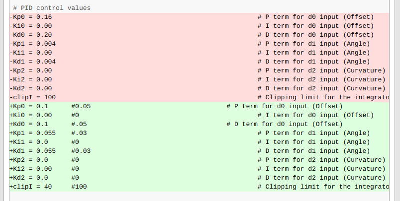
It's interesting that although some competitors tried very ambitious neural-network learning approaches to the contest, the winner just tuned the stock code with some better PID values.

The consensus from everyone is that the Pi Zero just doesn't have enough horsepower for proper AI.  The organizers are considering switching to Raspberry Pi 3 for the next season, which I heartily endorse.

Read more…

3689710071?profile=original

Hey everyone!

Emlid team is proud to present Reach RS - ruggedized, battery-powered RTK GNSS receiver. It enables centimeter accurate positioning for survey, mapping, agriculture and drones once again changing our perception of the equipment cost.

For laying out GCPs, or other types of survey work two Reach RS units operate together, one in base and another in rover mode. Reach RS is also seamlessly compatible with already available Reach module - compact and lightweight solution for drones with ability to integrate with autopilots for navigation and cameras for photo geotagging.


With an integrated high performance dual-feed antenna mounted on a large ground plane Reach RS is able to reliably track GPS, Glonass, Beidou, Galileo, QZSS and SBAS satellites.

3689709995?profile=original

The receiver is packed with Wi-Fi, Bluetooth, RS232. It is able to access NTRIP corrections, stream data to the cloud and fetch software updates. In remote areas Reach RS units can communicate via integrated LoRa radios giving you a reliable correction link on distances up to 8 kilometers. Reach RS is a seamless addition to your existing equipment thanks RTCM and RINEX support. 


Reach RS comes with a ReachView web app that works on any device with a browser and does not require an internet connection. Easily configure settings, record and download RINEX logs, view status, satellite signal strength, captured events and your location on a map. 2 gigabytes of internal storage are available for raw data RINEX logs and solution tracks which can be easily accessed from the ReachView app.

With IP67 rating and rugged polycarbonate enclosure Reach RS is ready for outdoor work. The receiver weighs only 700 grams and is just 145 millimeters wide making it one of the smallest and lightest RTK units available.


3689710017?profile=original

Special offer: pre-order Reach RS now and you will not only be among the first to receive it, but also get a $100 discount off each unit making it only $699!


Make sure to secure your units – offer is valid only for the first batch that will be shipped in mid-March 2017.


Learn more about Reach RS and pre-order with a $100 discount>

Read more…
3D Robotics

Tiny new uBlox GPS for drones

3689709929?profile=original

u‑blox has announced the launch of the ZOE‑M8G, an ultra‑compact GNSS (Global Navigation Satellite System) receiver module, specially designed for markets where small size, minimal weight and high location precision are essential.

The ZOE‑M8G offers high location accuracy by concurrently connecting to GPS, Galileo and either GLONASS or BeiDou. It also provides -167 dBm of navigation sensitivity. This makes the ZOE‑M8G ideal for wearable devices, unmanned aerial vehicles (UAVs) and asset tracker applications.

The ZOE‑M8G helps simplify product designs, because it is a fully integrated, complete GNSS solution with built‑in SAW‑filter and Low Noise Amplifier (LNA). This means it can be used with passive antennas, without the need for additional components, and without compromising performance.

The ZOE‑M8G GNSS module measures 4.5 mm x 4.5 mm x 1.0 mm. Due to its very small size, a complete GNSS design using a ZOE‑M8G module takes approximately 30% less PCB area compared to a conventional discrete chip design with a CSP chip GNSS receiver.

Uffe Pless, Product Marketing, Positioning Product Center at u‑blox, said: “When you’re designing products such as smart watches, fitness trackers, asset trackers, UBI dongles and even drones, every square millimeter and every gram counts. The u‑blox ZOE‑M8G makes it significantly easier for product designers to achieve precise location tracking while keeping within their strict form factor and weight restrictions.”

Read more…