All Posts (11069)

Sort by
3D Robotics

QGroundControl 3.5 released

3689738167?profile=original

Congrats to the QGroundControl team who have just released version 3.5 of my fave GCS. Along with a lot of bug fixes, these are the new features:

  • Overall
    • Added Airmap integration to QGC. OSX build only.
    • Bumped settings version (now 8). This will cause all settings to be reset to defaults.
    • Added Chinese and Turkish localization and partial German localization.
    • Added support for the Taisync 2.4GHz ViUlinx digital HD wireless link.
    • Fix loading of parameters from multiple components. This especially affected WiFi connections.
    • ArduPilot Support for ChibiOS firmware connect and flash.
  • Settings
    • RTK Add support for specifying fixed RTK based station location in Settings/General.
    • GCS Location
      • Added UDP Port option for NMEA GPS Device.
      • GCS heading shown if available
  • Plan
    • Polygons Support loading polygons from SHP files.
    • Fixed Wing Landing Pattern Add stop photo/video support. Defaults to on such that doing an RTL will stop camera.
    • Edit Position dialog Available on polygon vertices.
  • Fly
    • Camera Page Updated support for new MAVLInk camera messages. Camera select, camera mode, start/stop photo/video, storage mangement...
    • Orbit Support for changing rotation direction.
    • Instrument Panel
      • Added ESTIMATOR_STATUS values to new estimatorStatus Vehicle FactGroup. These are now available to display in instrument panel.
      • Make Distance to GCS available for display from instrument panel.
      • Make Heading to Home available for display from instrument panel.
Read more…

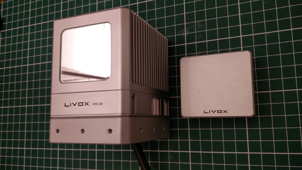
Livox Mid-40 LiDAR short review

livox_mid40.jpg?profile=RESIZE_710x Hi guys! Recently I had a chance to experiment with Livox Mid-40 - a 230 m range LiDAR using rotational Risley Prisms.
I thought I would share my findings with the community in case it can be considered a viable scanning solution!

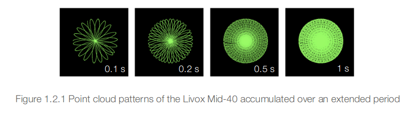
The first thing to note about this unit is the weight of 710g that could be a blocker for smaller UAVs. The scanning field of view is 38.4° (circular) and the scanning pattern is as follows:

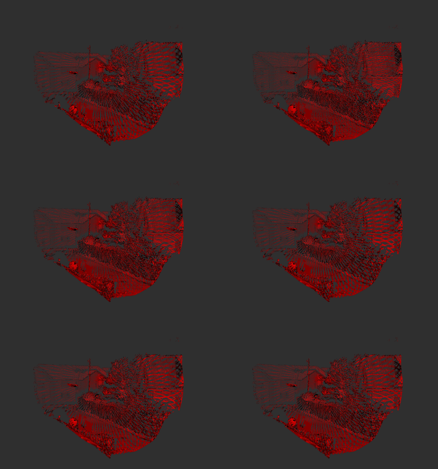
scan_pattern.png?profile=RESIZE_710xVisualizing the data here is a raw point cloud of a static scene (decay time - 0s, the gif shows the consecutive scans):

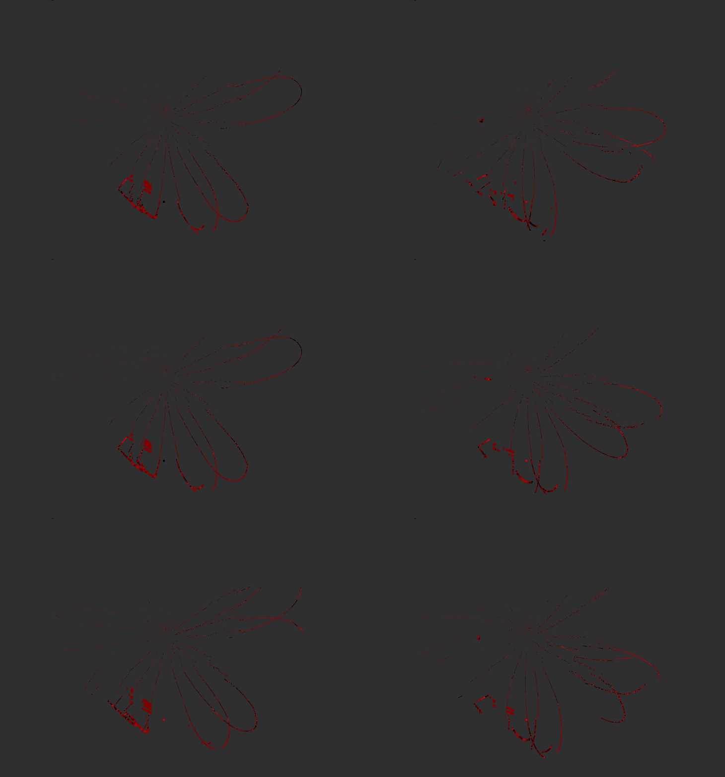
livox_outside_0_decay.gif?profile=RESIZE_710x

When we preserve each of the scan for 2 seconds we get such results:

livox_outside_2_decay.gif?profile=RESIZE_710x

My initial idea for using this sensor was for SLAM however due to the scanning pattern I found it difficult to use with off the shelf tools however I think the sensor could work well for UAV laser scanning (assuming a decent positioning system).

If anyone of you based in Europe has a platform that could carry this LiDAR and a positioning system we could use for referencing the scans then I'd be up for some joint integration project.

If you would like to learn more about this LiDAR here is a review that I wrote on my blog. Feel free to let me know if you have any questions and if you have any ideas for some further tests then let me know!

Read more…
MR60

Build video of an Ardupilot 3" micro quadcopter on a Kakute F7 ARM processor autopilot.

The build is an endurance HD camera & FPV ship with full autonomous capability thanks to Ardupilot, from take off, to landing.

Flight test & endurance video to follow...

Parts used in this build:

⦿ Frame : custom frame - watch build video here
https://youtu.be/xKhgZ4hKZ-4

⦿ Autopilot : Kakute F7

⦿ ESC : Racerstar Tattoo 35A 4-in-1

⦿ Video Tx : Eachine VTX03S

⦿ HD & FPV camera all in one : Runcam Split mini2

⦿ Radio telemetry : HK MX Mini

⦿ Radio receiver : FrSky R-XSR

⦿ Motors : EMAX RS1106 II - 4500 Kv

⦿ Propellers : Gemfan 3025BN

⦿ GPS & compass : Matek M8Q-5883

Cheers,

Hugues

Read more…

New thermal camera for from Workswell Labs

3689738089?profile=original

Workswell WIRIS Security is a thermal camera for drones (UAV or pilotless planes) designed specifically for security applications, such as building and perimeter surveillance, searching for missing persons, firefighting operations, field research, searching for and counting wildlife etc. 

WIRIS Security offers unrivaled resolution 800×600 px and thermal sensitivity 40 mK! No other thermal imaging camera for drones will offer you the same parameters! camera is equipped by incorporated specialized visual band imagery RGB camera with high sensitivity for dusk and night vision and possibility of optical ZOOM. Thus, the RGB camera image is cleareven with minimum light of 0.0008 lux. Focal length is variable within interval of 129.0 mm – 4.3 mm and it equals up to 30x optical ZOOM.

The Workswell WIRIS Security camera weighs 780 grams and its dimensions are 111 mm x 80 mm x 103 mm. The thermal camera spectral range is 7.5 – 13.5 μm, i.e. this is a regular LWIR camera, as has been the industry standard.

More informations about WIRIS Security.

Read more…

3689737946?profile=original

Melissa Schiele, MSc student from Imperial College London, joined the 2018 May expedition to the British Indian Ocean Territory to use fixed wing amphibious drones to look at megafauna distribution across the Chagos Archipelago. @explorer_mel


By Melissa Schiele, MSc   July 8th, 2018

I was thrilled when Dr Tom Letessier from ZSL chose me to help with his drone research as part of the Bertarelli Programme in Marine Science. To our knowledge, no one had a fixed-wing water landing drone. Our plan was to survey some of the islands of the Chagos Archipelago to compare distributions of megafauna around islands with birds nesting on them to islands with invasive rats on them.  The drones were amphibious Aeromapper Talons manufactured by Aeromao Inc., in Canada.

3689737835?profile=original

3689737964?profile=original

The use of UAVs (Unmanned aerial vehicles), or drones, is gaining traction in the world of ecology and conservation. In marine environments, drones are being tested for their ability to locate megafauna and map areas. Initial results have been promising across the board and many are looking to drones (of all types) to bridge the gap between ground truthing surveys (diving transects etc) and large-scale plane based surveys, which cover thousands of kilometres.

At the end of April 2018, I flew out to Canada to learn how to fly our new drones with Aeromao, the company that created our waterproofed fixed wing drone capable of flying huge distances with the strength, stability and mechanisms of a small plane. With a two-meter wingspan, the units look impressive. After a week of training and our first successful water landing on Lake Erie, I packed up the two drones and flew from Toronto to the Maldives.

3689738065?profile=original

After a tense few days waiting for customs to release our drones, one hour before departure, they arrived on board our research vessel and we steamed to the Chagos Archipelago. Our first deployment and retrieval was a success and we captured our first aerial footage. Our drones have two cameras on board; one on the belly of the fuselage takes snaps every second and one in the clear nose cone that allows for live streaming of the drone flight to a screen used by the drone pilot. The images that we took have proved our original concept worked and we were able to pin point sharks, birds and large fishes.

To read the full article: https://www.zsl.org/blogs/chagos-expedition/project-drone-pioneering-steps-into-water-landing-drones-in-marine-ecology

About the Aeromapper Talon Amphibious

The Amphibious version of the Aeromapper Talon allows maritime operations by autonomously belly landing on water.

Read more…

3689738216?profile=original

According to Verified Market Research, The Global Drone Logistics and Transportation Market are projected to reach USD 21.52 billion by 2025.

What is Drone Logistics and Transportation?

Drone Logistics and Transportation involve the use of robots to automate the 3D printing process. The adoption of automated 3D printers is increasing as these robots are flexible and easy to program and allow for the completion of tasks at an increased pace. There are several industries in which Drone Logistics and Transportation can be incorporated such as Automotive, Aerospace & Defense, Healthcare, Consumer Products, Energy and more.

Download The Free Sample Report Here...                                  https://www.verifiedmarketresearch.com/download-sample/?rid=5942

Global Drone Logistics and Transportation Market Outlook

In the report, the market outlook section mainly encompasses the fundamental dynamics of the market which include drivers, restraints, opportunities, and challenges faced by the industry. Drivers and Restraints are intrinsic factors whereas opportunities and challenges are extrinsic factors of the market. Factors such as the increasing use of unmanned aerial vehicles in various applications as well as the rising demand for sophisticated application-specific solutions is expected to drive the drone and transportation market. Factors such as the bandwidth as well as battery life concerns are restraining the overall Drone Logistics and Transportation market growth.

Verified Market Intelligence narrows down the available data using primary sources to validate the data and use it in compiling a full-fledged market research study. The report contains a quantitative and qualitative estimation of market elements which interests the client. The “Global Drone Logistics and Transportation Market” is mainly bifurcated into sub-segments which can provide a classified data regarding the latest trends in the market.

Global Drone Logistics and Transportation Market Competitive Landscape

The “Global Drone Logistics and Transportation Market” study report will provide valuable insight with an emphasis on the global market including some of the major players such as Pinc Solutions, Cana Advisors, Drone Delivery Canada, Dronescan, Hardis Group, Infinium Robotics, and Matternet. Our market analysis also entails a section solely dedicated for such major players wherein our analysts provide an insight into the financial statements of all the major players, along with its product benchmarking and SWOT analysis. The competitive landscape section also includes key development strategies, market share and market ranking analysis of the above-mentioned players globally.

For More In-Depth Insights  ... Download The Free Sample Report Here...                                  https://www.verifiedmarketresearch.com/download-sample/?rid=5942

Read more…

3689738302?profile=original

Global UAV Drones Market Analysis

According to research firm  Verified Market Research, the global UAV Drones market was valued at USD 13.93 billion in 2017 and is projected to reach USD 49.37 billion by 2025, growing at a CAGR of 17.22% from 2018 to 2025.

What are UAV Drones?

UAV drones, or unmanned aerial vehicles, are aircrafts that do not reuire a human pilot aboard it in order to control its flight. The unmanned aircraft system consists of the unmanned ariel vehicle itself, the controller, that is often ground based, and a form of communication that exist between the two. There are several applications of the UAV market such as in surveying and mapping, precision agriculture, media and entertainment, military drone applications and many more. With the increase in the advancement technology the UAV drone market is growing.

Global UAV Drones Market Outlook

In the report, the market outlook section mainly encompasses fundamental dynamics of the market which include drivers, restraints, opportunities and challenges faced by the industry. Drivers and Restraints are intrinsic factors whereas opportunities and challenges are extrinsic factors of the market.
Factors such as the UAV drones efficiency in capturing pictures and videos are enabling the use of the drone in a more personal as well as commercial capacity, which is driving the growth of the overall UAV drone market. Factors such as the price of the UAV drone as well as the lack of awareness about the technology is restraining the growth of the market.
Verified Market Intelligence narrows down the available data using primary sources to validate the data and use it in compiling a full-fledged market research study. The report contains a quantitative and qualitative estimation of market elements which interests the client. The “UAV Drones” is mainly bifurcated into sub-segments which can provide a classified data regarding latest trends in the market.

Global UAV Drones Market Competitive Landscape

The “UAV Drones” study report will provide a valuable insight with an emphasis on global market including some of the major players such as
Aerovironment, Thales, Lockheed Martin, 3DR, Boeing, Northrop Grumman, DJI, General Atomics Aeronautical Systems (GA-ASI), Parrot, Precisionhawk and Textron. Our market analysis also entails a section solely dedicated for such major players wherein our analysts provide an insight to the financial statements of all the major players, along with its product benchmarking and SWOT analysis. The competitive landscape section also includes key development strategies, market share and market ranking analysis of the above mentioned players globally.

For more details ... Download the free report @ https://www.verifiedmarketresearch.com/download-sample/?rid=4609

Read more…

3 Craziest Things Your Drone Can Do

Drone Fishing

Believe it or not the whole concept of "drone fishing" is becoming a growing movement across the world. Individuals who are enthusiastic about both fishing and technology are utilizing their drones for "remote line casting". Now people can base on a beach and get their fishing line far out into the deep water, with no more effort than a 60 2nd drone flight over the swells.

p>As soon as you get the drone over the area where you want your bait in the water, you simply give the line a little pull. It either slides off the slightly upward-bent coat wall mount, or off the quick-release clip. Either approach works well.

With a drone, you can really enhance your odds of catching those prize fish you constantly dreamed about, however might never ever reach!

Drone Cooking

How about cooking with drone? Think about it. The propellers are great for slicing soft veggies or skinning fruit, and what better method to plop things inside a hot boiling pot of water without burning yourself than using a drone?

This might appear silly to a great deal of individuals. I mean, it's difficult to envision risking damage to your $200 drone by utilizing the props to move and dice food. For food enthusiasts who like drones, maybe it's a marriage made in heaven?

If this strikes your fancy, go on and provide it a shot. We 'd love to see your cooking drone-masterpieces in the comments area listed below.

Drone Beard Trimming

I bet at least one of your friends is a bearded man. Tell him that from now your drone is his new barber. Chances are that after your drone will ruin his beard he will need a visit to a real barbershop, or at least using a facial hair trimmer to shape his beard again. But the fun you both will get will be unforgettable.


Now that drones are powerful enough to lift objects (and even people!), the potential uses for them continue to skyrocket all the time. Do you own any kind of drone? What’s the craziest thing you’ve done with your drone?

Read more…
3D Robotics

Is it a rocket? A ducted fan-copter? Both?

I dunno which it is, but it's really DIY and interesting, and that's all that counts. From Hackaday:

Quadcopters are familiar, and remote control planes are old hat at this point. However, compact lightweight power systems and electronic flight controllers continue to make new flying vehicles possible. In that vein, [rctestflight] has been experimenting with a brushless electric rocket craft, with interesting results.

The build uses a single large brushless motor in the tail for primary thrust. Four movable vanes provide thrust vectoring capability. To supplement this control a quadcopter was gutted, and its motors rearranged in the nose of the craft to create a secondary set of thrusters which aid stabilization and maneuverability.

The aim is to experiment with a flight regime consisting of vertical takeoff followed by coasting horizontally before returning to a vertical orientation for landing. Preliminary results have been positive, though it was noted that the body of the aircraft is significantly reducing the available thrust from the motors.

It’s a creative design which recalls the SpaceX vertical landing rockets of recent times. We’re excited to see where this project leads, and as we’ve seen before – brushless power can make just about anything fly. Even chocolate.Video after the break.

Read more…

Skywalker New Catapult On Sale for Fixed Wings

3689737648?profile=original

Skywalker are  launched new catapult for professional mapping survey at the

beginning of 2019.

     It is really amazing masterpiece at first sight. It looks superb and professional

design with aluminum alloy material. It is best choice for taking off fixed wings.

3689737773?profile=original

     There are some data as belows to take for reference:

     Max. launching weight: 4.5kg
     Unfolding length: 2.4m
     Unfolding height: 0.9m
     Folded length: 1.2m

3689737679?profile=original

3689737797?profile=original

3689737803?profile=original


Reminder: Portable and easy operation. Operate with attendance of experienced staff.


Attention: Forbidden empty launching or launching with total weight under 2kg! 


If you have any question, feel free to contact with me.


Skype:skywalker-ellen@outlook.com

Email: skywalker-ellen@outlook.com

Read more…

3689737744?profile=original

Hi,

We’ve reached the final chapter in our series of articles in which we compare the precision of different drone autopilots from various manufacturers.

All drones were flown on a typical area scan route created using UgCS flight planning software and compared in terms of how accurately can they stick to survey lines on horizontal and vertical planes.

3689737917?profile=original

Drones flown in these tests range from hobby-level drones such as Pixhawk with Arducopter firmware and popular consumer-grade drones such as DJI Phantom 4 to more professional drones like the DJI M600 RTK. This list even includes a very expensive drone with Kestrel autopilot that is used in the military and by law enforcement agencies - the Lockheed Martin Indago.

Since precision had to be measured numerically, Python scripts were written which compared the .kml file from each flight to the .kml file of the test mission. Only points from straight survey lines were used, points from turns (when transitioning from one survey line to the next) were ignored. Then the closest horizontal and vertical distances from each point in flight were compared to the test route. The table below presents the average and maximum horizontal and vertical deviations.

Autopilot / turn type

Turn type

AVG Horizontal Error

MAX Horizontal Error

AVG Vertical Error

MAX Vertical Error

DJI A2

stop and turn

0.62

2.7

0.45

1.71

DJI A2

bank turn

1.61

9

0.44

2.26

DJI A2

adaptive bank turn

1.03

5.13

0.35

1.66

3DR Iris - Pixhawk with PX4 fw

straight

0.32

0.91

1.27

1.96

3DR Iris - Pixhawk with Arducopter fw

straight

0.3

0.77

0.15

0.41

3DR Iris - Pixhawk with Arducopter fw

spline

0.54

1.74

0.34

0.57

DJI Naza-M V2

adaptive bank turn

1.04

3.29

0.62

1.96

DJI Naza-M V2

stop and turn

2.56

9.14

0.41

1.38

DJI Naza-M V2

bank turn

1.03

4.11

0.57

2.18

MikroKopter Quad XL


0.86

3.19

0.93

2.66

DJI Phantom 3

adaptive bank turn

0.16

0.55

0.09

0.23

DJI Phantom 3

stop and turn

0.18

0.53

0.13

0.63

DJI M600

stop and turn

0.28

1.04

0.08

0.19

DJI M600

adaptive bank turn

0.31

1.02

0.08

0.19

DJI M600 RTK

adaptive bank turn

0.14

1.19

0.03

0.1

DJI M600 RTK

stop and turn

0.1

0.45

0.03

0.1

DJI Phantom 4

stop and turn

0.31

1.36

0.11

0.3

DJI Phantom 4

adaptive bank turn

0.36

0.74

0.19

0.41

DJI Inspire 1

adaptive bank turn

0.16

0.53

0.36

0.85

DJI Inspire 1

stop and turn

0.26

1.12

0.26

0.85

Microdrone MD 4-200


0.58

2.31

9.76

11.49

LM Indago


0.67

3.05

4.73

17.81

Yuneec H520

stop and turn

0.1

0.34

0.62

0.8

As seen from the table, two drones with the lowest horizontal average error of 0.1 meters are the DJI M600 RTK and Yuneec H520. On a vertical plane, however, the DJI M600 RTK proved to be more accurate with an average vertical error of 0.03 meters.

It is also worth mentioning that Pixhawk autopilot with Arducopter firmware while being one of the cheapest drone setups in this list, proved to be quite accurate with an average horizontal error of only 0.3 meters and average vertical error of 0.15 meters.

Please note that these tests were not made under ideal circumstances. Environmental factors such as wind and temperature were not identical in all tests so it is likely that they had some impact on the results.

If you have any questions or ideas for more tests we could do, make sure to leave a comment.

Newest version of UgCS mission planning software can be downloaded here: https://www.ugcs.com/en/page/download

Wishing you safe and precise flights,

UgCS Team

Read more…

3689737719?profile=original

Air Sciences Inc. hired GeosUAS Inc, and Aeromao Inc. to demonstrate the Aeromapper Talon's capabilities for use in high resolution terrain mapping of a windy, dry lake bed in Southern California. Air Sciences is considering the Aeromapper Talon to acquire 3 cm resolution DEMs and orthophotos for around 8 km2 to be acquired on regular intervals.  

During the tests, the Talon flew several successful flights of up to 1.5 hrs.  The plane flew and landed successfully when ground level winds were about 15 mph and gusting to 20 mph. Once the images were processed with Pix4D Mapper, the resultant terrain and orthophotos were of high quality, equivalent to data obtained from an industry-grade quadcopter.

For Air Sciences, the Aeromapper Talon is particularly attractive because its price is less than half of its competitors.  Consequently, an operational Talon and a second backup system, still cost less than a single plane from other competitors.  As such, the Aeromapper Talon, in addition to being inexpensive can also provide a unique level of operational reliability, still at a reasonable cost.

The Aeromapper Talon is a turnkey sUAS manufactured by Canadian company Aeromao Inc. and designed for tasks such as mapping, surveying, precision agriculture, monitoring and surveillance. It is a multipurpose fixed wing drone with a multitude of payload options, including high resolution RGB cameras with PPk, thermal sensors, multispectral cameras and various combinations of these.

For more information please visit: https://www.aeromao.com/aeromapper_talon_uav/


About geosUAS, Inc.  

Is a United States environmental consulting company which specializes in natural resource assessments for energy, mining, land management and conservation purposes.  GeosUAS incorporate UAS/UAV cutting edge technology like the Aeromapper Talon as well as multirotors to monitor critical resources, find endangered vegetation or conduct overall monitoring and assessments so field scientists can focus on the resource. As a drone service provider, GeosUAS, saw the need to outfit other professionals so its team started businabox.com to help you grow your business using drones (UAS/UAV) technology by providing a web domain name, technical resources, training and solutions within your discipline.  Business in A Box has over 800 web-domain names to fit any business or industry.

For more information about GeosUAS visit  http://www.geosuas.com/


About Aeromao Inc.

Is the Canadian leading UAV manufacturer, developer of the Aeromapper series of turnkey unmanned aerial vehicles for mapping, surveying, precision agriculture and remote sensing.

With exports to more than 45 countries since 2012, Aeromao Inc. offers a line of products that adapt very quickly to market demands and to unique client’s applications, where no other UAV manufacturer goes.

Read more…
State-of-the-art MIMO for long range video streaming

3689738319?profile=originalDoodle Labs has an extensive portfolio of wireless building blocks developed specifically with the UAS application in mind. Its research is focused on leveraging the benefits of COFDM and MIMO technology to address the inherent RF challenges that unmanned aerial systems face. As a part of this effort, Doodle Labs has developed a set of UAS-focused features within its BII™ software stack that extend the flyer’s communication range and supports Beyond Line of Sight (BLOS) operations. 

With all the opportunities and challenges faced by UAS manufacturers, there is a strong need in the industry for the following features:

  • Minimal Size, Weight, and Power Consumption (SWaP). Flight times are directly correlated to the power consumed by the system. Every millimeter and gram needs to be accounted for, and components should only be consuming power to the extent that they are being used.
  • Long-Range, Beyond Line of Site Communication. Many unmanned systems have the ability to fly many kilometers away and across objects that impede direct line of sight, requiring data links that can do the same.
  • Command & Control and Sensor Data on a Single Link. The uplink connection to the vehicle needs to be highly reliable with low latency to send command and control information, while the downlink requires up to 20 Mbps of UDP throughput for streaming sensor data such as 4K video.
  • Encryption and Immunity against Cyber Attacks. Public Safety, Defense, and many Commercial applications transmit highly sensitive data. Communications must be secure and the vehicles must be protected from unintended parties gaining access.
  • Ease of Integration. Unmanned systems have unique, complex architectures and require communication solutions with a variety of interfaces and plug-and-play abilities to minimize time and effort spent on integration.
  • Licensed and Unlicensed-Band Operation. International and Defense customers have access to special frequency bands. UAS manufacturers need the ability to communicate in each of these frequencies without needing to redesign their system for each new project.
  • Mesh Networking. Wide area surveillance and multi-vehicle applications require advanced networking, including self-forming and self-healing mesh.

Download this Solution Note to understand how these requirements are met using Doodle Labs radios.

Read more…

3689737661?profile=original

Welcome to the wonderful world of drones. If you've just gotten your first drone, you’re in for a real treat, so get ready to enjoy the experience.

Perform Pre-Flight Procedures

Like any pilot, you’re responsible for completing a thorough, pre-flight inspection. A comprehensive checklist is an efficient way to ensure you don’t forget something important. You need to check everything that could affect the drone including the weather, obstructions like power lines, required permissions, firmware updates, planned flight route, etc. If you encounter any problems, make sure they're completely resolved before takeoff. You should always be refining your checklist as you encounter and solve problems with each flight.

The Weather Challenge

The weather affects your drone’s performance and longevity. The weather is extremely unpredictable, so you should have a reliable, current source of developing weather conditions.

Excessive temperatures can cause immediate and long-term problems. Cold and heat can damage the drone and impact battery performance. Fog can make it hard to see your drone and navigate it safely around hazards. Monitor your battery in case you need to cut a flight short. If it’s absolutely necessary to go up in inclement weather, try to plan a shorter trip and stay close to the drone.

Humidity can be a problem regardless of the type or amount. If there is any type of humidity present during a flight, be sure to thoroughly clean and dry the drone, or the unexpected humidity will be free to cause damage. The wind has the power to exert its influence. The best way to avoid potential damage caused by wind is to avoid flying when it’s windy.

Treat Your Drone With Respect

A drone blurs the line between a toy and a tool, but don’t let that fool you. As an electronic tool, it requires attention. If you don’t take proper care of your drone, it will become a very expensive, broken toy. For example, if you don’t manage or take care of your battery, it could cause severe problems down the line.  Many drone manufacturers will offer a maintenance schedule that will deal with everything from mechanical components to software upgrades. Following this advice and checking for updates to maintenance suggestions can help you to keep it running long-term.

Store Your Drone Safely

Storing your drone is an important part of drone maintenance. Like other electronics, drones need to be stored in climate-controlled spaces because extreme heat and cold can cause electronics to expand and contract which can lead to cracking and short-circuiting. The drone should be thoroughly cleaned before storage and wrapped in something that will offer some protection. It’s critical the batteries be removed because they can deteriorate and harm the drone.

With proper care, your drone will give you many years of service and enjoyment. Let your imagination be your guide!

Read more…

Latest from DroneMapper Rapid / Remote Expert Release

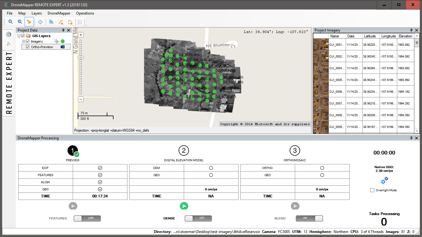
20181120-release.png?profile=RESIZE_710xThe free version "RAPID" now allows higher resolution DEM generation and blended Orthomosaic! 

DroneMapper Rapid and Remote Expert Version 20181120 has been released. Please download the latest version here. This release has the latest UI modifications, back-end API performance enhancements and features. See the full change log below:

  • New orthomosaic functionality, multi-threading (BETA)
  • Orthomosaic seamline feathering (BETA)
  • Alternate initial tie-point computation by image center distance to neighbors
  • Added functionality to compute DEM / Ortho at native resolution
  • Various bug fixes and API updates
  • UI improvements and updates
  • New real-time API log viewer window
  • Updated/improved 3D textured mesh creation
  • Improvements/simplification of mask creation tool
  • Generate undistorted TIF images based on aerial triangulation results
  • Process stereo pairs/epipolar imagery
  • Allow RAPID users dense processing mode (4x native DEM) and 2x native ortho options
  • Allow RAPID users ability to radiometric blend ortho tiles/seamlines
  • Deprecated REMOTE version
  • Updated processing form icons
  • Fixed GSD reporting truncation issue
  • Updated UI layout
  • Updated UI components/icons

thanks and best regards, 
the DroneMapper Team

Read more…


Our new video provides a simple overview of real-time kinematic (RTK), post-processed kinematic (PPK) and NTRIP. It also demonstrates how Reach RS+ can be used in the field for various applications.


Resources


Check Emlid docs to learn more about real-time kinematic and Reach:


Reach RS+ is available in Emlid Online StoreYou can also get Reach RS+ locally. Check the list of Emlid resellers on the dealer's page.

Read more…
3D Robotics

From IEEE Spektrum:

The NIMBUS Lab at the University of Nebraska has been developing drones that have the unique ability to dig holes in the ground and then fill those holes with sensors. If this sounds like a complicated task, that’s because it is: The drone needs to be able to carry a portable digging system a useful distance, locate a diggable spot, land, verify that the spot it thought was diggable is in fact diggable, dig a hole and install the sensor, and then fly off again.

At IROS late last year, folks from the NIMBUS Lab presented a paper detailing a rather burly quadcopter that could carry an auger with an embedded sensor and use it to place the sensor in the ground (you can see a video of this in action here). And at ISER a few weeks later, they presented another paper on how the drone can autonomously figure out whether it’s digging in a good spot or not.

One of the biggest challenges to a system like this is that by the time you pack in the drilling rig and all the sensors and computers that the drone needs to operate autonomously, you’ll be lucky if the thing will manage to keep itself aloft for more than just a few minutes. This is not particularly useful, since the whole point is to send the drone out to place sensors in areas that you can’t easily get to yourself. What’s needed is a way of extending the drone’s range, and the NIMBUS Lab came up with one: A helicarrier, a parachute, and one of the most bizarrely effective drone deployment systems I’ve ever seen.

Read more…

Hi,

In December we had a great chance to test the M600 Pro system with a terrain following module in sunny Peru!


In general, SF11/C works perfectly. There was one annoying issue: under extremely bright sun over some surfaces it can miss readings for a long time. Fortunately, a solution was found quickly: during the trials we used improvised lens hood.

3689737562?profile=original

.. from short distance:

3689737586?profile=original

These altimeters are quite popular in the industry and among DIYers, so be warned if you use them to fly over very low altitudes.

Now we use modified holder for standard lens hood for Nicon lenses, but any similar ones should work as well.

3689737476?profile=original

3689737441?profile=original

3689737493?profile=original

I must say that Peru is a very interesting place in many ways. Especially the rich history of the Incas and earlier settlers, the ruins and other remains of their civilisation. As one of our hosts put it, “you can dig in any place in Peru and will probably unearth some ancient debris”. A lot of artefacts and skulls were lying just like that in the middle of the desert where we were testing our system..

3689737610?profile=original

Safe flights,

Alexey Dobrovolskiy

http://www.ugcs.com

Read more…

Impressive multicopter wing hybrid

Finally, a novel wing rotor design which actually looks like it should fly.  It might only be the finished look instead of the usual carbon fiber rods & duct tape.  There's obviously still a torque problem on the wings, as it approaches higher speed.  It seems like a safer & more scaleable way of attaching many rotors than having a web of them right next to the payload.  Getting in doesn't require traversing a sea of propellers.  There's less danger of a human passenger falling on a propeller.  But the wing is heavier than a nest of carbon fiber rods.  

Read more…