Professional DIY radio communication equipment has changed over the years but this is a very big change moving from analog to digital ; the major brands are CUAV , XBEE & SLNTOR! The change has radios operating on 2.4ghz with range of over 20 kilometers caring control , telemetry signals as well as hiy definition video. It supports 2.4GHz (2. 402~2. 478 GHz) and suitable for long distance, stream and wireless transmitting application. The transmitting rate up to be 70Mbps and the farthest transmission distance is 20km air to ground. there is a number of new radios on the market replacing the old 3DR Radios on 400mhz - 900mhz, also WiFi to x bee radios. CUAV P 900 RADIO DATA TRANSMISSION MODULE 1000MW 1W 2PCS WIRELESS FOR PIXHAWK/PIXHACK FLIGHT CONTROLLER Frequency 902 - 928 MHz WTR24 Wifi to Radio module transfer xbee/sx/p900 data transmission wireless standards IEEE 802.11g, IEEE 802.11b transmission speed 11g : Up to 54Mbps, 11b: up to 11Mbps WIFI communication distance 150-500 meters (depending on computer or mobile phone) baud rate 57600 attended mode UDP:14550 channel range 1 - 13 (default 11 channels) frequency range 2412 - 2472MHz highest support 1080p input and 720p output. Connected to the computer via WiFi, mobile phone and other equipment. Transmission Range : 1-3km, EIRP : 500mW X2, Receiver Sensitivity (1%PER) : -95dBm ±2dBm, Frequency : 2.4GHz ISM Video Input Format : HDMI : 720P 1080P, Support : GOPRO3 GOPRO4 Xiaomi Yi camera which with HDMI output. http://brushlessgimbal.ca
Posted by Wade Zhang on January 22, 2018 at 7:02pm
ComNav Technology had released K726 dual antenna GNSS RTK Positioning&Heading OEM board half year in domestic market, had got successful cooperation with some UAV manufacturers during this period. This video is showing the performance of K726 board for agricultural spray drone hovering in "L" shelter environment.
Now K726 board is ready for international market. If any interests, please feel free to contact me by emailgnss.oem@comnavtech.com.
Posted by Shevelev Ilya on January 21, 2018 at 11:35pm
Solving urban problems requires timely information about every aspect of the city functioning. Today using UAV's is a great way for local governments to get precise data as 3D models, orthophotos and digital elevation models. However, collecting data is just a first step of decision making process, what is important is to have a set of special tools to work with this data and take all it advantages for urban design, land use and emergency management.
In "Geoscan" we work in close collaboration with local governments on creating efficient tools for urban development. The base solution we work on is Sputnik GIS and its web version – Sputnik Web. The core feature of Sputnik products family is ability to view 3D tiled models of city with no limits on data size. For example, we have created model of Tomsk city featuring total area of 320 square kilometers, and specialist from Tomsk urban department use it in daily tasks.
The great thing about using digital copy of city is an ability to embed design solutions to existing landscape and analyze all advantages and disadvantages of it. This approach helps to make project presentation process faster and cheaper and speed up decision-making process.
Along with 3D model embedding tool in Sputnik, there is an export tool. Once you have a model of whole city you can export single building or whole district to *.dae, *.3ds or *.obj format to share it with colleges, customers or for further usage in third party 3D software.
Sputnik GIS allows specialist to create city-design, zoning and other projects and share it with locals via web based local government 3D GIS portal based on Sputnik Web(use Google translate to translate web site from Russian), so people can evaluate solutions, leave comments, ask questions and participate in the future of city.
The number of built-in functionalities allows using Sputnik for solving wide range of problems without need of using other software solutions. For example, there are set of measurements of tools like area calculation, volume calculation, change detection, section generation, slope map calculation and more. Along with design and planning tasks local governments use this set of tools to monitor and inspect municipal construction sites, infrastructure and for waste management.
A few years ago I struggled a lot to study and understand OpenCV, especially the calibration process.
Now that I have just a little bit more the hang of it, I thought It might be helpful for people that are going to approach this incredible computer vision library starting from zero.
The process of installing OpenCV on some single board computers is not as straightforward as "apt-get install...." and you have no other choice rather than compiling it from zero.
Aeromao Inc, has delivered an Aeromapper 300 customized and ready for the Nano-Hyperespectral camera from Headwell Photonics to the University of Brasilia, in Brazil.
Since the initial approval was granted the custom integration was performed in a record time of only a few weeks.
When it comes to find a UAV dependable enough to trust such an expensive sensor, the Aeromappers are the obvious choice thanks to its affordability, dependability, ease of use, parachute recovery and great level of support.
The Nano hyperespec camera is fully enclosed into the payload bay, meaning that the sensor is very well protected by the carbon fiber/Kevlar pod of the aircraft. A quick swappable mount is provided so the aircraft can be also used normally with other sensors such as the RGB 24 Mp camera included.
The Headwall’s Nano-Hyperspec® sensor is a completely integrated hyperspectral camera designed for the VNIR (400-1000nm) spectral range, with interchangeable lens capability. A key advantage of the Nano-Hyperspec is that it also includes 480GB of on-board data collection/storage, plus attached GPS/IMU functionality.
Aeromao Inc. is a Canadian leading UAV manufacturer since 2011, developer of the Aeromapper series of turnkey unmanned aerial vehicles for mapping, surveying, precision agriculture and remote sensing.
With exports to more than 45 countries in less than 4 years after founding, Aeromao Inc. offers a line of products that adapt very quickly to market demands and to unique client’s applications, where no other UAV manufacturer goes. From wildlife monitoring in the Artic to water quality monitoring in Saskatchewan, to urban mapping in Thailand, the Aeromappers are currently being used by private companies, research organizations, universities and government agencies all over the globe for a wide variety of applications.
Posted by yangdaonline on January 20, 2018 at 8:51pm
Eagle Eye-30IE-360 is the new version of Eagle Eye-30IE,there are 2 features for this new 30X EO/IR zoom camera:the first one is its 360 degree rotation,that means the gimbal has unlimited Yaw angle,which is very useful in missions like security and surveillance.Imagine you are tracking a fast moving target,the tracking will possibly be lost if the gimbal reaches its Yaw angle limit.With the 360 rotation gimbal,this problem will no longer exist.The second feature for Eagle Eye-30IE-360 is that it is equipped with an Ethernet video out.In this case,IP video downlink can be used for video transmission.Anyway,if it happens that an HDMIvideo downlink is needed,then no problem,the gimbal comes with an IP over HDMI converter board.
There will be 2 modes for video out and video recored. Mode 1:1080P 60FPS video out plus 640*480 video recorded.Mode 2:640*480 video out plus 1080P 60FPS video recorded
Features:
1) Weight:1200grams(cameras included) 2) 1/2.8 inch 2.13MP CMOS sensor 3) 30X optical zoom,1080P/60 Ethernet output for video downlink 4) 640*480 H.264 video recorded for on-board TF card 5) Thermal camera:640*480,25HZ,1-4X digital zooming,radiometric(optional) 6) Auto object tracking function 7) Geotagging,gimbal Yaw/Pitch angle info,height,time will be displayed 8) PWM control and serial command control 9) Convenient wiring hub for RC receiver and video output 10) 3-aixs high stabilized gimbal system 11) Adjustable control speed: SLOW speed for large zoom range,accurate.FAST speed for small zoom range,sensitive and quick. 12) One key back to home position
Posted by Tersus GNSS on January 17, 2018 at 6:48pm
Get the centimeter-accurate multi-GNSS L1/L2 GNSS kit for your drone DIY projects. Standard 433/915 MHz and high-end radio versions are available.
Standard radio versions are 915 MHz (US) and 433 MHz (Europe). The two radio transmitters in an RTK system need to be able to pass RTCM data from the base station to the rover receiver. The bundle includes a basic low-power radio link that runs quickly and is good for short baseline applications.
High-end radio version is with Tersus radio station RS05R, which is a rover radio solution for wireless application. It provides reliable data communication for mission-critical applications where a combination of stability, supreme performance and long range are required. The RS05R is designed for digital radio communication between 410 and 470 MHz in either 12.5 or 25 KHz channels, which can be widely used in GNSS RTK surveying and precise positioning system.
Posted by Kay Wackwitz on January 17, 2018 at 12:00pm
The changes and developments we saw throughout thedrone industryin 2017 were incredible and deserve a proper examination. For the mostpart, the hype that drove so much misunderstanding and frustration in this space is gone and that’s a good thing. While the kind of hype we’ve seen associated with UAVs can create needed attention, it can also lead to irrational behavior and impossible expectations. Now that we can get a better sense of when drones will be able to reach the “plateau of productivity” from the GartnerHype Cycle, we can finally talk about the organizations and uses of this technology that will truly drive and define the drone industry.
How does our Drone Ecosystem Map help define what these developments look like in 2018 and beyond though? First, it provides a great overview of the most active and relevant players in the drone industry in their category and sub-category. We limited the Map to 1,000 players so you can focus on the companies and people that are set to have the biggest impact on the drone market. The Map is not totally comprehensive, and it’s not supposed to be. The focus is on the diversity and reach of this drone ecosystem.
The second way it can help is directly related to the first, since the Map can help you uncover niches and players you might not otherwise come across in this vivid market. Since we’re not trying to provide you with an all-encompassing look at the drone industry as a whole, you can use the Map to find technology and organizations that can make for ideal partners. We’ve heard from countless people who got in touch to say they used the previous version of this Map to locate strategic partners. This is a resource that has led to a great deal of investment for people on every side of the drone industry. Transparency can and does drive decisions in this space, and that’s why we want to share our knowledge with anyone who is or will be making a decision about drone technology. [...] read full article
If you have any questions, please reach out via info@droneii.com
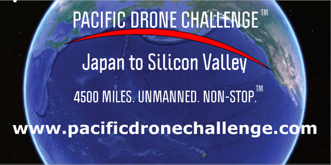
The Pacific Drone Challenge, inspired by the Xprize, has the goal of pushing the boundaries of what is possible with civilian drones. You have to do it for your name in the history books as there is no financial prize. Could we see this challenge accomplished by the DIY community? Getting the permits, insurance and having a pilot licence is not for everybody, but many are flying aircraft as a hobby, so it is possible. Right now, the Japanese company Irobotics and the organisation SabreWingAircraft accepted the challenge.
A quick calculation seems to show that battery only is out of the question for that distance. The best gliders have a 70 to 1 ratio. This would mean you would have to start at a height of 100 KM (or realistically, climb 100 km over the whole trip). Even if your plane was only made of batteries and it had perfect efficiency, the energy density of batteries is barely enough to provide the energy required (using an energy density of 950000J/kg). Optimization of the motor, the propeller and the air-frame is will be critical to succeed.
How would you go about this challenge? Build from scratch? Modify a glider? Use a flying wing? Let me know in the comments!
Posted by Yutaca Sawai on January 16, 2018 at 1:30am
Task 2.8 : Biomechanical simulation of Butterfly swimming (Improved version)
The biomechanical mechanism of butterfly swimming technology is very difficult and it is still necessary to continue the research. I could not be satisfied with my first achievement in this year and I rebuilt it over and over again. Therefore it became necessary for several days for this research.
The movement of the shoulder is very characteristic. It boldly spreads her arms, bravely rushes, draws an arc, draws back to the waist again. When I was designing this aggressive arm movement mechanism, adrenaline came out.
Task 2.7 : Biomechanical simulation of Breaststroke swimming
The final mechanism analysis has completed now. I'm planning to open and share this revolutionary rapid development framework. As a result of years of analysis to the esoteric mechanism of the animal shoulder, I came now to use the bolt action mechanism of the rifle that was widely used for US military weapons during the Civil War. Let's make this using our best.
From this year I will begin physical implementation of animal drone with high-level mechanics. We will be able to develop compact and organic tillers and cultivators. It can be produced in Canada and Mexico using precision parts made in the USA. It is feasible. I would use this effort to improve the industry between the USA, Canada and Mexico along with the end of NAFTA. In order to resurrect agriculture in Mexico, Branding is very important. To that end, promote the research and development of Mexican herbal medicines and organic farming methods. If cooperate with herbalists from Switzerland and France, It will be able to do interesting production. We can also get inspiration from Biodynamic farming of Rudolph Steiner and Natural Farming Method of Fukuoka Masanobu.
On the other hand, Now I see the European industry is troubled by the multinational companies. After confusing due to the emissions fraud, now there is a conspiracy to eradicate herbs and insects with herbicides and pesticides. In Europe, herbs have been used for medicine and bees have been used for honey and cosmetics.
Task 8.7 : Biomechanical simulation of jellyfishes
I notice the similarity relationship between jellyfish fins and ideal hand finger movements.
Task 2.5.1 : Biomechanical simulation of hands, the automatisme in orthopedics (final edition)
What are the advantages of these products?
A universal biomechanical linkage mechanism that I propose has no waste and allows rapid revolutionary development to deal with various types of small-scale production. This is very effective in the digitization and horizontal distribution of labor, which is the backbone of next generation manufacturing industry.
It provides infinite applications, it is possible to provide artificial automatic prostheses with high mobility, as well as it can also be used for the neuro-orthopedic rehabilitation method using an augmented reality device, exercise for athletes, animal and insect drones, collective intelligence and swarm intelligence (tactical training of ice hockey), etc.
The artificial animal bodies made up by the universal biomechanical link mechanism are superior in terms of light weight, energy saving and cost. It works with few actuators and generates a powerful inertial force. Therefore, there are various environments that it can use. It is also suitable for use in extreme conditions beyond the limits of activity of natural animals, such as life saving rescues in natural disasters, deep sea exploration, high-radiation environments such as outer space.
An electric motor is a higher torque output unit, but it is difficult to perform as gasoline engines, which maintains the maximum power required for conventional rotating elements such as wheels. As a result, the cruise distance is shortened, and the size of the battery increases.
The universal biomechanical link mechanism can draw the efficiency characteristics of the electric motor. In other words, it is applied to the impulse of the artificial wings and the artificial hind legs while obtaining high torque at low rpm. Using the natural environment as a springboard it can increase stride length and it can also charge the battery with like an automatic winding mechanism of a watch while using the pulse vibration generated by the movement of artificial limbs.
When I review niche products like this Tattu R-Line 4s HV LiPo battery, it is very hard to find an exciting introduction. I already rewrote the first sentence three times and still didn’t find something satisfying…
In nutshell, LiHV batteries are like nitro for racing cars. While standard LiPo packs can be charged with up to 4.2V/cell, the Tattu R-Line HV LiPo allows you to charge it up to 4.35V per cell safely. Consequently a standard fully charged 4s LiPo has 16.8V and a HVLi has 17.4V. Furthermore, theoretically, LiHV can store more energy than LiPo per unit of weight.
In addition to the higher voltage, the Tattu 4S1P High Voltage Lipo Battery Pack comes with ultra high discharge rate of 100C.
Tattu R-line 100C, 4S, High Voltage Li-Po battery review
Disclosure: I received this HV LiPo pack as part of a product review collaboration with Gens Ace. Although the battery was offered for free, all opinions in this article remain my own and I was in no way influenced by the partner.
As usual for Gens Ace, battery comes well packed with charging plug protector and safety instruction. At first look, no visual difference between the standard 95C and the HV 100C LiPo pack.
Battery pack measures around 75 x 35.5 x 33 mm (L, W, H) and weights 163 grams. Size and weight is comparable to other LIPOs with same capacity.
Core features and technical specs
Designed for professional racing drones;
Higher max voltage than standard LiPo packs (4.35v/cell instead of 4.2/cell);
Better storage capacity than comparable size packs;
No memory effect;
Minimum of 1300 mAh storage capacity;
4 cells of 3.8v. Total voltage of 15.2V;
Ultra high discharge rate of 100C;
Max Burst discharge Rate: 200C;
JST-XH charging plug;
XT60 discharge (drone) plug;
Net Weight: 163 grams (±20g);
Dimensions: 75 x 35.5 x 33 mm (L, W, H).
You might wonder to over-charge a normal LiPo to higher voltage like this Tattu 100C HV allows. My suggestion would be DON’T even try it! It would dramatically shorten your LiPo’s life or even cause fire.
If you are using mixed type of LIPOs (normal and HVLi), also keep in mind to always check the charger’s end voltage. It needs to be manually set according to your LIPO battery type. Chargers are unable to detect whether you have plugged in high voltage or regular LiPo.
Tattu High Voltage Li-Po battery review: Test
Prior to my test, I performed a Break-in procedure, which is recommended for new LIPOs. This?consists in 5 gentle charging/discharge cycles.
Recently, I received a QUAD PORT RC charger for review, which is not just compatible with HV LIPOs, but also can charge simultaneously 4 types of battery. I also ordered a thermal probe, which allowed me to monitor the LiHV battery’s temperature during charging/discharging.
As you can see in the comparison table bellow, the HV 100C finished the charging process with higher storing capacity. The end voltage was also higher with 0.6 volt compared to standard LiPo. Both batteries remained?cold (~21 °C) during the charge.
For the real world test, I used my FuriBee GT 215 drone, which can be powered from 4s to 6s LIPOs. Due to the poor weather conditions I managed to have only two short test flight (one with each type of LiPo). Frankly, I found only a slight difference between regular and the LiHV. Performance increase was negligible, at least for me. If you really need higher speed, it is smarter to switch from 4s to 5s (of course if your drone accepts it).
Those who need advantages of a high voltage LiPo battery, this one can be ordered with 15% off from here (delivery from both, US and EU, is available).
Posted by Kostas Alexis on January 12, 2018 at 11:00am
This is to share results on radiation source localization in GPS-denied environments using autonomous aerial robots that estimate the nuclear (Cs-137 in the experiments) source location and intensity, while simultaneously planning for informative measurements. Smart selection of measurement points is critical as the robot has to dwell for sufficient time to allow the Poisson statistics to derive a confident measurement. The robot is equipped with CsI(Tl) scintillator with silicon photomultiplier and miniaturized electronics for counting and spectroscopy. The first video is explenatory of our approach while the following is taking place in a more realistic environment:
Additional details:
* Autopilot: PX4
* Position Controller: Linear Model Predictive Control running on an INTEL NUC (ROS)
* Localization: Visual-Inertial
* Path Planning: Explicit function to optimize for distribution of measurements
Posted by Patrick Meier on January 11, 2018 at 8:48am
Mosquitoes are one of the world’s biggest killers, responsible for spreading deadly diseases including Zika, dengue and malaria. Among the many ways being researched to combat this threat is the Sterile Insect Technique (SIT) – flooding the environment with non-biting, sterile male mosquitoes, which after mating produce sterile eggs and a reduction in the local mosquito population. One of the challenges for the potential use of this technique is efficiently spreading millions of sterile mosquitoes. Ground based release of sterilized mosquitos (via car/truck) have proven effective in developing countries but this depends entirely on the existing of roads in rural areas. Even if dirt roads exist, they often become unusable during the rainy seasons, and not everyone lives near a road in the first place. This is where drones come in. Unlike cars, drones can release sterile mosquitos in a much for uniform and targeted manner.
So for the past year we have been working together with the IAEA Insect Pest Control Lab on a drone-based mosquito dispersion mechanism, as part of USAID’s Grand Challenge on combating Zika and related diseases. We're now preparing to field test this drone-based release mechanism in Latin America using live mosquitos. Here's the latest!
Posted by Patrick Meier on January 11, 2018 at 8:30am
Disasters in the South Pacific are a reality. In the past 10 years, major Cyclones have seriously affected hundreds of islands across Fiji, Tonga, Vanuatu and Samoa to name a few; disrupting millions of lives and causing millions of dollars of damage. Many of the countries in the Pacific region are also exposed to other high risk disasters including earthquakes, tsunami, storm surge, volcanic eruptions, landslides and droughts, not to mention the growing threat of Climate Change.
What does all this have to do with Artificial Intelligence (AI)?
Aerial imagery is “Big Data” challenge. It can take hours and more often days to analyze aerial imagery following major disasters. This explains why the World Bank, WeRobotics and OpenAerialMap have just launched the Open AI Challenge focused on the use of artificial intelligence to automatically analyze aerial imagery in the South Pacific. More information on the challenge and how to participate and download the aerial imagery is available here.
We'd be very grateful for your help in sharing this opportunity far and wide.
At the close of the Global Fortune Forum in Guangzhou on Dec. 7, the event's hosts set a world record for the largest drone swarm ever deployed. For 9 minutes, 1,180 drones danced and blinked out an aerial show. It was cool. It was also an interesting look into the potential future of aviation.
According to an executive at Ehang UAVs, which provided the swarm, each drone cost $1,500, which is pretty darn cheap considering their capabilities. Take, for instance, the datalink and software used. It lets more than 1,000 flying robots coordinate autonomously and synchronize movements, with a flight deviancy of a mere 2 centimeters horizontally and 1 centimeter vertically. If something goes wrong and a drone can't reach its programmed position, it automatically lands.
In the show last month, these machines created striking formations of China, a kapok tree flower, and a ship. They also showed off a lot of potential for the military and security sectors. The fact that the drones can move autonomously, landing if they don't fulfill their directive, is particularly intriguing. Ehang is essentially boasting that its swarms can make decisions on how to repair itself, as well as improvise operational functionality.
This is just the latest drone development to come out of China. At Zhuhai 2016, the China Electronics Technology Group Corporation (CETC) and Tsinghua University released a video of a swarm zooming in improvised, network-generated flight patterns. Though the CETC-Tsinghua drone swarm was unarmed, a CGI sequence showed the drones hunting an enemy missile launcher in urban area, and then dive-bombing into the missile launcher, destroying it. CETC followed up by launching a swarm of 117 drones in June 2017 (pictured above).
Released by high-altitude balloons, these shoebox-sized, flying-wing drones glide for a 60-plus miles while collecting and eavesdropping on enemy signatures.
China also is looking at taking its drone swarms into near space, alongside a planned arsenal of anti-stealth drones, hypersonic spy planes and high-altitude airships. In fall 2017, the Chinese Academy of Sciences used high-altitude balloons to release two shoebox-sized, flying-wing drones that flew downward from a height of 15 miles, and flew a distance of more than 60 miles. Those high-altitude micro UAVs have passive sensors for detecting electromagnetic activity and can map terrain. Similarly to the Perdix system drone swarm showed off by the Pentagon's Strategic Capabilities Office, the Chinese Academy of Science's flock could be released by fighters, bombers, and other drones.
Posted by Nadia Nilsen on January 8, 2018 at 6:13am
Our friend Stephan Schindewolf, in collaboration with Thomas Stone and I.R. Lock, developed an affordable, front facing collision detection solution for the 3DR Solo, using a LightWare LW20 (or SF20) and a servo.
The LW20 comes standard with a built-in servo driver for SLAM maps within user-definable view angle and distance. The Lidar is being controlled by an Arduino, which manages the Lidar configuration, scanning and obstacle detection.
The Arduino is connected to the IMX companion computer in Solo via USB. On the IMX Stephan added the required controls and actions, LED handling, speech output and collision prevention routines in shotmanager.
Functionality
Current features include:
3 sector scanning for obstacles (left, center, right) within a 6 meter range ahead of Solo.
Scan is enabled by log-button press on the controller paddle. A short button press toggles the GoPro on/off as before.
Scanning on/off is indicated by a text and voice prompt in Solex.
The Solo LEDs indicate the detection of an obstacle by flashing in purple color: Left LED: obstacle to the left; right LED: obstacle to the right; both front LEDs: obstacle in center (LED control requires Arducopter 3.5 or higher installed)
If a front collision is detected, Solo goes into BRAKE mode in all flight modes except LAND or RTL. You can exit BRAKE by pressing the FLY button anytime.
In all smartshots, you will get visual feedback by the LEDs and voice feedback in Solex.
Obstacle avoidance keeps track of the forward pitch angle along with Solo altitude. As soon as the pitch angle for the current altitude would cause the lidar beam to hit ground, obstace avoidance is temporarily disabled. Both front LEDs flash in yellow to indicate that status.
Text and speech output in Solex, for obstacles in the center of the flight path also the approximate distance to the obstacle is reported
The following videos show the result of the hard work:
1. All the modifications require a great portion of care since you are modifying some of the core modules of the 3DR Solo software. It is strongly recommended to backup all the original files on the IMX before making any changes.
2. This project will void your 3DR warranty.
3. The project describes a 3D printed plastic housing for the SF20, but the LightWare aluminium housing, as fitted on the LW20, is recommended to avoid possible overheating of the Lidar (the aluminium acts as a heat sink).
LightWare would like to thank Stephan and Thomas for this great project. I'm sure many will find it interesting and helpful.
For more information about the LW20 please visit our website: LightWare
Fitted on a Mass-Market Microcontroller, 360Fusion Software Technology Detects any Dynamic Obstacle and Helps Guide Drones Away from Collisions
GRENOBLE, France – Dec. 14, 2017– Leti, a research institute of CEA Tech, will demonstrate the world's first low-power, low-cost 3D anti-crash, fusion-sensor solution for drones at CES 2018 in Las Vegas.
Leti's 360Fusion software, in combination with miniaturized sensors, collects, analyzes and transforms millions of incoming 3D distance data items into relevant, actionable information.
This technology provides consumers and innovative companies with a reliable and affordable integrated anti-crash system. It also ensures safe navigation and enables prompt action in civil-security applications and ensures both fast response and maximum performance for drones in defense uses.
"360Fusion is a flexible solution that is compatible with all types of sensors and that can leverage data from the best of them," said Marie-Sophie Masselot, Leti industrial partnership manager. "Fitted on a low-cost microcontroller, this technology can be embedded in drones to detect any dynamic obstacle and guide the drone away from a collision."
Features of 360Fusion include:
The first obstacle-avoidance algorithm in a dynamic environment based on cutting-edge, laser sensor technology
Ultra-compact and miniaturized design that fits into a tiny, mass-market microcontroller
10x cheaper than comparable systems
A highly integrated perception system that weighs less than 40 grams
Seamless integration in existing drone technologies
In its continuing work on the prototype, Leti will equip a fleet of drones with this technology to show they detect and avoid nearby drones, fit miniaturized radar sensors on the fleet, enable detours to safe routs when obstacles are detected and enable autonomous flight.
KlauGeomatics has announced a new PPK GPS technology for accurate aerial surveying using any drone without placing ground targets. See https://www.veritypositioning.com/ for more details.
I have connected a Tarot T-2D gimbal to Windows 10. Since I could not find anything about it, I thought to post the pinout, mostly so I do not forget it.
So the problem is that the standard usb adapter delivered with the Tarot T-2D uses a Proliferic chip, which only seems to work on Windows 7. I could not test it, since I lost it.
What also works is this:
-Use a normal FTDI adapter
-Set the baud rate (very important) in the device manager: