Getting tasered in national parks is probably not the best promotional use of drones.
http://www.huffingtonpost.com/2015/04/28/ranger-stun-gun-hawaii-sanders_n_7166192.html
Getting tasered in national parks is probably not the best promotional use of drones.
http://www.huffingtonpost.com/2015/04/28/ranger-stun-gun-hawaii-sanders_n_7166192.html
I've mentioned on a couple of posts over the last few months that we've been hard at work developing a fully integrated ground control station and gave it the first public airing at Skytech in London last week. It is built around the patented Wing control device to enable both manual piloting and mission planner editing with one hand. The other hand is free to operate aircraft systems and camera gimbal through the keyboard and secondary joystick.
It's been a lot of work getting this far and I'd really appreciate any feedback.
Cheers,
Sam
Construction drone company using Pixhawk-powered technology gets a nice write-up in TechCrunch:
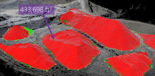
Mapping a job site – be it a construction site, oil field, or giant human battery pod factory – is a tough job. That’s why Identified Technologies’ Dick Zhang wants you to send in the drones.
His company, which is funded to the tune of $2 million, allows you to send a quadcopter around your job site to create a topographical map of the situation. It is completely autonomous, and the batteries can be hot-swapped as the drone maps. The system comes with a base station where the drone comes to roost when its done.
The company is already profitable with a number of contracts in Pennsylvania.
“We have a heavy focus in the Marcellus Shale region, which delivers over 40 percent of this country’s natural gas. We’ve experienced consistent growth every month. We are forecasting 10x growth in our deployments and revenue over the course of the year,” said Zhang.
Normally jobs sites like this hire planes to fly over the job site and take photographs. However, because this turnkey operation can be launched anywhere and by anyone you can map your site far sooner and far quicker than traditional methods. Instead of months of processing, job sites can be mapped in six hours.
Obviously the system is pricey and Zhang expects to offer subscription and paid services using the tool. However, if it saves time and money in your next major construction project/secret underground lair it will end up being a real hit.
Ah, the idea of using a phone as an actual drone controller. We keep coming back to that one every year or so, dating all the way back to my first cellphone autopilot (using Windows CE!) in 2007, to the PhoneDrone product we sold for a while at 3DR (too hard to use), to the "Flone", to the more recent U Penn/Qualcomm phone-powered drone. They always fail because, to be honest, phones aren't really designed for this and it's easier to use cheap dedicated autopilots and better cameras.
Nevertheless, phones keep getting better and lord knows we've all got a few spare ones. So there is now yet another "PhoneDrone" project on Kickstarter. Not enough details to know how it really works, but it's a cool concept. check it out and decide for yourself.

I am happy to report that a proposed 'drone' ban was unanimously defeated after a strong showing by my local FPV racing club, Detroit Drones. A lot of people came to the city council meeting. ALL speakers were against the ban. The council was overwhelmed with responses and enthusiastically rejected the proposal, including the council member that put forth the ban!
I fear if it would have passed, this would have spread like wildfire around southeast Michigan and elsewhere. If something like this occurs in your community, you need to ban together! It works!
For once the media was on our side, they made this proposal well known on the news over the weekend. If we had not known about it and shown up, it would have never been discussed at the meeting and likely passed.
Just wanted to thank you for being active users and let you know what you can meet with us and see UgCS 2.4 preview at AUVSI Expo next week.
Please be welcome at our booth #3144
Thanks,
UgCS Team
Here is the new member of our growing family of modules for our scalable ground control system. Sorry for the low quality photos, but we hardly ever have time to take decent pictures before the gear leaves the workshop. You can see the other modules at http://diydrones.com/profiles/blogs/a-handy-kit-to-control-apm-pixhawk-vehicle-systems.
The CamMan is based on our FPV controller of the same format, so it also has the transflective 10" panel installed. Because cameraship operators usually work with two or three person ground crews, many of our customers were asking for a special separate camera remote with industry standard controls. These now include the 3-axis joystick, follow focus, iris and axial/zoom speed controls on top of the usual shutter and video start/stop functions.
We're launching our all-new website later this week!
In the meantime, here's a video of some of our weekend...
Perceptive Labs is now taking pre-orders for SHIFT, which uses computer vision to do optical tracking. It supports Pixhawk, the IRIS+ and the DJI Phantom.
Regardless of your views on Middle East conflict, everyone in this community should feel very proud after watching this video, showing APM-powered planes used for humanitarian aid. Mark Jacobsen at the Syria Airlift Project is inspiring, and I personally will be backing his work.
The power to "democratize the skies" is why I started this community and is the ultimate goal of our projects here. I was sure that, by making it free and open, people would find uses for the technology that I could never dream of and Mark is just more evidence that's coming true.
To make center of gravity (COG) 's tuning easier when attaching your battery on its ship, here is a quick and simple 3D printed sliding battery mount system.
Bottom plate is fixed to your plane (copter), battery is placed on the sliding tray. Sliding tray is moved right or left until COG is placed where you want it to be. Then everything is locked in place with velcro straps:
You wanna slide ? hereunder STL and Autodesk123D files,
Enjoy,
Hugues
AirbotServices
All the craze is with multirotors these days but fixed wing aircraft have capabilities that rotorcraft do not. There aren't many videos of the 3DR Aero in action so we put this video introduction together. Hope you enjoy it.
It’s the perfect platform for regularly acquiring highly detailed and actionable data for large-scale operations such as farming, construction and conservation, as well as search and rescue and emergency response. We’ve chosen a lightweight and robust foam frame, which translates to less risk and cost per flight and multiplies the cost-effectiveness of our platform.
The Aero-M package includes a Canon S100 high-resolution 12 MP camera and the powerful image processing tool, Pix4Dmapper LT 3DR Edition software, to create highly accurate, georeferenced and orthorectified mosaics. Pix4Dmapper LT 3DR Edition works specifically with the Aero-M imaging system only. The Aero-M ships in a custom-designed hard-top travel case to keep all the components of the mapping system protected and easily accessible, ensuring that you're always ready to map. Aero-M stitches images only from the camera included with your 3DR mapping aircraft, including the Canon SX260 and S100. It is not compatible with GoPro cameras or other camera types not included with the 3DR Aero-M and X8-M.
*Specs reflect estimated values at ideal operating conditions. Environmental conditions can affect flight time, area coverage, and ground resolution.

Interesting idea, small deliveries adding up where large ones would be shot down. These are Pixhawk-powered fixed-wing UAVs.
From the BBC:
How do you deliver food and medicine to people in an area where a cargo plane would be shot down? It was a question that kept US Air Force pilot Mark Jacobsen awake at night after he met Syrian refugees in Turkey. Then he had an idea - a swarm of tiny drones, each delivering 1kg or 2kg at a time.
On an airfield in Sacramento a group of aircraft enthusiasts make noisy toy helicopters perform stunts in the air. US army vehicles sit nearby. It's a baking hot California afternoon, everyone is wearing caps and chasing children to smear sun cream on them as they stare up at the sky.
But next to the regulars is another group, testing custom-built drones. They catapult them into the air at regular intervals and make them circle repeatedly for kilometre after kilometre.
There is something different about this crowd. Along with the drone-flying geeks and their computers are Syrian and Iraqi refugees, girls in hijabs and an injured man in a wheelchair, who has only recently landed in California from Iraq.
And then their aircraft are all in the same colours - red, black, green and white.
The reason? These drones are made to fly into Syria, carrying vital aid to people in towns and villages besieged and deliberately deprived of food and medicine by one or other of the warring groups.
It's the deeply personal project of 33-year-old Mark Jacobsen, whose meeting with refugees in Turkey 13 months ago was nothing short of life-changing.
"What I experienced there is more real to me than almost anything else," he says, pausing for a drink of water and to allow a choking wave of emotion to pass..
"I just think a lot of people go through their daily lives not really thinking about what they're doing. And being over there and seeing this really epic struggle - doctors risking their lives to smuggle medical supplies, stories of people who were literally watching their children starve to death - coming back from that, nothing seemed important."
The goal of this project is huge - "to end starvation and medical deprivation as weapons of war". The concept of "swarming airlift", if it works, is one that can potentially be used not only in Syria but anywhere a transport aircraft - such as the C-17 Jacobsen flies for the US Air Force - would be at risk from anti-aircraft fire.
Unlike a big expensive drone, these little drones would be barely worth shooting down - and if they were, they could be quickly and cheaply replaced.
What Mark and his team eventually want to achieve is a conveyer belt of drones, taking off from Turkey, flying into Syria under cover of darkness and parachuting small boxes of aid at GPS co-ordinates agreed with contacts on the ground.
Then they want the drones return and do it all again. It's been called the Syrian Airlift Project.
For this testing weekend Mark's small house on the campus of Stanford University - where he is taking time off from the Air Force to study for a PhD in political science - is covered in planes. They're on the bookshelf, on the bed, there's a glue gun on the floor, and here and there a spare wing.
He wears a T-shirt with the project logo - which, for neutrality, combines the flags of the Syrian rebels and the Assad government - and tells me that the test drones about to be launched carry a 1kg box of aid and can travel 60km. That's 30km into Syria, if launched from the Turkish border, and 30km back.
"Just imagine an army of ants moving a picnic lunch," says the project's website.
A larger drone is on the way. This will hold 2kg and travel 100km - far enough to make a round trip to Aleppo, which holds special significance for one of the team.
Ali, an engineering PhD student at Stanford, left the city to study in the US before the war, not knowing he wouldn't be able to return.
His father is still there, not far from Aleppo, though he doesn't know exactly where.
Ali avoided news coverage from Syria for some time - he says he was in denial about what was happening to his country. But then he started reading and watching reports from the country, and it hurt.
 Ali (left): "I can imagine the happiness on the faces of the children"
"Most of the time it comes at night and it's really hard to sleep. I can't forget the faces of the children. Kids picking dirt to eat, I can't forget this."
In tears, he says he feels almost guilty being so far away from the conflict - but what they're doing in California does give him hope.
"The team I'm working with, there isn't a single word in English that can describe my gratitude, and I can't thank them enough for what we're doing," he says. "They're dedicating all this time and effort to help people and a country they've never been to. It's amazing."
The tiny aircraft are made out of simple materials - foam board, packing tape, and hot glue. The idea is that they will be assembled by Syrian refugees in Turkey, and decorated by Syrian children.
Even including the autopilot, battery and motor, each costs less than $500.
As they are relatively quiet, Jacobsen and his team are betting that few will be shot down if they fly at night.

They are aware, though, that there will be huge concern about the possibility of the drones falling into the wrong hands and are working on features to disable them if they're lost.
"Isis has been using quad copters to take video. This type of technology has been used in the Ukraine for reconnaissance. This stuff has already been happening," says Jacobsen.
"The technology is already out there. It's not going away.
"The bad guys have it. We want to give it to the good guys."
After returning from his troubling meeting with the Syrian refugees in Turkey, Jacobsen and his collaborators set about fundraising, and developing software they have called Swarmify - a mission planning tool for dozens or hundreds of simultaneous flights.
The testing day at the Sacramento airfield demonstrates, among other things, that the drones can be launched quickly - the idea is to launch 30 an hour - and can be successfully tracked on a laptop. All land safely, and one is kept flying until it completes the full 60km.

In Arabic, Ali explains the mechanics of the drones to two Iraqi boys who have fled Syria - and who nine years earlier had fled Iraq, the world's conflicts falling on their doorstep twice in succession.
As the sun begins to go down, the team tries out something they've all been dreaming about.
They gather the children on the concrete runway - Americans as well as Iraqis, Syrians and Palestinians who've been invited by the local refugee centre.
A drone launches and circles in the sky, but this time it flies lower than the others. A box drops, hanging from a parachute, and showers the waiting children with sweets. They hurry to grab a handful from the floor and quickly open the sticky wrappers.
The team are as happy as the kids. No-one has ever been this emotional over some Laffy Taffy. The empty box sits on the floor. It's been decorated by the younger refugees here, with the words: "Open for food and meds". It represents what the team wants to do in Syria.



"I can imagine the happiness on the faces of the children," says Ali. "Dropping aid from the sky and being able to have medicine, or eat. It's just so, so beautiful."
Fingers are crossed that a bigger test will be possible in Turkey this summer. If that is successful the next challenge will be scaling up - getting more funding and making more drones. A four-man team of refugees should be able to make 10 per day, the team thinks.
But the biggest challenges may be legal.
Exporting drones from the US to a war zone has to be done carefully, in compliance with US law. Launching them in Turkey, then flying them across an international border and back again, also raises delicate legal issues. The consent of the Turkish government will be critical.
The team's law specialist has 12 folders, each of which contains papers documenting the progress made on the 12 core legal obstacles she has identified.
But as Jacobsen sees it, failure is not an option - it hasn't been since his first meeting with the Syrian refugees.
"This project has made me feel more alive than any time in my life," he says, "because I really think it matters…
"It's not just a few aeroplanes. This is a movement."
Since UAVCAN is now supported in the most recent versions of APM, it is now possible to use Zubax GNSS with ArduCopter and ArduPlane. We prepared a tutorial at docs.zubax.com that explains how to configure APM to make it use UAVCAN-interfaced sensors; hopefully, this article will be included into APM wiki soon as well.
For those unaware, Zubax GNSS is a high performance positioning module that includes a state-of-the-art GNSS receiver with RF shielding, huge patch antenna, compass, barometer, and a UAVCAN interface. You can learn more about it here, you're encouraged to ask questions here, and it can be ordered from here and here. Over the last half a year we were delighted to find a number of discussion posts around the internets praising its performance, so we're convinced that Zubax GNSS deserves its price tag. ;)
As of UAVCAN - as was stated in a presentation on the recent ELC conference, last RFC will be released in a couple of weeks, but comments and feedback concerning the specification are already (always) welcome on the UAVCAN mailing list.
That's it for a spontaneous news post. Stay tuned for updates (say, why not subscribe to our forum?), as we're going to release something cool soon.
I would like to share this design made by a group of undergraduate students in the course called "Aerospace Systems Design Project".
Tilt rotor aircraft - The Flying Battenberg
Summary:
The iMechE set out a competition for undergraduate students across the UK to develop an autonomous UAS (Unmanned Aircraft System) to deliver aid to remote coastal locations. This presented the opportunity to investigate innovative methods of aerospace design for micro systems.
A difficulty in autonomous control of fixed wing aircraft is take off and landing, however they benefit from reduced power consumption, increased range and increased speed over multi rotor designs. As multi-rotors are capable of VTOL (Vertical take-off and landing).
The design pursued was to gain the benefits of VTOL and accurate payload delivery of multi rotors and attempted to also incorporate a fixed wing to increase range and additional forward propulsion for higher speeds.
The UAS constructed featured a meter long body with wings spanning 1.5 m and a chord of 300 mm. The wings hold pylons of 700 mm long on either side of the aircraft with three phase pancake style motors spinning 12" x 6.5" carbon fibre propellers at either end of the pylons. With four motors in total the UAS can operate as a quad rotor.
To take advantage of the large wing the motors are held on mounts that allow them to tilt forward. Once in sufficiently high forward speed the wing will generate lift for the UAS, leaving the propellers responsible for forward thrust only. During forward flight the four motors can no longer compensate for disturbances especially in pitch, as the mathematical model shows. This required the addition of aerodynamic actuators to be used in forward flight - aileron, elevator and rudder. In this flight regime the propellers act as a single thrust unit.
During forward flight the UAS back motors operate as pusher propellers as opposed to puller propellers as a multi rotor would commonly do. As the back motors were pusher they had to be mounted asymmetrically from the front two puller motors, and thus point downwards in multi-rotor flight regime.
The structure of the UAS was composed of rolled carbon fibre tubes, held together with 3D printed PLA clamps. The 3D printed clamps featured inserts for rubber O-rings, intended for plumbing application but research discovered they increased the friction coefficient of the clamps significantly, allowed additional force to be applied as they could be compressed more without fracturing like PLA alone and provided damping to reduce vibrations caused by the propellers.
3D printing was implemented not only for rapid prototyping of design components, but as a means of low cost high quality manufacturing that was very effective for low scale production.
The wing and tail-plane were constructed out of foam used in model aircraft. For the tail-plane a series of ribs were 3D printed and coated in film. The body of the aircraft is composed of a series of foam ribs, again coated in film.
Limited time, skills and budget constraints has resulted in the target of making the proposed aircraft autonomous unreasonable. A few solutions have been theorised but they either require intensive adaptations to readily available flight controllers or multiple flight controllers and a mixer as a work around.
Extensive testing has yet to take place, but initial performance analysis has suggested the UAS will operate at reduced performance in both quad-rotor regime and fixed wing. This is primarily due to the additional weight the UAS must carry. As the UAS essentially has a payload of a fixed wing aircraft in multi-rotor mode and a payload of a multi-rotor in fixed wing mode.
Further development of these concepts would require further work on possible structures of hybrid aircraft that do not suffer from the added weight incurred in this design.
First hover:
Another hover:
Note: Is not fully autonomous (yet...)
You can follow us and watch more interesting projects here:
Last time I looked at a set of 18650 batteries that had some nice specs, but in the end proved to give me less flying time than my half capacity LI-PO.
I got a lot of comments - thank you so much - and several people whispered NCR18650B as an almost mythical 18650 sized battery.
I went ahead and order two with solder tips - this caused by the uncertainty of the effects of using a cheap battery holder of dubious quality.
The NCR Panasonics state a 3400 mAh capacity at nominal discharge. The cell has a fuse that melts at 10A discharge for a longer period but is otherwise unprotected.
I quickly soldered the two batteries in series, and taped everything together in order to protect the solder tips and wires. End result was not the prettiest, but it worked and the pack is easy to charge.
The other day was a nice calm flying day, and I took my trusty delta wing to the skies with the stopwatch ticking. First up was my good old 1300 mAh turnigy lipo, which clocked just below 18 minutes at cruise speed (approx 45-50 % throttle).
Next up was the NCR18650B pack, which is approx. 15-20 grams heavier thus needing a bit more throttle to get airborne and cruise along.
I flew both packs until the ESC would automatically cut out to prevent battery damage.
The NCR18650B gave me 28 minutes and 10 seconds. So around 10 minutes extra time!
The flight itself wasn't particular interesting, flying slow in big circles - but the extra time was very noticeable.
This all sounds good, but there are some things to consider
Flying faster means a higher discharge rate, which also decrease the real capacity of the batteries - an effect that is much less seen in LiPO batteries. Flying both packs at full throttle would probably get more similar flight times.
The extra weight means that my delta wing is almost maxed out payload wize.
If you can carry several packs in parallel, it’s probably better because the load on the individual battery is less.
So I will probably fly the NCR18650B if I want to fly slow, for a longer period with little payload, and LiPO if I want fast and/or more payload.
That said, the NCR’s were definitely good batteries that seem to keep up to their specs unlike so many 18650 type batteries these days.... you get what you pay for :-)
In January we published news that we completed test integration of 3DR copter with Sagetech XPS-TR transponder.
http://diydrones.com/profiles/blogs/ugcs-integration-with-ads-b-and-3d-robotics-arducopter
We have received permission from Sagetech to disclose part of their communication protocol in our source codes and can publish all technical information of the solution.
In our experimental project we used Arduino board as communication layer between autopilot and transponder.
Arduino sketch controls transponder mode and decodes telemetry from autopilot.
Source code and schematic available at GitHub - https://github.com/UgCS/sagetech-ardu
Operation of ADS-B solution was monitored using following methods:
- ADS-B receiver Sagetech Clarity + FlyQ EFB application
- Ground control software UgCS with ADS-B receiver support
- Webpage Flightradar24.com
During tests 3DR Quad showed on all types of receivers without interruptions. Thus UAV was seen by nearby air traffic and its presence made known to ensure airspace safety.
Video of results is available here – video on Youtube
We hope that our experience can help you if you want to reproduce same solution.
Safe flights,
UgCS team
(my image: 2015)
Yesterday, I finally felt happy enough with my first mapping experiments to share my ideas, experiences and results with you. I was a little bit apprehensive at first; the prospect of adding gps location information to a non-gps camera seemed too daunting a task for me. But I persevered and got results. I'm starting to love and rely on Mission Planner more & more these days. It's just got so much tucked away in there.
(Google earth: 2003)
Anyway, if you would like to read and see what I managed to create please take a look at my blog here: http://dalybulge.blogspot.co.uk/
With my new ability to have gps referenced photos, I learned that it is possible to attempt 3D mapping (using a trial of Agisoft).
However, my computer didn't enjoy the experience. It basically collapsed on the couch, opened a beer, and told me to take a hike. I don't blame it as it was new in 2003.
There is a sweet little infographic on the blog I discovered earlier in the week:
Please let me know some thoughts, and possibilities. I'd be very grateful for input & improvement.
Thanks for reading.
It's like the best of both worlds! APM software with a familiar white GPS puck and nice wasp-waist controller box. Just $98 at HobbyKing.
-Chris