I'm sorry I can't embed it, worth a front page listing I think though.
More on MissionLab here http://www.cc.gatech.edu/ai/robot-lab/research/MissionLab/
Eagle Files:

Ardupilot Mega test flight report.
Today i did my first test flights with the APM installed in my Multiplex Twinstar II.
I tested the Stabilization mode and the Auto mode with six waypoints in a 1,4 km
long track.
Equipment
* Multiplex Twinstar with brushless motors.
* 35 MHz RC
* APM with shield
* Airspeed sensor
*U-blox GPS
* Aerocomm 868 MHz radio modem (Not used)
AP config
*Running software built 2010-09-07
* Custom config file exceptincreasing cruise speed and cruise throttle.
* Altitude mixing set to50%
* Air speed sensor enabled
Weather
* Wind about 10knots with gusts up to 16 knots. Moderate turbulence.
Result
Stabilizationworked great with standard settings. Maybe it responded to stick
movement a bit to abruptly, but it was really steady in the quite
turbulent air.
Auto mode worked fine. The plane flew the coursewithout any real problems and then started to loiter above the home
position. One strange thing i noticed was that the plane changed
direction during loiter after a few turns. Could it be that at first it
tried to reach home position but never came close enough and then when
it reached home it started circling in the other direction?
Altitudeholding worked fine and it was fascinating to see the AP cut the
throttle to zero when the plane reached some thermals when fighting
against the wind to reach a waypoint. You could really hear the throttle
going up and down during the flight.
The only thing that didn'twork was downloading the log files after flying. I could only read a
few lines before i got an error. I will file this as an issue at Google
Code.
Over all this was a real success. I now feel that i have aplatform that is easy to setup, maintain and fly.
Next time iwill add telemetry so i can log things as well so i can show off nice
maps.
Dear Friends,
FoxTeam after the development project Fox Hybrid , HG3.2 and support Arducopter with Hexafox project is' working on a new exciting project.
Ardurov, followed some pictures of the first rendering of the ROV we're doing.
There 's a lot of work to do, if someone wants to join the development team of the project can' contact me at my skype address: virtualrobotix
For more info follow the project on : http://www.virtualrobotix.com/profiles/blogs/foxteam-present-ardurov-the?xg_source=activity
Some of you may have heard about SmartPlanes in Sweden. We have been quietly working with survey and mapping from UAV's for about 5 years now and keeping a bit of a low profile. I have just been putting a bit more information on our homepage about the kind of work we do and wanted to share it with you guys here at DiYDrones. I know a lot of you have ambitions of doing something commercial with UAV's in civilian applications and I'd be glad to share our experience.
Our plane was designed to be a portable system for aerial photography that can handle professional use in the field. We use a flying wing made out of covered EPP with vacuum formed polycarbonate fuselage that can be disassembled into 3 pieces for transport. It has an aft mounted electric motor and weighs about 1.1kg with camera and flys for about 35min on a 2500mAH flight pack. Our first version of this plane used a MicroPilot 2028g, now we use paparazzi autopilot. ask me why. It is hand-launch and manual landing. Flight planning is done by defining a single rotated rectangular block with dimensions and one waypoint. The actual navigation path is calculated in the autopilot code.
I think that aerial photography over small areas and single objects is a very good first civilian application for UAV's. We have seen a lot of interest in the technology, but the market is really undeveloped. For most mapping applications though, it is not enough to just take pictures from the air- you have to be able to generate a georeferenced photomosaic that you can use in a geographic information system. This is an area we have put a lot of effort into, within smartplanes and through some partners. We now have some software that allows you to create a good georeferenced mosaic already in the field on a laptop. For the more demanding applications that require true orthophotos and surface height models, we send the data in for processing.
We have found a lot of interest especially in making surface height measurements over small areas, because you can then measure volumes of things like gravel piles, sawdust, peat, rock aggregate, garbage, compost. Whatever people scoop up into big piles, they usually need to measure it and it is expensive to do it with conventional ground survey or aerial photography.
We normally cover an area of about 500x500m in a single flight because aviation regulations in most places require flying within line-of-sight. We can however join several flights into a large block for mapping larger areas. I think the largest block we have done to date had 30 blocks and almost 8000 photos. Very interesting to know it can be done, but at this size, laser scanning becomes more competetive.
Anyway I just want to tell you a little about our work and invite you to have a look at our homepage. Leave a comment here if you have any questions.

Source: http://www.rent-a-drone.de
German company providing drone rentals @ 190 EUR [private use] or @ 420 EUR [commercial use]. Interesting to note, units supposedly easy to control for the novice via video goggles and Tablet PC, remote control or using GPS waypoint navigation. English translation of website via google available here.
For the record, not associated with firm(s) in any way -- posted for informational purposes only.
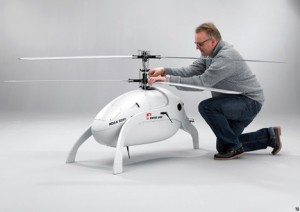
Swiss UAV have started touting this very cool platform and Patrick Egan fleshes out the rumours out there. Maybe before year end there could be a blanket COA for smaller UAS.

Natural gas leaked out of a PG&E pipeline in San Bruno, CA, killing an unknown number. Clearly the Buried Natural Gas infrastructure is beginning to age. Only UAV's can reasonably fly low enough in neighborhoods to create a map of NG concentration. I heard on NPR that PG&E flies airplanes to inspect gaslines, but clearly not low or often enough.
Given that Methane sensors are light, cheap and readily available:

It's conceivable that Amateur UAV's could fly a pattern and log Methane levels against a GPS coordinate.
(Does anyone else think this could be a viable task for UAVs? and Why not propose a T3 contest in which mapping methane is the objective?)
I have been tinkering with solar powered RC planes this summer. The photos above shows the latest incarnation.
This model uses the Parkzone Vapor's radio gear and motor ( http://www.parkzone.com/Products/Default.aspx?ProdID=PKZ3380 ), plus five Powerfilm solar cells ( http://www.jameco.com/webapp/wcs/stores/servlet/Product_10001_10001_228056_-1 ). The motor/prop are quite well matched to the cells, delivering about 2.5 watts in direct sunlight. Here are some test data:
All up weight is 38g, 18g in solar cells. It has a tiny 20mAh battery (1g) in parallel with the solar cells that acts to smooth out the voltage. Before I flew, I ran the motor using battery power until the voltage dropped too low to run the motor, then I plugged in the solar cells. That way, when I flew, I knew I was really running on solar power alone. I flew it for about 5 minutes or so, but it was a pain to fly because the wings were too torsionally floppy. I am planning the next revision that should address some of this design's shortcomings.
Related Work
There have been many successful solar airplanes. I found the following efforts particularly interesting because they are not military or NASA scale projects, and they are well documented.
Andre Noth's (ETH Zurich) 3.2m span Sky-Sailor, which flew 27 hrs in 2008
www.asl.ethz.ch/research/asl/skysailor
Carl Engel and Adam Woodworth's (MIT) 3.1m Aphelion, which has flown over 7 hrs
http://www.rcgroups.com/forums/showthread.php?t=572000&pp=15
Solar Cell Selection
In many applications, solar cell performance is measured by efficiency. In my experiments with the Powerfilm cells, I got about 70 watts per square meter. Using a fairly standard irradiance value of 1000 watts per square meter puts the cell efficiency at something like 7%. This is not particularly good compared to the state of the art (see e.g. http://en.wikipedia.org/wiki/File:PVeff%28rev100414%29.png).
The Aphelion uses an array of 18 A-300 Sunpower Solar Cells. The total encapsulated array weighs about 350 grams and can deliver 55 watts of power. These cells are reported to be upwards of 20% efficient. BTW, if you dig deep enough into the Aphelion thread referenced above, Carl reveals his secret supplier of these cells:
<quote>
Also, here is the contact info for our solar array supplier, now that he has given permission for it to be posted. One note that he wants to be made clear: he is very busy, and it's a small operation, so there can be a serveral month lead-time on ordering an array. With that, here is his info:
SunCat Solar is the name of the comany, and our contact in Alain Chuzel(pronounced "Allen"). His email address is
ahmchuzel<at>aol<dot>com. (replace the <at> with @and <dot> with . )
He can fabricate pretty much any size or confguration of array, given a good drawing (and enough money  )
)
</quote>
The weight of solar cells accounted for 47% of the total weight of my airplane. Therefore, I would argue that for a solar powered airplanes, an important performance measure of performance is watts per gram. I measured about 0.27 watts per gram for the Powerfilm cells. This compares favorably to the Sunpower cells at 0.16 watts per gram.
Some other attractive things about the Powerfilm cells is that they are reasonably priced, and readily available in small quantities. I have not contacted Suncat Solar to determine the cost/availability of the Sunpower cells.
Scaling Arguments
I think it would be very cool to build a solar powered drone that could stay up all day, and possibly all night. My little airplane has essentially no payload capacity. Presumably, a larger airplane would be required to carry up a GPS, IMU, two way radio, etc.
As the airplane gets bigger, we have more area for solar cells, but the weight gets larger too. So how does the power budget work out with a bigger airplane? Here are some scaling arguments to help answer that question objectively.
Definitions:
Preq: required power
Pavail: available power
Rp: the ratio of available power (Pavail) to required power (Preq)
D: drag
V: flight speed
W: weight
g: acceleration due to gravity
rho: air density
S: wing area
CL: lift coefficient
Kcell: power output of solar cell per area
LOD: lift/drag (or glide ratio)
WOS: wing loading, weight per area
Relationships:
(1) Pavail = K * S (assuming the entire wing is covered with cells)
(2) Preq = D * V
(3) V = sqrt( 2 * W * g/ (rho*S*CL) )
(4) D = W * g / LOD
Combining (2), (3), and (4) gives
(4) Preq = W * g/ LOD * sqrt( 2*W *g/ (rho*S*CL) )
Combining (1) and (4) gives
(5) Rp = K * S ^ (3/2) * LOD * sqrt(rho * CL) / ( (W*g) ^ 3/2 * sqrt(2*g) )
Finally, simplifying (5) gives
(6) Rp = K * (1/WOS) ^ (3/2) * LOD * ( sqrt(rho*CL/ 2) * g^(-3/2) )
There are four terms in (6). The first term depends only on the solar cell. The second term depends only on the wing loading. The third term depends on the aerodynamic efficiency of the airplane, and the fourth term we can treat as a constant. Thus, starting from my little airplane, as we increase the size of the airplane, if we use the same solar cells, maintain the same wing loading, and maintain the same LOD, then we should still have enough power to fly.
The bad news is that as airplanes are scaled up, their weight usually goes up faster than their area, thus their wing loading goes up. Stated another way, bigger airplanes usually have higher wing loading than smaller airplanes given similar structural technologies.
The good news is that as we increase the size of the airplane, we can expect the LOD to improve. The LOD of my airplane is around 7. Doubling or even tripling this value should be possible ( see e.g. http://www.rc-soar.com/tech/perfanal.htm ). The wing loading of my airplane is 540g/m^2. If we double the LOD, we can increase the wing loading (WOS) to 850g/m^2 (i.e a factor of 1.58) and maintain the same power ratio.
Also, as we make the motor and propeller larger, we might expect an improvement in propulsive efficiency, meaning that we fly with a reduced power ratio.
Considering these factors, building a bigger solar airplane is probably harder than building a small solar airplane. Based on the successes referenced above, I must conclude that it is possible, but not easy (or cheap).
Jose Juilo from the ArduCopter team has been doing great work adding the GPS position hold and autopan features to the code. Yesterday you saw the video of the flight; here's the picture that the quad took, a stitch of 8 photos taken with a programmed slow yaw movement linked to shutter triggers.
Full GPS navigation is the next feature ArduCopter will inherit from the ArduPilot Mega code. Expect a public beta within the month....
First bumpy, but successful landing in X-plane with Erlang autopilot from Benjamin Nortier on Vimeo.