All Posts (14048)

Sort by
Developer

Here a video a the latest firmware of the ThermoPilot v5.2 (2012 version) which uses a new algorithm (MLA) tested in HIL mode on Xplane v9.70 during a full autonomous slope soaring flight in high mountains. The ThermoPilot is a full enhancement of the ArduPlane v2.28 which adds the Thermal Hunting capabilitie and some others features for the gliders pilots. The ThermoPilot v5.0 has been tested successfully in july-august 2011 on a Cularis electro-glider and on oct 2011 on a ASW-24 3m50 electro-glider with an ArduPilot Mega 2560 v1.4 IMU (phase 3). The phase 4, now uses an APM v2 with the v2.28ThP5 firmware. I am using Xplane v9.70 as a test plateform in HIL mode because, it is able to reproduce with accuracy various weather conditions (thermal upwards, dynamic soaring, slope and/or ridge soaring) in a real 3D mapped world...

3689444730?profile=original

3689444601?profile=original

The ThermoPilot is able to do a cross country soaring mission and it is also able to do a slope soaring pattern pointed by two GPS points. These two points are pointed in flight by the pilot along the slope and then the glider is able to flight itself as long as the dynamics upwards are still actives.

3689444765?profile=original

3689444852?profile=original

3689444822?profile=original

More infos at:
http://diydrones.com/profiles/blogs/arduplane-v2-full-autonomous-flight-hil-simulation-of-a-nimbus-4m

and at: http://diydrones.com/profiles/blogs/thermopilot-project-a-thermal-hunter-glider-drone

Regards, Jean-Louis

Read more…

TBS @ USA: Road Trip!

Early december last year we spent a couple of days vacationing in the wild west and shooting some FPV videos. The videos will be released on a weekly basis over the next 2 months or so. We're kicking off the Road Trip with Lake Tahoe:

Follow the Road Trip on:

Facebook: www.facebook.com/teamblacksheep

YouTube: https://www.youtube.com/playlist?list=PL5B40A0CC1FE25C63

Special thanks to:

HobbyKing: www.hobbyking.com

GoPro: www.gopro.com

Burton: www.burton.com

Read more…

Fast-track PID lop setup

3689444449?profile=original

Last August I posted a blog "New offer of help with tuning PID loops" putting forward the idea of applying control doublets to a fixed wing aircraft in flight and using the responses to capture stability derivatives and decide autopilot gains. At that time I only had simulation results and was seeking flight test data. I have since got hold of some flightt test data  and analysis confiorms that my processing concept does work.

The first step is to fit a model of the aircraft response to the real data. Once this is done (the software only takes seconds) I've got an airframe transfer function from which I can directly calculate autopilot gains and stability derivatives which I can plug into an aircraft simulation.

Since autopilot gains need to be matched to vehicle aerodynamics, with further development, this scheme could end the era of triasl-and-error autopilot tuning. In the near term, if anyonre is interested, I could act as consultant on individual projects. Over the longer term, I could work with someone to package up the algorithms into existing autopilot software or perhaps and App with a view to bringing something to market.


Read more…

ROWLAND F1-535 nears production status

So guys here is what a finished one looks like. The level of stabilization is unbelievable, a key factor is in the torsional rigidity of the motor arms and the weight of the props. Whatever you do electronically I think it will be impossible to replicate this with upright long motors on a long stick. Demo videos will start when the weather improves. Bur after weeks of non stop wind and rain, efforts have been shifted to further dev. work.   

3689444581?profile=original

Read more…

BOB4 - new website in english! (Indoor UAV)

I finally translated all the website of my home-made UAV in english.

http://heli.bot.free.fr/index_en.html

accueil_2.jpg
Do not hesitate to post any question or comment about the UAV, about my work, or about the website!


Remember that this small UAV is totally home made, and do not come from any other project.
100% of the code is programmed by myself.

Have fun!

Leon - French hobbyist.

Read more…

OpenCV aspirations


In the quest for daylight flying, it's our 1st attempt at detecting the position of an aircraft using the SURF implementation in OpenCV. It's a long way from detecting something flying in a room with lots of background detail & even with a noise free background it has a hard time with accuracy. The single 3.7Ghz core does 8fps.

This is the algorithm used by every augmented reality app ever made. It was invented in 2006.

Another problem with aircraft tracking is it's a 3D object.  All the demos of SURF show it tracking planar objects.  It could probably track the Marcy 1 logo, but not the complete aircraft.

Noticed SURF doesn't have any transparency support, so it requires either a rectangular object to search for or no background detail.

SURF isn't the answer we were hoping would enable daylight flying.   You're still limited to old fashioned keying.  Difference keying is still the most effective at separating the copter from the background, but the camera can't move.
There are brute force techniques.  They would require a cascaded search.  For each resolution, draw every possible ellipse & take the best match.  That wouldn't handle rotated ellipses, but they only occur during takeoff.  The camera could stay still during takeoff & use difference keying.
There's the hough transform for ellipse detection, which seems to be just another brute force search.
There's hybrid difference keying.  Make the camera stop moving every few frames to recompute the difference key.
  It's not very obvious why the thing needs to fly in daylight.  Luma keying in darkness is basically the poor man's Vicon & they in their infinite budget use IR cameras to remove the background.
 

Finally, we have some footage of what Marcy 1 looks like in the flying space.  Handheld & wide angle gives new possibilities, if not good quality.

Read more…


This week I tested the Ardupilot's waypoint and autopilot functionality, and it had mixed results, which I now have identified as total user error. Go figure. :)


The waypoint feature performed as good as it could, it struggled a bit as my GPS module only has about a 25% view of the sky, which is clearly not ideal. I'm working now on a better mounting location that will give it 100% view.


Why do I think it's the GPS mounting location?

1.) Its mounted in a location that only gives it a 25% view of the sky, that alone is bad.

2.) I've since gone out and flown it, and the GPS couldn't get a lock for like 5 minutes. I moved the APM and GPS out of it's mounting location and into a full view of the sky, and it got a lock in like 20 seconds, really really fast. So clearly its got such a bad mounting location that it may not even connected as it is.

3.) After improving it's mounting location even just a little bit, it flew much, much better. That flight (just made yesterday) will appear on next week's episode.


So far so good. I am in total love with the APM and mission planner. Thank you DIYDrones for the awesome equipment and software!


Equipment Used:

Motor: http://www.hobbypartz.com/75m42-optima450-2220-950kv.html

ESC: http://www.hobbyking.com/hobbyking/store/uh_viewItem.asp?idProduct=13429

Batt: http://www.hobbyking.com/hobbyking/store/uh_viewItem.asp?idProduct=6306

Servos: http://www.hobbypartz.com/topromisesg9.html

Prop: http://www.hobbyking.com/hobbyking/store/uh_viewItem.asp?idproduct=5437 


Stats:

Weight: 32 oz

Thrust: 21 oz

Wing Area: 3.33 square feet

Wing Loading: 5.3 oz per sq ft


If you're interested in building the Nova, I've got free build instructions and plans on my website: http://www.MyGeekShow.com.


-Trent

Read more…

Good day everyone,


Today I was contacted by some producers who do a ton of work making programs for the Discovery Channel. They do the shows like military channel etc.


Today we discussed Aerosight's availability to assist in a new show that will follow the UAS operators tracking down lost people in a SAR type of mission. The show will be a series, paid, and in and outside the USA. The involved companies/persons will need their own equipment that is capable of live data feeds. We are not needing POST data retrieved ships like JUST MAPPING but UAS capable of live moving map, optical, thermal etc. The UAS doesn't have to be all military grade, just effective! We are looking for packable UAS and operators as most of the filming is in tough climates. Think of packing your UAS in the man vs wild episodes. It will be like that at times.

We do not have anything signed at this time. I am only locating talent to assist should the contract be signed in the future. Obviously we still have the FAA to deal with but part of our group are military contractors so MAYBE we will have some clout there. Once wages etc are all agreed on, Aerosight will discuss finders fees for the series with all involved.

Please list all of your contact info, abilities, pics of equipment etc. And list any/all projects you have done, IE: Searches, Mapping, etc..

Reply to my email below:


Dave Skala / Aerosight

www.aerosight.com

www.civilianuav.com

My email:

uavdave@yahoo.com

Read more…

Headlights when motors armed.

I added very bright LED headlights to the quad a while back a) to freak the locals out at night and b) to help with orientation when the quad is far away. These are 12V LEDs and run straight of the 3S lipo. All was well....

One thing I don't like much is the rather small and dim SMD LED to tell me when the motors are armed. Mostly because it is small and dim but I also want to paint my CD spindle housing black.

So, why not make the LEDs turn on and off when the motors are armed and disarmed? Simple. We have a relay which can be controlled and I speak code (well, sort off).

A delve into the current 2.3 source code and I think motors.pde would be the best place to do this.

A simple relay.on() and a relay.off do the trick.

Now, I run the power from the LEDs from the battery, via the relay and the to the LEDs. Lights on. Lights off. :)

Hopefully this will help someone else do something like this.

if(motor_armed == false){

    // arm the motors and configure for flight
    init_arm_motors();
    //turn the headlights on
    relay.on();

}

...snip...

if(motor_armed == true){

    // arm the motors and configure for flight
    init_disarm_motors();
    //turn the headlights off
    relay.off();

}

p.s.

If there is a better place to put the command, I'm all ears. I've not studied the whole code

layout.

Read more…
3D Robotics

DIY Drones at 22,000 members!

3689444550?profile=original

As is customary and traditional, we celebrate every new 1,000 members here and share the traffic stats. This time it's 22,000!

There were more than 1.33 million page views this month, which is a record. It just took us four weeks to get this latest 1,000 members--we're averaging about one new member every 43 minutes.

Thanks as always to all the community members who make this growth possible, and especially the moderators who approve membership applications and blog posts and otherwise answer questions and keep things ticking here. We've got about 40 moderators now, but if anyone would like to join this group, please PM me. If you've been here for a while and have been participating, you'll fit in great.

Read more…

Ducted Fan Tricopter

I have been experimenting with a ducted fan tricopter.  It flys much better then I thought it would, flying time is about 5 minutes on a 4 cell 3300mah battery.  It is a blast to fly.

Read more…

imperial_star_destroyer.jpg

Fascinating NYU experiment reveals surprising data on fluid-dynamics for top-heavy airborne structures.  

From ScienceMag (video) via Wired Science

"Think that floating pyramids are more metaphysics than physics? Think again. Results just in from an experiment that levitated open-bottomed paper pyramids on gusts of air reveal a curious phenomenon: When it comes to drifting through the air, top-heavy designs are more stable than bottom-heavy ones. The finding may lead to robots that fly not like insects or birds but like jellyfish.

The researchers placed hollow paper pyramids inside the cylinder. The objects were about 1 to 5 centimeters high and were made of tissue paper or letter paper on carbon fiber supports, like tiny homemade kites. Physicist Bin Liu led the experiments, attaching a beadlike weight to a post running down the center of the pyramid and changing the height of the bead to give the object a different center of mass. Common sense says that the pyramid should be most stable when the bead is at the bottom of the post, like ballast in the hold of a ship. But when the team released the pyramids over the subwoofer, the opposite was true: the bottom-heavy pyramids were likely to flip over and fall, whereas the top-heavy ones remained upright and continued to hover (see first video), the group reports in an upcoming issue of Physical Review Letters.

Zhang's team suggests that flapping pyramid or cone robots could combine stability and maneuverability. They would quickly right themselves if they leaned further than 30° in any direction, but within 30°, they should move freely."

Read more…

How to NOT get grounded by FAA...

3689444317?profile=original

Hello all!

Just a suggestion for those who got affected by the FAA enforcement policies against UAVs used for aerial Photography in LA area, and even if you are not affected by this you can use our telescopic masts that go up to 60 ft high.


No crashes, no more "mayday mayday, my batteries are dying", no police asking questions, no repairs and no parts to be ordered for replacement......

Most of my customers and even myself are completing 90% or more of the AP jobs only using telescopic masts, shooting the images from an average altitude of 35 - 45 ft.


Feel free to ask me questions at info@aeromao.com


More info is available here:

http://www.aeromao.com/telescopic_masts


3689444272?profile=original

Read more…

Spying on Europe’s farms with satellites and drones

Working for one of the UN Agriculture agencies in Rome, I thought this was worth sharing!

Source:

Bales of hay in Wiltshire, UK - file pic

Farmers who claim more EU subsidies than they should, or who break Common Agricultural Policy rules, are now more likely to be caught out by a camera in the sky than an inspector calling with a clipboard. How do they feel about being watched from above?

Imagine a perfect walk in the country, a few years from now - tranquillity, clean air, birdsong in the trees and hedgerows, growing crops swaying in the breeze.

Suddenly a model plane swoops overhead.

But there is no-one around manipulating radio controls. This is not a toy, but a drone on a photographic mission.

Meanwhile, hundreds of kilometres up in space, the same patch of land is being photographed by a satellite, which clearly pinpoints individual trees and animals.

What is there to spy on here? No secret military installations, just farmland.

Farmer and environmental researcher

But Europe's farms cost taxpayers billions of euros in subsidies each year, and EU agricultural inspectors are turning to technology to improve their patchy record on preventing fraud and waste.

Satellites have already been in use for several years, and drones are currently undergoing trials.

Scanning a farm with a satellite costs about one third as much as sending an inspector on a field visit - £115 ($180; 150 euros) rather than £310 ($490; 400 euros), says the UK's Rural Payments Agency (RPA), which is responsible for disbursing the subsidies in the UK and checking for irregularities.

"The RPA follows up only on those claims where there is some doubt about accuracy, and then only at the specific fields for which the doubt exists," the RPA says. "This saves time, lifts the burden on farmers and reduces cost to the taxpayer."

Satellites can rapidly cover a huge area in detail and quickly return to photograph it again if necessary.

In 2010, about 70% of the total required controls on farm payments in the EU were done by satellites, which photographed more than 210,000 sq km (81,000 sq miles) of land in all.

But they are not infallible. Austria does not use them, on the grounds that the shadows cast by very mountainous terrain sometimes make satellite images inaccurate.

And Scotland, unlike the rest of the UK, decided against satellites "because of the difficulty of getting enough clear weather for flyovers", a Scottish government spokeswoman told the BBC.

Many things in the countryside are constantly changing and when the satellite passes over, "the animals may be in a field or in a barn - you can't count the numbers very well", says Roland Randall, an English farmer and environmental researcher in Cambridgeshire.

"When planners looked at the aerial photo records of our farm they thought we had an additional building without permission, but it was actually a haystack," he told the BBC.

The satellite checks are done partly to produce accurate maps of farms, showing clearly the areas eligible for subsidies.

But farmers these days have to keep their land in "good agricultural and environmental condition" to qualify for subsidies, so images also reveal whether the farmer is complying with the rules on hedges and ponds, say, or buffer strips around arable fields.

Spotting erosion from satellite imagesThe monitoring is not always to spot infringements or illegal activities. Satellite images can help identify problems such as erosion. Farmers can then be asked to change their methods to prevent further damage. In the above images, overproduction and deep ploughing in clay earth meant rain washed soil away.

A farmer who breaks the rules risks losing 3% of his or her direct payment - and more if it is a repeat infringement.

There have been few prosecutions in the UK based on satellite evidence, says Ray Purdy, a senior law researcher at University College London (UCL) specialising in satellite monitoring.

One case in the UK was dropped in 2001 because a farmer proved that he had planted a linseed crop, even though the satellite image appeared to show bare earth. The sparse young plants had failed to show up against the bright reflection off chalk downland.

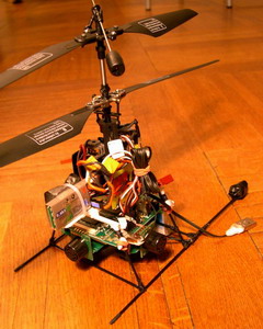
This could be the kind of situation where a drone - an Unmanned Aerial Vehicle (UAV) - would come in useful.

Drones are best known for their role as remote-control killers in Afghanistan, but supporters see a role for smaller and much simpler drones in agricultural monitoring. They can get up close and take sharp photographs - and unlike satellites, which always look directly down, drones can get an angled view of their subject.

They are currently being tried out in vineyards in the south of France, to check that "grubbing up" of vines is done legally and ecologically.

Wine-growers get as much as 10,000 euros ($13,000; £8,300) per hectare in subsidies for digging up uncompetitive vines - a scheme to prevent new EU "wine lakes" caused by overproduction.

"There has to be 100% control, as it's a huge amount of money," says Philippe Loudjani, an agronomist at the Joint Research Centre, the European Commission's main satellite monitoring hub in Ispra, northern Italy.

"The French are testing to see if the drones need to go up to 10cm resolution - to see what accuracy is required."

Graphic showing use of Atmos 6 UAV (drone)

Drones are also being tested in Italy, and are already in use on a small scale in Spain's Catalonia region, where authorities say their 25cm and 12.5cm resolution photos are ideal for inspecting the small landholdings with mixed crops that are typical of the Mediterranean.

The EU is hurrying to develop a "strategy for Unmanned Aircraft Systems", which would see the existing very tough restrictions on the use of civilian drones in Europe relaxed.

A discussion paper prepared for a European Commission workshop in Brussels this week, envisages their use not only in crop or farm monitoring, but also terrain cartography, goods transport, monitoring of borders, the fight against illegal immigration and drug trafficking, and intervention in natural or industrial disasters.

Warwickshire farmer

"They can also be sent to deliver rescue packages to ship crews in danger at sea," it adds.

However, in the short term it's likely that UAVs will only be widely approved for use within line of sight of an operator and at a distance of no more than 500m, which limits their value for agricultural inspection.

And what about the privacy issue?

Ben Hayes of the campaign group Statewatch worries that Europe is rushing into the use of drones without sufficient public discussion.

"We would accept the argument that there are lots of things they can be useful for, but ... the questions about what is acceptable and how people feel about drones hovering over their farmland or their demonstration - these debates are not taking place," he says.

Ray Purdy of UCL surveyed 202 farmers in the UK, and 428 in Australia - where satellites are routinely used to monitor land use, especially vegetation clearance - and found that only about a quarter in Australia and a third in the UK were against satellite monitoring.

Some farmers voiced concerns about invasion of privacy, but many said remote sensing was preferable to inspectors on their land taking up their time.

A majority in the UK also agreed that the satellites would help to deter fraud.

Rob Allan, a farmer in Warwickshire, said "it's modern life really - I don't think there's anything you can do about it".

Read more…