Broadcast starts at 10am mountain.
http://www.ustream.tv/channel/3d-robotics
Broadcast starts at 10am mountain.
http://www.ustream.tv/channel/3d-robotics
I have never seen anything like this, but I want one. Apparently the rotating cylinder creates lift through something called the Magnus Effect.
I am pleased that my friends panorama made with the help of my flight controller and frame :)
Stanislav Sedov (pilot) with hexacopter:
also photo from 515m with 5d mkII:
FC: acFC5.1 (special edition for airpano.ru)
ESC: HK BlueSeries 30A
motors: axi2820/14
propellers: 13" apc
Battery: 2x5800 Zippy
RC: Futaba T8FG s.bus
Camera: Canon 5D mkII
1-axis (yaw) gimbal
By Evan Ackerman
The UCSD robot is called FFR for "firefighting robot," although FLR for "firelocating robot" might be more technically correct. The robot uses a stereo camera and a thermal camera to generate 3D pointclouds with thermal overlays, allowing the robot to autonomously generate maps showing hot spots and humans even through smoke. The sensor hardware on board the robots doesn't look especially complex, meaning that the 'bots might ultimately become inexpensive (and replaceable) enough to deploy in swarms. So, instead of running around burning buildings looking for people, firefighters can just deploy a bunch of robots first, and rapidly build up a thermal map telling them where to go.
Incidentally, that nifty stair climbing system is something we first wrote about back in 2009, and it's great to see that it's been turned into something useful. Now, if they'd just give iFling some water balloons, it really could be a firefighting robot.
Fresh from Hobbyking is this video switch which allows you to switch a maximum of 3 camera's on your aircraft (or boat, car for that matter) by the flick of a switch. This switch features one receiver input, 3 camera inputs and one video output
With dimensions of only 30x18x6mm and just 4 grams this is a small and light device.
Available from Hobbyking
This is a screenshot from Ecosynth's brand new 500 by 500 meter photo acquisition method, taken at Patapsco State Park!
This is Wolfgang: our newest octocopter. It flew the 500 by 500 meter mission. Wolfgang is our biggest and heaviest copter, it can carry four lipo batteries plus its payload. It can stay aloft for 30 minutes of safe flying time. The camera is the new Ecosynth standard, the Canon Powershot ELPH 520. The camera is mounted in a card case for protection and ease of attachment to the copter; it points straight down to collect photos for aerial mapping.
Wolfgang uses the frame, legs, motors, and propellers of a Mikrokopter Miko XL. However the brain is an APM 2.5, and the ESC's are jDrones 30 amp (those Mikrokopter ESC boards are too finicky and fragile.) The electronics are covered by a tupperware container (not the most glamorous, but it is sturdy and gets the job done.) It carries four Venom 5000mAh 4-cell lipos. Control is the Spektrum seven channel. One Garmin Astro dog tracker is attached for locating the copter in an emergency situation.
Wolfgang's planned route in Mission Planner (created by Michael Oborne). The flight path is actually 550 by 550 meters, so that the 500 by 500 meter collection area is surrounded by 25 meters of buffer area on all sides. The tracks are 50 meters apart. The copter flies at 120 meters above the ground, so that pictures taken along adjacent tracks will overlap by 50 percent at the edges. This overlap is important to provide a seamless point cloud product. 550 by 550 is an unprecedented collection size for Ecosynth. Layed end to end, the flight is 7.8 km long, more than twice as long as out previous flight standard: 275 by 275 meters.
This screenshot from Google Earth displays the actual path followed by Wolfgang while it was gathering pictures. It managed to follow its router with great precision. I estimate it deviated no more than two meters from its planned track at any given time. In addition, according to the telemetry it very rarely dipped below 119.5 meters or 120.5 meters, so the altitude was very consistent. The groundspeed reported that it flew between 7 and 9 m/s along the tracks, which is well within desirable parameters. The photo collection took 20 minutes to fly over all 12 tracks, and the entire flight took 25 minutes including takeoff and landing.
An example photo from the set. Wolfgang recorded 2250 pictures in the collection area, all of which were sharp and detailed like this one. The sun was bright and unclouded, so the lighting was consistent throughout the entire flight. These favorable conditions and outstanding copter performance resulted in a very consistent and detailed point cloud. The pictures were run through Photoscan to produce this point cloud:
(View in HD and use fullscreen to gain the full effect. At least, the fullest effect that can be gained without manipulating the cloud yourself.)
130531 - Berkeley Marina from BayAreaCrasher on Vimeo.
Our friends Pablo and Matt joined us for a beautiful afternoon of flying around the Berkeley Marina. An NPR reporter tagged along as well. Pablo gave FPV ride-alongs around the marina, these are recordings of those flights.
Had a few people ask how we install the APM in the Nurf, so here's a short video of the install. Could use a bit of tweaking but it works for us. We do not like to put stuff in the wings as we do a bunch of testing and it makes it a bit harder to transfer gear. But there is plenty of room in the wings if you wanted to go there.
In some experiments used only the onboard camera and mouse,without hand remote control (like futaba etc).
This is a genuine solution, without the use of libraries like OpenCV, all calculations are carried on the aircraft board (Overo).
Hold position based on camera image.
Using closed Russian LRS (cofdm, 8 mbit, IP, mesh, >50km range)
A LowCost drone as a SAR project.
This test flight was the first one with WP route navigation.
Height was set to 100m (328 feet).
The flight was made LOS max distance was arround 950 m.
Testplatform: Blixler II
Autopilot: FY31AP (without datalink)
Battery: 4S lipo 4500mAh
Wind: 8-10m/s (very shaky in winds)
OSD: EzOSD (just what needed)
Videolink: Immersionrc 600mW 5.8Ghz with antennatracker, Diversity Rx,
Antenna from Ciculare wireless

A remote controlled helicopter has been flown through a series of hoops around a college gymnasium in Minnesota. It sounds like your everyday student project; but there is one caveat: the helicopter was controlled using just the power of thought. The helicopter was controlled by a noninvasive technique called electroencephalography (EEG), which recorded the electrical activity of the students’ brains through a cap fitted with sixty-four electrodes.
A remote controlled helicopter has been flown through a series of hoops around a college gymnasium in Minnesota. It sounds like your everyday student project; but there is one caveat: the helicopter was controlled using just the power of thought. The experiments have been performed by researchers hoping to develop future robots that can help restore the autonomy of paralyzed victims or those suffering from neurodegenerative disorders.
An Institute of Physics (IOP) release reports that their study has been published yesterday, 4 June 2013, in IOP Publishing’s Journal of Neural Engineering.
There were five students who took part in the study and each one was able successfully to control the four-blade helicopter, also known as a quadcopter, quickly and accurately for a sustained amount of time.
Lead author of the study, Professor Bin He from the University of Minnesota College of Science and Engineering, said: “Our study shows that for the first time, humans are able to control the flight of flying robots using just their thoughts, sensed from noninvasive brain waves.”
The noninvasive technique used was electroencephalography (EEG), which recorded the electrical activity of the students’ brain through a cap fitted with sixty-four electrodes.
Facing away from the quadcopter, the students were asked to imagine using their right hand, left hand, and both hands together; this would instruct the quadcopter to turn right, left, lift, and then fall, respectively. The quadcopter was driven with a pre-set forward moving velocity and controlled through the sky with the subject’s thoughts.
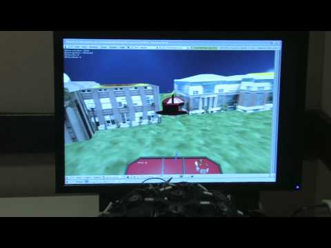
The students were positioned in front of a screen which relayed images of the quadcopter’s flight through an on-board camera, allowing them to see which direction it was travelling in. Brain signals were recorded by the cap and sent to the quadcopter over WiFi.
“In previous work we showed that humans could control a virtual helicopter using just their thoughts. I initially intended to use a small helicopter for this real-life study; however, the quadcopter is more stable, smooth and has fewer safety concerns,” continued Professor He.
The release notes that after several different training sessions, the students were required to fly the quadcopter through two foam rings suspended from the gymnasium ceiling and were scored on three aspects: the number of times they sent the quadcopter through the rings; the number of times the quadcopter collided with the rings; and the number of times they went outside the experiment boundary.
A number of statistical tests were used to calculate how each subject performed.
A group of students also directed the quadcopter with a keyboard in a control experiment, allowing for a comparison between a standardized method and brain control.
This process is just one example of a brain-computer interface where a direct pathway between the brain and an external device is created to help assist, augment or repair human cognitive or sensory-motor functions; researchers are currently looking at ways to restore hearing, sight and movement using this approach.
“Our next goal is to control robotic arms using noninvasive brain wave signals, with the eventual goal of developing brain–computer interfaces that aid patients with disabilities or neurodegenerative disorders,” continued Professor He.
— Read more in Karl LaFleur et al., “Quadcopter control in three-dimensional space using a noninvasive motor imagery-based brain–computer interface,” Journal of Neural Engineering 10 (4 June 2013) (doi:10.1088/1741-2560/10/4/046003)
Our new direct-drive brushless gimbal, coming soon to a copter near you!
There is also good news for everybody living in EU. We just got a massive load of Techpod kits and everyone is welcome to come by and get one!
We had already posted about our project for high-precision surveying thank photogrammetry techniques for ortho rectified and superfices digital models. http://www.habitatea.es
Ran across this video on youtube... This guy REALLY knows how to fly a quad.
On a lunch break last month, a small custom-built octacopter made a 10-minute flight through the city of Guildford, outside of London. Its special cargo: two large pepperoni pizzas.
The delivery was masterminded by a T + Biscuits, an English creative agency that was hired by Domino's to test prototypes. Read more here
Watch the Video
Dear Friends,
this is the first test of VR Gimbal that control 3 axis ... it's only pre alpha revision of code.
At the end of this week 31 / 05 / 2013
We finish to implement the VR Gimbal LT library .
Now start to implement
PID control and FORCE control lib ... in this video is possible to see the first revision of firmware with the pre alpha code . Not yet available PID only P control and we are using same code used in the past for contol servo with external potentiometer.
In the next week start to work on complete PID control and absolute control approach.
with this version of firmware we are testing :
All is ok so the board is ready for prodution :) That's good step for us :)
So in this early test on 3° axis we found that we need more force on 3° motor on yaw respect of other 2 axis when we are in limit situation . So wee need to use bigger motors with more couple.
About the developer sorry for delay but before to confirm the start of pre order we prefer finish to test electronic board of first batch .
For more info check here :
Best
Roberto Navoni
All your PIDs are belong to us!
____________________________________

Training Cambodian researcher and wildlife workers near Pu Trom
We have been busy developing and building ArduPilot Mega based UAV's for conservation and economical research the last couple of months together with our friends from ConservationDrones.org.
The goal is to provide an easy to use, durable, field fixable and affordable solution that can be operated in nearly any environment. Currently our UAV has been deployed to many locations around the globe. This have been interesting times traveling around the globe helping out with research projects and training researchers to use a UAV for their mapping and surveying missions.
This has created quite some media attention, for example in the New York Time, BBC News and local news papers. It is nice to read about the positive, non-military used of UAV's now and then.
Finally I got around to put a web site together. There might be a couple of interesting videos of our trips. If you are interested, hop over to www.researchdrones.com.
Chad Amonn, one of our mechanical engineers, has been busy designing some new products. He created this package to hold electronics designed by: Craig Elder, Sam Kelley, Kevin Bretney, and Jeff Wurzbach.
Any ideas on what this thing does?
(Edit)